
Nestled in the heart of the Cordillera Region in Luzon is what many Filipinos call as the ‘eighth wonder of the world’—the Banaue Rice Terraces. Although many casual tourists know the picture-perfect postcards of the rice terraces along the Banaue-Bontoc highway, a huge cluster of these rice terraces are tucked away in the villages of Pula, Cambulo, Batad, and Bangaan. These rice terraces have been ingeniously carved by the Ifugao people hundreds of years ago, and today stands as a historical landmark and a testament to the culture of the Filipino highlanders.
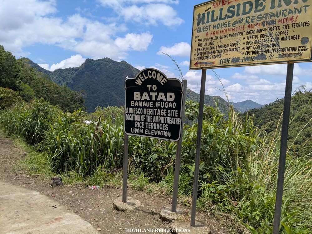
To see the rice terraces, one option is to trek the Awan Igid Trail, a local pathway that cuts through multiple barangays in the town of Banaue. The trail starts at the Awan Igid viewpoint in Barangay Viewpoint (yes, that’s the name of the barangay) before entering the rice terraces of Barangay Pula. From Pula, one has to pass through cemented dikes on top of terraces en route to Barangay Cambulo. The trek culminates at Barangay Batad, famous for its UNESCO-recognized rice terraces that is, undoubtedly, the most stunning rice terrace in the country. The hike stretches for 20+ kilometers long and is usually done on an overnight or a multi-day hike to maximize the time.
Here are the characteristics of the hike using the Pinoy Mountaineer format:
AWAN IGID TREK (Pula – Cambulo – Batad)
Jump-off Point: Awan Igid (KM 9), Viewpoint, Banaue
Days Required / Hours to Finish: 1-3 days / 8-10 hours
Specs: Major climb, Subjective difficulty 5/9 or 6/9, trail class 2
In doing the Awan Igid Trek, one can end the hike in Batad, just like what we did. However, for a longer trek, one can extend the hike up to Bangaan, another UNESCO-recognized heritage site within Banaue.
Trivia: There are five rice terraces recognized as UNESCO heritage sites in the region: two of them are in Banaue—Batad and Bangaan—while the three are located in the towns of Hungduan, Mayoyao, and Kiangan. I was fortunate enough to see the Hungduan Rice Terraces during our Mt. Napulauan hike back in 2025. Despite these formal recognitions, one can claim that the rice terraces in all of Banaue, and even the ones in Mountain Province and Benguet, are equally as impressive! We were about to see some of them in Pula and Cambulo.
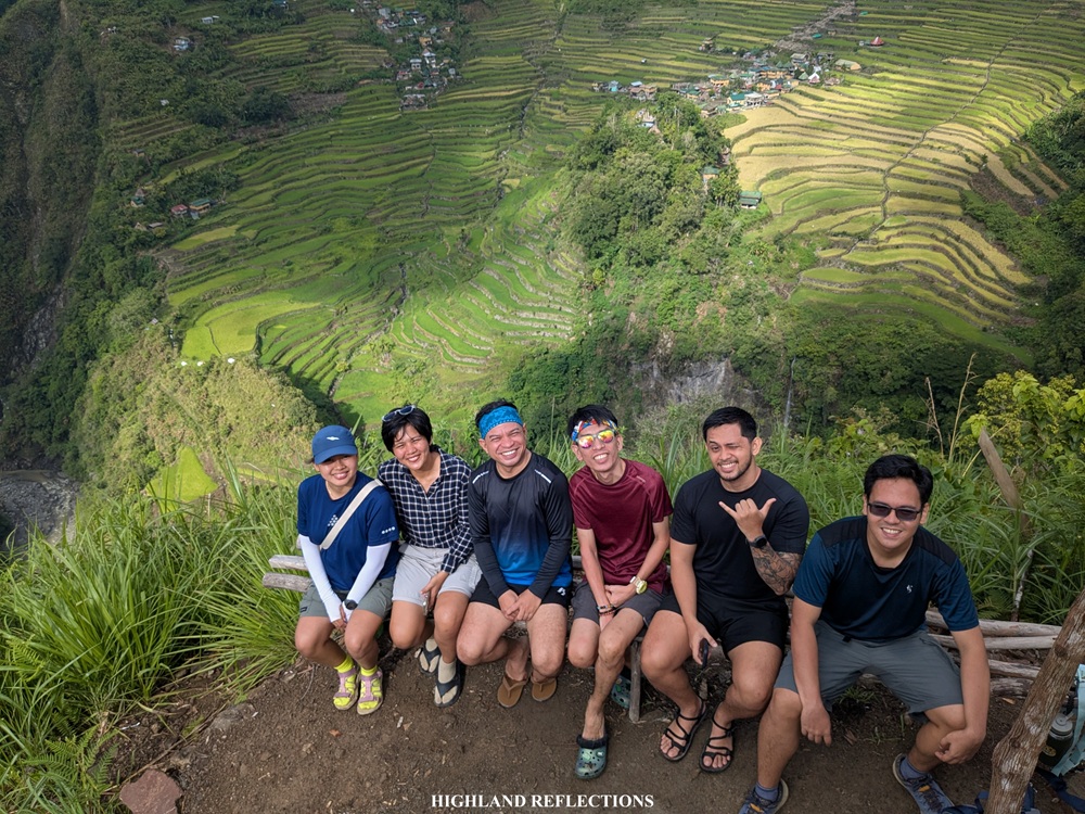
In doing the Awan Igid Trek during the last weekend of May, 2026, I joined an organized event by one of my go-to organizers, Rochelle of ILocanang Gala. Together with Rochelle are some companions in the hiking community, some of whom I have been with in my past hikes.
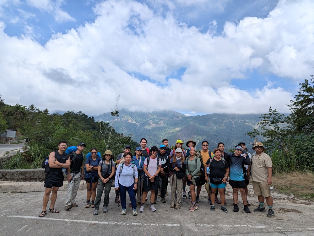
We were at the Poblacion (town center) of Banaue on the morning of May 30, where we had our breakfast and where we bought our packed lunch. We also met with Kuya Amor Halino, who was our guide back when I first visited Batad and Tappiya Falls in 2022, and when I did the Mt. Amuyao via Batad-Mayoyao Traverse in the same year. I knew I was in good hands for this hike!
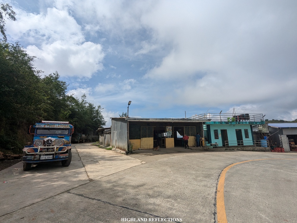
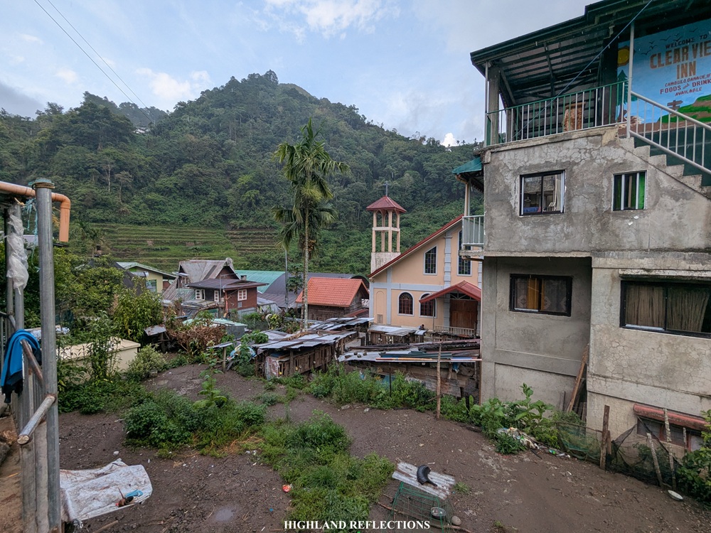
After having our breakfast, we climbed aboard our van to go to KM9 of the Banaue-Bontoc highway, which, as the name suggests, is 9 kilometers north of Banaue’s Poblacion. Upon arriving, we alighted at the side of the highway where a smaller road detours to the right, leading to the Awan Igid Trail. The jump-off point is near an eatery named Restorante Dugao, which, to its front, has some nice views of the higher portions of the Banaue-Bontoc highway near Mt. Polis in the Ifugao-Mountain Province boundary (not to be confused with the same Mt. Polis in Bauko).
We started the hike at 9:30 in the morning. The hike can be divided into four sections: Awan Igid to Pula, Pula to Cambulo, Cambulo to Batad, and Batad Proper.
Awan Igid to Pula (10 KM, 3-4 hrs)
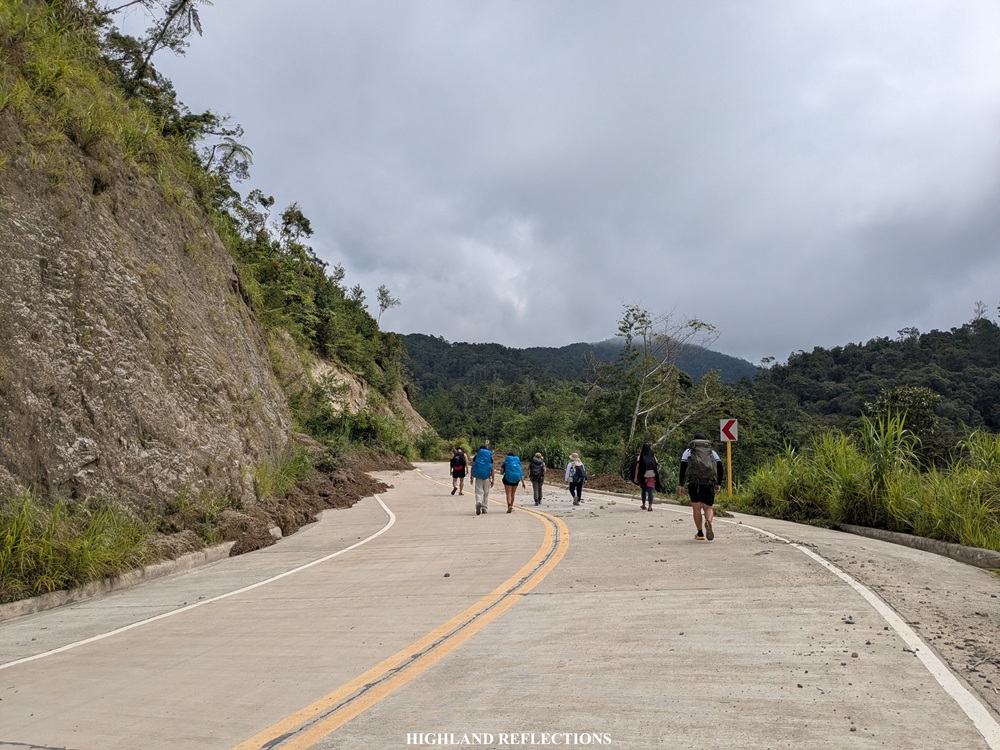
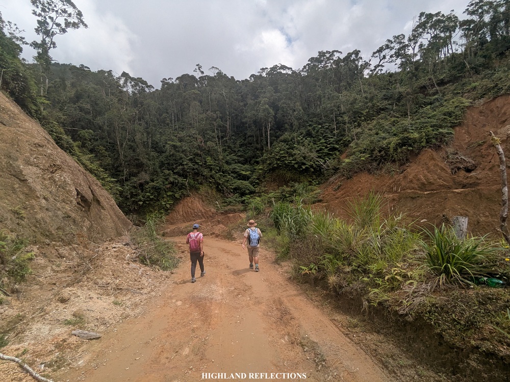
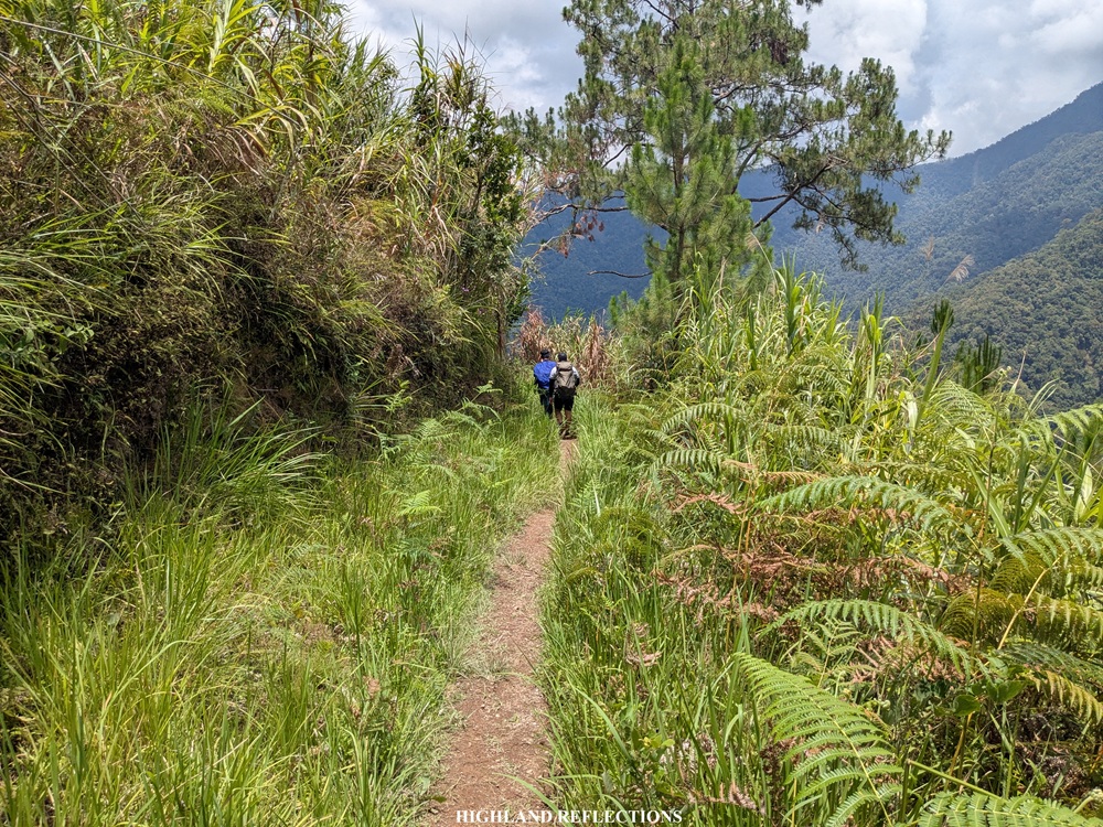
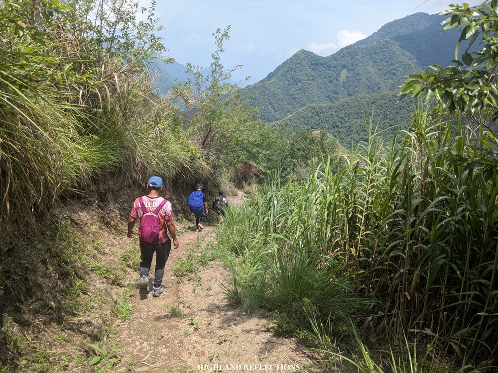
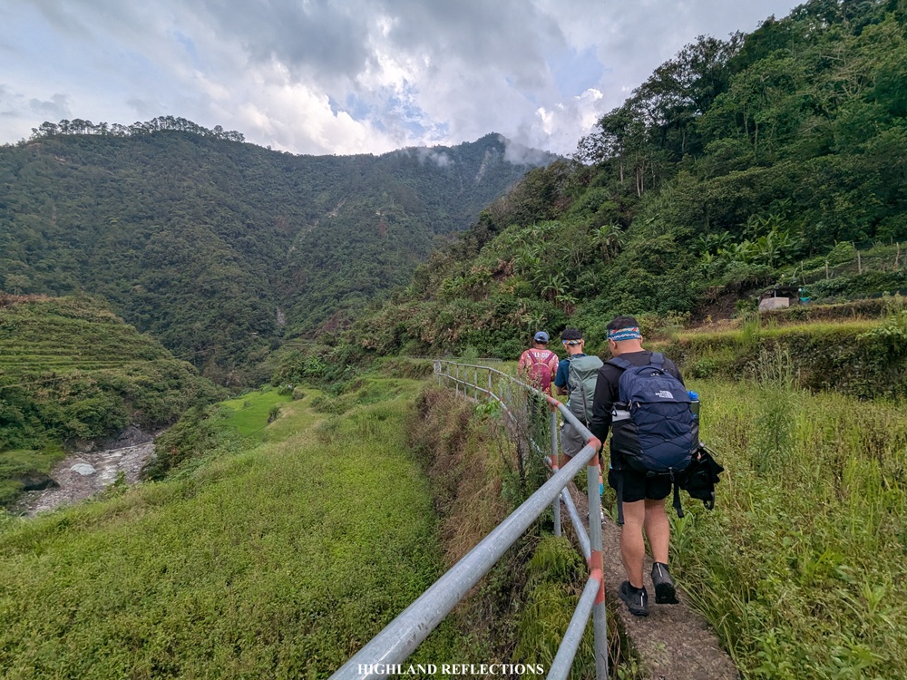
If one would start at the highway like we did, then the section from Awan Igid to Pula is undoubtedly the longest portion of the hike. This section initially consists of a 1.5-kilometer cemented road that mostly goes upward, followed by almost 6 kilometers of unpaved road carved along a mountainside. This unpaved section has some ascending portions, providing views of the faraway valley where Pula and Cambulo are located. One can opt to rent a jeepney or a motorcycle here to lessen the distance going to Pula.
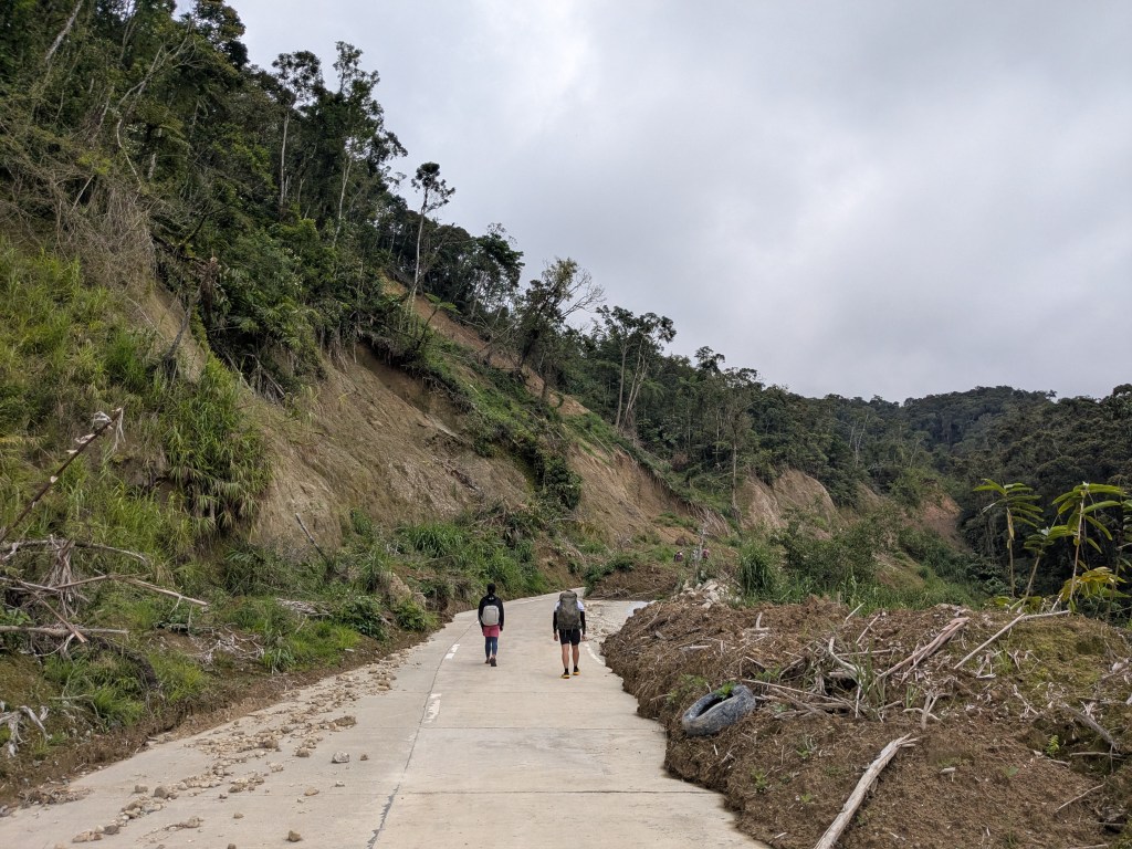
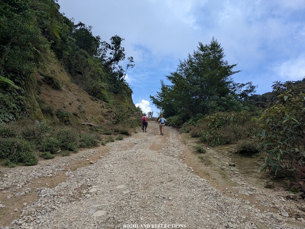
The other half of the unpaved road goes downwards. The last section of this rough road is marked by a waiting shed, signaling the start of the footpath trail. This was located eight kilometers from the highway, which we reached after walking nonstop for two hours.
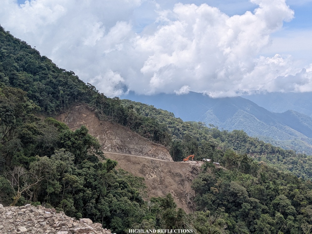
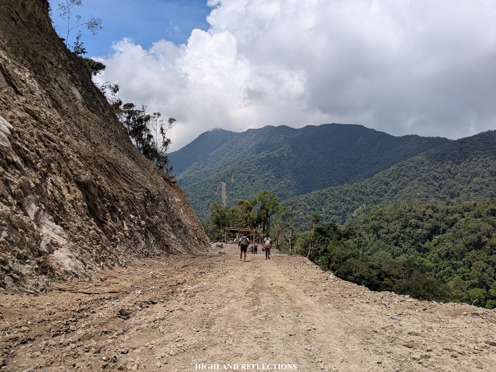
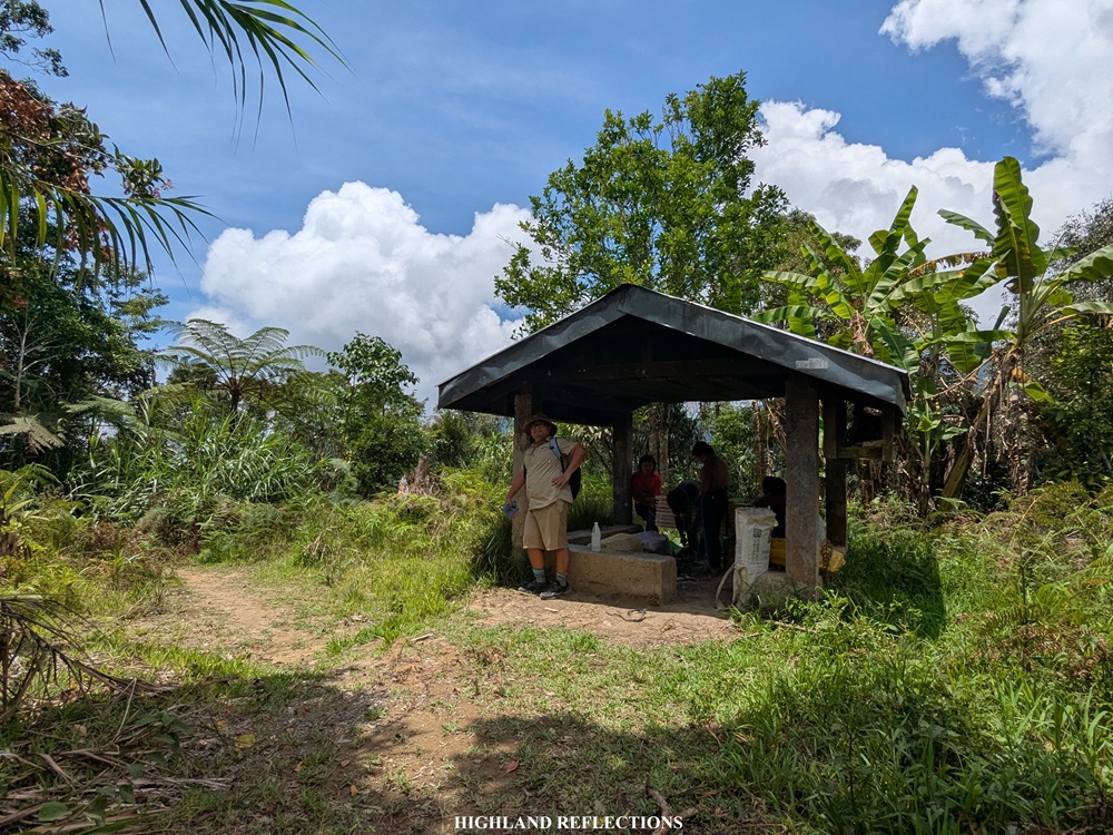
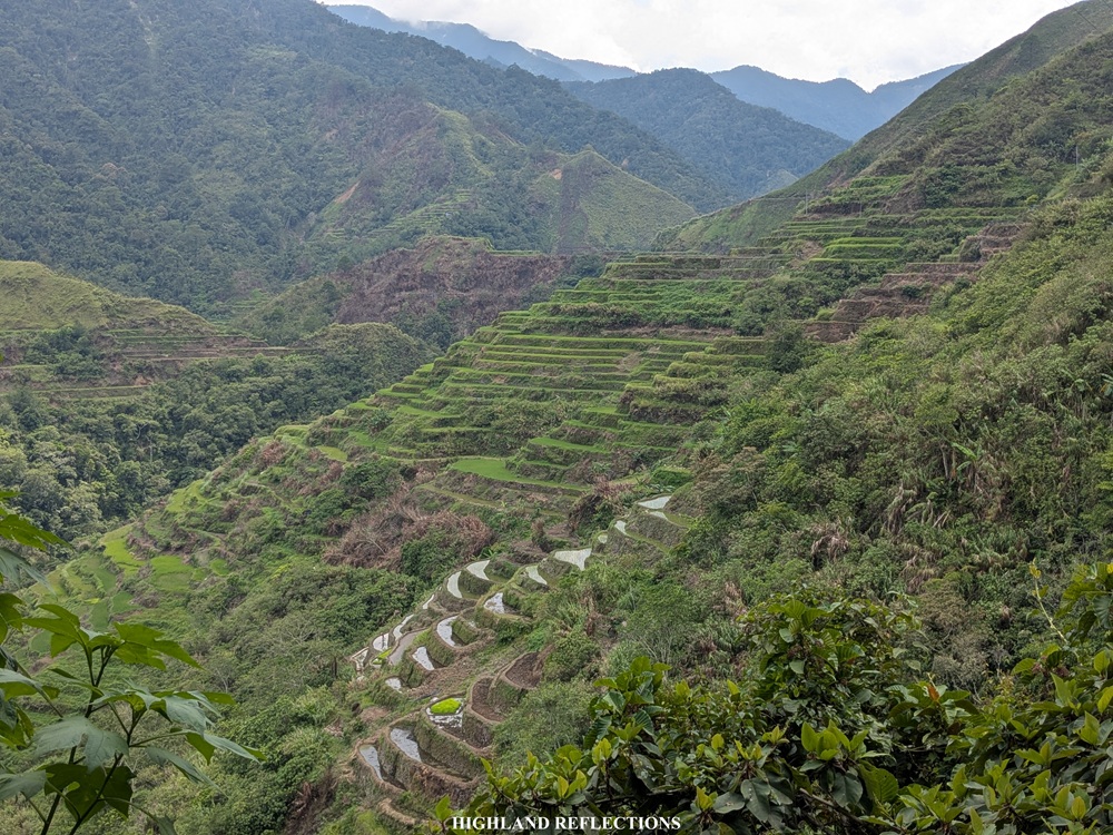
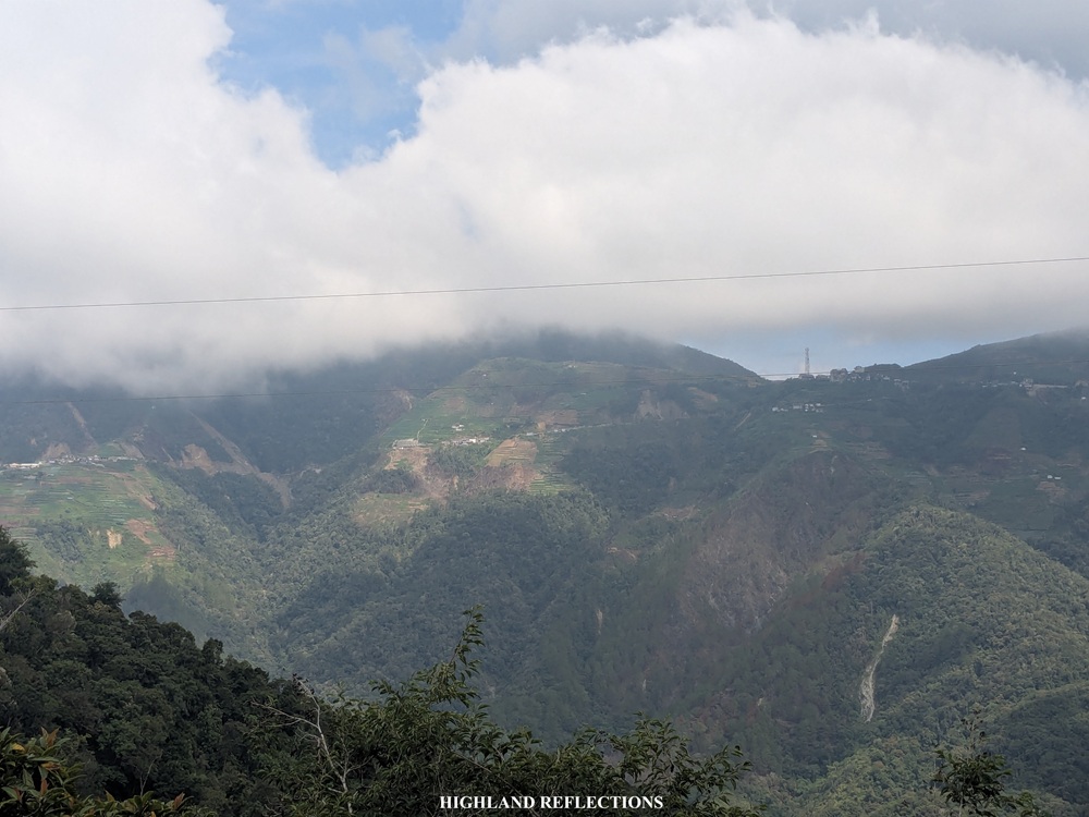
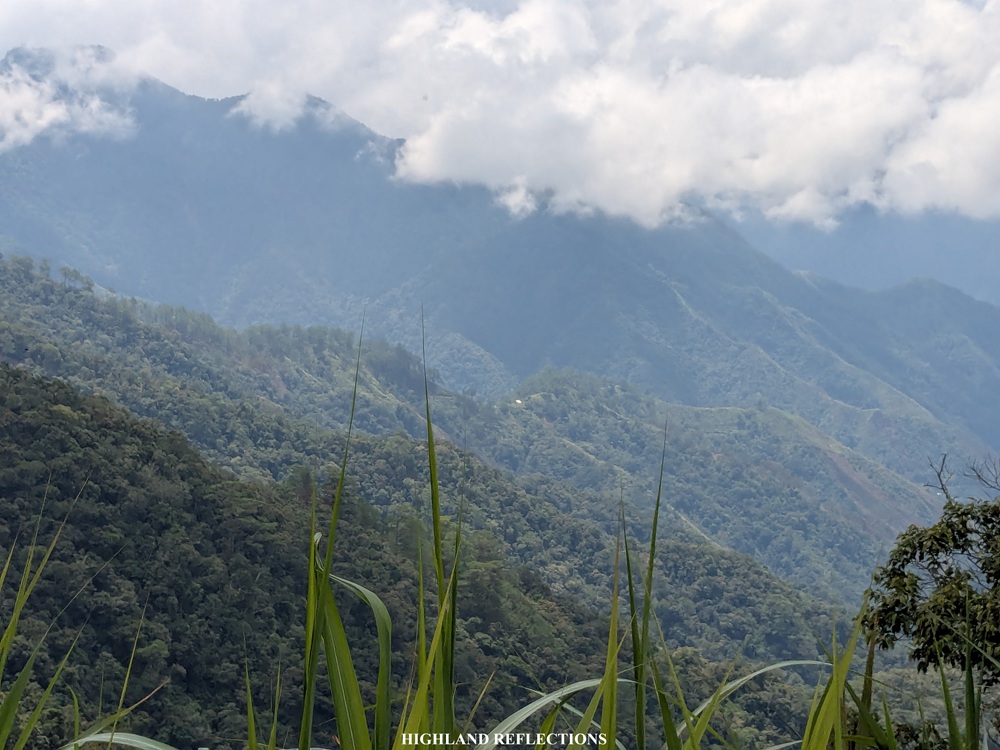
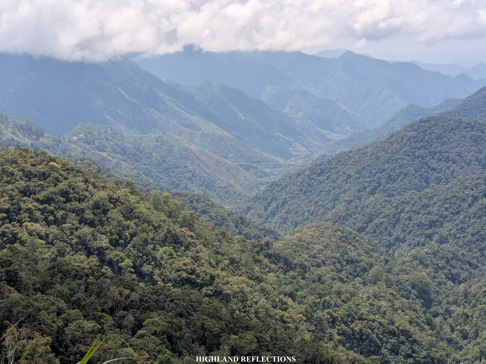
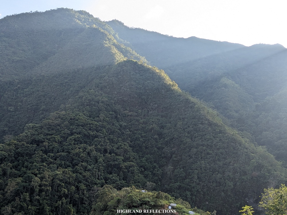
The initial parts of the trail had some alternating sections of forests and open areas, providing views of the nearby mountains that we just passed through, and some landslide sections brought by the onslaught of Typhoon Uwan in 2025. Then, at about the tenth kilometer into the hike, we reached the second waiting shed, which marks the beginning of Pula Village. It was 12 noon, two and a half hours after starting the hike.
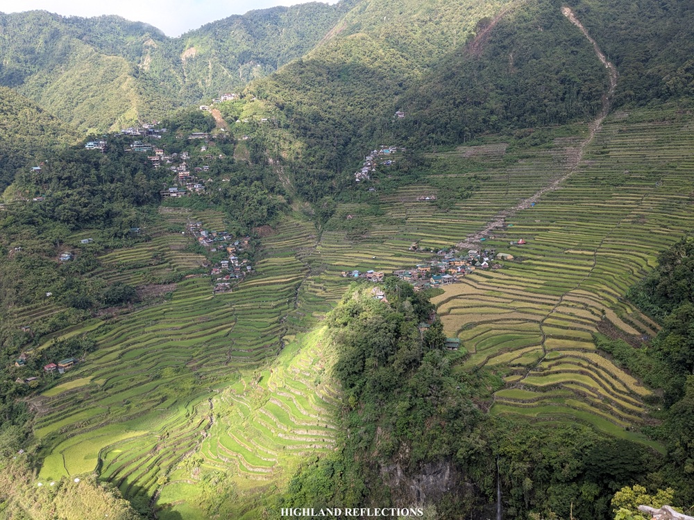
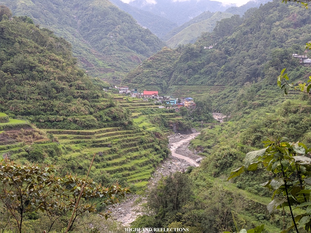
At the waiting shed, we had our lunch. Just beside the waiting shed is a ravine where, below, some mini villages tucked on the mountain slopes are visible. Kuya Amor informed us that those were some of the villages that can be found within Barangay Pula’s vicinity. While we can opt to go there, the trail to Cambulo does not pass through those villages. Still, we would be passing through other mini villages within Pula. I was about to find out what the rice terraces in the village look like.
Pula to Cambulo (6 KM, 3-4 hours)
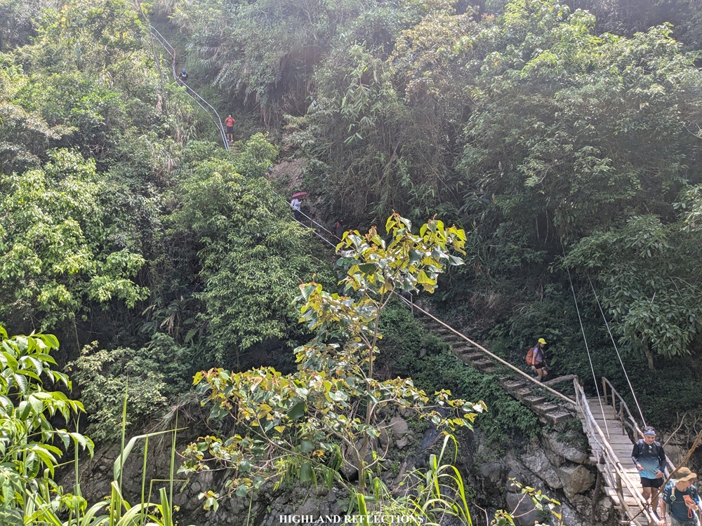
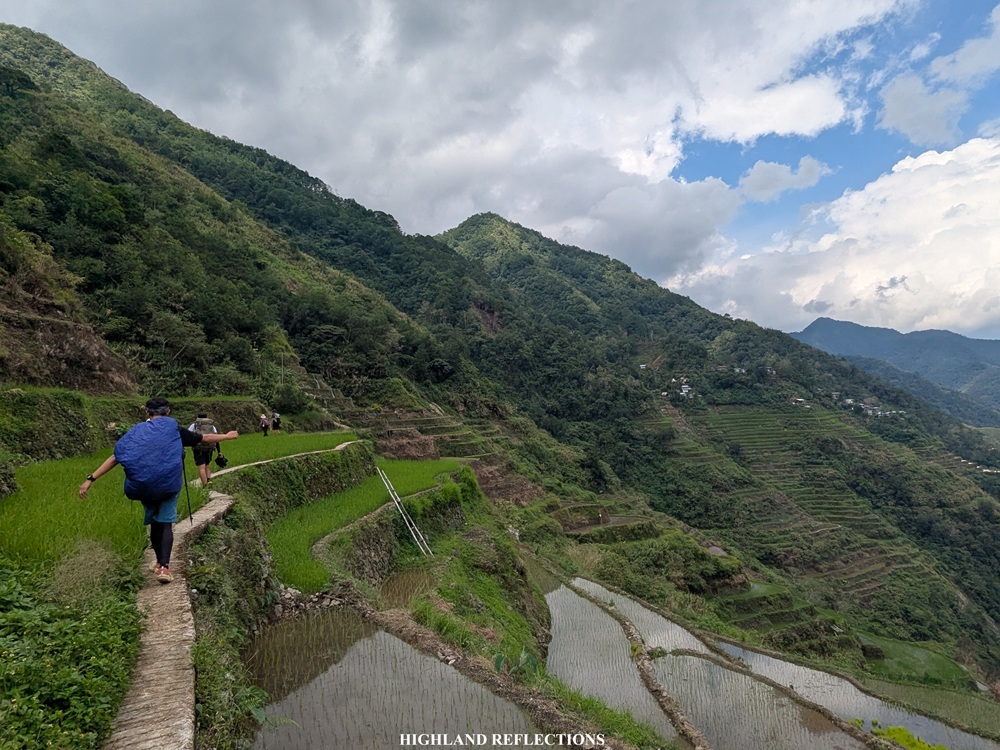
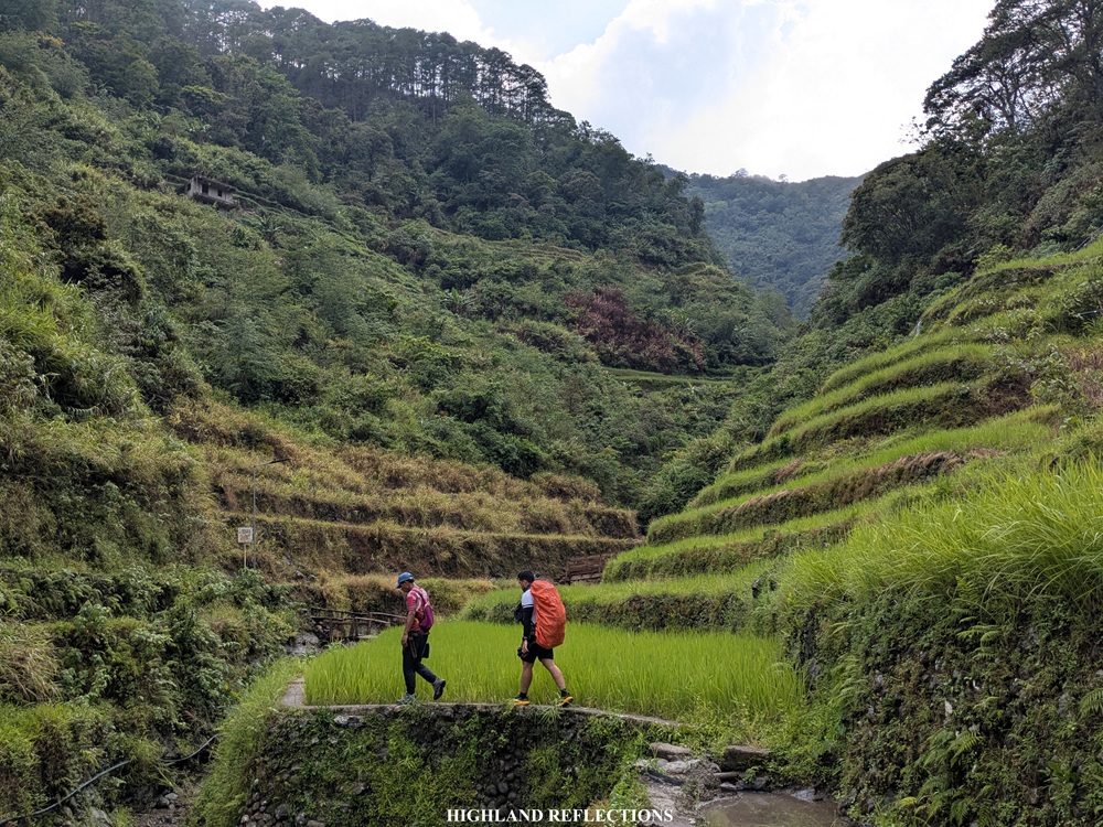
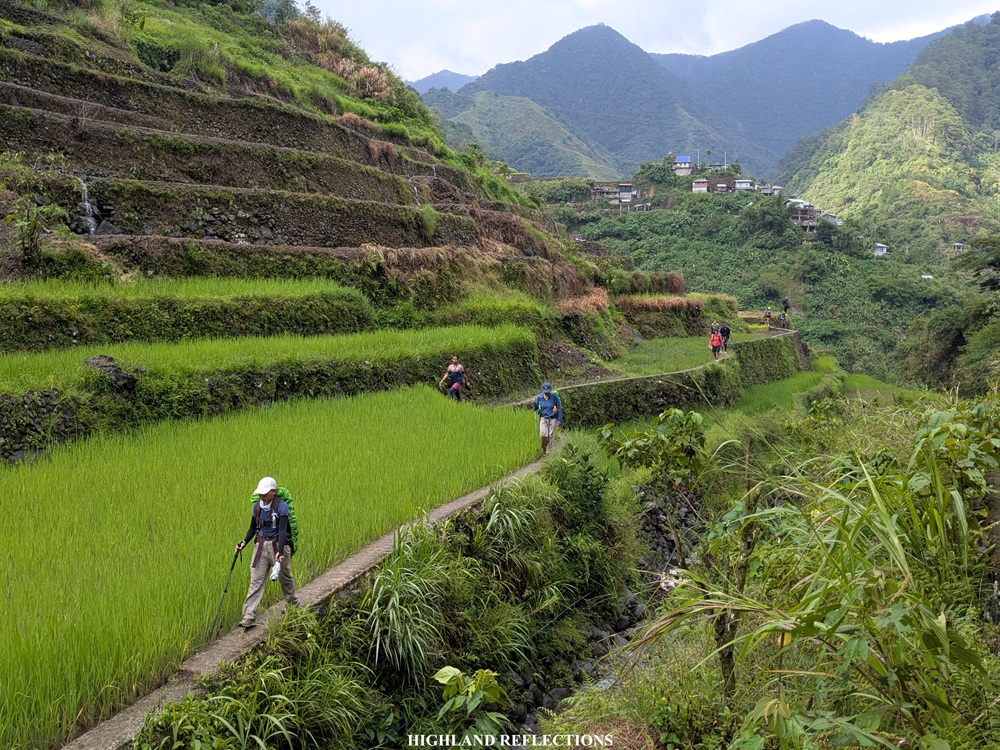
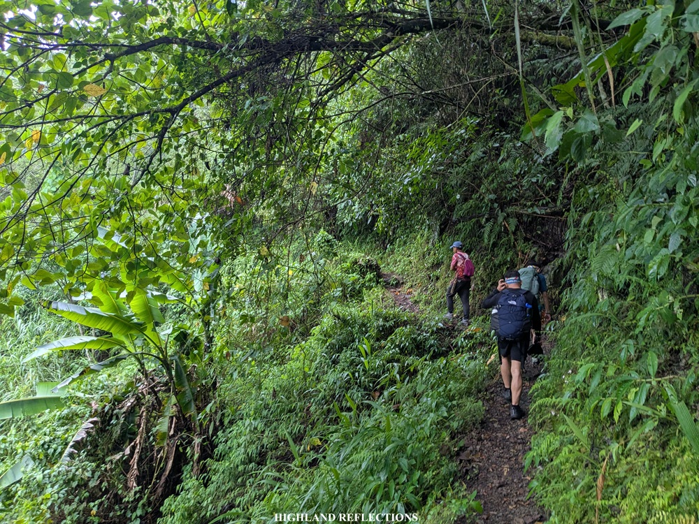
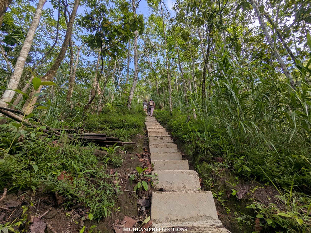
The trail connecting Pula to Cambulo is perhaps the most difficult yet the most scenic part of the hike. In this section, we had to walk through the dikes of the rice terraces and climb down some very steep cemented staircases that were hard on the knees.
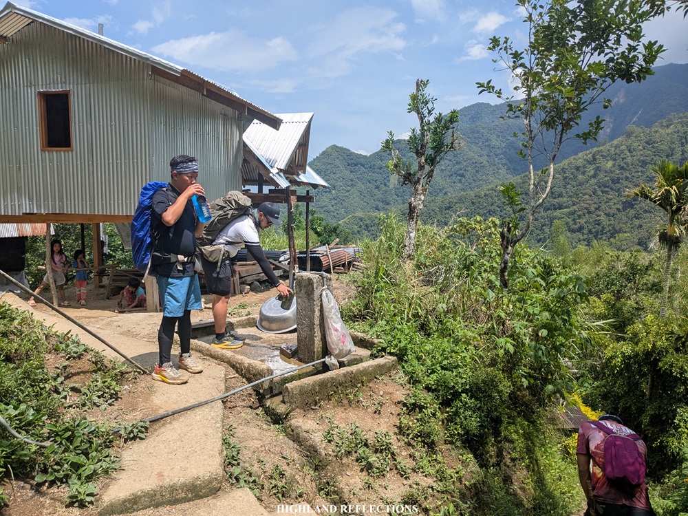
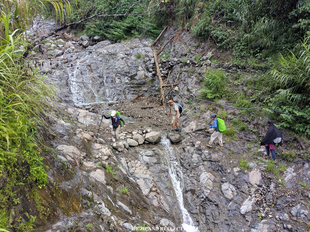
We started the hike at around 12:45 in the afternoon. From the waiting shed, we had to descend a trail with some sections with cogon grasses on the side, making us exposed to the heat of the midday sun. Just a few hundred meters, we encountered a house that had running water from a hose where we refilled our water bottles.
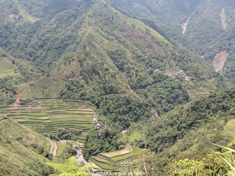
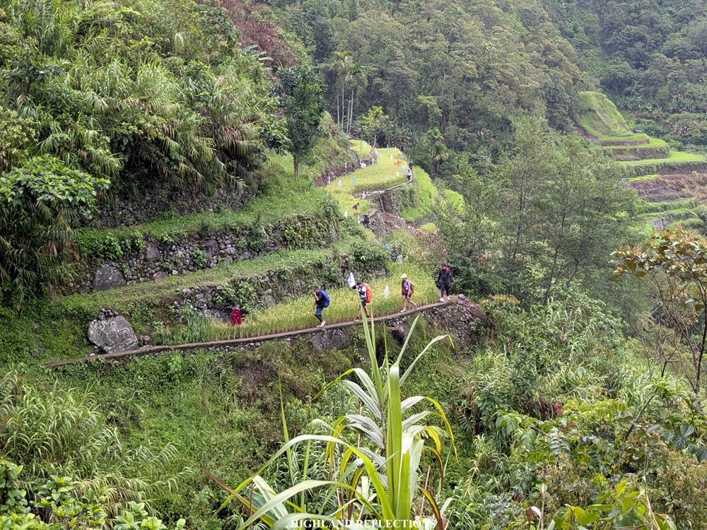
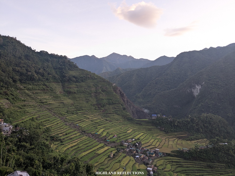
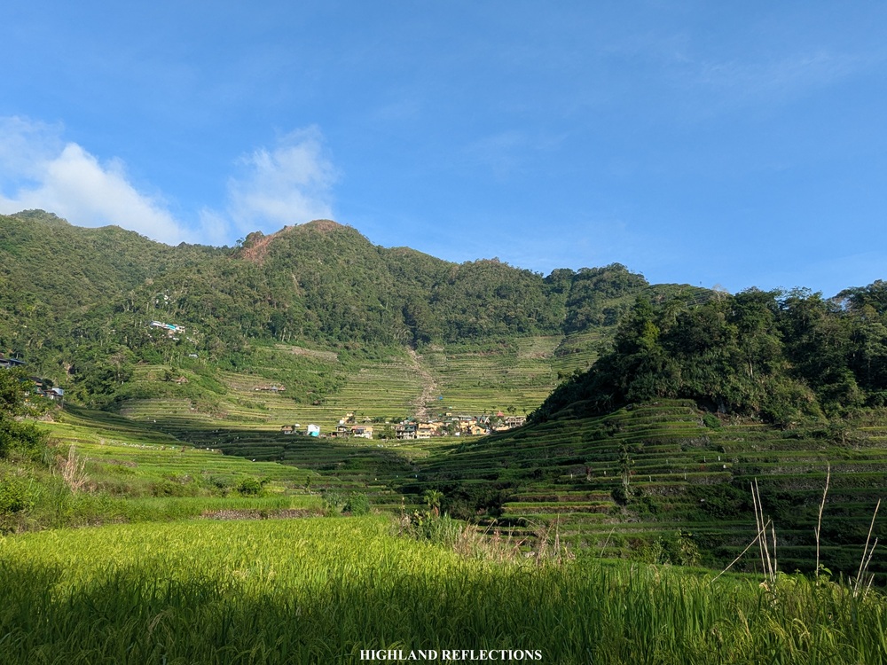
The pathway continues towards a mini village, downward staircases and all. This went on and on until finally reaching a valley where we encountered one of the many hanging bridges for this trek. Past the hanging bridge is a continuous flight of cemented stairs. At the topmost part is where we finally had our first glimpse of the rice terraces in Pula! It was 1:40 in the afternoon, an hour after starting the hike from the waiting shed.

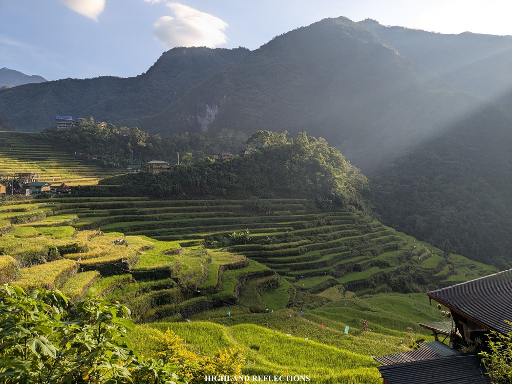
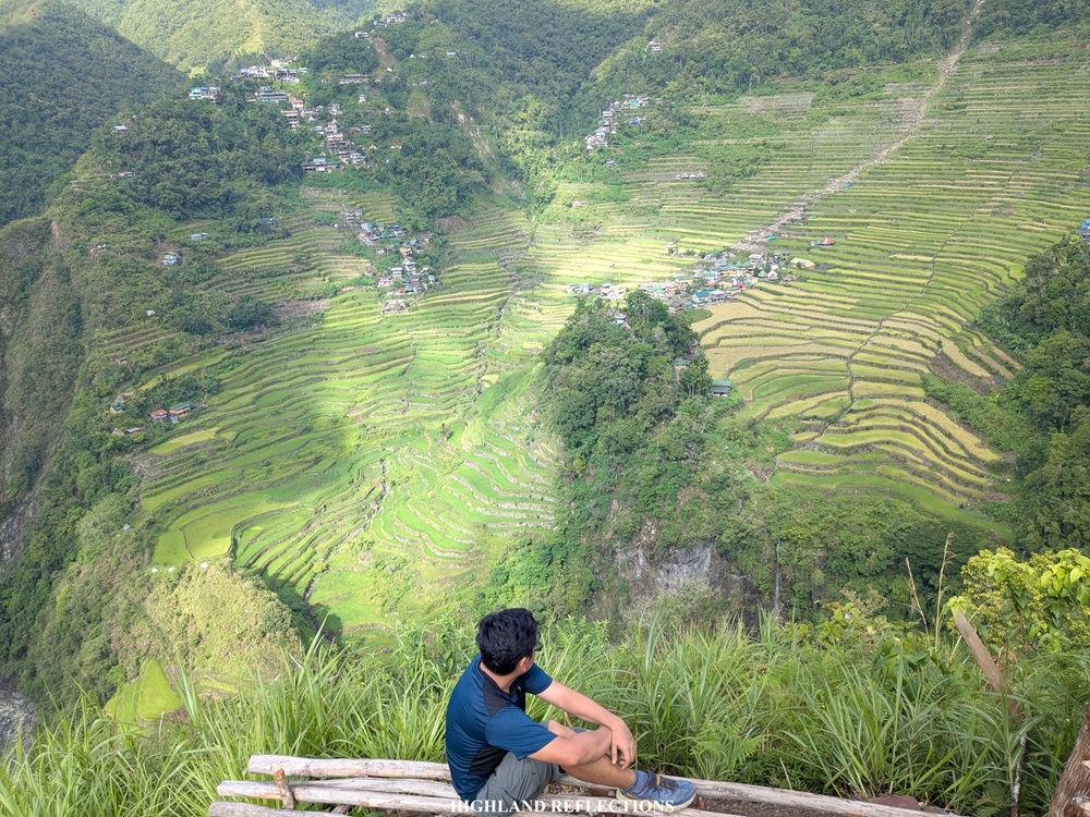
The trail continues on a footpath that leads towards the rice terraces. Around 2 in the afternoon, we were already at the vicinity of the rice terraces, walking on its dikes. To our right is an expansive view of the rice terraces at the opposite slope from where we were. At the bottom is a steep drop leading to some of the layers of the rice paddies, and way below, the river that meanders through the valley. Since we were walking at the edge of one of the rice paddies, we had some nearby encounters with the planted rice to our left.
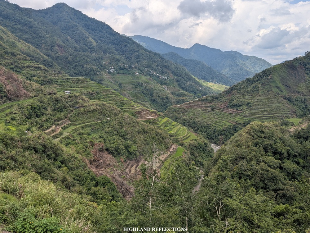
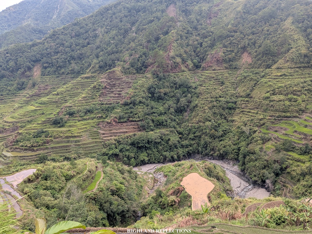
The rice terraces here are marvelous. With each distance we covered, new angles and layers of rice terraces were revealed to us. Despite having a good time marveling at the sight of the rice terraces, we faced an expected ordeal—an afternoon rain passed. Good thing was that we were inside a local’s sari-sari store when the rain poured. We took the chance to order some sodas to quench our thirst. Despite being in the Cordillera Region, our hike was so humid, it was making me sweat buckets!
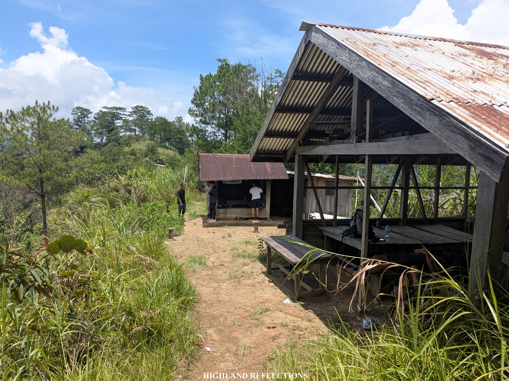
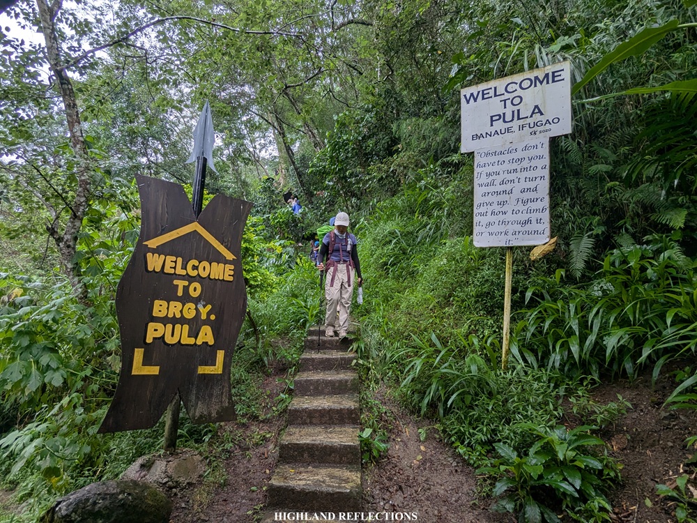
By around three o’clock, the rain stopped and we continued with the hike. Past the sari-sari store, we descended some of the last sections of Pula Village before reaching the boundary between Pula and Cambulo. This boundary was marked by a waiting shed and some signages welcoming hikers to Barangay Pula.
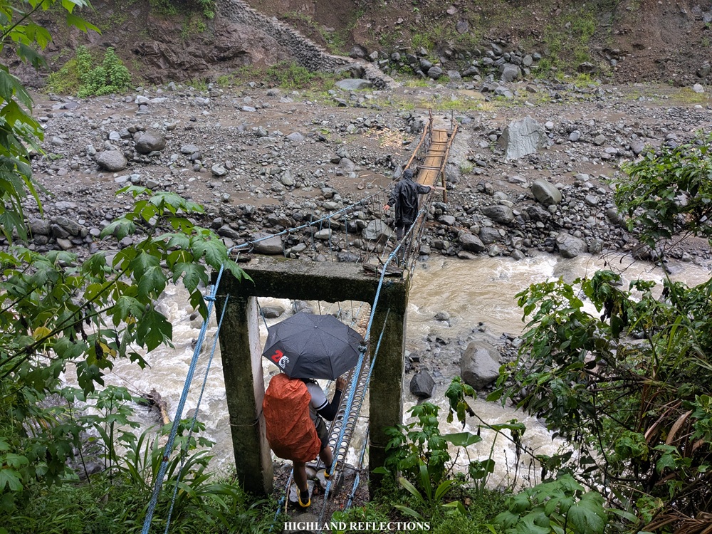
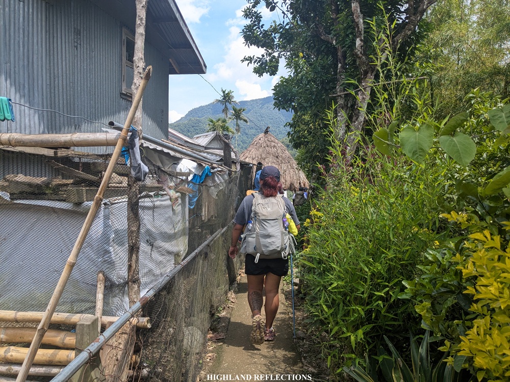
From the waiting shed, it was another round of descent again on the stone staircases, followed by crossing another hanging bridge that leads to some of the dikes of the next layer of rice terraces we needed to traverse within the vicinity of Cambulo. This was, perhaps, the easiest section of the hike, as there weren’t many staircases that we needed to negotiate. It was just us walking on some dikes and footpaths at the edge of the terraces. We saw some houses tucked along the nearby slopes along the way.
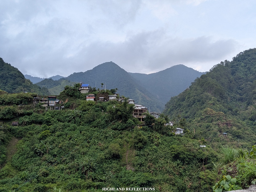
Finally, at 3:30 in the afternoon, we reached the main village of Cambulo. It was raining hard when we got there. Hence, we took the chance to have some snacks and take a rest at one of the sari-sari stores. These stores literally saved us for this hike! From the store, I had a nearby view of the church and the covered basketball court inside the village. I had fond memories of this court, as this was where we rested during our Mt. Amuyao hike four years ago.
We rested some more and got the chance to amuse ourselves in Cambulo. It was late in the afternoon when we started the last push to Batad.
Cambulo to Batad (less than 4 KM, 1.5-2 hours)
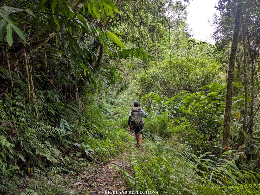
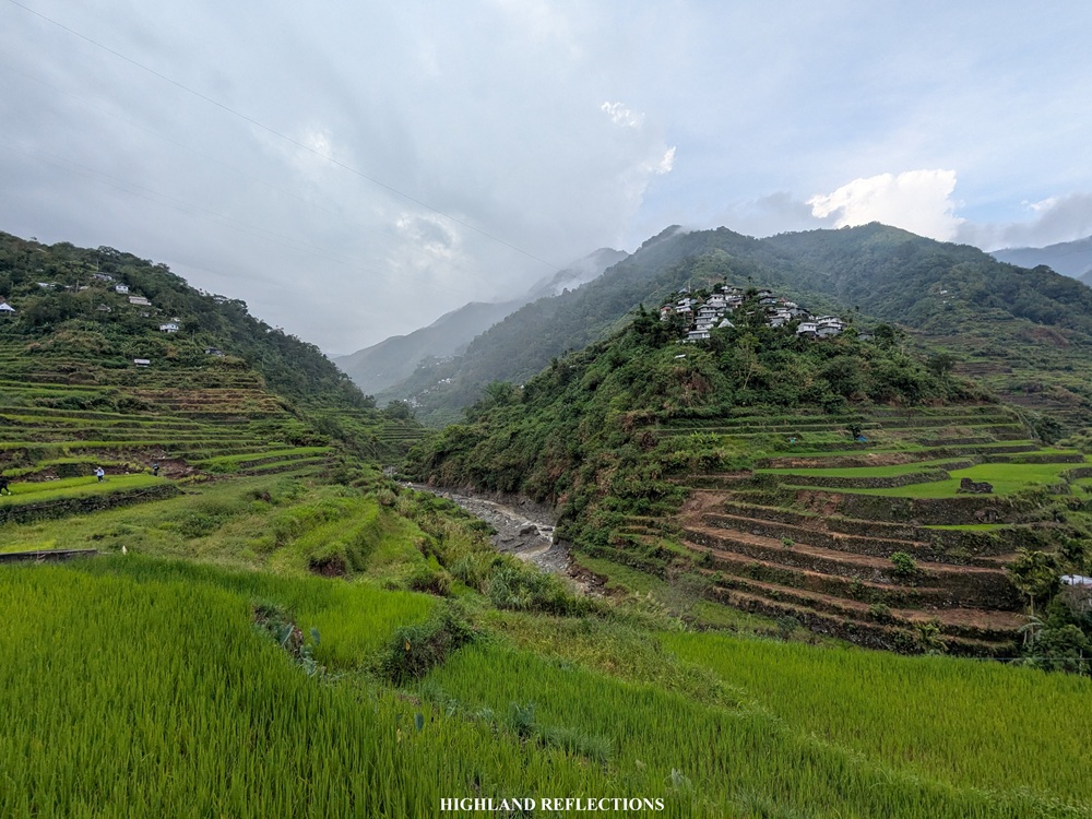
The easiest section of the Awan Igid Trail is the path connecting Cambulo to Batad. This was a familiar path for me as I have passed through this section in reverse during our Mt. Amuyao Traverse hike. Since Cambulo is the lowest point in the entire hike, it was expected that the trail going to Batad goes upwards.
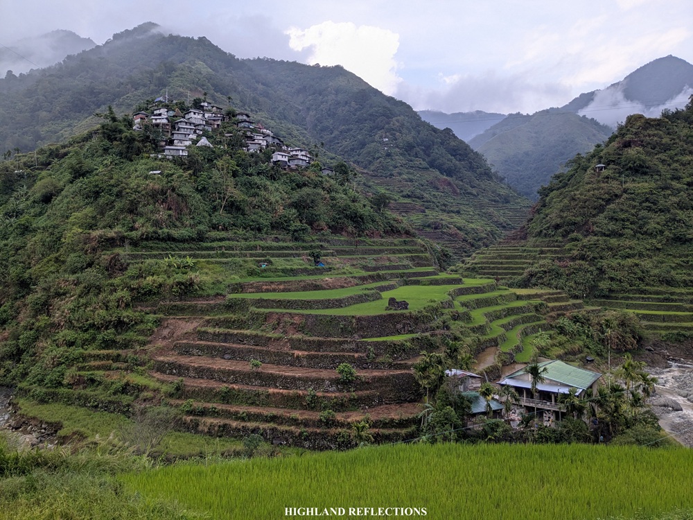
From Cambulo, we initially passed through some more rice paddies near the village. This led to some footpaths at the side of a mountain where some landslides are encountered. Some sections, of course, like the classic Ifugao trail experience, had some cemented staircase sections that was hard on the knees. Along the trail, we saw some petals of a jade vine that fell on the ground. I was trying to find if there was still a live jade vine nearby, but to no avail. Somewhere along the trail, we rested at a waiting shed, which, according to Kuya Amor, is the boundary between Cambulo and Batad.
We marched on and on to finally get to our homestay. At that point, I was already craving for some heavy meal and a bed to lie on. The final stopover along the trail was the house of a local where we refilled our water containers. From here, it took us some minutes of nonstop walk before reaching one of the highest viewpoints atop the rice paddies of the Batad Rice Terraces. It was 5:40 in the afternoon. Finally, we reached Batad!
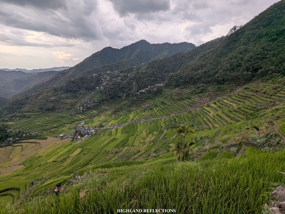
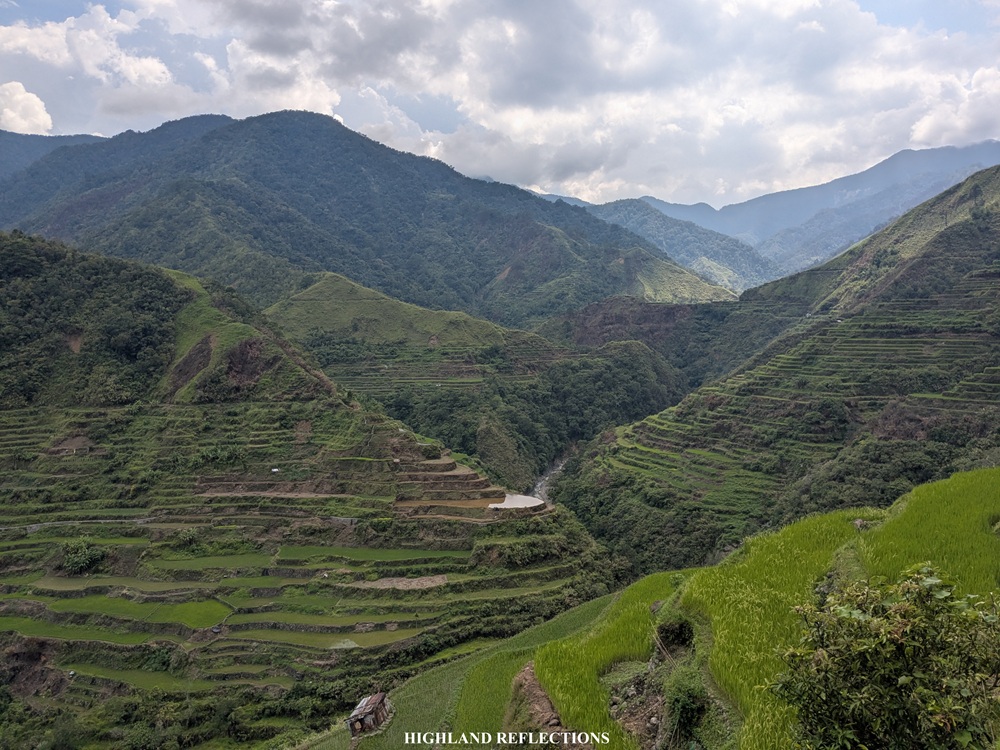
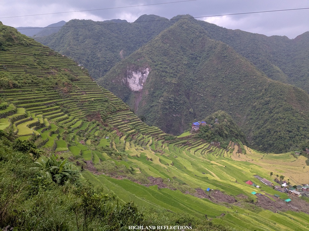
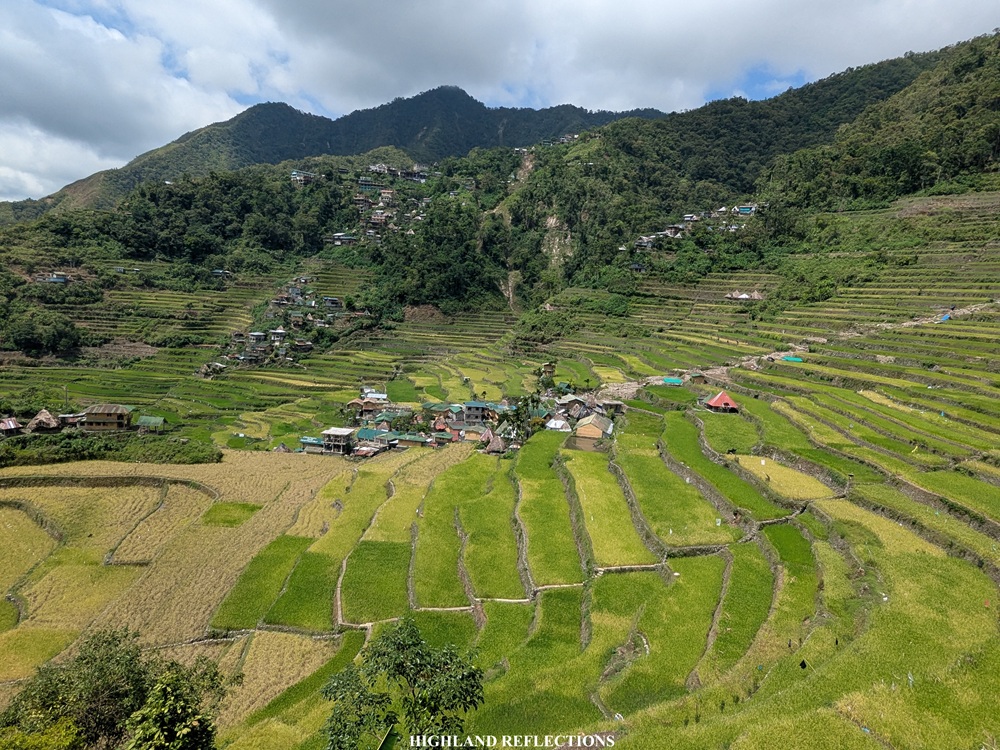
There, the majestic amphitheater-like structure of the Batad Rice Terraces unfolded right in front of us. It was still as stunning as ever, despite the huge scar-like landslide in the middle that was said to be caused by the destruction brought by Typhoon Uwan.
We savored the time taking pictures at the view deck, making use of the last bit of sunlight to appreciate the heritage rice terraces. As the sun was beginning to set, we marched the last one kilometer trek along the upper paddies of the rice terraces and some of the footpaths and staircases leading to our homestay inn.
It was past 6:00 in the evening when we reached our homestay inn, eight and a half hours after starting the hike. Technically, we’ve finished the entire Awan Igid Trek by that time. Mission accomplished!
That night, we had our late sumptuous dinner courtesy of the inn’s restaurant. We also had some socials to end the night. I took the chance to sleep, as we would be exploring some portions of the Batad Rice Terraces the day after.
I’m still in awe that we took the brunt of the entire Awan Igid Trek in just one day!
Exploring Batad: Palad View Deck and Tappiya Falls
For our second day in Banaue, we started our excursion early at 6:30 AM to avoid the heat of the morning sun. Although we could have extended the Awan Igid Trek towards Bangaan Village, we opted to just stay in Batad and explore some of the off-beaten paths in the area. For this trip, we circled the entire rice terrace complex, where we climbed down the river at the bottom of the terraces, climbed up to Palad View Deck (905+ MASL), climbed down the river again and followed its entire section going to Tappiya Falls, then traversed the mid sections of the terraces again to return to our inn.
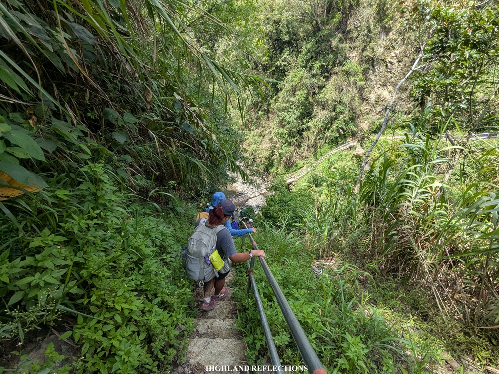
From our homestay, we descended the side of the rice paddies of the Batad Rice Terraces towards the river at the bottom. From ~950 meters above sea level, the descent required us to lose 250 meters worth of elevation onwards to the river, which sits at around 710 meters above sea level. We crossed to the other side of the river via a hanging bridge.

Opposite of the hanging bridge is a flight of cemented staircases once again. Along the way, we encountered a junction where the leftward ascent goes to Palad View Deck—our destination—while the trail towards the right goes to the higher Awa View Deck (1,035~ masl), which I wish to visit in the future. Left we went! We followed the continuation of the cemented staircases that led to short flat section. At the end of this flat section is the last assault going to Palad View Deck.
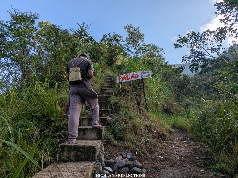
The last of the staircases were some of the steepest portions that we ever hiked in the entire two-day trip! The intervals in between each staircase were huge. My knees were close to touching my chest when I was making my way up! That’s how the steep the trail is. It reminded me of some of the similar ‘cardiac trails’ I encountered in the past. The last part before the view deck had some unpaved paths, but was still very steep. Finally, past 7:30 in the morning, we were at the top of Palad View Deck (905+ MASL).
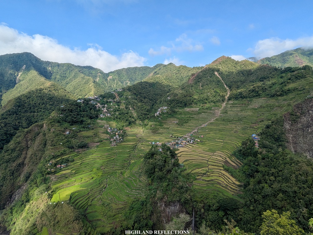
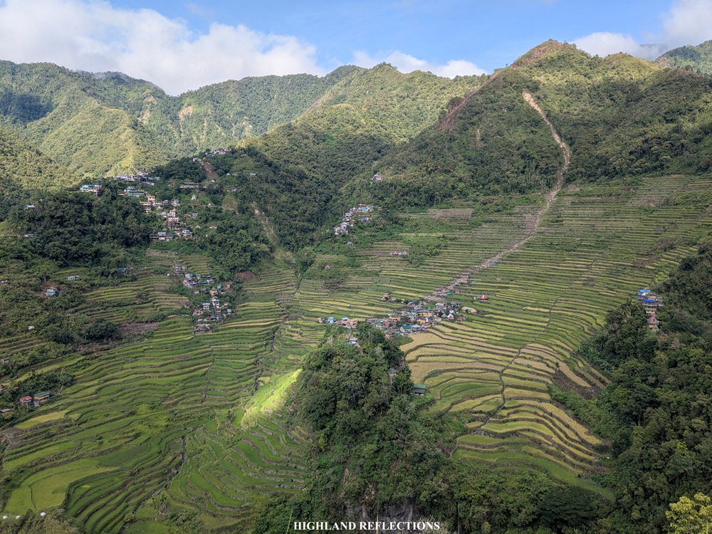
At the top, the view deck provided a panorama of the entirety of the amphitheater-like structure of the Batad Rice Terraces! It was like viewing an amphitheater on top of the main stage. I’ve never seen the Batad Rice Terraces from this angle! Opposite of us, I could spot our homestay which was a tad bit higher than us by about 50 meters. To our right, the village of Cambulo can be seen from afar.
We savored the beautiful panorama at the view deck. One by one, we took turns snapping some photos at a bench built at the edge of the cliff. Behind it is an unfinished man-made view deck where we climbed on top to get some better angles of the rice terraces.
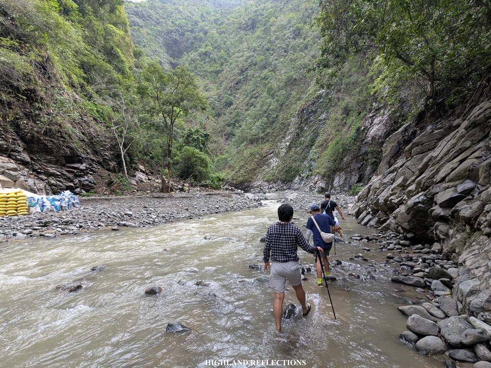
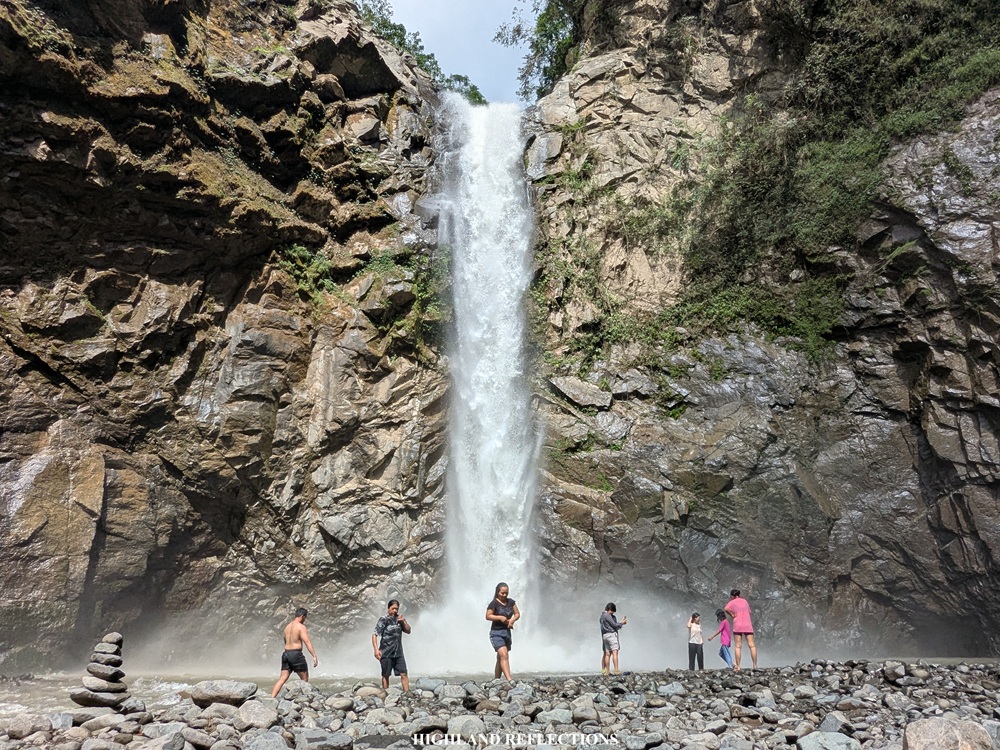
After enjoying our time at the view deck, we went down towards the river. It only took us about ten minutes to descend. Upon arriving at the river, we immediately started the river trekking, wading our feet inside the shallow waters of the river. I can imagine how strong the currents and how deep the waters here would be during the rainy season! Good thing was that we hiked during the near end of the peak dry season in the country.
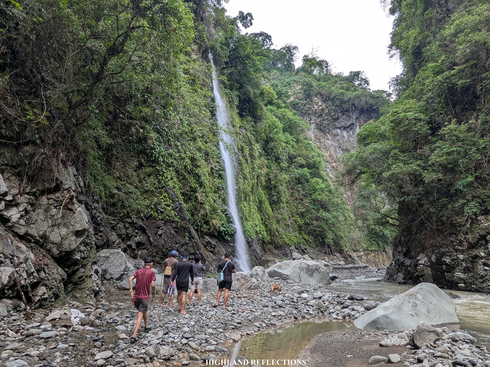
At the first part of the river trekking, we encountered a random waterfall at the side of the trail.
We crossed the river multiple times and walked on some rocky sections at its side marching forward. The river trekking didn’t require technical movements, and so we reached the vicinity of Tappiya Falls around after an hour of walking and crossing the river.
This was my second time seeing Tappiya Falls. My first time was in 2022 when I had a trip to Batad with my girlfriend and college friends. The waterfall was still as loud and as strong as ever! I sat down on a rock in front of the waterfall and reminisced my time here with some of my friends. I wished them well as I was contemplating.
We returned to our homestay by following the classic trail going to and from Tappiya Falls. At the side of a slope, we had to climb another set of cemented staircases that lead to what is famously known as the ‘Blue House’ located at the bottom right part of the Batad Rice Terraces. From there, we traversed the entire mid part of the rice paddies before reaching our homestay past 10:30 in the morning, completing the entire loop trip in about four hours!
I tried to rest and get some refreshments after that very humid hike. I also made sure that I was packed and ready to go home, as the inn already checked us out at 10 in the morning.
And that concludes my awesome weekend in Banaue! From our homestay, we still needed to negotiate an upward path-then-road to go the exit point where our van was waiting. We made our way home with souls fulfilled and with legs burned up. What a worthwhile weekend.
**
Of course, just like any other hike in the Cordilleras, discovering more sections of the region feels like unlocking a dark section of an adventure map. As someone with a high deprivation-type curiosity, I can’t help but always wonder what other sections I can explore in an area that I went to. In the case of the Awan Igid Trek, I wonder what lies on the long trail connecting Pula to the town of Barlig, Mountain Province where Mt. Amuyao is geographically located. Additionally, I wonder how high up the view is from Awa View Deck. Are there more trails beyond it? Lastly, I wonder what the Bangaan Rice Terraces look like. Given how proximally close it is to the Batad Rice Terraces, is it as equally majestic as its neighboring village?
This is something that I’ve already known for a while, but there are places like Batad and Banaue that you need to go to over and over again. Hopefully, I get to come back the soonest!
Itinerary
Day 1
07:30AM Banaue Poblacion, breakfast and buy packed lunch
09:00AM Awan Igid Viewpoint, last-minute preparation
09:30AM Start hike (KM 0)
11:30AM First waiting shed (KM 8)
12:00PM Waiting shed at Pula, lunch (KM 10)
12:45PM Resume trek to Cambulo
02:15PM Last village of Pula, rest and buy snacks
02:45PM Resume trek
03:00PM Boundary between Pula and Cambulo
03:30PM Cambulo proper, rest and have snacks
04:30PM Resume hike
05:30PM Batad Rice Terraces, take pictures
06:00PM Homestay inn in Batad
09:00PM Dinner
10:00PM Lights out
Day 2
05:30AM Wake-up call, breakfast while overlooking Batad
06:30AM Start exploring Batad
07:30AM Palad View Deck
08:15AM Start descent
08:30AM Start river trekking
09:30AM Tappiya Falls, take pictures
10:00AM Start hike going to homestay inn
10:30AM Homestay, rest and pack-up
11:30AM Walk to exit point
12:00PM Exit point, wash-up and eat lunch
01:00PM Start ride home going back to Manila
02:00PM Late lunch in Banaue
