Back in 2016, mountaineers and hikers in the Philippines were excited about a mountain that was being explored in Ilocos Sur. Said to be relatively as formidable as the country’s most difficult mountains to climb such as Mt. Guiting-Guiting, Mantalingahan, Sicapoo, Halcon, among others, this mountain became famous for its perilous knife edges, treacherous ravines, and steep pine forest slopes. This was none other than Mt. Tuwato, located along the boundaries of Cervantes and San Elias in Ilocos Sur.
As one of Ilocos Sur’s prime hiking destinations, Mt. Tuwato is a favorite among seasoned hikers and trail runners in the Philippines. Its name, an Ilocano term for dragonfly, was due to the abundant sightings of dragonflies by the locals along the mountain’s slopes. Despite being located in Ilocos Sur, the mountain—similar to the neighboring Mt. Namandiraan—is part of the Cordillera Mountain Range, and is geographically closer to Mountain Province than to the lowland municipalities of Ilocos Sur. It is also a historical mountain, as it sits within the Bessang Pass National Park, which served as a battleground between Filipino and American allies contra the Japanese soldiers during World War II.
Here are the characteristics of the hike using the Pinoy Mountaineer format:
MT. TUWATO via SAN LUIS LOOP TRAIL
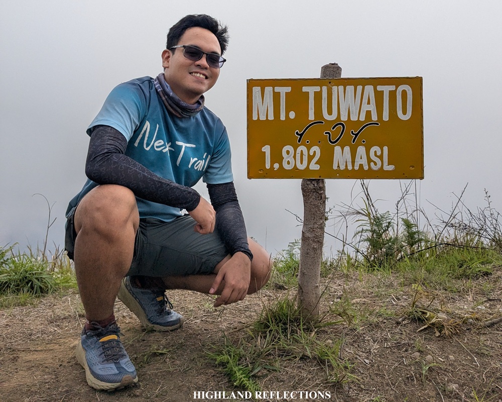
Jump-off Point: Sitio Liqueo, San Luis, Cervantes, Ilocos Sur
Days Required / Hours to Summit: 1-2 days / 6-10 hours
Specs: Major climb, subjective difficulty 8/9*, trail class 2-4
*Although the difficulty level is a subjective assessment of the blogger, it is based on the relative difference of Tuwato when compared to other mountains—it is as equally difficult as Namandiraan, Pantingan-Tarak Traverse, Kalatungan-Wiji Traverse, and Madjaas, all known to have difficulty levels of 8/9, but not as difficult as Guiting-Guiting and Mantalingahan which are classified as having difficulty 9/9
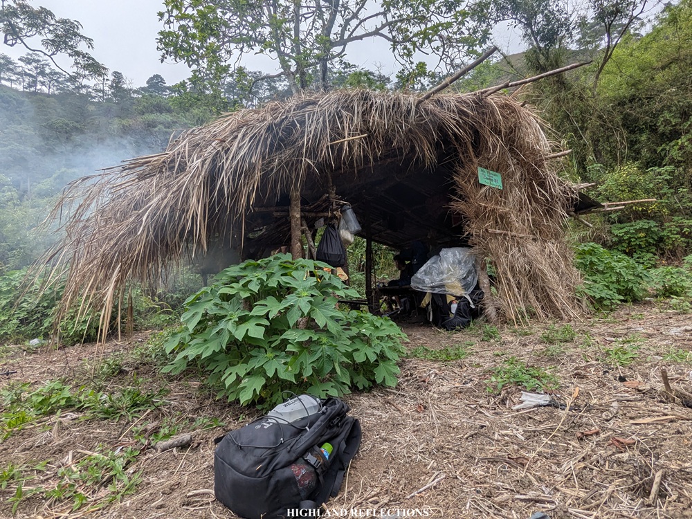
For this hike, I joined a trip organized by acquaintances in the hiking community—Eca and Ryan of Kuya Ry Travels, the group that I joined in my second Mt. Guiting-Guiting climb back in 2024. Together with us are other strong, seasoned hikers from the hiking community, some of which are regular joiners of Kuya Ry Travels. Prior to the hike, we were required to submit a medical certificate and pay the necessary fees. We were at the day care center of Sitio Liqueo—the jump-off point (~680 masl) for this hike—around four in the morning this summer of 2026.
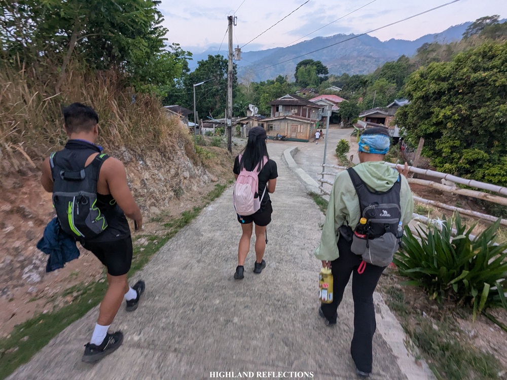
We commenced the hike at 5:30 in the morning—a late start compared to most recommended itineraries in which hikers should begin hiking at two in the morning to avoid hiking under the intense heat of the sun and to finish the hike with sunlight still up.
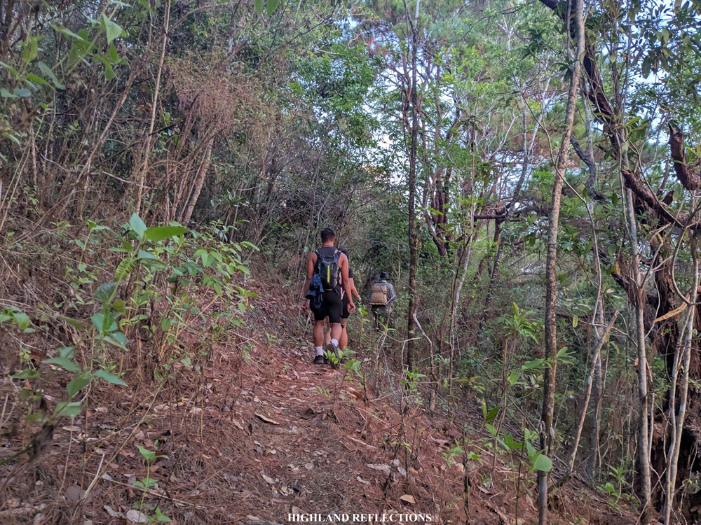
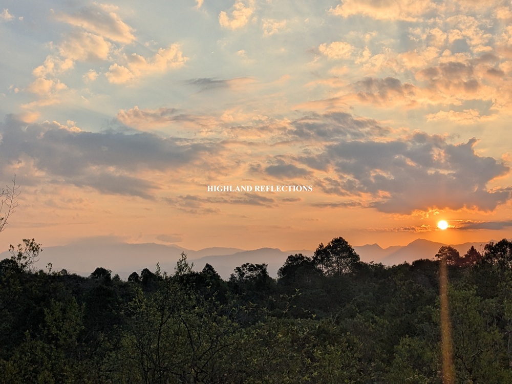
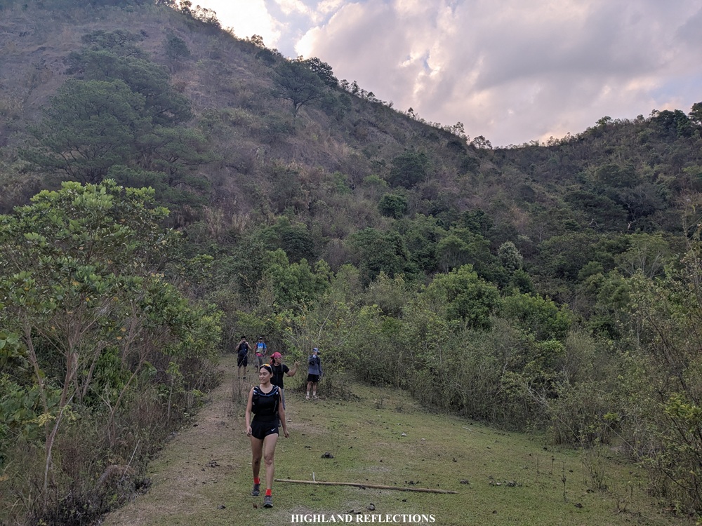
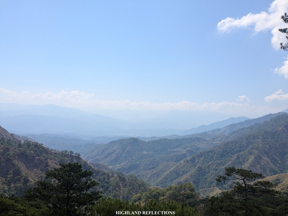
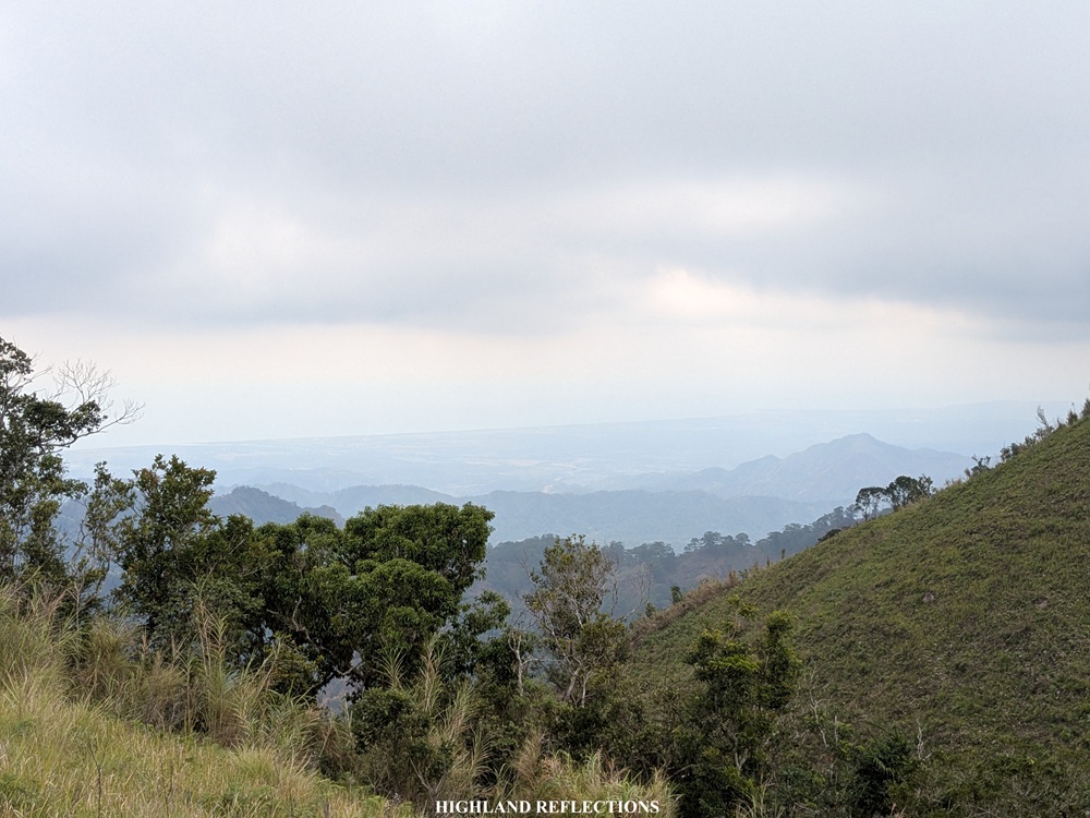
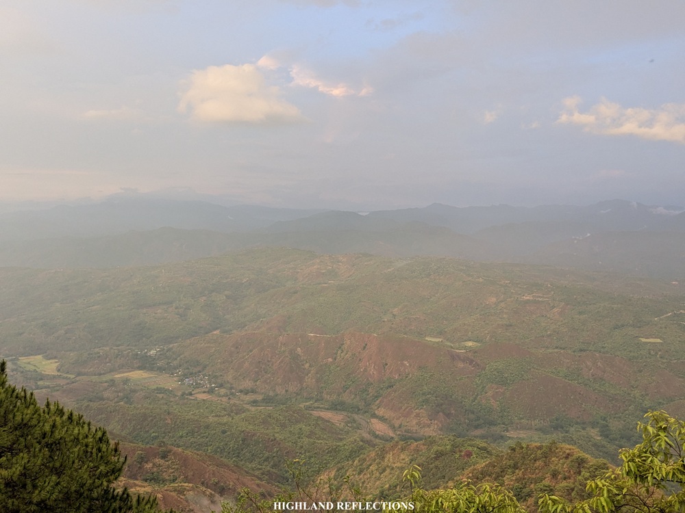
The initial parts of the trail was still relatively easy. We were passing through a kilometer’s worth of easy open trails that afforded us some views of the surrounding mountains and some cloudscapes from afar. Still, despite the relative easiness of the trail, we were panting and sweating like dogs due to the heat! About an hour into the hike, we were greeted with a continuously descending trail that gave way to some views of the nearby slopes of Mt. Tuwato’s outer fringes—its summit still hiding at the back.
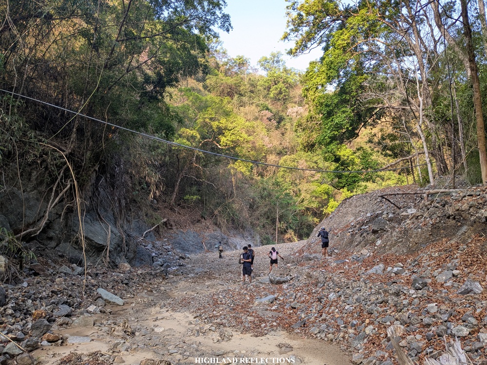
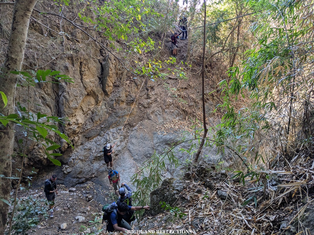
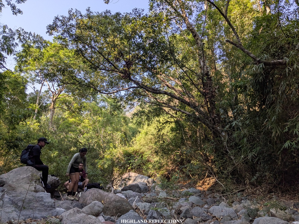
An hour and half after starting, we found ourselves resting at a dry river, which, I assume, during the rainy seasons, would not be dry at all. We took our first long rest here. Afterwards, we pushed on with the hike. The trail after the river gave some sneak peeks of the steep ascents but returns to the usual descending trail. Somewhere along this portion is a steep segment that required us to use a rope to go down. This up-then-down series finally ends at another river which served as our only source of water for the entire way up. We reached this at 8 in the morning after covering 3 hours of hiking.
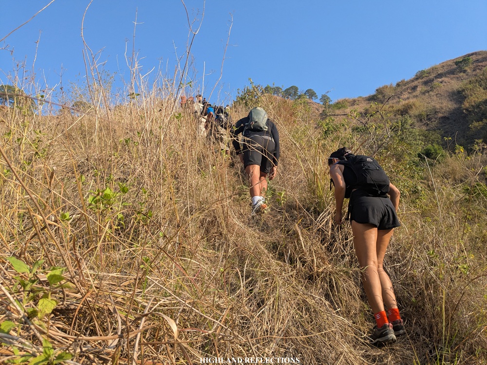
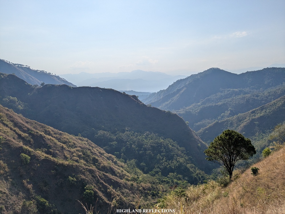
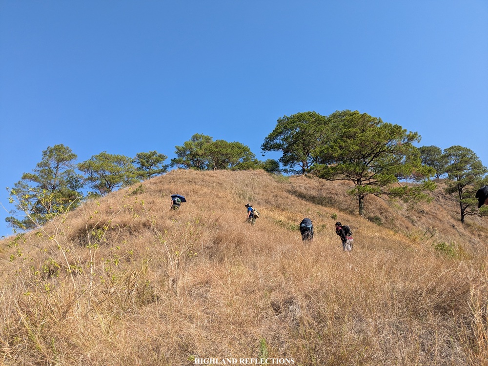
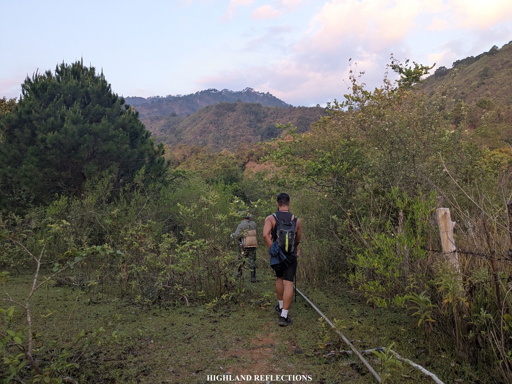
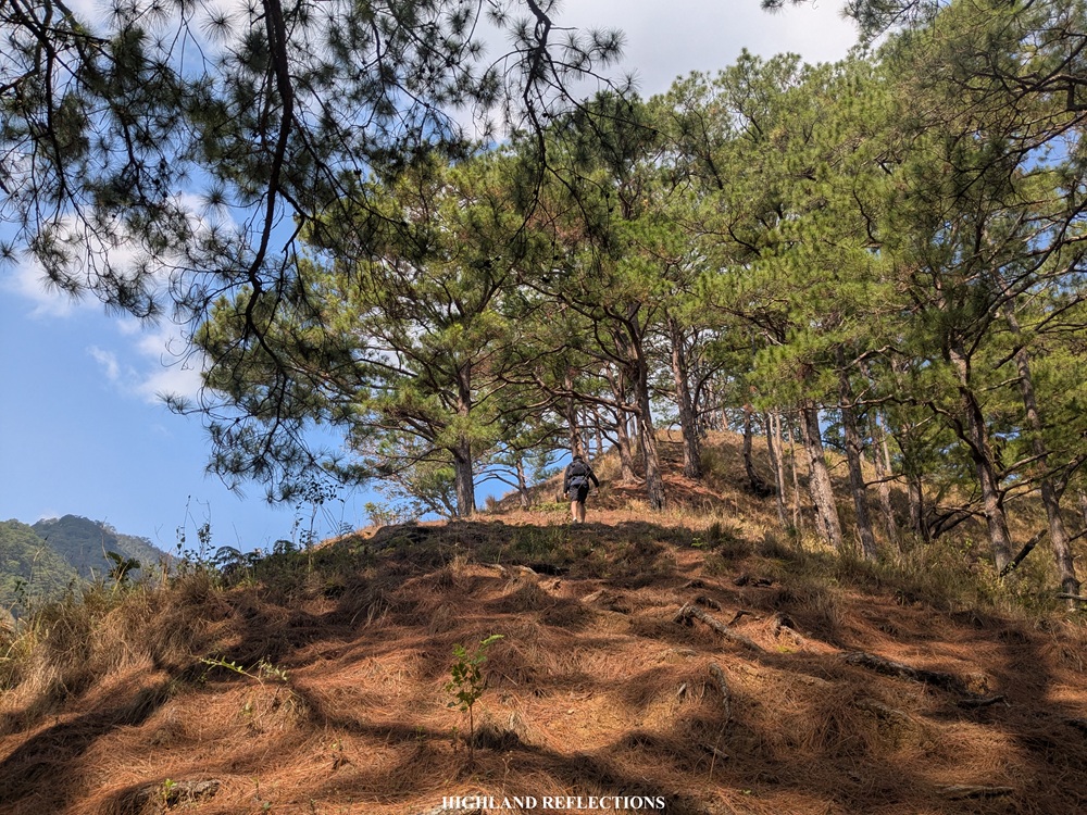
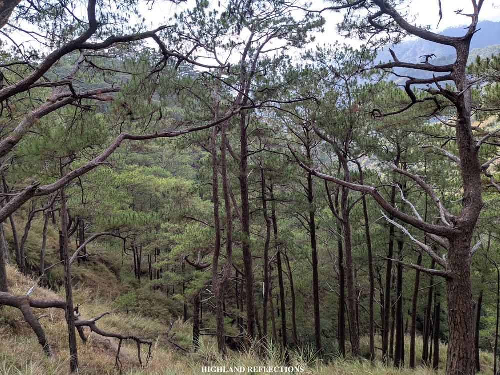
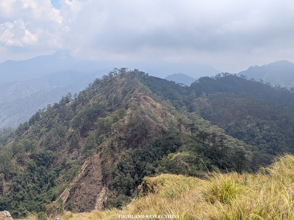
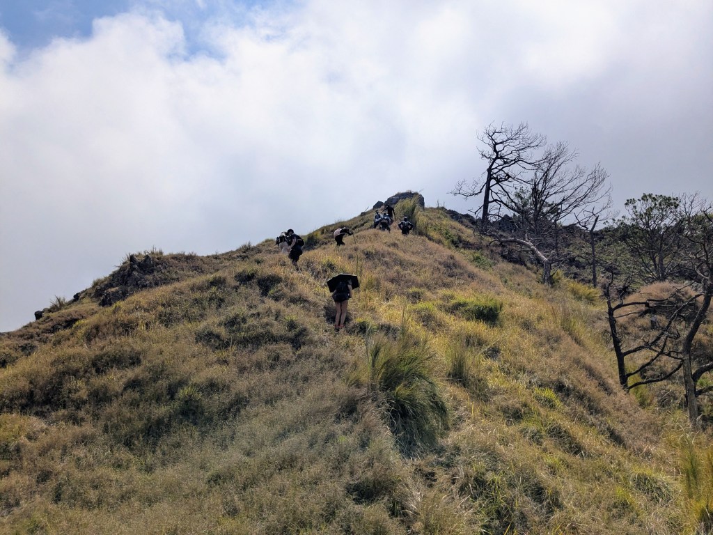
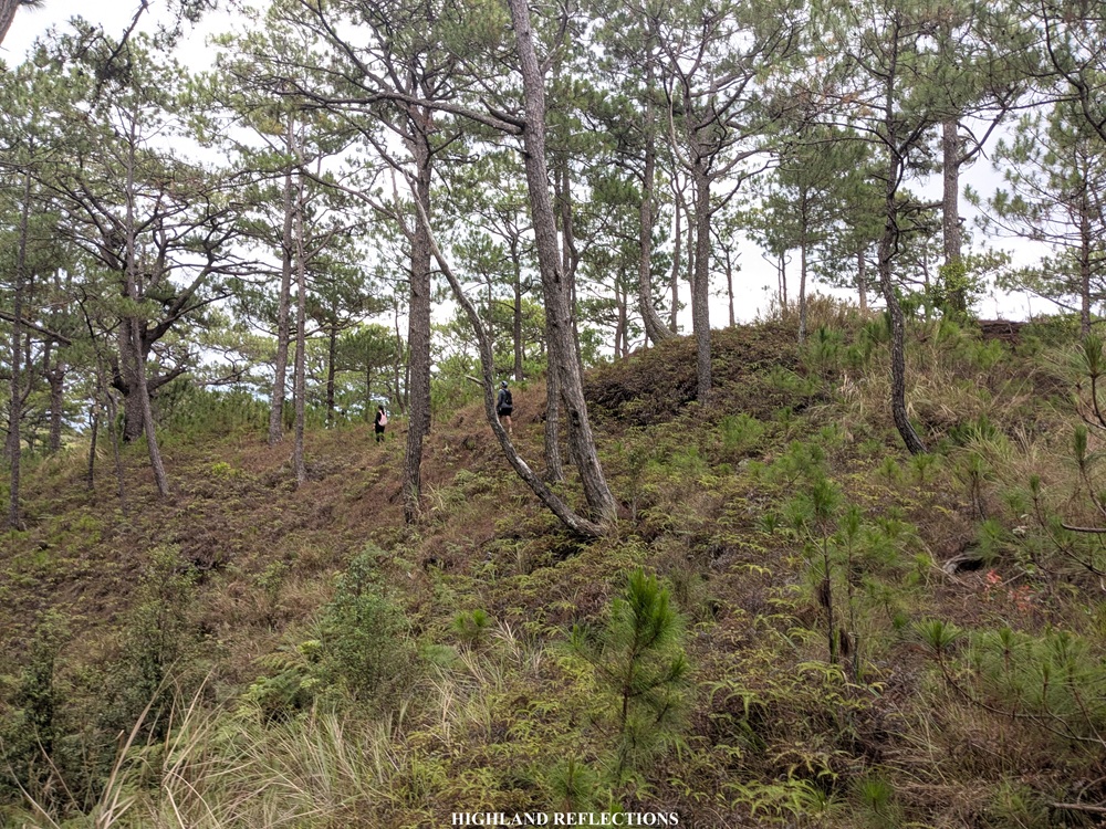
The trail past the river is where the continuous barrage of ascents started. The surroundings here were highly reminiscent of the pine forest slopes of Mt. Manmanoc in Abra as well as Mt. Pulag’s Akiki Trail! This led us to one of the many ridges at the peripheries of Mt. Tuwato sitting at a thousand meter elevation. The whole ascent was a series of leveling up from one ridge to another before seeing the ‘final boss’ for the hike, which was, of course, Tuwato’s summit.
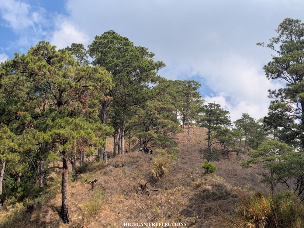
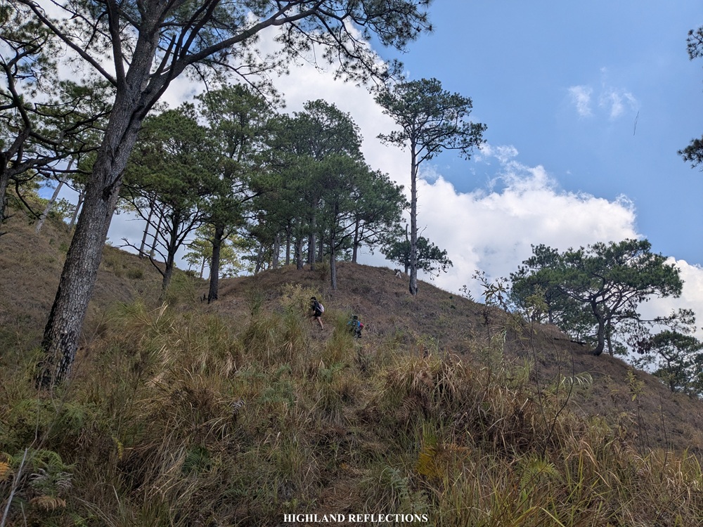
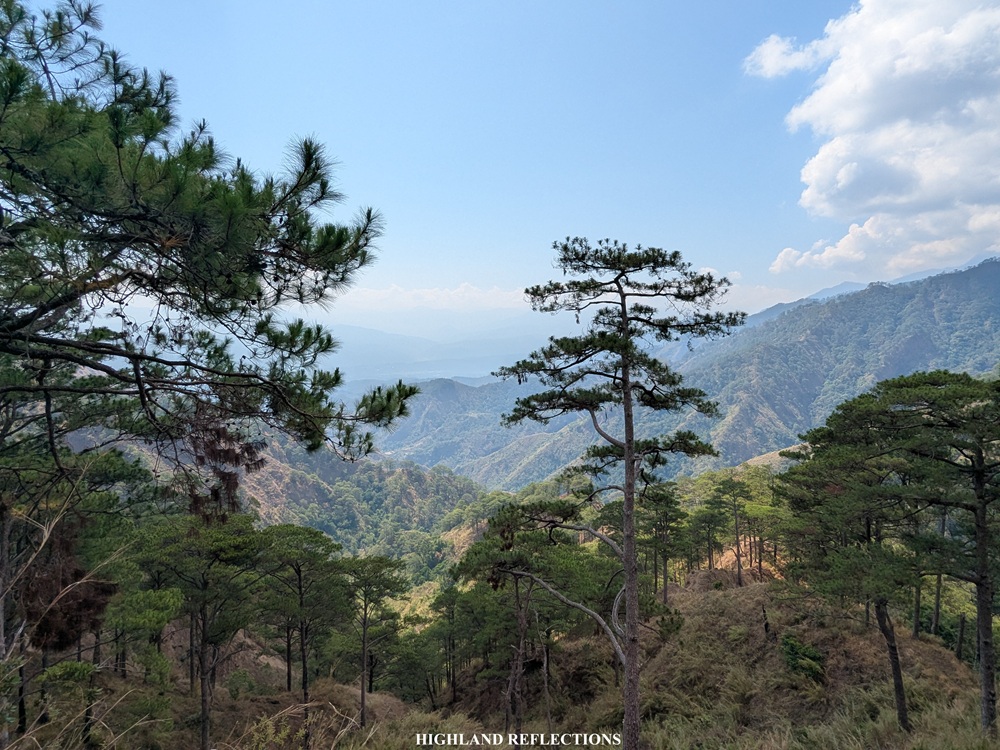
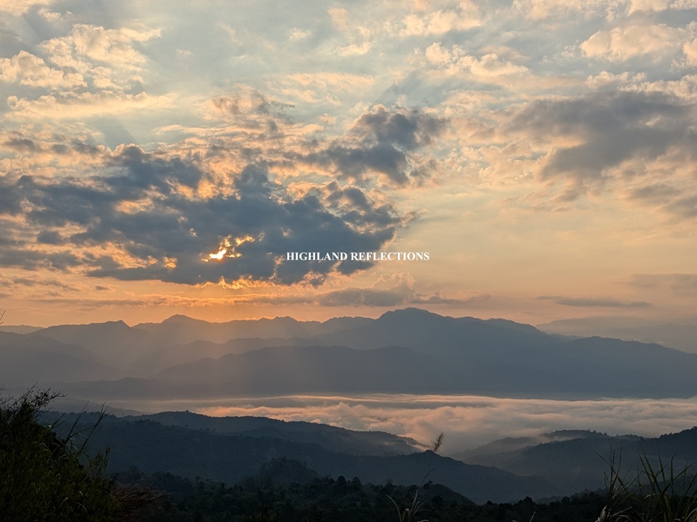
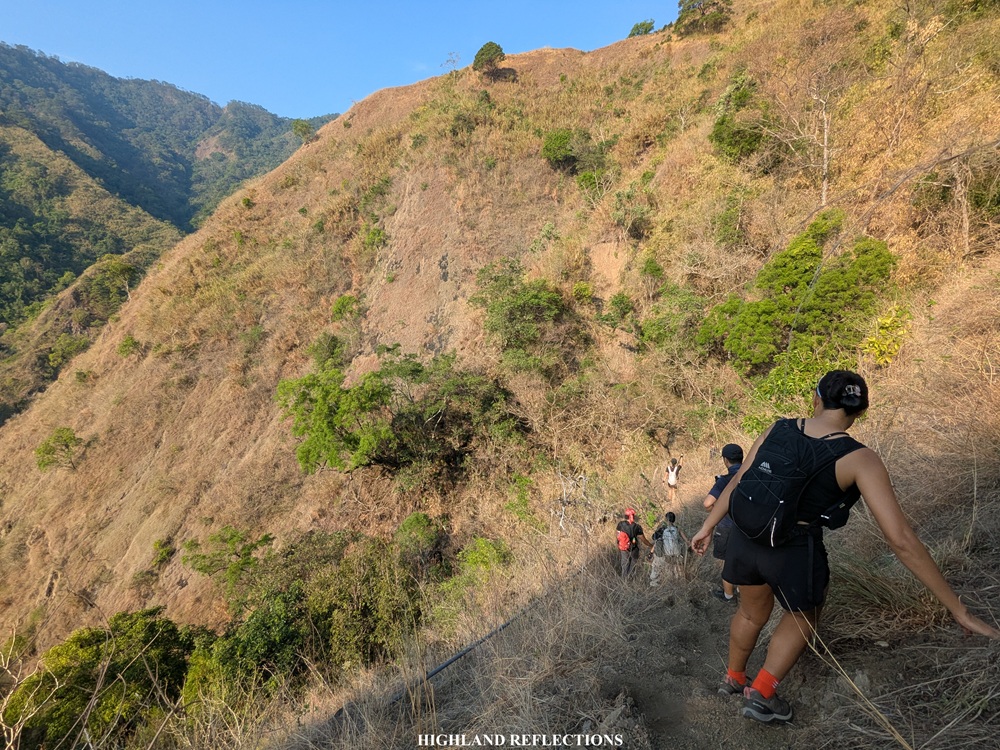
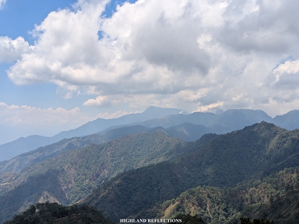
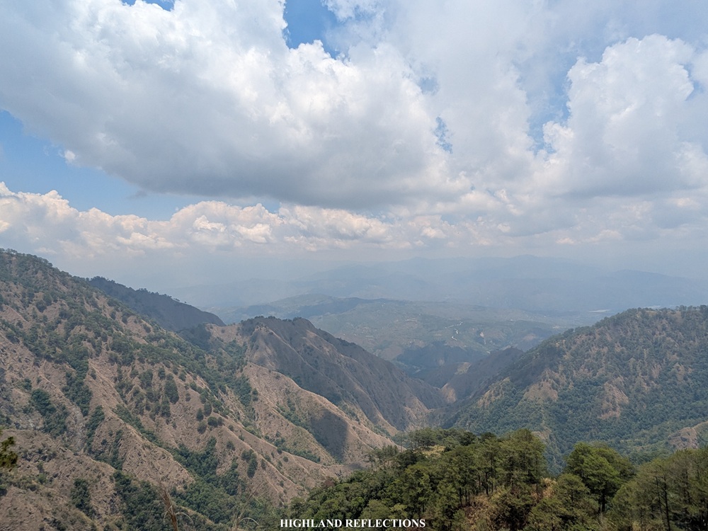
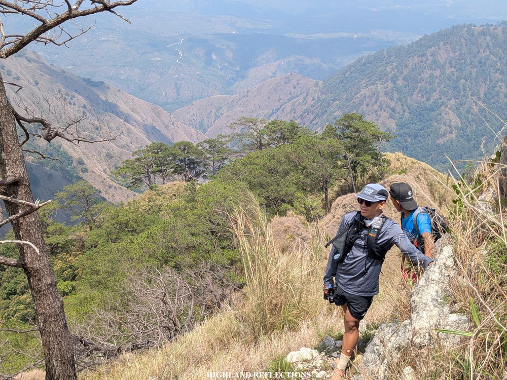
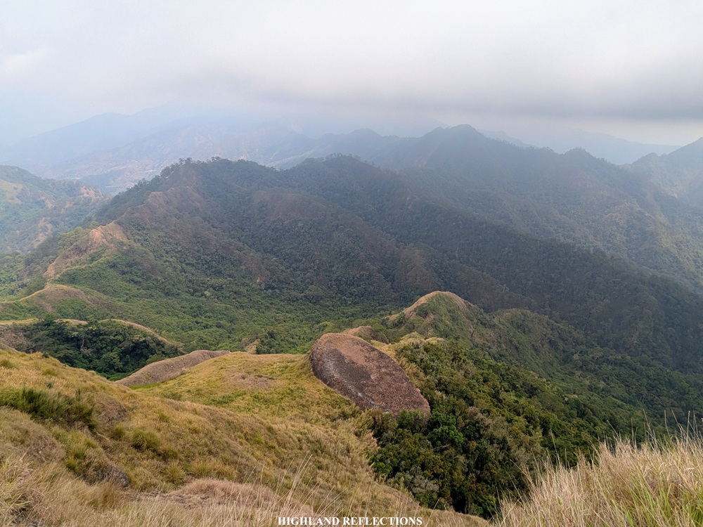
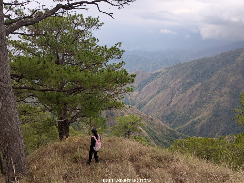
Somewhere in the middle of the long ascent, around 1300 meters above sea level, we saw a glimpse of Mt. Kimat Patil-ao’s summit nearby. This was a newly-opened mountain at the fringes of Mt. Tuwato’s pine forested ridges that I am aiming to climb soon. At our backs, we had a panoramic view of the 2000-meter plus mountains south of Cervantes, one of which, of course, includes Mt. Namandiraan—the highest mountain in Ilocos Sur. Below Mt. Namandiraan is the valley containing the town proper of Cervantes, and beyond them are the towering mountain ranges of Sagada, Bauko, and Sabangan in Mountain Province, the highest of which I can only assume is none other than Mt. Kalawitan.
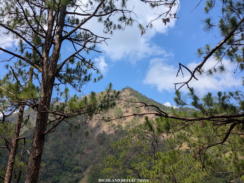
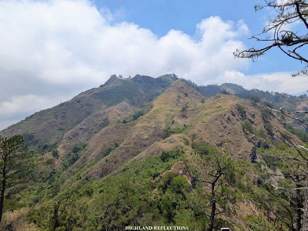
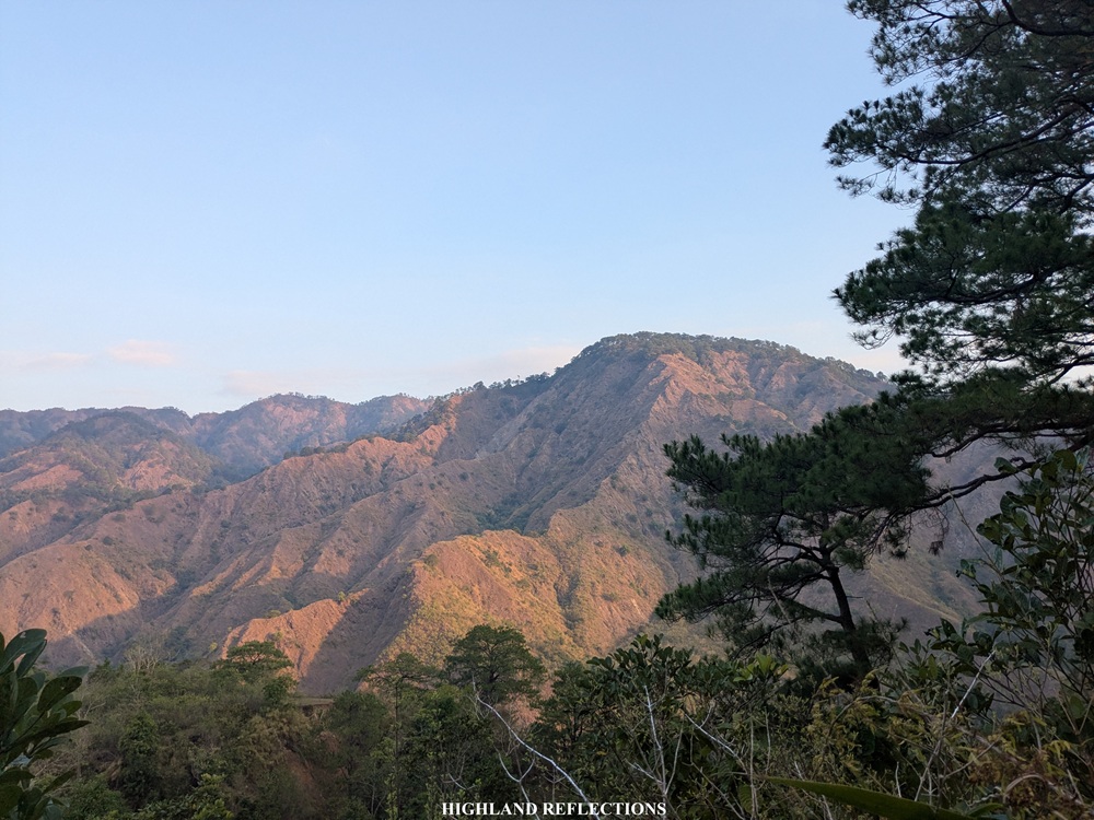
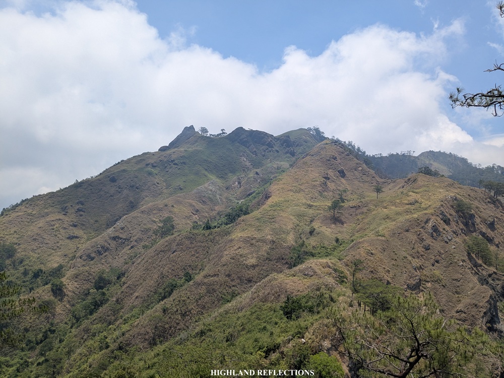
Upon reaching an elevation of 1,450+ masl, we finally had a view of Mt. Tuwato for the first time. Just looking at the 1,700 meter mountain can already make you feel that you’re still quite far from it! According to our guide, it’s still about two to three hours from where we were! It was 10:45 in the morning.
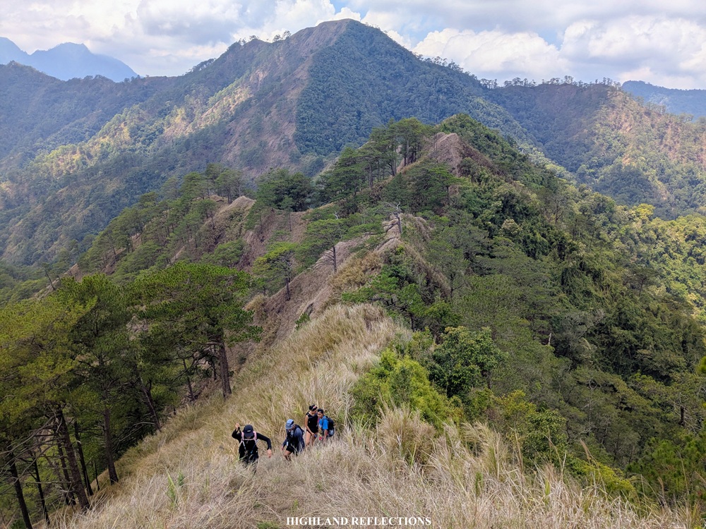
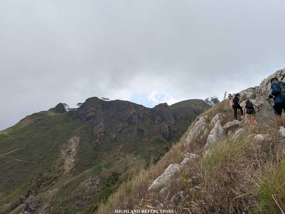
We spent no time resting. We traversed on top of the pine forest ridges that brought us closer and closer to Tuwato. Finally, past twelve noon, we were at the iconic knife edge ridge, which meant we were now near the summit face of Tuwato.
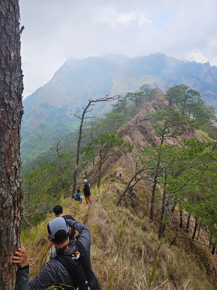
Crossing the long knife edge ridge was such an exhilarating predicament. On both sides are ravines with drops so steep, you can’t even peek at its bottom. You just know that you’re way, way up. The most iconic spot along the ridge is a rock that one needs to climb down using all four limbs. Climbing down was quite frightening given that both sides of the rock are ravines where one could fall down!
Past the knife edge ridge, we were finally at the slopes comprising Mt. Tuwato’s summit face. This was highly similar to reaching the Camelback of Mt. Guiting-Guiting after negotiating its knife edge. It also reminded me of the summit assault when climbing Mt. Kabunian.
The first portion of the assault towards the summit required us to climb a grassland slope that led to a boulder trail. Afterwards, we entered a short forested section that emerges onto a forked trail—going left leads to the summit area, while the rightward trail goes to the campsite. Left we went! This short trail shortly took us at the saddle in between the famed monolith and the summit. It was only a 5-minute assault along an exposed barren slope before finally reaching the summit of Mt. Tuwato.
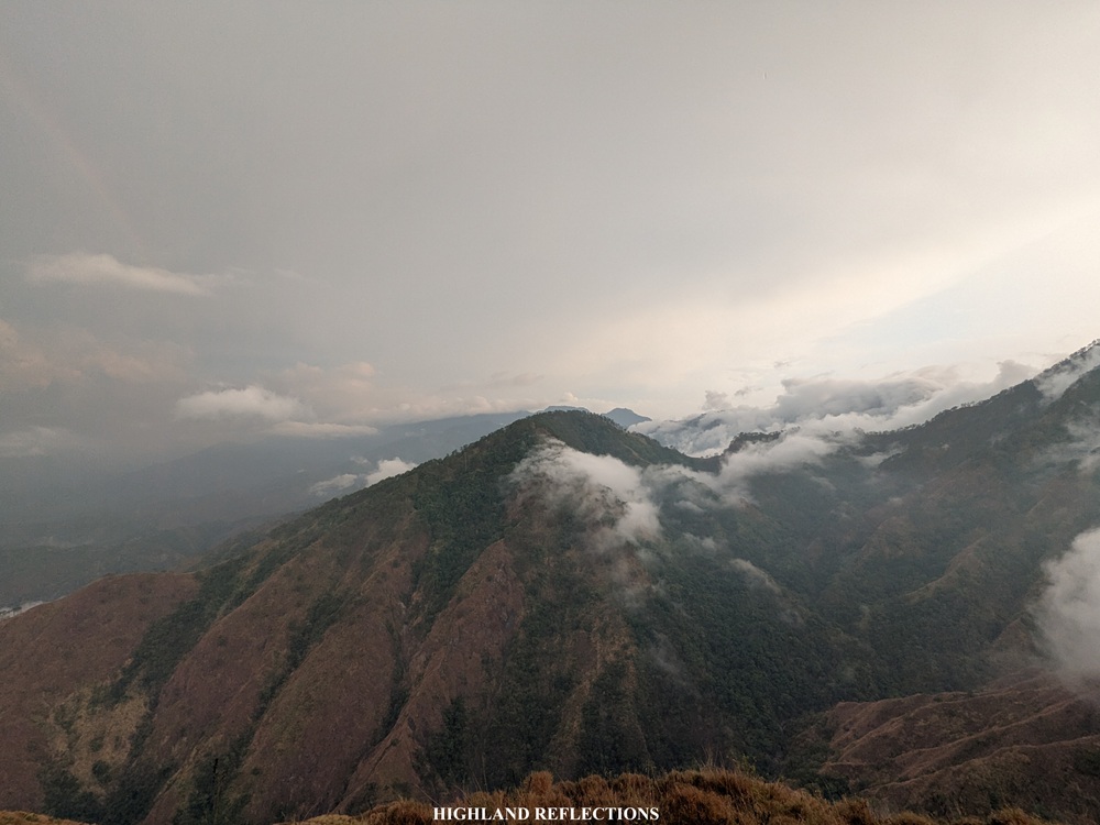
It was 1:30 in the afternoon when we reached the summit, taking us eight hours for the entire ascent! Talk about extreme difficulty. Although I was targeting to climb the summit at a faster pace, I guess the heat really took a toll on us. I was still thankful for bearing no injuries on the way up! I was in good spirits surrounded by good companions. Despite the fog surrounding the summit, the mountain still gave way for some occasional views of the surrounding mountains in the western direction, and in the horizon, the coastline of Ilocos and West Philippine Sea beyond.
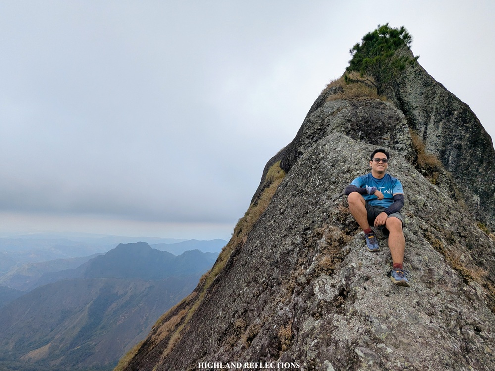
Fun fact: When you spot Mt. Tuwato from some of the high summits of the Cordilleras, and even when looking at topographical maps, the mountain contains multiple peaks that form a ‘summit ridge’. One of these peaks, christened as Mt. Monserrat by hikers, can be accessed from the opposite San Elias Trail! The San Luis loop trail only accesses the monolith and the ‘Tuwato’ peak. I am hoping to try the San Elias trail in the future!
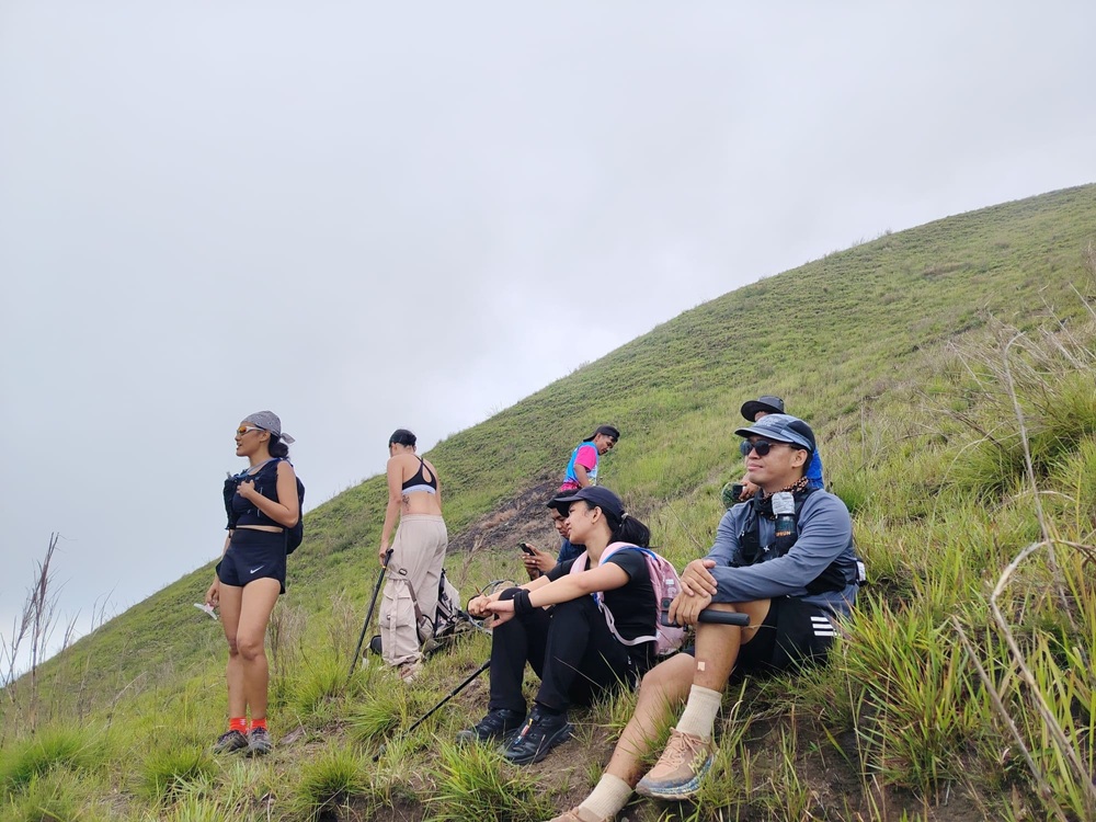
From the summit, we snapped some pictures before moving to the monolith peak at the other side of the saddle. Although guides permit hikers to climb the monolith, none of us chose to climb it since we were all tired from the long ascent we just did! There weren’t any ropes installed either, so it was too risky to climb it.
After enjoying the windy atmosphere at the summit for about an hour and a half, we went down to the campsite, which was opposite of the trail we took earlier at the bottom of the summit, taking us around 15 minutes to reach it. At the campsite, we took the chance to refill our water containers, eat our lunch, and get a quick nap before starting the descent. There was still a long descent ahead of us.
It was already four in the afternoon when we decided to start the long descent going back to Sitio Liqueo. For the descent, we took another trail that loops back to the sitio at the opposite side of the trail we took on the way up. Initially, we passed by a beautiful pine forest plateau where the chirps of birds welcomed us.
In no time, we found ourselves descending the face of a steep mountain slope filled with pine trees. It was so steep, we could literally see the peak of the mountain we needed to go to on the way down, and beyond that, the lowlands of Barangay San Luis. We were still so high up the mountain!
And then the unpleasant happened (well, not that unpleasant if you’re used to it)—a summer rain poured on us, which, if not for the lightning and thunder, was an added joy to our overheating bodies! The rain made the trail quite slippery, but one underrated silver lining was that it made the blades of grasses bearable to hold on to while going down. I was quietly chanting some prayers not to get hit by lightning while going down.
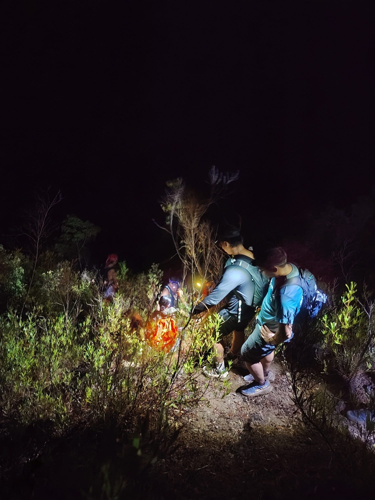
Finally, we reached the peak that we saw earlier, which, apparently, led to another plateau that provided us magnificent views of the surrounding mountain slopes opposite of the valley below us. At the end of this plateau, we saw our lead companions at a ridge below. With flashlights on, we followed the trail to where they were. We made a right turn towards the side of a mountain face slope, which then, curves towards the direction of the ridge. In no time, we finally caught up with our companions in the lead group.
From the ridge, it was still a 500 meter descent to reach the valley below. At this point, nighttime caught up, prompting us to turn on our headlamps to see the way down. The trail was quite difficult to trace as we were the first to pass through after the mountain’s reopening from its closure back in 2023! The hike on the way down was made more difficult by the slippery and dusty scree-like path which persistently bothered us for the entire 500-meter descent.
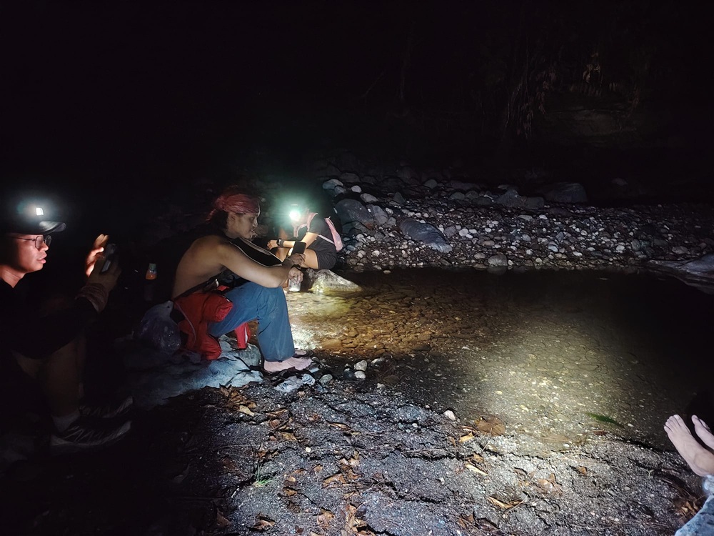
It was already past 8:30 in the evening when we reached the river at the valley below the mountain slope. As we were all exasperated, we took the chance to get some rest at the side of the river. After regaining our energies, we power-walked the last three-kilometer leg of the hike which follows the entire river that we saw earlier from atop. The last kilometer required us to walk our way up a road, which was honestly a bummer to take! It was past 10 in the evening when we reached the daycare center, clocking off at 17 hours for this hike. I’m sure we could have taken this entire hike faster if not for the heat and dehydration, but what matters most is we survived this formidable mountain.
At the daycare center, we took the chance to have our late dinner consisting of a warm, hearty tinola over rice, and to wash-up our dirt-encrusted bodies. Our sweeper group arrived some time between two to three o’clock in the morning, all complete and alive! To make the most out of our trip, we grabbed some breakfast and coffee in San Juan, La Union come daytime.
And that ends my adventure to the dragonfly mountain of Ilocos!
Mt. Tuwato is such a daunting mountain to climb. I’m glad to have finally seen what everyone was hyping about way back in 2018 when I took my first major climbs in the country. And man, I hope I made my younger self proud by strongly (albeit not quickly) finishing this bucketlist-worthy mountain. Hopefully, I get to climb the mountain from the San Elias side, which, God willing, would still be open if and when I’d have the time and money to go there! I also hope to climb some of the newly-opened mountains in Cervantes—Mt. Kimat Patil-ao and Mt. Namogokan, which have equally scenic trails as the ones in Mt. Tuwato and Mt. Namandiraan.
Here’s to taking more challenging mountains up north!
Itinerary
04:00AM Sitio Liqueo daycare center, last minute preprations
05:30AM Start hike
06:45AM River, rest
07:30AM Roped segment
08:00AM Water source, rest
08:30AM Resume hike
10:30AM First view of Tuwato
12:00PM Start of knife edge ridge
01:30PM Summit, take pictures
02:00PM Monolith, take pictures
03:00PM Campsite, refill water and rest
04:00PM Resume hike on the way down
09:00PM River, take rest
10:00PM End of hike
