
As a Filipino hiker passionate for adventures and seeing the beauty of the highlands, I have always dreamt of climbing the beautiful mountains outside of the Philippines. My fervor for discovering the mountains overseas grew stronger each year every time my contemporaries in the Philippine hiking community post their pictures posing at the some of the iconic peaks of Southeast and East Asia, and beyond. Finally, in 2026, I was able to have my first international hike and travel in Mt. Fansipan (Phan Xi Păng), the highest peak of Vietnam and all of Indochina!
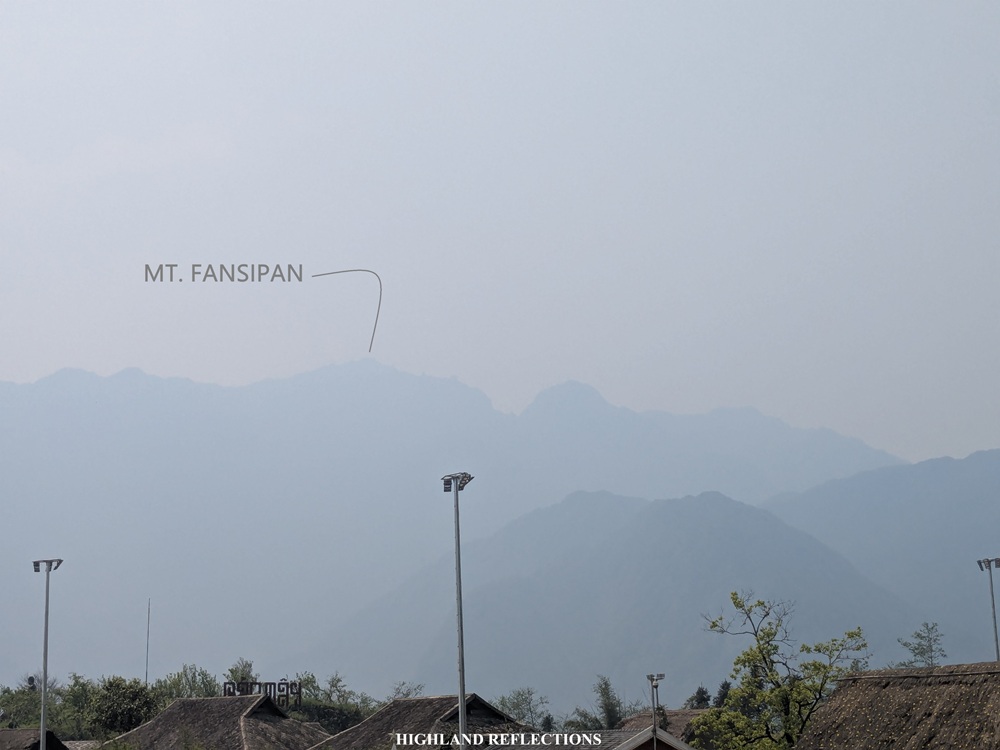
Standing at 3,147 meters above sea level (masl), Mt. Fansipan is part of the Hoang Lien Son Mountain Range that towers above the misty town of Sapa in the Lao Cai province of Vietnam. Being in the northern part of the country, the mountain range is considered a tail extension of the Himalayan Mountain Range which contains some of the highest peaks in the entire world. Beyond its geographic eminence, the mountain bears cultural and spiritual importance to the indigenous people of Sapa such as the Hmong, Red Dao, and Tay groups. It is also home to a variety of flora and fauna, some of which are endemic to the mountain.
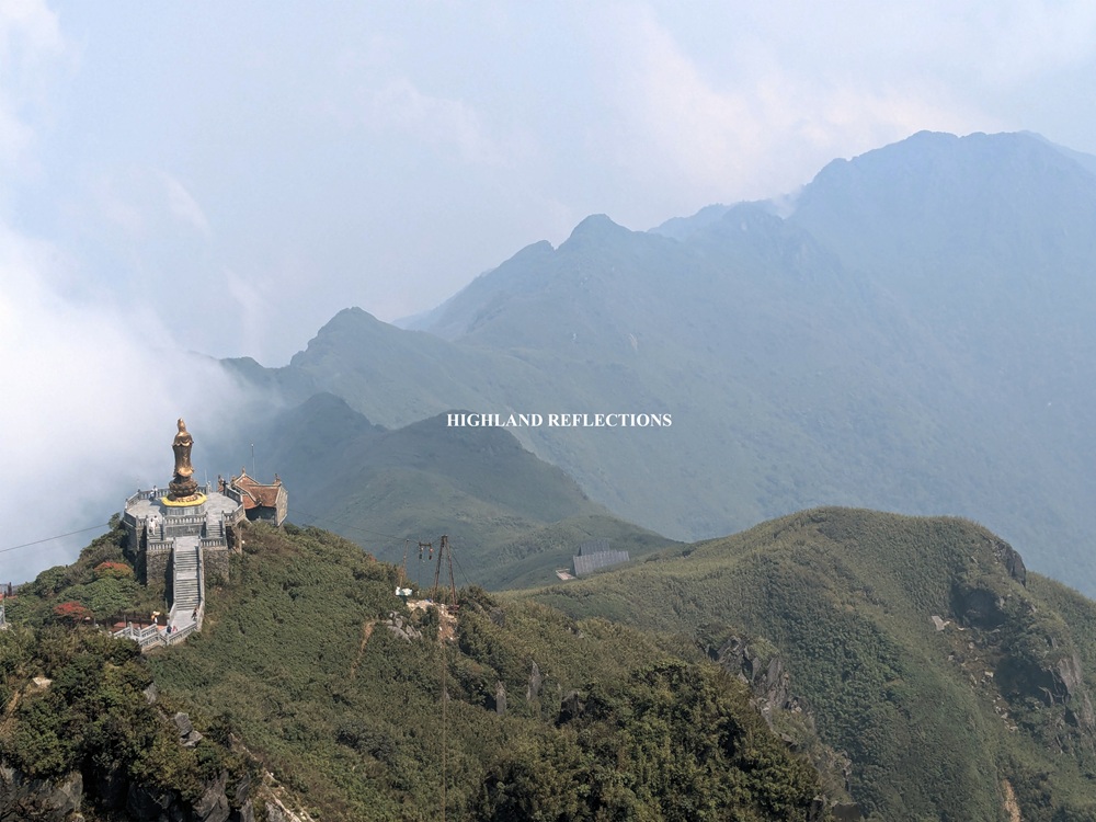
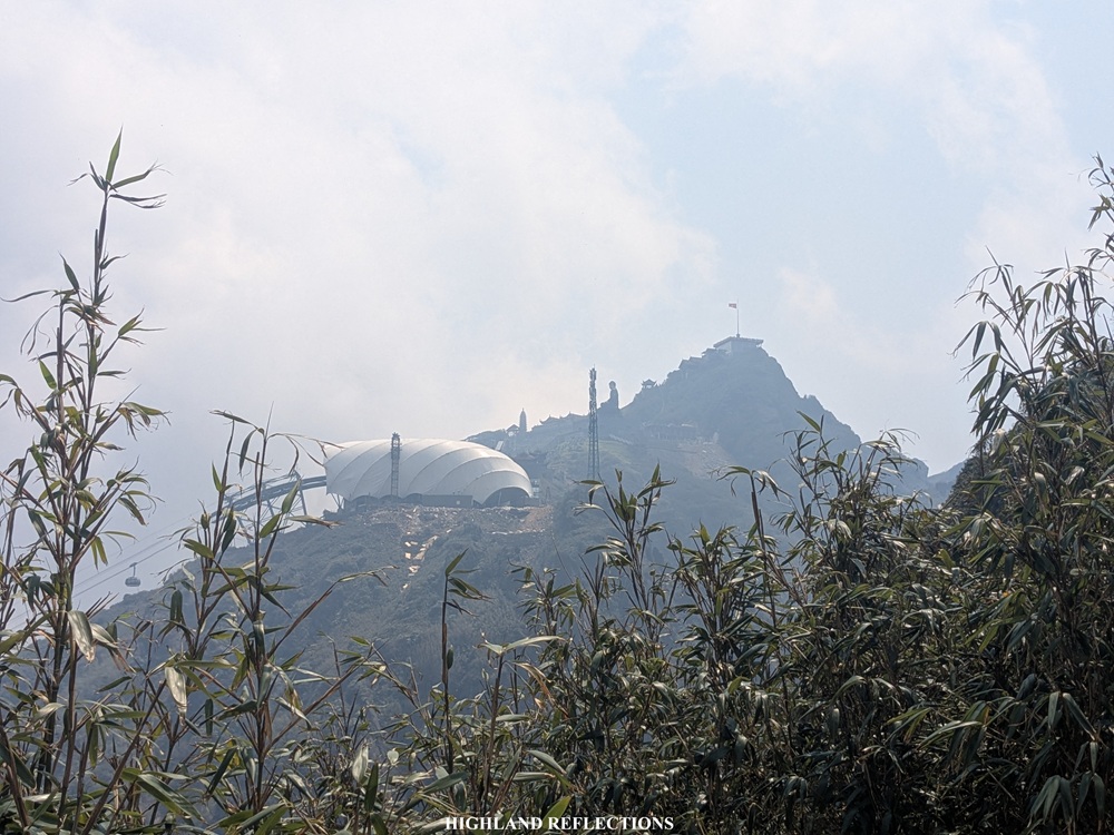
Mt. Fansipan has become a huge tourist destination in Vietnam in recent years due to the installation of cable cars and funiculars from Sapa. This has made the climb to the highest peak of Indochina accessible for casual tourists. Because of the commercialization of the peak, the summit area has been converted into a huge tourist complex filled with restaurants, eateries, pagodas, giant Buddha statues, walkways, and gardens. In fact, a Starbucks branch just recently opened there this year!
Beyond these touristy gimmicks, however, some (including me) would still prefer to make the climb up to Fansipan the old fashioned way—taking the steep hike up its trails from Sapa! The most well-known route is the Tram Ton Trail, which starts at the Nui Xe Ranger Station (~1,950 masl), the same jump-off point when going to the famous Love Waterfall. The trail requires a 1,500 meter gain involving some ups and downs (mostly, vertical ups) on the mountain slopes at right side of Mt. Fansipan.
Using the Philippine system of categorizing mountains, the hike via Tram Ton Trail can already be considered a major climb, with trail class of 2 to 4, and a difficulty rating of 6-7/9 due to its challenging nature. A good fitness level and hiking experience is a must to finish the 11-kilometer trail to the summit. The entire hike takes around two to three days to complete, but can also be done on a one-day hike. Since I had a tight itinerary for our Vietnam trip, I opted for the one day-hike courtesy of an organized tour which I booked via GetYourGuide. On a one-day itinerary, the climb takes around five to six hours all the way to the summit, and another four to five hours for the descent (a total of around ten to twelve hours to finish the entire out-and-back trail). However, one can also opt to take the cable car on the way down to save time.
Heading to Sapa and an Advanced Visit to Fansipan
The idea of going to Vietnam was birthed from the idea of my girlfriend—Pat, whom I was with for this trip—when short videos of the Mường Hua funicular, surrounded by lush greeh mountain slopes, was all over social media around two to three years ago. Since then, we planned going to Sapa in the nearest time possible. Thankfully, our (or more specifically, her) trip materialized as we planned everything from the get-go at the start of 2026. Part of the plan was for us to go to Fansipan via the cable car for our first day in Sapa, and have my one-day hike the day after. Yup, this is how crazy I am for the mountains—my past and future self would haunt me if I didn’t take this hike!
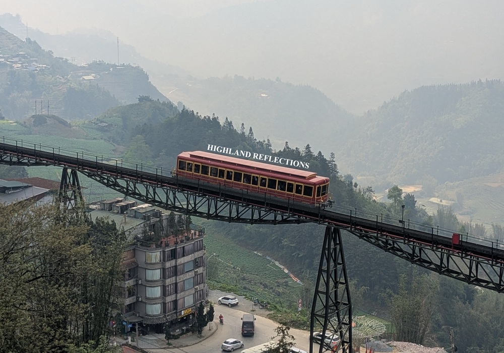
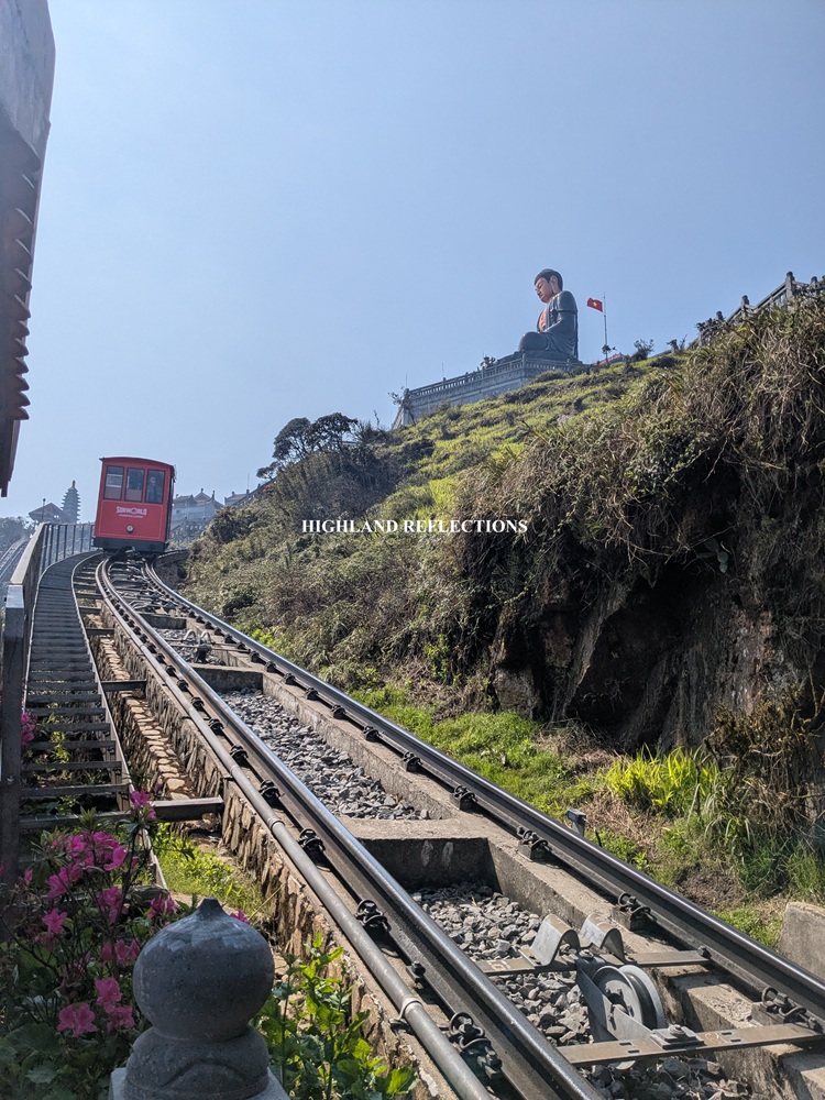
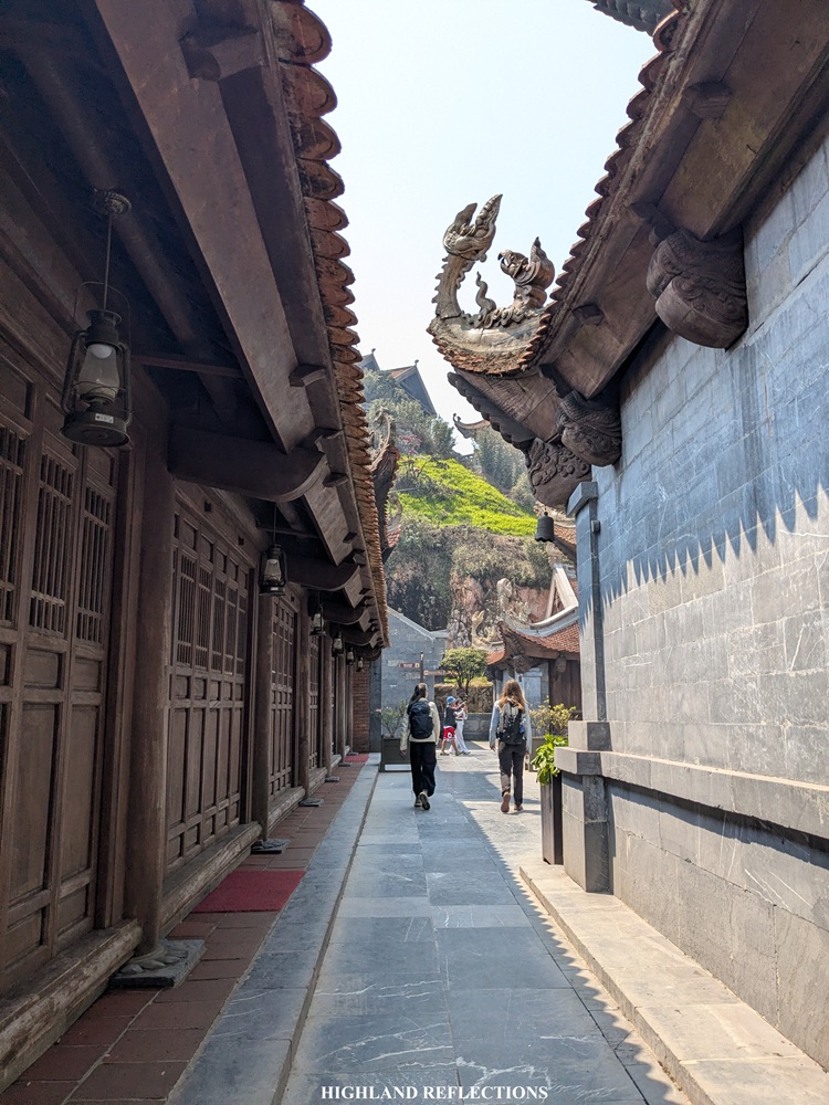
We arrived in Sapa one misty Friday of March, 2026. After leaving our packs at our hotel and eating breakfast at Sapa Center Cafe Restaurant, we made our way up to Fansipan the easy way, involving a three-stage process: riding the funicular from Sun Plaza Station in Sapa to the Sunworld Fansipan Legend Park/Mường Hoa Funicular Station, getting transported up via the cable car, and finally, taking the short funicular ride directly to the summit. Tickets to these three can be booked via Klook to save time. The Klook booking includes all ticket rides on the way up and down except for the short funicular ride from the summit on the way down.
Pat and I enjoyed the cold mountain air atop the summit. However, since it was our first time being above 3100 meters above sea level, almost two hundred meters taller than the highest mountains we have in the Philippines, we were adjusting with the slight dizziness and headache caused by the thin air. Though of course, as a hiker, I found it easier to adapt compared to Pat. We spent almost the entire morning exploring the summit complex. After going down, we ate our lunch, checked in at our hotel, and explored other attractions in Sapa.
That night, I was reeling from the tiredness from the continuous travel from Manila to Hanoi, and then to Sapa. Still, I was in high spirits as I knew I’d be able to experience the wild side of Fansipan that not everyone gets to see in their lifetime.
The Climb to the Tottering Rock!
The term Fansipan, or more accurately, Phan Xi Păng, has been the subject of etymological debates. The most commonly accepted theory is that it came from the local term Hủa Xi Pan, which means “tottering rock giant,” a reference perhaps to the steep rocky terrains of the peaks of Fansipan. Others would say that it translates to “Azalea Mountain,” owing to the numerous azaleas or rhododendrons found on its slopes. Regardless, both etymologies capture the beauty and grandeur of Phan Xi Păng!
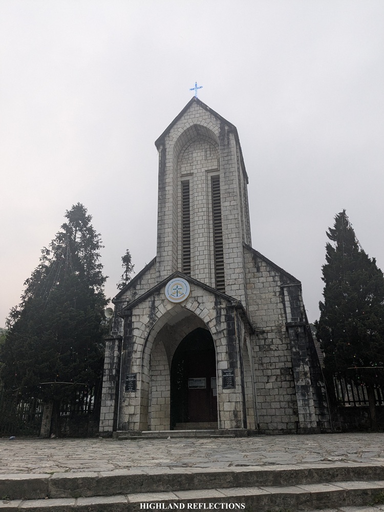
The adventure to the summit of Fansipan started at the Sapa Stone Church, where I met with my guide—young Vietnamese lad Chou and his brother—at six in the morning. There, I found out that I wasn’t alone for this tour, as I was with eleven Europeans and two Americans, making me the only Asian for this hike (I later on found out that a lot of Filipinos climb the Tram Ton Trail, but they mostly come in groups). I bade my good bye to Pat—she’d explore the town while I was away.
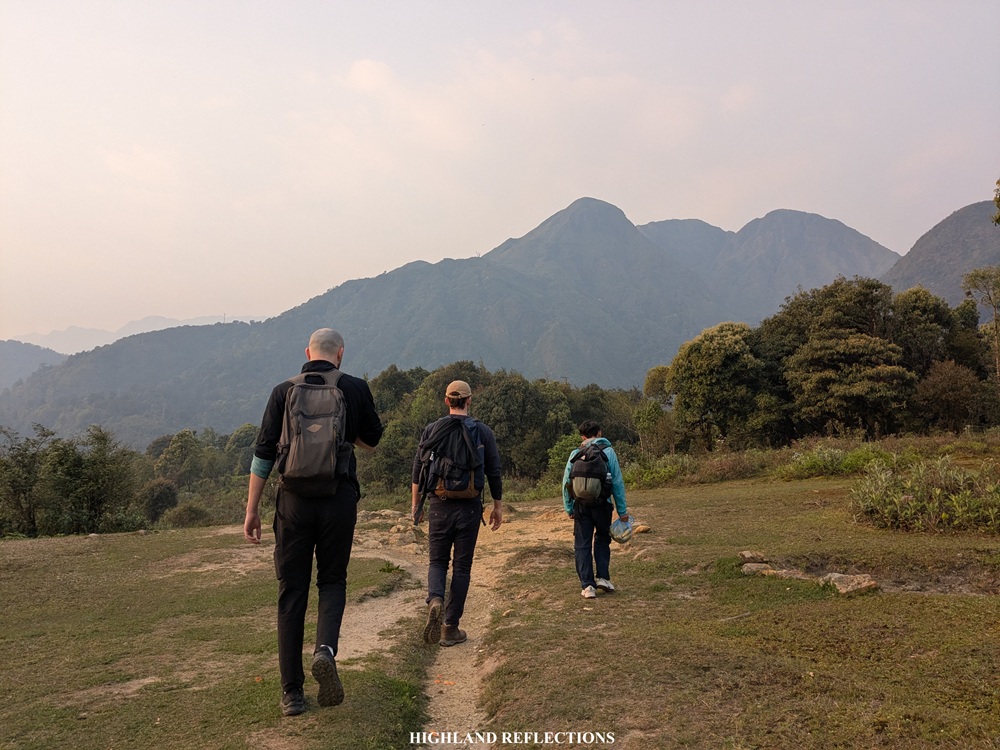
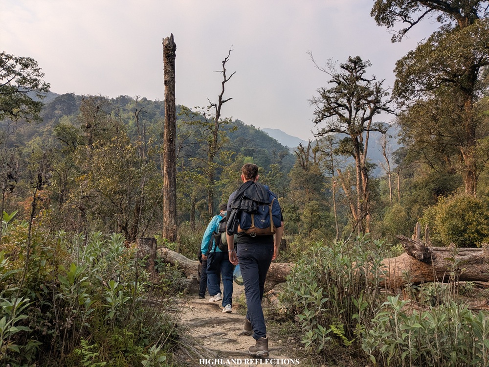
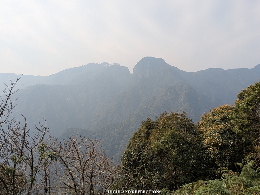
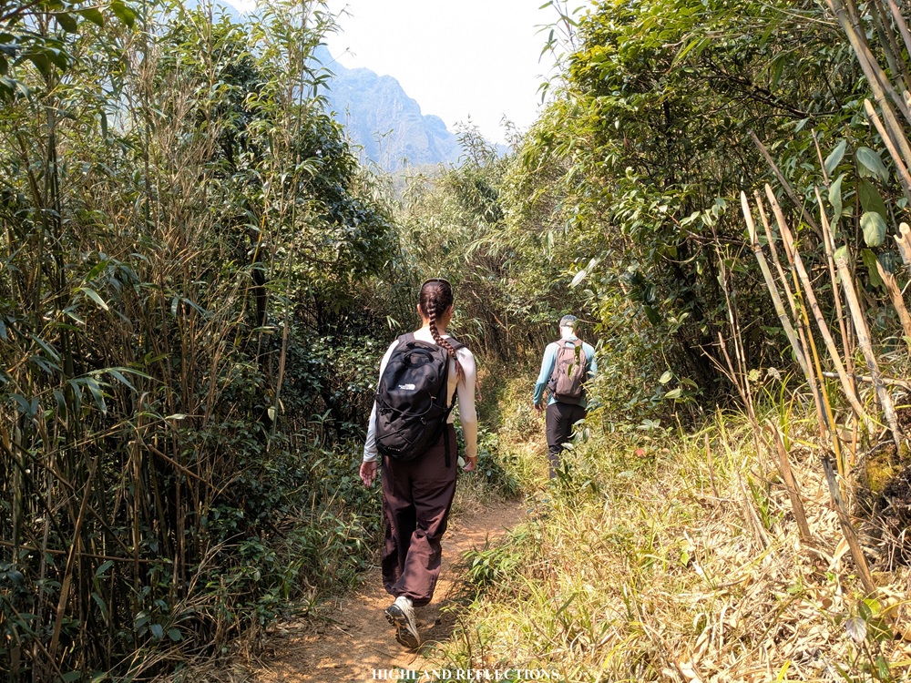
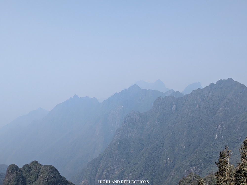
From the church, it took us less than thirty minutes of traversing the zigzagging highway to reach the Nui Xe Ranger Station (~1950 masl). On the way to the park, we had magnificent views of the Hoang Lien Son Mountain Range and the sun rising somewhere in the east. These views were also present even at the ranger station, where we could see the numerous domes, slopes, and ridges of the mountain range towering above us. I was excited to get in those mountains and finally have a taste of Vietnamese hiking! Finally, at 6:45 in the morning, we started the hike.


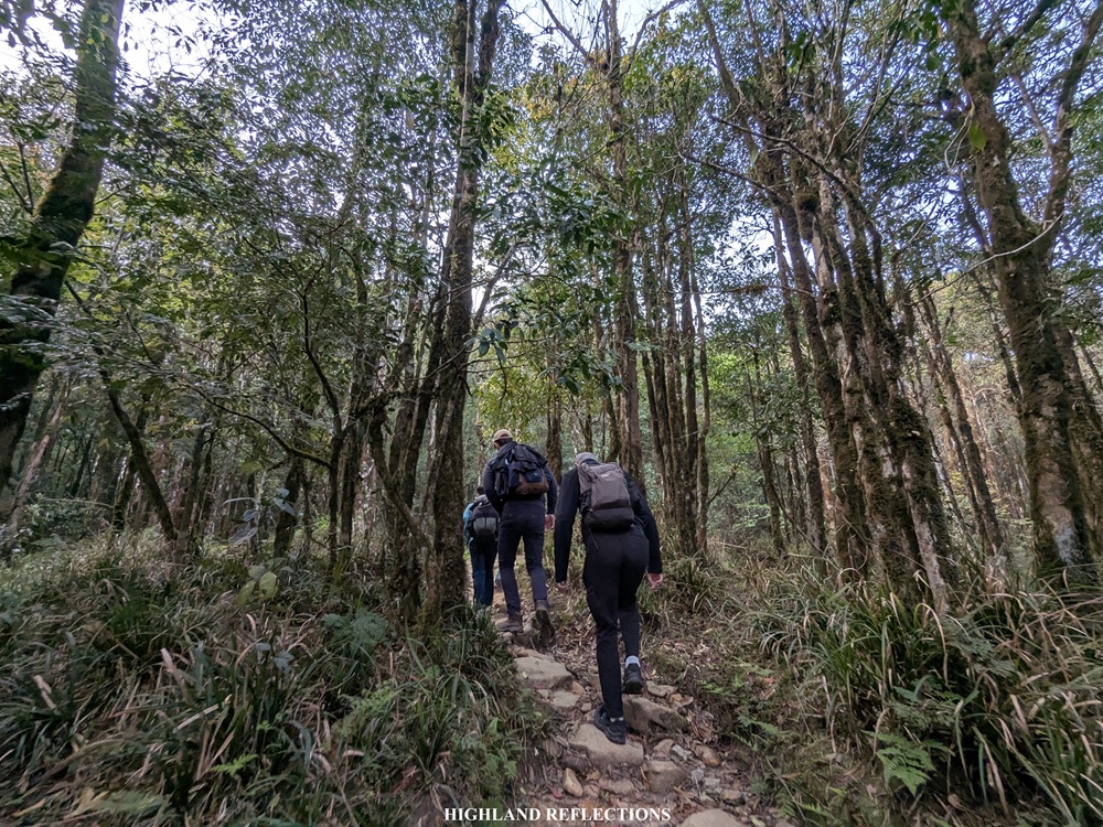
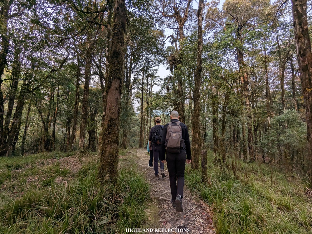
The trail starts at the rear part of the station, where a beautiful lush forest and a creek welcomed us. The trail was mostly rolling with a mixture of ups and downs before exiting towards an open section that provides views of the mountain range up close. We had our first rest here as we were still adjusting from the first round of ascents.

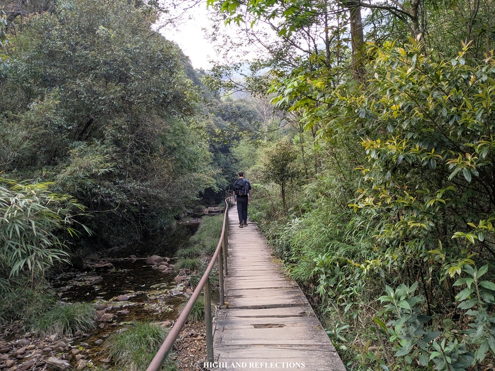
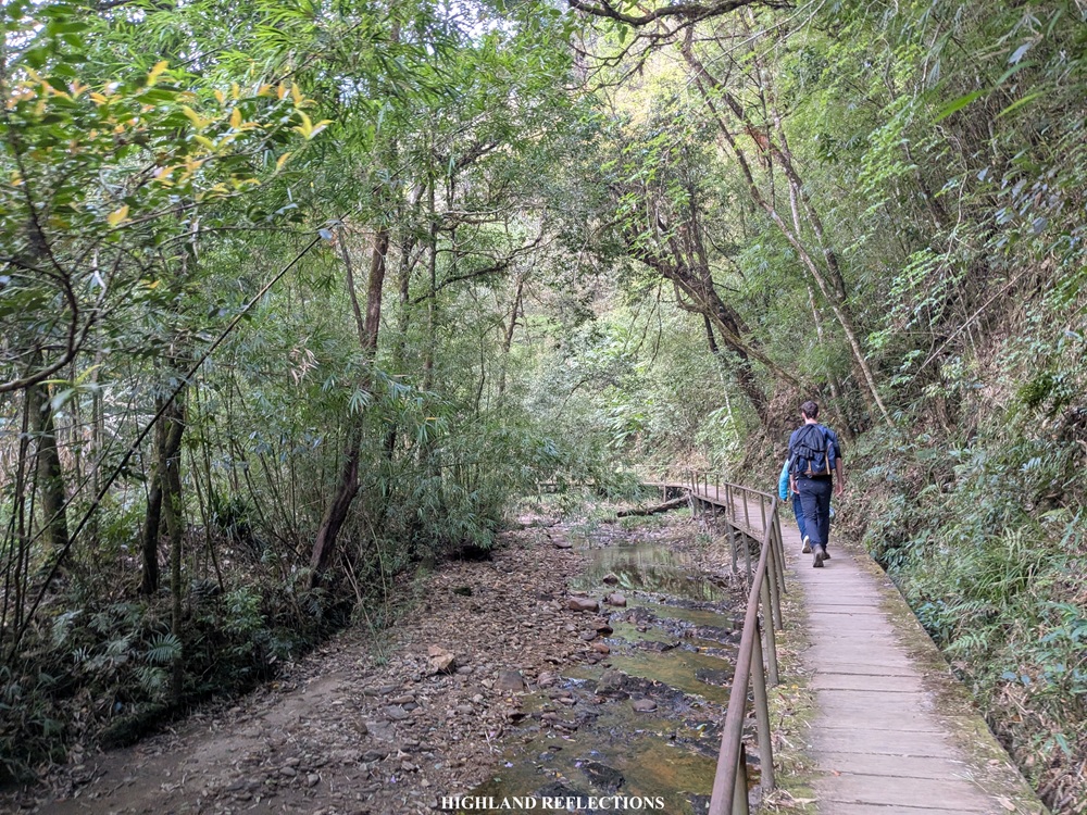
Past this open area, we entered the forest once again. Here, we walked on wooden bridges and platforms that cross the side and on top of a brook.
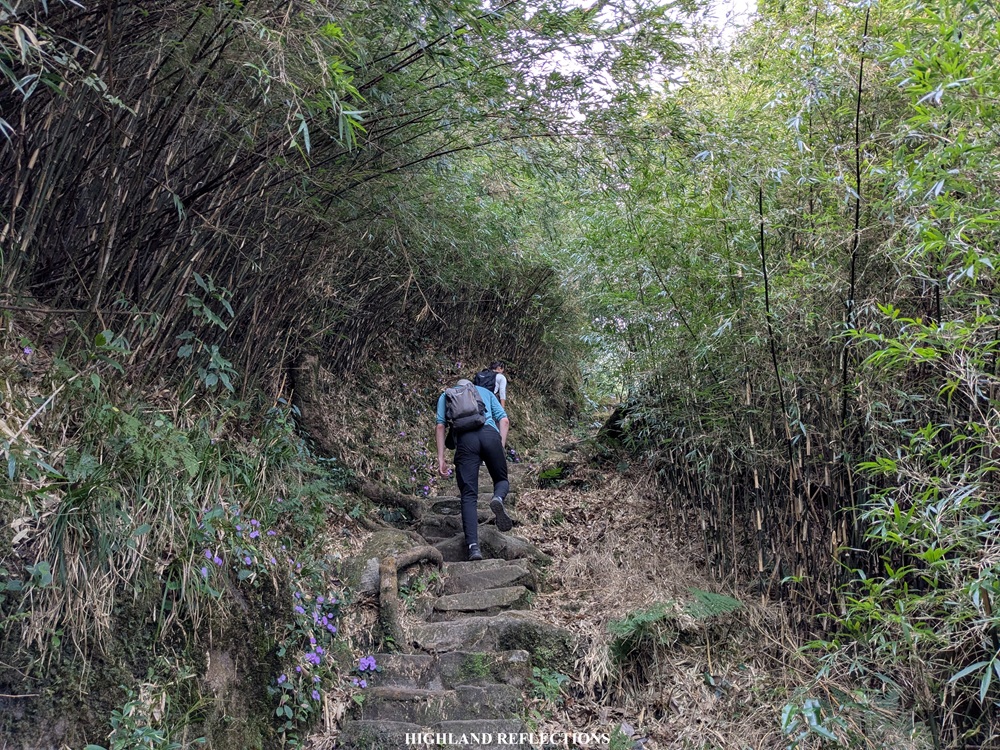
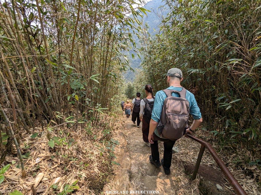
The trail, then, continues up the forest, some of which are covered in green, yellow green, and sometimes, orange moss. The forest was brimming with so much life and positive energy as it is illuminated by the orange hues of the rising sun to our left. We were happily sun kissed into our forest bathing! At this point, I was reminded of the mossy forests in the mountains of the Cordillera Region in my home country.
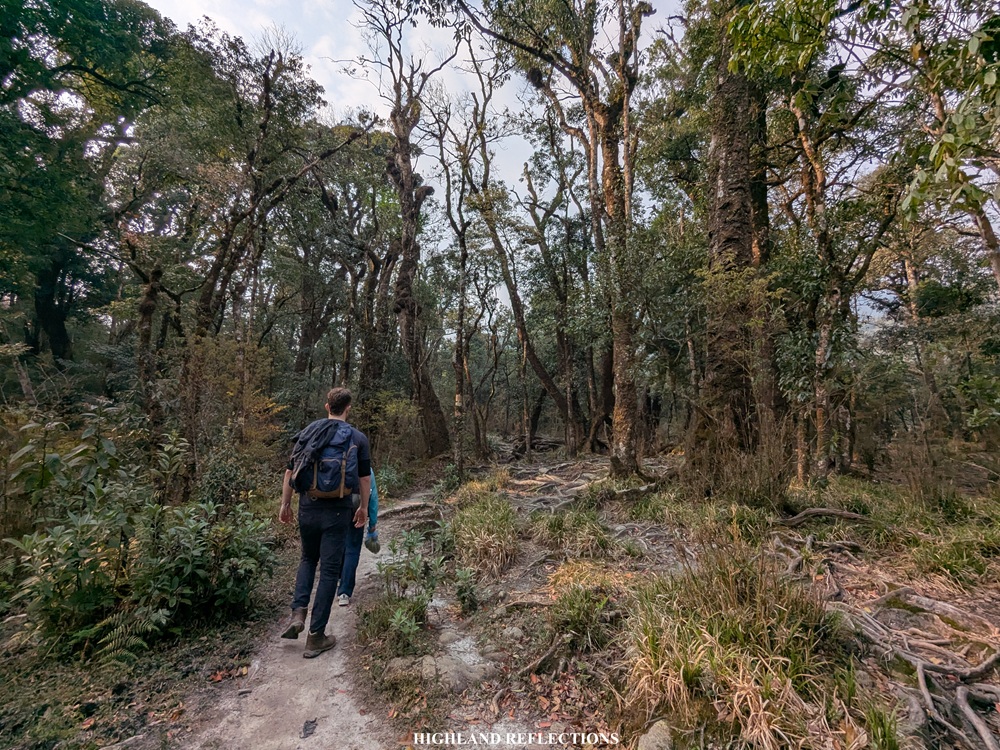
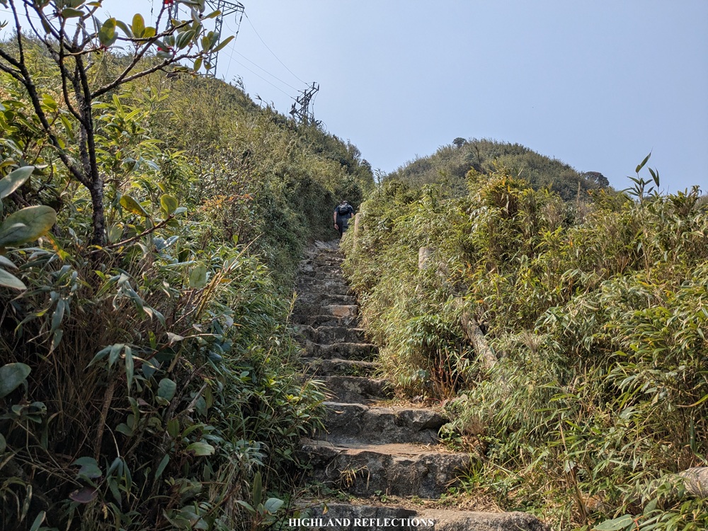
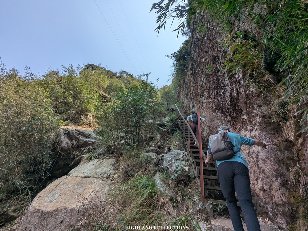
Despite the loveliness of the forest surrounding us, this didn’t take away how challenging the trail is. While there are some flat and descending sections inside the forest, the ascending ones were quite a challenge to climb—they’re not really technical and ultra steep, but it was still definitely graded enough to burn my quad and calf muscles! Some parts of the trail were also carved to resemble staircases, which added more to the brunt of each step we took.
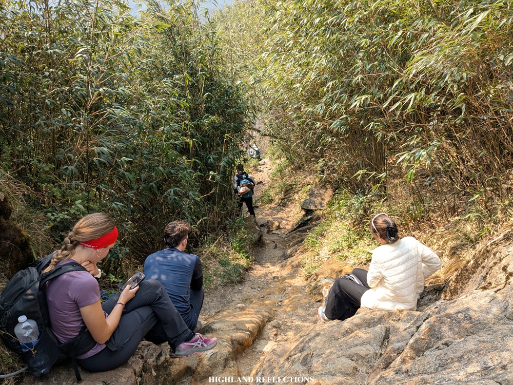
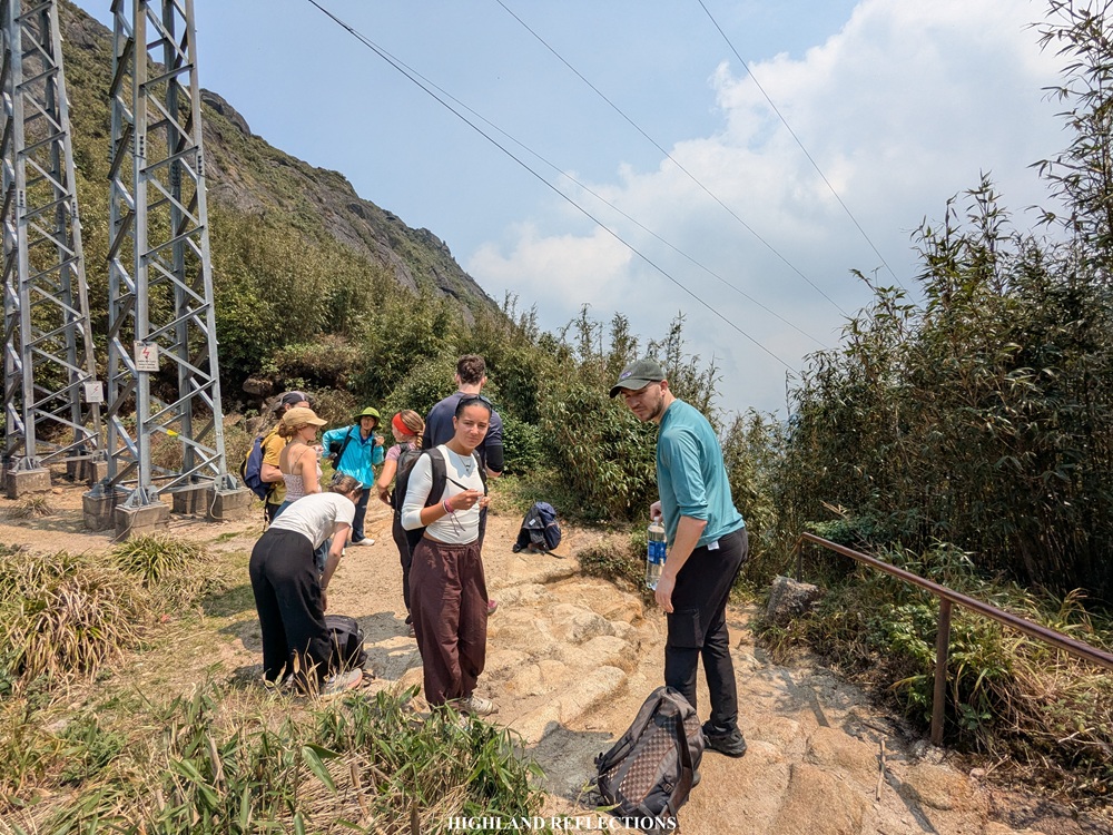
Our first long rest was on a view deck on top of a boulder three kilometers away from the jump-off point (2,143 masl). To reach this boulder, we had to climb a set of steep staircase-like trail at its side. We munched on our trail food provided by our kind guides—some bananas and Vietnamese brands of biscuits.
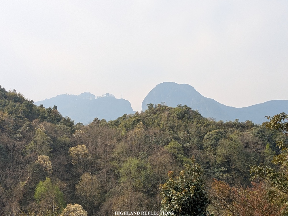
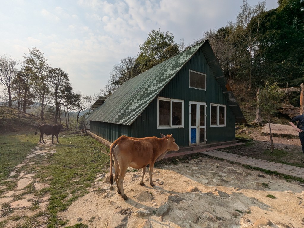
We continued with the hike after the much needed rest. The trail continues up the forest where we had views of the summit of Fansipan for the first time! It was easily distinguishable with its buildings and structures atop. Shortly, we reached Camp 1 (~2,180 masl), an area filled with abandoned bunkers and some cows roaming in the area. We didn’t spend too much time resting here as we were still fresh from the long rest at the view deck.
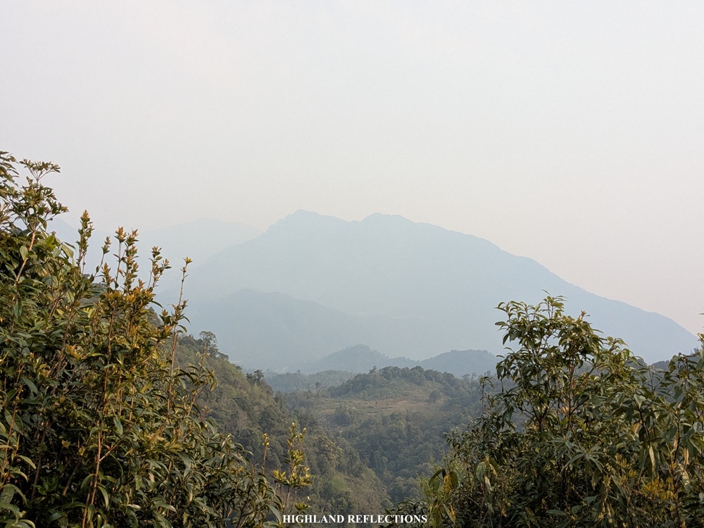
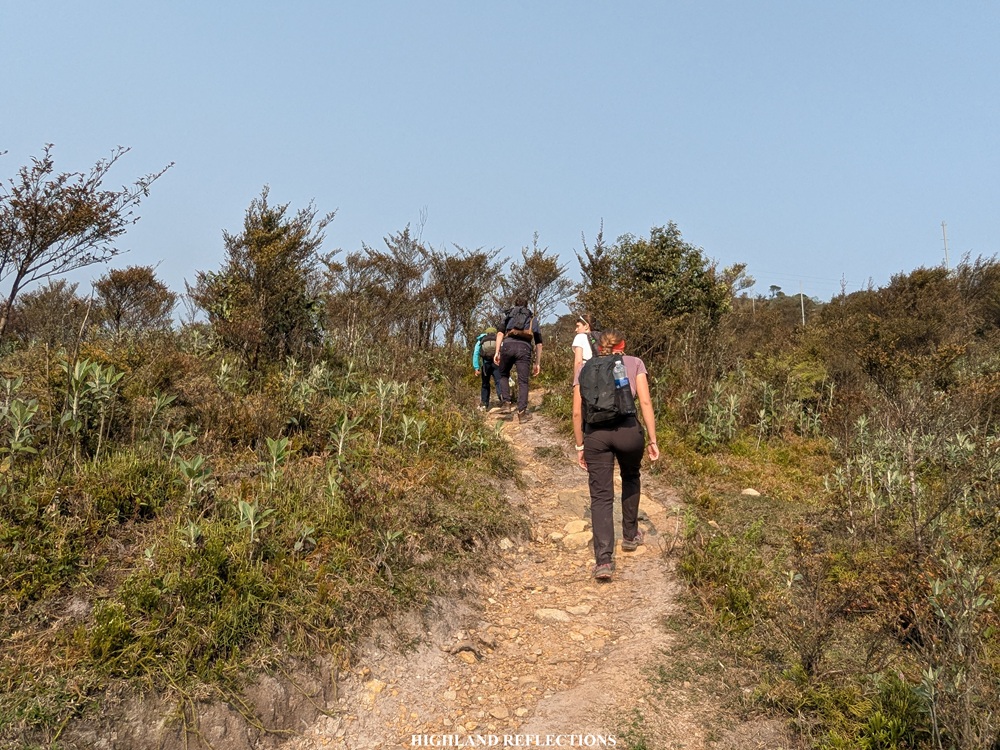
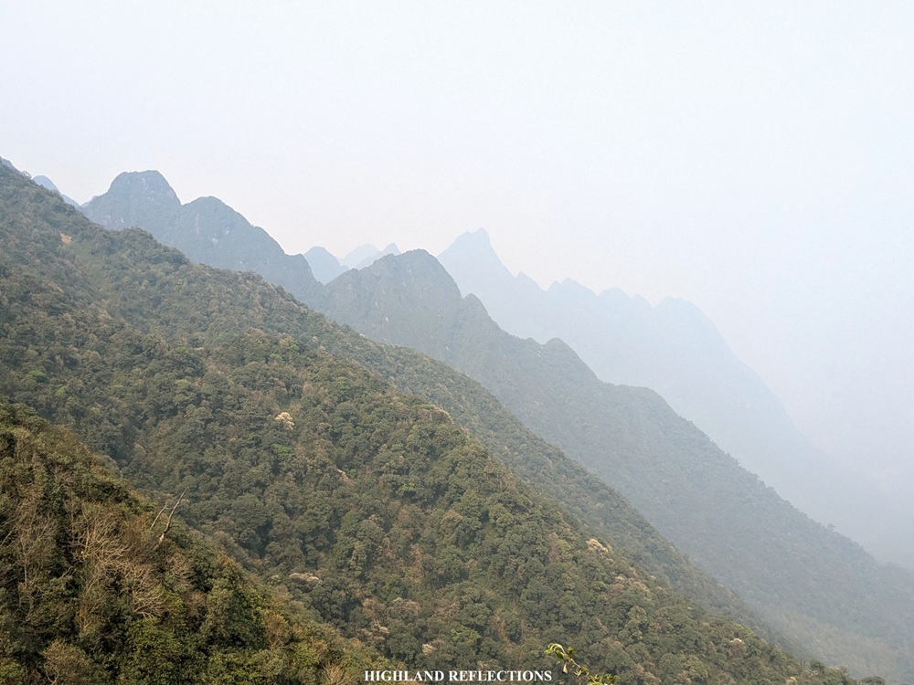
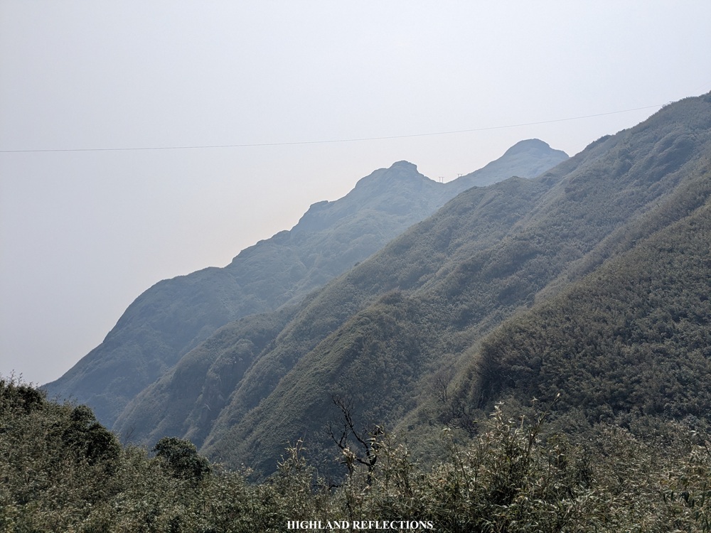
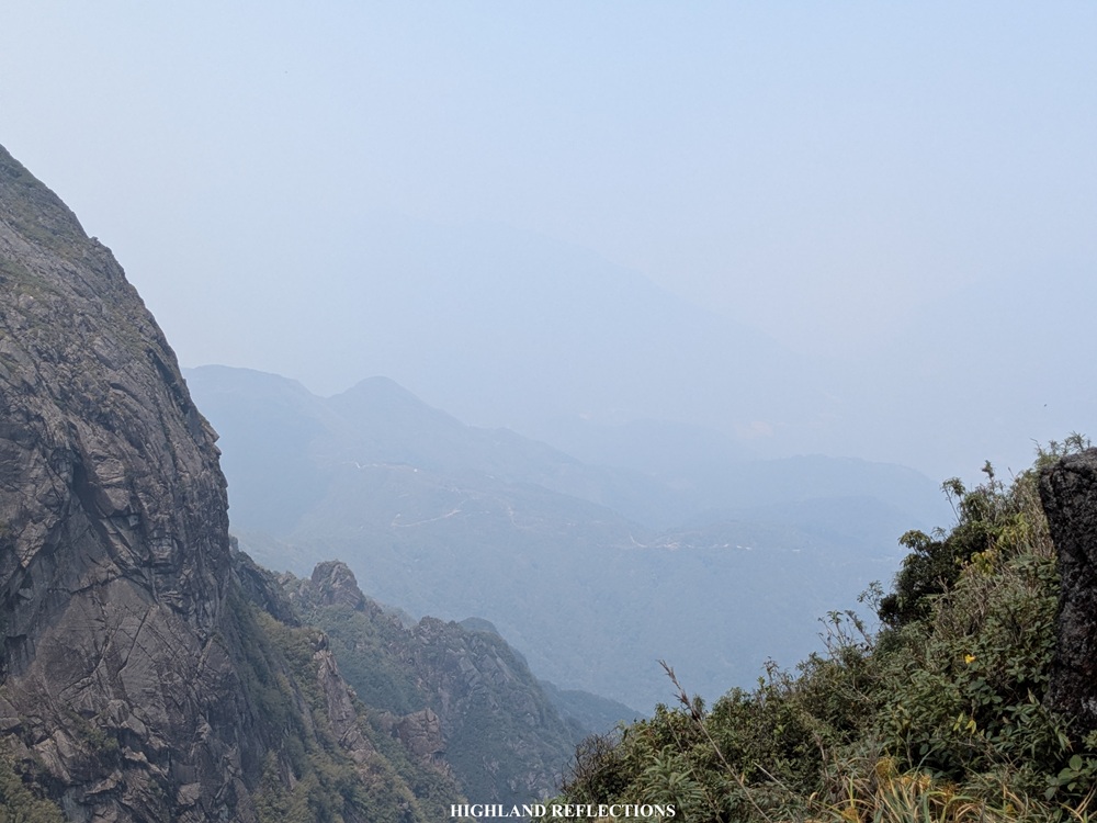
Past Camp 1 is where the forested section of the trail ends, and where the semi-open trail to the summit begins. It was a good thing that I climbed during the spring season, as the clear and dry weather permitted me to see the towering mountains surrounding the trail! I most probably wouldn’t appreciate the trail this much if everything is surrounded by fog—which was mostly the predicament I saw in the vlogs that I watched.
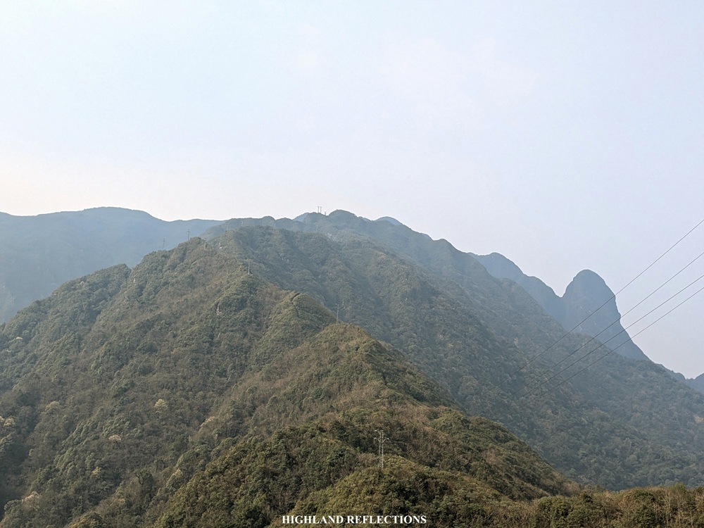
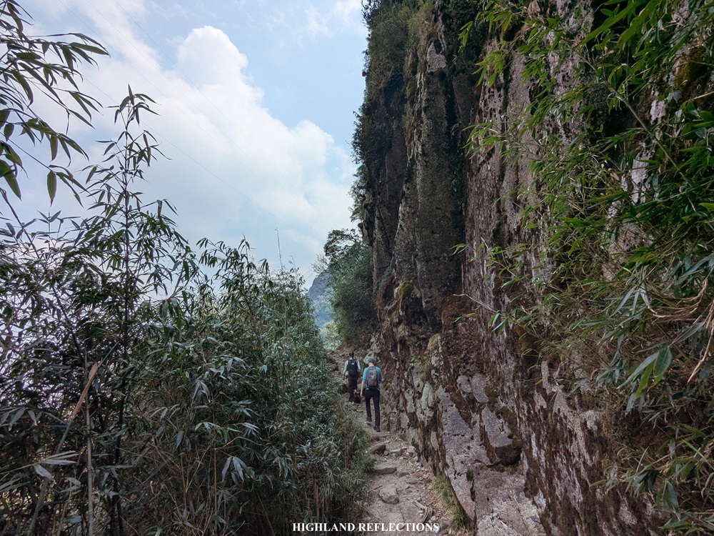
At the start of the semi-open trail, one can already see the steep ridges that we had to climb through on our way up, most of which are covered in tall bamboos. To the left of this ridge, we had a much closer view of the structures and buildings atop the summit. I noticed that at the right side of the summit is a boulder that is so huge it can already be counted as a separate peak! Apparently, we will be passing the rear part of this boulder peak on the way to the summit.
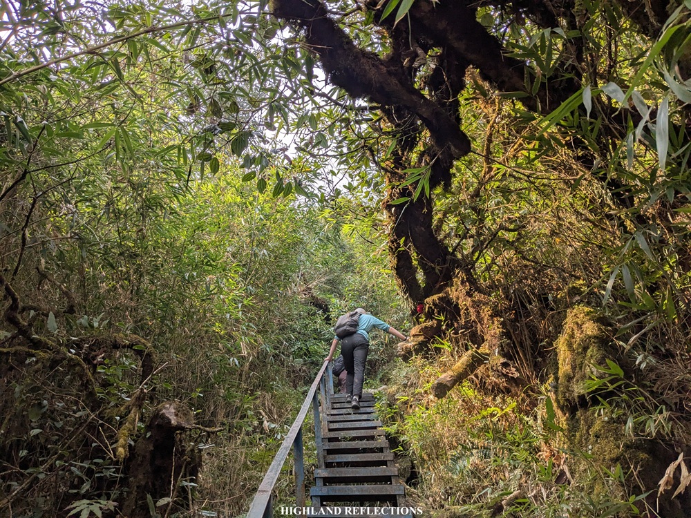
The initial parts of the semi-open trail was on an easy dirt path that took us to some exposed hills at the base of the mountain range. Behind us are views of mountain ranges stretching towards the horizon. Upon reaching the highest part of this hill, we started the steep ascent up the ridges of the mountain range. This was undoubtedly one of the steepest and most difficult portions of the trail, with some sections having some steel staircases. This was where my cardio and my leg strength were tested. And here I thought the initial sections of the trail were already difficult!
Somewhere in the middle of the trail, we stopped by a view deck which provided a magnificent vista of the surrounding mountains and a valley to our right (~2,470 masl). The peaks and crests of the mountains viewed from here were so sharp and pointy!

From the view deck, we continued with the climb, taking on some of the last few portions of the steep exposed section before finally entering the forest once again. We took the brunt of a long stair-like path before entering the forest. I was reminded of the never-ending stair-like trail of Mt. Amuyao in Mountain Province, Philippines.
Inside the forest, the steepness never dissipated. Still, it was nice to take the steep trail with some covers from the trees. At this point, my pace significantly slowed down as I was feeling a pang of pain in my legs. I made sure to tag along with my companions and keep up with their pacing as I couldn’t get left behind by their long strides. My Asian height needed to compensate a lot to not get left behind!
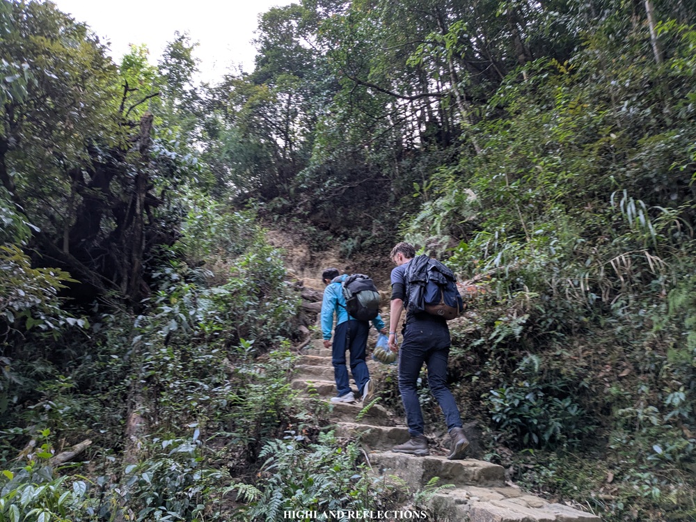
Somewhere in the middle of the trail, we encountered a short, technical steep section that goes downwards. This was followed by crawling up two long steel ladders installed on the surface of huge boulders. This was, no doubt, the most difficult portion of the hike.
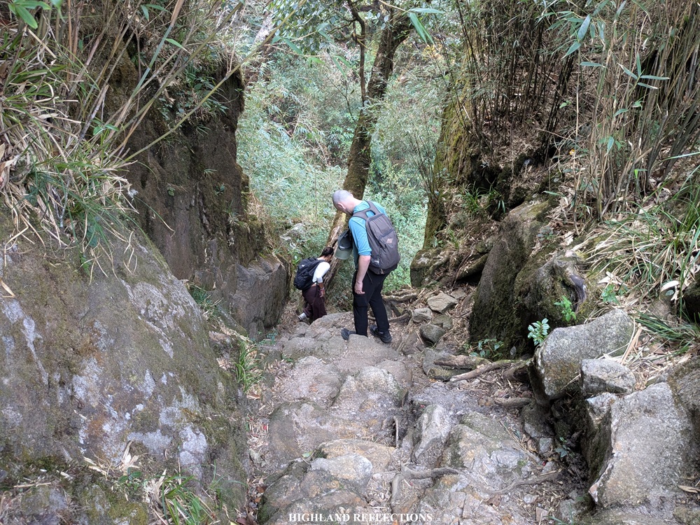
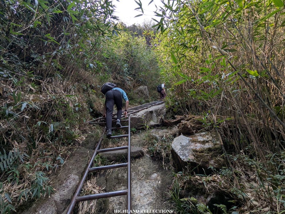
Past the two steel ladders, the ascending trail continues on a steel staircase, followed by another long section of a carved stair path inside a bamboo forest. The ascents here were relentless!
At the end of the ascending portions, I found my companions resting at an area, with their faces painted with the same amount of tiredness as I have. I joined them in their quest to get some minutes of sleep and rest.
Past the rest area, we continued marching on, this time, and thankfully, on a relatively flat trail inside the bamboo forest, which shortly led us to Camp 2—the final stopover before the summit. It was 10:20 in the morning, three and a half hours after starting the hike (~2,785 masl).
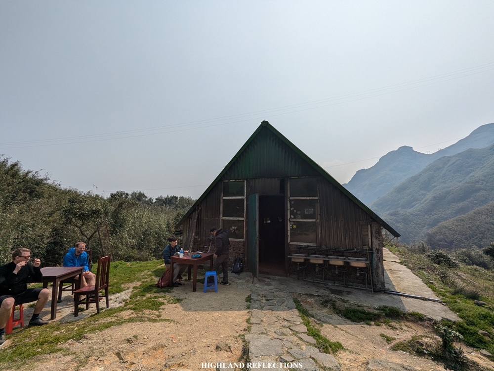
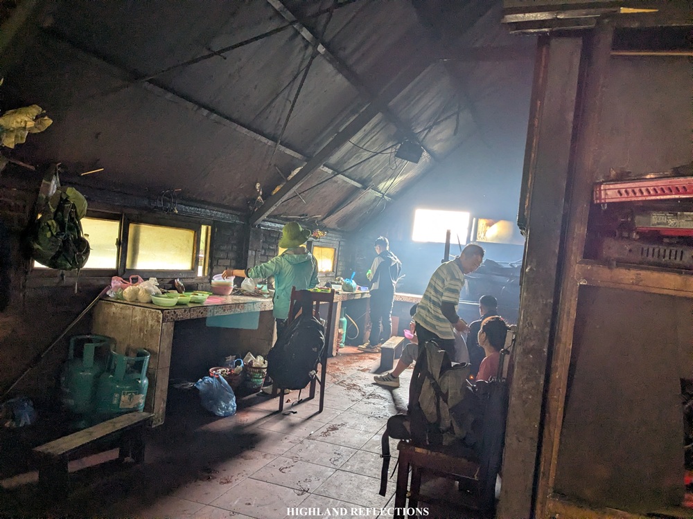
At Camp 2, we joined with the other hikers from other groups having their lunch inside the bunker. We savored the long rest as our guides were cooking and preparing our lunch for us. After an hour, we finally had our hearty lunch consisting of chicken pho and some sliced fruits such as apples, oranges, and sweet, sweet mangoes. The mangoes were thankfully as sweet as the ones we have in the Philippines!
With our reenergized bodies, we continued with the last push towards the summit. Given that Camp 2 is located around 2,840+ masl, we only have three hundred meters of elevation left to reach the pinnacle of this hike.
From Camp 2, we ascended shortly up another section of bamboo forest before making a left turn towards a long flat section that traverses the entire mountainside.
The trail, then, passes through the rear part of the boulder peak that we saw earlier below. At the highest part of this section is a small area where two electric posts are installed. We had a magnificent view of the summit area directly in front of us.
Past this area is the last one-hundred meter descent before the final assault to the summit. We could already feel the heat of the midday sun at this part.
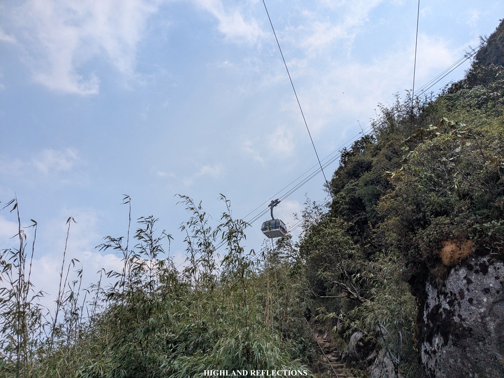
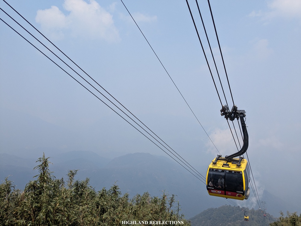
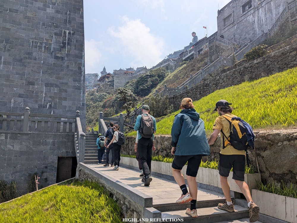
After the descent, we took on the last leg of the trail before entering the summit complex. We climbed the last steel staircase and ascended until we were directly below the cable car station. Above us, some cable cars were passing by, and we were saying hello to the passenger tourists from below!
Behind us, we had a magnificent view of the boulder peak that we passed through, and below it, the slopes that we climbed on. Further away, we could spot the town of Sapa which was way, way below us! Seeing these views, I was quietly grateful for the good weather all throughout the hike. It was one in the afternoon.

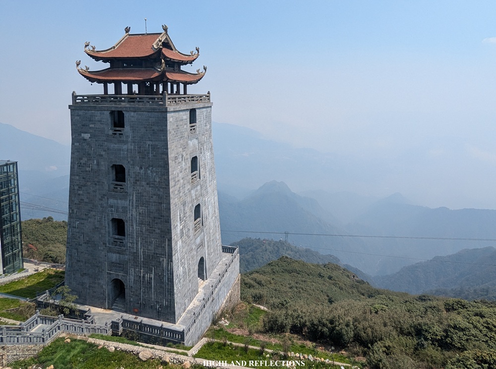
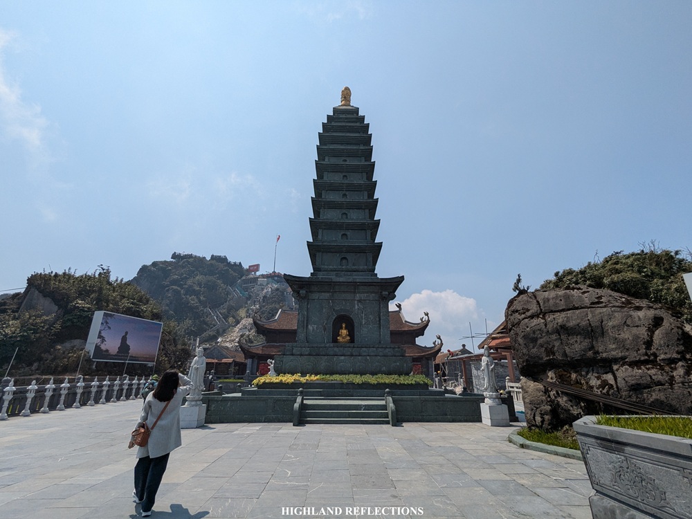
We, then, finally entered the summit complex. The first section required us to tread on a cemented path outside of the restaurant area, located beside the cable car station. Then, we approached the base of Dai Hong Chung watchtower and climbed the staircase beside it. This staircase took us at the front of Bich Van Thien Tu pagoda near the funicular station which takes tourists to the summit. Since we weren’t taking the funicular, we had to climb the summit the long and hard way.
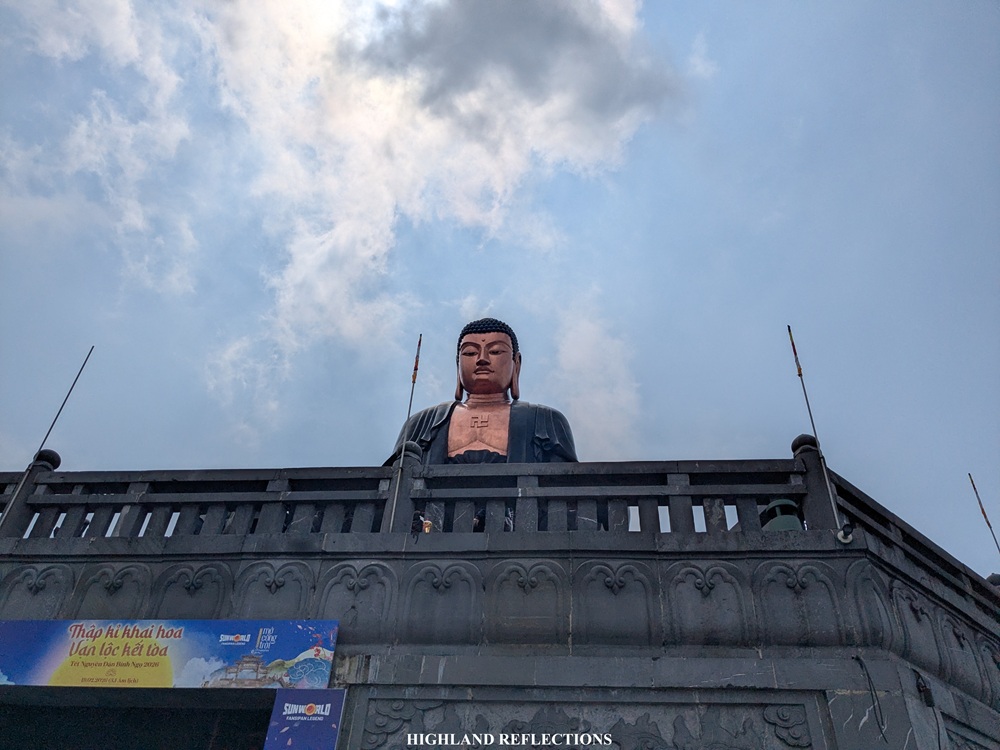
From the funicular station, we climbed the long stairs all the way up towards the giant Buddha statue. We were taking each step slowly and gradually so as to not overspend the meager supply of oxygen we could get from the thin air. From the Buddha statue, we traversed the long walkway going towards the Rhodendron gardens, passing through some more pagodas, before finally climbing the last few staircases on the way to the summit. Here, I was trying to lead the group, with my excitement pushing me through despite how difficult it was to breathe.
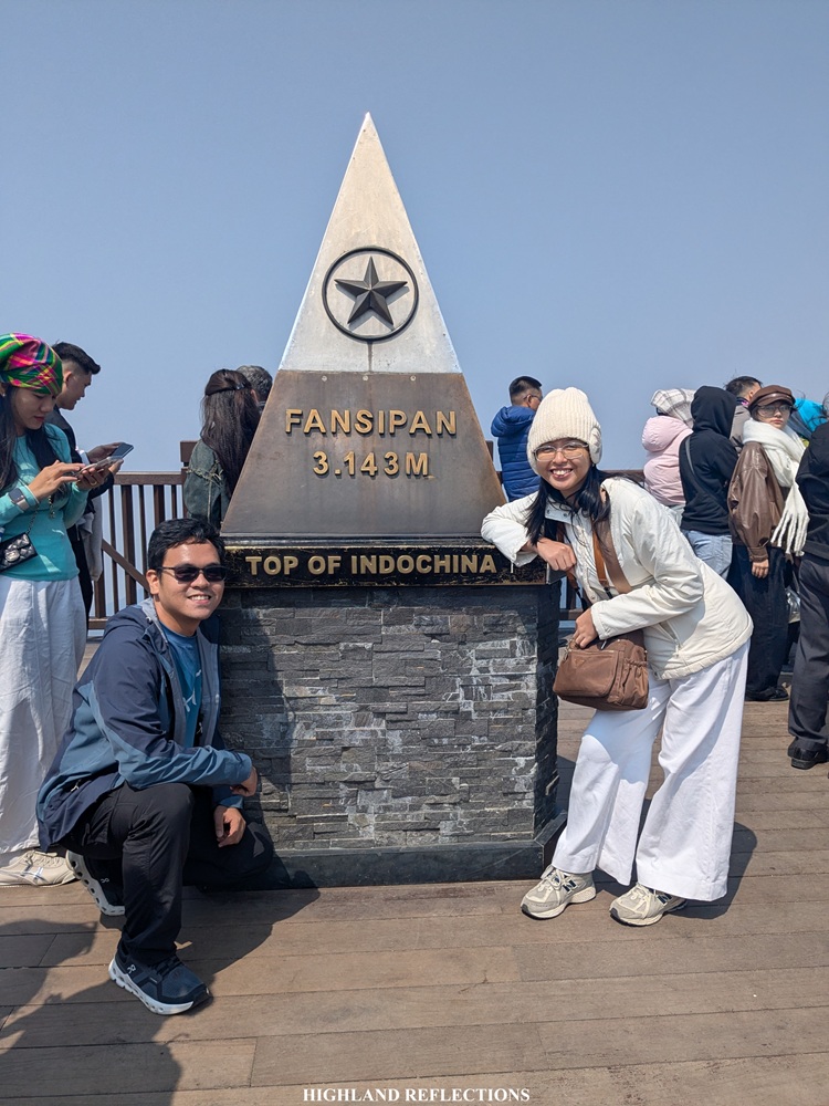
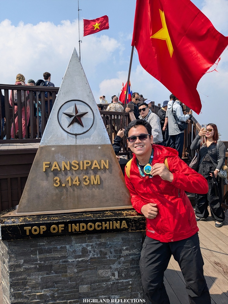
And then finally, at 1:30 in the afternoon, we arrived at the summit of Mt. Fansipan! Reaching it meant that I was now a two-time Fansipan summiteer!
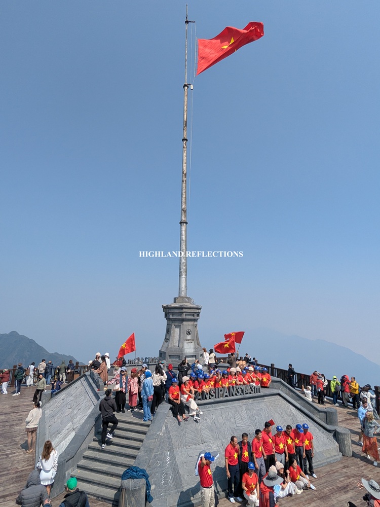
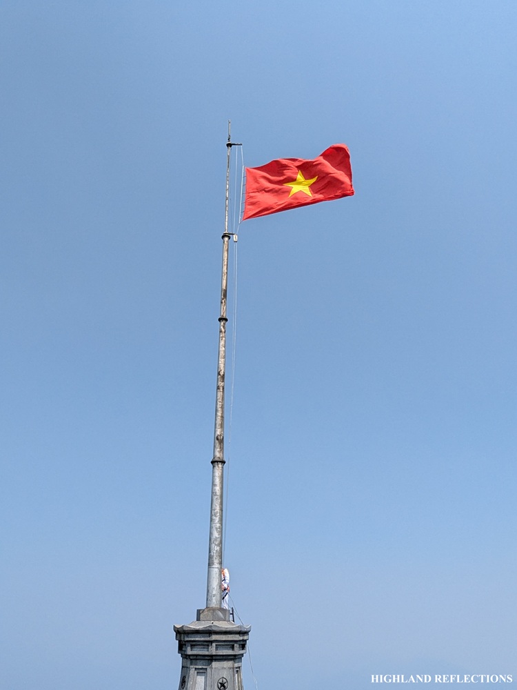
The summit area is divided into two wooden platforms. The higher platform contains three separate pyramid metal markers with an inscription of the word ‘Fansipan’ and its corresponding elevation of 3,147.3 m’. The lower platform, on the other hand, is where the flagpole is erected. Even at midday, tourists were all over the summit area of Fansipan.
Our guide gave us medals for successfully summitting the mountain, which, of course, we pridefully wore as we were taking pictures at one of the summit markers. Snapping pictures here was quite a challenge as we needed to negotiate with the other tourists to let us have our turn! Still, even if we were sharing the space with lots of people, our spirits were high and we were gleeful with the accomplishment in spite of our tired and battered bodies and legs. As we were celebrating the hard-earned accomplishment, a flag-raising ceremony was taking place.
More than the pride brought by the accomplishment, I was really thankful to be there.
I was thankful for the strength and endurance that I had for this hike. That even if I was tired from the days of working and traveling, I had a body that could take me to such amazing places.
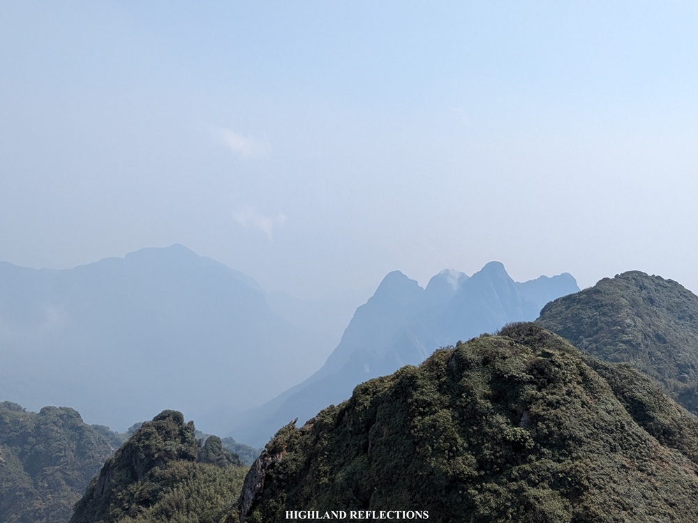
I was highly grateful for the good weather and magnificent views we had atop the summit. Even with the clouds rolling and dancing around us, I could spot some some of the peaks of the mountain ranges surrounding Fansipan. They were surreal! Some of them were even complemented by the views of the Buddha statues and pagodas surrounding the summit complex.

I let my eyes and my entire being savor the mountain view. The thin air in my lungs and the reduced oxygen in my brain were not strong enough to diminish the awe that I was experiencing on top. Surreal!
We spent around an hour of dilly-dallying and whatnot at the summit. But of course, everything that comes up must come down. And so there, my companions and I bade good byes, as some of them took the trail on the way down, while some of us rode the cable car. I had to take the faster way down since I didn’t want to leave Pat alone for the entire day, and I wanted to explore more of Sapa with the remaining time I have for this trip. I munched on a pancake sold near the summit before going down.
And that essentially ends my adventure to the Rooftop of Indochina!
The hike up to Fansipan is such a memorable experience; something that I’ll dearly cherish for the rest of my life. During the hike, I couldn’t help but compare every part of the trail to the ones we have in the Philippines, especially the parts that reminded me of the Cordillera Region. This reminiscing experience was complemented by being struck in awe of the novelty that I was experiencing, as of course, this was my first time seeing the mountains of mainland Southeast Asia, and my first time experiencing the mountains outside of my home country. It’s as if Vietnam gave me a teaser of what the high peaks of Asia have in store, while also giving me a full-blown novel experience!
I’m excited to have more international hikes in the future!
**
Note:
In hiking Mt. Fansipan, the Tram Tron Trail is the most accessible and mainstream among travelers. However, there are two lesser known trails for those who want a more challenging hike up to Fansipan. Both of these trails, according to online sources, are climbed on a two to three-day itinerary, and that one-day hikes are not yet common. The first is the Sin Chai Trail, which involves a strenuous climb inside wild, overgrown forests filled with mountain leeches. The trail starts at Sin Chai Village, located directly below the cable car station in Sun World Fansipan Legend Park. The second is the Cat Cat Trail, touted as the longest and most difficult of the three trails. As the name suggests, it starts at Cat Cat Village in Sapa, located at 1,300 masl. It is not surprising that it is the longest trail, as such a low starting elevation requires a higher gain going to the summit. The trail here, according to online sources, is grueling. If I have the privilege of time and money in the future, I would definitely want to try this trail!
Itinerary
06:00 Meet-up at Sapa Stone Church
06:30 Nui Xe Ranger Station
06:45 Start hike
07:10 First open area, rest
07:40 First major rest area
08:00 Resume hike
08:15 Camp 1, continue hike
08:30 Start of steep ascent
09:00 Mountain view deck, rest
09:30 Steel ladder
10:15 Camp 2, long rest and lunch
11:30 Resume hike
12:20 Last one hundred meter descent
12:40 Entrance to summit area, climb up stairs
13:00 Pagoda areas, take walkways and stairs to summit
13:30 Summit, take pictures
14:30 Start descent via cable car
15:30 Back in Sapa
