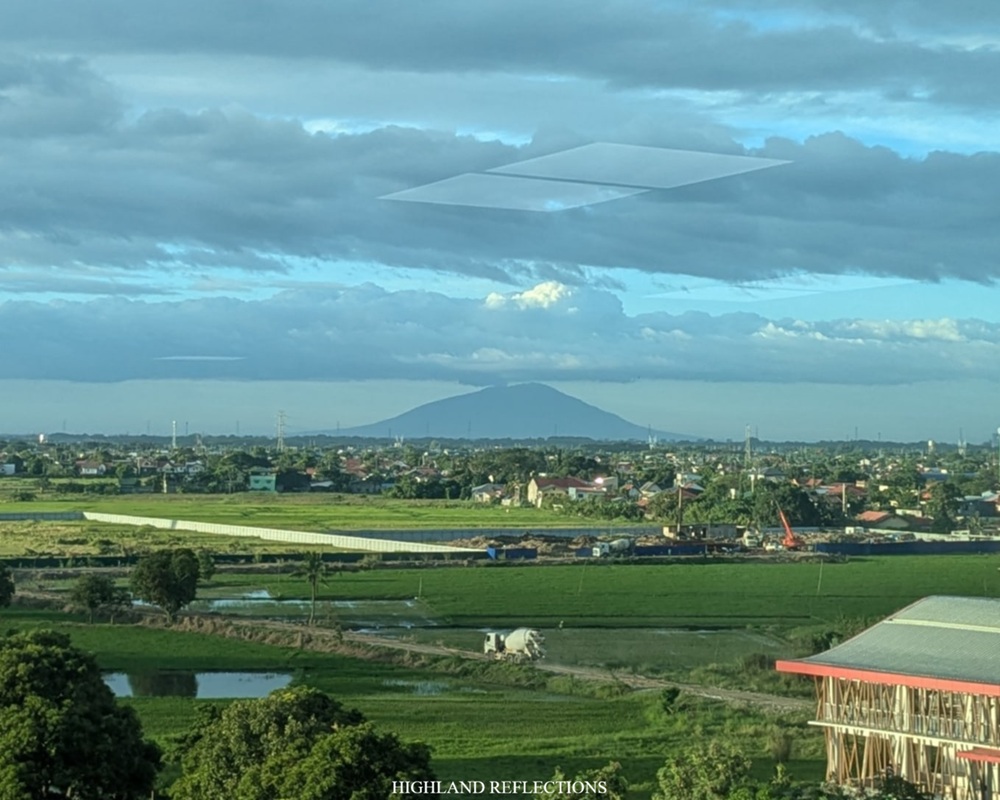
Mt. Arayat has been one of my favorite mountains. Its close proximity to my home province of Bulacan, as well as its significance in my childhood life (owing to seeing it from time-to-time when my family would go to SM Pampanga or in Clark), has propelled me into having a deep fascination with the Kapampangan mountain. This has prompted me to climb Mt. Arayat thrice from 2018 to 2023—my first hike involved traversing the mountain from north to south back in 2018, passing through the two primary summits of Mt. Arayat, the North and South Peak; my second and third hikes were on the southern side, to which I took the Pinnacle Peak-South Peak loop way back in 2021 and 2023. With these three climbs completed, I was highly curious as to what lies ahead of what extreme hikers call as the ‘Quad Peak’ Trail.
The Quad Peak Trail of Mt. Arayat was popularized just before the pandemic hit the country. The trail crosses the southeastern quadrant of the mountain loop before reaching the very steep ascending trail to Alde Peak, also known as the TKO Peak—a subpeak formed along the eastern slopes of the mountain, facing both the South and North Peaks. Past Alde Peak is the long and highly technical connecting trail to the Pinnacle, South, and North Peaks. The hike finally culminates by either returning to the southern part of the mountain (called as Quad Peak Circuit Trail), or descending the northward trail to the town of Magalang (called as Quad Peak Traverse Trail). As such, the Quad Peak Trails (both the circuit and traverse trails), to date, are the most difficult among the trail combinations that can be done in Mt. Arayat.
The characteristics of the hike are as follows
MT. ARAYAT QUAD PEAK TRAIL
Jump-off point: Arayat National Park, San Juan Baño, Arayat, Pampanga
Exit points: Banal na Bundok Nature Park in Magalang (Quad Peak Traverse), or
Arayat National Park in San Juan Baño (Quad Peak Circuit)
Specs: Major climb, difficulty 7/9, trail class 3-4
Days required / Average hours to finish the hike: 1 day / 10-14 hours
I was able to hike the Quad Peak Traverse Trail of Mt. Arayat in November of 2025. This served as my training climb for Mt. Matutum, a mountain in South Cotabato that has a similar terrain with that of Mt. Arayat. However, after climbing the two mountains, I later on found out that I overtrained for Mt. Matutum, since the Quad Peak Trail is much more difficult and technical than the Mindanaoan mountain. Haha! Still, I thoroughly enjoyed the challenge and beauty of both hikes.
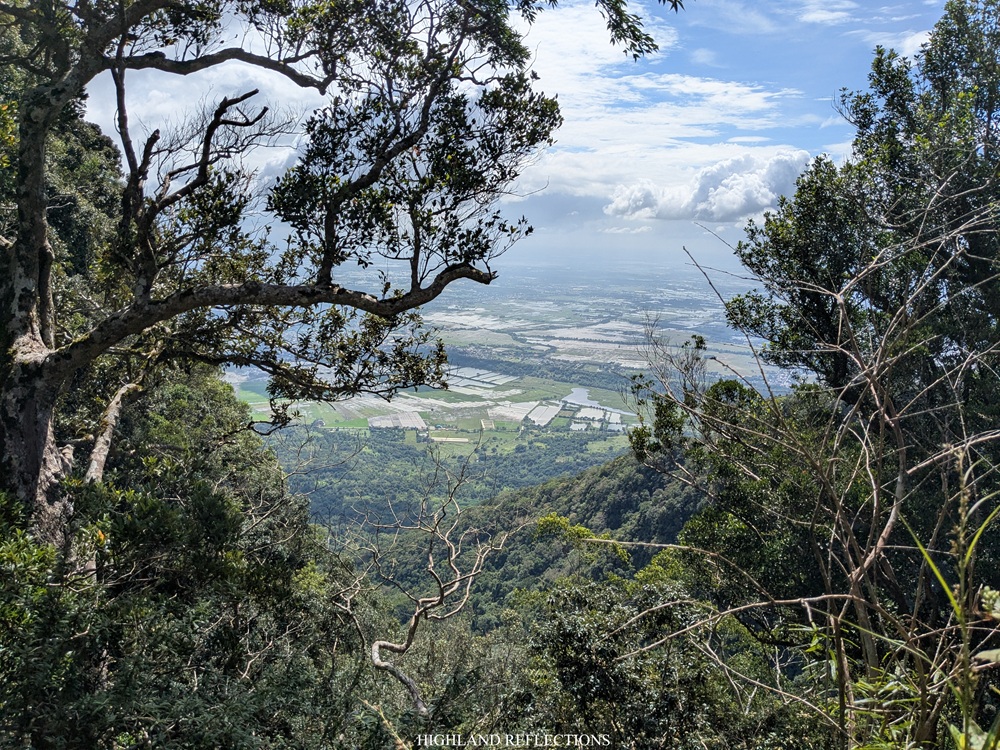
For my Quad Peak hike, we started the hike at around 3:45 in the wee hours of the morning under an indigo sky. The first part of the hike, as mentioned, crosses through the southeastern quadrant of the mountain complex, going northeastwards to where Alde Peak is located. The open trail runs on relatively flat to rolling ground, with Mt. Arayat looming to our left. To our right, city lights glimmer from below.
Then, after an hour of brisk walk, we were greeted by a barrage of overly steep trail, some of which were around 70 to 80 degrees of incline. We took this path with no ropes to assist us, battering our knees and quads with every step of the climb. This was when realization struck me—the Quad Peak Trail can also be a reference to the burning sensation in our quads as we were making our way up!
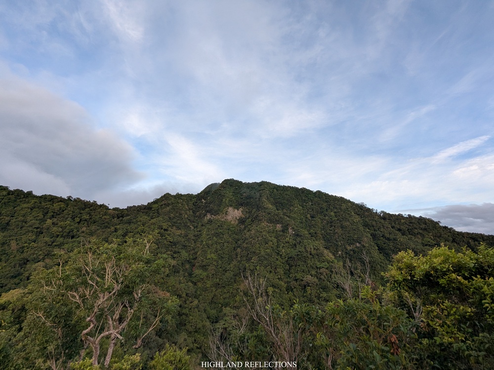
Since this side of Mt. Arayat is less frequented compared to the other trails, the forest here was dry yet dense and alive, strewn with large rocks and peppered with loose soil. It was an undertaking that sets Arayat from its more verdant sisters in the south, Makiling, Malarayat, and Irid, and its neighbors in Bataan—Mariveles and Natib.
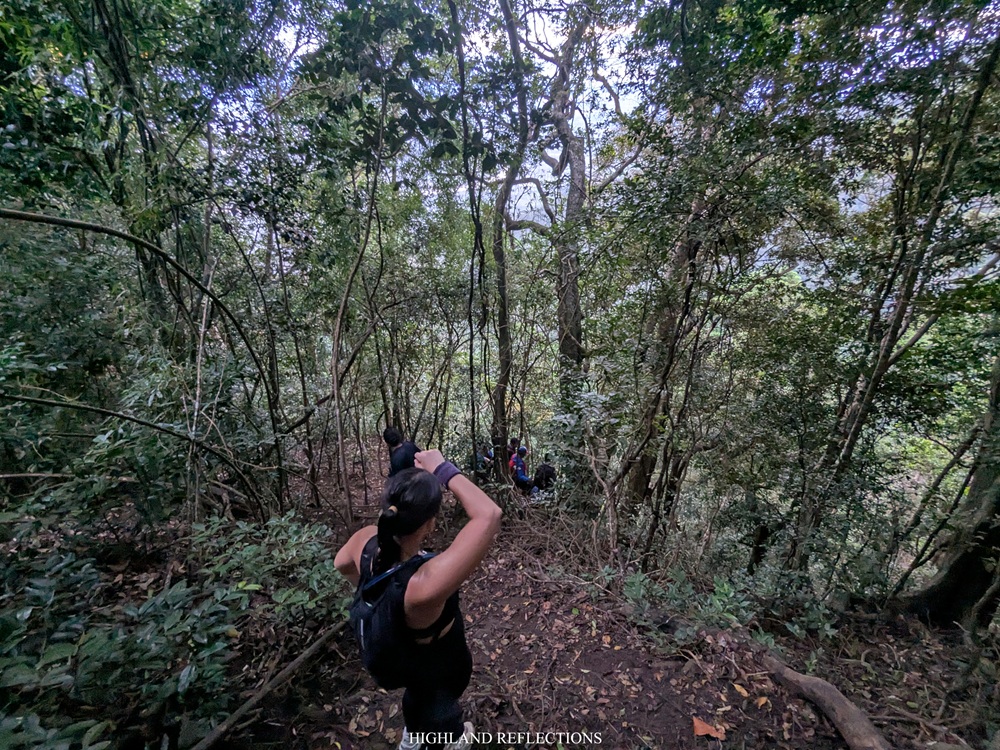
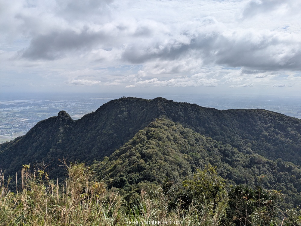
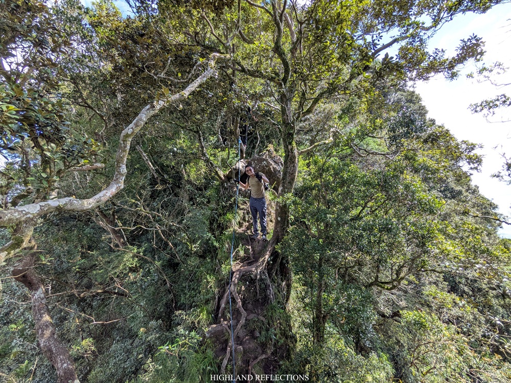
The trail runs on continuous inclined paths inside the dry forest until finally reaching the junction to Alde Peak. We reached this point of the hike past six in the morning, more than two hours after starting the hike. From here was a steep, root-filled climb up Alde Peak, which took me around twenty minutes to reach the top. The peak was a small area that could only accommodate around less than ten people. Surrounding the peak are ravines that lead to what I can only assume as death drops.
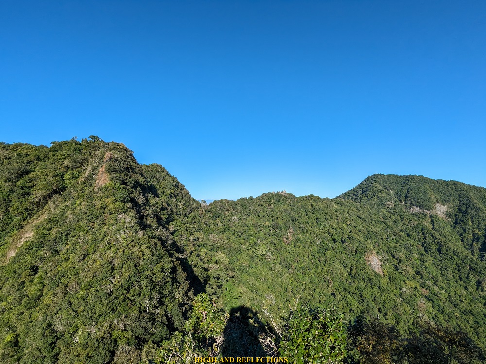
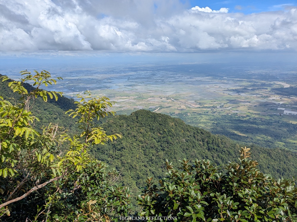
Given that it’s my first time on top of Alde Peak, I thoroughly savored the view. In front of me was the entire eastern face of Mt. Arayat, with the Pinnacle and South Peaks to my left, the ridgeline connecting the South and North Peaks to my front, with Haring Bato in the middle, and of course, the North Peak to my right. It’s from this vantage point where you could truly appreciate Mt. Arayat and its entirety, with all its steep ravines covered in greenery and its titanic presence towering above the plains of Central Luzon.


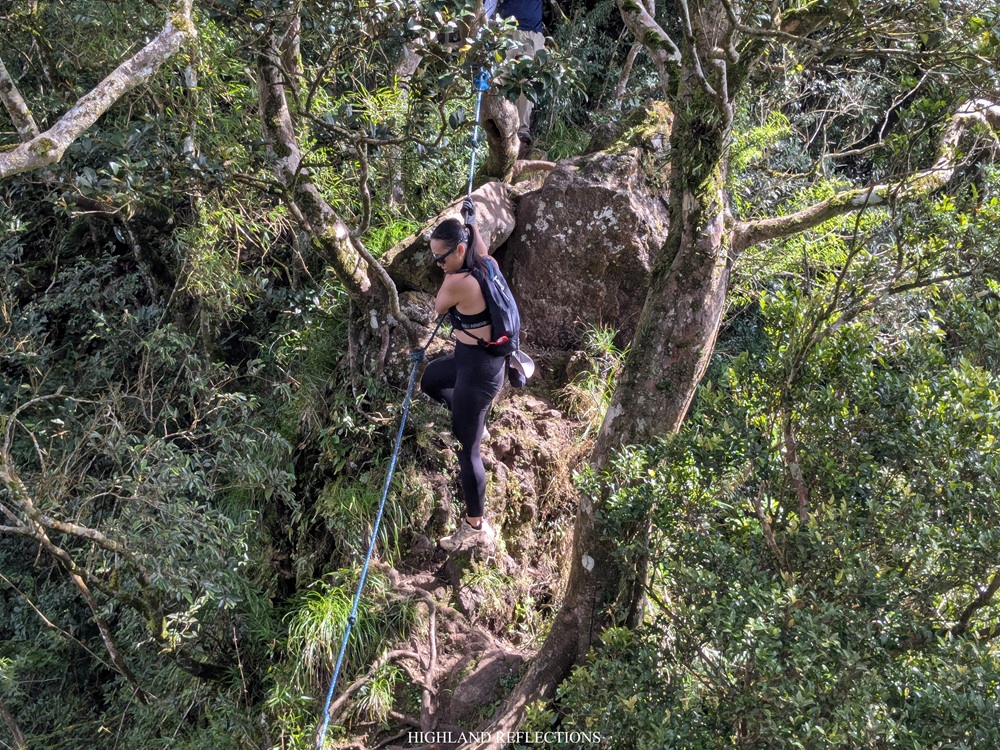
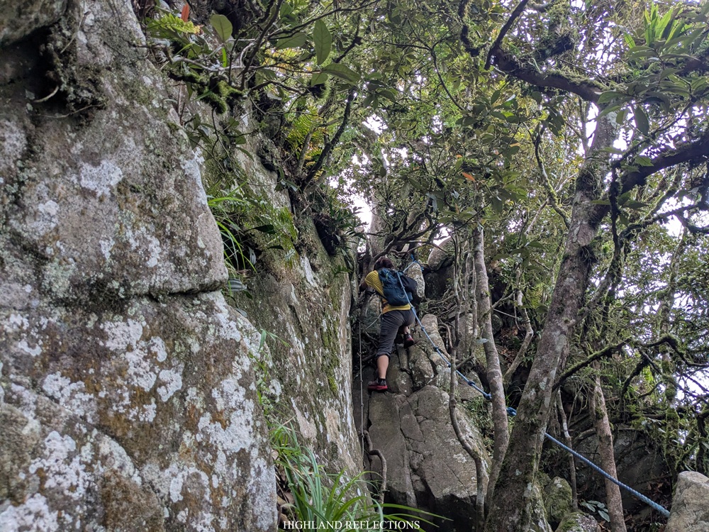
At seven in the morning, we decided to return to the junction, taking us around ten minutes of descent along the steep trail. At the junction, on we went to another trail that connects the Alde Peak to the Pinnacle Peak, which is perhaps the steepest and longest part of the hike. From the junction, the trail took us to a very steep, 100-meter descent complete with roped segments and loose rocks. It was at this point where I felt the brunt of the trail, realizing that this side of Mt. Arayat is much more rugged, and much more precarious.
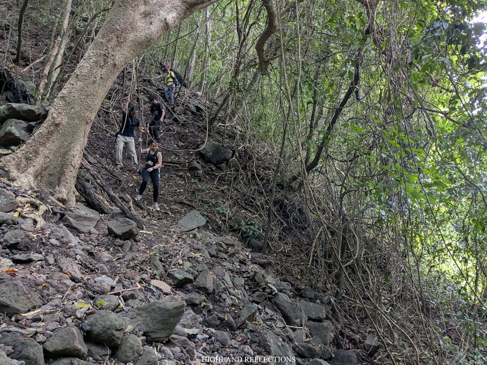
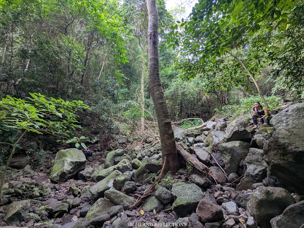
It took us around fifteen minutes to negotiate the dangerous downward path. This led to a dried riverbed surrounded by steep forested slopes marking the start of the long climb up the Pinnacle Peak. At this point, we took an hour’s worth of rest to wait for our companions. Honestly, if given that chance, I would have loved to continue with the rest of the hike since I still had a lot of energy to spare.
We (finally) continued the hike around nine in the morning. From the resting area, the trail was all ascents as predicted. It’s the sort of climb that requires you to get some take-five rests every few meters given how painful the climb is to the knees and legs. But since I had the eagerness of a hyperactive monkey at that time, I informed my guide that I’ll go ahead. From there, I took the climb up alone.
The climb to the Pinnacle Peak was all sorts of enjoyable for someone who’s been thrilled to see this side of Arayat ever since. A large portion of the 320-meter ascent was on a narrow ridge where you’ll need to make your way-up and pass some large roots, protruding boulders, and chaotic sprouting of branches. My entire person was feeling every breath and taking in every scenery of this natural wonder.
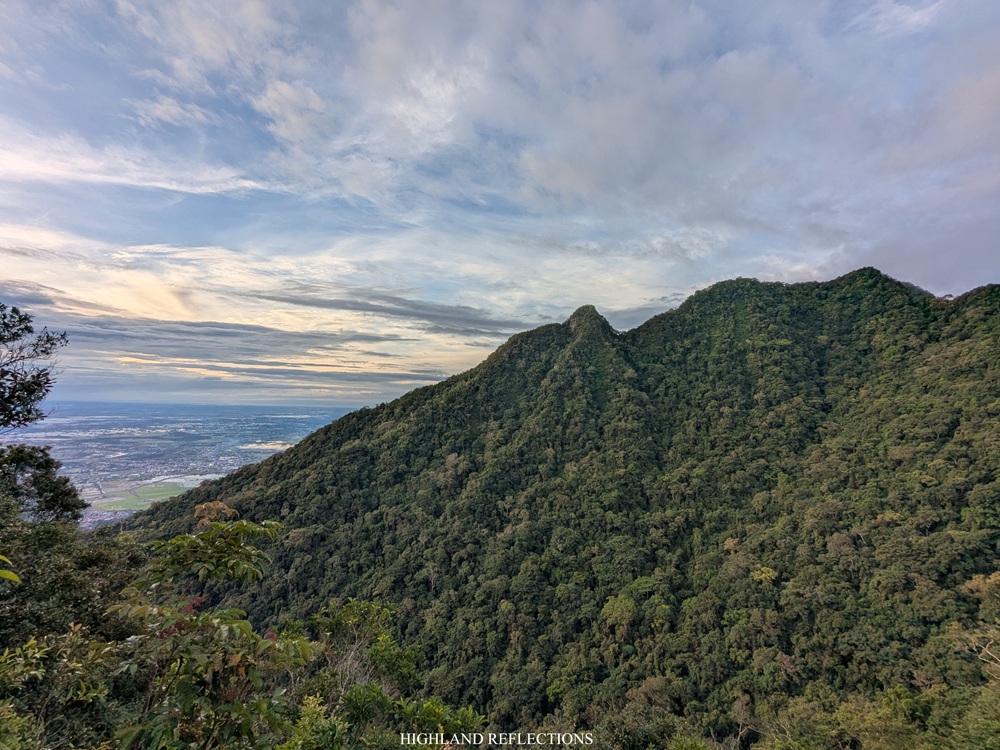
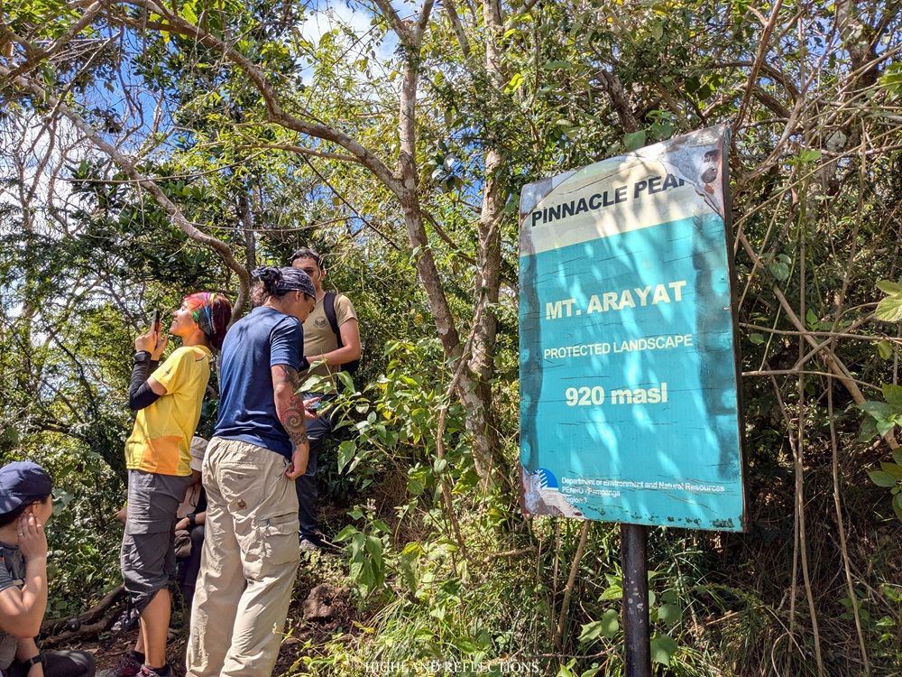
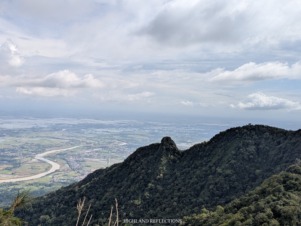
When I emerged onto an exposed, narrow ridge filled with thick grasses, I sensed that I was approaching the top of the Pinnacle Peak. In no time, I reached the view deck of the Pinnacle Peak, with sweeping views of the North and Alde Peak to my right. To my left, I spotted the entrance to one of the trails coming from San Juan Baño. Yeah, I remember this spot very well—I was in familiar territory. Since it was sunny around the view deck, I decided to further climb my way up the steep trail to the topmost part of Pinnacle Peak, where I rested for around forty minutes to wait for my companions.
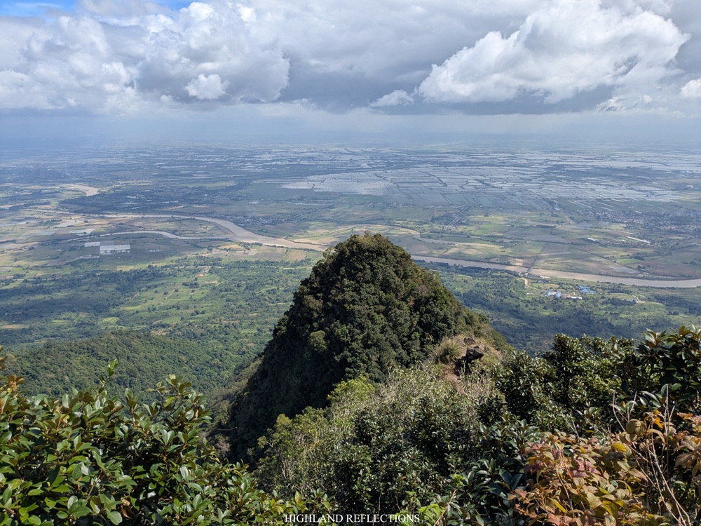
From afar, the Pinnacle Peak resembles that of a bull’s horn. At its tip, one can have a closer view of the South Peak and trace the ridge that connects the two peaks. Alas, as our companions finally arrived from the grueling ascent, I invited them to take one of the most exciting parts of the hike—the Monkey Trail!
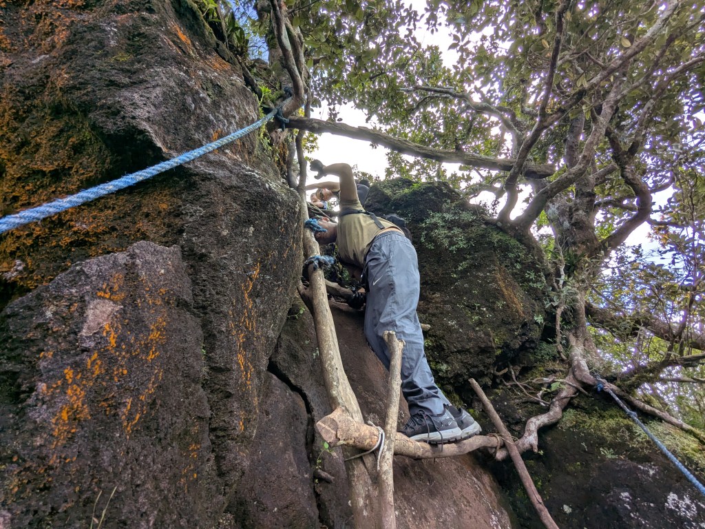
Just directly below the Pinnacle Peak is the steep, 90-degree descent to the Monkey Trail. Caution must be exercised at this point as the trail is tight and narrow, with both sides leading to fatal drops inside Arayat’s gnarly forest. To climb down successfully, one must utilize the ropes and footholds on the trail, and trust your entire upper and lower body in making your way down (of course, trust your mountain guides as well).
Since it was my third time taking the Monkey Trail, I enjoyed every second of ‘play time’ while I was in the area (though of course, I wasn’t letting my ego get the best of me since the possibility of slipping and falling down the ravine is still very, very high). My monkey brain was seriously having a dopamine rush, and was probably on high alert with my ancestors waking my adventurous, passionate spirit. I passed the entirety of the technical trail successfully, leading me to the ridgeline that connects it to the slopes of South Peak. I realized, as of this writing, I do not have any picture of myself while taking the Monkey Trail.
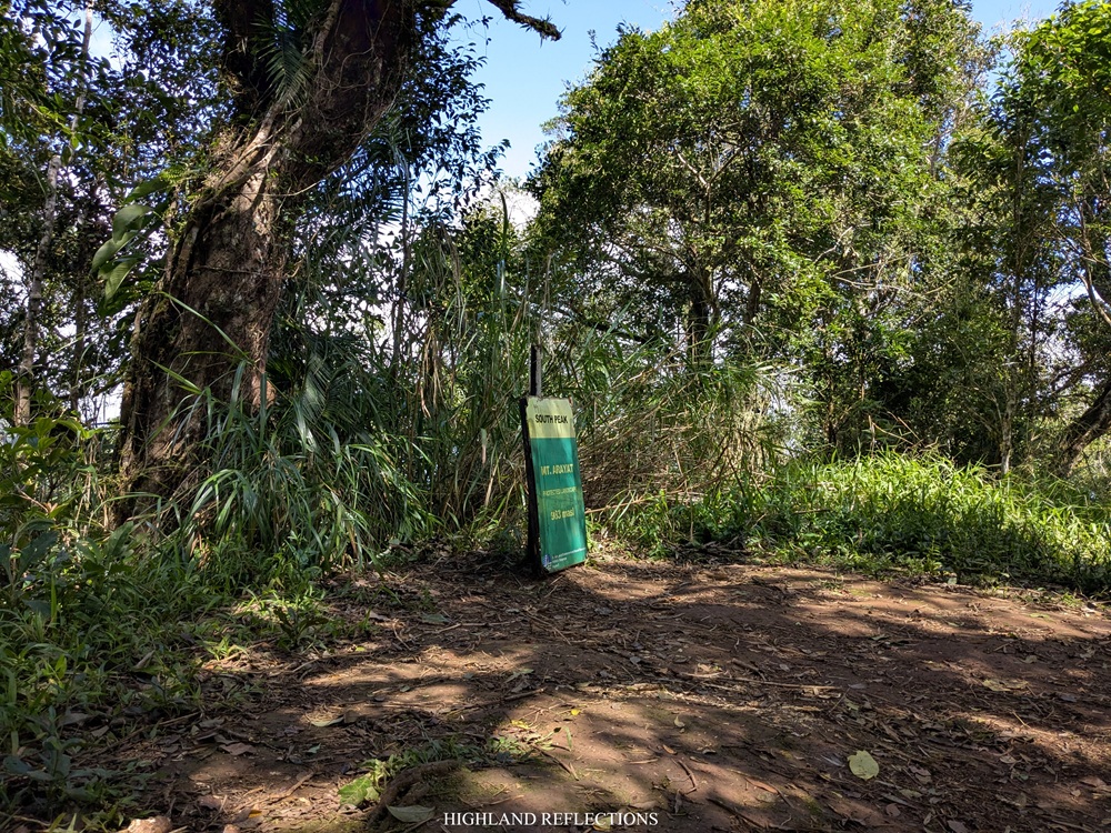
Past the Monkey Trail, we crawled our way-up some large roots, carved steep paths, and mountainside paths to finally reach the top of South Peak. At this vantage point, one can fully appreciate the horn-shaped Pinnacle Peak, towering above the plains of Central Luzon. If we only had time, I would have loved to snap another picture here.
It was 12 noon. We were late by an hour to reach the cut-off time at 11 in the morning. Still, we persuaded our guide that we could finish the Quad Peak at a reasonable time. He heeded our cries. We munched on our lunch as fast as we could so we could get going.
We savored the limited time to rest inside the vicinity of South Peak. Here, the wide area was enveloped in trees, making for a spacious campsite if one wants to spend a night here (although, seldom do we encounter hikers who camp overnight since there is no water source inside the mountain). The trees provided cover from the midday sun.
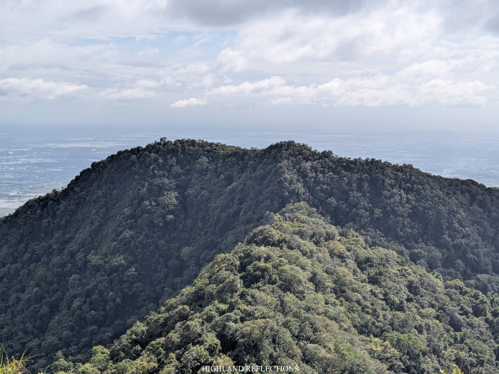
I didn’t have the time to process how I was excited to finally return to some of the spots I took in my first major climb back in 2018—the narrow ridges connecting the South and North Peak, the famed Haring Bato, and the sweeping views on top of North Peak. In a rush after eating our lunch, we went to the trail going to the North Peak. Since seven years have passed, I only have faint recollections of the trail; so now, it felt like I was taking the trail again for the first time.
And lo and behold, the trail immediately welcomed us with a slippery steep descent on top of a ridge. One slip could lead us falling on the ravine—we just had to choose whether we’d like to fall on the eastern or western side of the mountain!
In front of us, we could see Haring Bato perched on top of a cliff. As we were making our way down the forest, the view of Haring Bato disappeared. We, then, entered the forested part of the ridgeline and made our way up the base of Haring Bato.

We climbed the side of the enormous rock with the help of some footholds and a rope. At the top, passing rain poured, stopping me from going to the edge of the boulder to have some views of the Pampanga lowlands.
After getting some rest, we continued with the hike amidst the rain. The trail past Haring Bato was on a ridgeline surrounded by trees, tree roots, and boulders, typical of a Mt. Arayat hike. After some minutes of walking, we found ourselves climbing up a slope that leads to the North Peak. Rain stopped and the atmosphere gave way for some expansive views of Pampanga. It was 1:45 in the afternoon. It felt good to be back!

The North Peak is the highest point in the entire Mt. Arayat mountain complex. From the summit, one can view the ridgeline that connects North Peak to South Peak, with Haring Bato peeking on top of it. One can also see the entire ridgeline that connects the South to the Pinnacle Peak. Beyond these sceneries are the lowlands of Pampanga, Nueva Ecija, and Bulacan, with Pampanga River meandering in the middle of these plains. This was honestly one of my favorite view points in the entire country. Even if it’s not highly appreciated by others, I can never not romanticize what it’s like being on top of the mountain that served as my first-ever major climb.
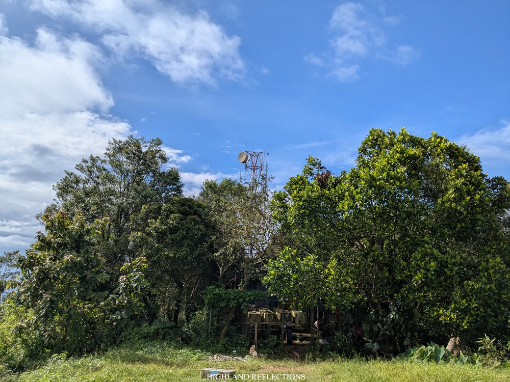
At the summit area, we rested at the barracks beside the radio towers manned by army men. Of course, we paid courtesy to them while snacking on our trail food.
At around 2:20 in the afternoon, we decided to start our descent. In doing the Quad Peak hike, there are two options to go down. The first option is to descend via the trail to Magalang at the northern side of the mountain. The second and the more difficult option is returning to South Peak and climb down the trail to Arayat National Park, which requires renegotiating the entire ridge connecting the North and South Peaks. Since we were pressed for time, we opted for the first option. I would love to try the latter option in the future!
It was such a joyful experience climbing down the Magalang side of Mt. Arayat. Back in 2018, we took this trail to climb up the North Peak in the dark morning sky, so it was such a treat seeing what the Magalang side has to offer under the blessings of sunlight! Of course, similar to the trails in any part of Arayat, the trail to Magalang is strewn with large rocks and tree roots. There’s also an off-trail that leads to the andesitic lava dome called White Rock. According to Kapampangan legends, this was believed to be the resting place of Aring Sinukuan, the guardian deity of Mt. Arayat. I would love to visit this in my future hikes.
What surprised me about the Magalang trail is that relative to the other trails of Mt. Arayat, the slopes here were gentler. Don’t get me wrong, it’s still gradually steep, but compared to the ones we took going to Alde, Pinnacle, and South Peak, the trail here was a welcome respite. I reckon that it was even less steep compared to the exit trail in San Juan Baño!
The gradual steepness dissipated upon encountering the Stations of the Cross inside the forest. From here, the trail was wide and flat enough to tread on. Another off-trail would be encountered here, leading to a giant statue of Jesus Christ where devotees would go to every Lenten season.

At the end of this trail is the Banal na Bunduk Nature Park—the terminal point of the hike. We reached this point at around 3:45 in the afternoon, completing the entire hike in twelve hours! That afternoon, we washed-up at one of the houses in the area and bade goodbye to Mt. Arayat. We had a celebratory dinner at an inasal place in the town of Arayat before going home.
Finally, I have completed all four trails of Mt. Arayat sans the Quad Peak circuit trail!
It was such an honor to have treaded all available trails within my childhood mountain. As someone who has been longing of entering its domain ever since I was a child, it felt very fulfilling completing the Quad Peak Trail of Mt. Arayat. Of course, since this mountain is very close to home, I plan to climb Mt. Arayat multiple times in my lifetime. Despite its mosquito-filled environs and its throat-parching trails, I have found solace in its slippery steep slopes. Still, since it’s not often that we get a chance climb a mountain in our lifetime, let alone climb it multiple times, I’ll make sure to say hi to Arayat, regardless if I’m in my home province, on the road, or in another mountain in Central Luzon or in the Cordilleras.
Itinerary
03:45AM Start hike in San Juan Baño (58 masl)
06:10AM Junction to Alde Peak (640 masl)
06:30AM Alde Peak (760+ masl)
07:00AM Start descent to junction
07:40AM Dried riverbed (520+ masl), rest
09:00AM Continue hike to Pinnacle Peak
10:20AM Pinnacle Peak (920+ masl)
11:00AM Monkey trail
12:00PM South Peak (983+ masl), short rest and lunch
12:20PM Continue hike to North Peak
01:00PM Haring Bato (935+ masl)
01:45PM North Peak (1,030+ masl), rest
02:20PM Start descent to Magalang
03:45PM Banal na Bunduk Nature Park, end of hike (225+ masl)

Great work! Your adventure post is so well-presented and insightful. Keep sharing such valuable content!
LikeLike