If one would create a list of some of the most revered mountains in the Philippines, one would probably include mountains in the Cordillera Region, the high peaks of Mindanao, and the hard-to-reach peaks of Western Visayas and MIMAROPA Region. But when it comes to the pinnacle of Philippine mountaineering, one can narrow down the list to some of the highest and toughest mountains to climb in the country. Mt. Mantalingahan in Southern Palawan would undoubtedly be in that list.
This is an account of my 4-day adventure in hiking Mt. Mantalingahan!
Mt. Mantalingahan: The Rooftop of Palawan and the Mountain of God
Mt. Mantalingahan is locally known as “the Mountain of God” by the Palawan people. Joining Mt. Mantalingahan is a roster of magnificent peaks and ultramafic mountains within the province, long thought to be the last frontier of Philippine biodiversity. Mt. Mantalingahan stands as the grandest among these mountains in the province, and is considered to be one of the most difficult to climb in the entire country. After scaling another formidable mountain in the neighboring province of Romblon—Mt. Guiting-Guiting—twice, I had my eyes set on Mt. Mantalingahan ever since.
Like Mt. Guiting-Guiting, Mt. Mantalingahan is one of the very few mountains to have been given a difficulty rating of 9/9 by local blogger Pinoy Mountaineer. These two are joined by Mt. Halcon in the province of Oriental Mindoro to form the MIMAROPA Knife Edge Trilogy—three of the most technical, longest, and ultra difficult mountains to climb in the Philippines. Among these three, Mt. Mantalingahan is said to be the most intricate as it combines the length of Mt. Halcon and the technicality of Mt. Guiting-Guiting.
Another thing that makes the Mantalingahan hike difficult, apart from the technicality and length of the trail, is from the fact that both the starting and exit points are near sea level (30+ masl for the starting point; <20 masl for the exit point). Hence, the elevation gain and loss for this hike is as high as the summit’s elevation (2086+ masl), with some additional gains and loss from the up-and-down parts of the trail.
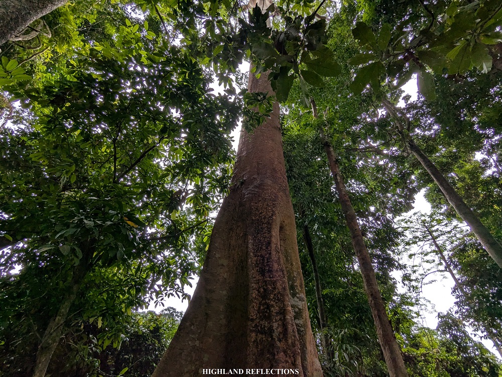
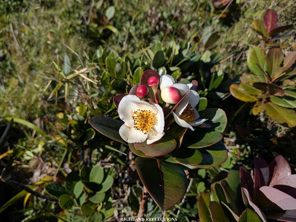
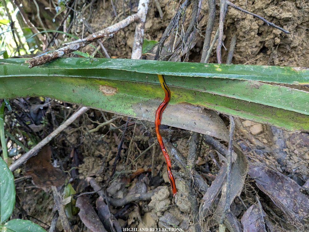
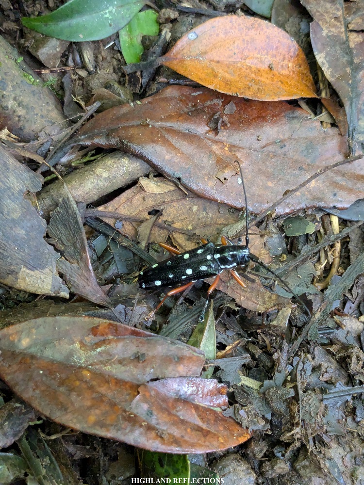
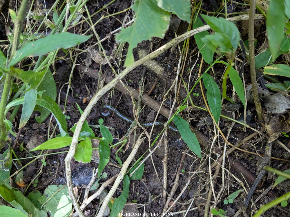
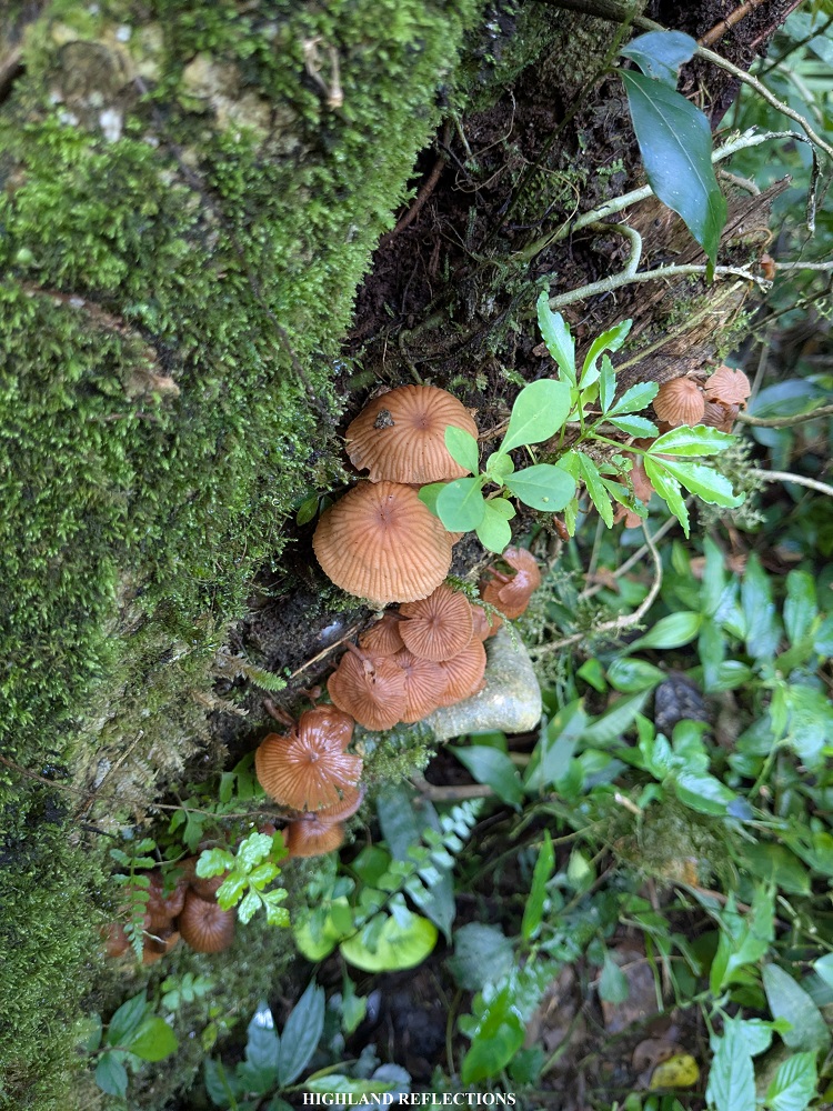
Adding to the sheer difficulty of climbing Mt. Mantalingahan, what makes it an enticing destination is the fact that the mountain is home to a diverse set of flora and fauna, some of which have only been discovered and given names in the last twenty years. This is why Mantalingahan has been declared as a protected landscape by virtue of the NIPAS Act (Republic Act No. 7586), covering the entire range spanning the towns of Rizal, Quezon, Bataraza, Brooke’s Point, and Sofronio Española. The traverse trail is located in the towns of Rizal and Brooke’s Point. Furthermore, mining is prohibited within the protected area by virtue of the Writ of Kalikasan issued by the Supreme Court in 2023.
Besides the flora and fauna, the indigenous peoples called Palawan, particularly the tao’t bato (People of the Cave/Rock) and tao’t daram (People of the Night), reside within Mt. Mantalingahan’s forests. These indigenous peoples have been the caretakers of the mountain, and have been living with old customs such as arranged marriages and polygamy. In fact, some of our guides and porters shared to us that they have two (consenting) wives! The tao’t bato have also been the subject of certain documentaries, particularly those living in the caves of Singnapan Valley—an area near the jump-off point in Ransang, Rizal—which can be a side trip or a destination in itself when visiting the area.
The tao’t daram, on the other hand, are shrouded in mystery. Although Pinoy Mountaineer notes in his blog that they have been extinct, locals say they still live in the upper reaches of the mountain. On our fourth of day hiking, there was an area where we were told to keep our voices low, as it might disturb the hunting practices of the tao’t daram. Our guides also advised us to stick together, as the tao’t daram do not treat outsiders well especially if they are alone, or if they do not have any local Palawan guides with them.
One notable story from our guide was that in 2023, a DENR official who was camping in the area received a warning shot in the form of poison darts for being loud at night. Adding to these mystique to the tao’t daram is that, in the past, they were told to have super powers, where they can leap from one branch to another, and that they have pinpoint accuracy in using poison darts. They were also said to be cannibalistic. Hence, we heeded our guides and proceeded with caution.
These cultural elements, coupled with Mantalingahan’s reputation, make the mountain a highly compelling destination.
Day 0: A Prelude to the Climb
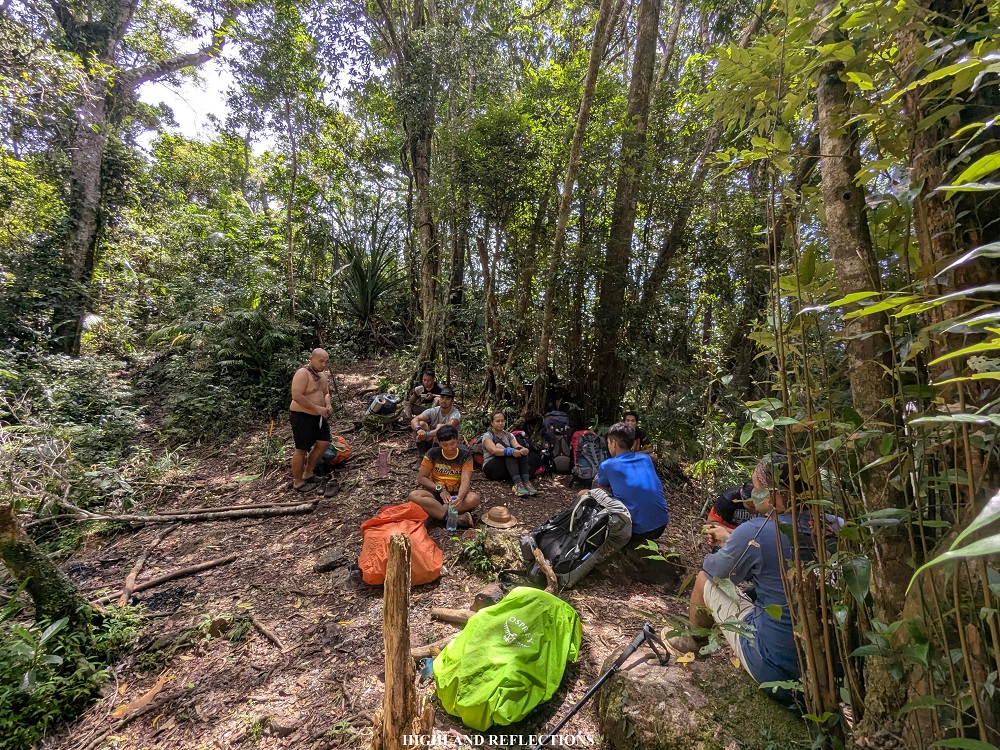
In climbing Mantalingahan, I joined a 4-day organized event led by Jason Millor and Bugz (HakbangPasulong), together with other organizers/coordinators, Kimpoy and Jonathan. We were joined by Jason’s regular joiners—Telai, Atty. Jess, Mawel, Darvs, Topher, and Sendo. This climb was planned way back in November of 2024, when one of my friends from my second Mt. Guiting-Guiting climb invited me for a Mantalingahan Traverse at the end of May, 2025. Sadly, she was not able to join me due to some personal reasons, leaving me as a solo joiner for this climb.
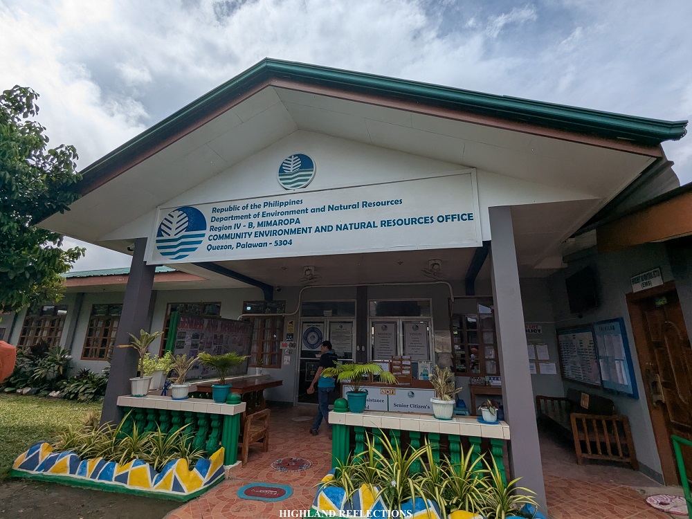
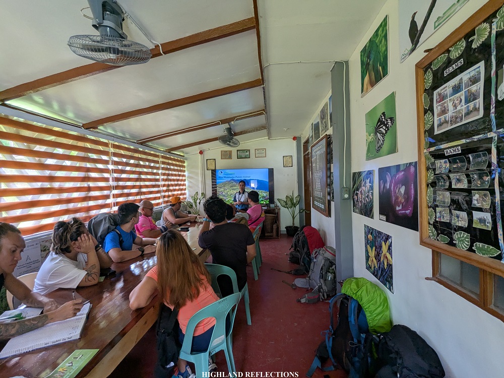
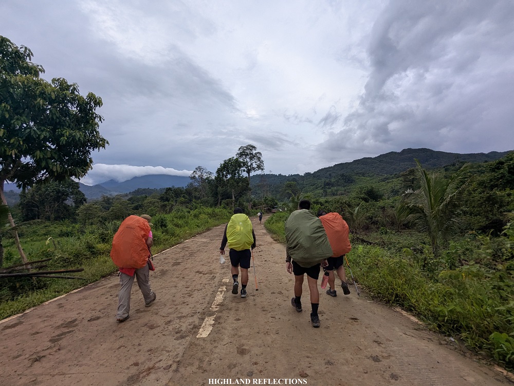
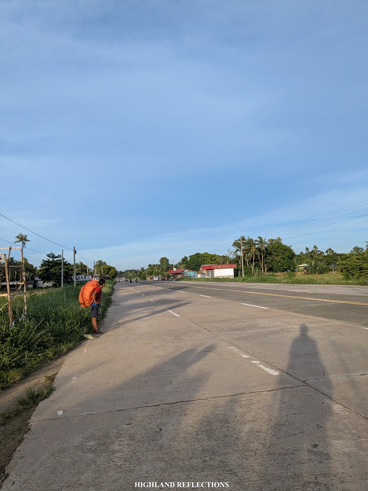
I rendezvoused with the team at a McDonald’s in Puerto Princesa City, Palawan morning of May 26, 2025. We chartered a van that took us to the DENR Office in the town of Quezon, where the Mount Mantalingahan Protected Landscape office is located. There, we had our orientation where we watched some informative videos about the mountain and submitted our medical certificates. Our organizer also bought some last minute supplies within the town.

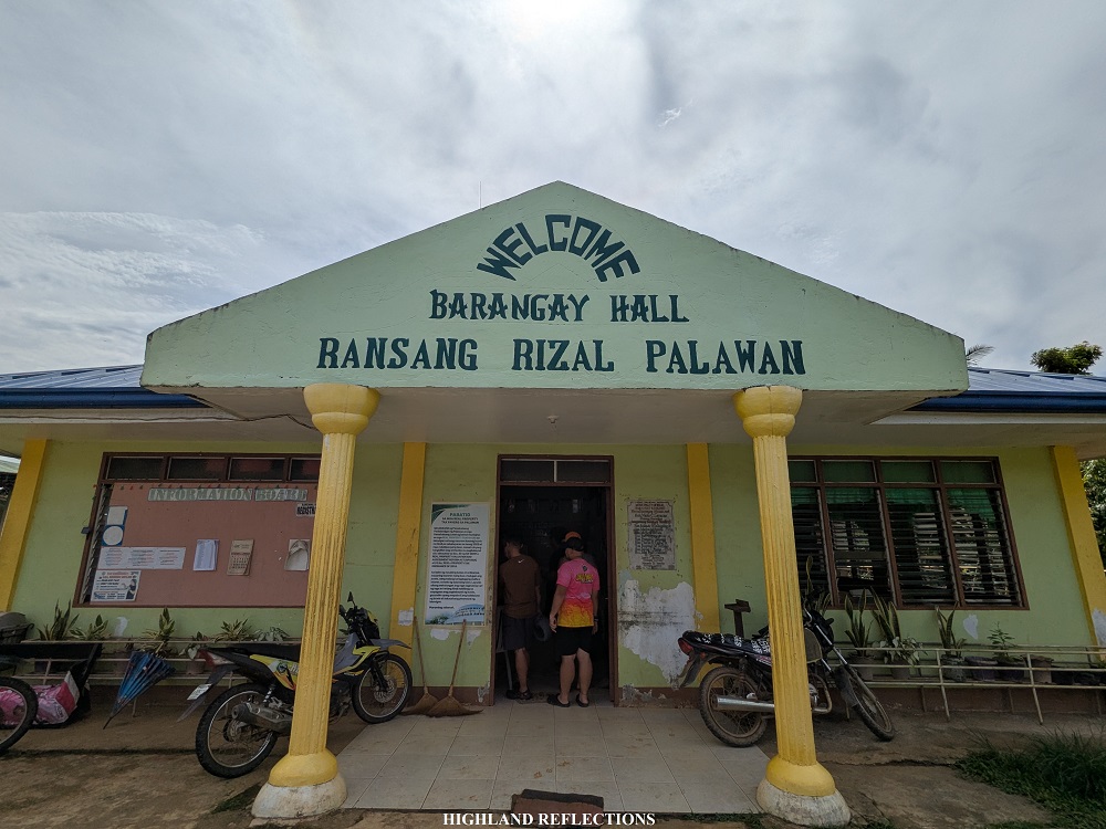
Then, we went to the town of Rizal to register at the tourism office and to pay courtesy to the town’s police department. We, then, had our lunch at a carinderia nearby before going to our last stop—a registration at the barangay hall of Ransang. Afterwards, we went to Sitio Balen-Balen to settle for the day at the house of one of Mantalingahan’s legendary guides—Tatay Denio.

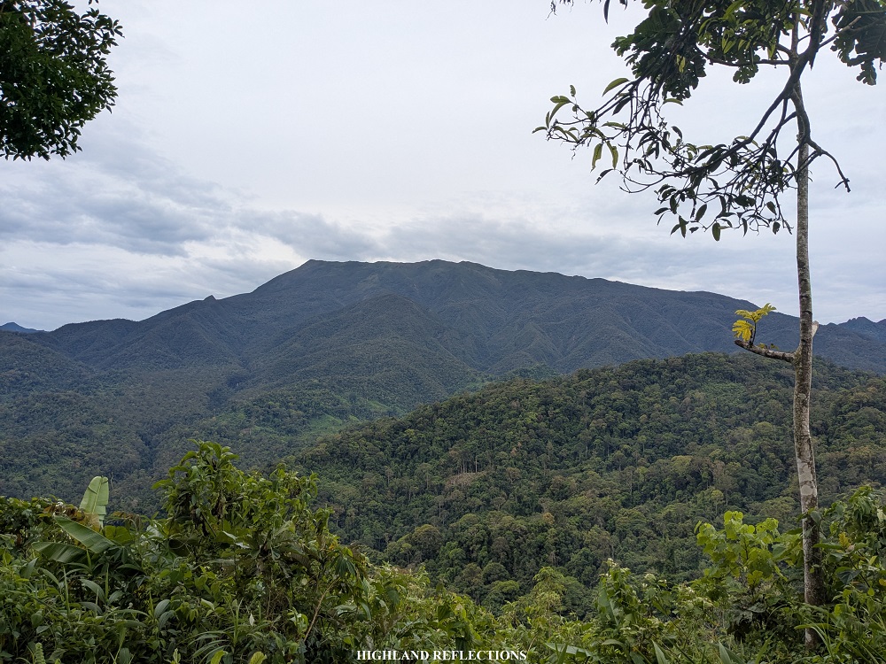
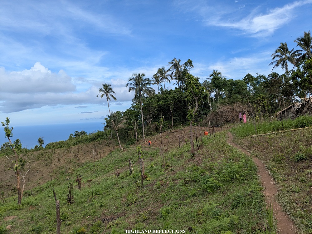
All of these pre-climb activities comprised our Day 0. From Puerto Princesa City, it took us four hours before reaching the town of Quezon, passing through the towns of Aborlan and Narra. At Narra, I was delighted to have seen Mt. Victoria—Palawan’s second highest mountain. During the entire ride, I couldn’t help but notice how rural most of Palawan is. Even at the town center of Quezon and Rizal, there weren’t many residential and urban structures. It’s mostly farmlands and bucolic sceneries.
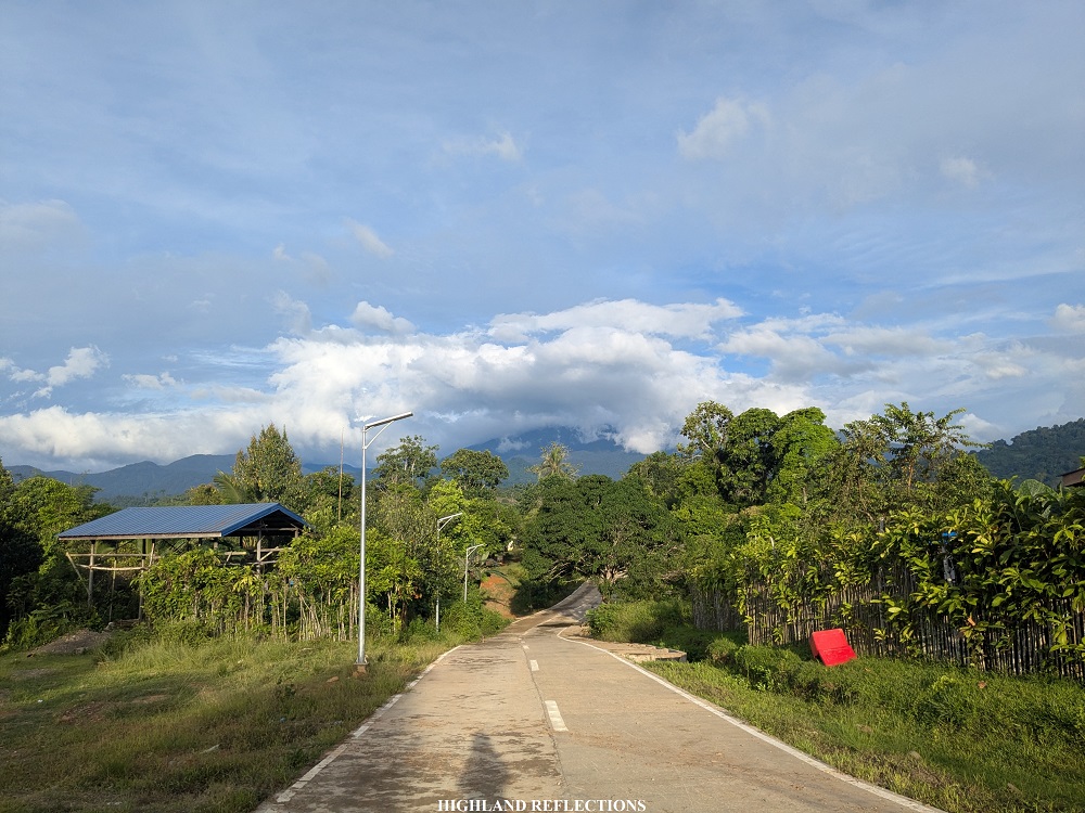
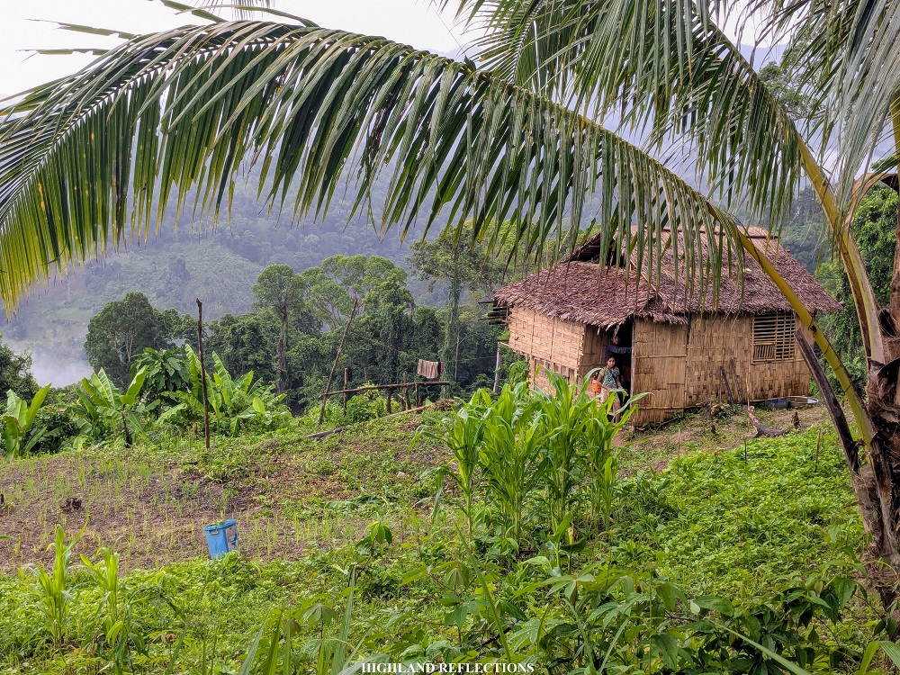
This countryside vibes was more pronounced when we reached Sitio Balen-Balen in Ransang, Rizal. The quiet community was located on top of some lowland hills, much of which were transformed as pastoral lands, reminding me of a similar scenery in Barangay Flores in Culasi, Antique—the jump-off point of Mt. Madjaas.
To make the most of our stay in Balen-Balen, we went to a nearby store where we connected to a WiFi machine and charged our mobile phones since there was no electricity at the house of our guide. When twilight came, we went back to Tatay Denio’s house located at a nearby field.
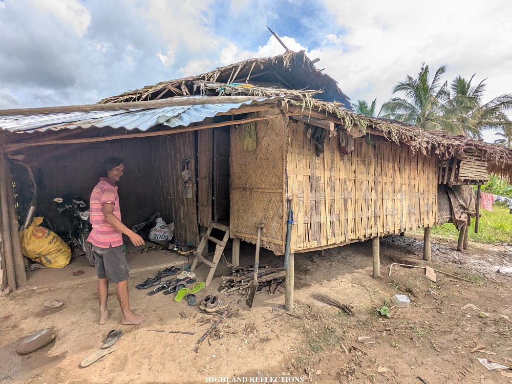
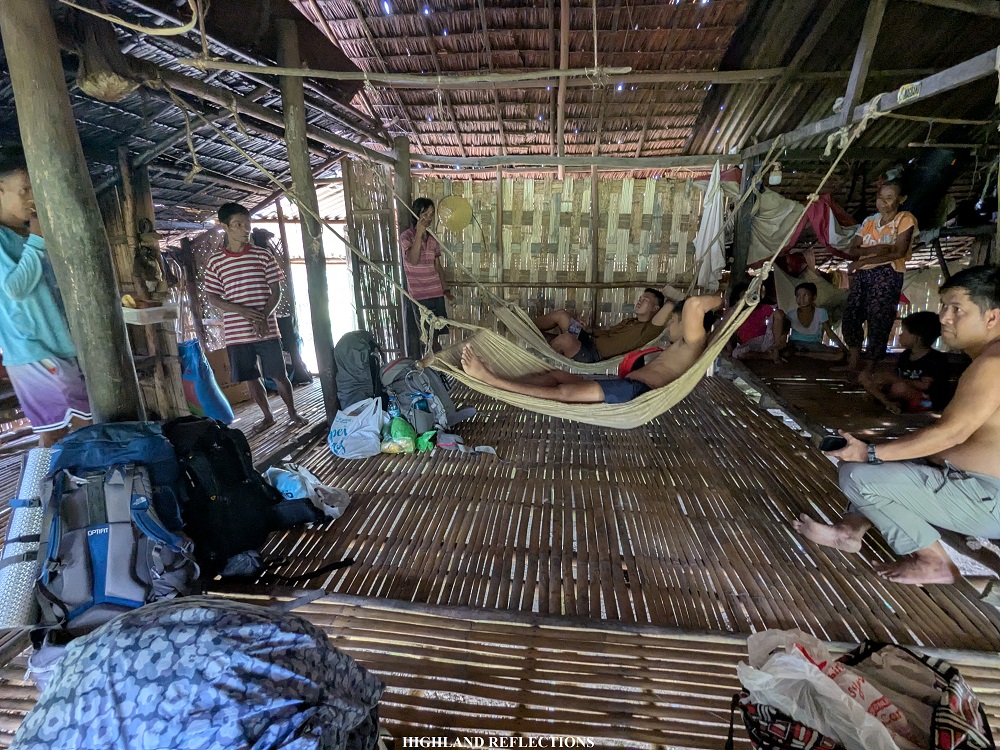
As I spent the night inside Tatay Denio’s house—an open air nipa hut—I can’t help but muse that finally, after months of preparing and overthinking, I was finally here. I am finally going to climb one of the sought-after mountains by experienced Filipino hikers. I thought back then that I may not be in the best condition, but at least I am here—I am going to reach the summit, and finish the traverse! Whether we would get some nice views on top, or get battered by rains and howling winds, at least I was here. I brought with me not just the preparations that I did for this climb, but all of the lessons and experiences that have accumulated in my seven years of hiking experience. I am here.
As I ran through these musings, I could hear the snores and grunts of some of my companions, the latter of which was due to the mosquitos that kept pestering us throughout the night. The high humidity inside the hut, devoid of any electricity, made it more difficult to sleep as well. I spent seven hours unable to sleep. Still, I was thankful for this safe space provided by our guides.
Morning came, and the ringtone alarms of my companions blasted the entire place. With my sleepless body and tired mind, I thought: it was finally time to take on Mt. Mantalingahan. Bahala na!
Day 1: From Balen-Balen to Baluin—Taking the Mud-Soaked Trail Under the Rain
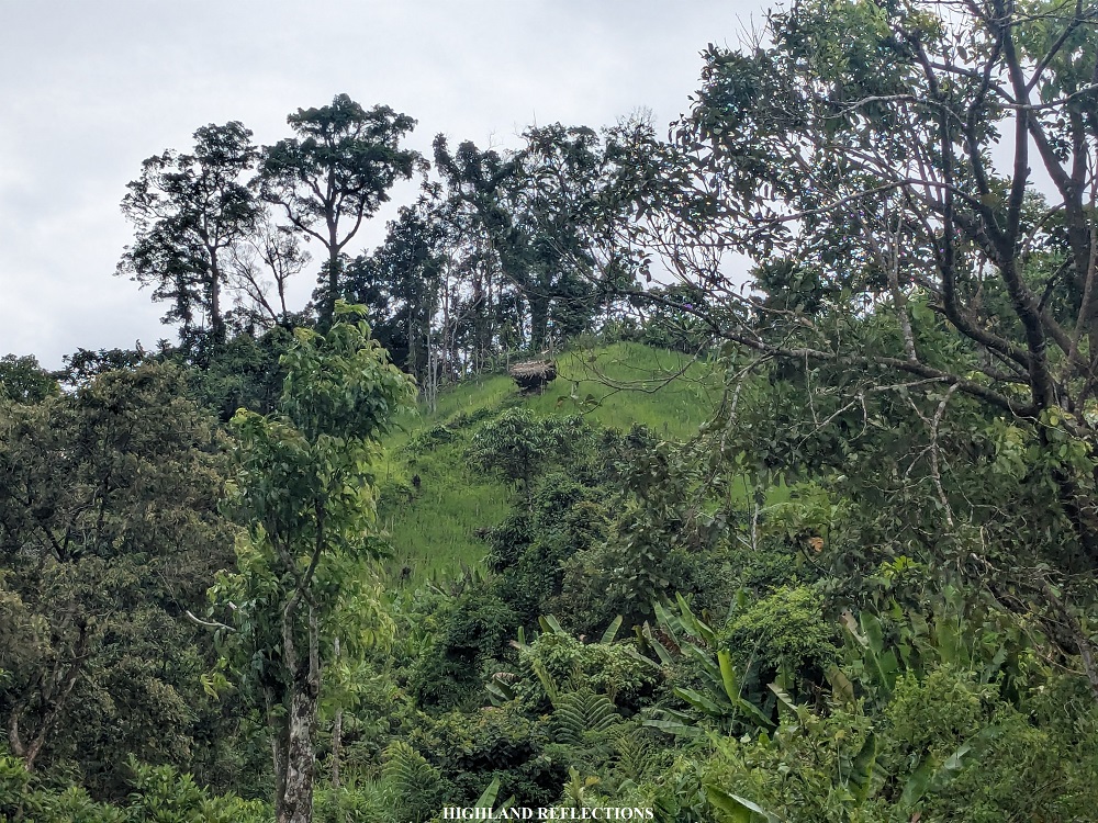
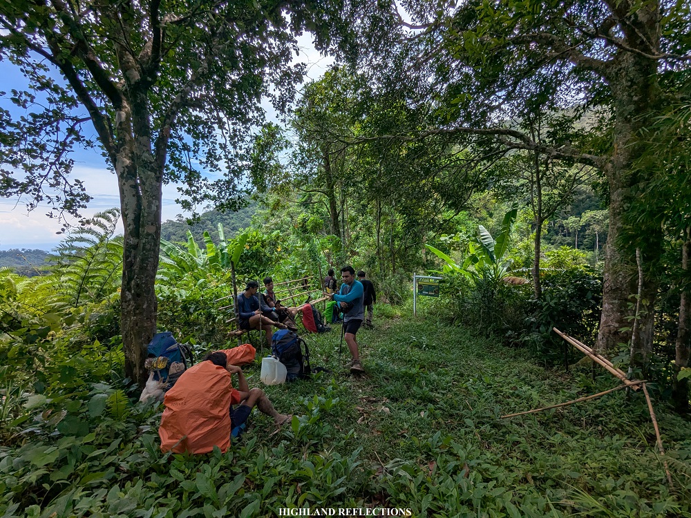
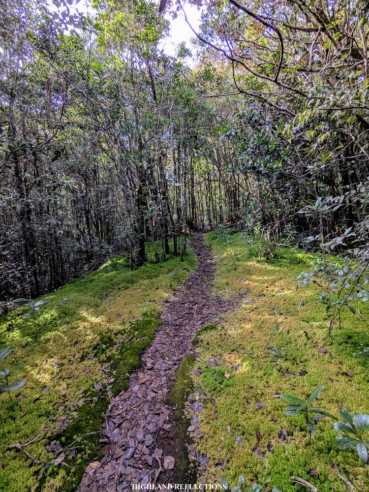
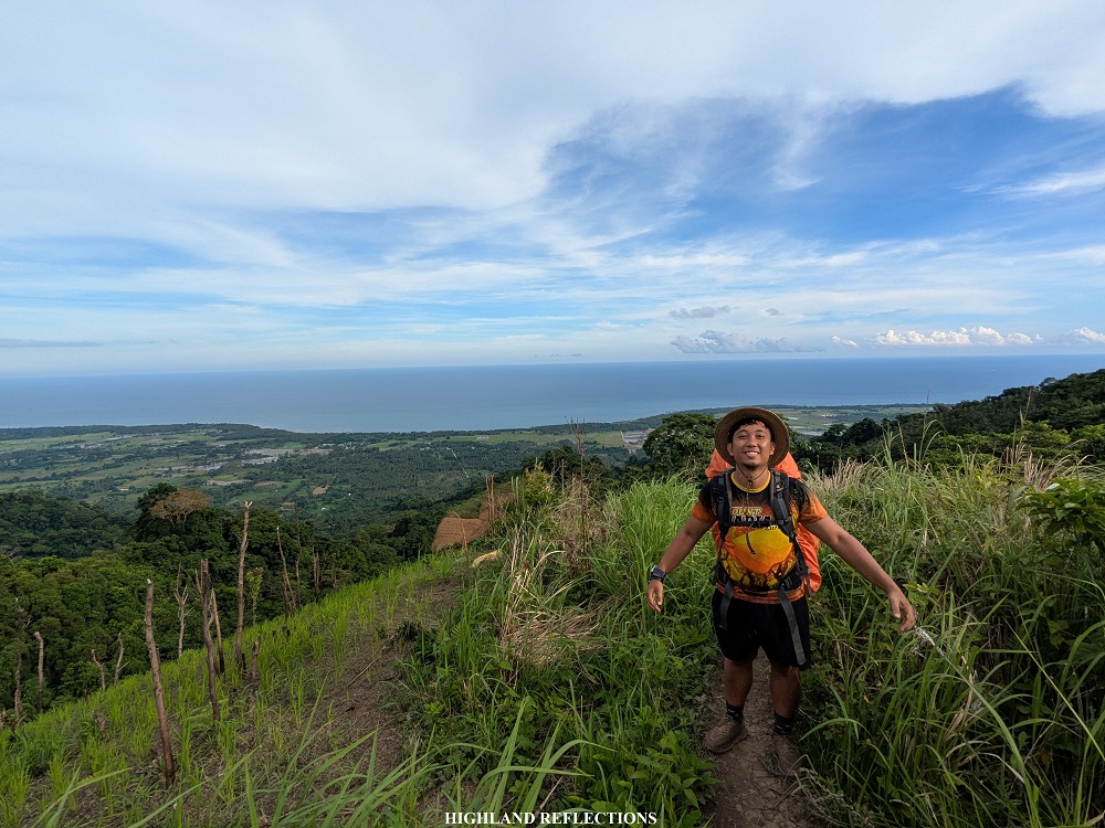
Our original plan for Day 1 was to reach Cabugan Campsite, located some 13 kilometers away from the jump-off point. However, due to continuous rains in the past few days and during our hike, the trail was mostly muddy and hard to tread on, slowing us down in effect. We were also informed that environmentalists from the DENR went ahead and set camp at Cabugan, so we probably did not have any space left at the campsite. This prompted us to settle at Baluin, a small village some 10 kilometers away from the jump-off point. Along the way, we passed through a view deck (KM 4, 330+ masl) and then to a campsite called Bulldog (KM 5, 410+ masl) before reaching the village of Baluin (KM 10, 675+ MASL).
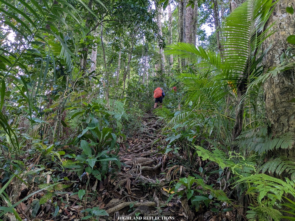
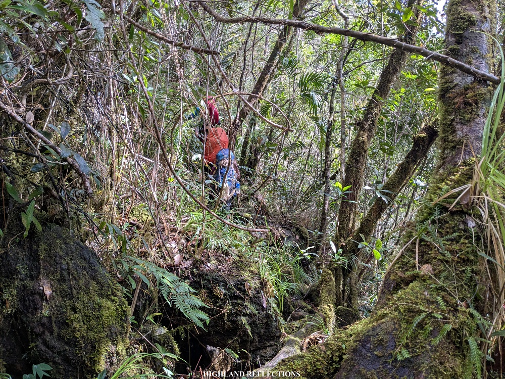
We started the hike past six in the morning. From the house of our guide, the first few parts of the hike required us to walk through a kilometer of cemented road before reaching what seems to be a cleared rough path for road construction. Afterwards, the rough path narrowed down, transforming into a trail where some tao’t bato locals pass by. In no time, the rain poured. Good thing was that the forest cover shielded us from the large rain drops, else, it would have been sensory overload dealing with both the muddy trail and the rain.
An hour passed, we rested under a giant Manggis tree inside the lowland forest. All of us were recuperating from the shock of the first uphill—our bodies were still adjusting to the terrain. Afterwards, we pushed through. This time, however, the trail was on an open grassland where we took the brunt of both the rain, the muddy trail, and the sharp grass blades.
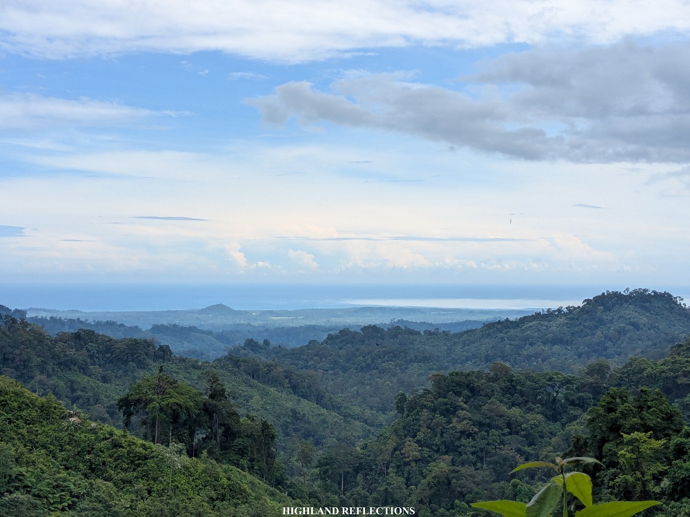
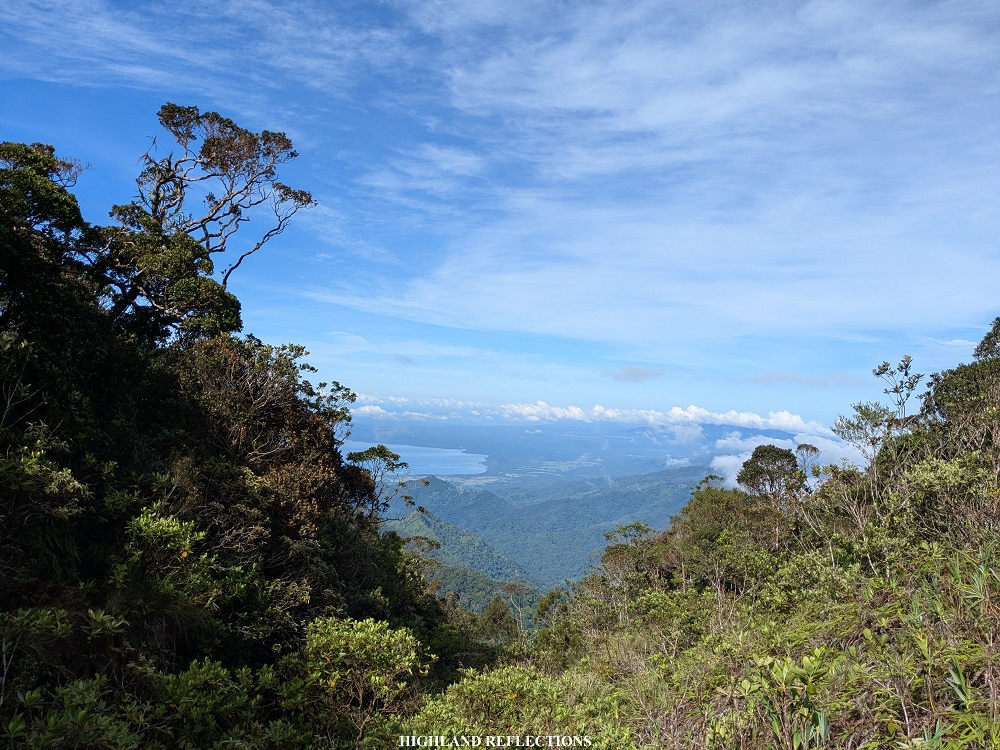
Luckily, we reached the view deck (KM 4, 330+ masl) where a wooden platform served as our cover. We rested here for long minutes, hoping for the rain to subside. Near the wooden platform was a nipa hut where some locals reside. Despite the rain, the lowland parts of Ransang and West Philippine Sea were visible.

The rain did not stop even after spending some long minutes resting on the wooden platform. We decided to just get on with the hike despite the rain. After the view deck, we had to return to another set of grassy and muddy trail. I was sliding my feet as a result since I didn’t have any choice but to wade on the mud! We then entered the lowland forest once again through an ascending trail with less mud.
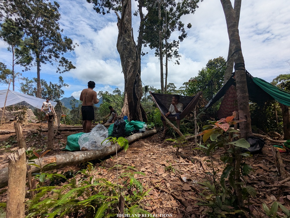
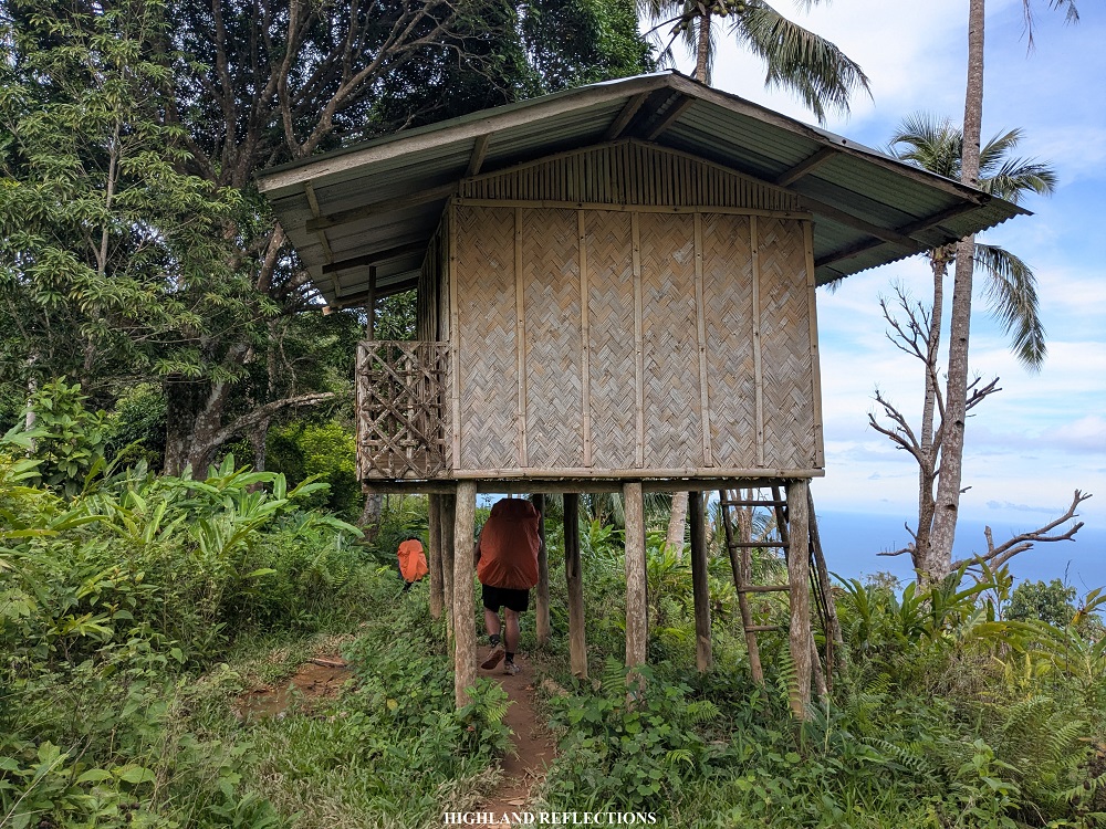
At 9 in the morning, we reached a campsite called Magtangob, famously called by the guides as “Bulldog” (KM 5, 410+ MASL). The name of the place was from the name of the original caretaker of the village (Bulldog), who has now long abandoned the place when the mountain was opened to hikers more than a decade ago. This is one of the negative impacts of hiking that we must not ignore, as we must be the ones to adjust when entering the indigenous people’s abode! Still, we were momentarily content with what the abandoned village offered, as we had to ourselves some nipa huts that shielded us from the torrential rain. We munched on our trail food and shared stories, waiting for the rain to subside.
But alas, the rain did not stop. After spending an hour at the village, we decided to just continue the hike albeit the rain. From Bulldog, we were still very far not just from the campsite, but from the summit of Mantalingahan as well. The entirety of Day 1 required us to negotiate kilometers’ worth of up-and-down trails within elevations of 400-700 meters above sea level. Fortunately, the rain stopped as we were taking the long trail inside the forest.
At 12:30, noon time, we reached a water source along the trail (KM 9, 700+ masl). We decided to have our lunch here and have some ample rest. We also tried to cleanse our lower extremities from the accumulated mud. After stuffing our bellies full from our trail food, and after refilling our water bottles, we pushed on with the last kilometer of hike for that day. Despite the short distance, it took us an hour to negotiate the trail, as it was already trampled on by the previous hikers who have already passed through this muddy path. The mud was so slippery and unstable that we needed to take each step carefully, holding on to the sharp grass at the side of the trail as a precaution.
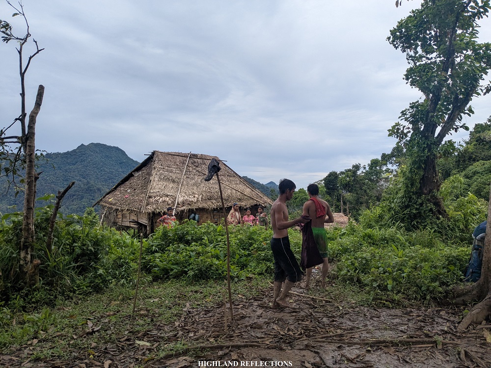
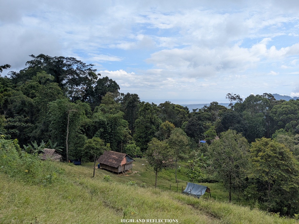
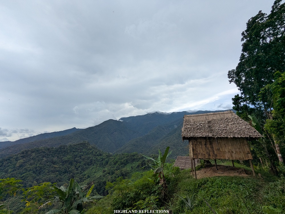
The four of us in the lead group (Topher, Sendo, Bugz, and then me) finally reached Baluin past two in the afternoon (KM 10, 675+ masl). The village had a lone family living inside a hut near the edge of a plateau. We set up our tents just beside the hut.
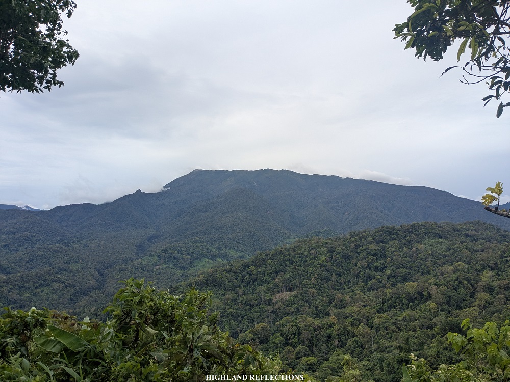
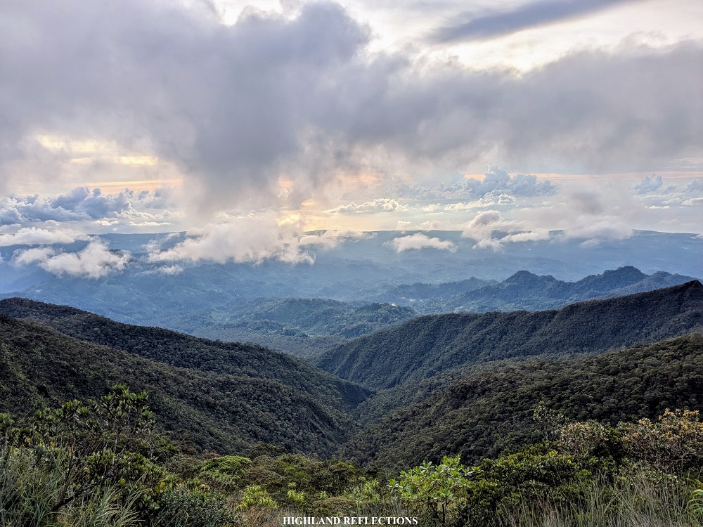
As the sky was clear during our arrival, we had a view of the entirety of Mt. Mantalingahan’s western face. We could also see some of the high slopes that we would be passing through on our third and fourth day! It was as if the mountain was finally warming up to us after soaking us in the rain the entire time! I let out a smile and prayed that, hopefully, two days from now, we would get the same clear view atop of it.

Our companions arrived an hour later. We set up our camp here and decided to rest. At around six, dinner was served. It was a good thing we settled in Baluin as we wouldn’t be able to have an early dinner if we pushed on to Cabugan. Afterwards, every one of us retired to our tents to finally have some good night’s sleep. At midnight, I woke up to the sound of howling winds. It was still quite difficult to get some quality sleep.
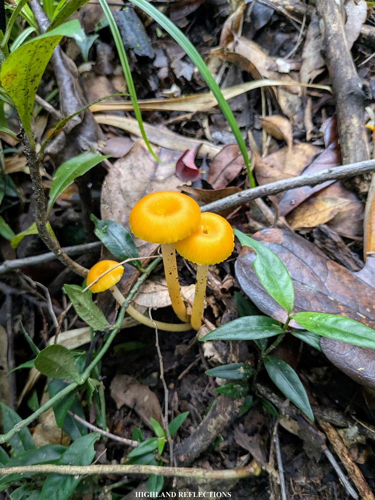
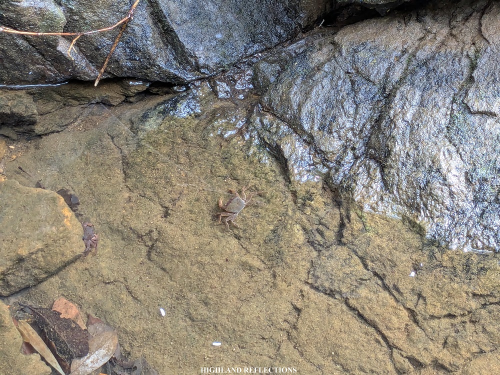
The following day, we woke up at 5:30 to have our breakfast and to break camp. As I was disassembling my tent, I found several ants, caterpillars, and one giant preying mantis on top of my tent’s rain cover! My companions also had the same problems—some of them even had limatik (leeches) inside their tents! I did not have any slight worry upon seeing these fauna, as I knew that this was a sign that the mountain’s biodiversity is still very much intact despite human activity.
When everyone was finished packing their stuff, we strapped on our bags to start Day 2.
Day 2: The Long Ascent to Paray-Paray Campsite
For Day 2, we had to cover at least nine kilometers and almost a thousand meters of elevation gain from from Baluin to Paray-Paray high camp (KM 19, 1,620+ masl), passing through Cabugan campsite (KM 13, 735+ masl), Kawayanan campsite (KM 15, 700+ masl), and Agung-Agung campsite (KM 15.8, 830+ masl).
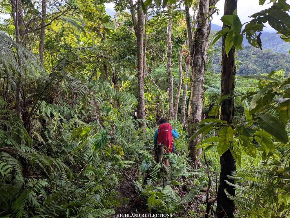

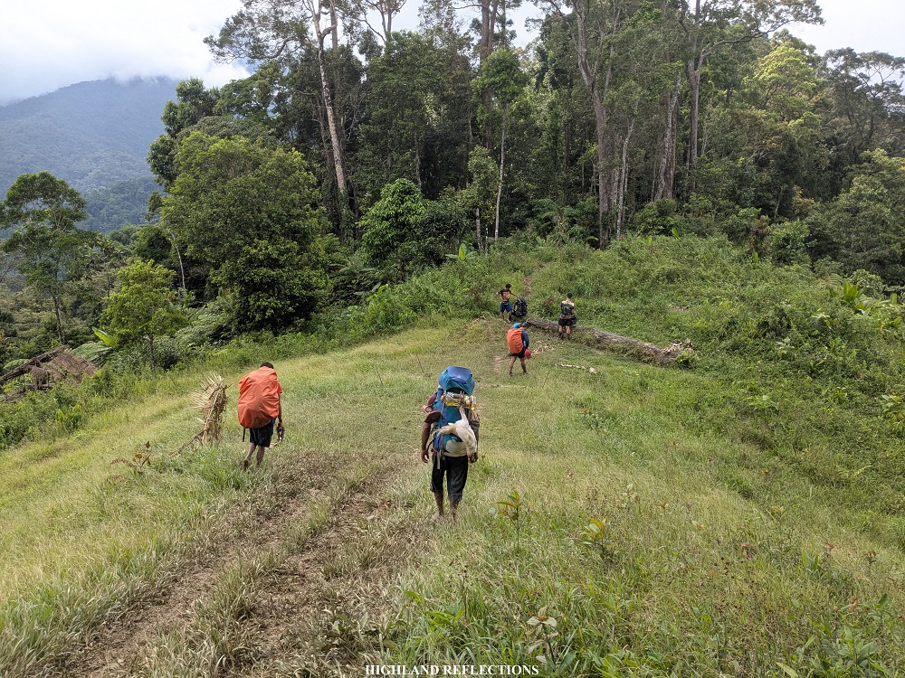
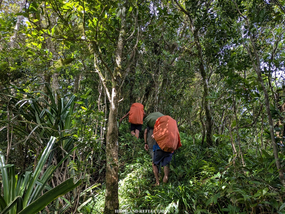
We started the hike from Baluin at 6:30 in the morning. Past Baluin, we had to negotiate another round of muddy trail passing through some cleared slopes used for farming, much of which was on a descending manner. After the descent came a continuous round of ascents inside the forest. Most of the trail was covered in tree roots, which assisted us in every step as we made we made our way up. It was highly reminiscent of some steep sections of Mt. Arayat!

Two hours from Baluin, we reached Cabugan campsite (KM 13, 735+ MASL). It was still quite astonishing that even after covering thirteen kilometers, we aren’t even halfway through the elevation of Mantalingahan’s summit! This is what makes Mantalingahan such a difficult hike—the distance and technicality will surely test your mental fortitude.
We rested at Cabugan and refilled our water bottles. The environmentalists from the DENR have already gone—half of them will stay at Agung-Agung camp, while the other half will be with us in Paray-Paray later on. We resumed our hike after thirty minutes of rest.

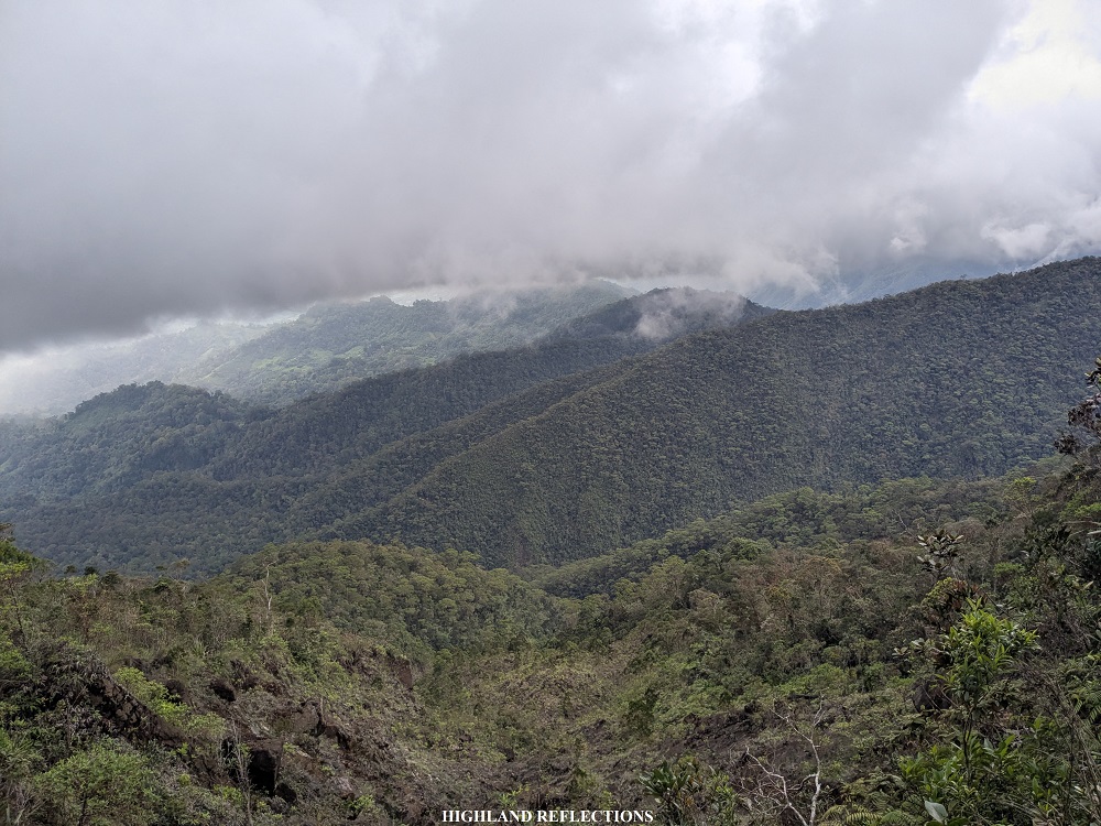
From Cabugan, the trail transitioned from forest to grassland and vice versa. At this point, I could already feel that we were getting closer to the slopes of Mt. Mantalingahan. Yet, I was teed off in knowing that upon reaching Kawayanan campsite (KM 15) at 11 in the morning, after multiple rounds of up and downhill battles, we were still at 700 meters above sea level—almost the same elevation as that of Baluin and Cabugan! Still, it was a delight to see the western face of Mantalingahan up close, as this meant that we were already (and finally) at the foot of the mountain. We rested at Kawayanan as the trail after the campsite was the start of the never-ending ascent to Paray-Paray camp.
At 11:20, we resumed our hike. After Kawayanan was an uphill trail inside the forest. Since the sky was clear during our hike, I could feel the heat not just coming from my body, but from the atmosphere as well. It was really tiring making our way up!
After forty minutes of nonstop ascent, we arrived at a cleared area called Agung-Agung, where one half of the DENR environmentalists were staying. We decided to take our packed lunch here. We also took the time to get some ample rest to replenish the energy that we just spent from ascending. Finally, at 1:30 in the afternoon, we decided to resume the hike upon the arrival of our companions.
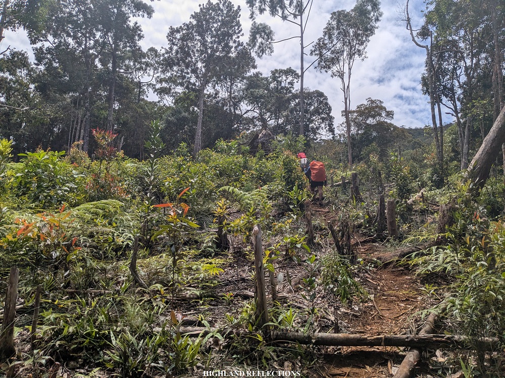
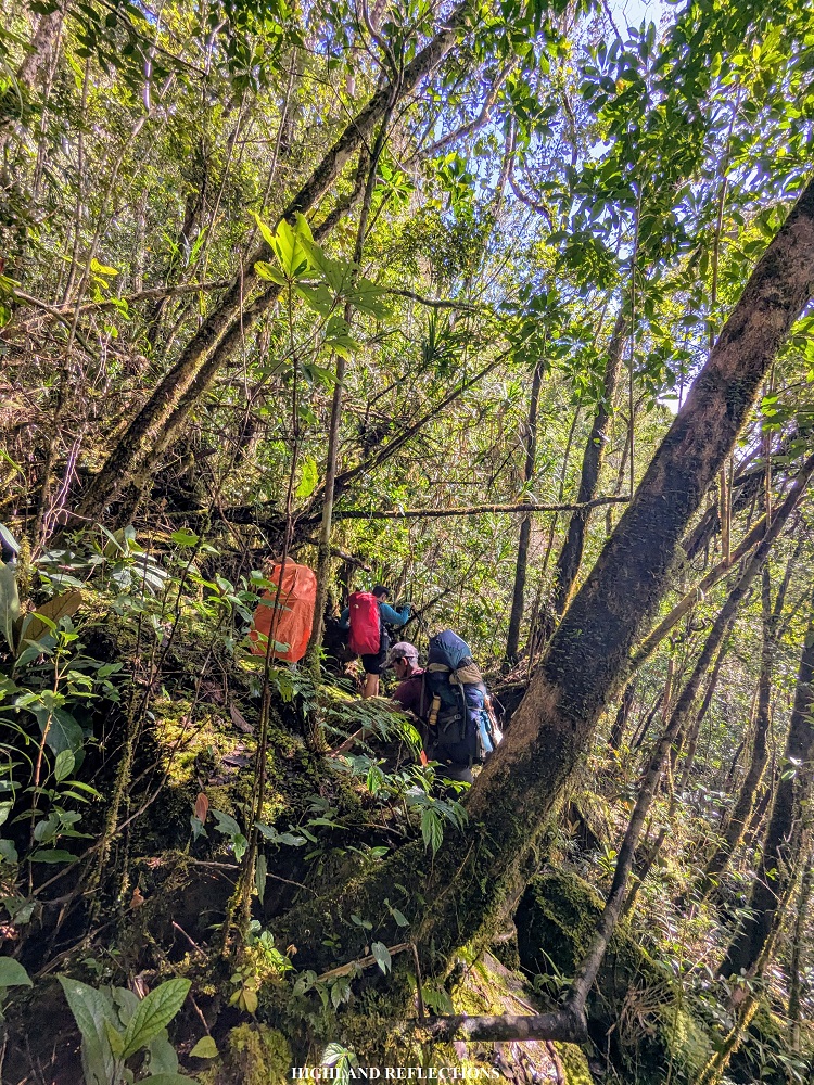
From Agung-Agung, the ascents were, again, nonstop. It was not as steep as that of other major mountains like in my previous climb in Mt. Napulauan, but the distance that we’ve already covered and the accumulated exhaustion were enough to make the ascents more challenging at this point. There were some parts that were quite technical to take on as well, requiring the use of hands to balance myself. The carbs and protein that I took were on overtime work to repair all the muscles that I’ve been tearing for this climb.

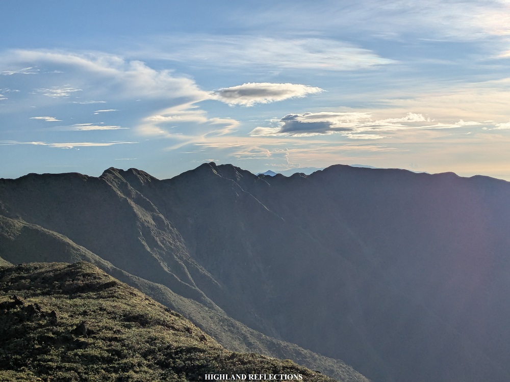
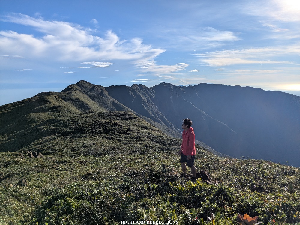
As I was lagging behind the lead group by a few meters for almost the entire time on the way up, I was thrilled to find them on an open view deck past three in the afternoon. There was a fast mobile data connection at the view deck, so I joined them in updating my loved ones via my social media accounts while snacking on our trail food. In the distance, we could see rain clouds pouring on some of the slopes from afar. Little did we know that the clouds would swiftly get to where we were! We decided to go ahead while being soaked in the rain.

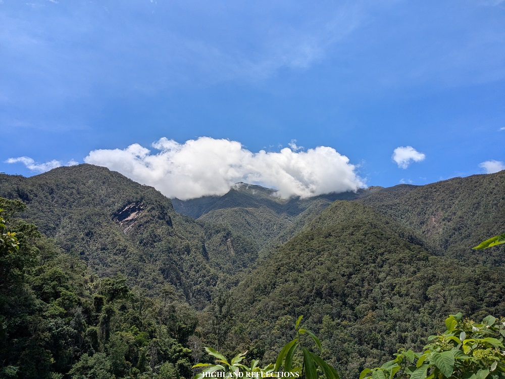
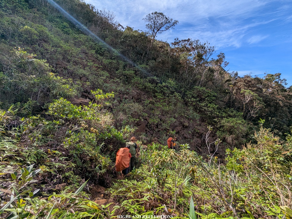
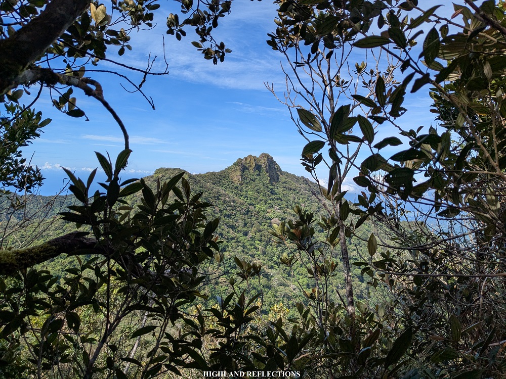
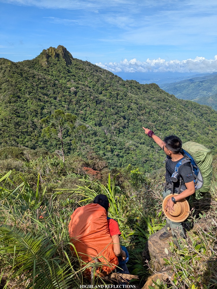
After the view deck, the trail was filled with ultramafic boulders, reminding me of the route going to the Camel Back in Mt. Guiting-Guiting—where boulders are perched on a knife edge ridge with steep drops on both sides. This part was the most enjoyable for me, as I have been so accustomed to such technical trails, in what I have described in my past Guiting-Guiting blog as ‘a playground for the madmen.’ Apparently, this trail was a foreshadowing to the trail that we will be taking en route to the summit! Somewhere along the ultramafic boulders was Pulanggok Peak. A supposed view was present here if not for the fog surrounding us.


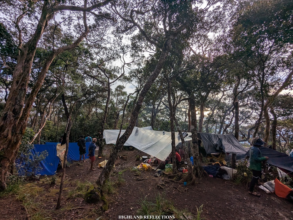
Past the bouldering parts, the ascent returns to the usual footpath inside a mossy forest. Then, finally, at around five in the afternoon, I reached the high camp, Paray-Paray (KM 19, 1,620+ masl). The campsite was a spacious area in the middle of a mossy forest.
A few meters away from the campsite, there was an open area filled with more boulders leading to a water source, providing not just nourishment, but views of the West Philippine Sea and the lowlands of Rizal, Palawan as well. After covering almost 19 kilometers of hiking in the past two days, I can’t help but be ruminative upon gazing at the view from the water source. I was internally emotional and reflective seeing the view.
That night, I assembled my tent, took my dinner, and slept soundly to prepare for the summit assault the next morning. I was hoping and praying for some good weather the following day.
Day 3, Part 1: The Summit Assault
We woke up at 4 in the morning, primed to go to the summit. The morning coffee that we sipped helped wake our systems up. By 4:45, we commenced the summit assault.
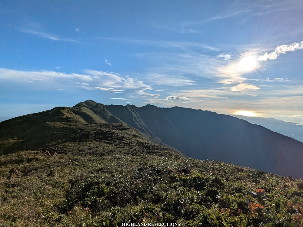
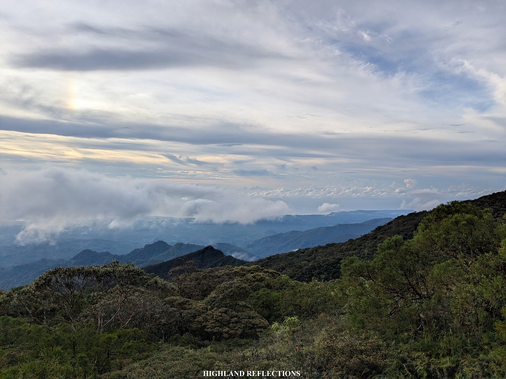
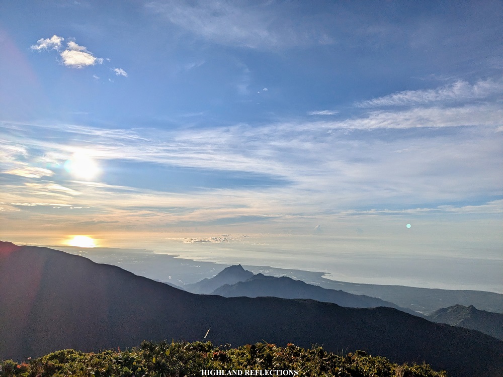
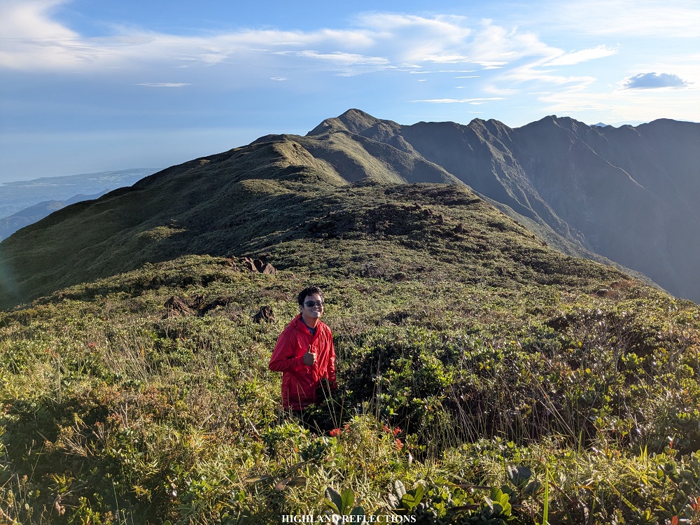
From the campsite, the start of the trail going to the summit was already filled with ultramafic boulders from the get-go. Under the dark sky, we took on another knife-edge ridge filled with boulders. Above us, I could clearly see the silhouette of Mt. Mantalingahan and the clear indigo sky, foretelling of the weather we would have later on. With the eagerness that came after seeing the clear skies above, I expedited my pace, with me tailing the lead group.
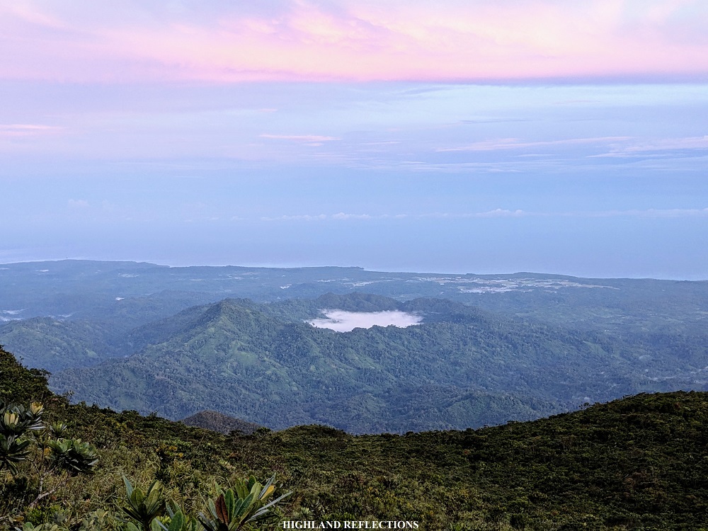
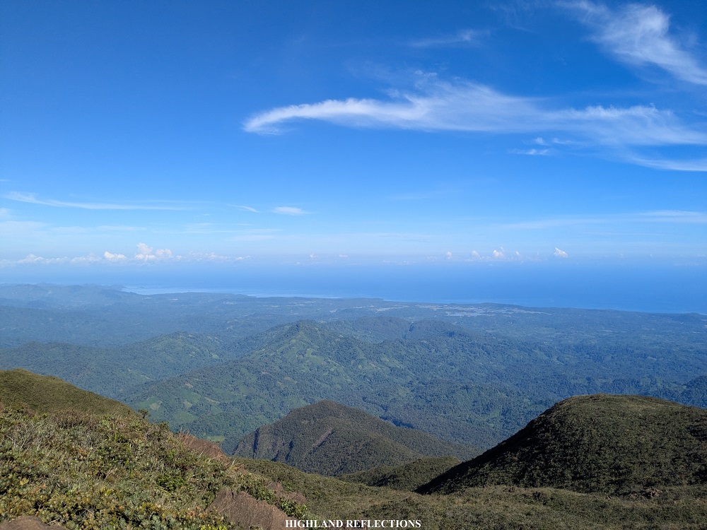
Somewhere in the middle of the summit assault was a short section inside a mossy forest. Past this, the trail required us to squeeze our bodies through dense thickets and place each step on moss-covered rocks. At this point, sunlight has penetrated the sky, illuminating the clear surroundings. From the trail, we could see the expanse of the West Philippine Sea and the many slopes that we had to pass through on the way up from Ransang. From afar, there were some low clouds formed above Singnapan Valley, creating the illusion of a volcano lake.

Since my companions in the lead group were still busy taking some pictures and videos along the trail, I decided to go ahead past them. At that time, I was quite anxious that clouds may roll up and cover the views surrounding the summit, prompting me to expedite my pace on the way up. Right above, I could see our lead guide already making his way up to some of the higher slopes going to the summit.
The ascent reminded me of the bouldering portions of Mt. Apo, where we had to leap from one boulder to another. I was brought back to the joys of climbing up the highest mountain in the Philippines. Slowly, I made my way up, covering each boulder to make myself closer and closer to the summit. And then finally, at 6:25 in the morning, I reached the summit of Mt. Mantalingahan (KM 20.5).

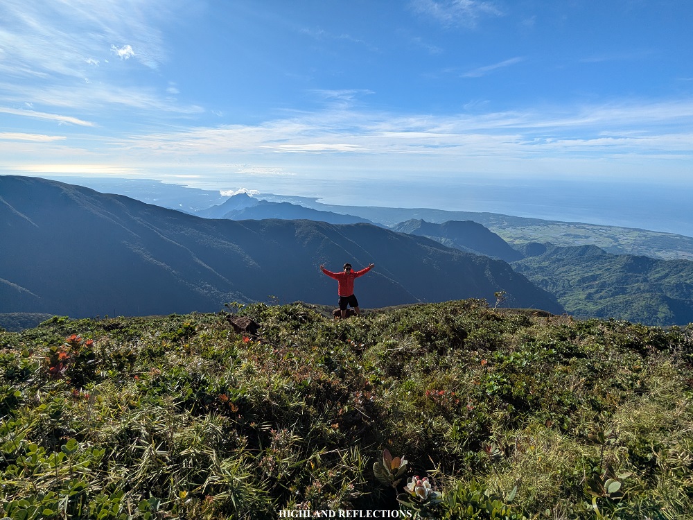
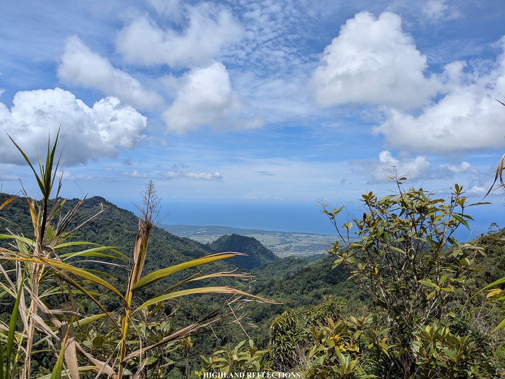
At the top, I was blessed with a three hundred and sixty degree view of the entire Southern Palawan. The very first thing that I did was to stare at the north-northwest direction, where the ‘true summit’ of Mt. Mantalingahan is—yes, the farthest that the trail can reach is just at the shoulder of the summit, which was around 20 meters lower than the true peak. According to our guides and to some sources online, it would be very challenging to try to go to the true summit, as hiking it would take up majority of the entire third day. Still, I was content with what I was seeing in front of me.
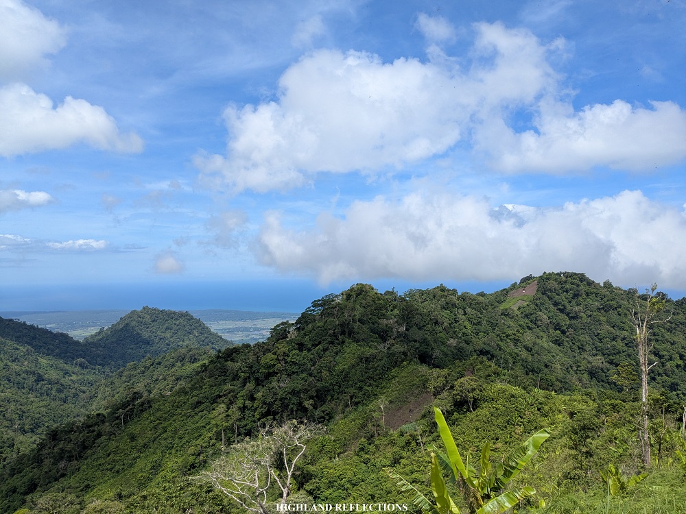
Together with the true summit, the entire northern face of Mantalingahan can be seen. In the horizon, I can only assume that the faraway mountain silhouette was none other than Mt. Victoria in Narra, Palawan.
Turning south, one can view the continuation of the mountain range, ending in the lowlands of the town of Bataraza and the rest of Southern Palawan. There was also a faint view of the stunning Balabac Islands. Staring at the southern direction made me realize how close we were from Sabah, Malaysia and Brunei—we were literally just a few kilometers away from Mt. Kinabalu! Another notable view here is the one-thousand meter mountain called Mt. Bulanjao (Escarpado Peak in Google Maps) in Bataraza, which sadly has a visible mining operations at its base.
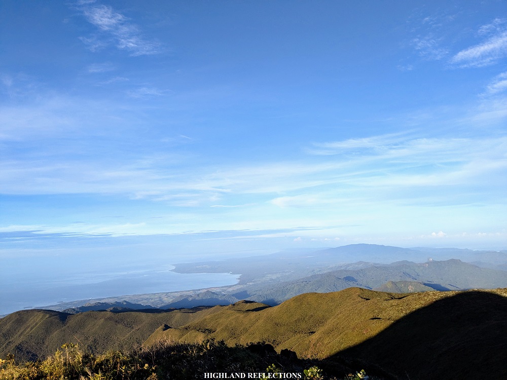
To the west, the vista comprises of the Palawan coastline in the towns of Rizal and Quezon. Beyond them is the expansive West Philippine Sea, containing the contested Spratly Islands and the Sabrina Shoal. They aren’t visible from Mantalingahan, but it’s good to know how close we are from these areas within our territories. West Philippine Sea is ours no matter how a certain foreign neocolonizer tries to force its narratives onto the rest of the world.
To the east, one can view the mountains that we will have to pass through on our fourth day. Beyond them, the coastline of Brooke’s Point and Bataraza can ben seen. In its background is Sulu Sea, separating Palawan from the rest of the MIMAROPA provinces and Western Visayas.
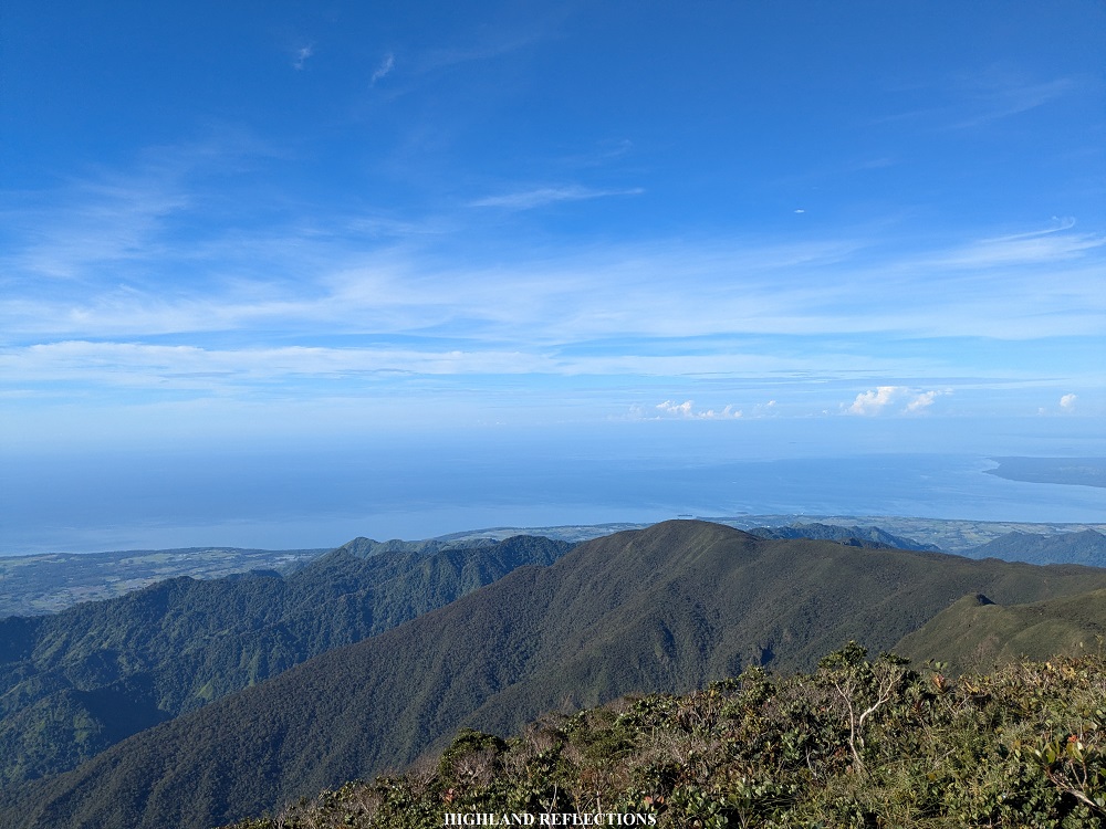
Being on top of Palawan, one can appreciate just how short Palawan’s horizontal east-west axis is. Despite its shortness, it is compensated by how large Palawan is when stretched from north to south, making it the fifth largest island in the Philippines next to Luzon, Mindanao, Samar, and Negros. Just standing on top of it provides a majestic feeling—a feeling of success like no other. We were here standing on top of perhaps the most difficult mountain to climb in the country, and on one of the most magnificent provinces in the Philippines!
One by one, our companions arrived. I tried to give everyone a fist bump to congratulate them for making their way up. Everyone was in high spirits. This was a well-deserved accomplishment after putting our bodies and our minds to the test for the past three days. It was a welcome success.
At 8 o’clock in the morning, we started the descent to return to Paray-Paray campsite. Going down made me appreciate just how high we were from the sea, and how far Paray-Paray campsite is from the summit. From the trail, you could literally see the canopy of trees where Paray-Paray is, and reaching it felt like an eternity for someone who has not taken any breakfast.

At 9:45 am, I finally arrived at Paray-Paray camp (KM 22), where I hurriedly took a heavy breakfast as I was famished from the summit assault. Afterwards, I disassembled my tent to break camp. There was still a long trail ahead of us.
Day 3, Part 2: The Technical Trail to Pisa-Pisa Camp
After doing the out-and-back summit assault, it was now time for us to start the latter half of this hike. From Paray-Paray, we would be trekking the southern face of the mountain going east until we reach the exit point in Malis, Brooke’s Point the next day. As with any other climbs, the descent is always thought of as the quick denouement—it can be difficult to the knees, but at least it’s quicker than going up. This is not the case in Mantalingahan.
The latter half of the Mantalingahan traverse does not just involve descents. From Paray-Paray, one would have to pass through more than twenty-kilometers of volatile terrains, perilous paths, and some subsidiary peaks at the eastern side of Mantalingahan. In fact, many mountaineers and hikers tout the traverse to Brooke’s Point as the more difficult route compared to the trail from Ransang, Rizal. I was not excited to find what out what lies ahead.
To slightly reduce the distance from Paray-Paray Camp to the exit point, we had two choices—either camp at the nearer Pisa-Pisa Camp (KM 24.5), or go all the way to Magringgit Camp (KM 29). Since there was a possibility of reaching the latter at night time, we settled for the nearer Pisa-Pisa Camp, and relinquish the distance that we could cover for the following day.
We started the descent at around 12 noon. From Paray-Paray, we backtracked for a little, going to the trail to Ransang before reaching a fork where we took a left turn. From here, we traversed the entire southern face of Mt. Mantalingahan going east to Pisa-Pisa. Since we were following the face of Mantalingahan horizontally, one would think that the trail would follow a flat, unobstructed path. Nope.
The trail was carved on a mountainside with steep mountain wall to our left, a deep drop to our right, and several boulders and tree roots that we needed to make our way through in front of us, making the trail highly technical to take! It’s like Arayat’s monkey trail, or Mt. Napulauan’s Balentimol Trail. It was a full-body workout that we had to endure. It rained for almost thirty minutes upon starting the descent. I folded my trekking poles since I needed my hands to push my body up the boulders and tree roots.
Two hours after starting the descent, we reached a rivulet in the middle of the trail where had our lunch and refilled our water bottles (KM 23.5, 1,460+ masl; we only trekked one kilometer and a half from Paray-Paray, yet with how technical the trail is, it took us two hours to reach this water source). At this point, I could already feel the fatigue in my body, that not even a thirty-minute rest in the trail was able to recover the energy that I’ve spent. I was just tired at that time, but I was glad to have finally taken the chance to replenish my lost carbs and protein. I savored the packed lunch that I brought from Paray-Paray camp.
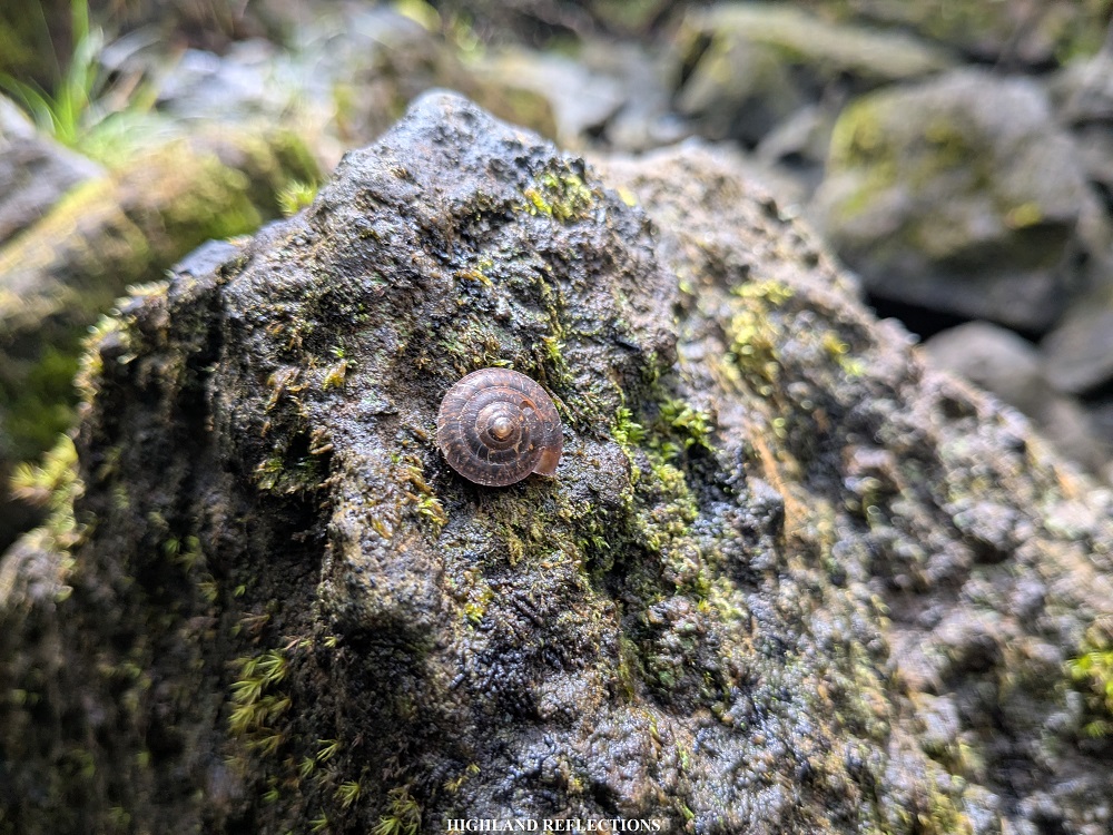
Past the water source, the trail continues on the same narrow trail surrounded by Mantalingahan’s disheveled forest. What kept me motivated during this time was that despite how chaotic the environment is, I kept spotting some very colorful leaves, flowers, and butterflies along the trail. I said to myself that this was, perhaps, one of the most biodiverse mountains I’ve ever been in my more than seven years of hiking experience!

At 3:30 in the afternoon, we finally arrived at Pisa-Pisa camp (KM 24.5), which was in the middle of the rainforest at 1,475+ masl. I took the chance to have an early rest that afternoon to prepare for the most difficult parts of the trail the next day. To end the day, we had a joyful dinner and mini socials before getting into slumber.
That night, there was some light drizzle. I found it hard to sleep. With the slightly strong mobile data connection available at the campsite, I browsed my social media accounts. It feels weird getting limited access to my social media accounts for almost four days when I’ve been accustomed to browsing it almost anytime of the day when I’m in the lowlands. Still, I was thankful for the opportunity to be fully immersed in nature this long.
Day 4: The Long, Technical, and Dangerous Trail to Malis, Brooke’s Point
The day has finally come for us to descend to the end point of this hike. Despite being the last day for this 4-day itinerary, Day 4 constitutes perhaps the most difficult part of the hike. For Day 4, we did not just descend. We had to pass by and climb several subsidiary mountains at the peripheries of Mt. Mantalingahan.

We started the descent to the exit point at around 6:45 in the morning. Two kilometers away from Pisa-Pisa (KM 24.5, 1,475+ masl), we gradually climbed all the way up to Lapong Camp (KM 26, 1,595+ masl), a small area in the middle of the mossy forest, through some easy trails for more than an hour. We regrouped at this campsite as apparently, Lapong Camp is the area where the mysterious tau’t daram reside. As I have mentioned in the earlier parts of the blog, we were instructed by our guides to stick close to each other and to lower our voices when passing through this area. I spotted several hunter traps along the trail. Our porters also pointed to a scrapped signage somewhere. They said that it used to be the signage erected at Lapong Camp. The local tau’t daram may not have taken a liking to it.

Past Lapong, we took some gradually descending paths until finally reaching a technical descent akin to that of Mt. Guiting-Guiting’s Olango Trail. The descent, like the upper reaches of the mountain, were filled with boulders that we had to crawl on on our way down.
In front of us, we could see the next mountain that we had to climb coming from Lapong—Magringgit Peak. This was the first among the many peaks that we had to pass through on the way down (and perhaps the only peak with a name given its notable shape from afar). Good thing was that our guide told us that we did not need to climb all the way up to the peak, as we would only pass through its shoulder.
Past the descent, we moved on to the ridge connecting the main face of Mantalingahan to Magringgit Peak. In no time, we found ourselves ascending the forested slopes of Magringgit. The trail was quite steep, slippery, and hard on the calves. The ascending trail inside the forest just went on and on until finally reaching what seems to be a gradually descending trail. Just like on our third day, what made this punishing predicament enjoyable was that we were able to spot some wildlife along the trail.
Apparently, the start of the steep descent on an open trail marks the point where we are now on the other side of Magringgit Peak, where Magringgit Camp is located. Before reaching the campsite, there was a steep, slippery, dusty downward open path that we had to negotiate. What made the descent terrifying was that there were no blades of grass, branches of trees, or rocks to hold on to despite having a ravine to our right! I carefully let my shoes slide down the path while using my trekking poles for balance. Past the descent, we entered the forest once again and reached Magringgit Camp (KM 29, 1,215+ masl). It was 10:40 in the morning—four hours after starting from Pisa-Pisa! We had our early lunch here.
We resumed the hike down past 11 in the morning. Without any warning from our guides, the trail past Magringgit Camp greeted us with some of the most perilous paths in all of the 4-day activity that we did. The trail was similar to the paths that we took on the way to Pisa-Pisa on Day 3. However, this time, the path we could step on was only a foot wide and had some very loose and crumbling muddy soil. One wrong step and we could fall down the forested downward slope to our right. I was holding on for dear life at some of the roots and grasses to my left.
Little did I know that I would be committing the ‘one wrong step’ that I mentioned earlier. Good thing was that after tripping, I fell down on the trail and not on the slope to my right. Another good thing was the soil that I was stepping on did not crumble! Unfortunately, this prompted me to reflexively hold on to a poison ivy (lipa) to my left. The palm of my left hand was stinging days after the hike.
Past the narrow trail, there was a short landslide section where some boulders and fallen trees block the trail. It was at this point where I realized how our lives where at the mercy of the elements of the mountain.
From the landslide area, we had to climb the sturdy branches of a fallen tree to reach the trail. After the tree, I was met with a slippery 80-degree incline. This was undoubtedly the steepest part of the hike. There were no roots or branches to use as leverage—it was just my legs making its way up a ridiculously inclined muddy path! What made the incline more terrifying was that a Vespula wasp (commonly known as yellowjackets) landed on the trail parallel to my face. I was so terrified and astonished with such a reputable insect near me. It flew away as I was grabbing my phone to take a picture of it. I hurriedly climbed my way up to avoid any possible encounter with other forms of wildlife within the steep trail. I was panting heavily when I reached the topmost part of the slope.
At that point, my body was slowly feeling the fatigue. Our two lead packs—Topher and Sendo—were already far from where I was. Fortunately, I was with Kimpoy and another porter for this hike. The rest of the team was lagging a few minutes/hours behind us.
After the perilous predicament, we took another round of up-and-down paths, some of which are blocked by overgrowth, passing by a ridge connecting Magringgit to another subsidiary peak. On the way up to the next peak, we encountered several overgrown sections where the trail was once again on a 1-foot narrow path on loose, muddy, crumbling soil, only this time, the steep downward slope was to our left. It was such an unexpected ordeal, one that tested my patience and the remaining strength that I had for this hike. Upon reaching the top most part of the trail where there was a limited space to rest, we dropped our bags, munched on our trail food, and grabbed some power naps.
After replenishing our energy, we pressed forward. With how tired I am at this point, I could hardly remember the trail. This is the first time that I seem to be unable to remember certain details of our climb. I guess that’s normal, given the length of this hike. From what I can remember, we passed through some narrow paths carved on top of ridges and subsidiary peaks, leading to an area called Kawang-Kawang (KM 32, 1,100 masl) which we reached at 1:20 pm. It was hardly a campsite, given how limited the space and how slanted the slope is in that open area.

Past Kawang-Kawang is an open trail on top of some ridges. From here, I saw a nipa hut perched on a hill a kilometer from where we were. A short grassland section ensued here before entering the forest again, ascending up the hill where the nipa hut is located.
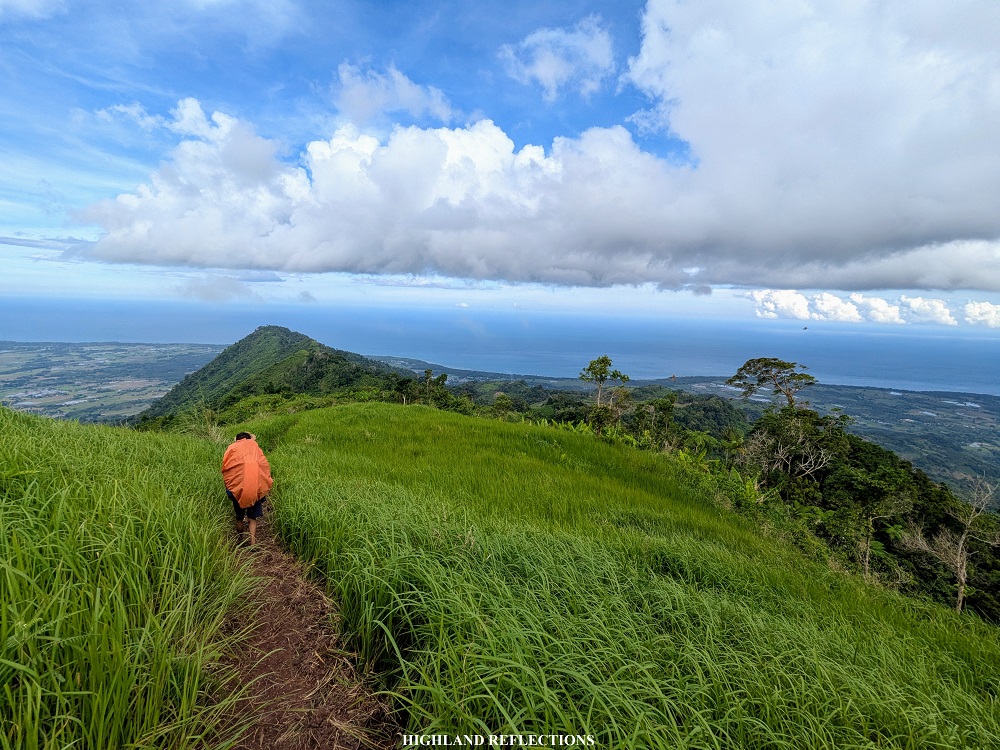
Past these, we entered some forested sections on top of a ridge at around 800+ masl before eventually exiting to a grassland section where, finally, the coastline and the vast expanse of Sulu Sea is visible. Several villages and communities can also be seen at the side of the trail, meaning that we were probably close to the end point!
However, my hopes were derailed as, upon checking my mobile map, we were still at 830+ masl (KM 35). That feeling of malayo na, pero malayo pa persisted inside my head. We still had to lose almost 800 meters of elevation despite being at the final leg of the hike! Still, I was thankful that we were now past the forested sections of this hike. It was past three in the afternoon, almost eight hours after starting the hike from Pisa-Pisa.
Despite my tired body, I was trying to soak in the view from the grasslands. It was such a beautiful sight knowing that we were about to finish this 4-day traverse. The view then disappears as we entered Kupang Village where some communities and farmlands are located. At one point, Kimpoy and I stopped at the village to try to buy some snacks. Unfortunately, we settled with what they had—several candies and a water source. I donated my packs of medicine to the people in that village upon their request.
Past the villages at around 500+ masl, we continued descending some more community paths. I was already frowning from tiredness at this point. My body’s resilience was slowly diminishing. But I persisted, as going down and reaching the exit point is mandatory.
We had our last stopover at a small village around 200 masl where both my companions replaced their shoes with flip flops. Just like me, they were probably enduring the pain from the blisters on their soles.
The community path, then, transformed into a descending rough road, signaling that we were finally at very low elevations of the mountain, and that residential areas are abound. With the pain on the soles of my feet, I pressed on, tailing behind my two companions. Past the descending rough road, we power walked a flat path that stretched for a kilometer.
And then finally, after the one-kilometer path, we arrived at the main highway, marking the very end of this hike! We clocked off at 5:45 in the afternoon—eleven hours after starting the hike from Pisa-Pisa! Kimpoy and I exchanged some gleeful greetings of congratulations for finishing the hike. We walked for an additional two hundred meters to reach the barangay hall of Malis (KM 41), where the two lead packs were already resting and done with their wash-up. They reached Malis past four in the afternoon!
And that was it! I have completed the venerable and formidable Mt. Mantalingahan Traverse! I smelled like someone who hasn’t taken a bath in four days. I washed-up at an area near the barangay hall. The touch of cold water and soap on my skin was such a rewarding feeling. I was finally clean again. My equipment and clothes, though, were all stinky, and I was quite anxious of how it would smell at the airport the following day. Bahala na.
As I was resting while waiting for our companions to arrive, I felt the pain in my whole body, and I could barely walk. I was astonished by the feeling, as this was the first time that I’ve experienced this despite numerous major climbs in the past. It was as if the pain was a badge of honor; an accomplishment in itself.
Conclusion and Epilogue
Fortunately, our companions in the sweeper group arrived just around seven in the evening. All of them were still in high spirits after the 41-kilometer, 4-day hike that we just did. We started our journey back to Puerto Princesa City that night, stopping by the poblacion of Brooke’s Point to eat some dinner. I ordered chao long—a variant of the Vietnamese pho that is a delicacy to the province of Palawan. It was love at first sip. I knew then that I would be craving for chao long in the days to come (I still am as of writing this blog). Then, we slept soundly inside our van as we continued the journey back to Palawan’s capital. We arrived at Puerto Princesa City past two in the morning.

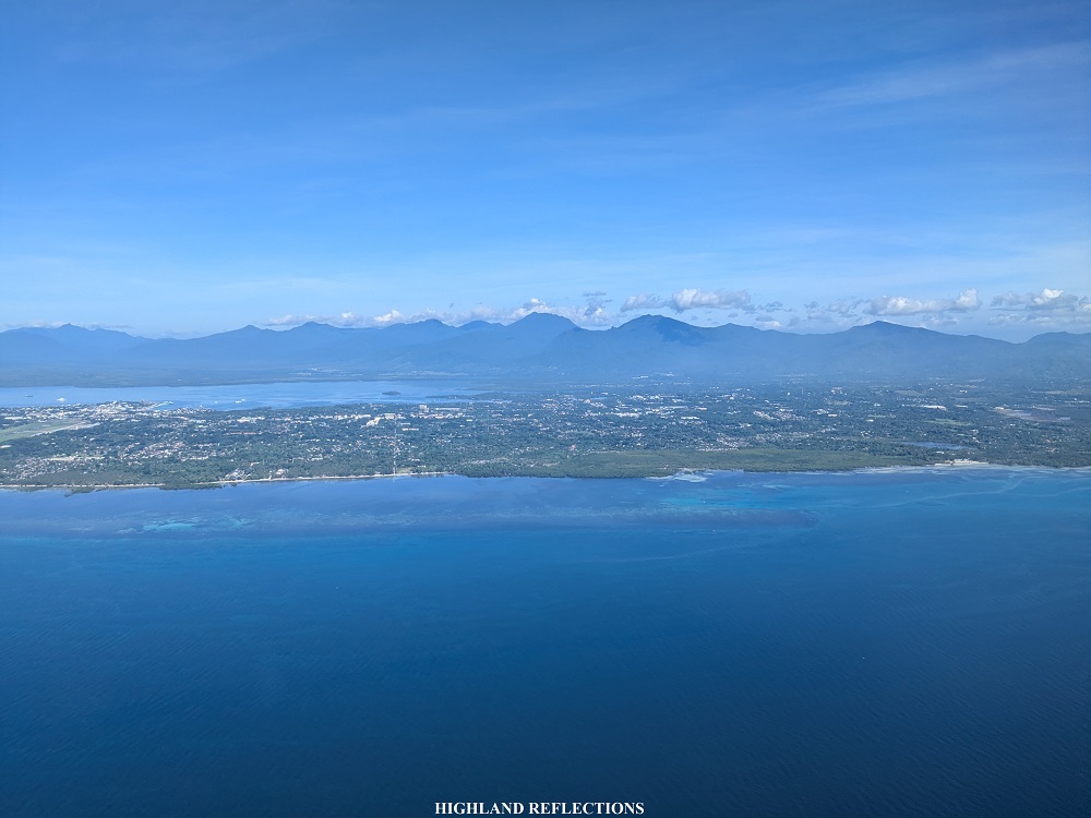
Much later that early morning, I woke up not just for my flight, but to get another bowl of chao long before leaving Palawan. Afterwards, I was supposed to get some coffee at a local cafe, but I was pressed for time, so I had to go to the airport immediately after stuffing myself with a hearty bowl of chao long. Before returning to Manila, I spotted from my plane seat Mts. Thumbpeak and Beaufort—two mountains within the vicinity of Puerto Princesa City—which I hope to climb in the future! As the airplane was making its initial ascent, I also spotted the lofty Cleopatra’s Needle (Palawan’s third highest mountain) and the limestone mountains within the Puerto Princesa Subterranean River National Park.

Days after my climb, I felt a slight injury in my right ankle. Thankfully, it healed swiftly. My body took more than a week to recover and be back to a fully-functioning state.
With the past injury and the accumulated tiredness that I was feeling after the hike, I could confidently say that Mt. Mantalingahan is my most difficult hike to this date. I realized how those 41 kilometers could have been easier, and could have been finished within two days, had the trail not been technical. And when I say technical, it’s those parts where we had to crawl our way up or down some perilous paths, wade our way through mud, and negotiate every step to make sure we tread on the trail safely. Those 40+ kilometers weren’t just taken through walking; they were taken through using our entire body to move forward, just to cover kilometer per kilometer to reach the summit, and then the end point.
I’m glad I showed up for this climb. I wouldn’t have thought that I would be able to do it. But here I am, finally writing and finishing a blog for this hike.
Would I go back to Mantalingahan? Not in the foreseeable future. But if one day, someone would invite me for an expedition to the mountain’s true summit, I would most probably say yes to this craziness. Because what crazy human being would want to suffer the same fate, and experience the same pain? Hikers. They’re called hikers. And that’s who I am.
Itinerary
Day 1
06:00AM Start hike at Sitio Balen-Balen, Ransang (KM 00, 30+ masl)
07:00AM Manggis tree (KM 03)
08:00AM View deck (KM 04, 330+ masl)
09:00AM Magtangob/Bulldog Camp (KM 05, 410+ masl), long rest
10:00AM Resume hike
12:30PM Water source (KM 09, 700+ masl), lunch
01:00PM Resume hike
02:00PM Baluin Village (KM 10, 675+ masl), set camp
06:00PM Dinner
08:00PM Lights out
Day 2
05:00AM Wake-up call
06:30AM Resume hike
08:50AM Cabugan Campsite (KM 12.94, 735+ masl), rest
09:20AM Resume hike
11:00AM Kawayanan Camp (KM 15, 700+ masl), rest
11:20AM Resume hike
12:00PM Agung-Agung (KM 15.8, 830+ masl), lunch and rest
01:30PM Resume hike
03:00PM First view deck
03:30PM Resume, start of bouldering
04:00PM Pulanggok Peak (KM 18, 1375+ masl)
05:00PM Paray-Paray Campsite (KM 19, 1620+ masl)
08:00PM Dinner
09:00PM Lights out
Day 3
04:00AM Wake-up call
04:45AM Start of summit assault
06:25AM Summit (KM 20.5, 2,086+ masl)
08:00AM Start descent to Paray-Paray
09:45AM Back at Paray-Paray (KM 22), breakfast and break camp
12:00PM Start hike to Pisa-Pisa
02:20PM Water source (KM 23.5, 1460+ masl), lunch
02:045PM Resume hike
03:30PM Pisa-Pisa Camp (KM 24.5, 1475+ masl), set camp
07:30PM Dinner
09:00PM Lights out
Day 4
05:00AM Wake-up call, breakfast, and break camp
06:45AM Start of hike
08:00AM Lapong Camp (KM 26, 1595+ masl), regroup
08:30AM Resume hike
10:40AM Magringgit Camp (KM 29, 1215+ masl), lunch
11:10AM Resume hike
01:20PM Kawang-Kawang (KM 32, 1100+ masl)
03:15PM Start of grassland area and community (KM 35, 830+ masl)
05:45PM Exit point at Malis Brooke’s Point (KM 41, <30 masl), wash-up
09:00PM Start return to Puerto Princesa City, dinner along the way
02:00AM Puerto Princesa City
For organized tours, you may send a message to HakbangPasulong on Facebook. Rabas Outdoors (organized by Win Calleja) also has frequent organized events in Mt. Mantalingahan throughout the year. For those who want to DIY, you may send an email to mantraveresepalawan@gmail.com. Walk-ins are not allowed. Reservation must be made two weeks before the climb. Only one group is permitted for booked dates. You may go to their Facebook page (Mt. Mantalingahan Protected Landscape) for updates and more details.

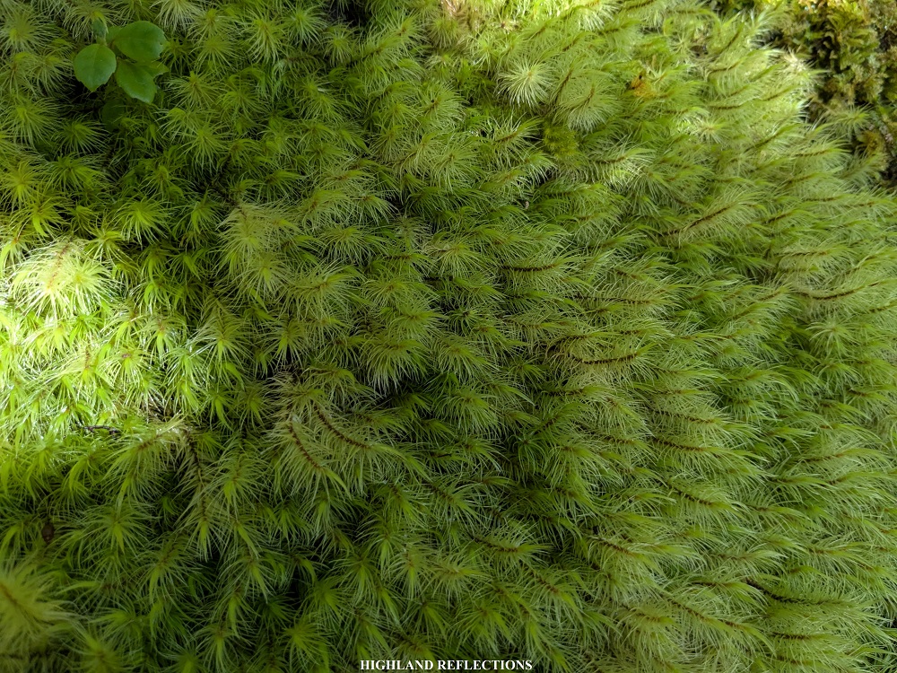
Missing the trails surrounded by mossy forest 🙂
LikeLike