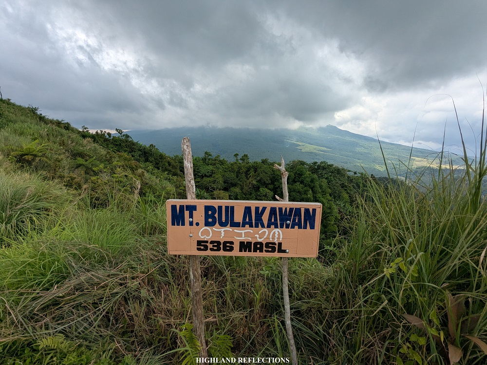
At the northern fringes of the majestic Mayon Volcano lies a small mountain range — the Mt. Bulakawan Nature Reserve. This small mountain range located at the town of Malilipot, Albay provides a beginner-friendly yet challenging hike with its steep, continuously inclined trail, so it takes almost one to two hours before reaching the summit. Once the summit is reached, one can view a roster of magnificent attractions: from the three of the most gigantic and venerable mountains in the province of Albay, the Magayon (‘beautiful’) Trio — Mayon, Malinao, and Masaraga, all the way to Lagonoy Gulf and Catanduanes Island. Its views are from sea to summit!
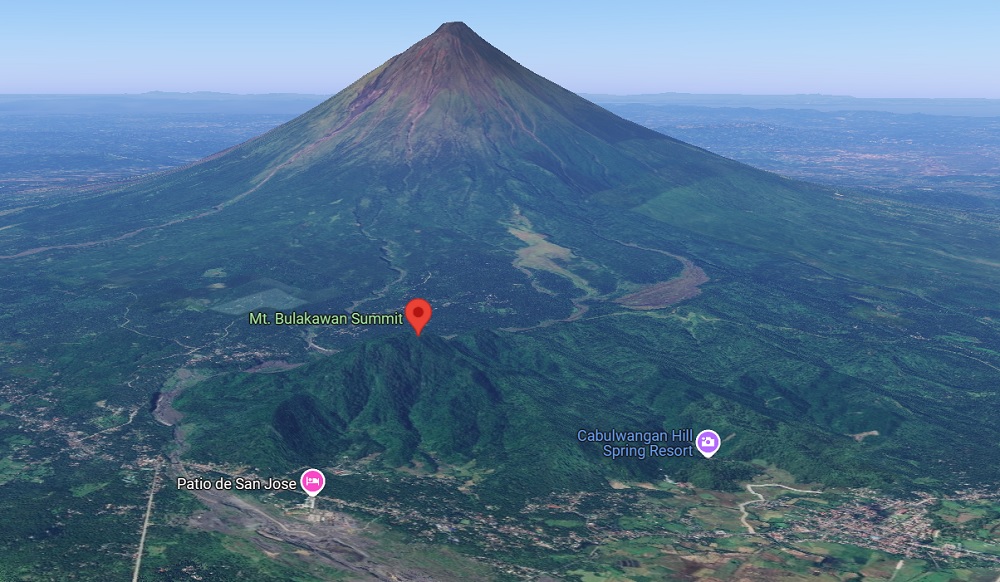
For this hike, we were fortunate to try the traverse trail, where we took a different path on the way down leading to Busay Falls, a casual tourist spot within the area.
The characteristic of the hike are as follows:
MT. BULAKAWAN TRAVERSE TO BUSAY FALLS
Jump-off point: Santa Teresa, Malilipot, Albay
Specs: Minor climb, difficulty 3/9
Trail class: 2-3
Days required / Hours to summit: 1 day / 1-2 hours
Features: View of the Magayon Trio, Lagonoy Gulf, and the lowlands of Malilipot
Here is my narration of our hike in Mt. Bulalakaw:
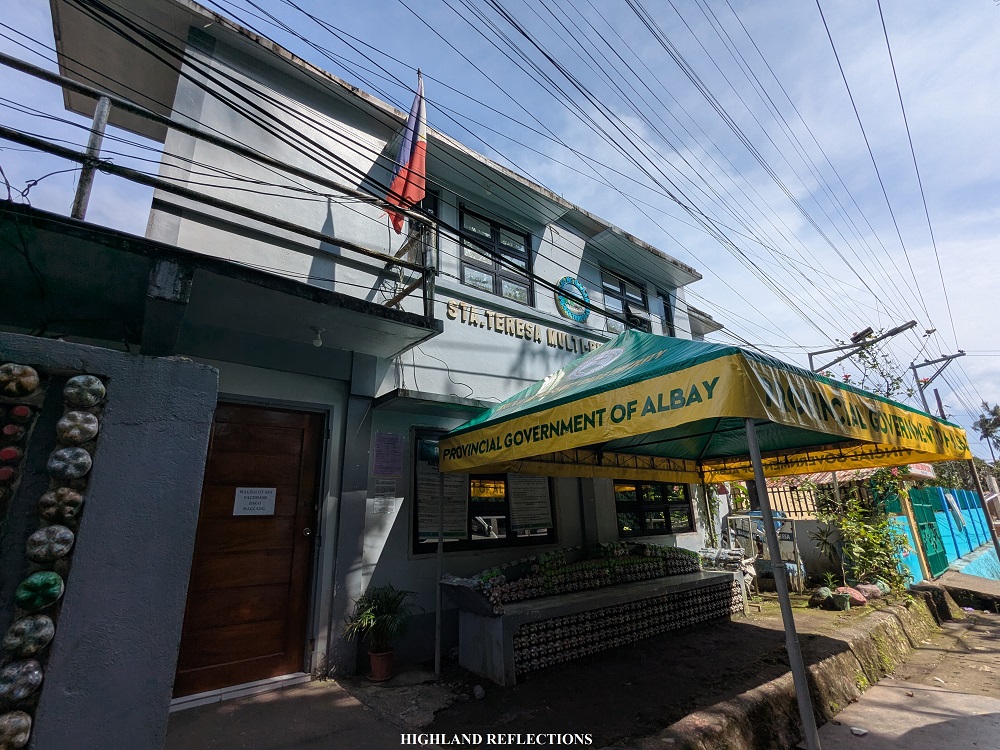
After camping at The Campsite in Mt. Masaraga in Ligao City, Albay, we went to the town of Malilipot to hike Mt. Bulakawan. We were required to register at the barangay hall of Santa Teresa upon arrival. Then we started the hike from the municipal hall, walking almost less than five hundred meters to reach the trailhead, which was obscurely at the side of a community road.

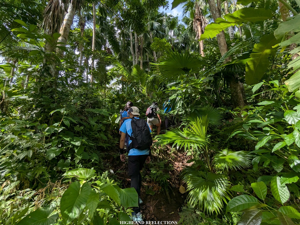
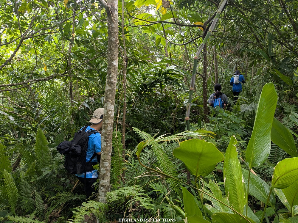
Past the road, the trail immediately greeted us with a round of ascents inside a lowland forest filled with abaca, palm trees, cogon grasses, and other fruit-bearing trees. The ascent provided a good work-out, as it did not make way for any flat area! Despite being in a forest, the trail occasionally provided views of the coastline and some glimpses of Mayon Volcano.

Somewhere in the middle of the ascent, there was a short flat area filled with tall cogon grass, which, eventually, led to another round of steep ascents on slippery soil. After the slippery ascent, we reached a small, cleared area where we rested, serving as the halfway point of the hike. This was, apparently, the junction going to Busay Falls, which we would return to later on the way down.

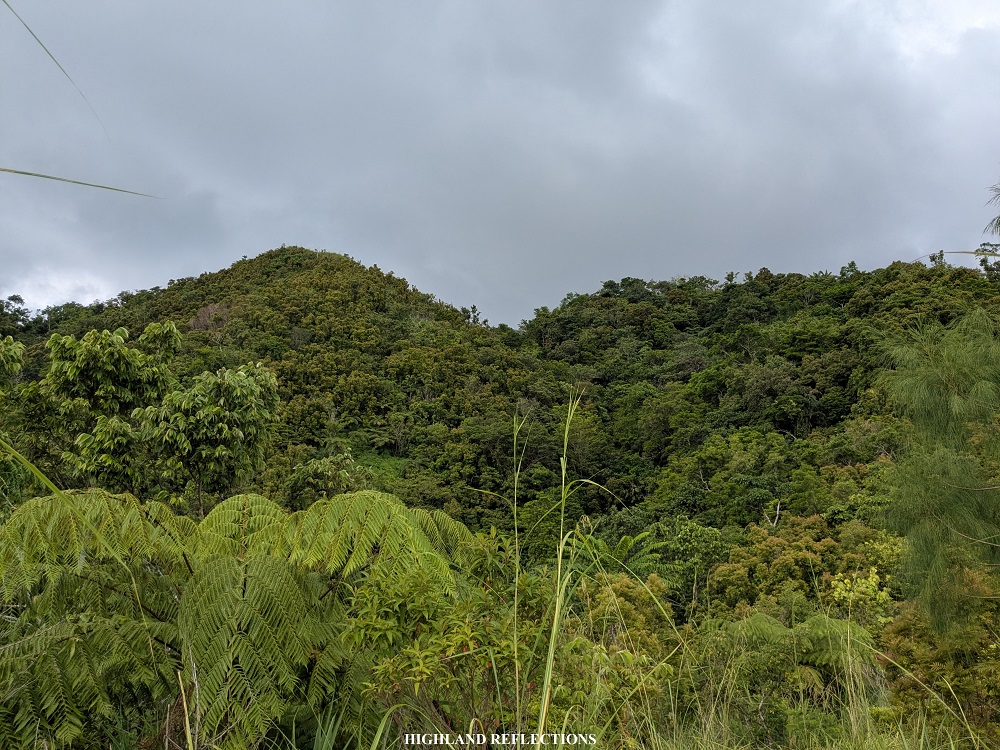
Past the rest area was a short section of gradually ascending trail where the summit is visible, marking the start of the last assault to the summit. The trail here was highly reminiscent of the last portions of Mt. Kalisungan in Laguna, where the trail was carved on a steep incline surrounded by tall cogon grass. However, unlike in Kalisungan, the cogonal trail in Bulalakaw continues on a flat trail atop a ridge at the shoulder of the summit.
Past the ridge, the trail passes through the highest point of the mountain. We went past this point as the summit view deck was still around thirty meters away from it. We reached this view deck an hour and a half after starting the hike from the barangay hall!
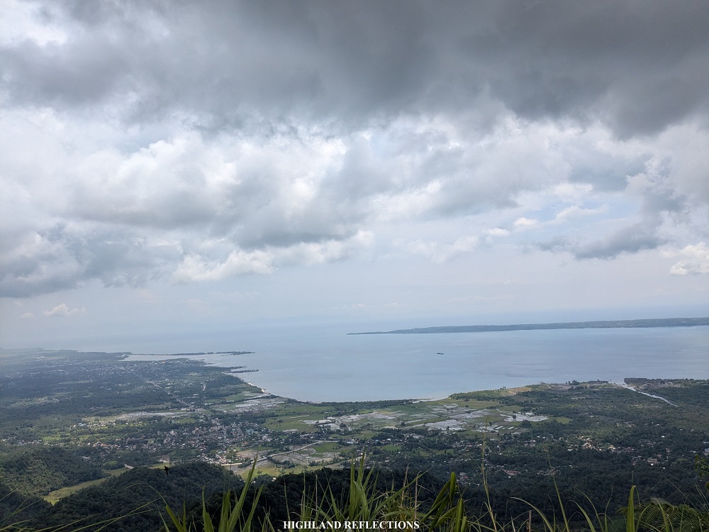
The view deck, which was a grassy ridge at the edge of the summit area, provided views of both the seas and the highlands. In front of the view deck, one can view the entirety of the town of Malilipot, and beside it, some parts of the town of Malinao. Beyond the coastlines of these towns, the islands of San Miguel and Bacacay can be seen, together with the seawaters of Lagonoy Gulf and the rest of the Pacific Ocean. In the horizon, the province of Catanduanes can be spotted. This was my first time seeing the province with my very own eyes! I’m hoping to visit the province, known as the land of the howling winds, in the future!
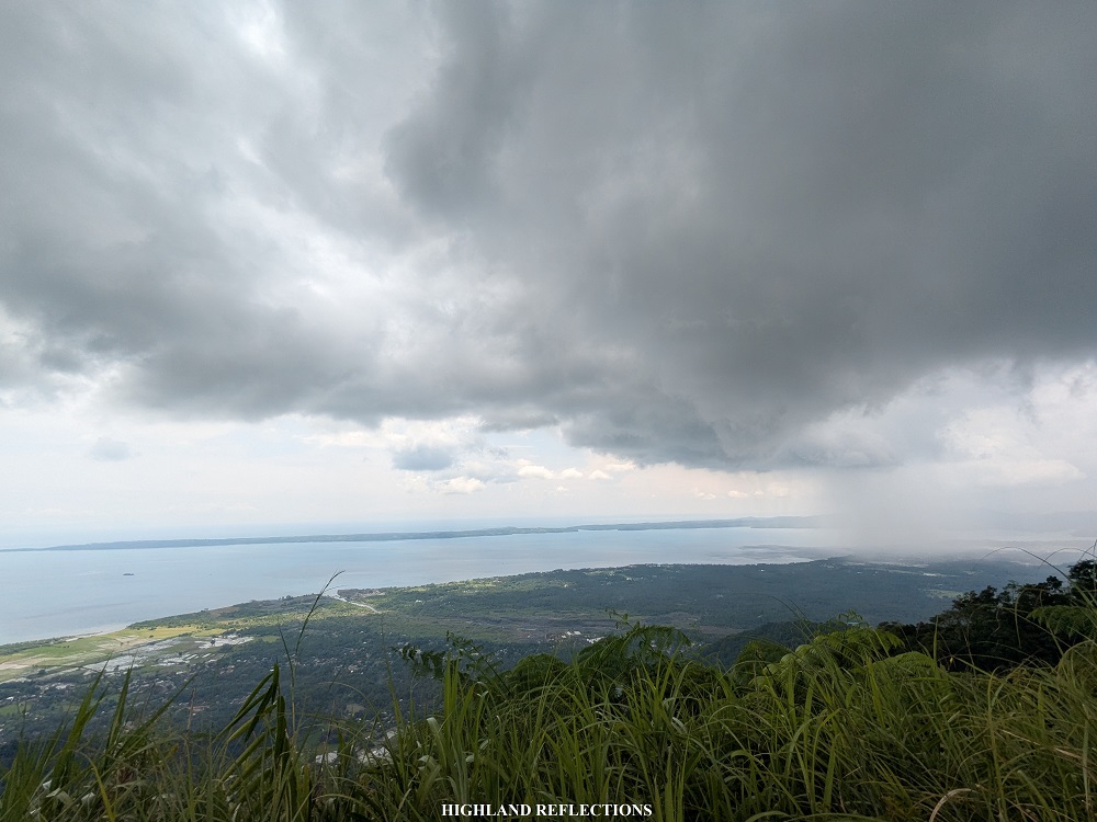
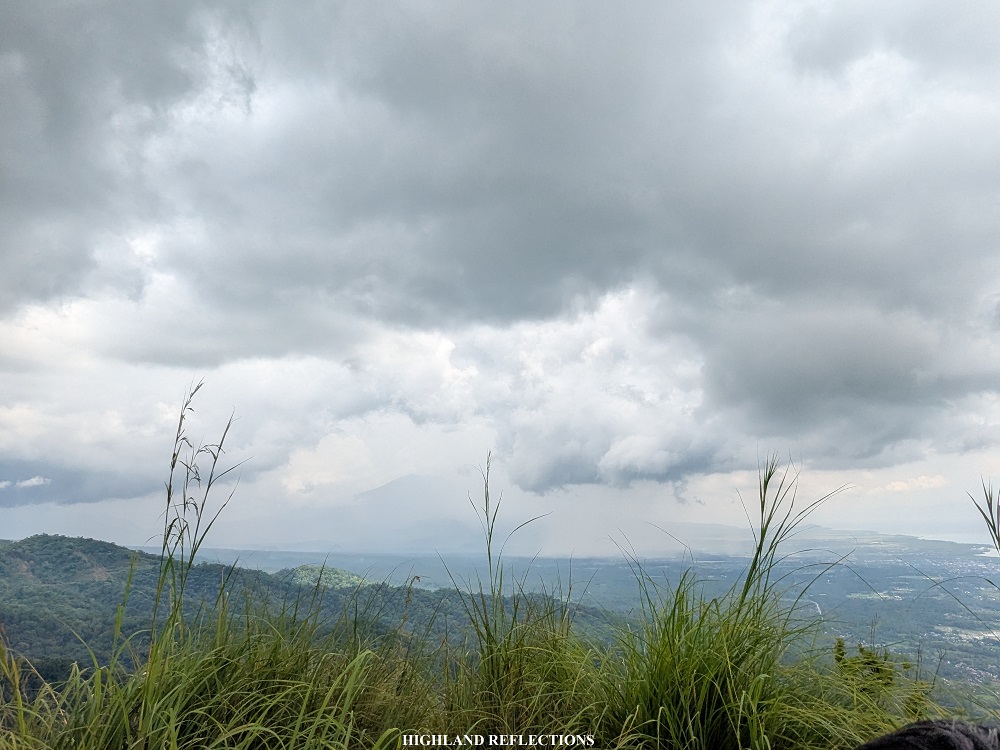
Shifting our view to the left, which was where the summit signage is, one can view the gigantic Mt. Malinao, one of the Magayon Trio, in the town of its namesake. To its left is a faint view of Mt. Masaraga hiding behind the slopes of Mayon Volcano. Finally, at the southern direction, Mayon Volcano dominates the entire view, serving as a colossal figure that obligates you to stare at its majestic beauty. During our hike, we were not able to see the entirety of Mayon Volcano due to the thick morning clouds looming in the atmosphere (fortunately, we saw the entirety of Mayon Volcano during our stay at The Campsite in Mt. Masaraga a day before, and when we visited Daraga Church later that day).
According to some accounts published online, the Mt. Bulakawan Mountain Range served as a shield when Mayon Volcano erupted in the past. Due to the strategic presence of the mountain range, residents did not need to evacuate when the volcano erupted. One can claim that Mt. Bulakawan is a blessing to the residents of Malilipot.
After soaking in the views from the summit, we decided to go down. On the descent to the junction, we passed through the same steep trail, providing a moderate challenge to our legs and feet, as the trail was mostly slippery. Trekking poles here are a must for beginners, as there weren’t any trees to hold on to for assistance!
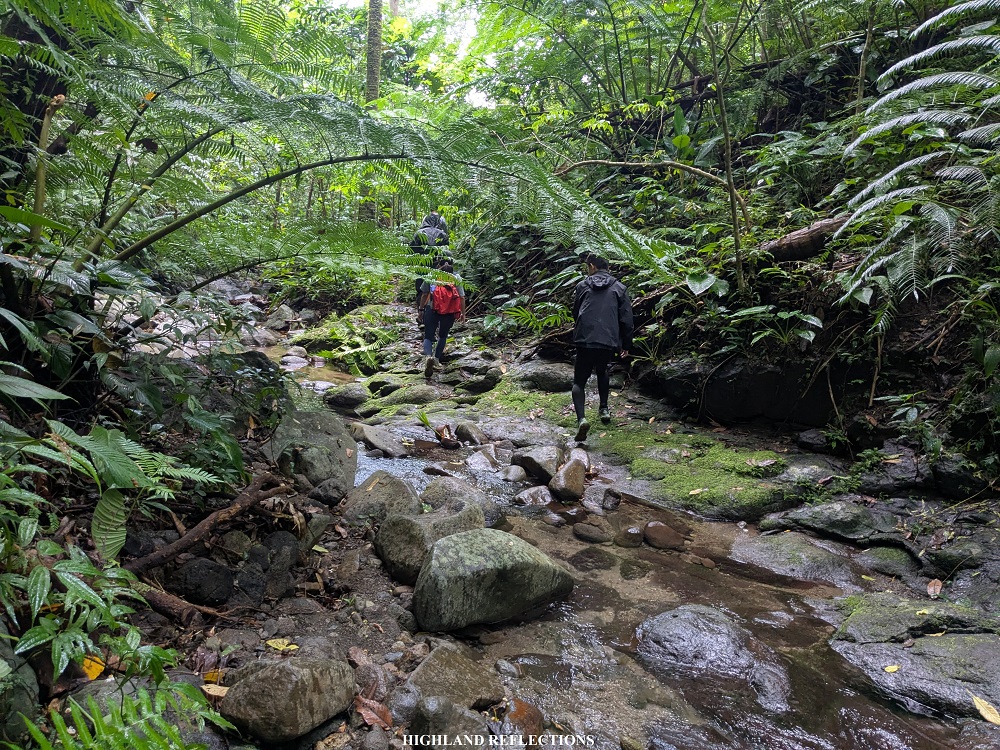
Upon reaching the junction where we rested earlier, we immediately took a left turn towards a trail that was much more verdant than the trail that we took on the way up. This jungle-like path was such a breath of fresh air from the hot, humid, and mostly cogonal trail that we took on the way up. This would continue until reaching Busay Falls!

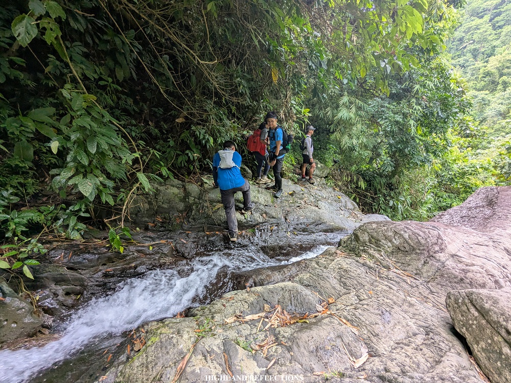
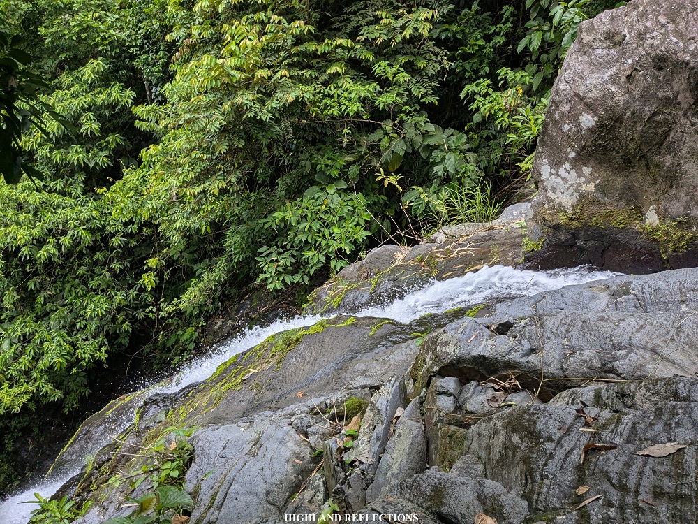
The traverse trail had a continuously descending course inside the jungle of Bulakawan. Somewhere along the way, there was a short roped section along a steep slope. Frankly, the steep trail was manageable, but its slipperiness was what prompted the use of a rope. Past the roped section, we treaded a few meters inside the jungle until finally reaching the river where the five tiers of Busay Falls flow! Specifically, we were at the vicinity of the third tier of Busay Falls. From here, one can visit an off-trail to the left to visit the fourth and fifth-tier, which my companions in the lead pack did!
Since I wasn’t keen on visiting the falls, we continued with the last portions of the descent. The remaining parts of the trail pass through the side of the second and first tier of Busay Falls. Ropes are again installed here as the trail was along some slippery boulders. Caution must be exercised here as one misstep can lead to a fall onto a ravine and in the raging gushes of the waterfalls. Past the roped segments, we finally reached the vicinity of the first tier of Busay Falls, where casual tourists were swimming in the verdant waters at its basin. This marks the completion of the traverse hike! We ordered several bottles of Coke as a celebration and to quench our thirst coming from a humid hike.

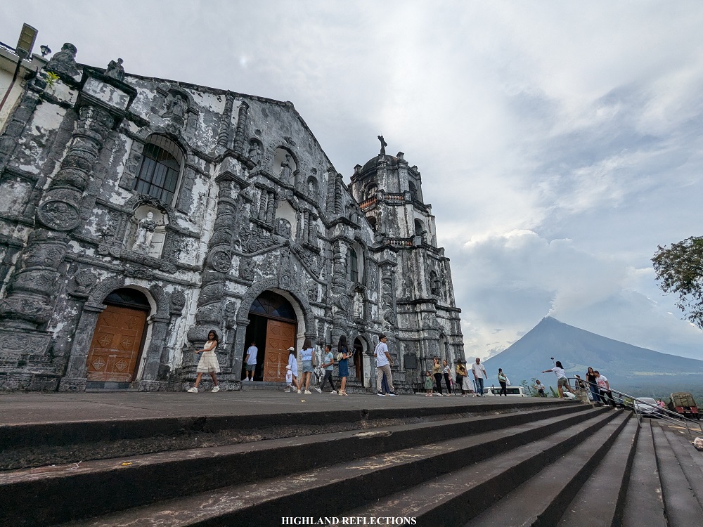
Several comfort rooms are installed within the vicinity where we washed-up before going back to Manila. Later that day, we went to Daraga Church as our last stopover for the Albay Tour that we did that weekend. We went home with fulfilled spirits brought by the natural wonders that Albay offered.
It was such a pleasure to get introduced to Bulakawan—a short but challenging mountain that hides shyly behind the majestic Mayon. I am grateful to Bulakawan for being my first hike in Albay! I am excited to go back to the province to climb the Magayon Trio in the future!
Itinerary
09:00AM Register at Santa Teresa Barangay Hall
09:10AM Start hike
10:30AM Summit
11:00AM Start descent
12:20PM Busay Falls, wash-up
01:30PM Start journey back to the city

Nice shots! Kaso parang hihabol kayo ng ulan, nonetheless, ganda ng trails, napaka relaxing 🙂
LikeLike
For some reason, nasa paligid namin yung ulan, pero hindi kami inuulan. Although, may konting ambon nung nagsimula na kami sa traverse trail. Fortunately, hindi siya nagtuloy sa malakas na ulan. 🙂
LikeLiked by 1 person