Situated just south of the venerable Mt. Ugo in the Cordillera Region are the peaks of Alang Salacsac in Kayapa, Nueva Vizcaya—Tugew, Cabo, Kabuan, and Sadjatan. These interconnected peaks provide panoramic views of the southern Cordillera Mountain Range, bordering the provinces of Benguet, Nueva Vizcaya, and Pangasinan. Its trails are gentle and are carved along the barren mountain slopes, making it perfect for beginners sans the heat. With this, the characteristics of the mountain are as follows:
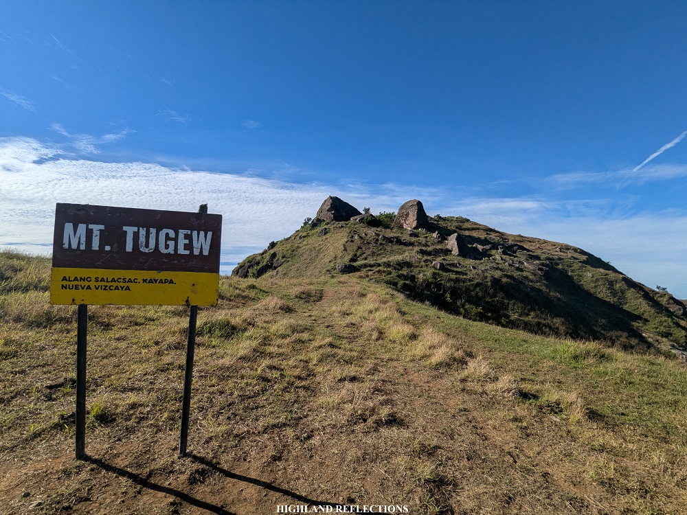
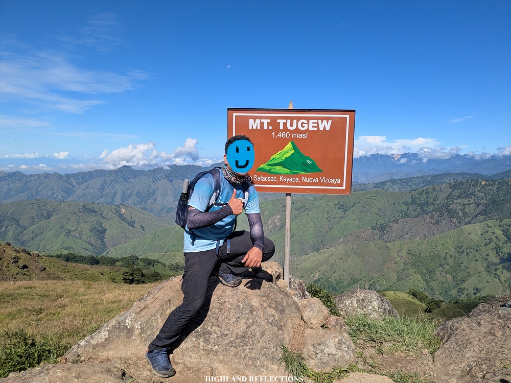
MT. TUGEW with CABO, KABUAN, and SADJATAN PEAK
Jump-off point: Alang Salacsac, Kayapa, Nueva Vizcaya
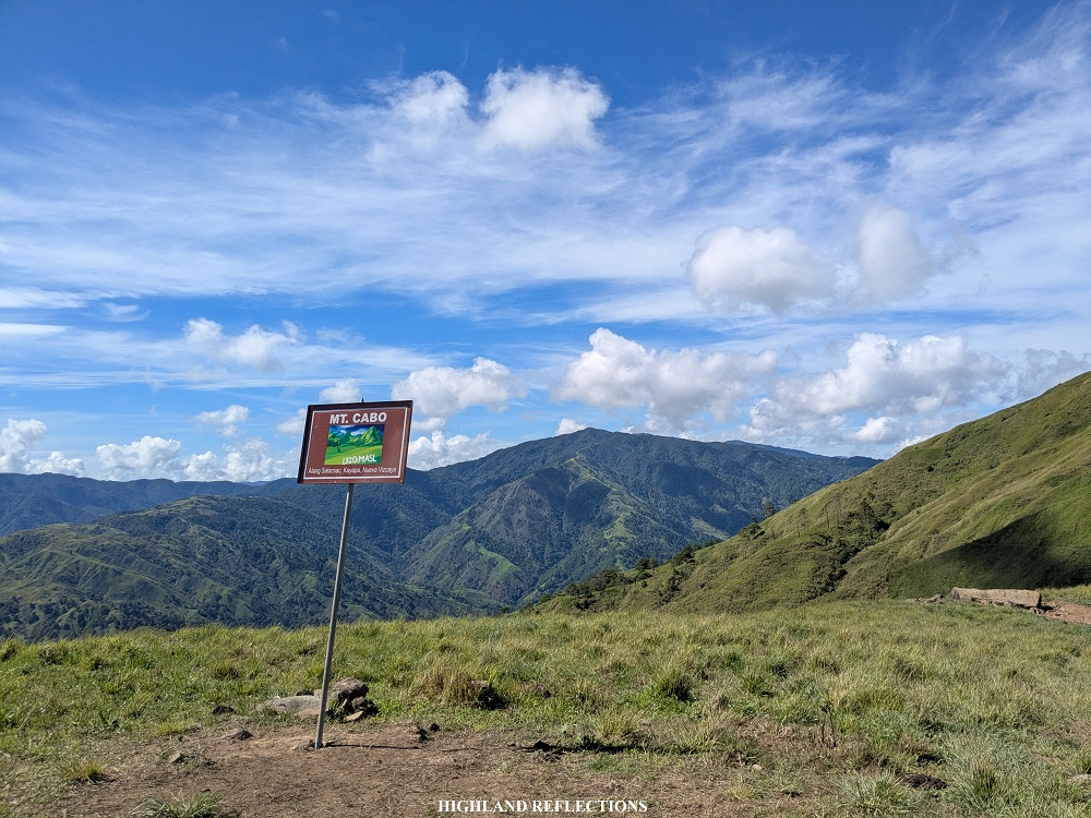
Elevation: 1,467+ MASL (Tugew), 1,320+ MASL (Cabo), 1,420+ MASL (Kabuan), 1,438+ MASL (Sadjatan)
Specs: Minor climb, difficulty 3/9
Trail class: 2
Days Required / Hours to Complete the Hike: 1 day / 6-8 hours
Features: Panoramic views of Southern Cordillera
Mt. Tugew (pronounced as tugow) caught my attention back in 2024 after watching a vlog by trail runners who were doing some recon expeditions in the area, as its trails are used as routes during events. I promised myself I’d visit the mountain one day after watching that vlog. Little did I know, just a year later of watching it, Mt. Tugew and its neighboring peaks would emerge as a popular hiking destination, with trails now linking it to nearby mountains. Despite my busy schedule, I squeezed in a visit to Mt. Tugew and the peaks of Alang Salacsac in February of 2025. I also returned in June of the same year. I had foggy weather during my hike in February, and a sunny hike when I returned in June!
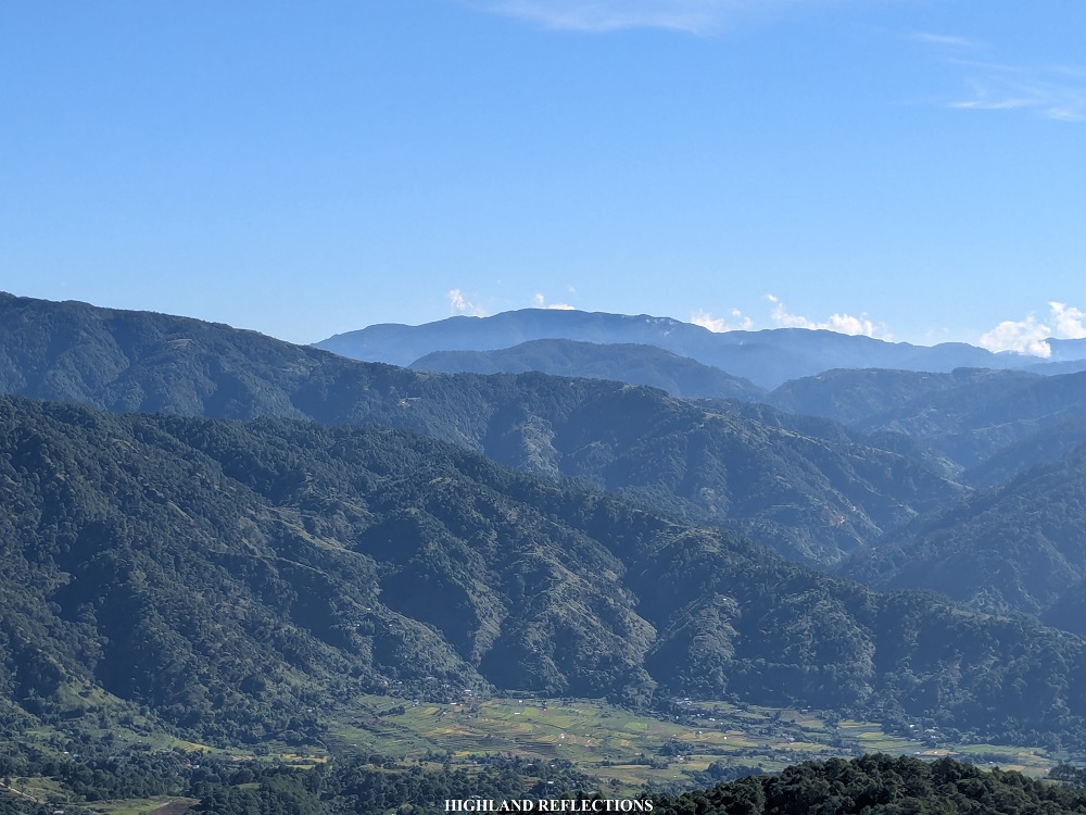
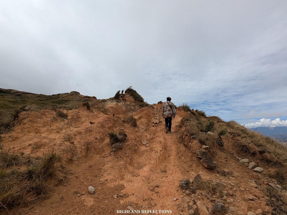
The adventure to Mt. Tugew starts in the town of Kayapa. From the town center, one would have to pass through a 17-kilometer narrow, landslide-prone road. Many hikers who have been here say that passing through this road is what makes the adventure to Mt. Tugew a bit difficult (minor hike, major byahe), as it can get a bit bumpy and scary due to the presence of some landslides. However, once you reach the vicinity of Kayapa Proper West, everything becomes bucolic and scenic—pastoral lands and rice terraces surround the barangay. Past Kayapa Proper West is where Alang Salacsac is, where Mt. Tugew is located. The barangay is nestled on top of a hill overlooking the Kayapa Proper West Valley.
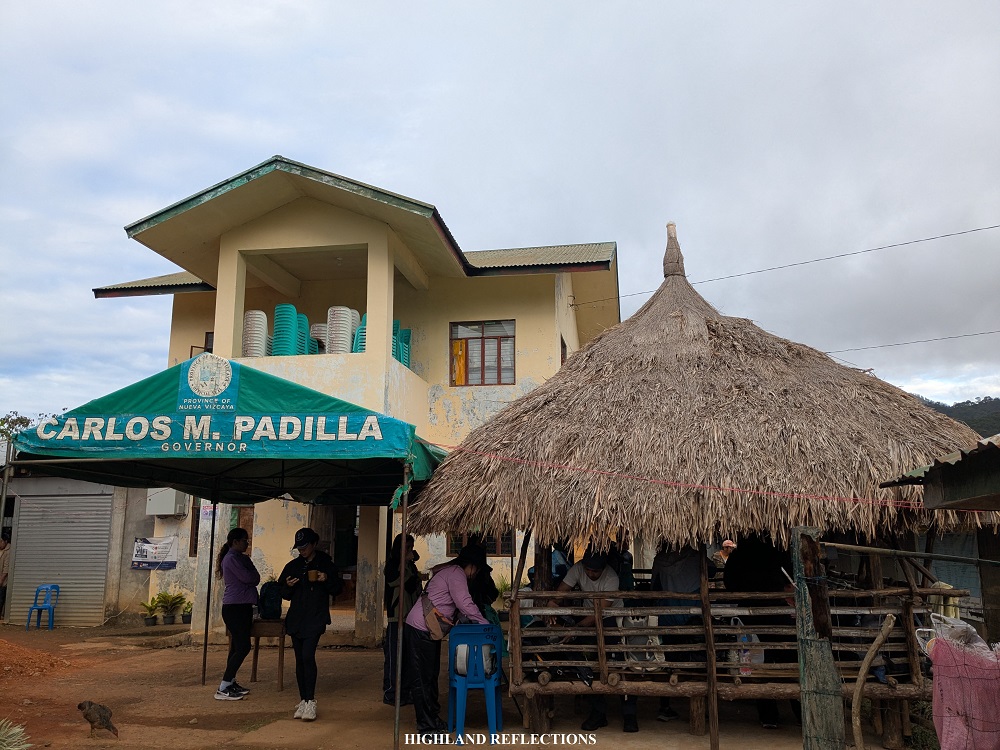
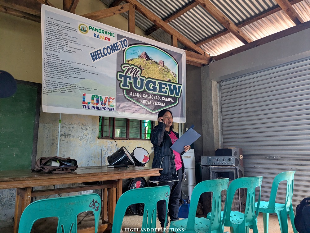
The officials of the barangay welcomed us with such warmth. At the barangay hall, we had a brief orientation about the mountain’s lore all while sipping free hot coffee made from locally sourced beans. Based from the briefing, Mt. Tugew bears cultural importance to the locals as it is a mountain rich in folklore.
The mountain got its name from the tragic tale of a maiden from the I’wak tribe. Tugew, the maiden, was promised in an arranged marriage to a man named Molmog, but she didn’t wish to marry him. In defiance, she fled and climbed to the peak of a mountain. There, she cried out, wishing to transform into a rock rather than be forced to love a man she did not choose. The heavens granted her wish, and she was transformed into a stone. This stone now stands as the summit marker of Mt. Tugew.
After the orientation, we started the hike. The initial parts of the trail passes through an upward cemented road that goes through some of the farming communities surrounding the barangay. This goes on for about a kilometer and a hundred meters of elevation gain before reaching the last of the few houses where a sari-sari store is located.
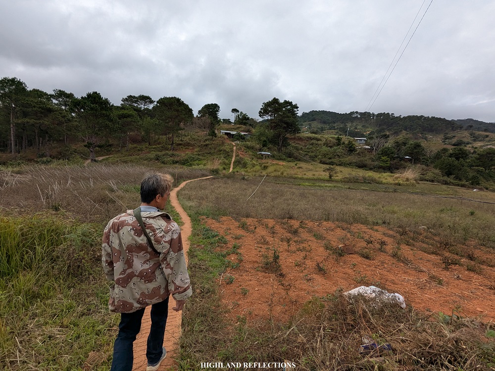
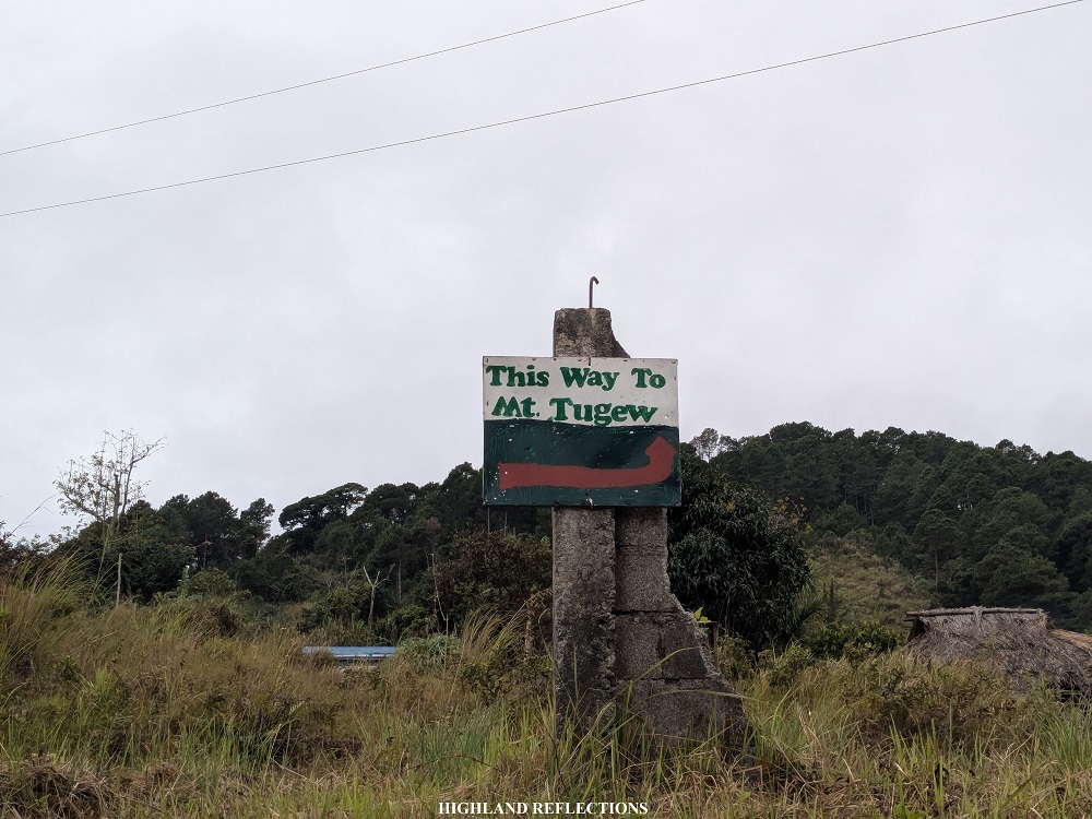
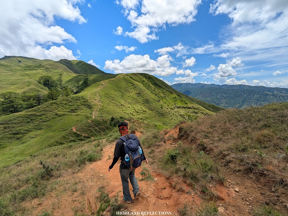
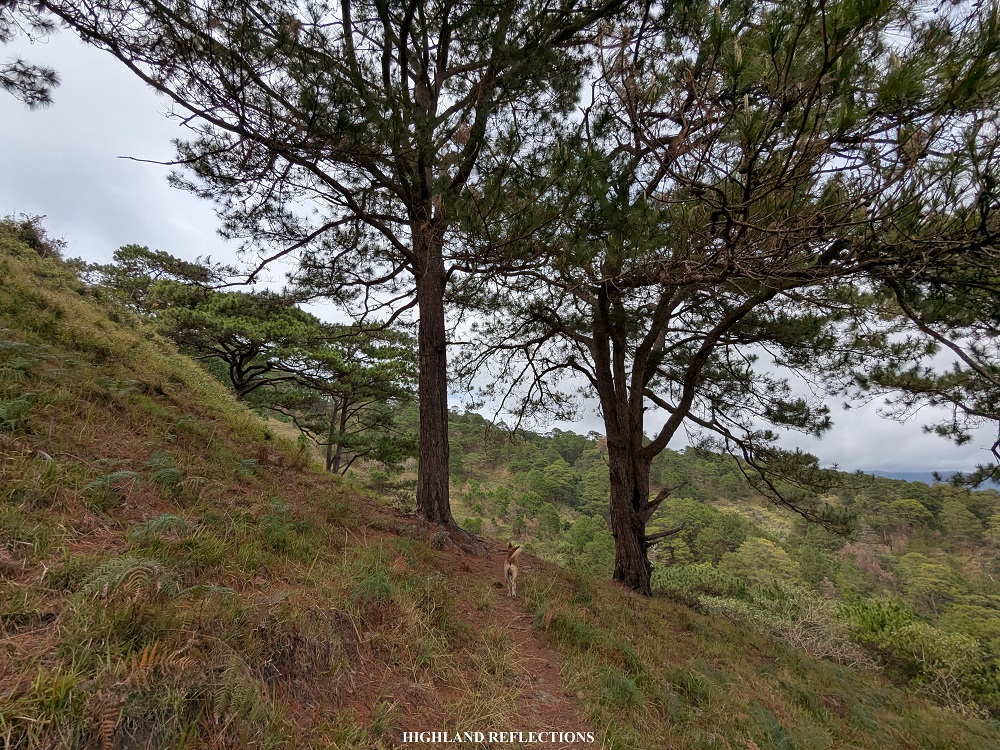
Past these residential areas is where the trail starts. This is marked by a junction, with the right trail going to Mt. Tugew, and the left trail going to what is labeled as the “Padilla Trail,” which we will take on the way down. Once we entered the trail after the junction, pine trees dominated the surroundings. With its gentle ascending slopes, I was reminded of Mt. Ulap!


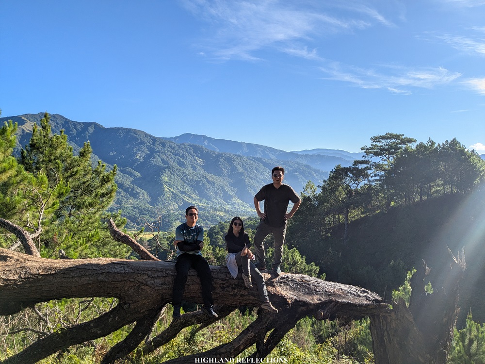
Along the pine forest, we snapped some pictures on top of a fallen pine tree, with Barangay Alang Salacsac and Kayapa Proper West as backdrop.

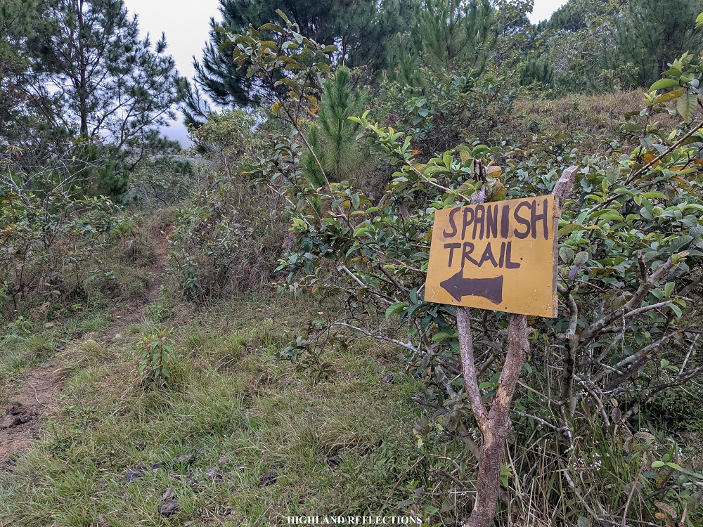
Afterwards, we encountered another junction. The signage with an arrow pointed left reads “Spanish Trail,” which, according to our guide, may also be used as a trail going down. Mt. Tugew has a lot of trails, so a guide is a must so as to not get lost!
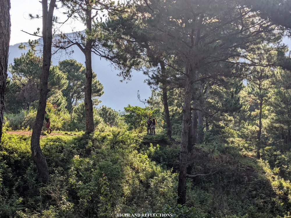
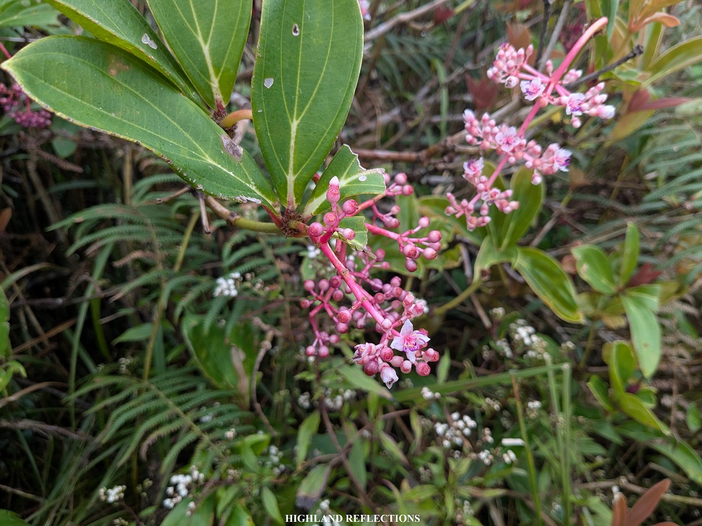
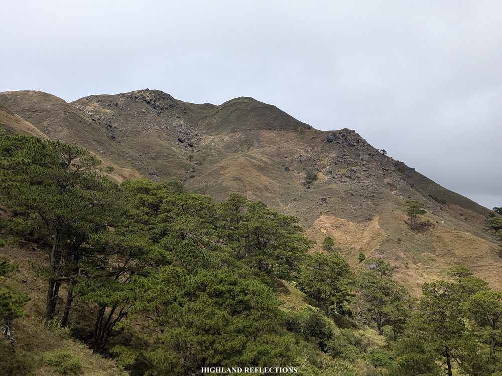
Just after the junction, pine trees disappeared and the entire surroundings were dominated by barren slopes dotted with giant boulders, with the mountain’s upper reaches now visible. We marched through the exposed trail and passed by the base of the summit, where some medinilla flowers were visible. After this was the final left turn going to the summit, where a waiting shed was built.
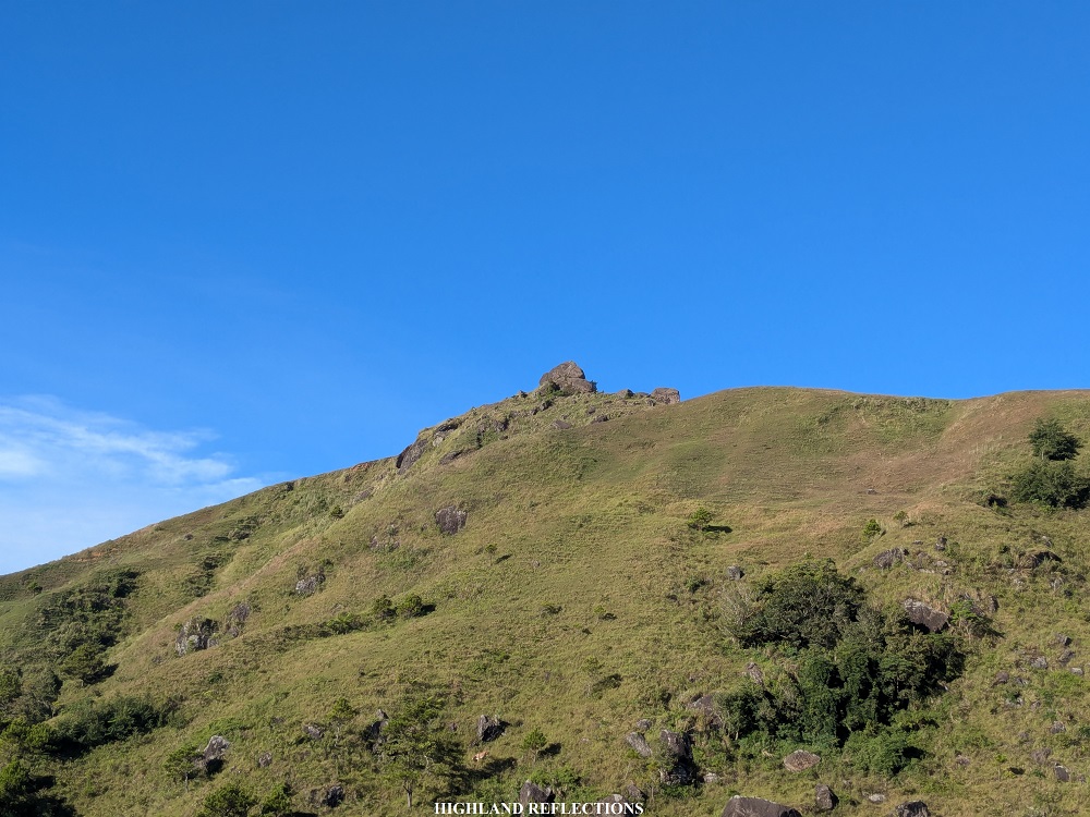
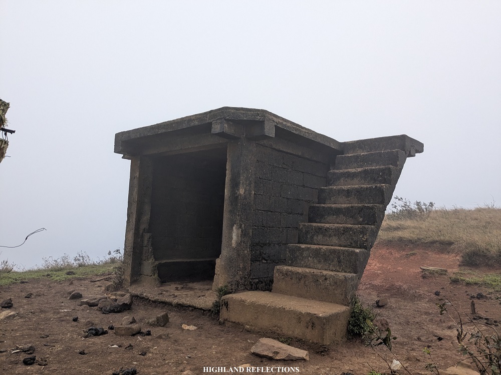
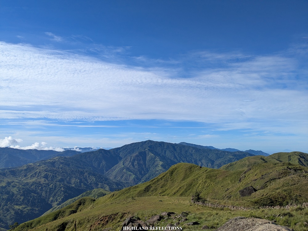
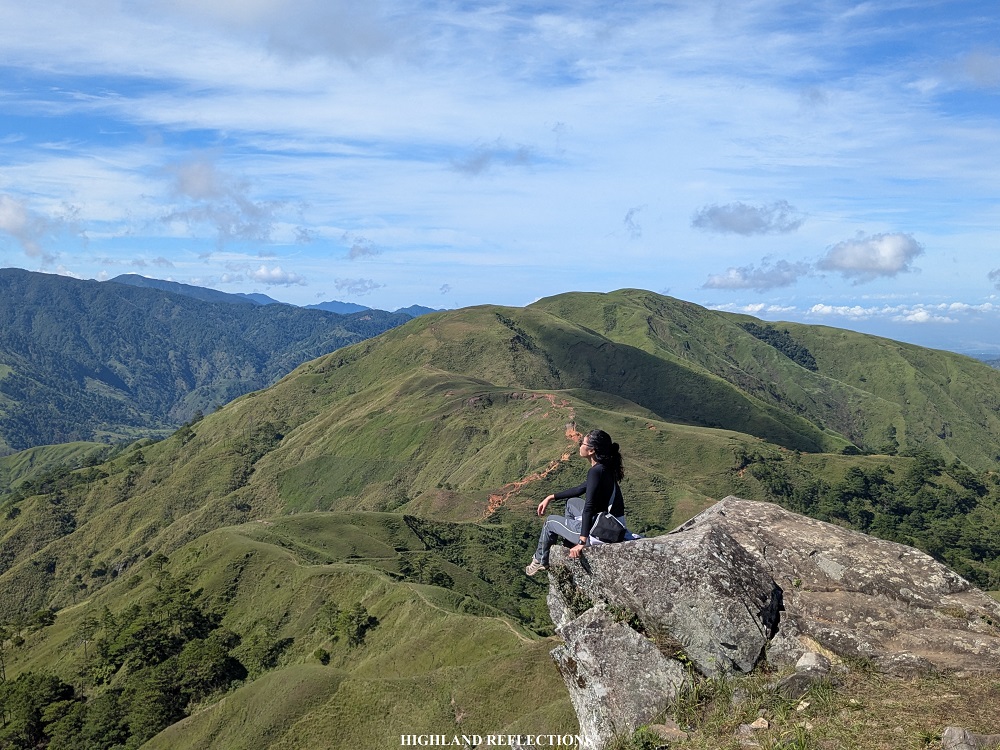
After the waiting shed was the last five minute-assault to the summit of Mt. Tugew. The trail on the way there was magnificent! It provided a three-hundred and sixty degree view of the entire surroundings, with the rock formations at the summit right in front. Slowly, we inched our way closer to the summit.
After two hours of ascent from the barangay hall (long rests included), we finally reached the vicinity of Mt. Tugew’s summit! Driven by my curiosity on what it was like to be on top of the rock thought to be as Tugew, I climbed on top of it. There, I had the entire view of the southern Cordillera mountain ranges!
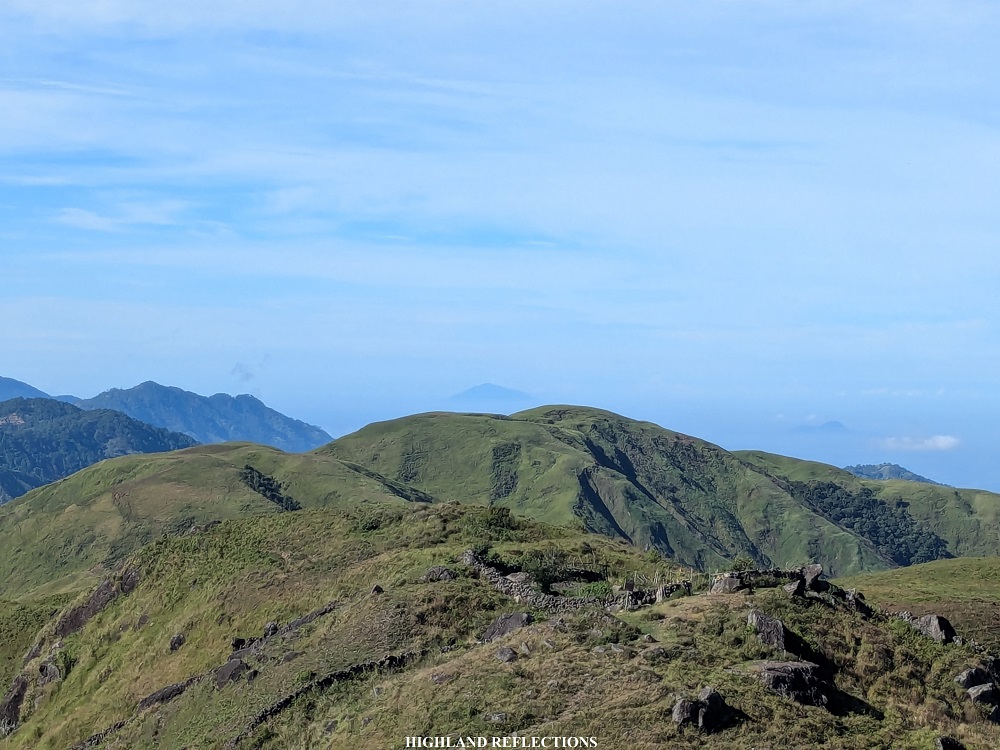
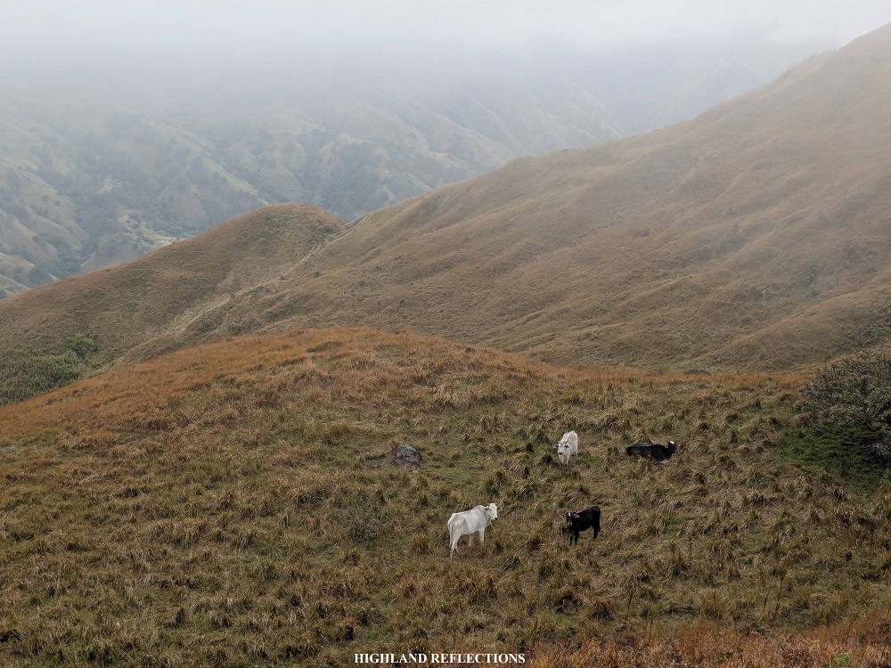
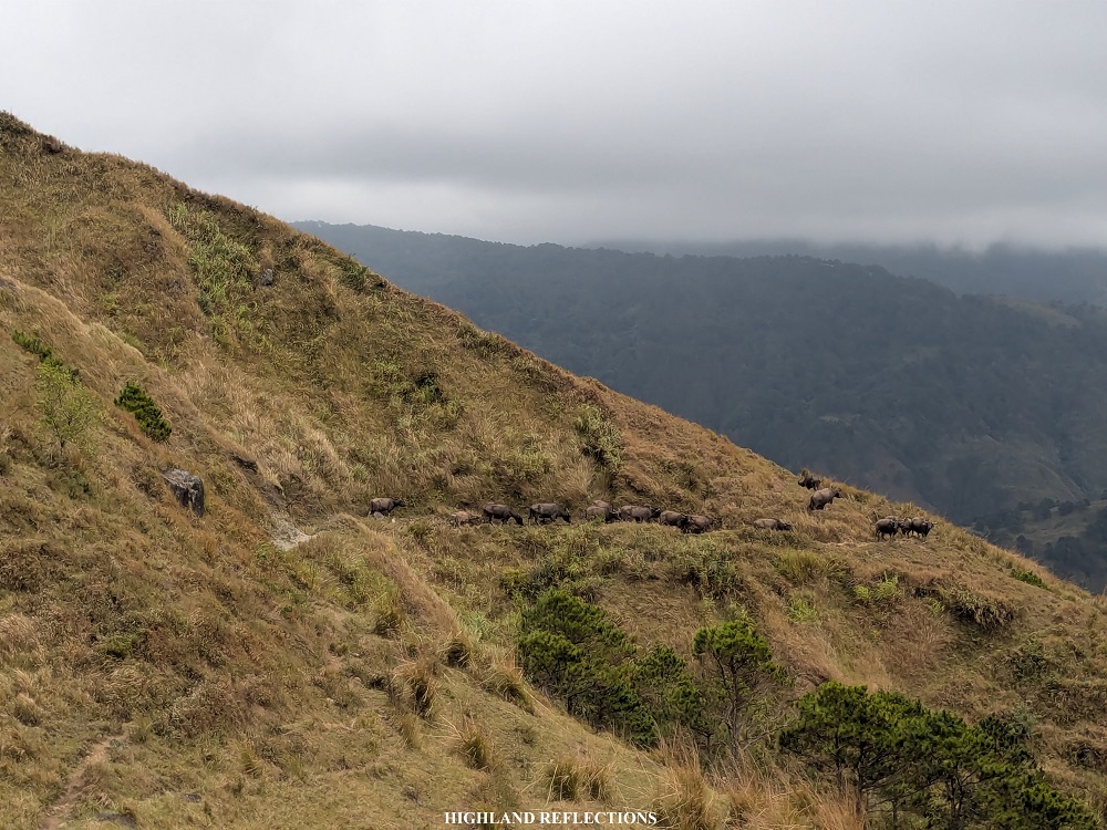
After snapping some pictures and eating our snacks at the summit area, we decided to go ahead and march to the second mountain—Mt. Cabo. Although counted as a ‘peak’ by some hiking enthusiasts, Mt. Cabo is actually not a mountain, but a grassy saddle connecting Mt. Tugew to Mt. Kabuan. The saddle ridge bears the name of a herdsman who built stone walls along the mountain’s slopes, which we passed through just a few minutes after descending from the summit of Tugew. These stone walls were perhaps to set boundaries or to contain the numerous cows roaming in the area.


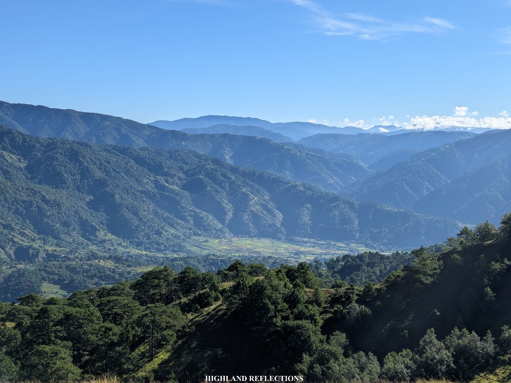
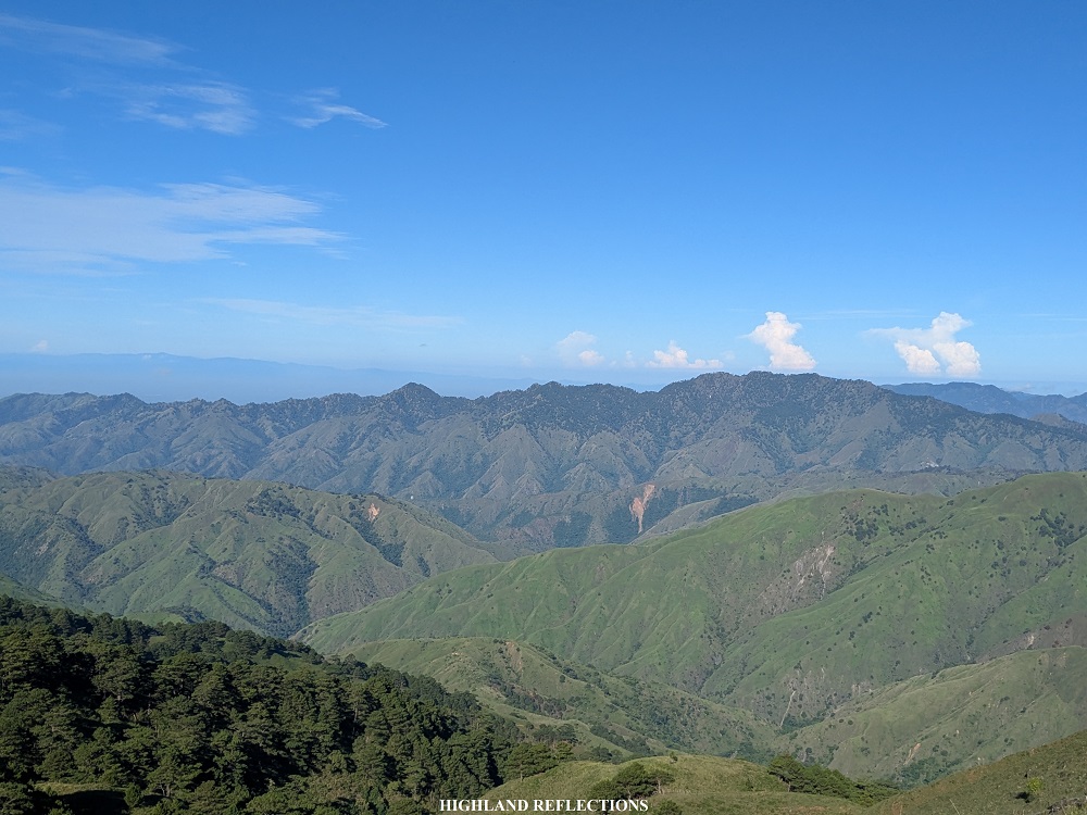
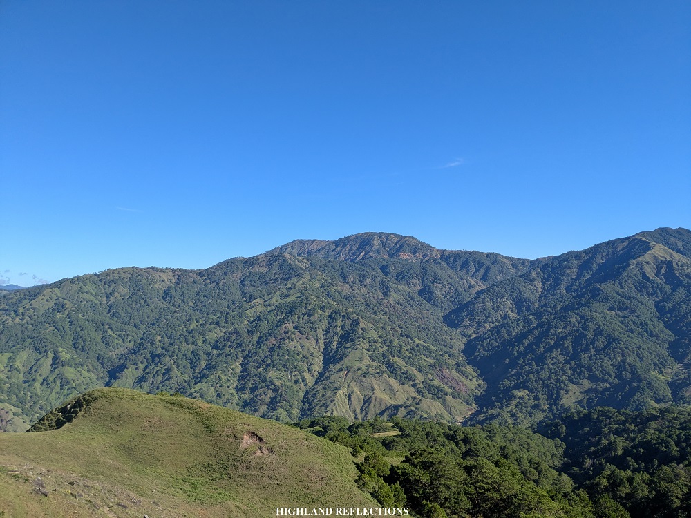
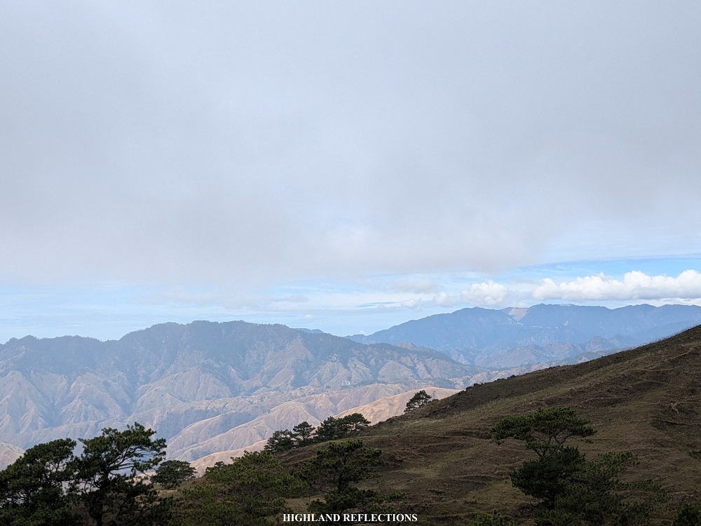
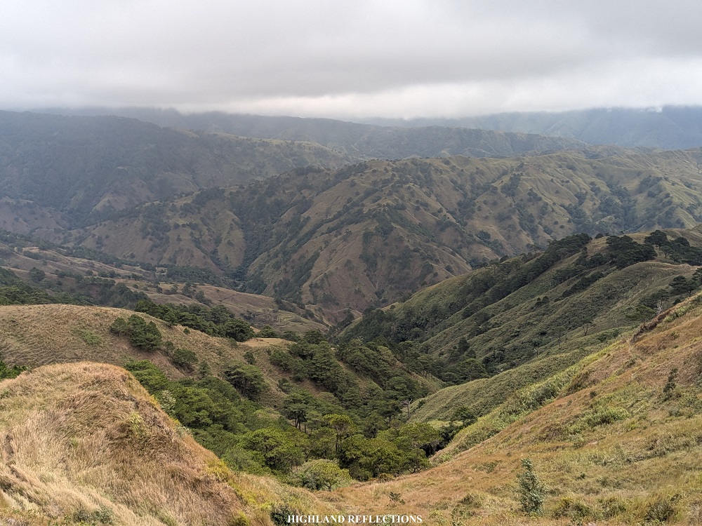
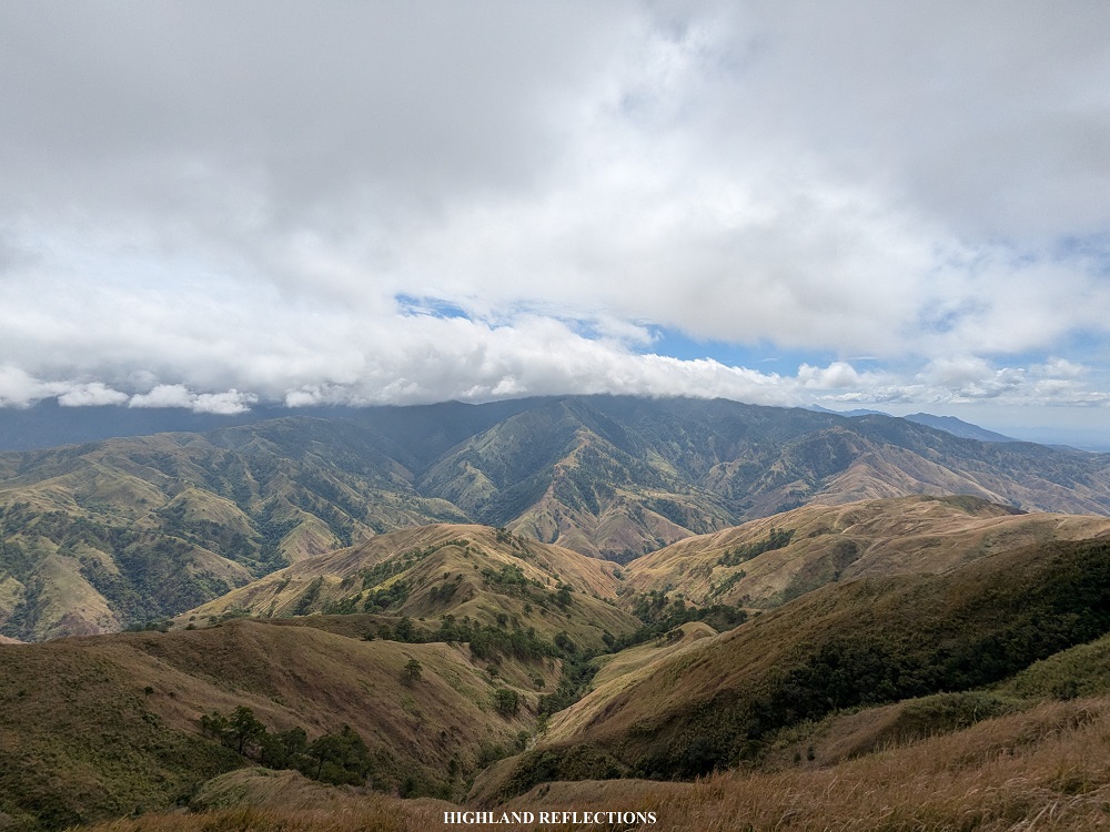
Past the stone walls, a panoramic view of the entire southern Cordillera graced us with all its beauty. To my left are the mountains of Aritao and Santa Fe, Nueva Vizcaya, as well as those in Malico, Pangasinan. Complementing these are the grassy hills connecting Mt. Tugew to these aforementioned mountains.

To my right is a barren mountain range containing Mt. Pigingan in Itogon, Benguet, which I was able to hike back in 2020! Behind Mt. Pigingan was a mountain range that has a landslide in one of its slopes, in what I can only assume as Philex Ridge where Mt. Ulap is located! This was when I confirmed what other hikers commented about Mt. Tugew—camera phones cannot give justice to the stunning views!
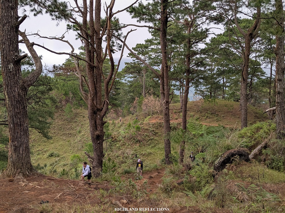
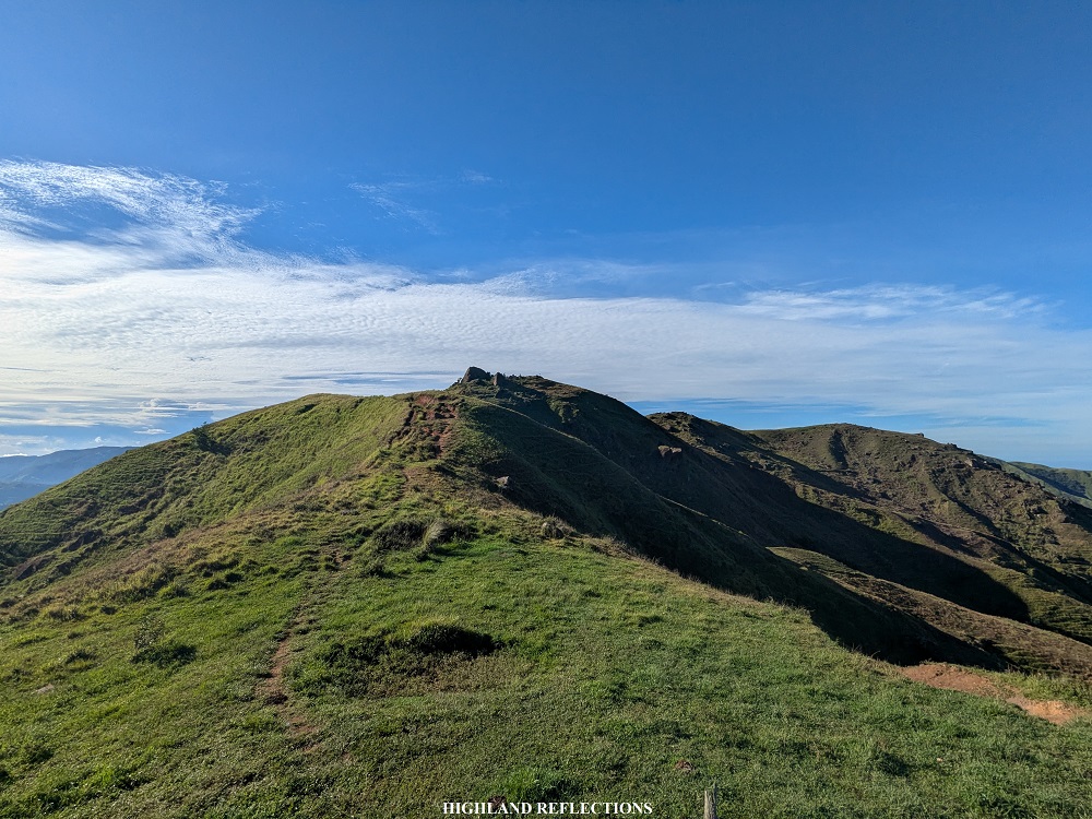
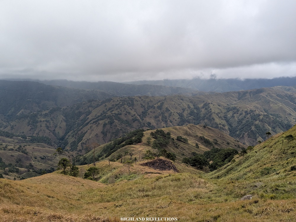
The final descent before reaching Mt. Cabo’s ridge had some perched boulders at the side of a cliff, giving a panoramic view of the mountain slopes of the neighboring Mt. Kabuan. We reached the grassy ridge after around 30 minutes of descent from the summit of Mt. Tugew. After quickly snapping some pictures, we went ahead to the base of Mt. Kabuan.

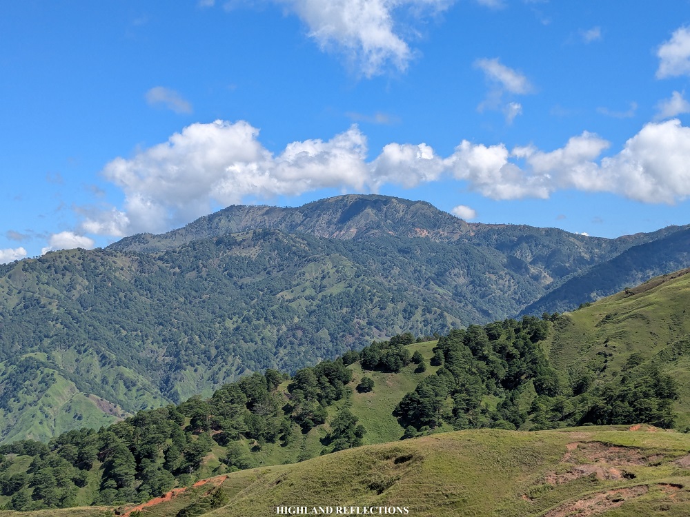
The final ascent to Mt. Kabuan involved a wide dirt path that leads to a double switch back in the middle of the grassy slopes. Here, I was able to appreciate a wider view of Mt. Ugo. I had such great memories of hiking this gigantic mountain that I can’t stop staring at it even if I was in another mountain!
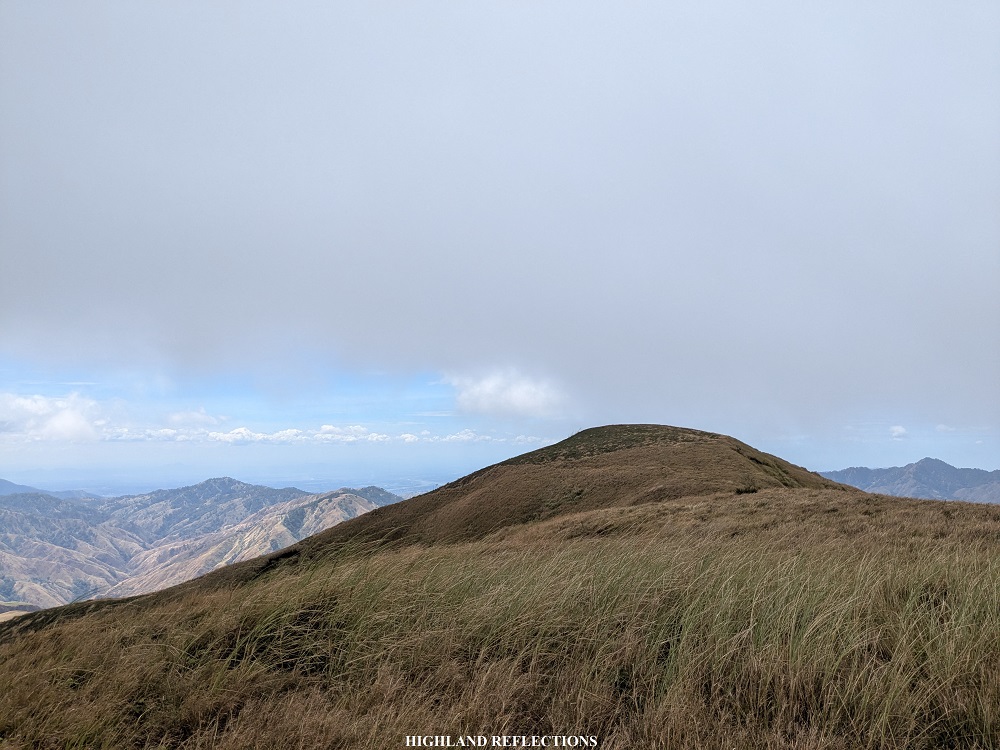
After the double switch back was a straightforward trail going to the top of Mt. Kabuan. Although Mt. Kabuan looked far from Mt. Cabo, it only took us 30 minutes to climb to its peak!

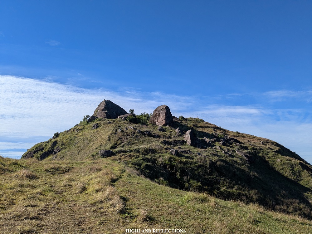
The signage of Mt. Kabuan’s summit is at the edge of the plateau. However, the actual summit of Mt. Kabuan can be seen beyond the signage, and requires a little bit of ascent on a knoll. During my first hike here in February, 2025, I was able to request from our guide to take us to the highest point of the first summit.
At the actual summit, one can notice that there is another peak conjoined with Mt. Kabuan. I decided to check it out alone with permission from our guide. From the summit of Mt. Kabuan, we had to push away tall grasses to reach the connecting trail to the second peak. In between the two peaks is a steep but short descent to a ridge, followed by a 60-meter ascent to the second peak. Upon reaching the top, I found another nearby peak! Given that I might give my tour group a burden to worry about, I decided not to pursue it and went down.
Apparently, this second summit of Mt. Kabuan is now christened as Mt. Sadjatan. I was thankful to have checked the area before its opening around August of 2025.
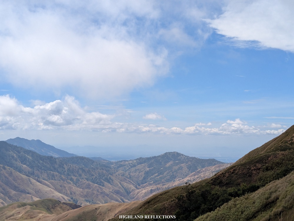
I savored the view on the trail at the side of Mt. Sadjatan—with the nearby mountains of Malico, Pangasinan, and in the distance, the lowland parts of the province.
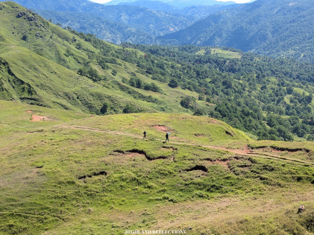
On the way back, our guide took us to a flat trail that is carved at the mountainside of Mt. Kabuan instead of going all the way up again to the summit. This trail merges with the original path at the base of Mt. Kabuan. During my second hike here, we also took this trail on the way back from the first summit of Mt. Kabuan.
Upon reaching the base of Mt. Kabuan, we backtracked until reaching the junction just before reaching Mt. Cabo. The leftward trail goes back to Mt. Cabo, while the trail to the right is the entrance to the Padilla Trail. Right we went!
The Padilla Trail is a long, straightforward path that snakes through the mountainside of Mt. Tugew. Instead of going back to the summit and negotiate an upward-then-downward trail, the Padilla Trail offers an easier path to return to the jump-off point. Since it is carved along Mt. Tugew’s slopes, caution must be exercised here as the right side of the long trail is a ravine, and the left part is an upward slope where cows roam.
Several pine trees and creeks dot the Padilla Trail. Along the way, one of the creeks served as a water source where we refilled our water bottles. We also encountered a herd of cows at one point in the trail, much of them were curious about us visitors and tried to come closer. We let our kind guides deal with them.

It took us more than an hour’s worth of fast paced walk before we reached the barangay hall of Alang Salacsac past lunchtime. All-in-all, I was able to finish both my hikes in February and June within 6 hours! Special thanks to the two local dogs who guided us the entire hike. The total trek time reminded me of Mt. Pigingan and Mt. Ulap. Even with four peaks, the Alang Salacsac hike can be managed by beginners!
After having some late lunch cooked by the locals in the barangay, we went home and left the province of Nueva Vizcaya all contented and happy that we got to experience its raw beauty. The Cordilleras indeed never fail to amaze me with its jaw-dropping destinations! The mountains near Malico, Pangasinan, and the area surrounding Mt. Tugew are some prime examples that there is more to the Cordillera Mountain Range that we must still see!
Sample Itinerary
04:00AM Alang Salacsac, breakfast and briefing
06:00AM Start hike
06:30AM Padilla Trail junction, continue hike to Mt. Tugew
07:00AM Fallen pine tree, take pictures
07:20AM Start of barren trail
07:30AM Waiting shed, rest and take pictures
08:00AM Summit, rest and take pictures
08:30AM Start descent
08:40AM Stone walls
08:50AM Boulders before Mt. Cabo, take pictures
09:10AM Mt. Cabo, snap pictures and continue hike
09:20AM Base of Mt. Kabuan, start last assault
09:40AM Mt. Kabuan, rest
10:00AM Mt. Start hike to Mt. Sadjatan
10:15AM Mt. Sadjatan
10:30AM Start the hike back to jump-off
12:00PM Start of cemented road, rest at the sari-sari store
12:30PM Back at the jump-off point, wash-up
02:00PM Ride back to Manila

Great blog, as always!
LikeLike
Thanks sir!
LikeLiked by 1 person
Anytimeee!
LikeLike