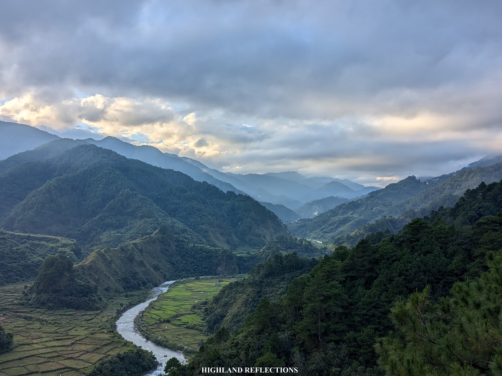
If you’ve ever been to the Cordilleras, you know that the region offers unique hiking experiences owing to the sceneries brought by the trail: pine forests, mossy forests, rice terraces, farmlands carved along mountain slopes, meandering river systems, village paths, and the undeniable cold weather atop some of the highest points in the entire country. The Sabangan Trail of Mt. Kalawitan provides an immersion into these aforementioned sceneries, in one of the most panoramic yet underrated trails in the entire region.
The Sabangan Trail can be considered as the original trail of Mt. Kalawitan. Pinoy Mountaineer’s blog entry for Mt. Kalawitan notes that the guide system for the Sabangan Trail has existed as early as 2010, thanks to the efforts of Swiss volunteer Rolf Boller. The trail, which starts at the town center (Poblacion) of Sabangan, passes through pastoral lands parallel with Chico River, just beside Halsema Highway. This trail ends at the historic Apa Campsite, an area where locals used to hide during the time of (world) war in the past. After Apa Campsite is the continuous climb up the summit, passing through pine forests in the initial parts, and mossy forest in the latter half of the trail.
MT. KALAWITAN via SABANGAN TRAIL
Jump-off point: Poblacion, Sabangan, Mountain Province
Days required / Hours to summit: 1-2 days / 6-8 hours
Specs: Major climb, difficulty 7/9, trail class 2-4
Trail distance: 22 kilometers out-and-back (backtrail)
The Sabangan vs The Talubin Trail
In the past few years, the Talubin Trail has been more frequented by hikers climbing Mt. Kalawitan. This was also the trail that I took in my first two attempts for this mountain (an account of my overnight hike can be accessed here). What are the differences between the two trails?
- The Sabangan Trail is in the town of Sabangan, which starts at either the tourism office of the town, or at the town center (Poblacion). On the other hand, the Talubin Trail is under the jurisdiction of Barangay Talubin in the town of Bontoc, and starts at the Golden Farm Resort.
- The Sabangan Trail accesses the western portion of Mt. Kalawitan. On the other hand, the Talubin Trail is located on the northern ridge of the mountain (see STRAVA map below).
- The Sabangan Trail is much more steeper but shorter, with a trail distance of 22 kilometers out-and-back. The Talubin Trail is much more gradual but longer, with a trail distance of 28 kilometers out-and-back.
- The Sabangan Trail has an initial flat trail that runs along the rice terraces beside Chico River. This would extend up to Apa Campsite. On the other hand, the trail after the Golden Farm Resort immediately welcomes hikers to a pine forest ridge.
- There is a loop trail known as the ‘Kalawitan River Trail’ which starts and ends at the Talubin Trail. The junction for this loop river trail is found in the upper reaches of the Sabangan Trail. The author of this blog has never tried this trail combination.
- Both trails are equally scenic, with the Sabangan Trail having the higher difficulty level as per the consensus of our group during this hike.
Enough with the details! Let’s get on with our story of climbing Mt. Kalawitan via Sabangan Trail!
Day 1: Sabangan Farmlands, Apa Campsite, Asoan Pine Forest, and the Hunter’s Camp
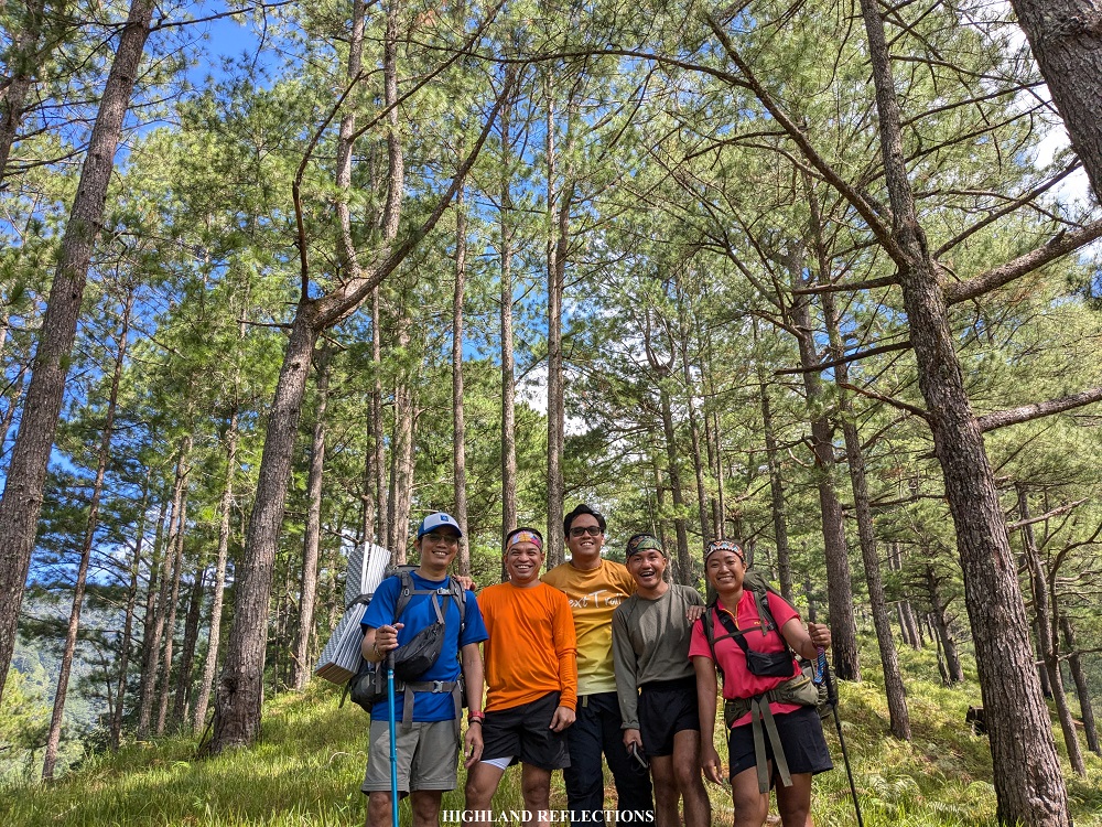
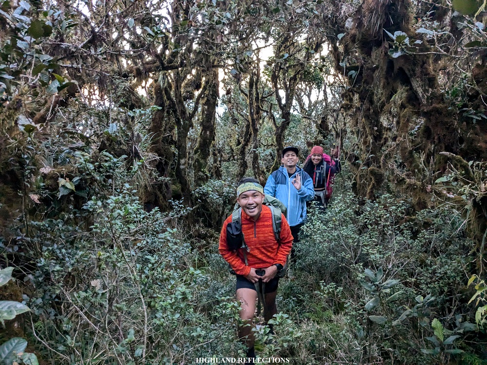
In my adventure of climbing Mt. Kalawitan via the Sabangan Trail, I joined an event by ILocanang Gala. Even with my hectic schedule in the academe, I immediately signed up for the event when Ilocanang Gala herself sent me a message for this hike, as this has been in my bucket list for so long, and I badly wanted to cross it out! Several familiar faces were in the hike. There was Khael whom I joined with in my Mt. Mandalagan and Mt. Isarog climb, together with his best friend Rainer, who I met in Mandalagan. There was also Ryan, who I met in Mt. Al-al and Mt. Isarog just this year. Of course, the organizer, Ilocanang Gala herself, Rochelle, whom I have joined in her Mt. Mandalagan and Mt. Bullagao events. Another familiar face was Luz, an avid trail runner who I met in my Mt. Namandiraan climb. Together with them are eight individuals who are also passionate people of the outdoors.
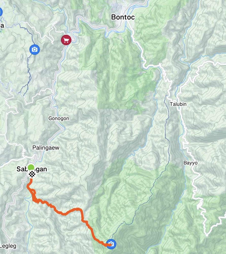
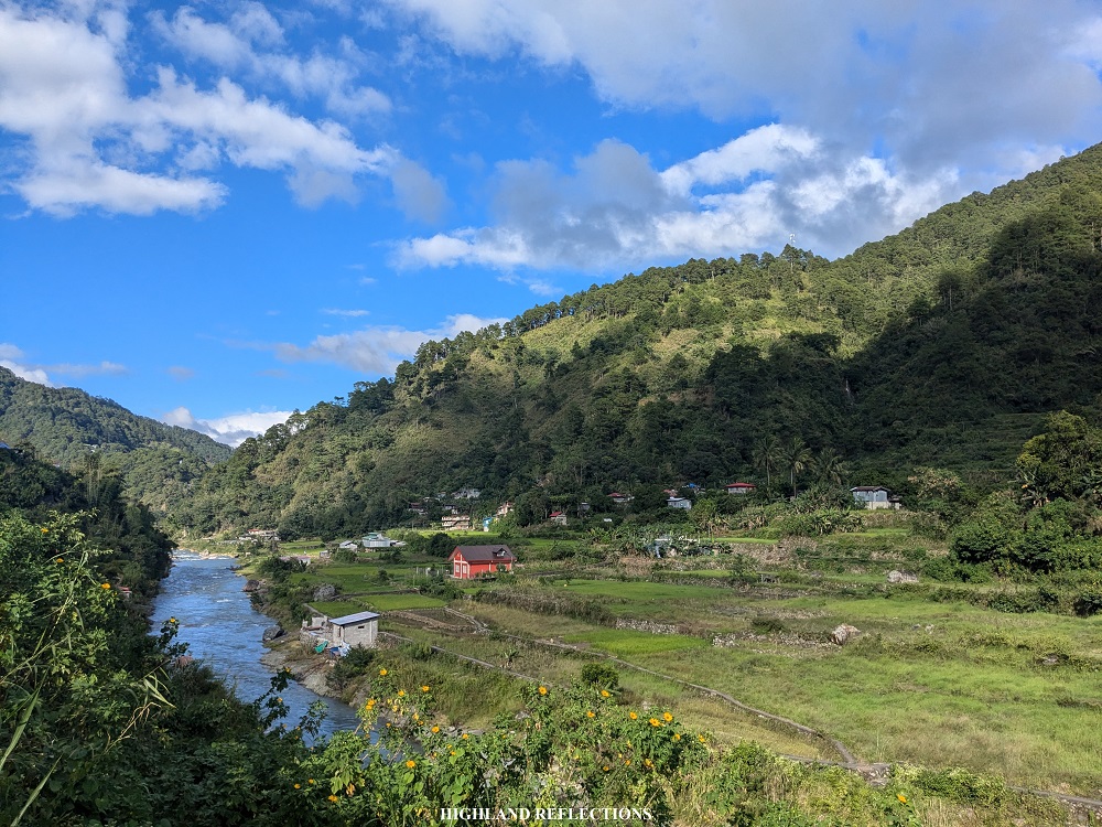
We arrived at the tourism office (1,240+ MASL) of Municipality of Sabangan at around 6:40 in the morning after a five-hour ride from Baguio City and a short breakfast session in the town of Buguias. The office was just beside the Halsema Highway, providing panoramic views of Dagiwdiw Rice Terraces below, constructed strategically beside Chico River. Behind these pastoral views is the towering western façade of Mt. Kalawitan, with its summit visible from this vantage point. This, I think, is an advantage of the Sabangan Trail compared to the Talubin Trail – you would have a view of the entire mountain that you will be climbing from the jump-off point, whereas the jump-off point of the Talubin Trail is so far from the summit that you won’t have any views of it. We took so many pictures at the view deck of the tourism office as the panorama was just breathtaking!
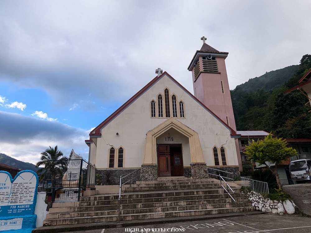
After meeting with Cloe, one of the officers at the tourism office and our would-be guide and porter, we climbed aboard our van and went to the Poblacion of Sabangan, located just below Halsema Highway (1,055+ MASL). Our van parked in front of the town’s church. There, we prepared our equipment. Once everything was accounted for, we started the hike. It was 7:50 in the morning.
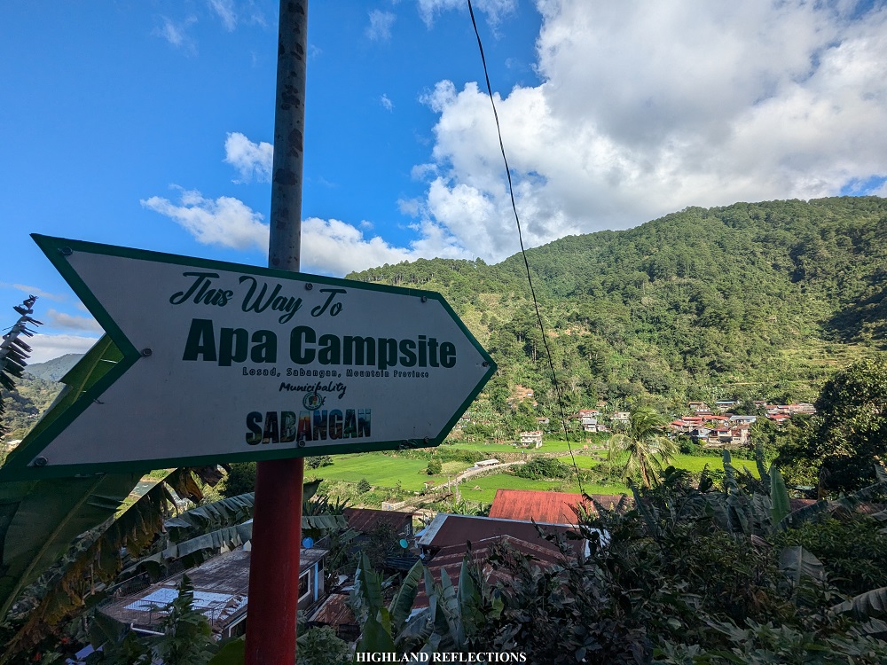
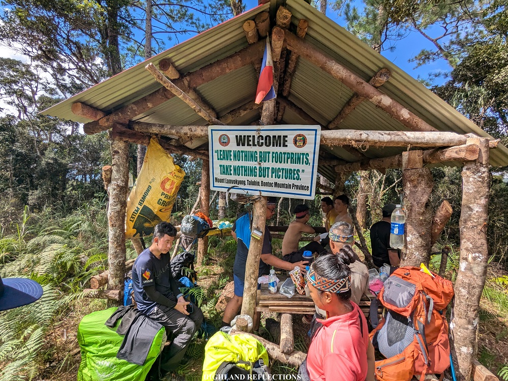
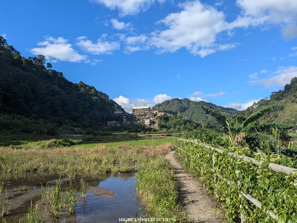
We initially followed the community road before descending to the farmlands of Sabangan. The first part of the trail was on a dike beside Chico River. The sun was up during our hike and we were all exposed to its heat and brightness. Then, we met with our other guides and porters at a junction marked by a welcome tarpaulin marking the start of the trail to Apa Campsite. Past this, we crossed a metal hanging bridge to get to the other side of Chico River (1,040+ MASL).
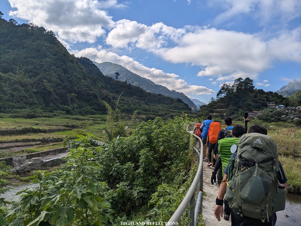


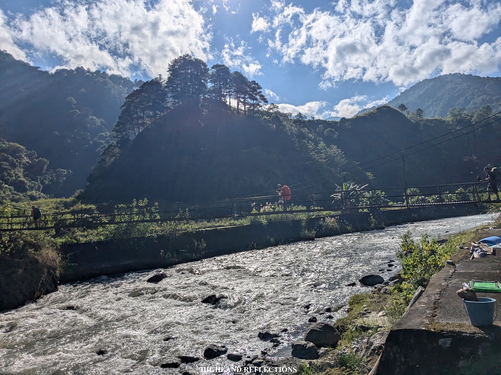
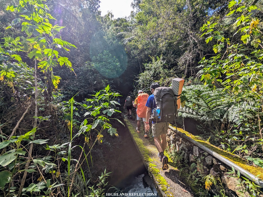
We inched closer to the foot of Mt. Kalawitan past the hanging bridge, entering a valley where to our front is the entire mountain range of Mt. Kalawitan. To our right is a grassy hill attached to Mt. Kalawitan’s slopes, which we will be taking on the descent the next day. The trail here runs on a humid grassland that runs parallel with another river system in the town of Sabangan, the Kapangdanan River, which was much smaller but more intense than Chico River, providing irrigation and water supply to the town of Sabangan. As the river was not advisable to be crossed due to its strong currents, our guides decided to divert and climb up a slope before arriving at a cemented pathway that runs above Kapangdanan River. This cemented path was quite narrow, and one misstep could leave us falling onto the raging river to our left!
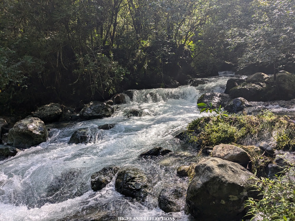
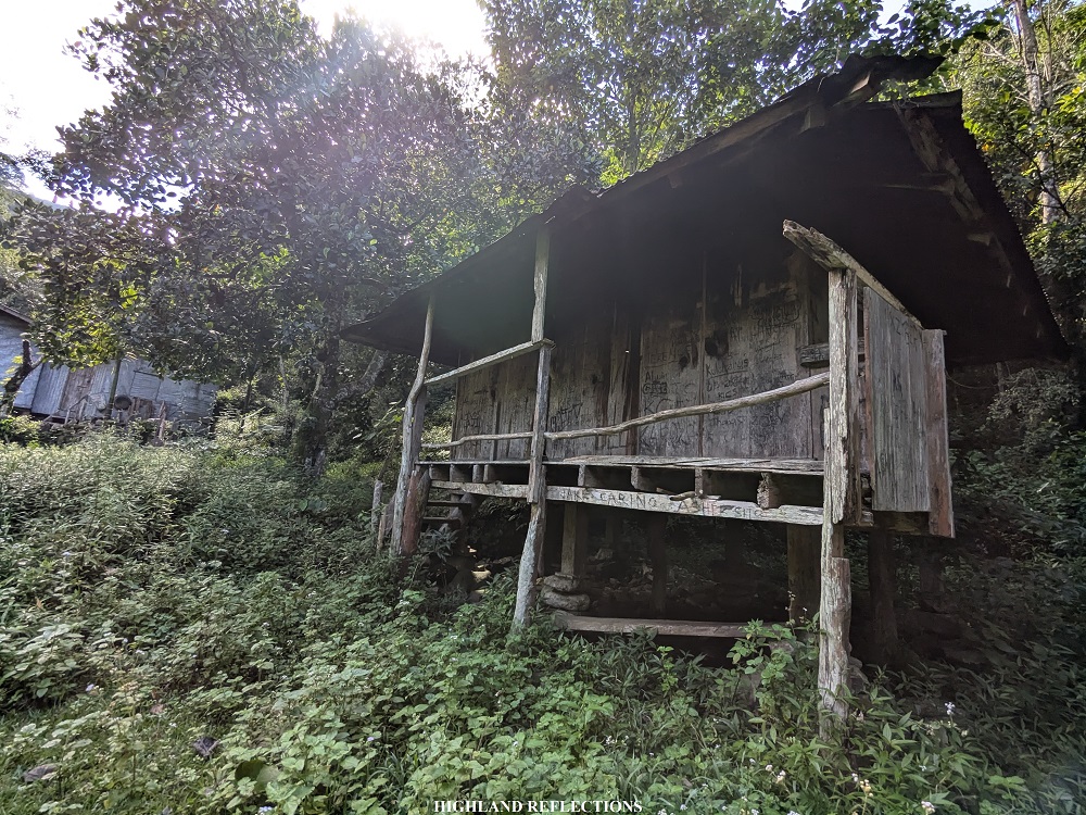
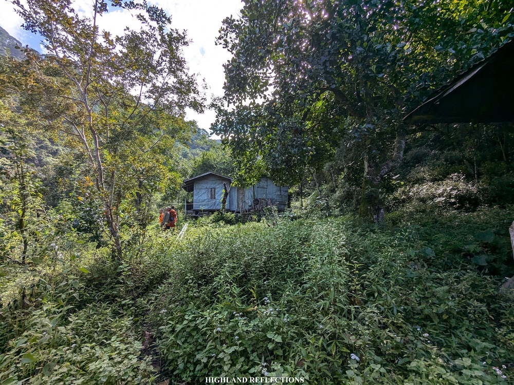
The last few portions of the cemented path almost meets with the waters of Kapanganan River. You’d know this trail would be unpassable if there was ever a storm or nonstop torrential rain! Just past this portion was Apa Campsite (1,185+ MASL), also known as Camp 1, which we reached at 9:40 in the morning, after two hours and covering 4 kilometers of nonstop walking! The campsite had a hut and a makeshift homestay in its vicinity, complemented by a water source, where we refilled our bottles. We tried to rest here for a moment.
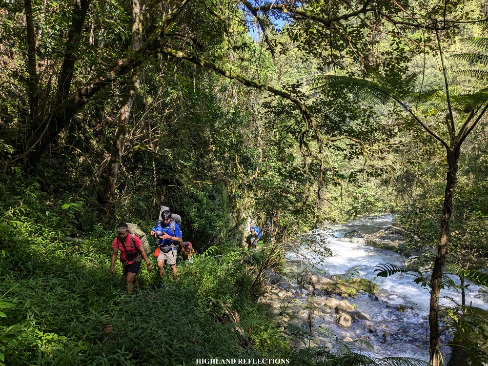

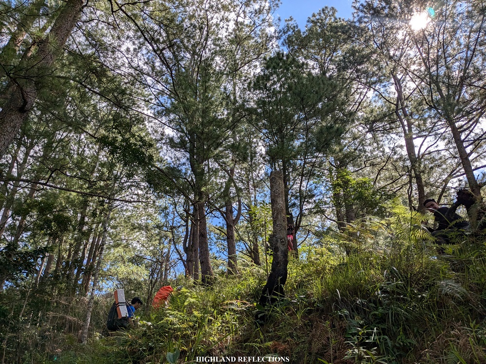
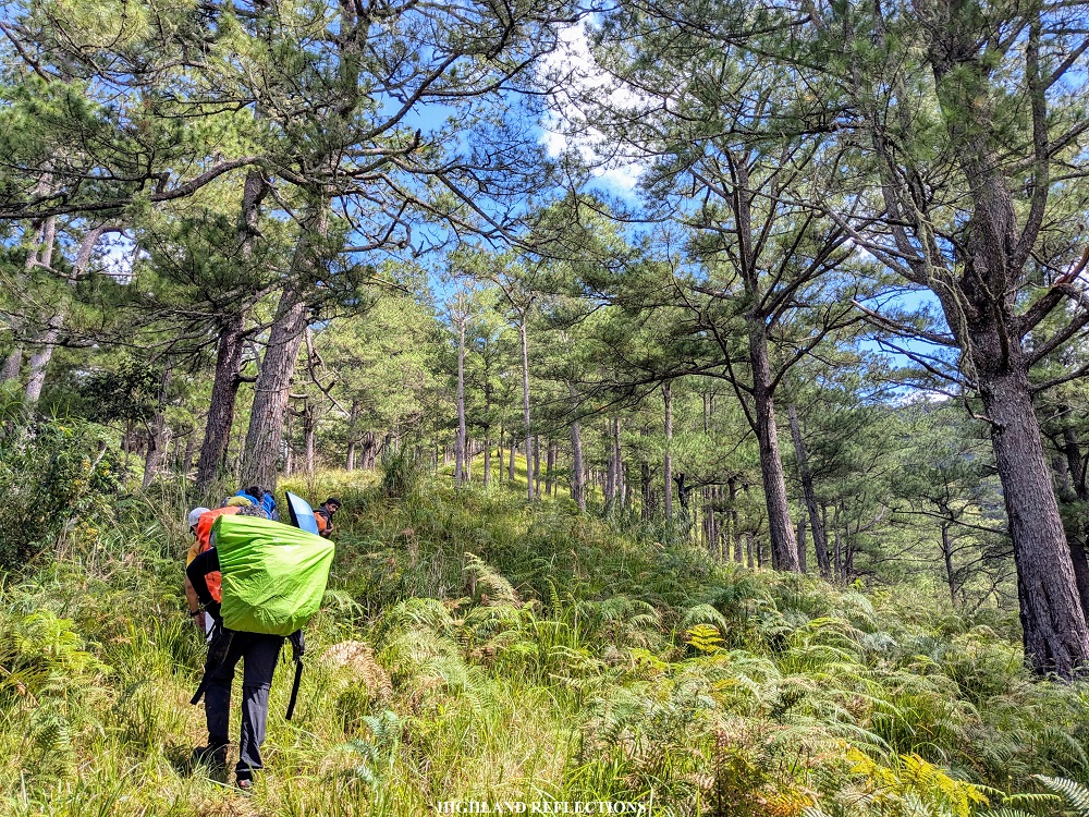
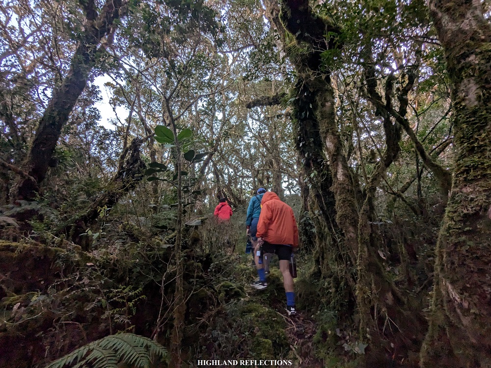
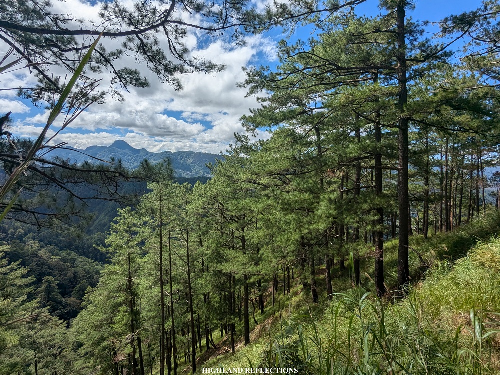
Continuing the hike, just after a few minutes past Apa Campsite, we encountered an unreinforced cemented bridge on top of Kapangdanan River (1,200+ MASL). Opposite of this bridge marks the beginning of the nonstop ascent to the summit of Mt. Kalawitan! A short cemented pathway welcomed us opposite of the bridge, which continues up a very steep trail with bushes on the side. This was where we slowed down, as the trail was too sharply inclined, and was painful to the knees! Then, pine trees started showing up, and, in no time, dominated the entire surroundings. With the steepness and switchbacks, it was like I was transported to Mt. Pulag’s Akiki Trail! This was now the start of the Asoan Pine Forest trail.
Upon reaching a few hundred meters of elevation, we decided to have our first rest after that punishing round of steep ascent. As we were resting, we spotted Mt. Polis in the town of Bauko, which I climbed back in 2022! I later on found out that the town of Sabangan also claims jurisdiction of Mt. Polis, and calls it Mt. Oona instead.


We continued with the ascent. The steepness dissipated but only for a little bit, as the ascent was still quite painful to the legs! The switchbacks (zigzag trail) also disappeared as we were now taking the entire slope in a straightforward ascending fashion! We found ourselves resting again just after covering one hundred meters of elevation gain. Good thing was that I was with passionate and patient companions. We were all taking our time with the rest-climb routine, all while exchanging stories and sharing rants of the hike’s difficulty!
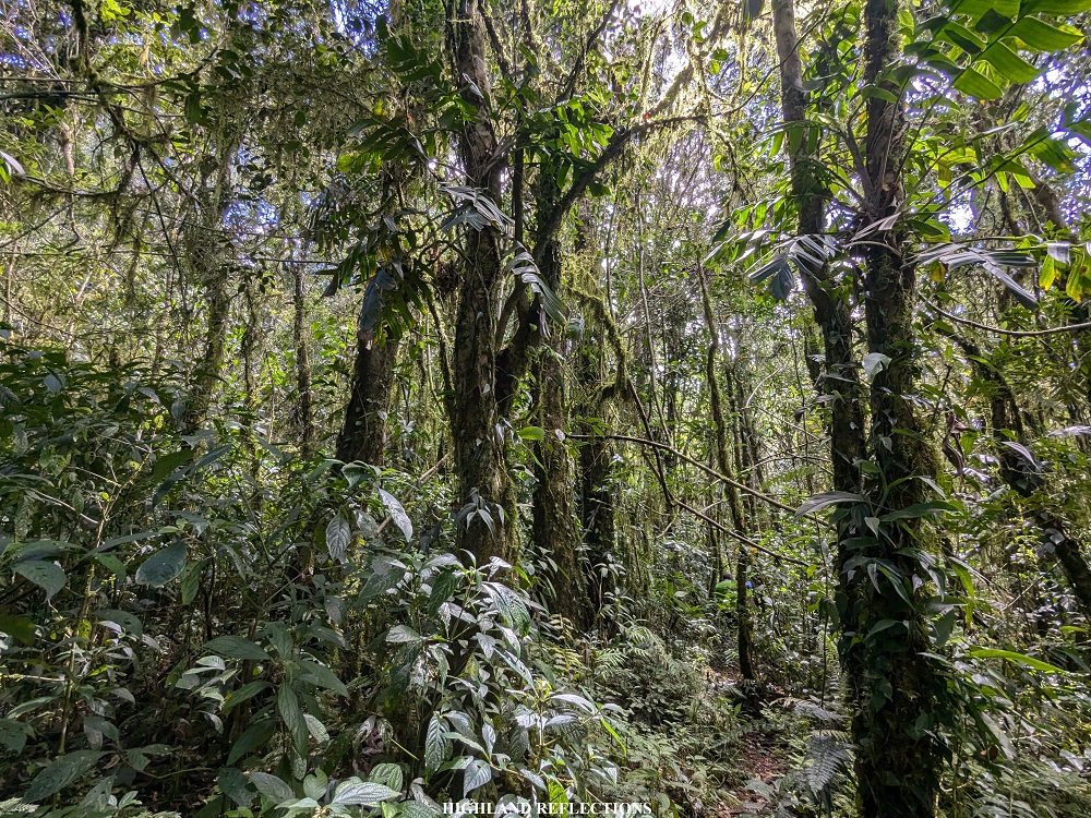
After gaining almost more than 500 meters of elevation and spending two hours with the rest-climb routine, we were welcomed by a thick undergrowth, marking the entrance to the mossy forest (1,730+ MASL). It was twelve noon. This was such a welcome situation for us as we were now spared from the heat of the sun coming from the moderately exposed trail in the Asoan Pine Forest! I could feel our pace expediting for a little bit! I don’t even remember us resting at this point.
After gaining a hundred meter elevation, we reached a junction after passing by a cemented waiting shed in the middle of the mossy forest, marked by wooden barriers. The trail opposite of this wooden barrier leads to two paths: a pine forest trail that descends to one of the slopes near Sabangan Poblacion (this route was used in the Kalawitan Sky Run (a trail run event) in March of the same year), and the other path leads to the Kalawitan River Trail, which merges with the portion of the Talubin Trail just above the Golden Farm Resort in Bontoc. Of course, we ignored the wooden barrier and continued the hike up the Sabangan Trail.
Past the junction are some gradual ascents and some flat portions of the trail. The forest here was such a nice treat, as our body and souls were bathed with the greenery surrounding us. Another round of hundred meter ascent ensued, leading to the Hunter’s Camp (Camp 2; 1,940+ MASL). It was 12:50 in the afternoon, five hours after starting the hike. We had our lunch here. A nearby stream served as our water source, where our guides refilled our water containers.
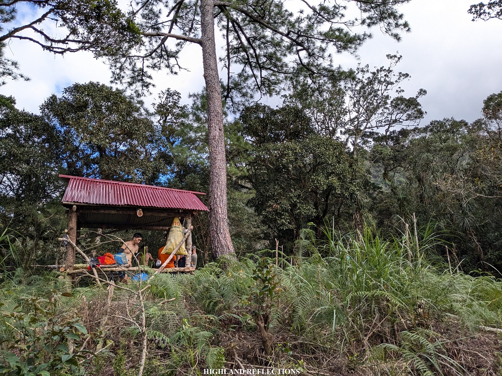
Although most of us wanted to set camp at the summit, our guides decided to set camp at Camp 2. This was due to three reasons. One, our guides think it is more strategic to set camp here as there was a nearby water source. There was no water source at the summit, which would make it difficult for us to cook and have spare water supply for everyone. Second, it would take three to four hours to reach the summit, which would mean that we would arrive before nighttime, prompting us to cook dinner late. We would also later on find out that the weather and wind at the summit was unbearably cold! Lastly, our guides had not yet taken their lunch, and they would need to take a longer break than us since they would need to cook first. This would delay our summit bid if we continued with the assault on the first day. Since we were at the mercy of our guides, we obliged. We pitched our tents at the campsite and called it a day.

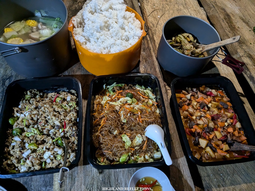
At 7 in the evening, we had our dinner consisting of sisig, menudo, pansit, nilagang baboy, and pinakbet. We stuffed ourselves with these hearty food – a much-deserved treat after an arduous first day! Afterwards, I tried having socials with Rochelle, Khael, Rainer, and Edward. We rested for the summit assault afterwards.
Day 2: Summit and Back
Time check: 3:00AM. Due to the fog surrounding the campsite, we all thought it was raining. This prompted us to delay our summit assault and extended our rest inside our tents. But of course, a lot of my companions wanted to do the summit assault. So one-by-one, they got out of their tents to prepare. I, on the other hand, wanted to continue with my well-deserved rest, as I didn’t have the chance to sleep in our van ride going to Sabangan the previous day. But as with my previous climb in Mt. Kalawitan, the only thing that motivated me to get up was the fact that this mountain’s name literally means “to climb” in the Kankaney language! If the mountain’s name is already inviting those who dare enter its domain, who am I to reject it? Yup, that’s how superficial my reason was to get me going.
To climb or not to climb? In Mt. Kalawitan, the answer is only “to climb!”
Kalawwit!
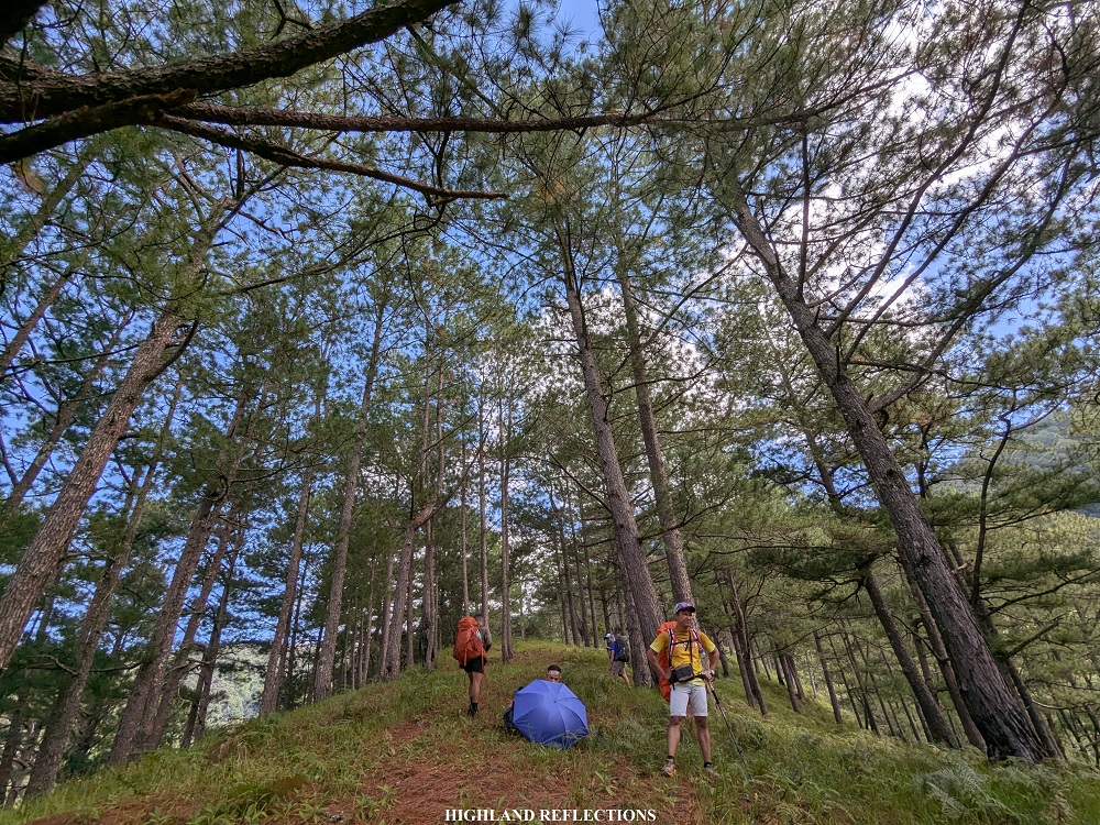
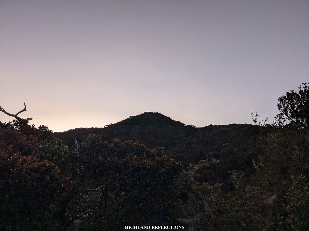
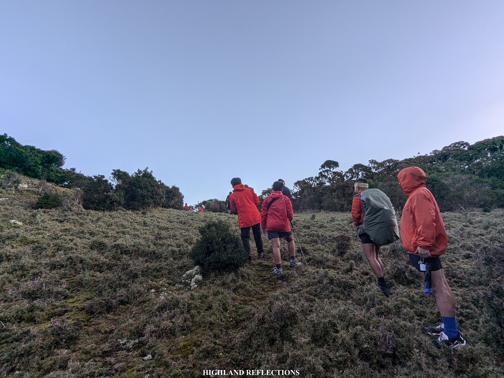
And thus started our bid for the summit. As the mountain’s name implies, the trail was all ascent. Its steepness was highly reminiscent of the trail after the Bantang River Camp in Mt. Madjaas in Antique. The steepness dissipates for a bit at around 2,190+ MASL, as we were welcomed by a wide flat ridge. Past this portion is where the ascent continues on a short pine forest trail before returning to the usual mossy forest environment.
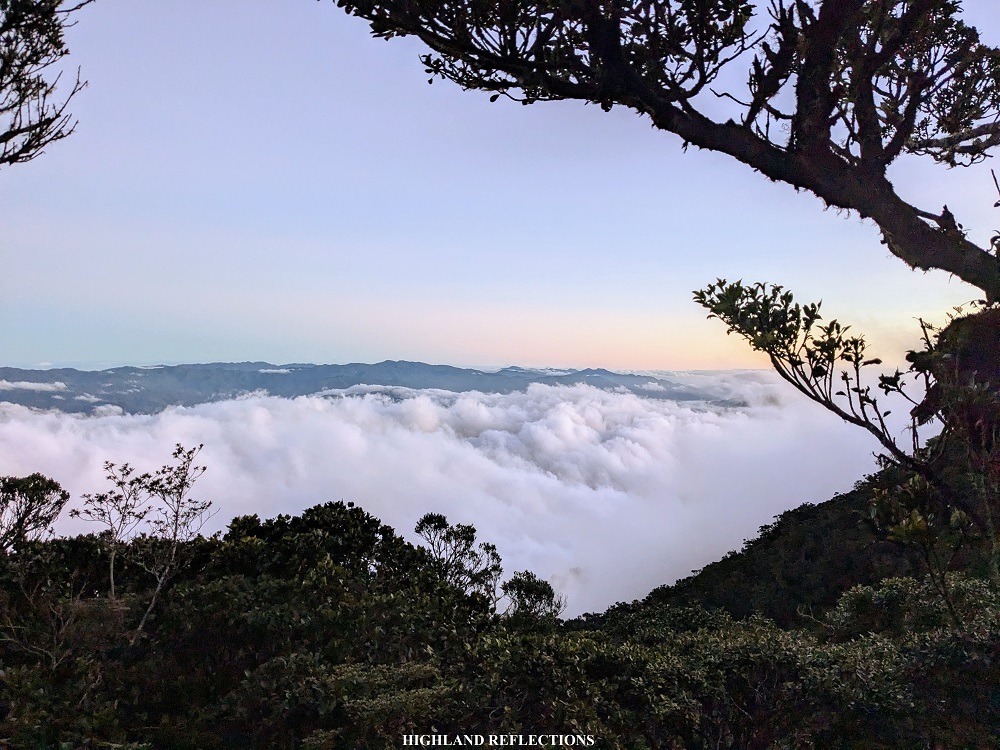
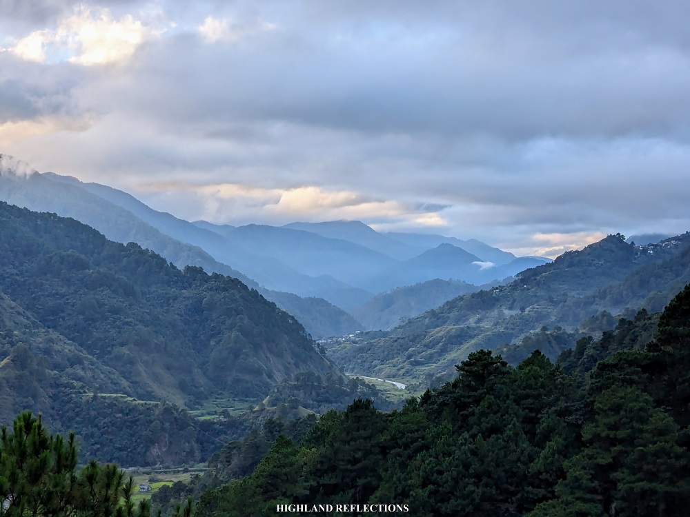
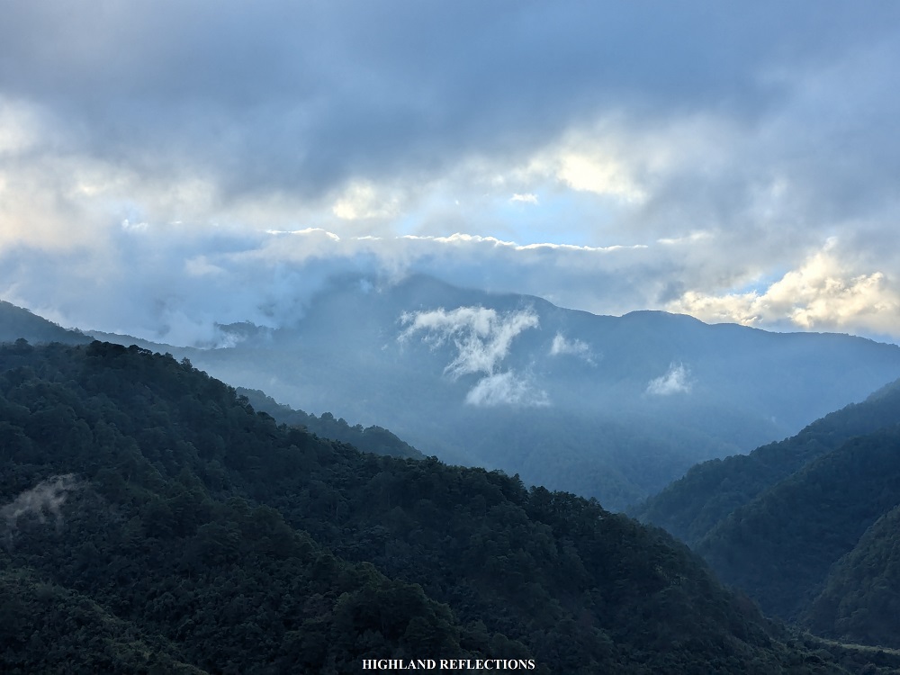
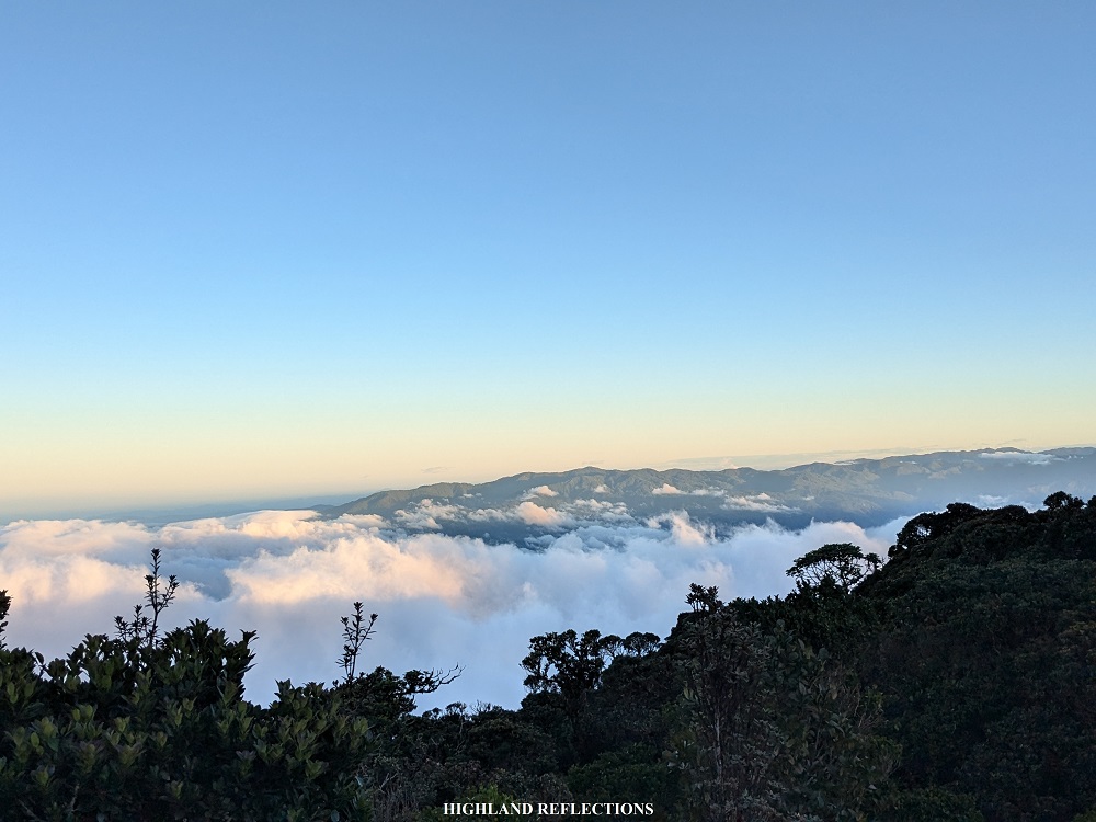
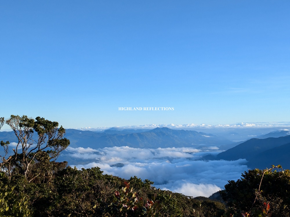
As we gained more elevation, mosses became thicker and thicker. And as the first ray of light illuminated the surroundings, we were blessed by a sea of clouds scenery beside the trail, energizing us to continue the climb. At around 2,540+ MASL, we stopped by a view deck marked by a pine tree at the side of a ravine on the left part of the trail, providing a vista of the the sea of clouds panorama in the northern direction. In front of us, we could already see the forest-covered summit of Kalawitan!
Past this view deck was a very short, almost 70-degree descending path. Of course, as we were doing a summit assault, we knew this would be compensated by an equally steep ascending path at the other side! This ascending path required us to climb 80-meters of elevation, ending at an open area filled with tiny bamboo grasses, reminiscent of Mt. Pulag’s upper reaches! Another view deck was present here (2,625+ MASL).
After snapping some pictures, I decided to go ahead and leave my companions. I entered again a mossy forest trail. At this portion, the mosses were much thicker and much more verdant! The entire surroundings was, for the lack of a better term, alive! Inching closer to the summit, I passed by a dried swamp where the ground was also covered in moss.
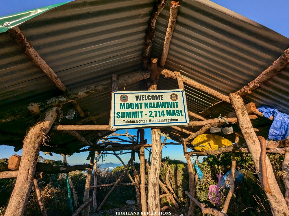
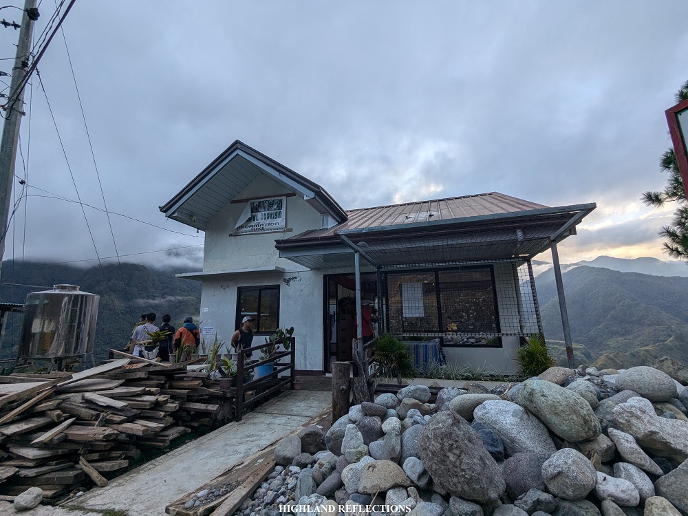
At 6:20 in the morning, after less than three hours of climbing from Camp 2, I finally reached the summit of Mt. Kalawitan! From the mossy forest, I emerged at the rear portion of the summit, where a makeshift waiting shed and viewing platform was present, complete with a signage inscribed with the words “Welcome Mt. Kalawwit Summit – 2714 MASL, Talubin, Bontoc, Mountain Province.” A few meters away from this waiting shed is what is considered as the “front part” of the summit where the summit marker and the iconic tree is located. As I was the first to arrive at the summit, I climbed the iconic tree and enjoyed the view of sea of clouds panorama from up there! One by one, my companions arrived. I had my pictures taken atop the tree.

I had my breakfast after snapping some pictures. As the chilly wind was blowing strong, I settled at a covered area at one of the portions of the Talubin Trail near the summit marker. Afterwards, I joined with the rest of the group taking group photos.
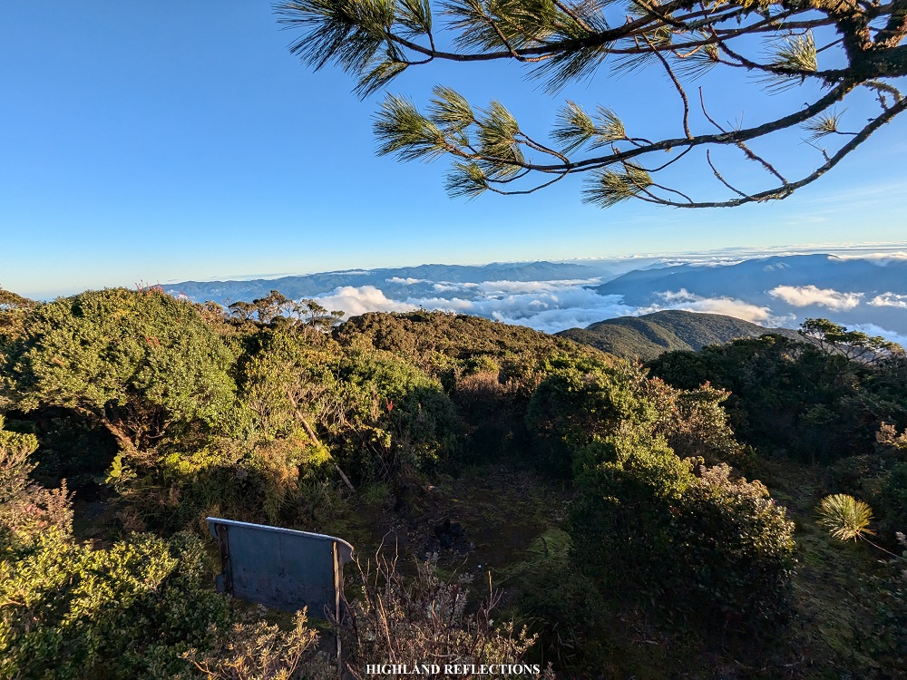
As everyone seemed to be busy taking turns snapping pictures, I decided to relax by the waiting shed. My interest, though, was piqued by the viewing deck atop the shed! Could the platform provide me a three-hundred and sixty degree view of the surroundings? As I made my way on top of the platform, I let out a smile. Since the thick dwarf trees block the entire view at the summit, I was happy to see that the surrounding mountains were visible from the platform! And not just the nearby mountains, even the faraway mountains of Benguet and Ilocos Sur were visible from that vantage point.
Of course, time for a site orientation!
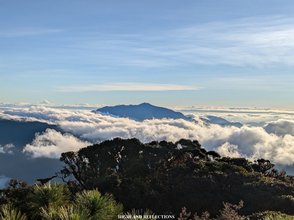
At the direction of the iconic tree, which was east-northeast, the neighboring Mt. Amuyao in Barlig, Mountain Province rises above the clouds. This mountain is like a twin sister of Mt. Kalawitan, as both mountains are culturally significant for the peoples of Mountain Province. I was fortunate to have already climbed Mt. Amuyao twice in the past, one coming from Barlig, and the other was the mega traverse from Batad to Mayoyao, Ifugao.
Shifting my view to the opposite direction, which was the main view provided by the platform, the perspective to the west provided such a vast panorama of the surroundings. Just below us, the mountains and even the barangays of Bauko are partially visible, blocked by the cloudscape below Kalawitan’s summit.
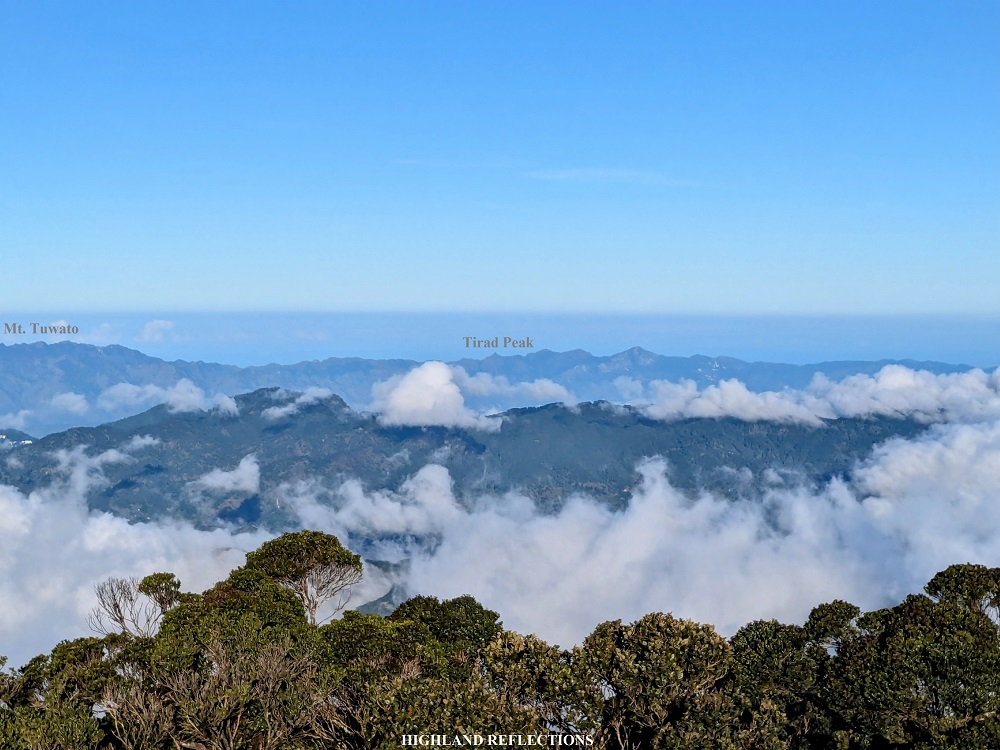
Beyond Bauko, an expansive view of the Ilocos Sur mountains were present! The pointy Tirad Peak in Gregorio Del Pilar, Ilocos Sur can be spotted, which I hiked back in 2020. Shifting my view a bit to Tirad Peak’s left, I can only assume that the higher mountain with several crests is the formidable Mt. Tuwato in the boundaries of Cervantes and Sigay, Ilocos Sur. To the left of Mt. Tuwato was a much more gigantic mountain that seems to almost rival the height of Mt. Kalawitan. I surmised that this was no other than Mt. Namandiraan in Cervantes, Ilocos Sur’s highest mountain! I was able to climb this mountain back in 2023.
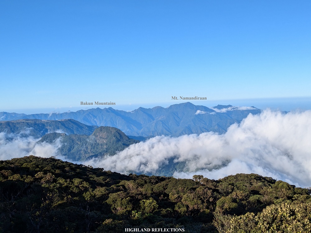
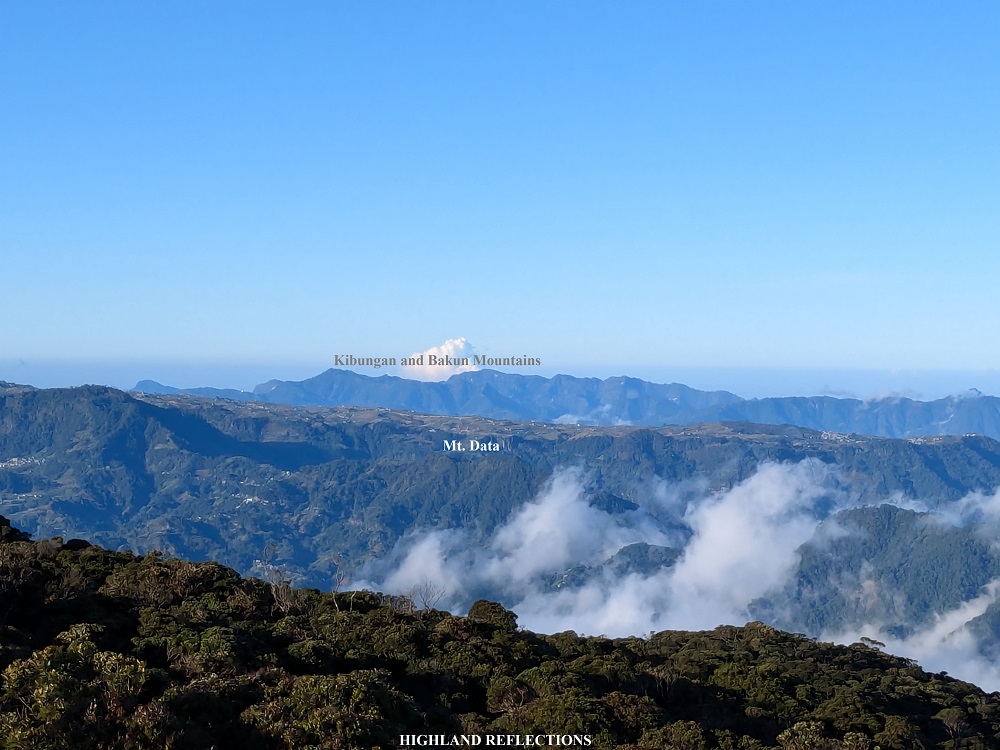
To the left of Namandiraan, in the west-southwest direction, is a stretching mountain range extending towards southwest and south-southwest. If you have some knowledge of geography, you can pretty much already infer that these mountains are no other than the Bakun and Kibungan mountains in Benguet! Of course, it was quite difficult to pinpoint which was Mt. Patullok, Tenglawan, and Kabunian. It was also quite difficult to distinguish the Kibungan mountains such as Mt. Tagpaya and Mt. Tagpew, as there are other unnamed mountains with 2000-meter elevations in that area.
Shifting my view to the left of the platform, which was south, I was brimming with joy seeing a very faraway pointed mountain rising above the clouds. The pointed shape of this mountain is so recognizable that I was sure of what mountain it was – it was no other than the highest point in the entire Luzon Island, Mt. Pulag! I was so giddy pointing it out to my companions.

To the front of Mt. Pulag are several mountain domes that rise up above the sea of clouds as well. Now this was where I was unsure which mountain is which. What I am sure is that, since these mountains are up above the clouds, they are the highest mountains of Luzon together with Kalawitan and Amuyao. I can only try to infer from their relative positions compared to Mt. Pulag.
To the left of Mt. Pulag, which was nearer from our perspective, was the venerable Mt. Napulauan in Hungduan, Ifugao, which I climbed back in 2019 (I am excited to return to this mountain some time soon). To the right of Mt. Napulauan is a nearer mountain dome, which I think is Mt. Kapiligan, one of the candidates to be one of the highest mountains of Luzon. Near Mt. Pulag, there was a peeking mountain slope behind Kapiligan. Upon tracing the mountain via Google Earth, this was most probably Mt. Tabayoc in Kabayan, Benguet, the second highest mountain of Luzon, which I am also planning to return to soon! To the right of Mt. Kapiligan was another near mountain which I can only assume was Mt. Molmog (also called Mt. Abao in geographical maps), another candidate to be one of the highest in Luzon and which I am planning to climb soon, as there seems to be guides in Bauko who have already summitted the mountain in the past. Shifting my view to the right, a faraway view of Mt. Timbak, the third highest mountain in Luzon, can be seen, although I wasn’t able to capture it in the photo above.
If ever that a list of top ten official highest mountains in Luzon are to be created, then these mountains mentioned would make it to the list, with Mt. Pulag, Tabayoc, and Timbak comprising the undisputed top three highest. However, the spots for the 4th, 5th, and 6th highest is still tentative, as there seems to be inconsistent readings in past and present elevations of the three candidate mountains: Mt. Al-al (also called as Mt. Panotoan, which is located near Pulag and Tabayoc, and not visible from our vantage point as it was being covered by clouds), Mt. Kalawitan, and Mt. Amuyao. These three are followed by Kapiligan (unverified elevation), Molmog/Abao (there may have been readings of past hikers who have climbed this mountain), and Napulauan.
To create this official list, the elevations for Kalawitan and Amuyao need to be reassessed as their elevations seem to only sit at 2660-2680 MASL when viewed from new mapping models, a bit lower than the mainstream 2714 and 2702 MASL elevations respectively. On the other hand, official elevations must be assigned for Mt. Kapiligan and Mt. Molmog.
(At this point in my writing, I just realized that I have nerded out too much for this blog. Sorry po! This is really something that I am passionate about and I would like to do this project of verifying their elevations in the future!)
Anyway, to end this site orientation, at the north-northwest direction, the town of Sagada can be spotted. When I pointed that out to Cloe, our guide, she was able to spot the towers of Mt. Ampacao, the highest point in Sagada, although I admit I wasn’t able to spot it. She was also able to spot Marlboro Hill! What I spotted, however, was the higher mountain behind Sagada, which I can only assume as Mt. Sisipitan, a non-mainstream hiking destination at the boundary of Sagada and Besao, which I mentioned in my Mt. Ampacao blog. Finally, to the north, the mountains of the province of Kalinga are visible. As I have only been to Kalinga once, I have no knowledge of the mountains in that area.

Anyway, at this point, you are probably exhausted now from the info dump I did above. Let’s get started with the descent.
We decided to descend around 8 in the morning. It was so nice to finally move again as we were all chilled from the windy breeze at the summit. We reached the campsite around 9:30 in the morning. We rested and broke camp while waiting for our breakfast to be cooked.

After breakfast, we started the final descent at around 11:30 in the morning. I was mostly in the middle group chatting with Ma’am Luz to pass the time. However, since I was also stopping by to take some photos, she went ahead, leaving me alone in the trail. After an hour, I reached the start of the Asoan Pine Forest trail, where I could spot Ma’am Luz and the lead group resting at a pine forest slope a hundred meters below me. Good thing was that they were resting and taking pictures, so I had the time to catch up to them.
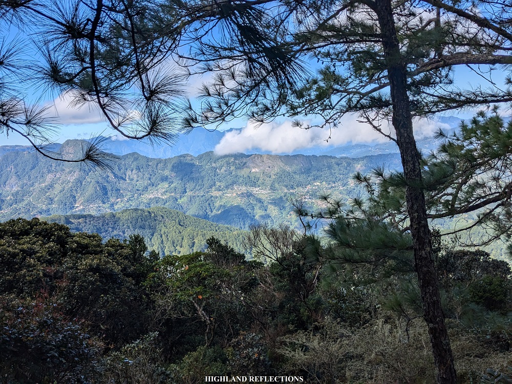
When I arrived at where they were resting, the rest of the group went ahead. Good thing was that Ma’am Luz, Ryan, and his companion, Gelo, were still resting. I was with the three of them for the entire descent in the Asoan Pine Forest. While descending, we would sometimes stop to snap some pictures in the middle of the pine forest. I also spotted a nearby pointed mountain nearby while descending. Upon looking at my map, the mountain was Mt. Sesekan in the boundaries of Bauko and Sabangan. Locals of Sabangan also call this as Mt. Lamagan.
We reached the end of the pine forest, where the overly-steep switchback trail is located, at one in the afternoon. In no time, we were at the vicinity of Apa Campsite. It was 1:30 in the afternoon. We took the time to rest and munch on our trail food here.
After the much needed rest in Apa Campsite, we continued with our descent to return to the jump-off point. Here, we negotiated once more the perilous cemented trail above Kapangdanan River. At this point, I was concentrating on every step, since getting distracted meant tripping and falling onto the ravine and into the river to our right.
We noticed that the cemented trail was quite a bit longer than how we remembered it. Everyone of us did not notice that our guide did not detour onto the trail that we took yesterday, and, instead, took us further straight on the cemented path. This, apparently, led to upper portions of the hill that we spotted when we entered the trail near Kapangdanan River the day before!
As we reached the edge of the grassy hill, located above Dagiwdiw Rice Terraces, we started the descent towards the Sabangan farmlands. The descending trail was quite perilous, as it was steep and unstable. Additionally, there was a ravine to our left, and with the instability of the rocks at the trail, we could only hold on to the cogon grass to our right for dear life. Good thing was that we had nice views of the Sabangan farmlands and Chico River while descending. We could also spot the hanging bridge that we had to cross from afar!

In no time, we reached the bottom part of the hill on to a farm path leading to the hanging bridge. Then, we crossed the hanging bridge and back tracked the dike leading to the community in Poblacion. We reached the community at 3:30 in the afternoon. With our almost equal pacing, everyone in the group arrived in no time. Our van fetched us to bring us back to the tourism office in Halsema Highway, where we washed up before going back home.
As we were starting the van ride back home, I was staring at Mt. Kalawitan. I was fulfilled for finally doing one of my long-time hiking goals. Back then, when we would go to Sagada or Bontoc, we would pass by the town of Sabangan on the way home, and I would only wonder where the Sabangan Trail would start and where it was carved on the mountain slope that I was staring at. This curiosity started when I read Pinoy Mountaineer’s blog entry for Mt. Kalawitan more than ten years ago. I’m glad to have finally fed this curiosity of mine.
We reached Baguio City at 10 in the evening, where we had our celebratory dinner at Good Taste.
Of course, just like any other of my blogs in the mountains of the Cordillera Region, I would always end with something like: The North never ceases to amaze me. And it’s only because it’s true! I have been in this region many times since I was a kid, more so when I started regularly hiking back in 2018. But in the numerous times that I’ve gone here, it always surprises me with more picturesque spots, more panoramic views, and fresh set of transformative experiences that satisfy my curious soul. To Mt. Kalawitan and the titans of the Cordilleras: see you again and again in my future climbs up the amazing North!
Itinerary
Day 1
06:40 AM Sabangan tourism office (1,240 MASL), register and orientation
07:00 AM Sabangan Poblacion (1,055 MASL), prepare equipment
08:00 AM Start hike
08:30 AM Hanging bridge (1,040 MASL)
09:40 AM Apa Campsite (1,185 MASL)
10:00 AM Resume hike to Asoan Pine Forest
12:00 PM Mossy forest entrance (1,730 MASL)
01:00 PM Hunter’s Camp (1,940 MASL), lunch
03:00 PM Set camp at Hunter’s Camp
07:00 PM Dinner
08:00 PM Lights out
Day 2
03:00 AM Wake-up call
03:40 AM Start summit assault
06:00 AM Grassland (2,625 MASL)
06:20 AM Summit
08:00 AM Start descent
09:30 AM Hunter’s Camp, breakfast and break camp
11:30 AM Start descent
12:30 AM Asoan Pine Forest
01:30 PM Apa Campsite, rest
02:00 PM Resume hike
03:30 PM Sabangan Poblacion
04:00PM Back at tourism office, wash-up
05:00 PM Start ride back home
10:00 PM Baguio City, dinner
For contact details, you may coordinate with the Sabangan Tourism Office in their social media pages.
