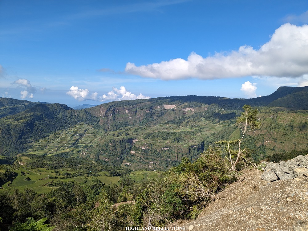
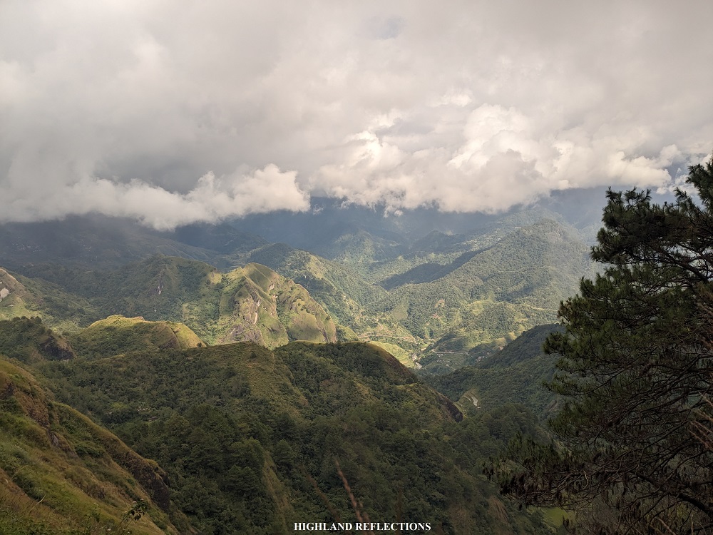
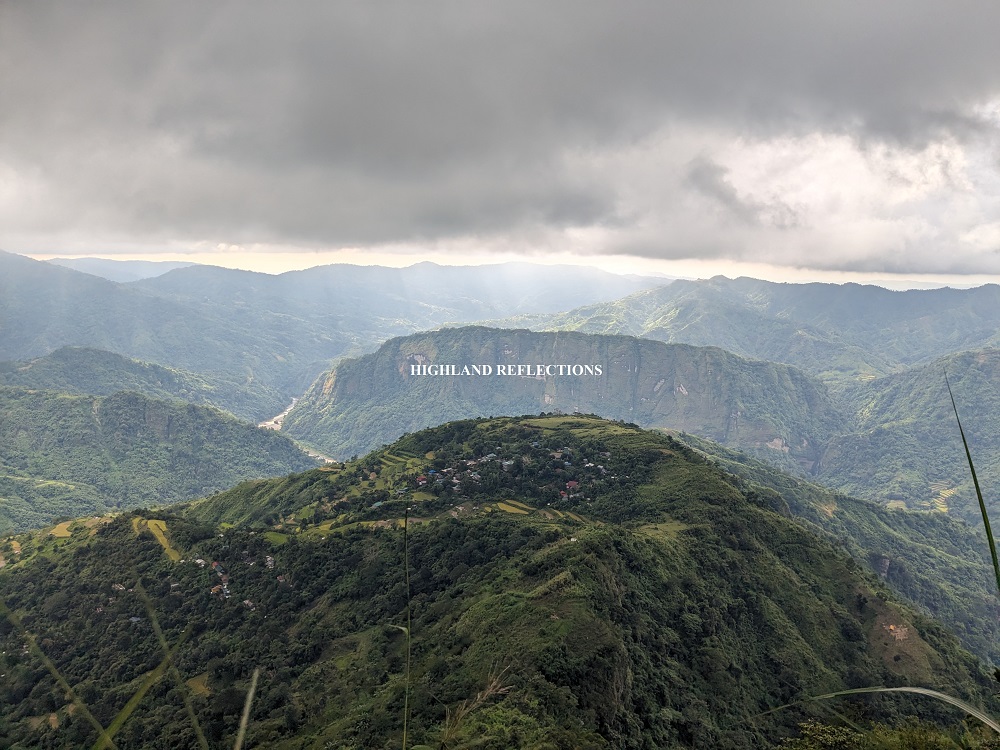
Ask any experienced Filipino hiker their top ten most beautiful hikes within the Philippines and most probably, you will hear the place “Kibungan” included in their list. Kibungan, a municipality located in the northwestern portion of Benguet Province, showcases some of the most awe-evoking terrains and plateaus in the entire country. What makes the “Kibungan Cross Country” (KXC) hike distinguishable from other Cordillera hikes is the presence of rocky, grassy mountain walls which form unique contours. These gigantic structures, only found in this town and its neighboring towns such as Bakun and Kapangan, are further complemented by pine forest trails, rice terraces, multiple hanging bridges, local villages, and some of the most awesome vastness in all of the Cordillera Region.
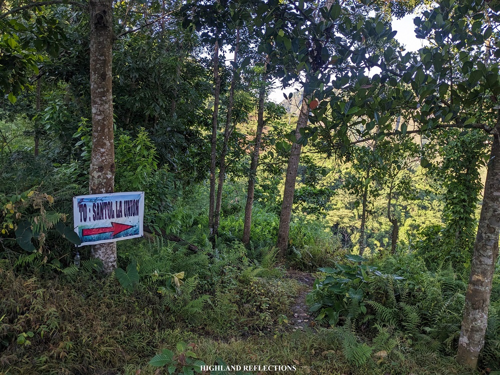
Although a misnomer, “Kibungan Cross Country” was hyperbolically derived from the idea of needing to cross three provincial borders, as the hike traverses from Kibungan, Benguet to Licungan in Sugpon, Province of Ilocos Sur, and then finally, to the town of Santol, Province of La Union. Thus, hikers also (appropriately) call this as Kibungan Tri-Provincial Traverse.
Here are the characteristics of the traverse hike using the Pinoy Mountaineer format:
KIBUNGAN CROSS COUNTRY (KXC; KIBUNGAN TRAVERSE)
Jump-off point: Sitio Tanap, Tacadang, Kibungan, Benguet
Exit point: Sitio Inasan, Tubaday, Santol, La Union
Specs: Major climb, difficulty 8/9
Days required / Hours to complete: 2-3 days / 14-16 hours
Trail class: 1-4
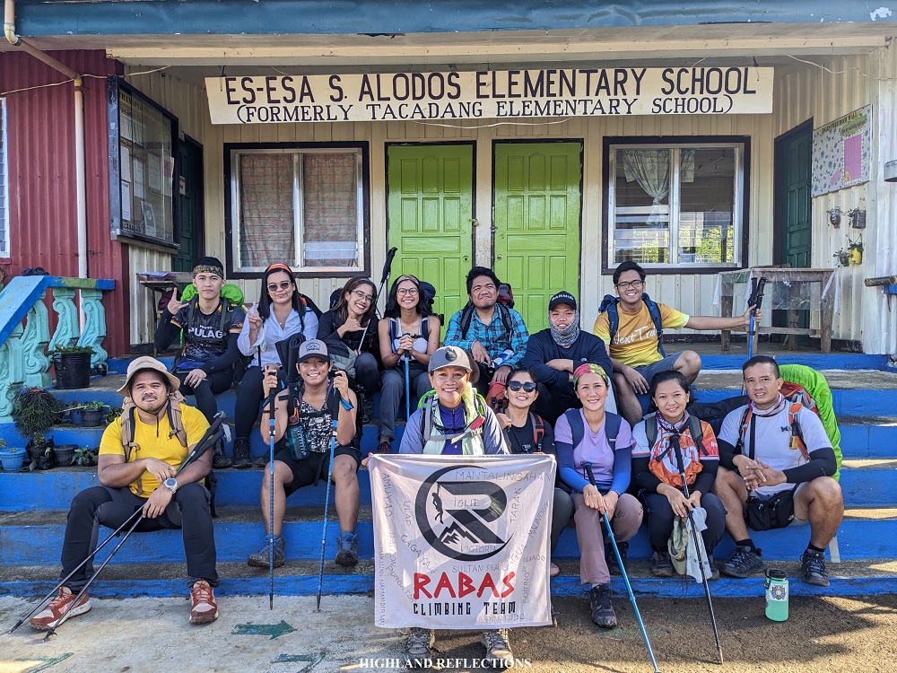
For this hike, I joined an event by Win Calleja’s Rabas Outdoors. We were with his trusted coordinators, Arnold and Gabs, for this hike.
Here is our three-day excursion into the very heart of Benguet!
Day 1: Sitio Tanap, Mt. Tagpaya, and Tacadang Proper
It took us 7 hours to finish the hike for the first day. We had to traverse Mt. Buga and Mt. Tagpaya to get to our first stopover for the day: Tacadang Elementary School.
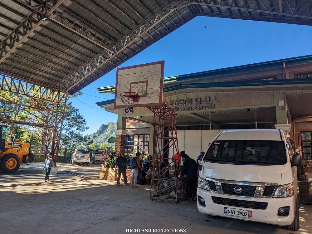
Our first day kicked off at Everman’s Eatery in Kapangan, Benguet. As a solo joiner in Rabas Outdoors’ event, it felt nice hearing the stories of other experienced hikers over a cup of coffee and a plate of silog as our breakfast. I wondered, then, if I could share my experiences. I knew I could offer something to the table, and I knew I wanted to (clout chaser mode haha). Slowly, I tried barging into their conversations. But of course, as distant others, we were still dealing with the awkwardness of not knowing each other.
After everyone had consumed their breakfast and bought packed lunch, we went to the municipal hall of Kibungan to register and prepare our equipment. Once everyone and everything was accounted for, we climbed aboard our van and went to the roadside jump-off point of the hike in Sitio Tanap, located some twenty minutes away from the municipal hall.
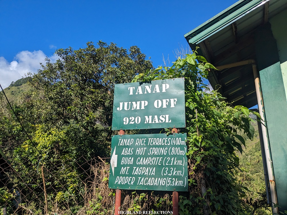
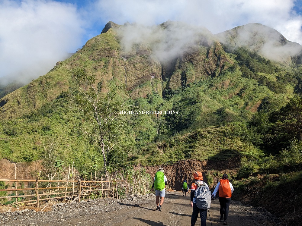
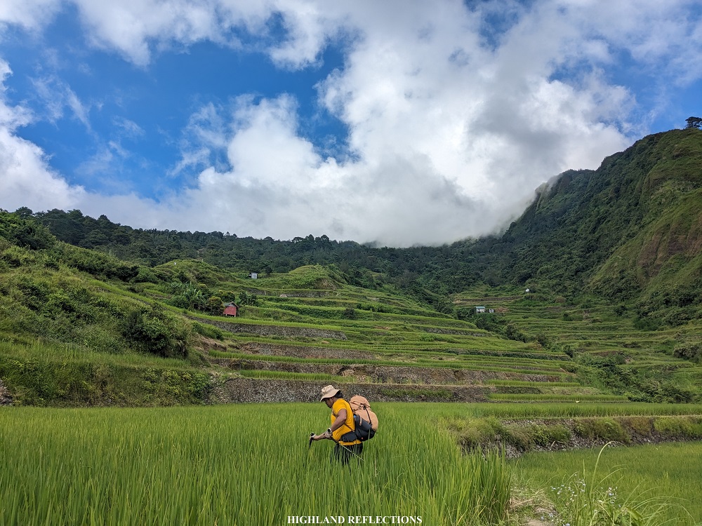
We started the hike past 9 in the morning. The first part of the hike required us to lose a good amount of elevation, descending towards Tanap Rice Terraces. To our right, I spotted the pointy Mt. Kilkili in Barangay Palina, which was hypothesized to be a sleeping volcano because of its conical shape. In front of us is the first layer of mountain that we needed to climb to Sitio Buga and Mt. Tagpaya. Somewhere in the trail, we crossed the first of the many hanging bridges that we encountered in the hike. After this was a very short exposed section leading to the foot of the mountain past the rice terraces. The heat of the sun foreboded.

As I took the first few ascents of this hike, I was punished by the clear weather and dryness of both the land and air. Everything was just exposed to the light of the sun. Every time I found some limited shade, I tried stopping for some minutes to recuperate, breathe, and enjoy the view. At each stopover, I could see the highway road where we came from, as well as the Municipal Hall from afar. Later on in the hike, the elevation that I gained dwarfed these sceneries.
At this point, the lead group and those in my back were far apart that I was alone for almost the entire first day.
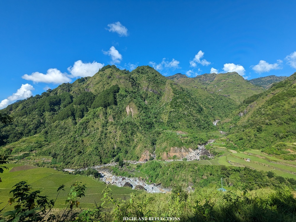
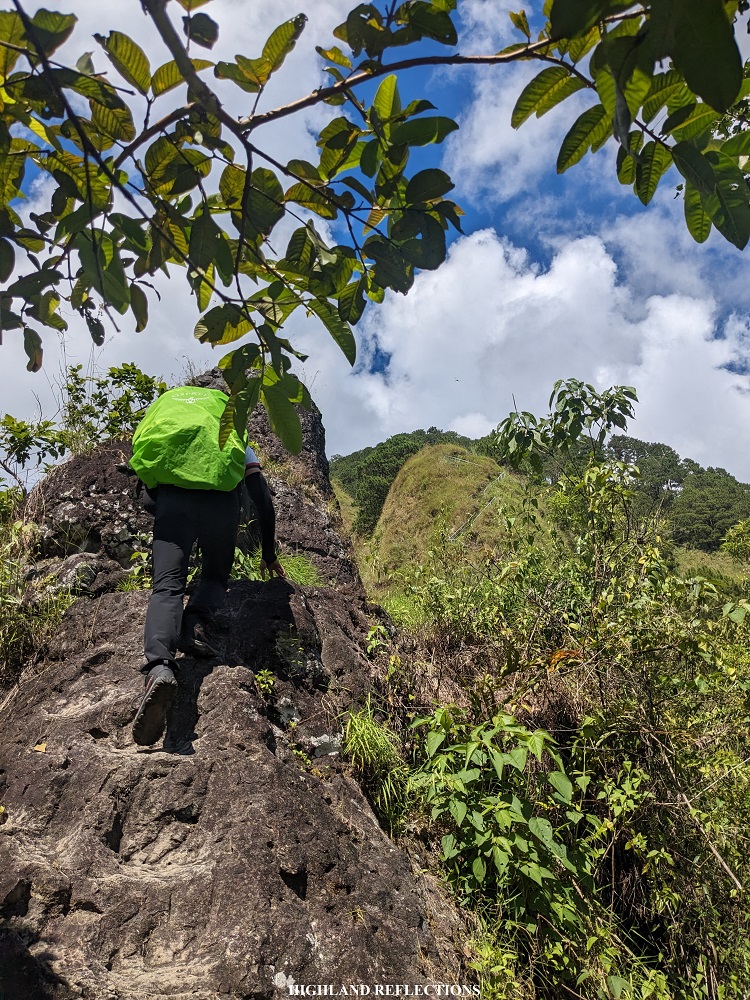
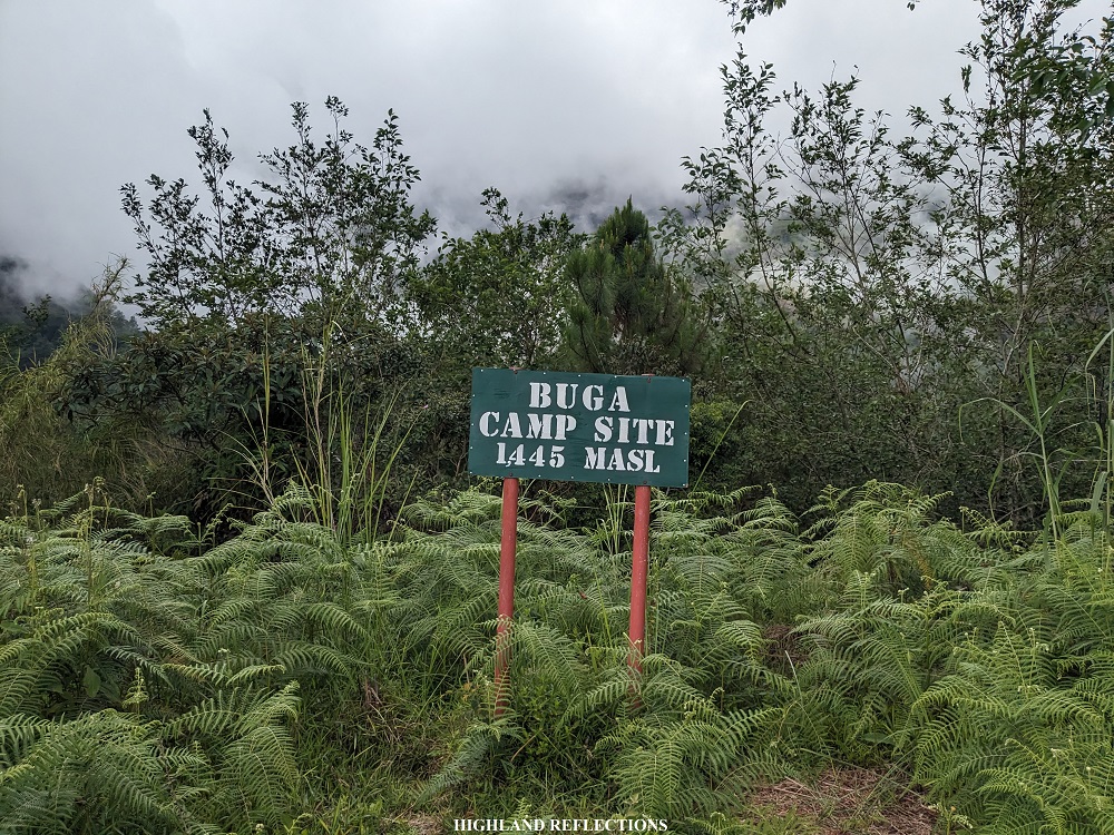
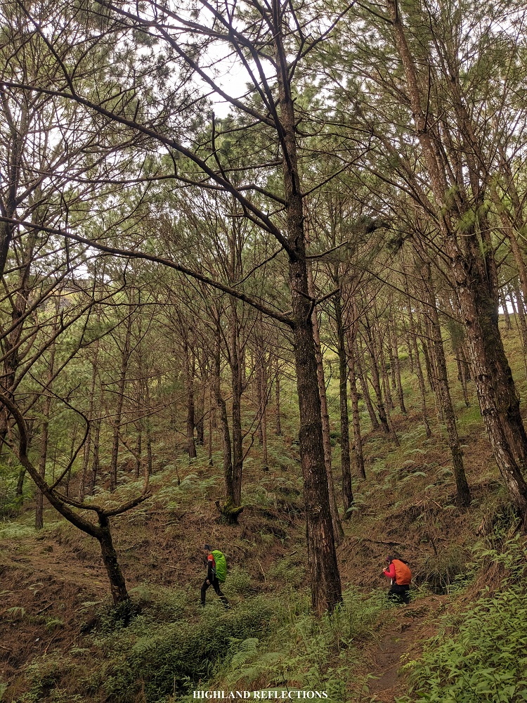
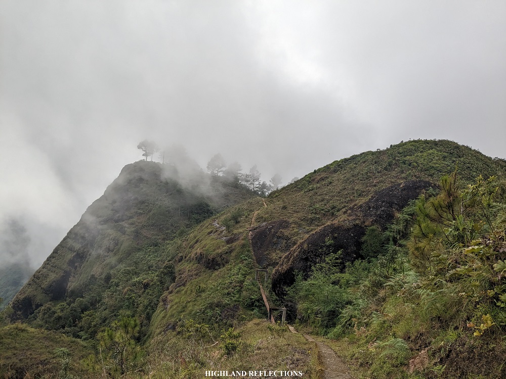
After an hour and a half of climbing, I reached a portion where the trail was carved on two huge boulders. Then, after some few minutes of hiking, I encountered a long ascending staircase constructed on a steep grassy slope. From here, the continuous ascent persisted along a grassy, mildly pine forest slope. I could now see the upper slopes of Mt. Buga, the first mountain that we have to climb for this traverse hike!
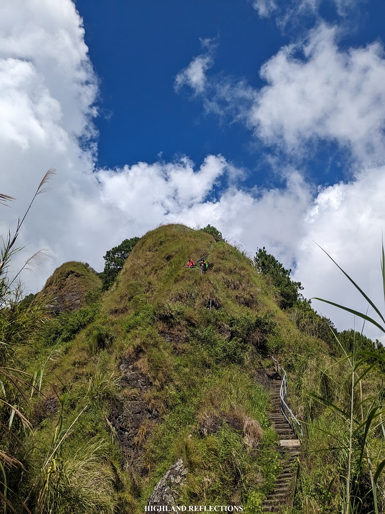
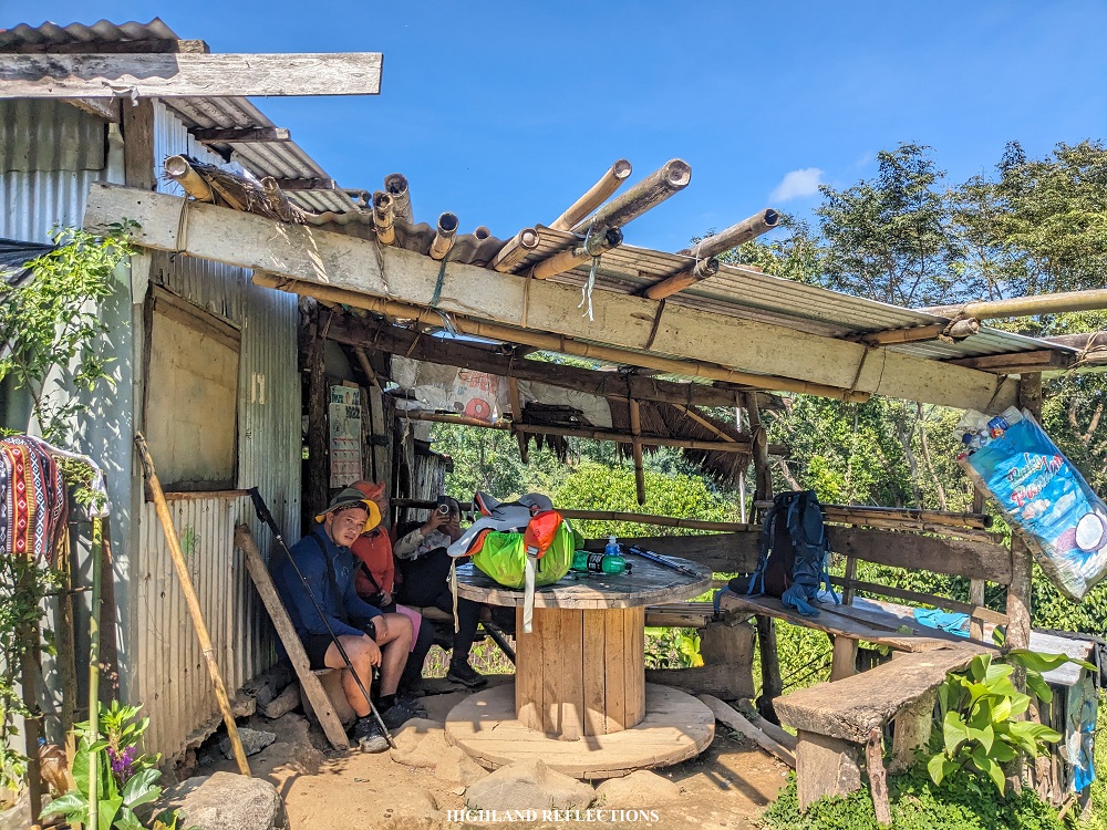
I was able to reach the signboard of Buga Campsite around 12 noon after three hours of slow-paced ascent. I continued ahead and reached a point where some houses near the campsite are present. Here, I was able to replace my lukewarm water and refill my tumbler with colder, mountain-blessed water. After saying my thanks to the residents of the campsite, I continued marching on. At this point, I said to myself that I was unprepared for the hike. I could feel the effects of a sedentary lifestyle coming from months of focusing on work.
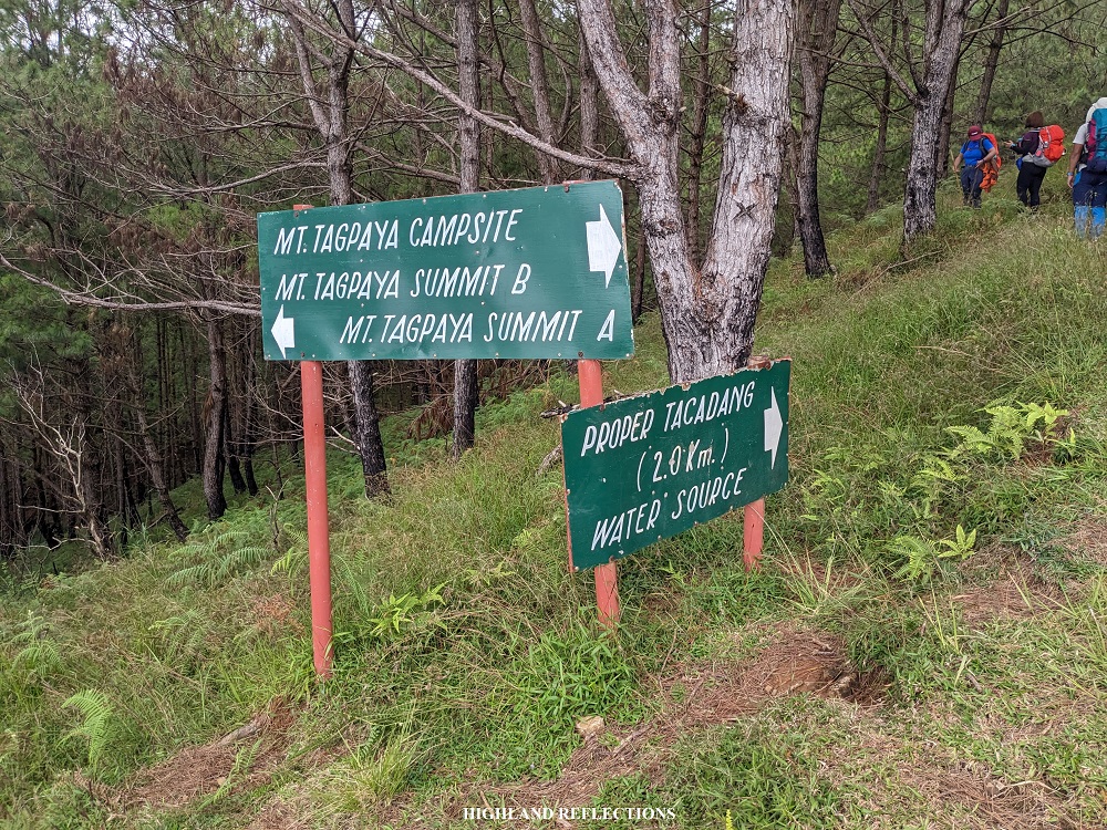
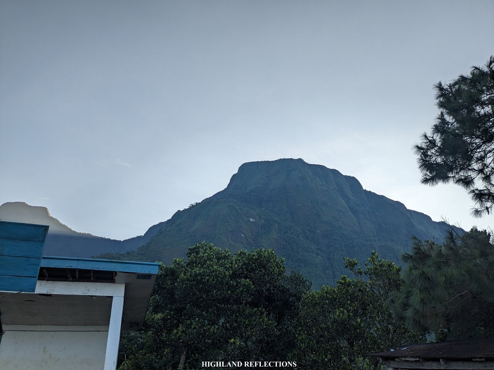
As I was musing on my lack of preparation, a gigantic wall of rock appeared above me. This was the mountainside of Mt. Tagpaya, the highest point in the entire traverse.
Slowly, with my weakened yet persevering soul, I climbed the grassy slopes of Mt. Tagpaya, where, after an hour, I found the lead group resting under a protruded crag above the trail. Here, I took my lunch. The view at the side of the trail provided a magnificent vista of both nearby and faraway surrounding mountain slopes. There’s no better way to eat lunch than enjoying it with a mountain view!

After eating, we continued with the hike onwards to the junction located above Mt. Tagpaya. After ascending a perilous slanted rocky slope, we finally reached the junction at 2 in the afternoon. At the junction is where three paths diverge. To the left is an obscure trail leading to one of the two summits of Mt. Tagpaya. On an even more obscure path to the right is a trail leading to the other summit of Mt. Tagpaya and towards the trail of the Kibungan Circuit hike, where Mt. Oten and Mt. Tagpew are to be found. This was another hiking destination that I wish to do in the future! I was brimming with curiosity on what lies ahead of that trail. But of course, we needed to take the third path, which was to our front. This path is the KXC trail, leading to Tacadang Proper and towards Ilocos Sur and La Union.
After snapping pictures with the panoramic view at the junction, we continued with the hike. As the Tagpaya junction is the highest point in the entire KXC traverse, we started gradually descending on a pine forest slope akin to those of in Mt. Purgatory and Mt. Ulap. At this point, my two companions advanced forward as I (silently) suffered from cramps throbbing in two of my knees. This was probably brought by the heat during the ascent. Since I was already accustomed with the rather painful feeling, I sat and calmly rested on the trail and enjoyed the quietness. I was hoping that my companions who were lagging behind would reach to where I was. No one had come when I decided to continue hiking. I marched again alone forward.
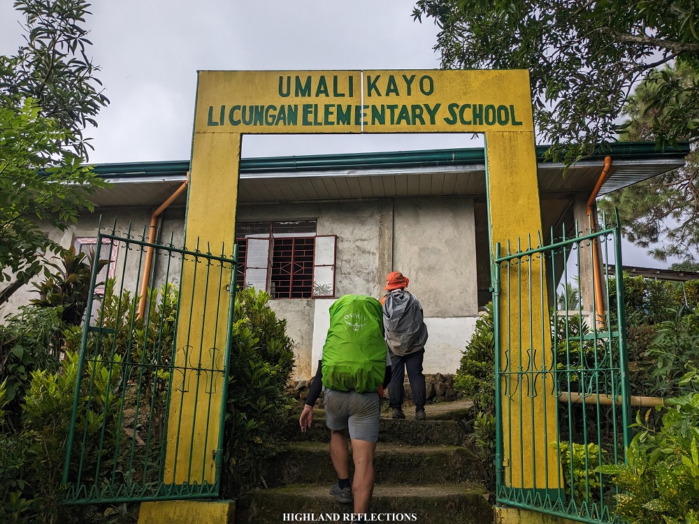
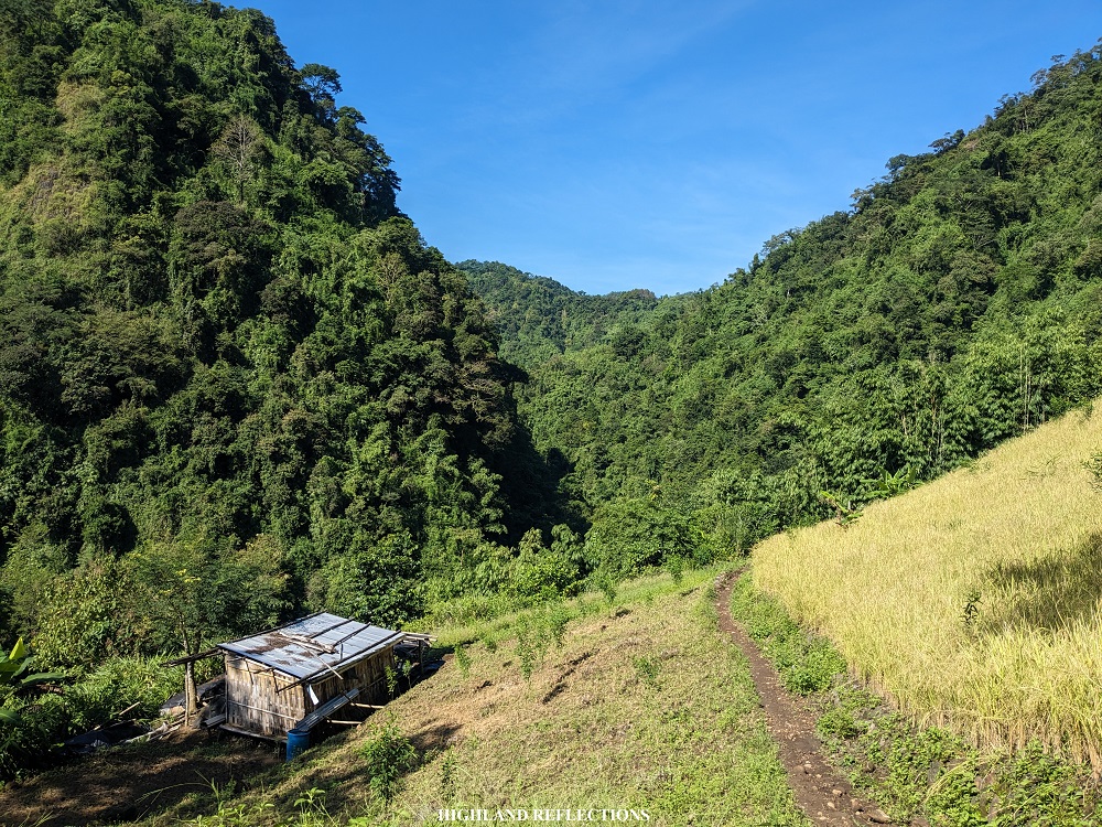
I descended the pine forest slopes slowly and carefully, making sure that I won’t injure myself further. Past the pine forest was a long mountainside trail on a grassy slope. After covering some few kilometers of distance, I heard the shout of kids playing. I surmised that I was close to the sitio where the elementary school was located. Luckily, at that point, the porter assigned to our group appeared and caught up with me. He led the way. After the mountainside trail, the porter and I emerged towards an uncemented road. We were now at the vicinity of Sitio Bekes in Tacadang Proper! Thick fog enveloped the entire surrounding. I was close to reaching the elementary school—our end point for day 1.
When doing a day hike, hikers can already proceed to the trail at the other side of the road. But since our goal was to reach Tacadang Elementary School (now named as Es-esa S. Alodos Elementary School), we turned left and walked for a kilometer to reach the school. Good thing that the porter was there with me since I wouldn’t know that we needed to take a left detour! At 4 in the afternoon, the porter and I finally reached the school. There, I found the lead group resting. All of us settled in one of the classrooms in the elementary school, and afterwards, bought snacks at one of the open sari-sari stores (they have refrigerated drinks!). I also took the chance to take a bath at one of the toilets nearby. By 5 in the afternoon, everyone else in the group arrived in good shape!
Good thing was that the interior of the classroom that we were staying in was well-maintained. We even had electricity for our entire stay. We all slept soundly that night.
To be quite honest, I was unimpressed with the trail and the view that we had during our first day. This was probably because of the heat getting into my nerves, irritating my body, and even my soul. Despite the imposing elevation of the viewpoint at Mt. Tagpaya, I couldn’t get amazed with the view it provided, as I have seen similar views in other parts of the Cordillera.
That version of me still didn’t know what was in store for our second day. I was about to find out why Kibungan was considered by many experienced Filipino climbers as one of the most awe-evoking places in the entire country.
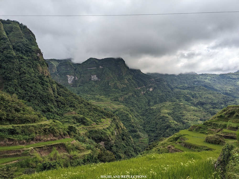
Day 2: Crying Mountains, Les-eng Rice Terraces, Batangan, Litalit Trail, and Licungan, Ilocos Sur
It took us another 7 hours to complete the second day.
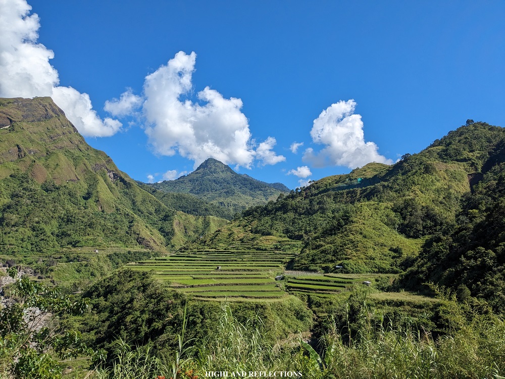
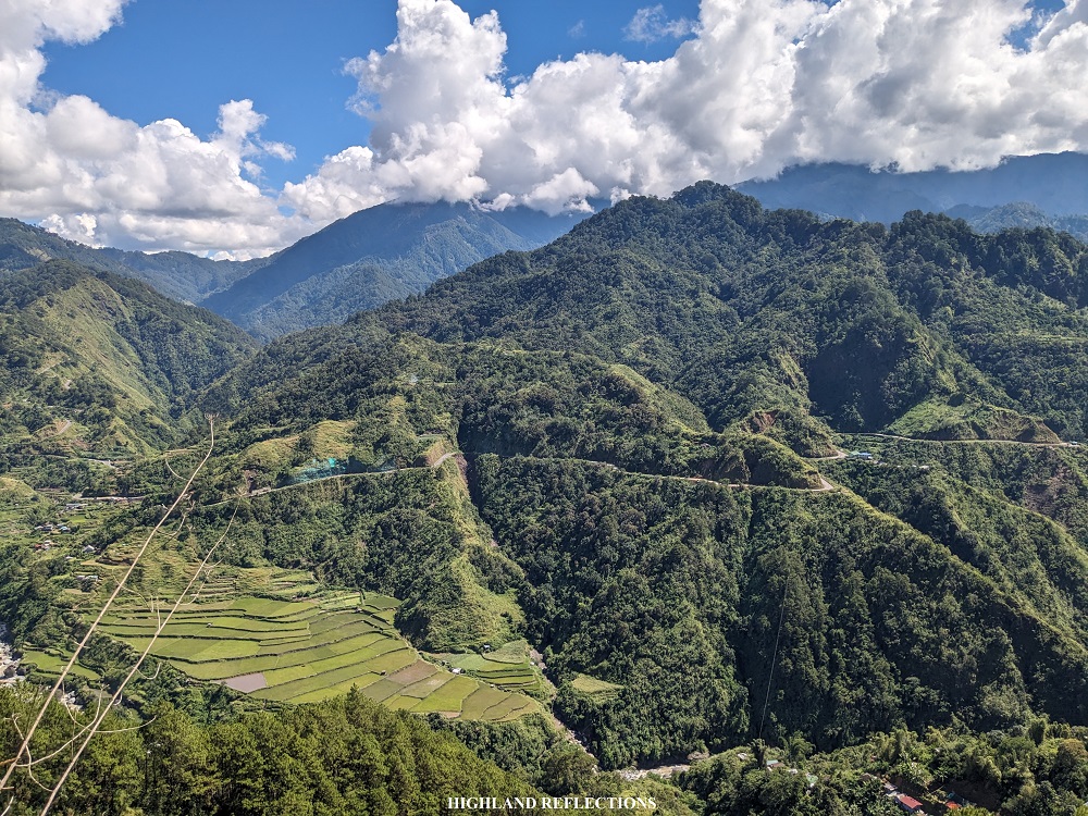
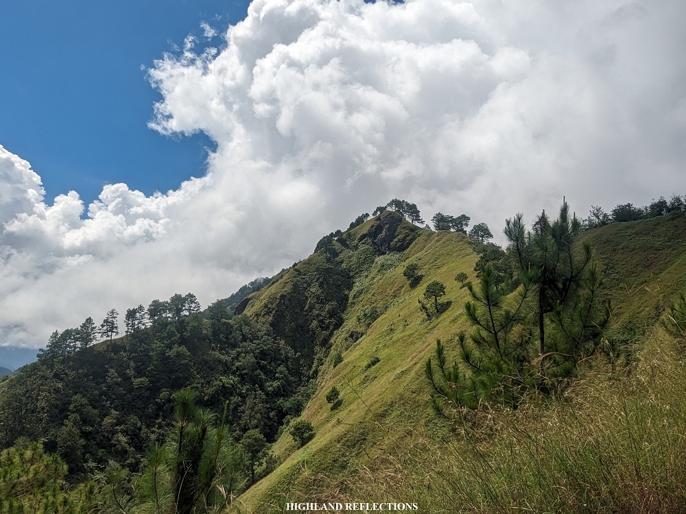
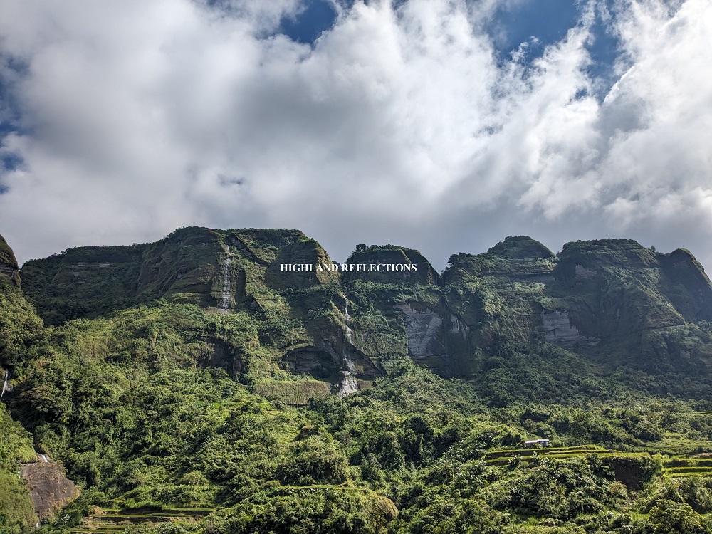
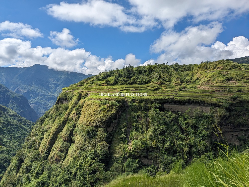
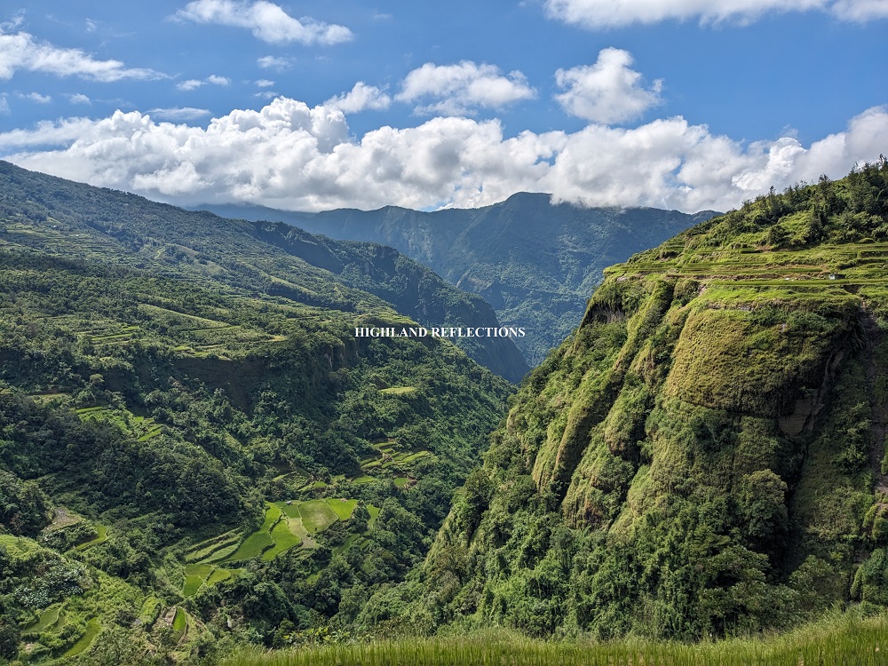
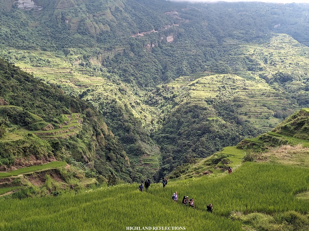
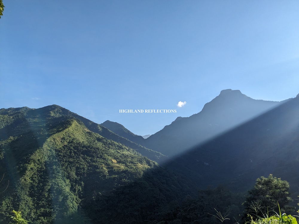
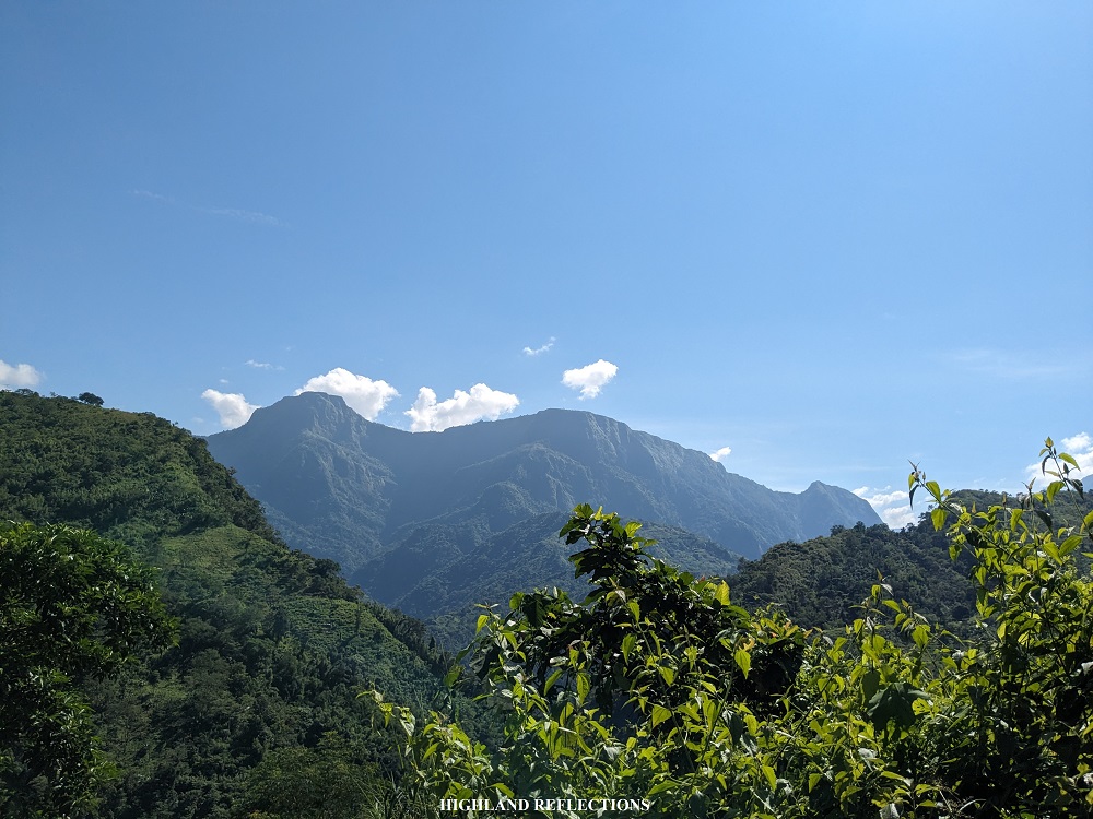
Our second day already started with a bang-for-buck view of the Kibungan mountains. As we left the elementary school, we were welcomed with an expansive view. The mountains here are so different from the usual contours of slopes found in the Cordilleras—they’re really gigantic rocky walls! It felt like I was Simba, watching over his vast natural kingdom from Pride Rock.
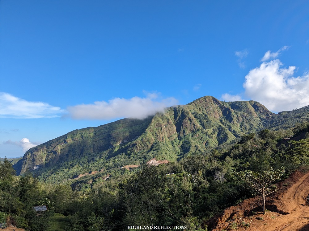
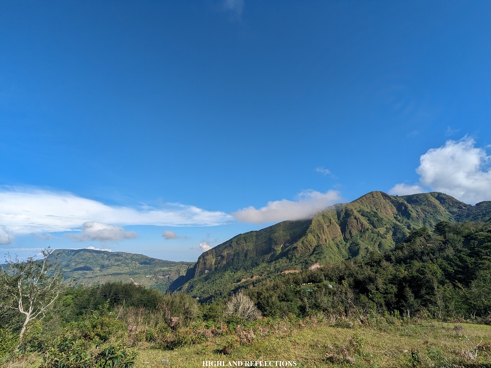
We marched on by descending the unpaved road coming from the elementary school. Early on, we were rewarded with a view of a towering mountain wall in our front us, slowly approaching it as we were making the descent along the unpaved road. Every one of us did not hesitate to take pictures revealed by the scenery as we were descending.
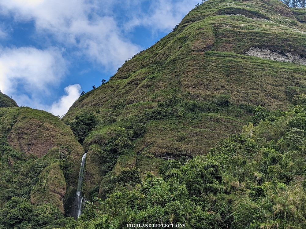
We reached the bottom part of the mountain wall and entered a shrubby narrow trail. In just a few minutes of hiking within the trail, the famous crying mountains appeared in front of us. I uttered a gasp of awe upon seeing it. We were so close to it!

The several waters gushing from the plateau were not that strong, and you could tell that some of the other waterfall spots were dry. Still, I was thankful to have finally seen it. Seeing it up close was an indescribable experience.
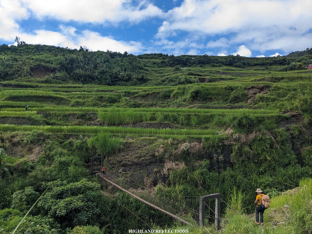
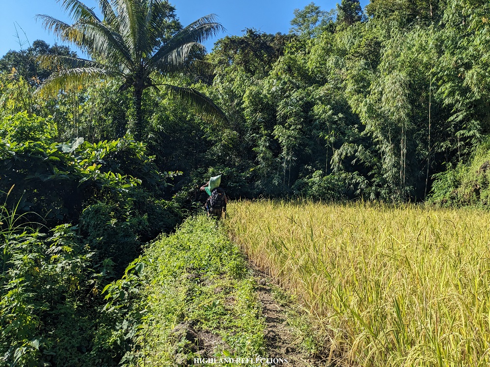
The trail past the crying mountain are a series of farming paths where we passed through several rice terrace dikes and countless hanging bridges. After less than an hour or so of hiking, we arrived at a dried rice terrace with a beautiful back drop of the entire Kibungan Crying Mountain. All of us stopped here and took numerous photo shots!


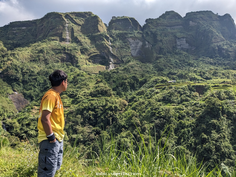
My mindset for day 2 was to go slow and enjoy the view despite the hot weather, as well as to socialize with my companions. While walking on the community paths and rice terrace dikes of Les-eng Rice Terraces, I was exchanging stories with another experienced hiker who had already hiked in Kibungan multiple times in the past. He told me that besides the two most popular trails here (KXC and Kibungan Circuit), there are lesser known trails used by locals which pass through the different sceneries that we saw from afar. One story of him that drew my attention was when he went to the lesser known parts of Les-eng Rice Terraces via Mt. Amanayao, to which our guide pointed the location—it is one of the mountains in the expansive view that we saw when we left the elementary school! I hope I get to see and cross that side of Kibungan in the future.
Time went by without me noticing. Yet, I was mindful of the changing landscapes that Kibungan was providing us. Such impressive views!
Along the way, we saw smaller waterfalls randomly appearing when we detour and reach certain parts of the rice terraces. We passed by another hanging bridge above a gorge connecting two beautiful plateaus. Past the hanging bridge was another round of ascent on the rice terrace dikes. Here, I decided to leave my companions behind and went ahead.
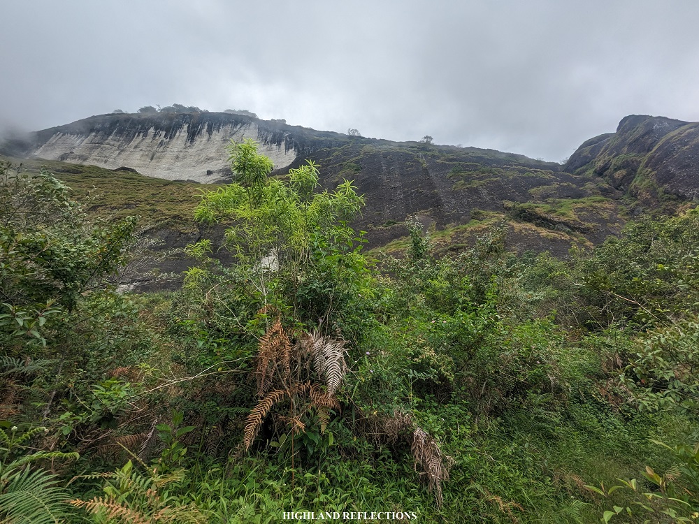
Upon leaving my companions, I reached an ascending trail—the start of a not-so-long assault onwards to Sitio Batangan. A unique feature of this exposed portion was that we were ascending on a scree. It felt like we were climbing a volcano! Good thing was that the sky was already enveloped in clouds, making this part of the climb bearable.
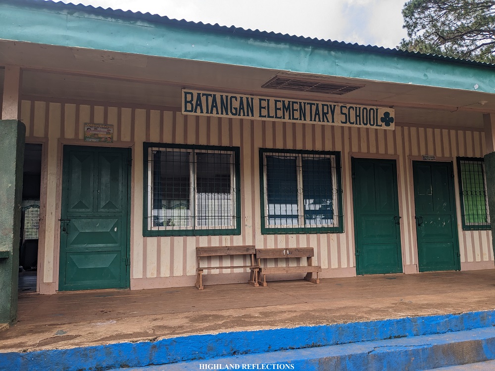
After ascending an elevation of 250 meters, we reached the community in Batangan. Past this community is a pine forest where Batangan Elementary School is located. We decided to take our lunch here and have some ample rest as it was already 12 noon. We also refilled our water bottles. Fog enveloped the place as we were eating our lunch.
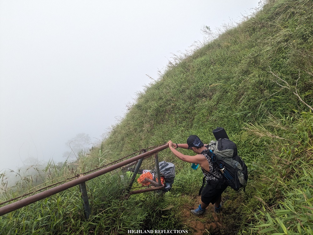
As we bonded over our rice meals, I could already feel that each of us in the group was getting closer to each other. What one of our coordinators said during our first night rang true: A multi-day hike allows people to bond deeper as it allows hikers to focus more on socializing and less on the pressure of finishing the hike, making it more intrinsically motivating. Well, despite the fulfilling connectedness, we needed this newly-formed bond to distract ourselves from taking the next part of the hike: the perilous, infamous Litalit Trail!
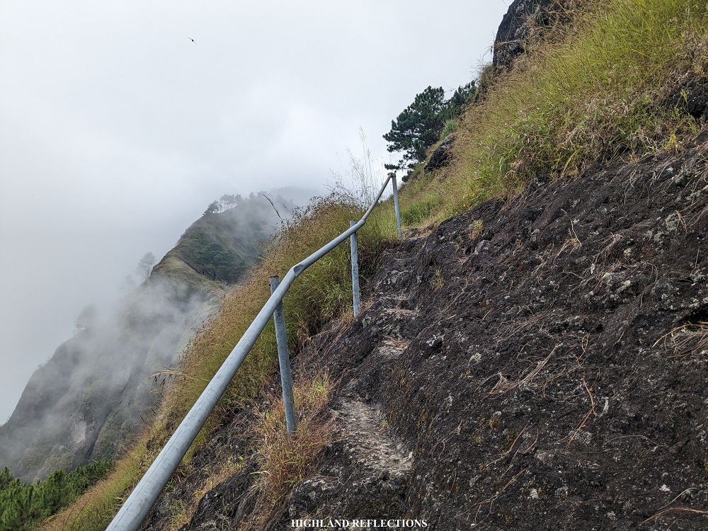
What makes Litalit memorable among hikers is that the trail is carved along an exposed, grassy 80-degree slope. You literally have to hold on to metal railings for dear life as you make the 600-meter descent going to Licungan in Ilocos Sur. Fortunately, I have been already accustomed to steep descents, which enabled me to go down on a relatively faster pace. Still, fear creeped. The surface of the trail was all wet and somewhat muddy. We didn’t have any view due to the thick fog surrounding us. Our coordinator said that it was very rare to get a clear view at this part in the afternoon. He also told stories about a time when there were no installed metal railings on the side of the trail, so you literally had to crawl your way down. I wondered what the view was from this part of the trail.
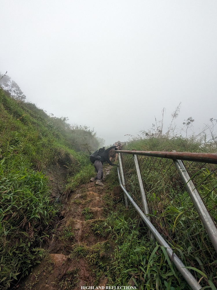
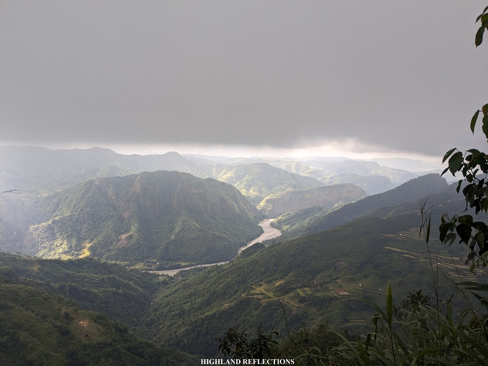
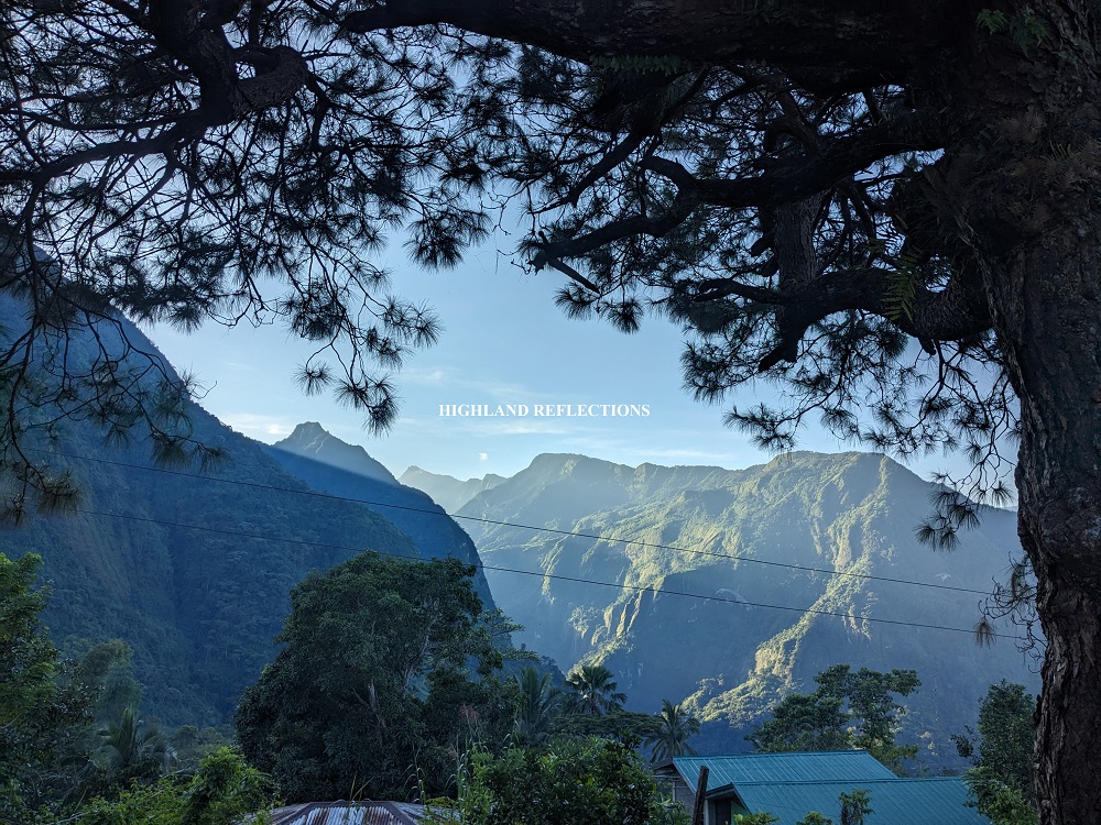
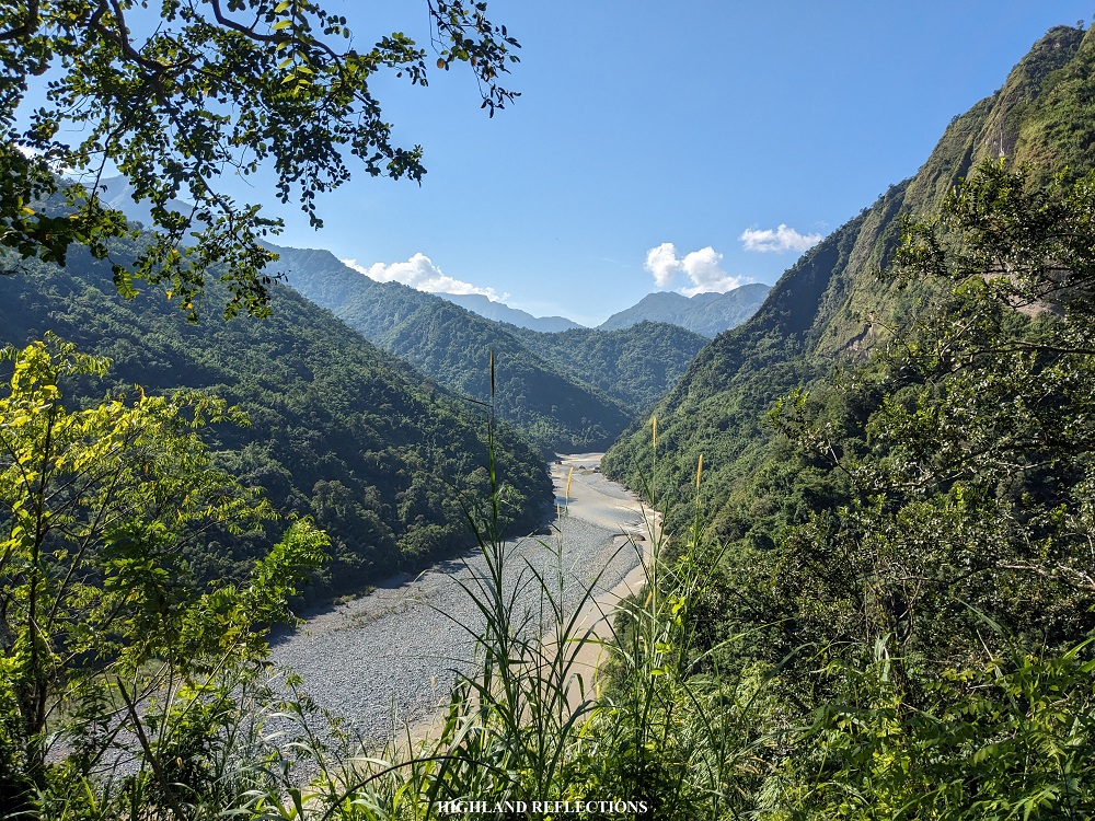
At the halfway point of the Litalit Trail is a waiting shed where exasperated hikers can rest. As I still had vigor, I pushed on with the descent. Past the waiting shed is a short section of cemented stairs, which reverts back to the usual mountain trail afterwards. The trail here, despite it being steep, was more manageable, and does not need any metal railings for assistance. Fortunately, at this portion, the sky cleared up, and we had an awesome view of Barangay Licungan in Sugpon, Ilocos Sur, magnificently perched on top of a hill surrounded by mountain ranges. At the back of Licungan, we could also spot Amburayan River, which serves as a boundary between Ilocos Sur and La Union.
We reached the community of Licungan around 3:30 in the afternoon, two and a half hours after starting from Batangan. Just like in Tacadang, we settled and slept in the classroom of the barangay’s elementary school. The rooms here were less cozy than the ones in Tacadang. Still, we were thankful for the secure shelter.

At five in the afternoon, a torrential rain poured as I was taking my bath in one of the toilets of the elementary school. Good thing was that all of our companions were already within the vicinity of Licungan. It would have been a terrible and dangerous predicament if they took the Litalit Trail when the rain poured. We thanked the heavens for securing our safety for this hike.
At night time, we had a heartfelt dinner and social session. Although most of us were getting ready to sleep, we couldn’t help but join the social session as some of our companions were opening up about their lives.
The sky went clear as we were about to sleep. The slopes of the Litalit Trail were discernible from the black sky.
I felt contented.
Day 3: Descent to Amburayan River, Inasan Hanging Bridge, and Final Ascent to La Union
I already felt contented. It felt like the hike was already over.
But we needed to keep going. We had to conclude the hike.
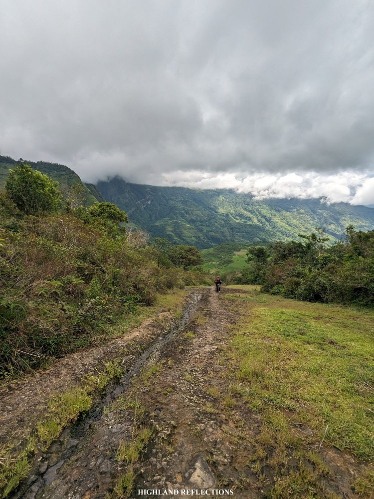
After taking our breakfast and doing our toilet rituals, we geared up for the descent to Amburayan River, then the final ascent to La Union. Past the elementary school was an expansive grassy plateau which provides a view of the surrounding La Union mountains. Although not as high as those of in Kibungan proper, these mountains are still an integral yet peripheral part of the Cordillera highlands.
The descent to Amburayan River was on a cemented one-way path. Some parts of this path were slippery. The entirety of it, of course, was excruciating to the knees! It was also quite worrisome to tread on since motorcycles pass by the pathway, requiring us to stop for a while at the side of the cemented path whenever we hear the roaring of engines getting close.

Fortunately, a lot of Cordillera mountain hikes in the past have already prepared me with this kind of pathway, enabling me to run the entire descent despite my semi-full pack, leading the entire team for the descent. There were instances, as well, that required us to take the descent at the side of the cemented pathway as the concrete was covered with slippery moss.
I completed the 550-meter descent to Amburayan River exactly after an hour. To get to the other side of the river, I had to cross the Inasan Hanging Bridge, the longest and most terrifying hanging bridge in the entire hike. It may as well be one of the longest hanging bridges within a hiking trail in the entire Cordillera region!

I decided not to wait for my companions and crossed the hanging bridge alone. The first few meters felt like a normal crossing on a hanging bridge. But as I reached the middle part, I was consumed by the terrifying feeling of being on a vulnerable, pseudo-fortified structure that could break any time (though of course, I was trusting the fact that locals have been using this since time immemorial). The height of the hanging bridge from the river also added to my anxiety. To my amusement, the last few portions of the hanging bridge was ascending. I successfully crossed it after more than three minutes!
I was advised by our guide to wait at the sari-sari store above the bridge. There, I rested and cooled off while waiting for my companions in the lead group. Unfortunately, the sari-sari store was closed during that time.
Upon my companion and the guide’s arrival, we continued with the final ascent to La Union. Leading the way, we took the trail inside the lowland forest, gaining almost 300 meters of elevation in less than an hour. I was panting heavily at this point, but I knew I was in good condition compared to my experience on the first day of the hike. We had two stopovers along the trail—one on a makeshift waiting shed and the other on a water source where we refilled out containers.
Past the water source was the final ascent—final, yes, but certainly one of the most excruciating portions. The trail was on an exposed grassy slope, and since we were near lowland elevation, the heat was more unbearable compared to our experience during the first day! I used my umbrella to fend off the scorching sunlight—a peculiar thing to do when ascending. Every few meters, I was hoping for this to end already.
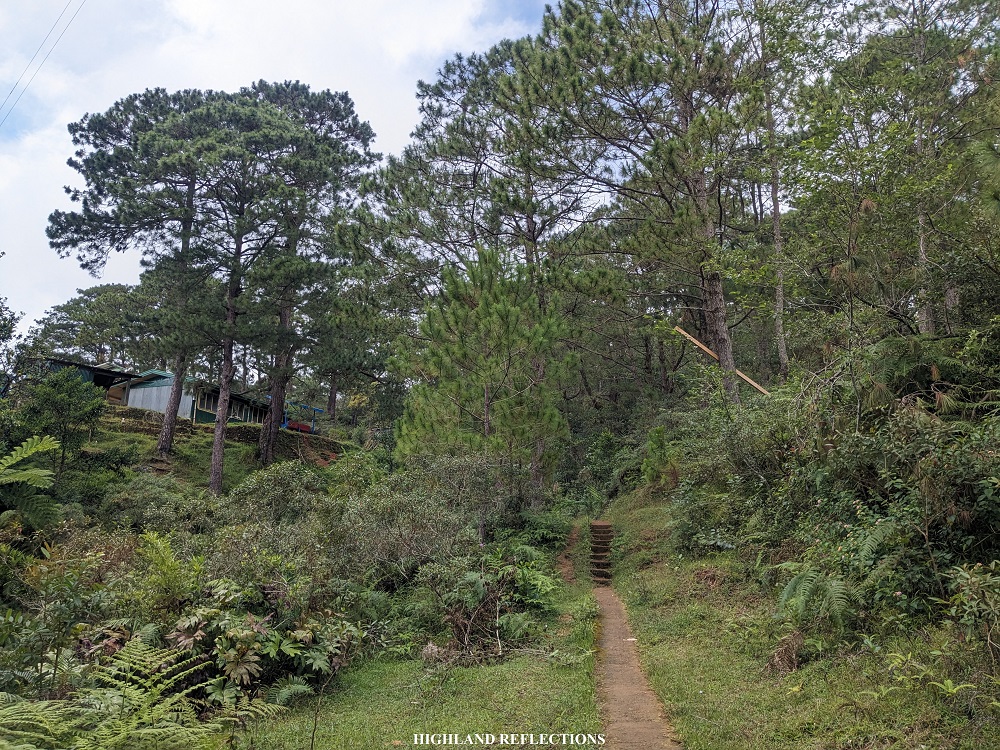
I gladly reached a short pine-forest trail which provided enough shade. Here, the porter, the guide, and I decided to take a long rest and wait for our other companions. After a few minutes, the four individuals tailing me arrived. We all complained about the heat! When everyone got their ample rest, the five us plus the guide and porter went on with the final 100-meter ascent on a paved road. We reached the community in just a few minutes, marking the end of the entire traverse. It was 10:30 in the morning, three hours after starting the hike! The five of us exchanged messages of short congratulations for the success. As we were the first to finish, we had to wait for our other companions to arrive at the end point of the hike. The five of us told stories to each other to pass the time.

The remaining individuals in the team arrived in three batches: two individuals arrived at 11:30AM, followed by 12:30PM, and then lastly, 12:50PM. We were complete before one in the afternoon! Luckily, our service jeep also arrived just in time. We descended to Santol town proper via the jeepney for about an hour. We took our baths at a resort within the town, where our van driver was already waiting for us.
Along the way home, we celebrated with a late lunch at a road-side eatery in La Union.
And that concludes my Kibungan Cross Country hike! Hands down, one of my best hikes this year.
It was indeed an awesome experience finally crossing out one of the long-time hiking goals in my bucket list. As of this writing, only Kibungan Circuit, Bakun Trio (although I have climbed Mt. Tenglawan in the past), and Mt. Patukan in Kalinga are the only remaining mountains that I have yet to climb within the Cordillera Region (although, of course, there are still so many mountains that I know I could climb within the region besides those mentioned, but that is for another story). I hope I get to hike them sooner as I am excited to form stories and reflections about my unclear and unrealized projected experiences with these mountains.
These projections were once incomplete and unclear back then when I was only reading blogs about KXC. But now that I have completed the traverse hike, I could confidently say that experiencing it personally was very different from just reading it.
I hope you get there as well and see it for yourself.
Itinerary
Day 1
09:00AM Sitio Tanap (920 masl), start hike
09:15AM Tanap Rice Terraces (810 masl)
12:00PM Buga Campsite (1,445 masl)
01:00PM Lunch along the trail
02:00PM Mt. Tagpaya junction (1,800 masl)
04:00PM Tacadang Elementary School (1,450 masl), set camp
07:00PM Dinner
08:00PM Lights out
Day 2
05:00AM Wake-up call
06:00AM Breakfast
08:30AM Start hike
09:30AM Crying mountains (1,150 masl)
12:00PM Batangan Elementary School (1,330 masl), lunch
01:00PM Litalit Trail
03:30PM Licungan Elementary School (720 masl)
07:00PM Dinner
09:00PM Lights out
Day 3
05:00AM Wake-up call
06:00AM Breakfast
07:30AM Start descent to Amburayan River
08:30AM Amburayan River, cross Inasan Hanging Bridge (150 masl)
10:30AM Santol, La Union (600 masl), end of hike
01:00PM Departure to Santol Proper
02:00PM Santol Proper, wash-up
03:00PM Departure from Santol Proper
10:00PM Home

Amazing storytelling! thank you for this, looking forward to my climb
LikeLike