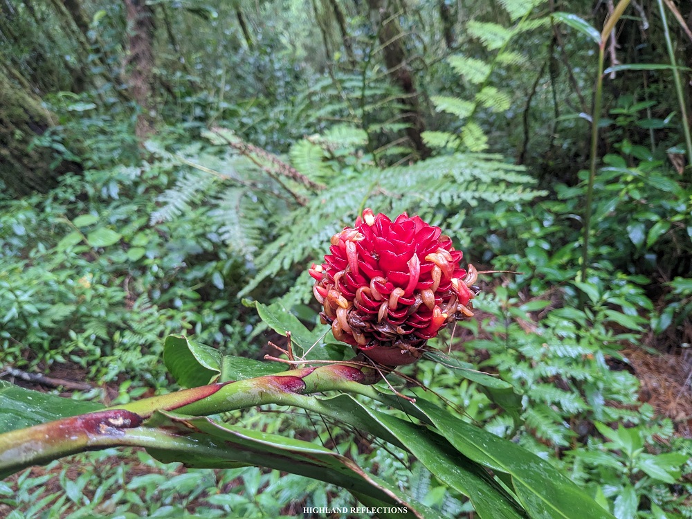
They say that among the four primary trails of Mt. Pulag, the one in the town of Ambaguio in Nueva Vizcaya is the longest yet the most rewarding and scenic. The hike to the longest trail of Mt. Pulag is an immersion into the bucolic mountain town, taking hikers from one village to the next, and having views of faraway villages tucked within the mountain slopes. Moreover, the trail provides sceneries of the eastern portion of the Cordillera Mountain Range and some occasional faraway views of the Caraballo and Sierra Madre Mountain Ranges. After completing the Ambangeg (2019), Tawangan (2022), and Akiki trails (2023), I geared myself up for hiking the Ambaguio Trail of Mt. Pulag in August of 2023 to complete my personal Pulag series!
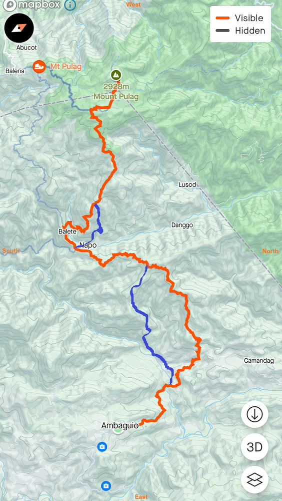
For this hike, we did a three-day traverse, taking the Ambaguio Trail to climb up Mt. Pulag, and the bloody and mossy Tawangan Trail as our exit point. The entire first day of our hike was spent in Ambaguio, where we started the hike from the town hall and took the 21-kilometer road going to Balete Village located at the foot of Mt. Pulag. On the second day, we climbed the eastern portion of Pulag filled with a lively mossy forest, and then ending the day at Camp 2 in the Ambangeg Trail. On our last day was the summit bid and the descent to Tawangan.
Based on my observations, here are the characteristics of the hike:
MT. PULAG (Ambaguio-Tawangan)
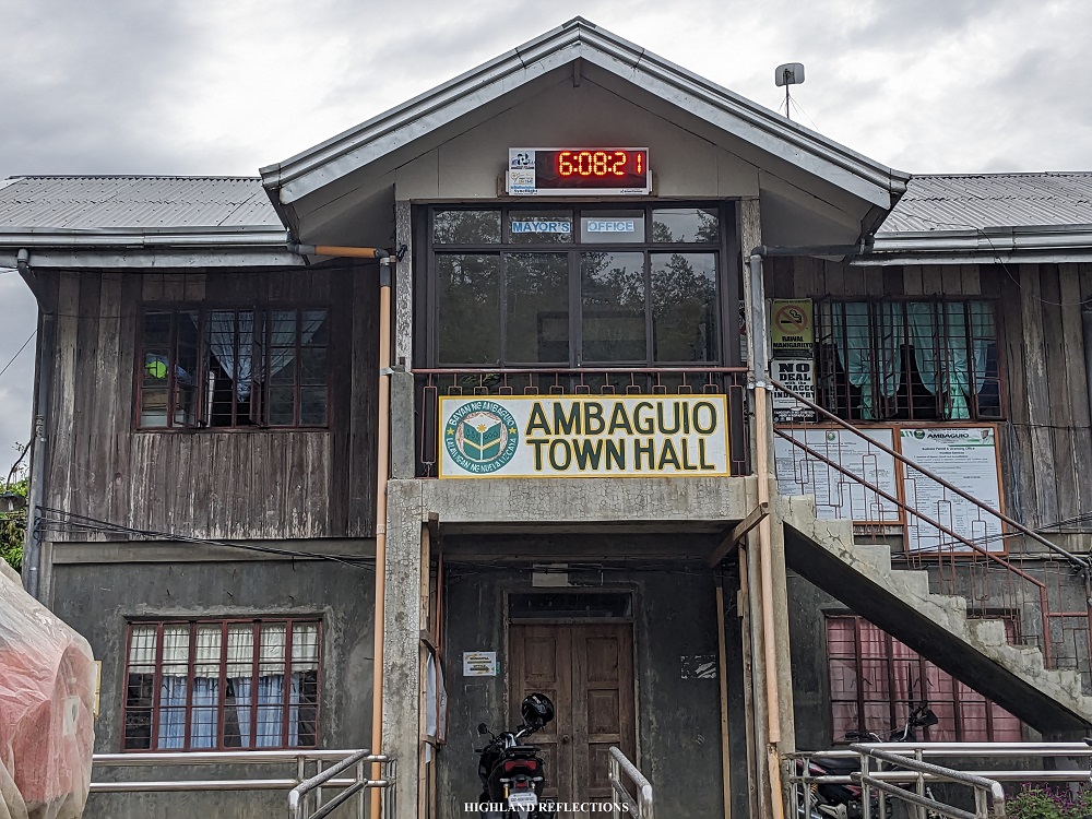
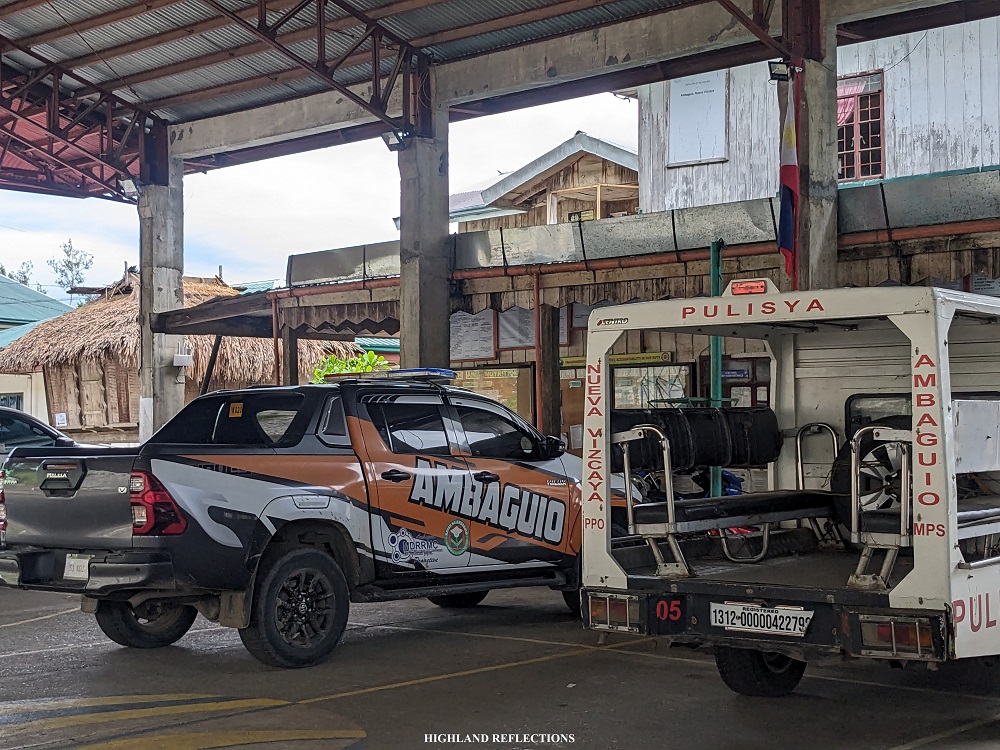
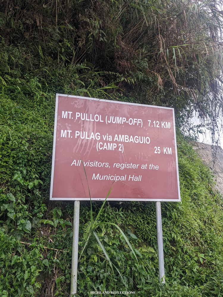
Jump-off point: Ambaguio Town Hall, Ambaguio, Nueva Vizcaya
Alternate jump-off: Ammoweg, Ambaguio, Nueva Vizcaya
Days required / Hours to Summit: 2-3 days / 15-18 hours
Specs: Major climb, Difficulty 8/9, Trail class: 1-4
Trail distance: 33 kilometers (Ambaguio Town Hall to Pulag summit)
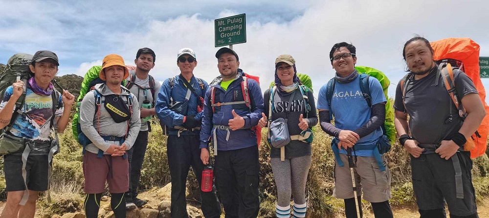
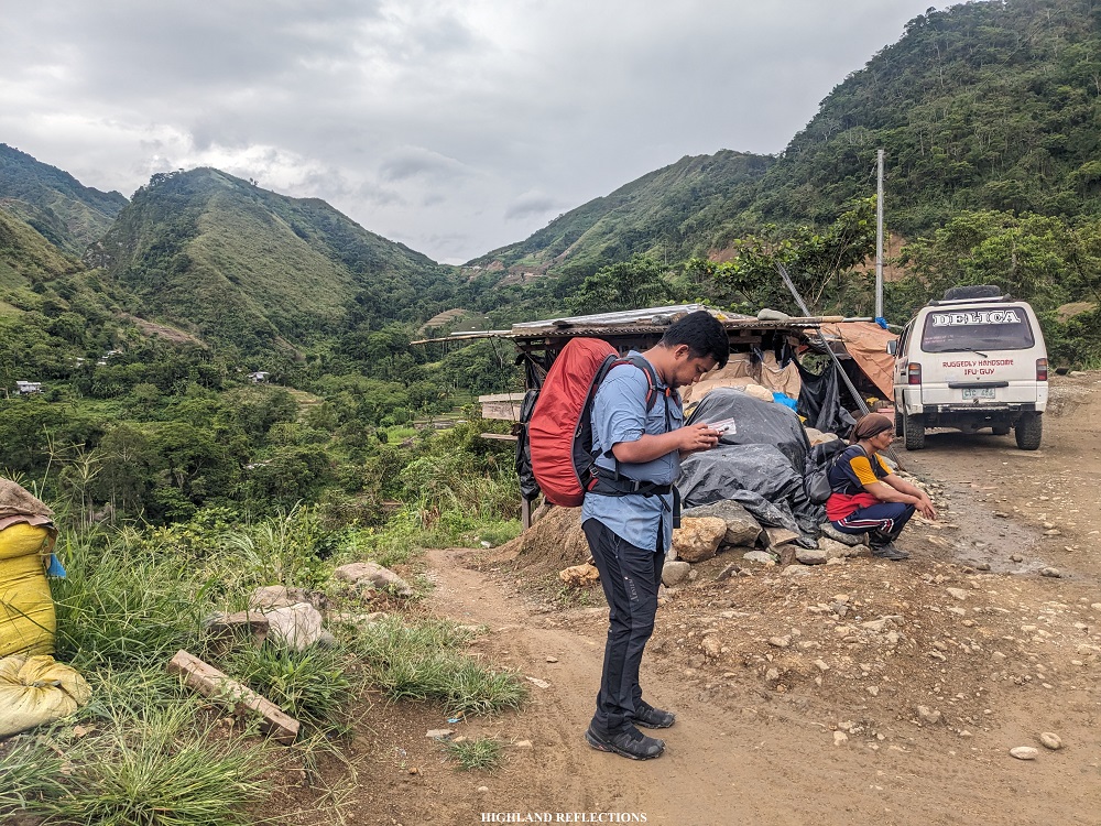
Our hike was organized by Jomar, the same organizer that we had during our three-day climb via the Akiki Trail. We were permitted by the tourism office of Ambaguio in doing this hike and also provided us our kind guide: Kuya Ramirez, who was very patient with us during the entire three-day hike. Besides Jomar, Kuya Ramirez, and me, there were six other individuals in the team.
Here is my narration of our epic adventure in the longest trail of Mt. Pulag!
Day 1: Ambaguio Town Hall to Napo and Balete Village (10 hours)
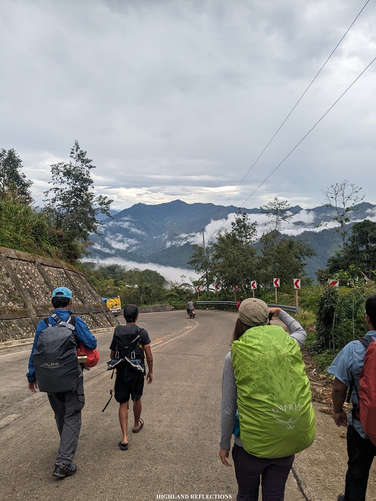
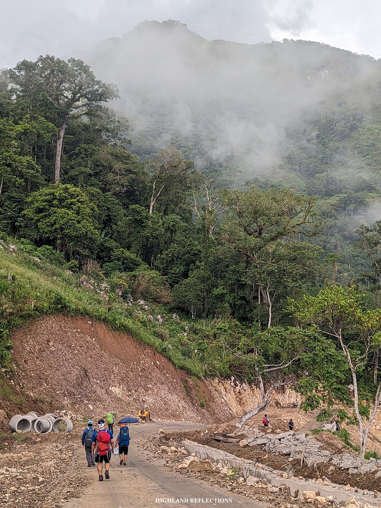
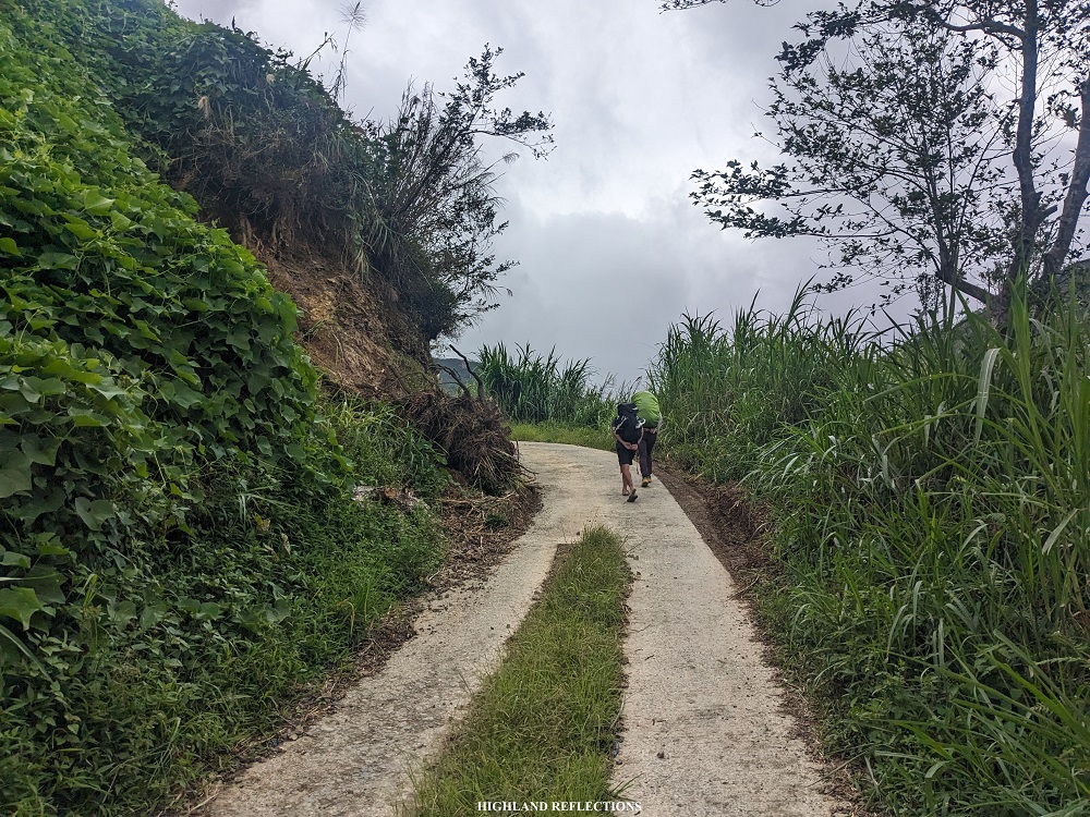
We started the hike at 8 in the morning at the town hall of Ambaguio (~1,180 masl). Our original plan was to hire a truck or jeep going to our first day’s stopover—Barangay Balete, located 25 kilometers away from the Town Hall. I personally know some hikers who have done this to cover the long distance. However, since most of us wanted to get a feel of Mt. Pulag’s “longest trail”, we decided to walk the entire rough road going to Balete.
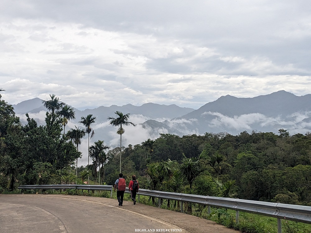
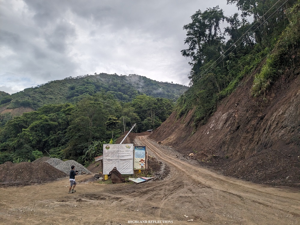
The first part of the hike involved walking a 4-kilometer cemented road going down to Barangay Ammoweg—the original jump-off point of the Ambaguio Trail (~620 masl). The road provided scenic views of the mountain ranges surrounding Ambaguio dressed in small clouds. Some parts of the road were still uncemented, and some parts were heavily eroded with landslide.
We reached the community of Ammoweg an hour after starting the hike. The barangay was marked by a cemented road bridge on top of a river. At the other side of the bridge are some eateries and makeshift stations where locals hang out. We ate a heavy breakfast at the eatery and bought lunch.
The eatery at the end of the bridge was the original jump-off point of the Ambaguio Trail. The actual trail, which is at the left of the eatery, leads to a trail that follows the entire river before taking a steep cardiac assault trail (in the STRAVA map uploaded above, this was the one with the blue marking). This steep trail converges with the rough road going to Barangay Napo and Barangay Balete. However, this trail has not been used both by hikers and locals for a long time.
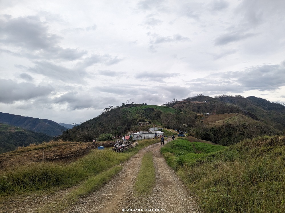
Hence, to go to Barangay Napo and Barangay Balete, we needed to take the long rough road that passes through some communities within Ambaguio. The rough road goes directly to some of the barangays located in the northern, western, and southwestern parts of the town.
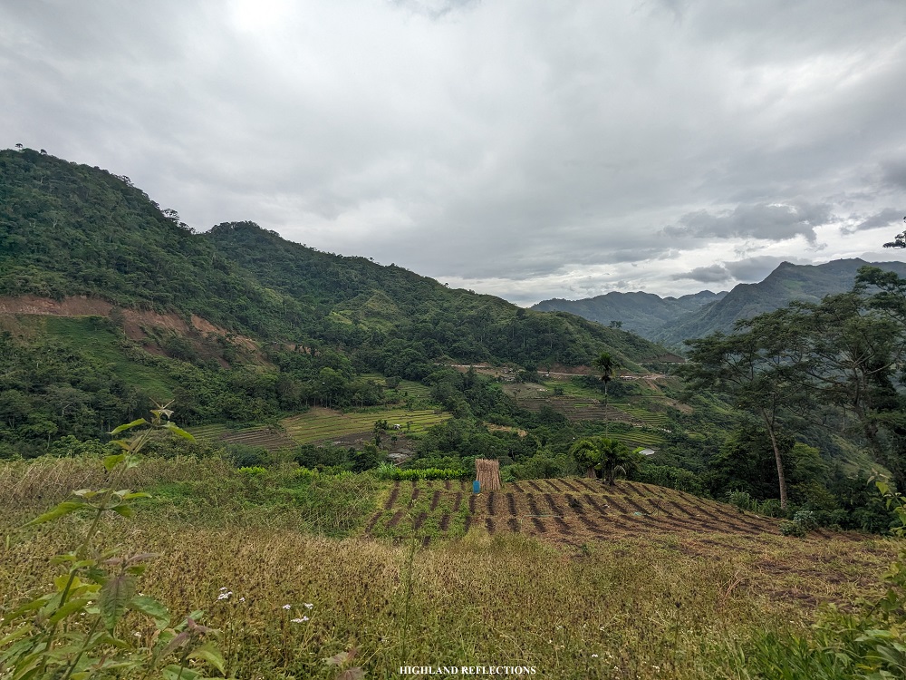
On we went on the rough road. Tempted as we were every time locals riding their motorcycles passed us, we persisted. Along the rough road, we detoured to a trail on the left side of the road which took us to some farmlands and a small community tucked inside a mountain. This community path was a shortcut going to the western portion of Ambaguio, as the rough road would add four kilometers of distance going to the northern parts of the town before detouring towards west.
We reached the small community within the path (~800 masl) sometime past 11 in the morning. We took the chance to rest and stay at the small community and bought some small bottles of Coke as we were resting.
By 11:30, we left the community and continued going westwards. The trail after the community was on a forested area and was continuously ascending. At a snail’s pace, we finally reached the rough road (~1,130 masl) once again past 12. Since there was a sari-sari store at the side of the road, we took another chance to rest and enjoy the beautiful vista provided to us by Ambaguio.
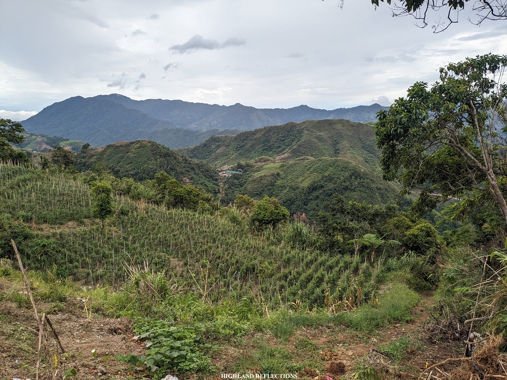
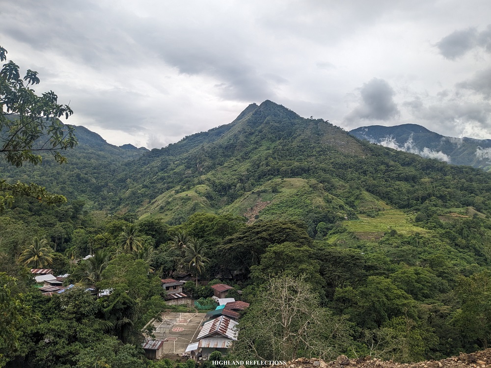
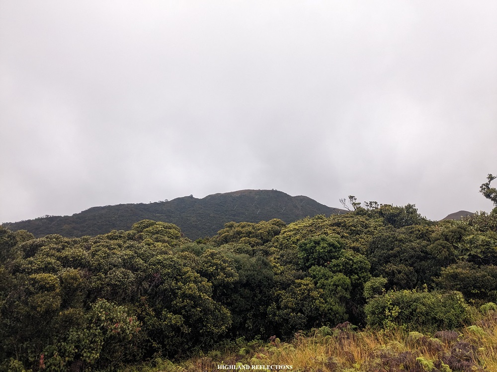
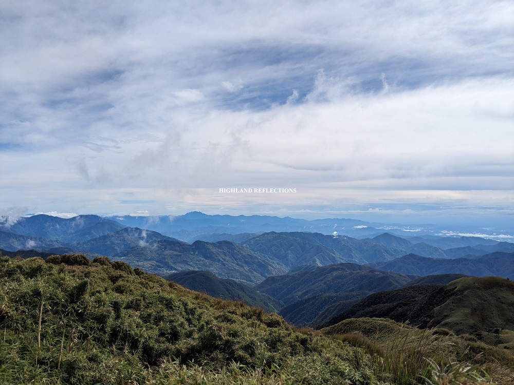
We continued on with the hike along the ascending rough road, now going southwestwards towards Napo Village. The path was highly reminiscent of the rough road from Indupit to Domolpos when hiking Mt. Ugo! Along the rough road, we had an awesome view of Mt. Pullol, one of the hiking destinations in Ambaguio.
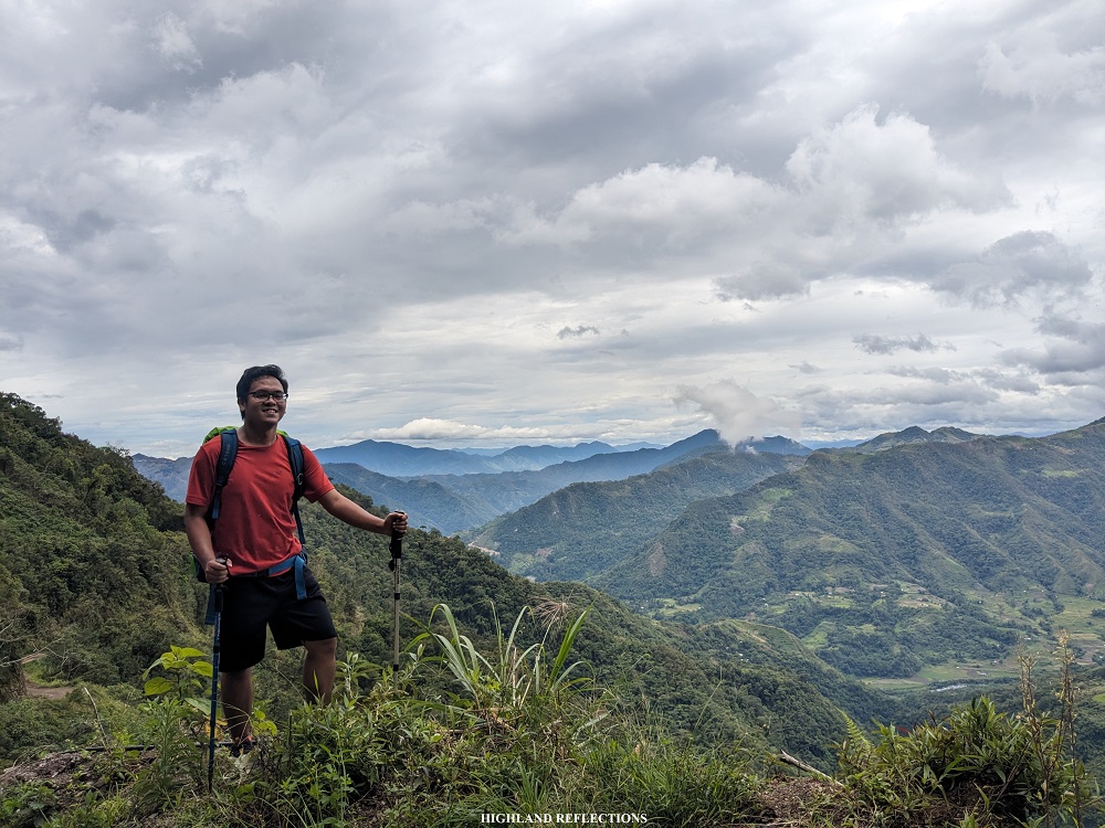
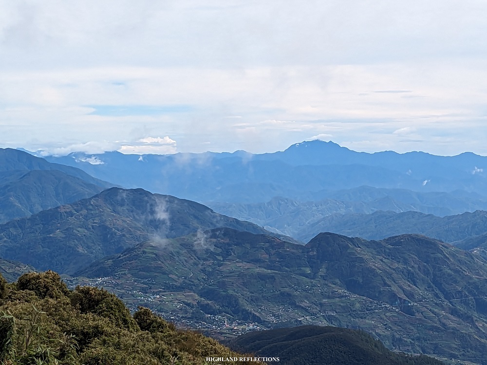
After two hours of continuous ascent along the rough road, we reached a farmland area where the original cardiac trail of Ambaguio converges with the rough road (~1,630 masl). At this point, the houses comprising the Upper Napo community is already visible from a distance. We savored the available mobile data signal as well as the relaxing gusts of wind in the area. At the western direction, we spotted Mt. Palali (1,715+ masl) in the town of Quezon, Nueva Vizcaya, which I hiked back in 2018! It surely felt nice seeing one of the mountains where I had one of my first major climbs.
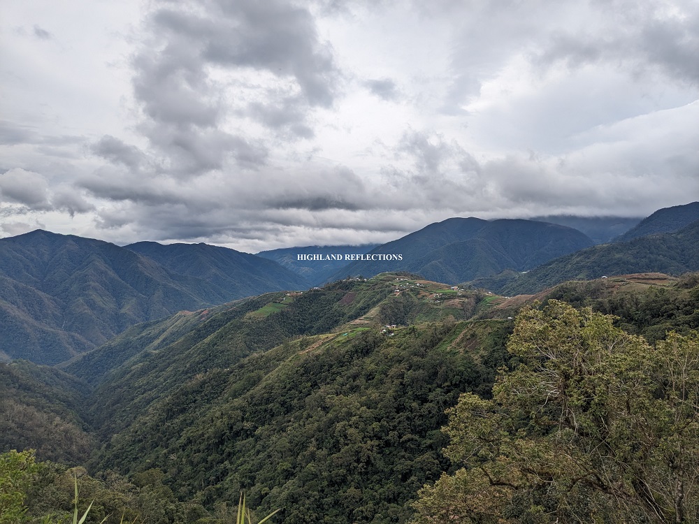
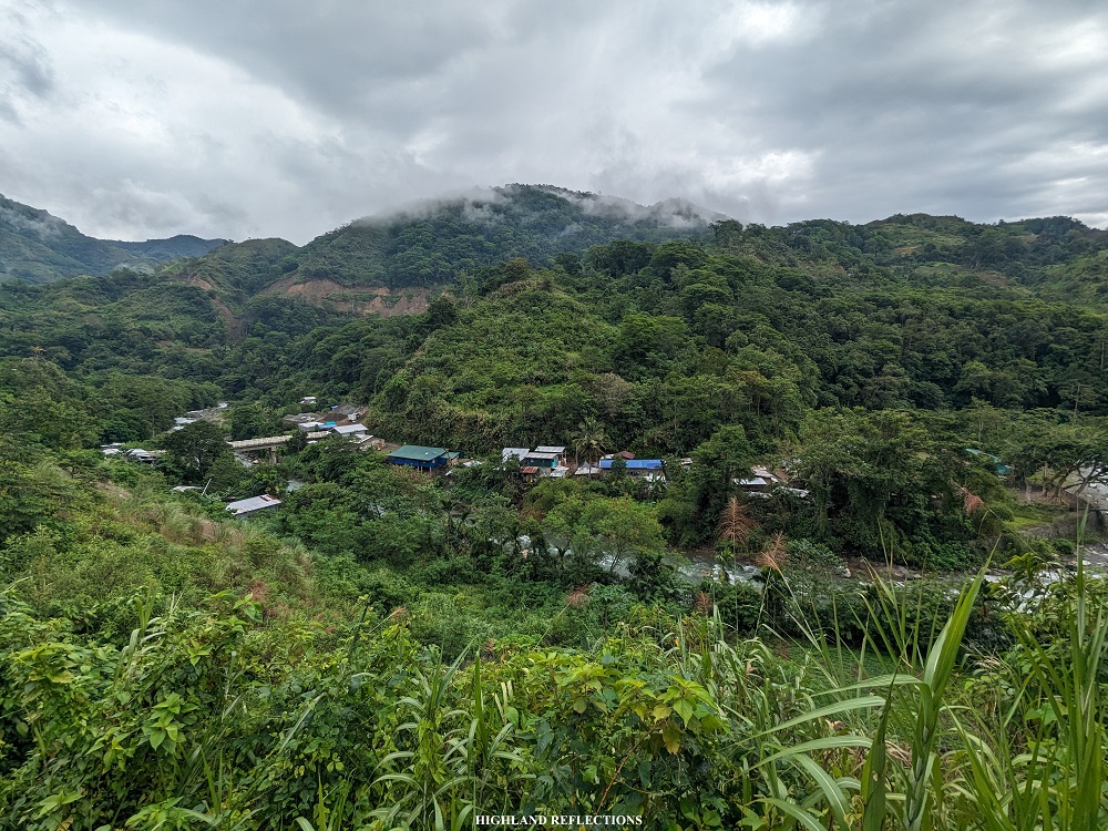
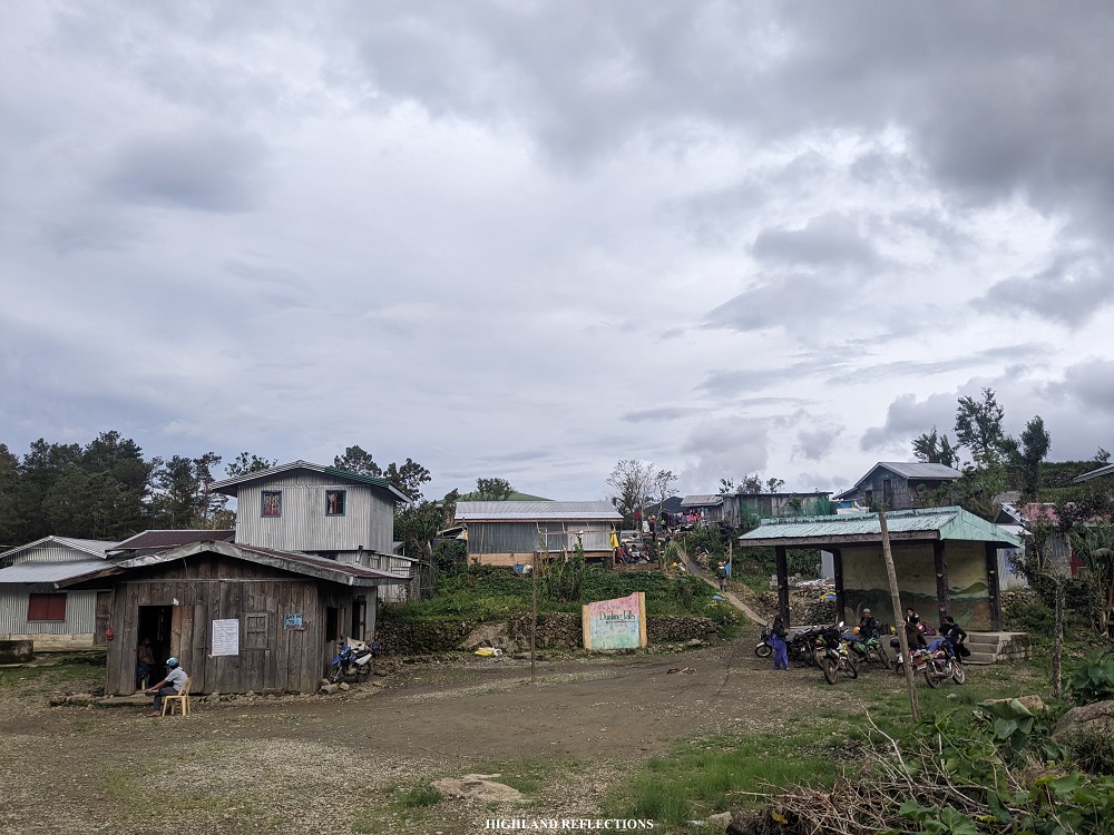
We continued with the long rough road walk and reached Upper Napo (~1,520 masl) around 4:20 in the afternoon. Without any rests, we marched on and left the village onwards to Lower Napo. Along the descending rough road, we had a view of Balete Village tucked on a hill above Lower Napo. The entire scenery felt bucolic as we enjoyed the mountain range vistas surrounding the village. These mountain ranges, I can only assume, are very near the northern portions of Mt. Purgatory and the Ambangeg side of Mt. Pulag!
Before 5pm, we reached the junction of Lower Napo and Balete (~1,380 masl). Years ago, the stopover for hikers doing the Ambaguio Trail was in Lower Napo (~1,320 masl). However, Kuya Ramirez told us that the trail past Lower Napo going to Pulag had already been eroded. Hence, hikers are now advised to go to Balete instead.
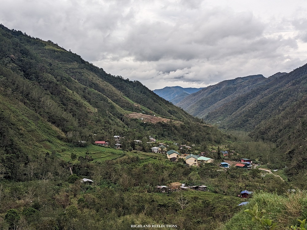
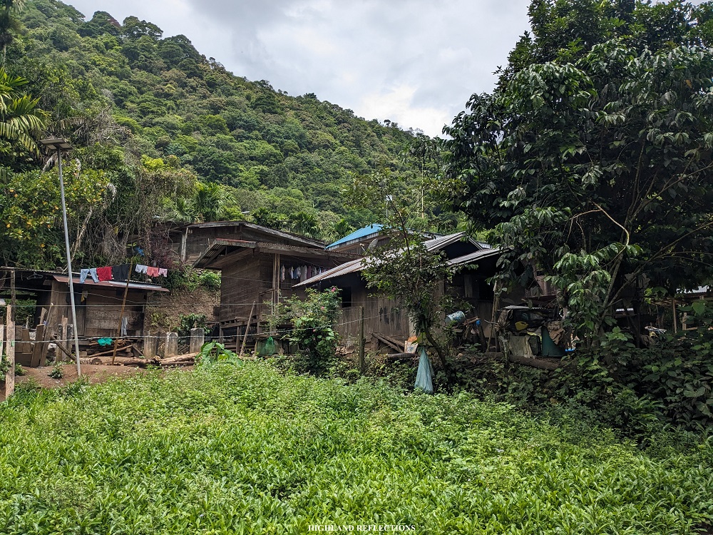
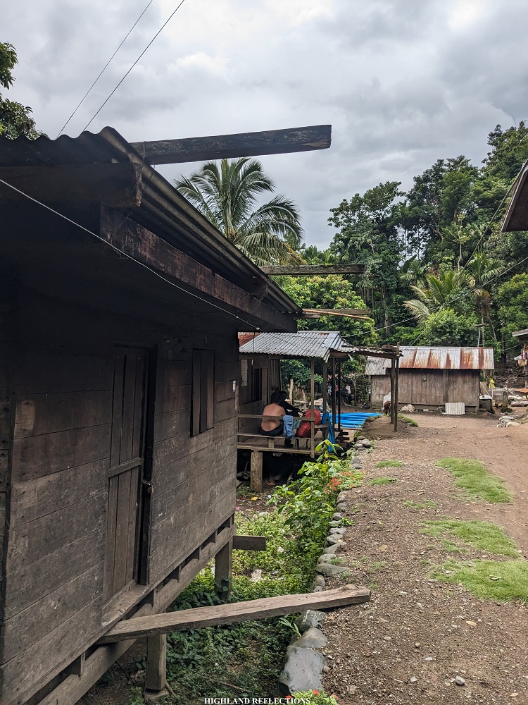
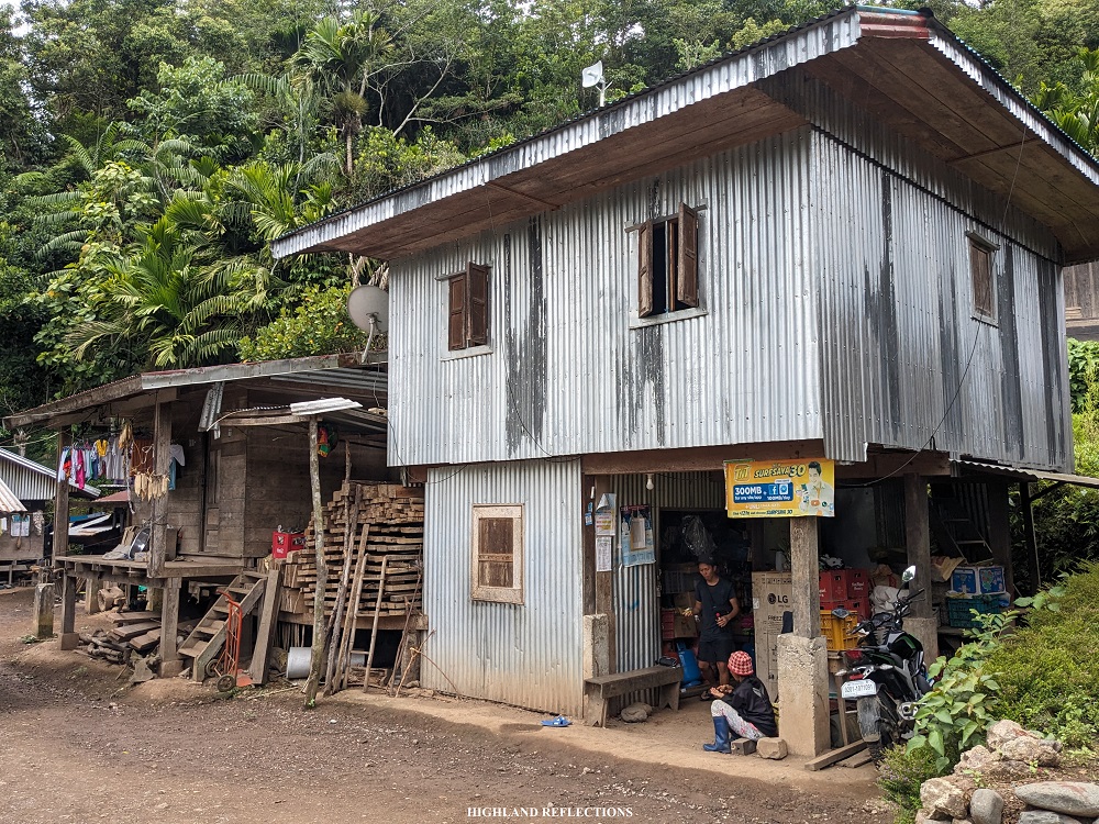
At 5:20pm, we continued with the final ascent to Balete Village. Along the road, we had a nice view of the houses and some school buildings in Lower Napo. Then, as the clock ticked before 6 in the evening, we had finally reached Balete Village (~1,520 masl). To my surprise, I found out that Balete is within the jurisdiction of the town of Kayapa, and not Ambaguio!
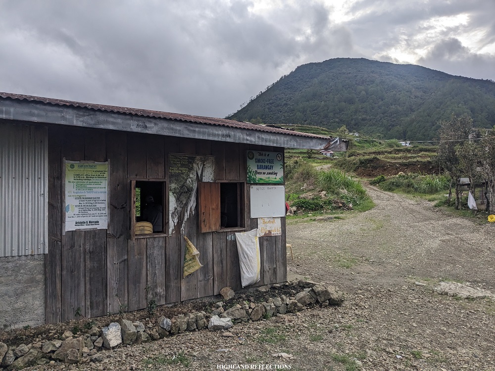
Upon arriving, we were welcomed by the smiles of some curious locals. We were also formally welcomed by some of the officials of the barangay. The officials permitted us to stay at a bunker in front of the barangay hall. This bunker provided us with a table, a wooden divider, and a kitchen sink. After cooking and eating dinner, we unfolded our sleeping equipment on the floor of the bunker and had a good night’s rest. It was a much-needed slumber after the long excursion!
Day 2: Balete Village to Ambangeg Trail Camp 2 (8 hours)
We woke up to the gust of cold wind and drops of rain.
It was 6 in the morning of our second day. The fair weather from the first day had turned gloomy. This was, we reckoned, brought by Typhoon Goring which was passing through the northeastern portion of Luzon during our climb.
After breakfast, I put on my long raincoat. We started the hike for day 2 at 8 in the morning.
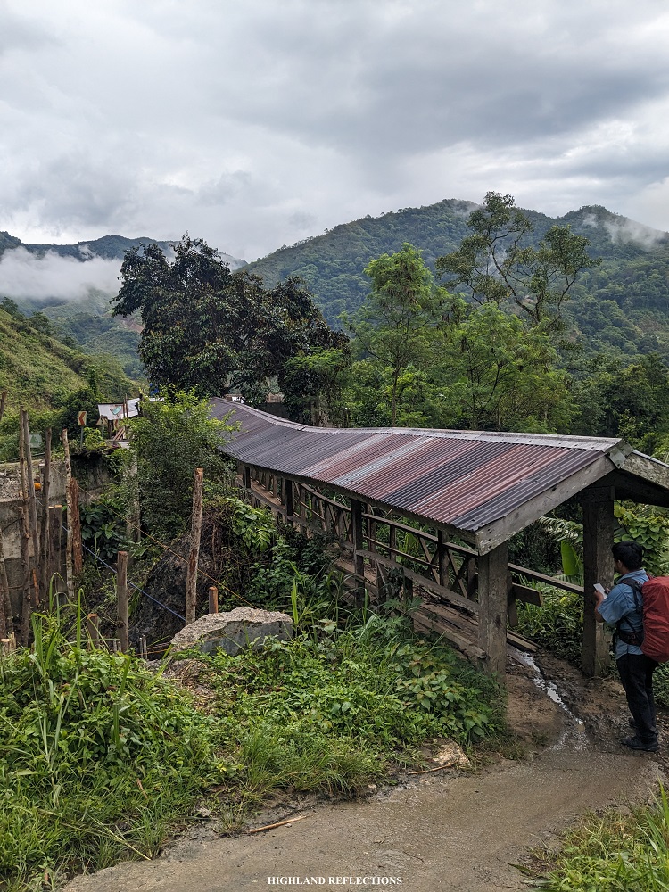
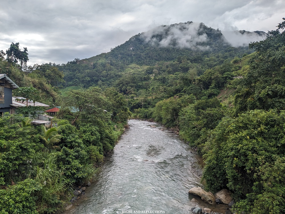
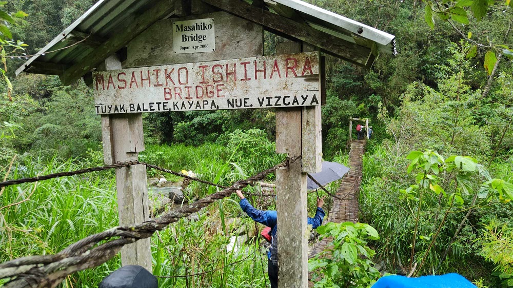
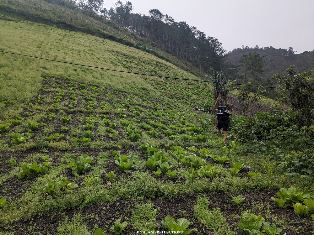
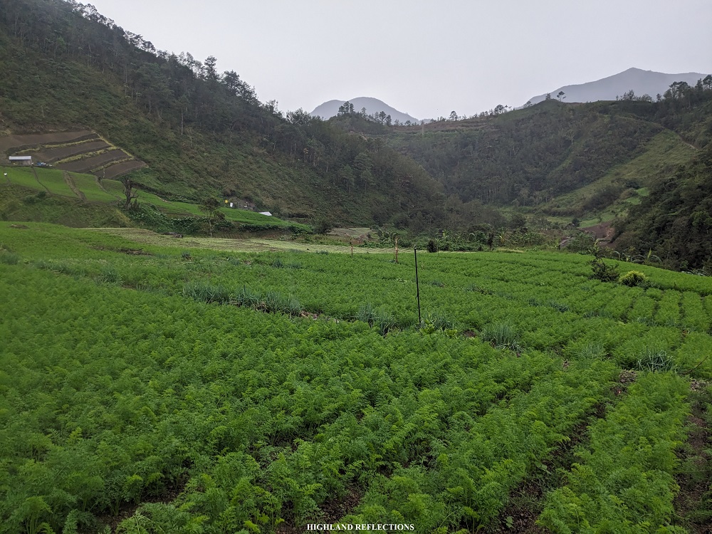
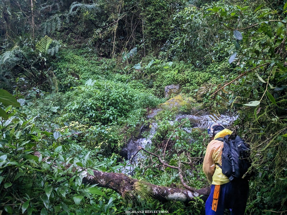
From Balete Village, we descended for 100 meters and crossed a semi-dilapidated bridge, labeled as the Masahiko Ishihara Bridge, on top of a river. Past the bridge, the trail brought us to some of the wide carrot and cabbage farmlands near Balete, where we met some farmers, and passed a few cows and carabaos.
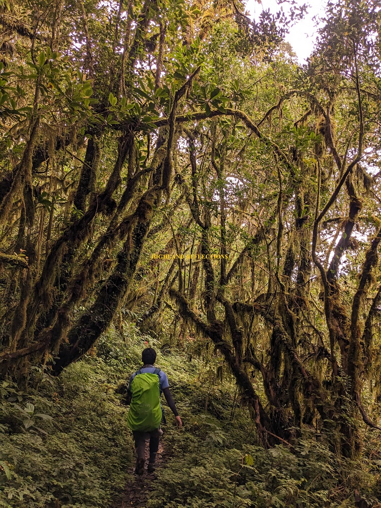
Past the farmland is the start of the ascending trail inside the forest comprising Mt. Pulag’s eastern portions. Inside the forest, we encountered two landslides at the earlier parts, requiring us to stop and let our guide figure out the safest way to pass through it. After the landslide, we reached a house in the middle of the forest, empty, but guarded by a dog. We took the chance to rest and have our late morning snacks here. We also refilled out water tumblers. The drizzle continued.
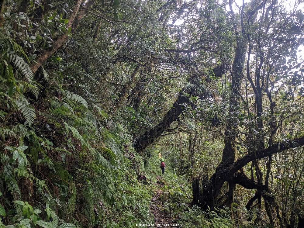
Past the house was a continuation of the ascent inside the forest. Here, we traversed a dried river trail in between two mountain slopes, where several mossy boulders and dried plants comprised of black leaves were scattered around. Afterwards, the steady ascent inside the forest continued, where trees were now all covered in moss!
The ascent was nonstop at this point. Along the middle of the forest, we encountered a ‘crossing’ type of junction, where there are available trails on both left, right, and in front of us. Luckily, the correct path, which was the one to our front, was well-marked with a trail sign. A few hundred meters after that junction is another junction where the previous trail coming from Lower Napo converges with the trail that we were taking (~2,010 masl).
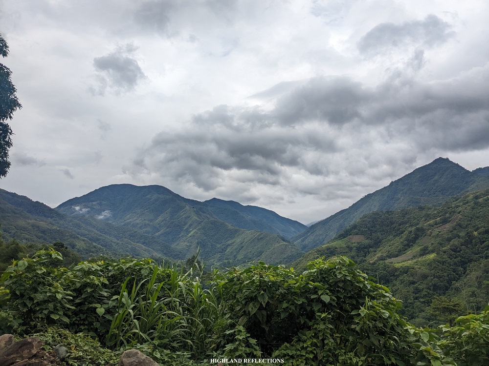
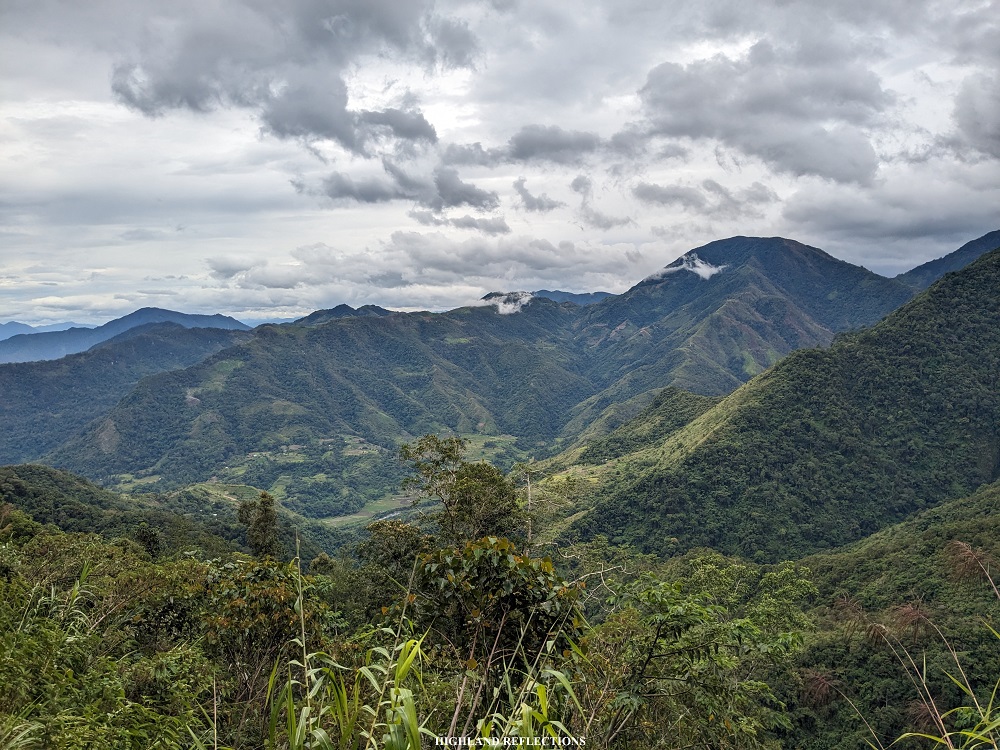
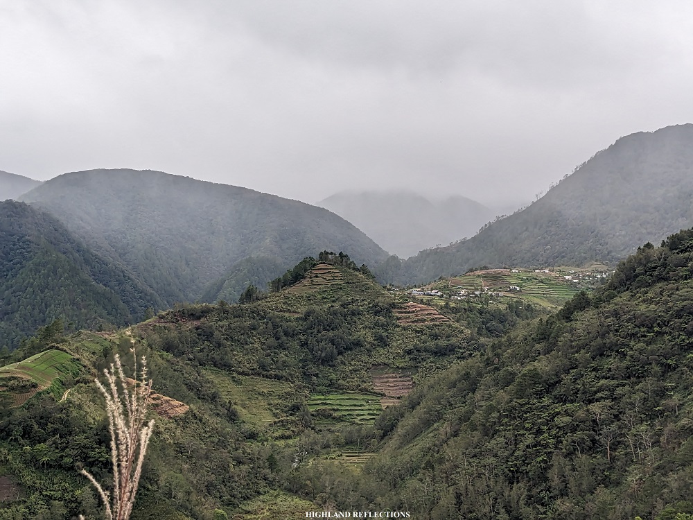
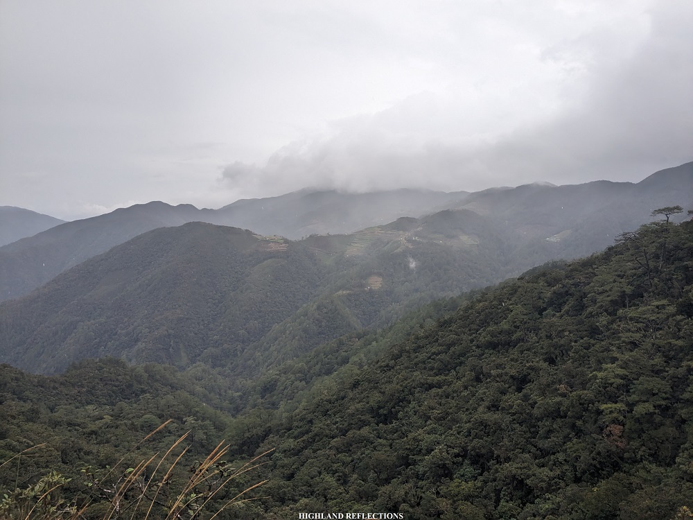
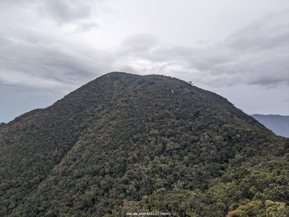
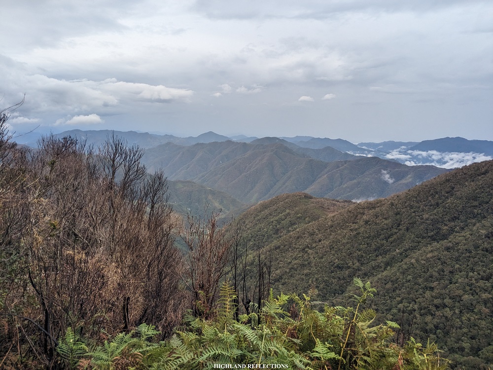
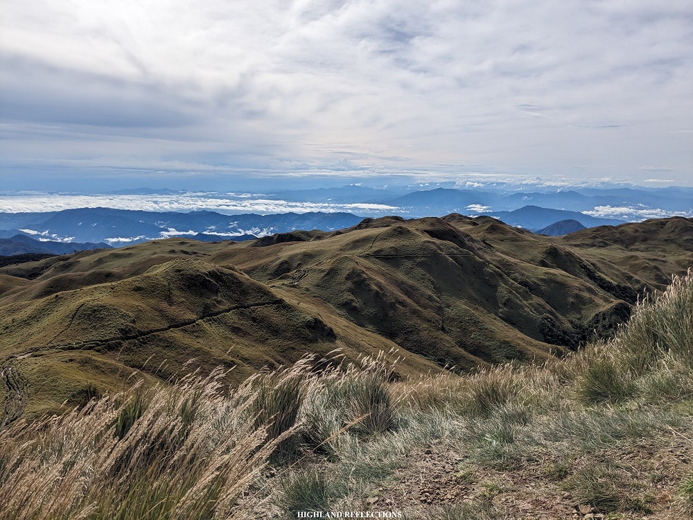
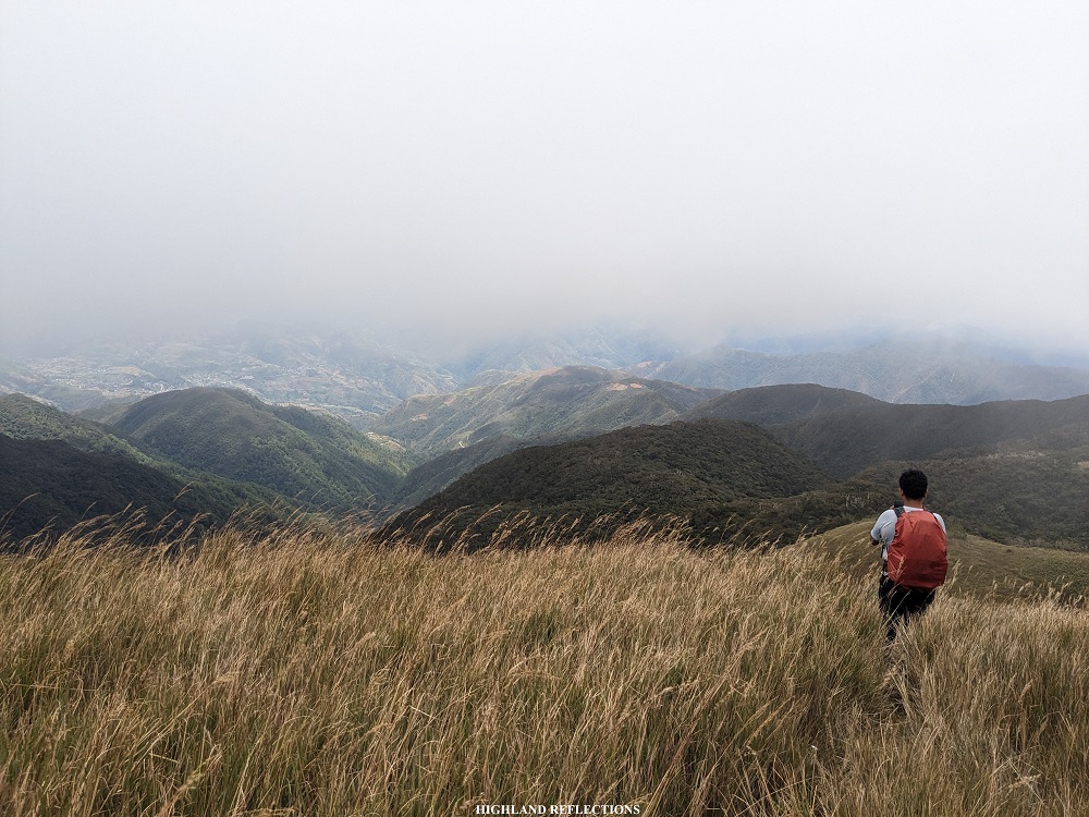
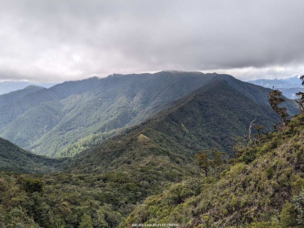
Past the two junctions, the hike became easier. We exited towards an open area where to our left is a ravine providing views of the mountain ranges nearby Ambangeg and Mt. Purgatory! I also spotted a village flanked on a mountain slope. I can only assume that this was either Balete or the faraway Cabayo Village.
Past the ravine is a grassy ridge which connects the forested mountain that we took on the way up from Balete, and the next level of mountain that we had to climb. Upon shortly reaching the entrance to the forest of the next mountain, I rested and savored the awesome view.
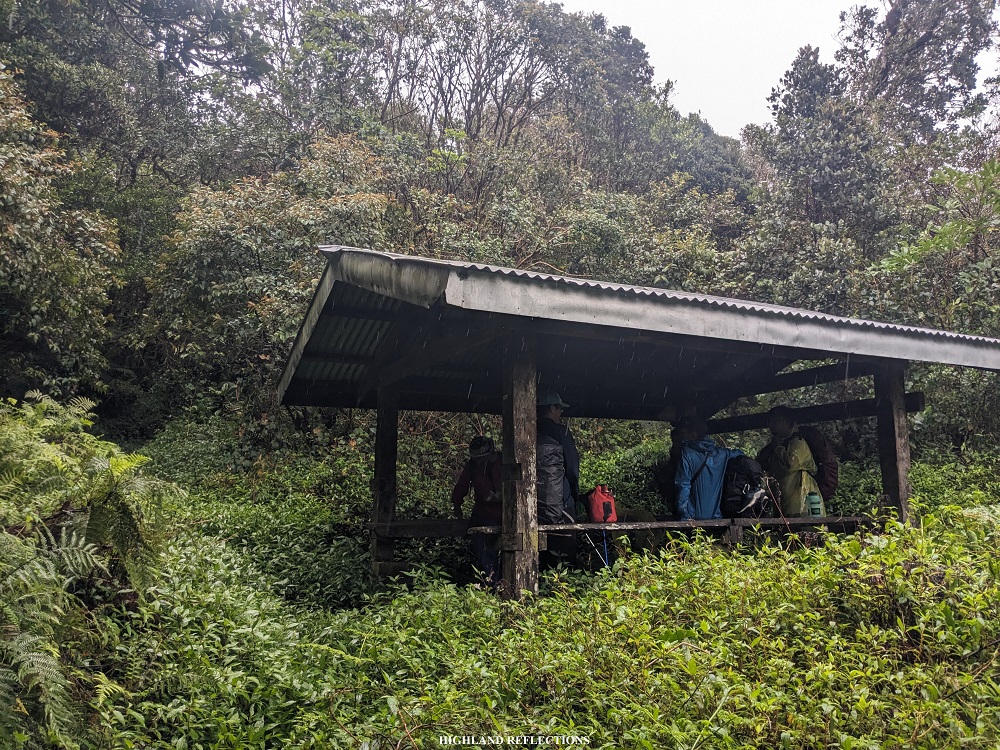
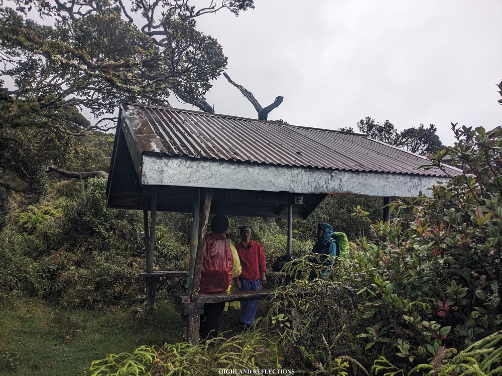
We entered the forest once again. After minutes of monotonously walking inside the forest, we found ourselves at a waiting shed (~2,310 masl), where we ate lunch and rested. It was 1:30 in the afternoon, five and a half hours after starting the hike. I took the chance to change my top as my shirt was already wet from the incessant rain.
We continued on with the hike after the much-needed lunch. The trail past the waiting shed was an easy gradual ascent. I encountered once more an open trail where to my left is a ravine with a view of a nearby mountain slope containing some rice terraces. Based on my relative position on my GPS tracker in my mobile phone, I hypothesized that these rice terraces are the farmlands near Sitio Babadak—the jump-off point of the Ambangeg Trail! I continued with the hike after getting the chance to nerd-out my geography skills to myself.
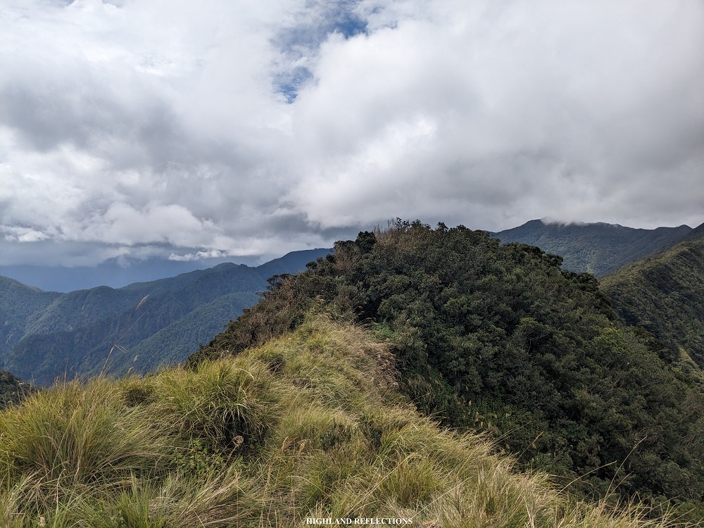
Alas, with our continuous pursuit, we reached another open area at around 2,450+ masl where we encountered the second waiting shed. Here, we already had a sneak peek of the grasslands of Mt. Pulag provided by a mountain slope to our front. Since the cold was too unbearable, we decided to push through and only had a water break at the waiting shed.
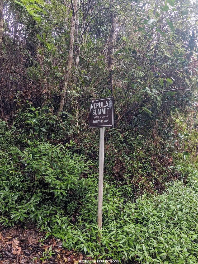
We knew that we were very close to reaching Camp 2 of the Ambangeg Trail. With our invigorated spirits, we continued with the last push. The trail was a mix of open area and some portions of trail inside a mossy forest. Along the trail, we encountered a junction where the other trail leads to the grasslands of Mt. Pulag. Some latter portions of the trail were flooded by the rain. After minutes of continuous fast-paced walk, Kuya Ramirez halted on a grassy area and signaled to us to turn right. Following his directions, we found ourselves on a wide, well-established trail. Realization struck us: we were now in the Ambangeg Trail! In less than five minutes, we reached our stopover for the day—Camp 2. It was four in the afternoon.
Appallingly, once we entered the vicinity of Camp 2’s bunkhouse, torrential rains brought by Typhoon Goring poured in all its rage. This would go on nonstop for the entire evening.
The four of us in the lead group climbed aboard the elevated bunkhouse and crammed ourselves into corners inside. We were sharing the abode with some hikers from the Akiki Trail. Despite their presence, we didn’t hesitate to change clothes and make ourselves cozy. As I was changing clothes, I found a limatik bite on my right foot as I was changing. I guess there are some minimal limatik presence inside the mossy forest of the Ambaguio Trail!
At 7 in the evening, the remaining individuals from the sweeper group arrived. We decided to just cook and eat instant noodles for our dinner. Then, we attempted to get some sleep, with the biting cold interrupting us every few hours.
Day 3: Summit Bid and Descent to Tawangan (8 hours)
We could see the grey skies from one of the openings of the ceiling of the bunker. Almost everyone in our team was hesitating if we would push through with the summit assault. Past 6 in the morning, I decided to fetch some water near the camp. As I reached the open area of Camp 2, I was glad to see the sky in its blue hue, a sharp contrast to the weather just the night before!
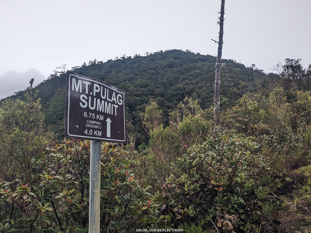
With my restored excitement for the summit bid, I decided to push through with the summit assault alone at around 7:20 in the morning after taking some hearty breakfast. I took the time to push through with the summit assault with a relaxed pacing. Somewhere along the trail, I spotted a faint view of Mt. Amuyao—Luzon’s 5th highest mountain—being flanked by two nearby hills of Pulag’s summit area.
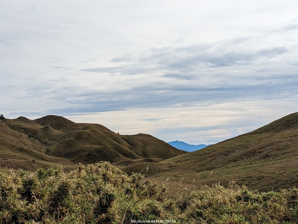
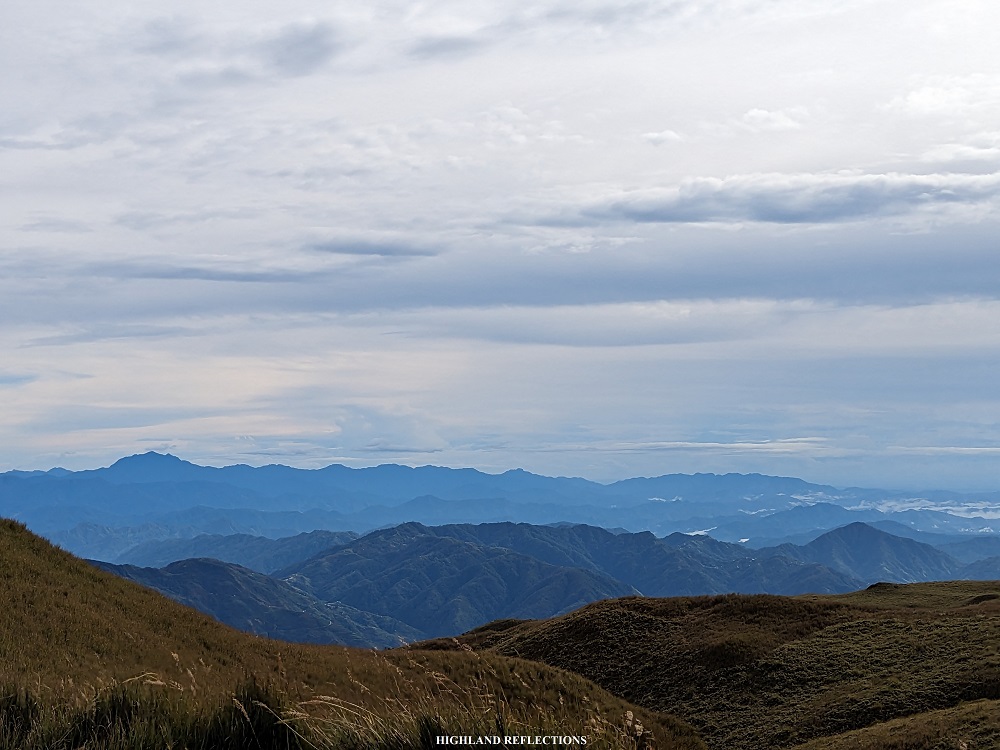
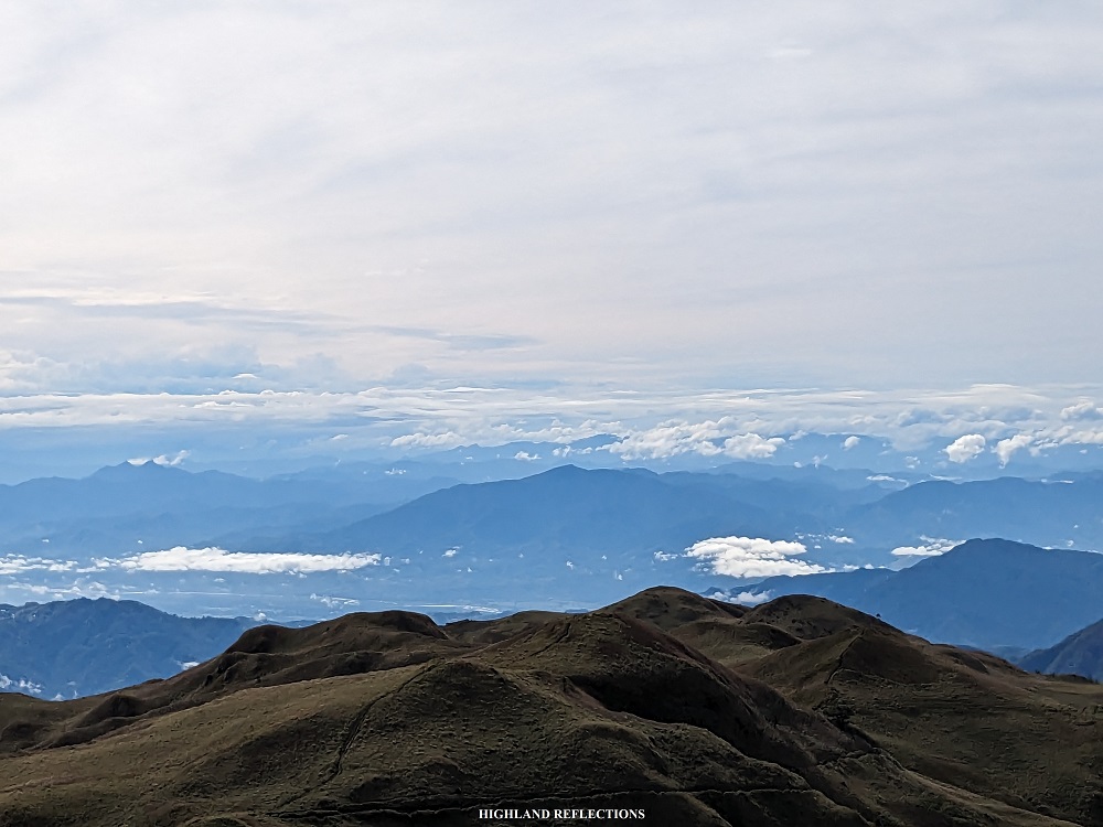
I reached the summit an hour after starting the hike from Camp 2. This was now my fourth time summitting the highest mountain of Luzon! Instead of snapping a picture at the side of the signboard marker, I went to the view deck at the side of the summit and savored the awesome vista. Since there wasn’t any sea of clouds at that time, I was able to fully appreciate the clear views at the northern, northeastern, and eastern direction, where I saw the town of Tinoc, Ifugao, and the lowlands of Nueva Vizcaya for the first time from Pulag’s summit! I was also able to trace the mountain slopes where the Tawangan Trail is located.
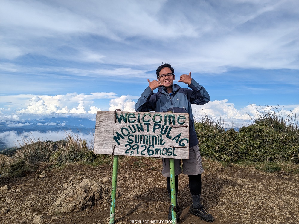
After sightseeing, I joined with some of the hikers from Ambangeg and Akiki at the summit marker, and requested to get my picture taken as I was solo. Then, the rest of the lead pack of our team arrived. They quickly snapped some pictures and immediately descended.
I was back at camp past 9 in the morning. Immediately, I packed my things and ate my lunch as we readied ourselves for the long descent to Tawangan Trail.
The Tawangan Trail of Mt. Pulag, located in Kabayan, Benguet, is dubbed by many as the “bloody trail”, owing to the abundance of limatiks or mountain leeches in the trail. The trail is covered mostly by a picturesque mossy forest, which, in my opinion, is one of the most magnificent in the entire country. Luckily, I have taken the Tawangan Trail a year prior so I was familiar with some of the awesome landmarks within the trail!
We started the descent late at 11 in the morning. Since Tawangan is in the northern portions of Mt. Pulag, we needed to pass through the grassy slopes of the summit area once more until reaching the junction that goes to Tawangan. From there, everything was a familiar sight. We reached the entrance to the mossy forest an hour after starting from Camp 2.
As we entered the limatik kingdom, the trail greeted us with a very steep descent. We halted at one of the awesome landmarks in Tawangan—an otherworldly tree filled with lobed, mossy branches. After snapping some pictures at the picturesque landmark, we continued with the descent. Many parts of the trail were blocked by fallen trees, requiring our guide to halt and cut them down to make a way.
The limatik attack started when we descended an open trail filled with thick undergrowth. This trail’s overlooking view of the forests of the Tawangan Trail compensated for its vexing features. Then, the descent inside the forest continued. Every few meters, small limatiks were attaching themselves to my legs!
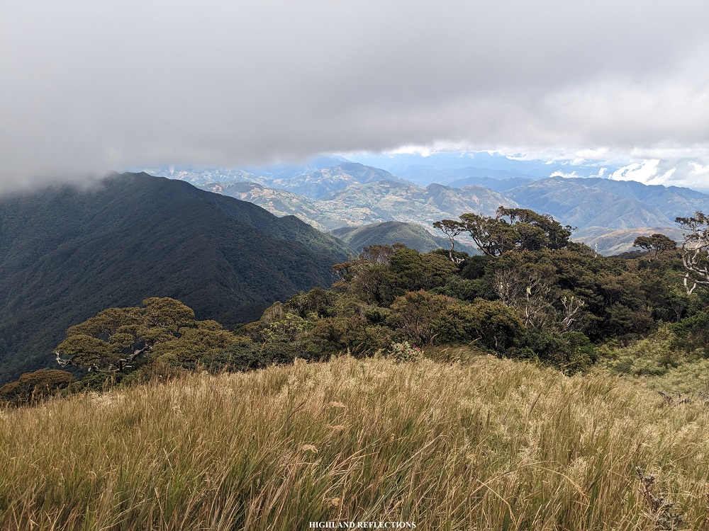
At 2 in the afternoon, we reached a small grassy ridge (2,360 masl). During my first time in Tawangan, we had no views when we reached this ridge due to the thick fog surrounding us. However, in this Tawangan descent, we had an awesome view of the surrounding mountains!
We rested at the ridge and took the chance to both eat some snacks and remove the limatiks that attached themselves to our legs. After Kuya Ramirez was done munching on his trail food, we continued with the hike. Past the ridge is a short ascent. Then, the descent continued until reaching a more gradual part. The mossy characteristics of the trees here were enchanting! I couldn’t stop taking pictures of it! The surroundings felt so alive. Still, despite the relaxing sight, limatiks wouldn’t leave us alone.
We reached a waterfall blocking the trail at 3:30 in the afternoon (~2,110 masl). I remember having our breakfast at this waterfall during my first time in Tawangan!
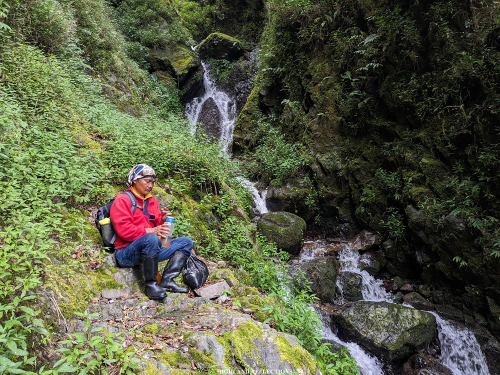
After munching on some snacks and refilling our water tumblers, we continued with the hike. The trail past the waterfall gradually transforms into a pine forest. Despite the presence of pine trees, because of the undergrowth, the presence of limatiks did not wane down at all! Somewhere along the long trail, we encountered a junction, where to the left is the continuation and the last portion of the Tawangan Trail.
We thought that this would just be a short, easy denouement towards the end of the trail. We were mistaken! The last few portions of the Tawangan Trail runs on a downward stream. Probably because of previous typhoons and due to the lack of activity in the trail, we encountered several landslides and fallen trees, both blocking and destroying some portions of the trail as a result. Several times, we had to halt and wait for our guide to create footpaths for us.
As the clock was ticking past 6 in the evening, we finally found some of the last portions of the trail, which were fortunately undisturbed and still well-established. After a few hundred meters, we exited towards some of the farmlands of Barangay Tawangan. Despite the aching knees, we power-walked the long, cemented road going to the barangay proper. We reached the barangay hall before 7 in the evening. I had 5 additional limatik bites brought by the resident creatures of Tawangan!
There, I washed-up all the dirt on my body and put on some coverings for the limatik bites that I incurred. Afterwards, we spent the rest of the night waiting for some of our companions who were still inside the trail. One of them arrived at 9 in the evening, while the last two arrived at 1 in the morning! All of them were safe and sound despite the exhaustion in their bodies and their bloodied skins.
**
I have now taken all four primary trails of Mt. Pulag. It felt surreal that I have seen and experienced Pulag from all available angles and jump-off points. It was made more special with what Ambaguio provided—awesome vistas, a favorable weather (despite the storm), and a deep immersion into the villages and footpaths of the eastern Cordilleras.
The three-day experience provided me with some of the most humbling yet exciting experiences in my hiking pursuits. I have learned to take things slowly and appreciate the things around me—the shape and color of leaves, the sound of the forest and rivers, the panting of my companions, and the swirling thoughts inside me as I make sense of everything that my body absorbs. Thanks to my companions, I have also learned the perfect pair for perseverance—an attitude of never caring for difficulty levels and distances, but rather, enjoying what is offered to you by the mountain and the events presented by the hike. Truly, the longest bloody trail of Mt. Pulag brought out the entire humanness in me.
Will I ever return to this Luzon highland? Definitely. It wouldn’t be my favorite if I wouldn’t long of returning to it.
Itinerary
Day 1
05:00AM Ambaguio Town Hall, rest
06:00AM Breakfast
08:00AM Start hike from town hall
09:00AM Ammoweg, breakfast and buy packed lunch
10:00AM Resume hike
11:00AM Village, rest
11:30AM Resume hike
12:00PM Rough road going to Napo
03:00PM Original Ambaguio trail junction
04:15PM Upper Napo Village
05:00PM Lower Napo and Balete junction, rest
06:00PM Balete Village
08:00PM Lights out
Day 2
06:00AM Wake-up call
08:00AM Start hike
10:00AM Water source, rest
12:00PM Junction
02:00PM First waiting shed, lunch
03:30PM Second waiting shed
04:00PM Camp 2
09:00PM Lights out
Day 3
05:30AM Wake-up call
07:00AM Breakfast
07:20AM Summit assault
08:20AM Summit, take pictures
09:15AM Back in Camp 2, early lunch and pack-up
11:00PM Start hike to Tawangan Trail
12:00PM Entrance to Tawangan Trail
02:00PM Grassy ridge
03:30PM Falls
04:30PM Last portions of Tawangan Trail
07:00PM Barangay Tawangan, wash-up

Hello! I am coming to Luzon in December and am planning to spend a week hiking. Your blog is great, it’s been really helpful already 🙂 I wonder if you would be able to email me with some information about how to find a local guide for a multi day hike e.g. the Mt. Pulag via Ambaguio Trail (although I am not yet decided on what routes I will do)? Local guides aren’t something that you typically need for hikes in Australia so I don’t know where to start! Would love to connect if you would be happy to share some info with a clueless foreign hiker! Thank you
LikeLike
How much was your budget? Any more tips when taking this trail. Thanks a lot!
LikeLike