Mt. Mandalagan: An Overview
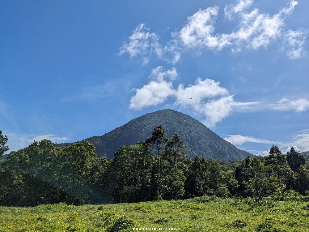
Mt. Mandalagan is one of the three primary mountains of Negros Occidental, sandwiched between Mt. Silay in the north and the venerable Mt. Kanlaon in the south. Its old-growth forests are characterized by a diverse flora with mossy characteristics in the upper reaches. Its rainforests are well-preserved and its trails, despite being well-established over the years, retains its primordial characteristics.
The primary hiking activity inside the enormous, potentially-active volcano complex is through visiting the main crater of Mt. Mandalagan called Tinagong Dagat, located in the western portion. Another destination is the Sulfutara some two hours away from Tinagong Dagat. Both attractions can be reached via either of three trails: Campuestuhan Trail in Sitio Campuestuhan in Cabatangan, Talisay City; Patag Trail in Patag, Silay City; and Canlandog Trail in Canlandog, Murcia. For this trip, we took the Campuestuhan Trail as an entry point and Patag Trail as the exit point.
However, unbeknownst to many, the highest summit of Mt. Mandalagan is located in the southeastern portion of the mountain in the municipality of Salvador Benedicto, with an elevation of 1,885 masl. Some information online say that there is a trail going there, albeit less popular, and has a traverse trail going to the western attractions of the mountain such as Tinagong Dagat.
The highest possible point that can be reached via the Campuestuhan to Patag Traverse is the Marapara Peak (1,647 masl), located northwest of the mountain complex. The descriptor “possible” is added since going to the peak is optional, as guides say that the trail there is very steep and technical. Guides would often opt for an alternate trail going to Patag which does not require to pass through Marapara Peak.

Mt. Mandalagan, as I see it, is a mountain still filled with numerous potentials. While it is a main hiking attraction in Negros Island, there are still many things about the mountain that can be discovered, one of which, as mentioned above, is its not so well-known highest summit. Even its etymology is quite difficult to search online. “Dalagan” according to the Hiligaynon language means “to run”. Although I am by no means a Hiligaynon local, I surmise that the mountain became a hideout of Japanese soldiers during World War II (i.e., to where they run). This is evidenced by the metal shrapnel, equipment, bomb shells, and other World War II remnants reported by those who have hiked via the trail in Salvador Benedicto.
Anyhow, here is my observation of the characteristics of our hike:
MT. MANDALAGAN (Campuestuhan to Tinagong Dagat to Patag)
Entry point: Sitio Campuestuhan, Cabatangan, Talisay City
Exit Point: Patag, Silay City
Days required / Hours to campsite: 1-2 days / 4-6 hours
Specs: Major climb, difficulty 6/9 (subjective), trail class 1-4
Features: tropical rainforest, crater lake
Here is my story of hiking Mt. Mandalagan.
Day 1: The Slippery and Wet Campuestuhan Trail
A month prior to the hike, our entire team processed the necessary requirements in climbing Mt. Mandalagan, which included some fees, a mountaineer’s information form, a notarized waiver, and a Trek Orientation Certificate which will only be given after taking a Google Form quiz. Such requirements, personally, were quite a hassle to process. I hope the Northern Negros Natural Park will try to rethink about its requirements and gather best practices from other natural parks in the country and internationally.
Still, I commend their commitment in making sure that Mt. Mandalagan remains clean from unnatural wastes as evidenced by their recording and checking of wastes of every hikers. This, I think, is a win for them!
Enough with the commentary. Let’s get on with the story.
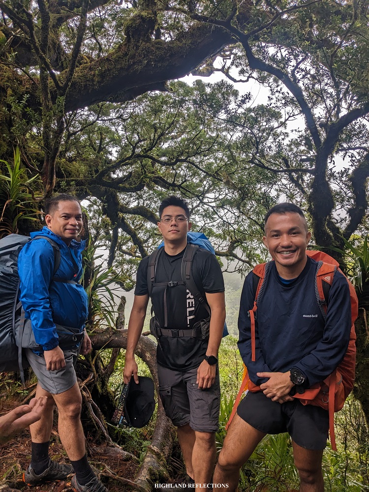
We spent the night in the heritage-rich City of Silay. I was with my usual hiking friends JM, Leniva, Rex, Fara, and Cristine. I was also with Cristine and Fara’s close friend, Mylene. All seven of us joined a semi-DIY, semi-organized tour led by Rochelle, Khael, and Rainer. We were also with some of their friends, Faisal, who was with two Ilonggo hikers, Jay and Tyson. All thirteen of us met in Jollibee Silay and were fetched by a jeep going to Sitio Campuestuhan in Cabatangan, Talisay City, which took us more than an hour to reach. The jump-off point was just near Campuestohan Highland Resort, a popular tourist destination in the area.

We started the hike at around 9:20 in the morning. The trailhead (~790 masl) is just behind residential houses barred by a signage that tells the trail is off limits (unless of course, you have a permit to hike). Initially, we passed through beautiful lowland forests, all made up of well-preserved and huge dipterocarp trees and an abundance of shrubs and plants. Then, just after ten minutes, we exited towards a short grassland section where the many peaks of the western portion of Mt. Mandalagan are visible. Towards our left, in the northern direction, Makawili Peak stands.
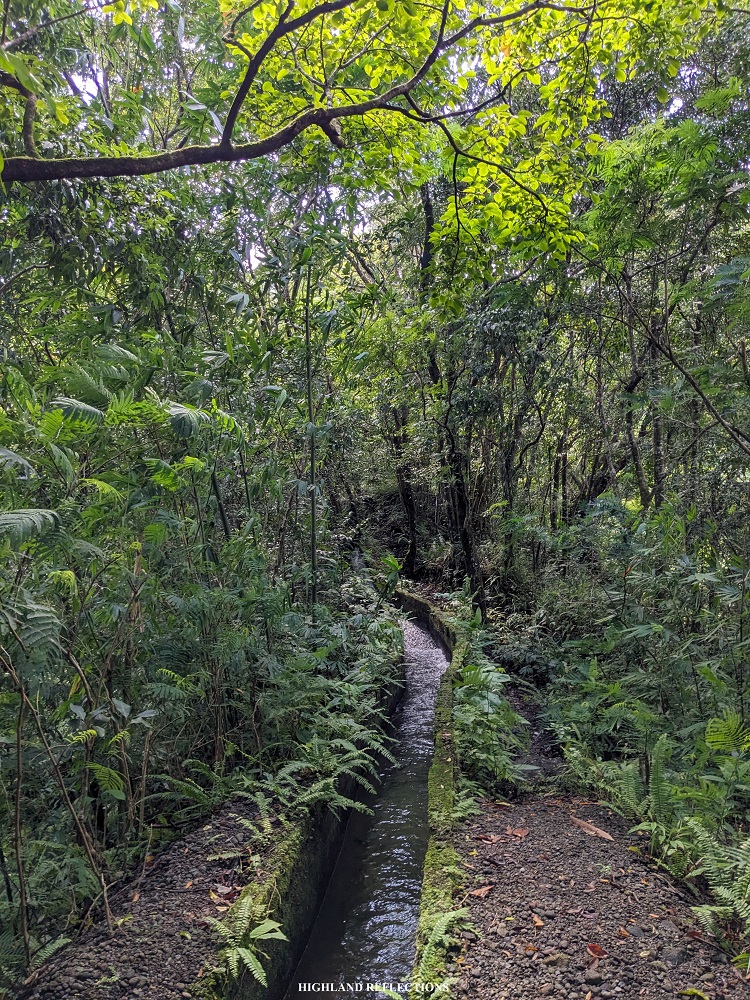
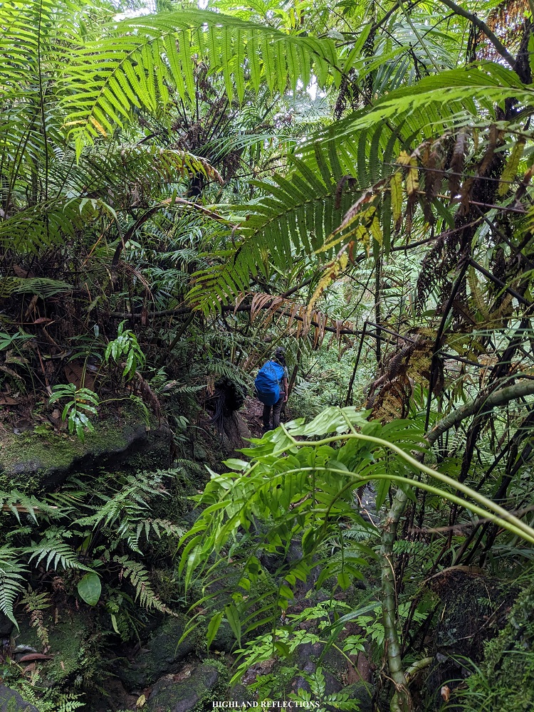
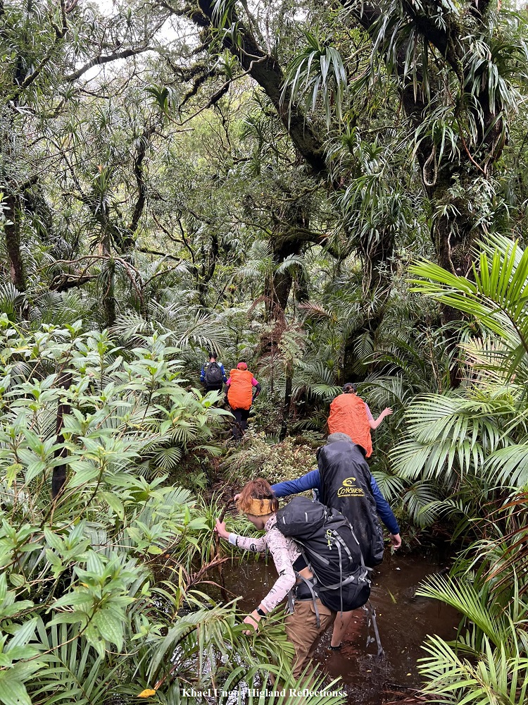
I spent the entire hike up with my friends JM and Leniva, all three of us were the last, making us the sweepers. Several times, we encountered some waterway canals at the side of the trail. The last portions required us to walk through the side of the canal cramped by an overgrown slope at the side. As I was having difficulty negotiating the trail, I decided to take my shoes and socks off and just walked the middle of the canal barefoot. The end of the canal is a mini dam which we passed through.
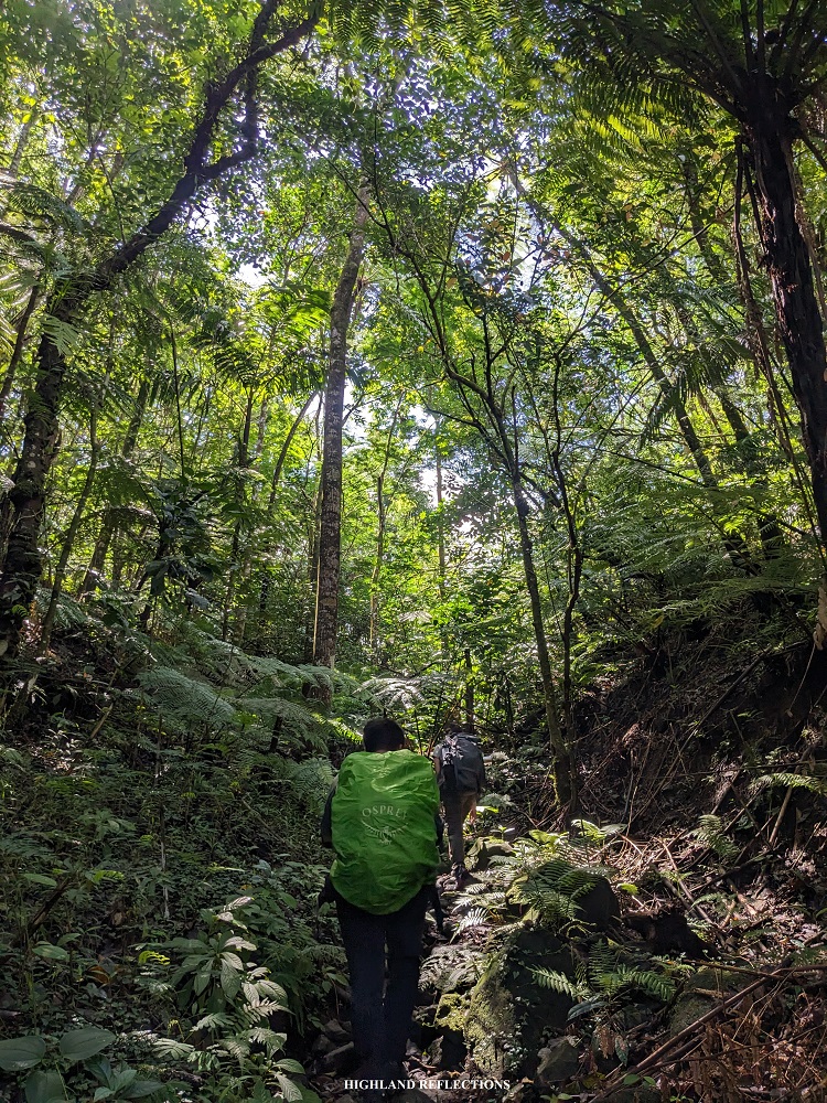
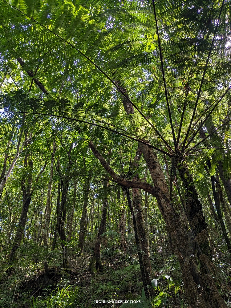

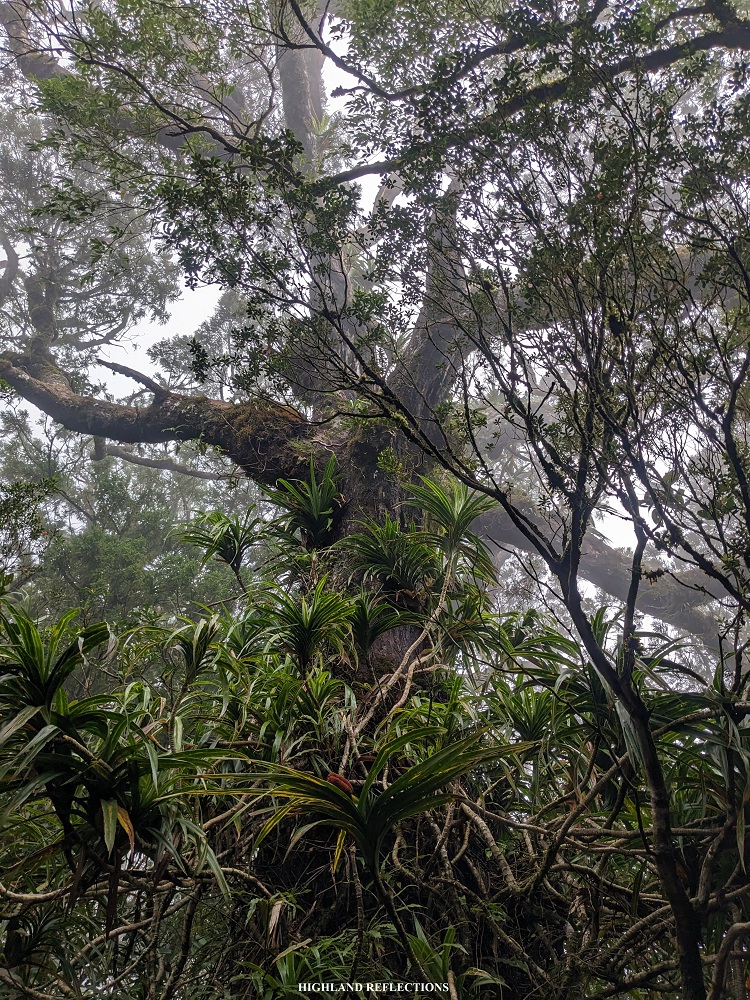
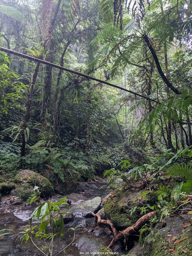
Then, past the dam is a continuous ascending trail inside Mt. Mandalagan’s rainforest. The trail here was very slippery and was dotted with mossy boulders, making it very difficult to tread on. Some portions were sharply steep, and was quite challenging for someone with a full pack. Along the trail are wild flora, much of which I can never identify as I have no background in botany, except for pitogo trees, almaciga, and some flowers I often see in the rainforests of Luzon such as the Medinilla (or Showy Asian Grapes, scientific name Medinilla speciosa). The trees inside the rainforest are some of the largest I have seen in the entire country!

At 1:30 in the afternoon, after hours of continuous ascent, we reached the highest point of the Campuestuhan Trail (1,510+ masl), just sitting above the Tinagong Dagat. We took the chance to rest here as the surroundings were quite magnificent. Besides the magnificent trees, several Medinilla were scattered around the area.
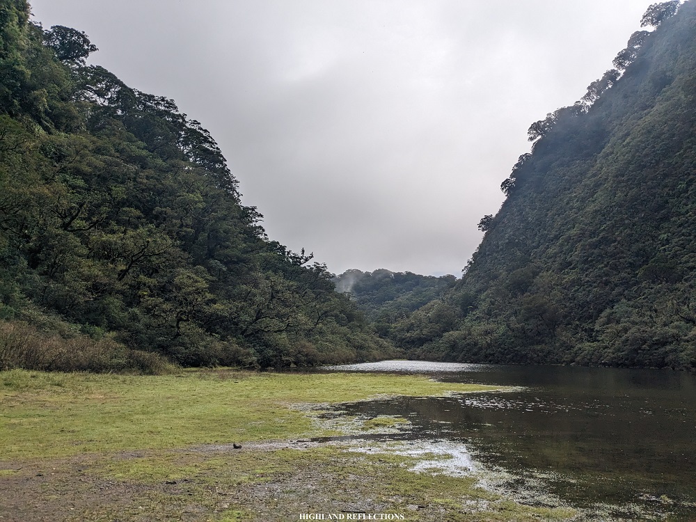
After just ten minutes of descent, we reached Tinagong Dagat (1,450 masl). There, the team was already settled. Rochelle and Khael were cooking some pansit and lugaw, while the rest of the team were taking pictures. The entire area was filled with knee-deep water, except for the southern area where we set up our tents. As the main crater of Mt. Mandalagan, it is enclosed by a forested slope covered in bonsai-like giant trees.
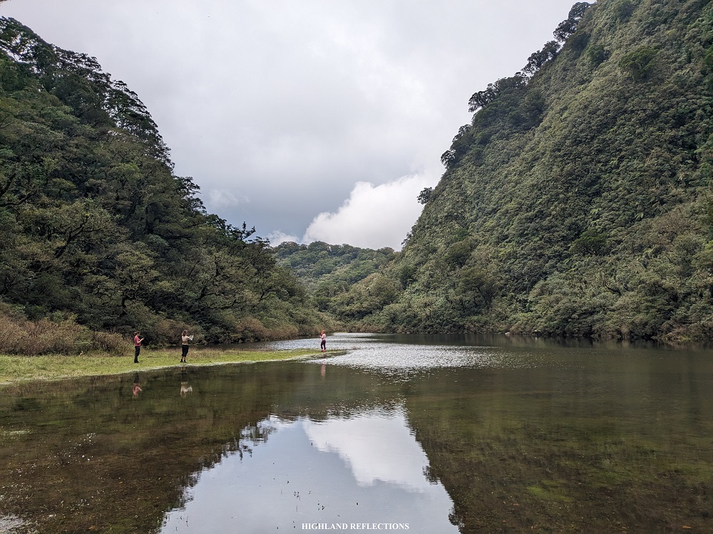
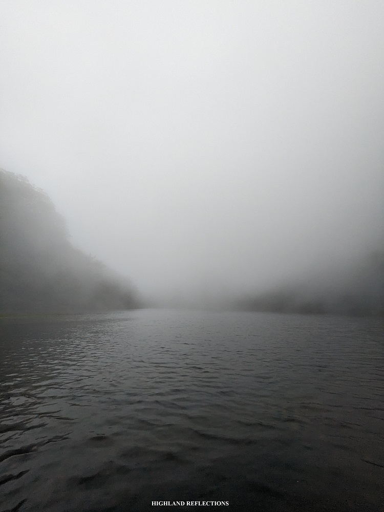
We enjoyed the entire afternoon doing all sorts of shenanigans inside the undisturbed campsite. Sometimes, fog would envelop the entire place, adding further mystique. There were some occasional rains too. At night time, we bonded over a sumptuous dinner prepared by Rochelle, Khael, Rainer, and Rex. Then, we concluded the day with a not-so-quiet stargazing.

Day 2: The Limatik-Filled Patag Trail
Since I needed to catch my afternoon flight back to Manila, I decided to ‘lead’ the lead pack on the way down, comprising of just me and Jay, one of the Ilonggo hikers. We left the campsite at 9:10am after having our breakfast and several more shenanigans with the group enjoying the marshland that is Tinagong Dagat.

Since the entire crater was filled with water, we needed to pass through the side of the mountain slope to the left of Tinagong Dagat to avoid getting our shoes wet. The initial parts was a monkey trail, in which we needed to pass through several boulders and fallen trees. Then, as we reached the northern tip of Tinagong Dagat, we entered an area called by the guides as the Swamp. True enough, the entire trail was filled with muddy waters. Past the swampy area, we ascended towards the ridge top. I took a breather after the 2-minute steep ascent.
After the ascent was a rather enjoyable hike on top of a forested ridge reminiscent of Mt. Talinis’ Nagbalagbag Ridge in the Dauin side. Somewhere along the trail, we passed by the junction going to Marapara Peak. The entire ridge was filled with almaciga trees.
And then, after the ridge was a nonstop descent. The trail wasn’t that steep. Some portions were even flat and nontechnical. However, what made the descent quite challenging was the abundant presence of limatiks. They were everywhere! My shoes and legs were filled with these creatures every few meters! I even stepped on an assemblage of dried leaves filled with limatiks. My entire left shoe was ‘soaked’ with these little creatures. I was trying to take them off every few meters but they were persistent!
With only minimal rests, Jay and I reached the river above Dumalabdab Falls at around 11:50am, marking the last portions of the entire descent. Since rain poured during that time, I wasn’t able to ask my guide if there is a trail going down to the falls. We, instead, continued with the last 15-minute portion of the hike. At 12:15pm, we reached the exit point of Patag Trail where several resorts are dotted. There, I found four limatik bites on my left foot and two on my right. The insides of my hiking shoes were also filled with limatiks, both big and small!
Almost everyone reached the exit point just past 12:30pm, and we were complete by 1:50pm. We took the chance to cleanse ourselves in the resort. Then, we returned to Silay City. The seven of us who parted ways with Rochelle’s group had our celebratory late lunch in Mang Inasal.

I took my afternoon flight alone while the rest of my friends explored Silay and Talisay City. The quick weekend trip concluded with a beautiful sunset overlooking Taal Lake, and then, Manila Bay, as we were having our flight’s descent.
I hope to see Bacolod and Negros Island some more in the future!
Itinerary
Day 0
Flight to Bacolod-Silay International Airport
Day 1
06:00AM Meet-up at Jollibee Silay, breakfast
07:00AM ETD to jump-off
09:00AM Sitio Campuestuhan, Silay City
09:20AM Start hike
11:00AM Dam, rest
01:30PM Campuestuhan highest point
01:45PM Tinagong Dagat, free time
09:00PM Lights out
Day 2
06:00AM Wake-up call
07:30AM Breakfast
08:30AM Break camp
09:10AM Start descent via Patag Trail
09:30AM Swamp
09:50AM Ridge
12:00PM River near Dumalabdab Falls
12:15PM Exit point, wash-up
02:00PM ETD to Silay City
03:30PM Silay City
04:30PM Flight back to Manila
10:00PM Home

I enjoyed looking at the pictures of you guys while you’re in your journey to Tinagong Dagat. Thanks for this wonderful experience through your picturesque image. I hope I could experience what you’ve been through to reach the Tinagong Dagat at Silay.
LikeLike
One of my bucket list! thanks for sharing your experience!
LikeLike