For my 4th climb in Mt. Pulag, I took the challenge of hiking up on one of its major trails: the Akiki Trail. The trail is known for its “killer” steep pine forests which are at par with Mt. Purgatory and Mt. Ugo. Moreover, wondrous landmarks within the trail include the Eddet River, Marlboro Country, and the western side of Mt. Pulag’s summit which contains the highest campsite within Mt. Pulag, the Saddle Camp. Hiking Akiki Trail graced us with the best and classic northern elements typical of any Cordillera hike.
The Akiki Trail is dubbed by the Philippine hiking community as Pulag’s “Killer Trail”. Its moniker surely entices the curious soul about what lies ahead — steep pine forest slopes that could “kill” anyone with a weak heart! However, this title has become perverted over the years. Hikers would often tell stories of the trail’s straightforward steepness. However, today, the trail has now been carved in a zigzag manner, that although it contains some steepness, it has now become more gradual. Still, with its near 10 kilometer distance from jump-off to summit, and with its near 1800 meters of elevation gain, the Akiki Trail still poses a worthy challenge to those looking for a thriller climbing the country’s 3rd highest summit.
Here is my narration of climbing Pulag’s Akiki!
Day 1: A Prelude of Pine Trees, an Epilogue of River
For this hike, I was with my mother. This was her “revenge” climb in Mt. Pulag after an unsuccessful summit bid last February 2020 in the Ambangeg Trail brought by the heavy rains and strong winds. I was also with one of my closest friends from college, JM, together with his significant other, Leniva. We were also joined by Dan, another close friend from college; Jay, who has been with us through many hikes since 2018; and Stella and Angelo, Leniva’s college classmates. We were also with Bettina, who joined JM, Jay, and me last 2018 in our first Mt. Purgatory hike. We were also with Ted, Lisette, and Roelle. All of us were part of an organized hike led by Jomar.
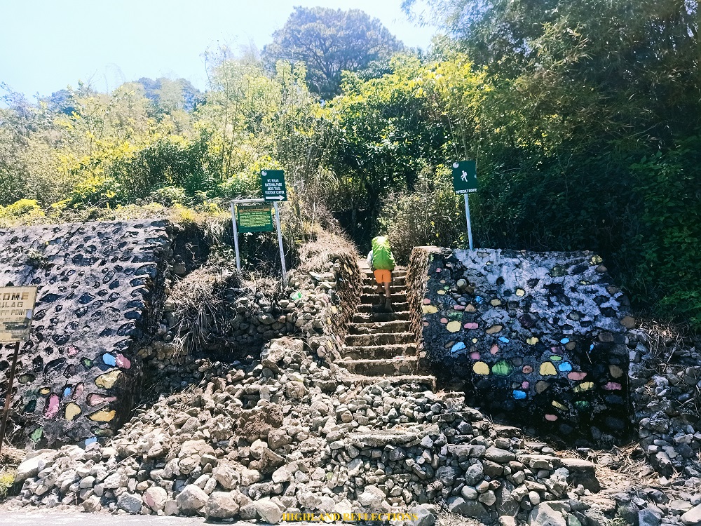
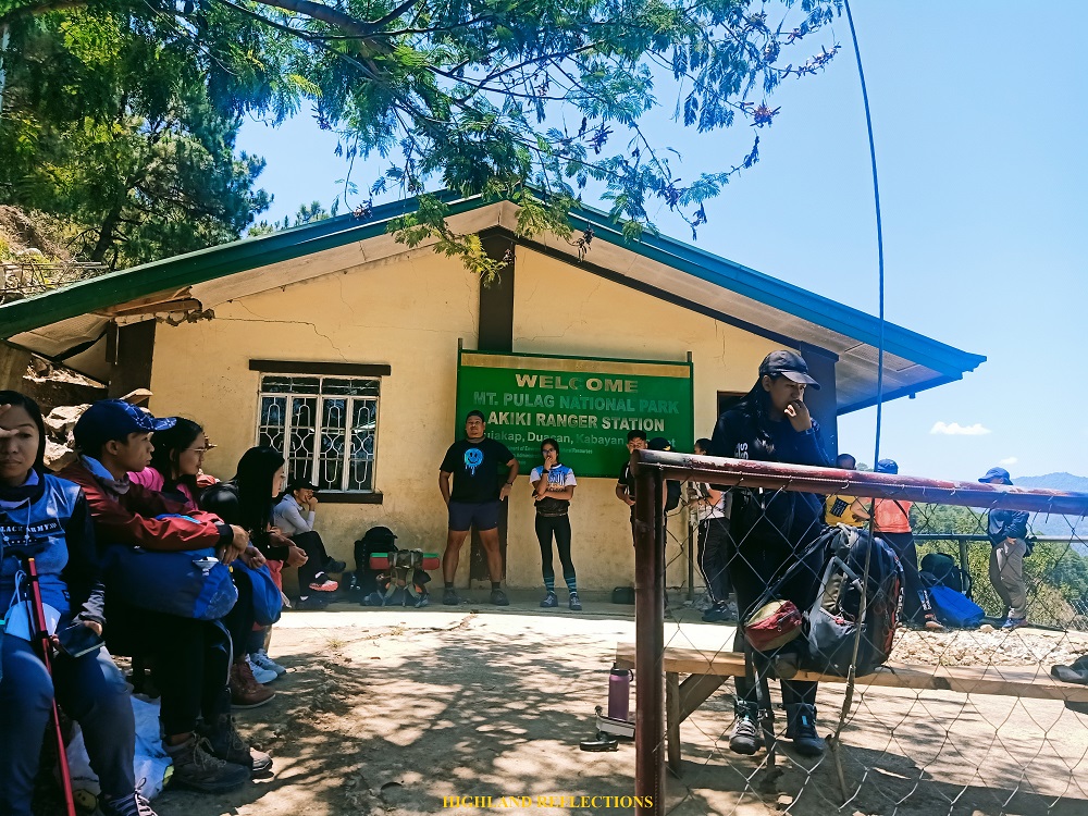
For this three-day adventure, we started the bid up Pulag’s Killer Trail at the DENR office in Ambangeg, Bokod, Benguet. After an hour of orientation, we went to Barangay Duacan in Kabayan, Benguet, some thirty minutes away from Ambangeg, where the jump-off point of Akiki is located just beside the highway. A cemented ascending portion already greeted us en route to the ranger station of the trail some 50 meters above the highway. There, we waited for our porters and guides for the hike. We also had our lunch there. While waiting, I met Dominic, one of my companions in my Bauko Spanish Trail + Mt. Polis hike a year prior!
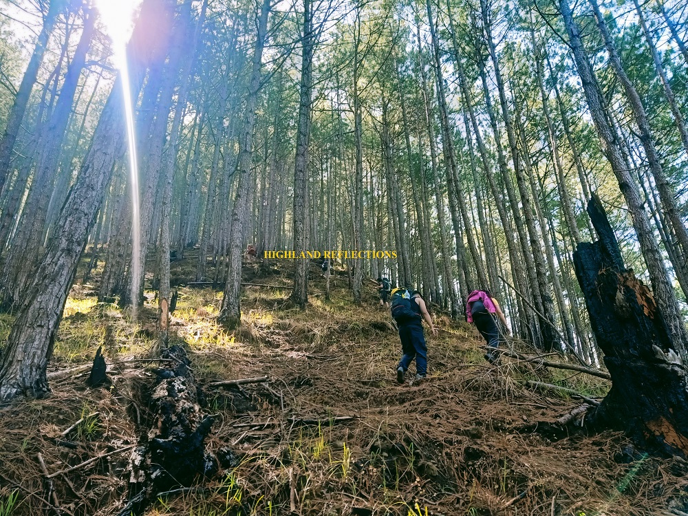
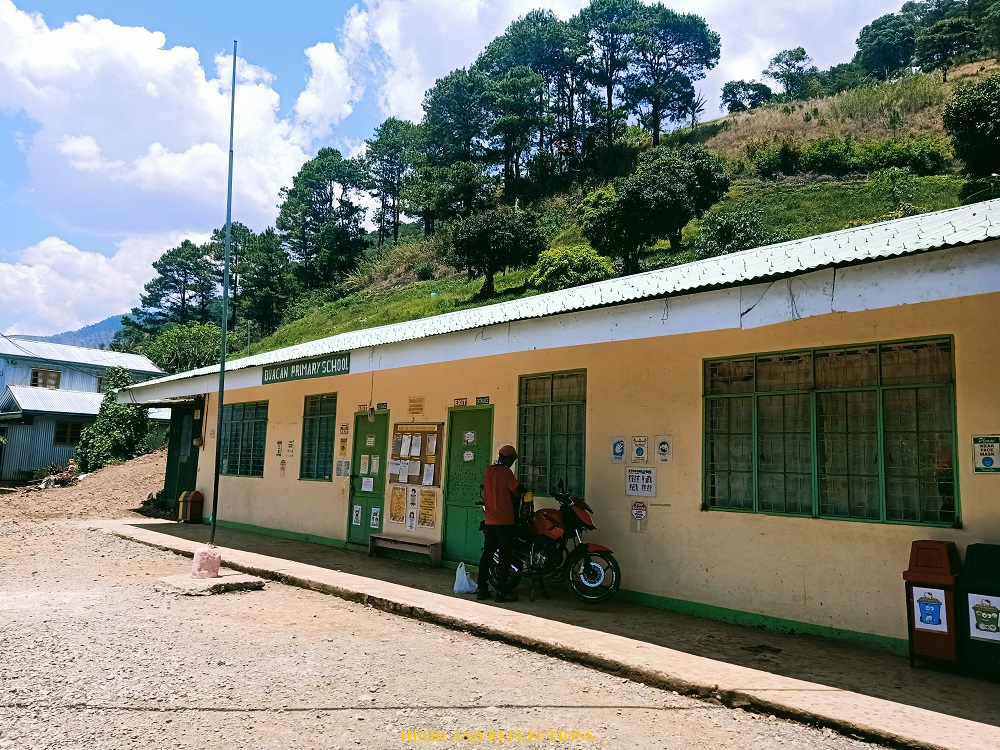
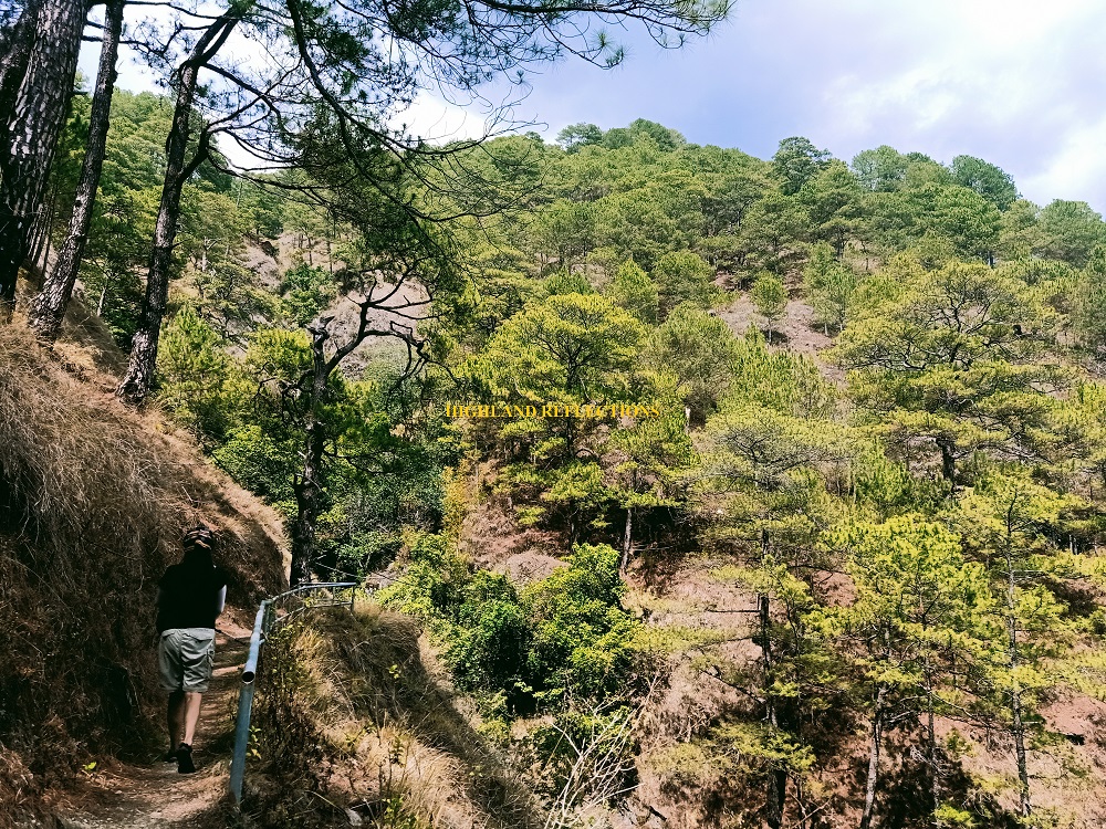
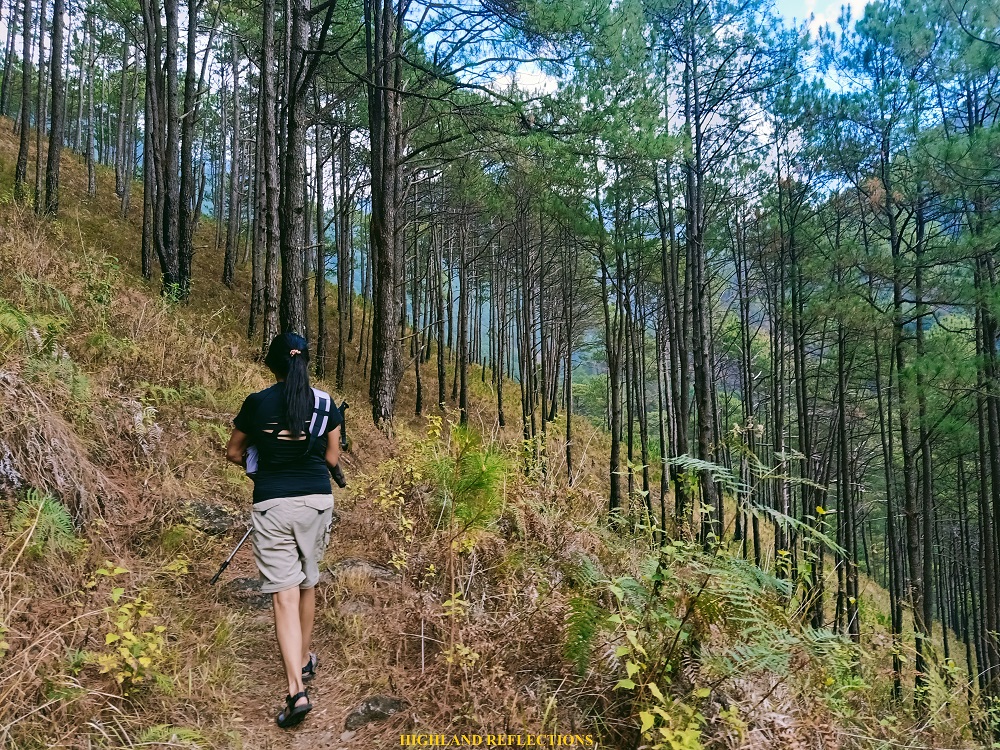
We started the hike at around 12:30 under the scorching heat of the sun. The trail past the ranger station passes through Duacan Primary School, which leads to a rough road afterwards. After a hundred meters or so, we entered a trail which snakes through a mountainside filled with pine trees, where to our right, the mountain slopes containing the farmlands and forests of Barangay Eddet can be seen. We were welcomed by the sight of pine trees.

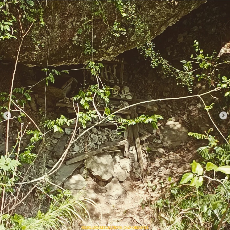
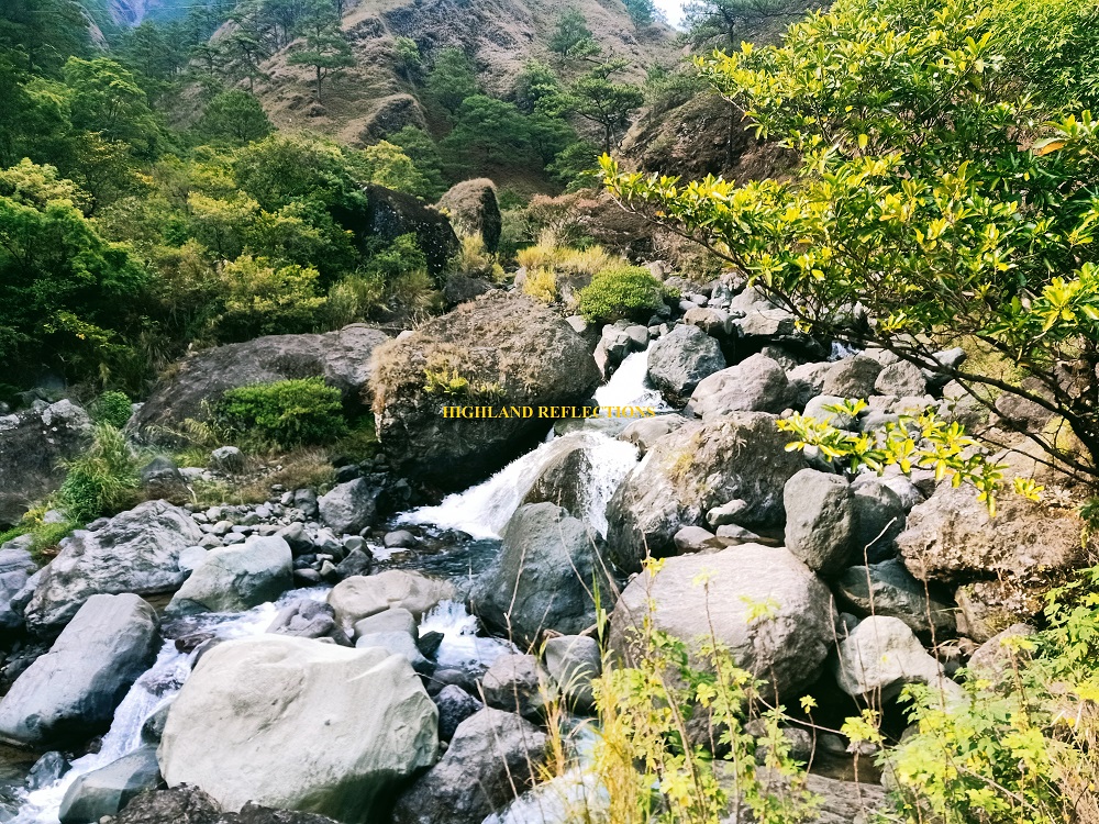
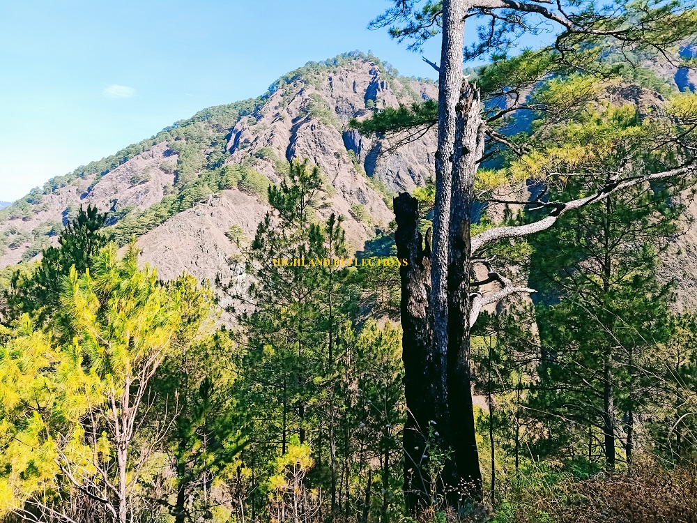
In the midst of the trail are some farmlands and boulders containing burial sites. The entire trail spanned 4 kilometers before reaching Eddet River, which we needed to descend to for a good 15 minutes. As we gained sight of the river below, the slopes containing Pulag’s steep Akiki Trail loomed ahead of us, with its slopes culminating on a horizon-like pine forest, blocking the view of the upper parts of the mountain.

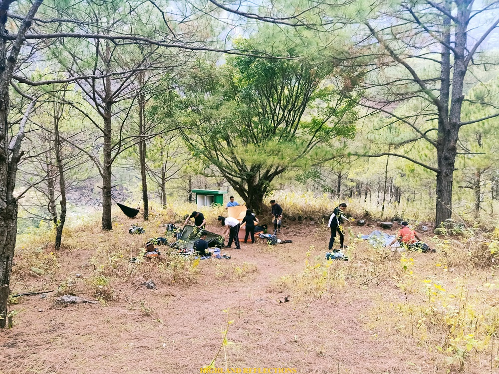
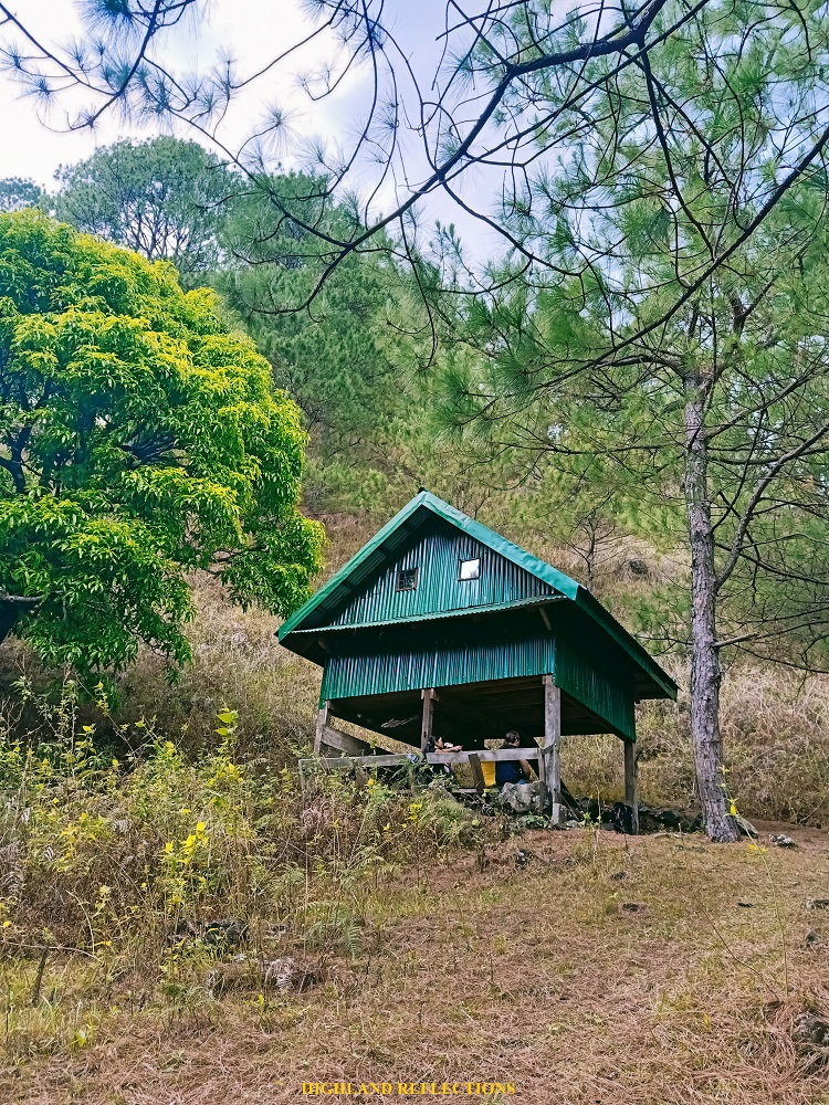
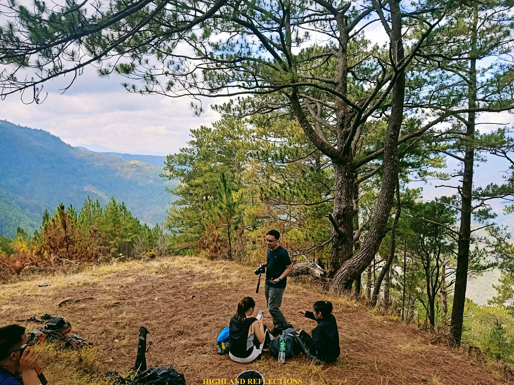
We reached the campsite near Eddet River just before the clock ticked at three in the afternoon, almost two and a half hours after starting the hike at the ranger station. The campsite was a spacious plateau above the river, complete with a bunkhouse and two comfort rooms. We were lucky enough to just have settled at the campsite as flocks of hikers went to set camp at Marlboro Country, which is still three hours away from Eddet River. Although we still needed to cover almost 1600 meters of elevation gain from the river up until the summit, we at least avoided the crowd, and everyone had an intimate camping experience. This was just the first night!
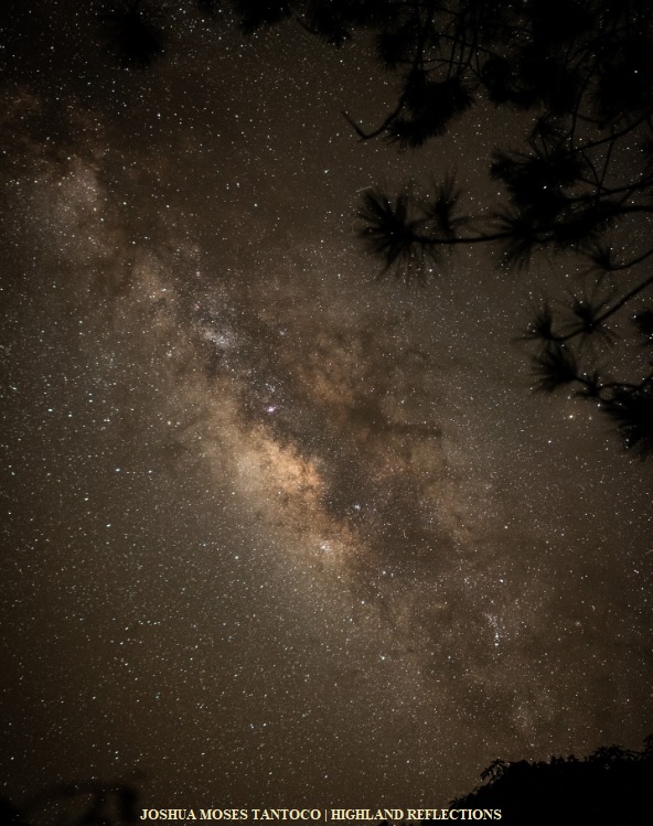
After dinner, we retired for the night at the bunkhouse. The cold was still bearable compared to what we experienced during our second night. Some of our companions slept at their tents. JM decided to take a shot of the Milky Way in the middle of the night.
It was a much needed night to recuperate and get ready for the second day’s fury.
Day 2: Thriller Killer, Shivering Rain, and the Saddle Camp
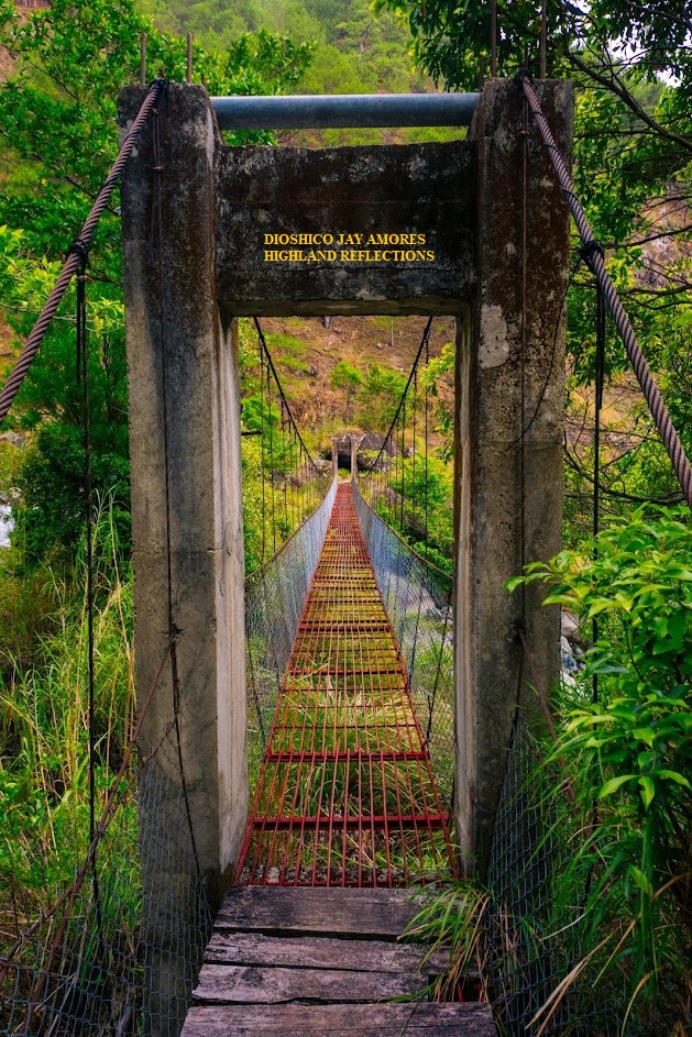
The first part of the day involved enjoying the hanging bridge atop of Eddet River and climbing through some of the boulders around it. I don’t know. I have done this many times, but that was the first time in years where I felt like a kid again. Climbing those boulders around the river felt like I was a little kid climbing stacks of cements as if we were little hikers. There was something about Eddet that brings the child in me.
After the play-around was breakfast. And then, it was time for action.
We started the second day’s Calvary at exactly 7:18 am. After crossing the hanging bridge atop of Eddet River, we were immediately greeted with a barrage of ascending slopes surrounded by pine trees. My mother was taking her time with every zigzag turn, trying to conserve energy and catch her breath every now then. Notwithstanding what seems to be a cardiovascular predicament, she seemed determined and filled with ardor.
Despite stopping every now and then, we didn’t have any long 5-minute stopover. We quickly gained elevation, and only took a minor rest stop at around 1450MASL, where we sat down under a pine tree. Afterwards, we marched on nonstop. We were greeted by a few bird chirps as we were ascending. I was trying to comprehend if the sound that they were making resembles the sound of “A-ki-ki”, as the name of the trail was said to be an onomatopoeia of the chirp of birds heard within the trail. It seemed like it, but I’m still not sure if the sound was exactly “Akiki”.
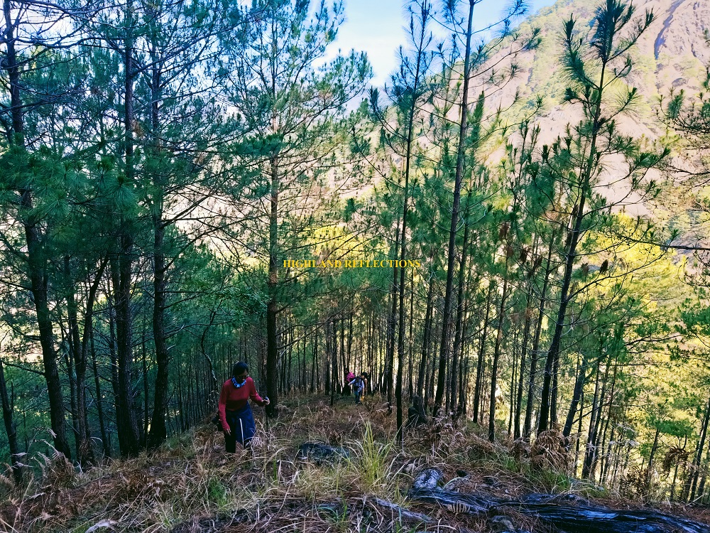
While ascending, I was watching my STRAVA record every now and then. My GPS tracker was gaining a hundred meters almost every after 30 minutes. Slowly, we went from 1300MASL (Eddet River) to a quick 1450, then, 1500, 1600, 1700, 1800, 1900. Every hundred meters, we were munching on Hany chocolate to get some much needed supply of energy.
At 1950 MASL, we took another minor rest stop where mama and I munched on some of our other snacks. We rested by a beautiful pine-filled slope where to our back is a beautiful pine tree shaped like a carabao’s head (which was named by hikers as an elephant tree). After that is the final zigzag ascent to Marlboro campsite, located 2130 meters above sea level. Mama and I reached the camp at 11 in the morning, three and a half hours after starting from Eddet River. Not bad!

The Marlboro camp was named as such owing to the similarity of the vista within the camp to those of Marlboro commercials back in the days (I am too young to know this). The campsite is located at a small plateau bordering a mountainside, where to its front, a vista of Sitio Babadak’s mountain slope-turned-farmland can be seen. This Sitio is where we will descend for the third day.

Another stunning view from Marlboro is on the western direction, where Mt. Timbak, Luzon’s 3rd highest summit and the country’s 9th, can be seen. To the left of Timbak is the town of Atok.

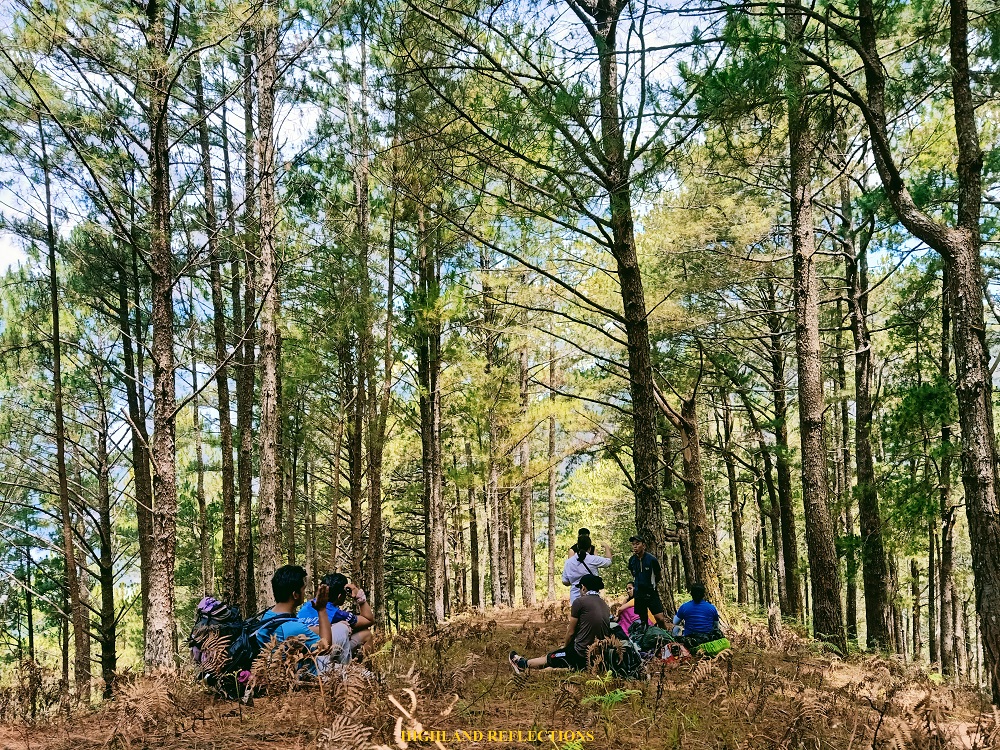
We took an hour of rest at the campsite, where we had our lunch and drank some barako coffee. Much like the Eddet River campsite, the Marlboro camp also had a bunkhouse and two comfort rooms.
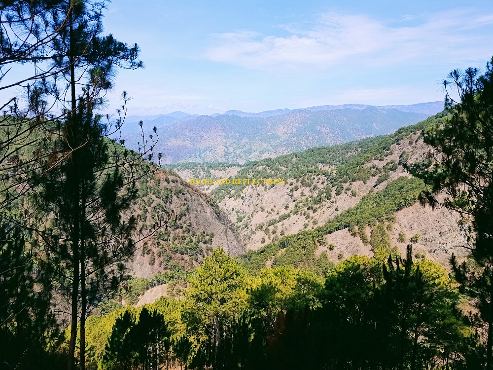
At 1 in the afternoon, we resumed hiking. Past Marlboro camp is another round of uphill battle on pine forest slopes. In no time, the surroundings transformed into a mossy forest. Prior to reaching the entrance to the mossy forest, we spotted Mt. Tabayoc, Luzon’s 2nd highest summit, and the country’s 6th, to our left.
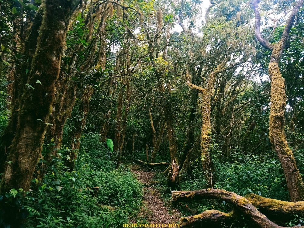
Although not as grand as that in the Tawangan Trail or Mt. Napulauan and Mt. Purgatory, the mossy forest of Akiki Trail has a luscious character to it, making it alluring in its own worth. However, although we appreciated its beauty while being bathed in sunlight, fog slowly caught up, and in no time, a summer rain poured. Since it was cold in the trail, we needed to keep moving. The trail was quite long as well. This was now a true test of mental fortitude.
As we reached an e-camp inside the mossy forest (which by the way, was a very beautiful spot), we waited for Jomar and one of our guides to ask what we would do to proceed given the rain and the shivering cold. They assured us to keep going until reaching the Saddle Camp, our stopover for the day.
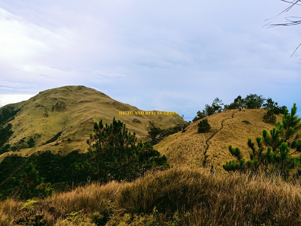
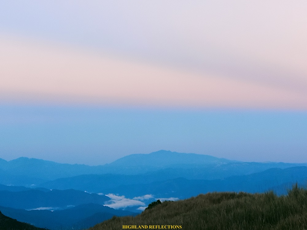
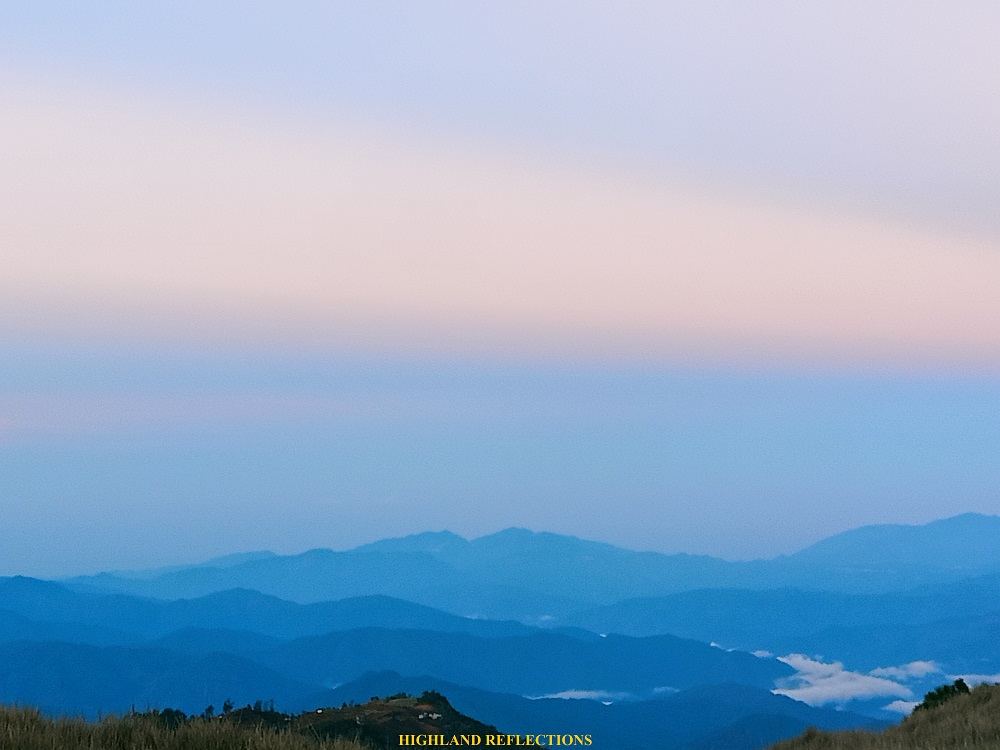
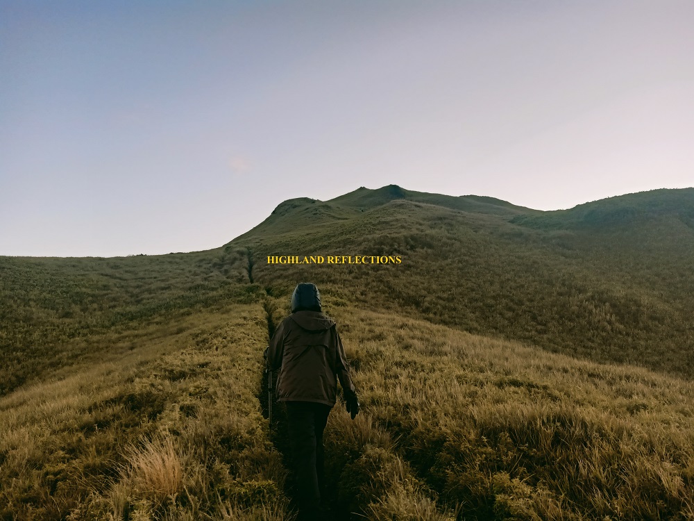
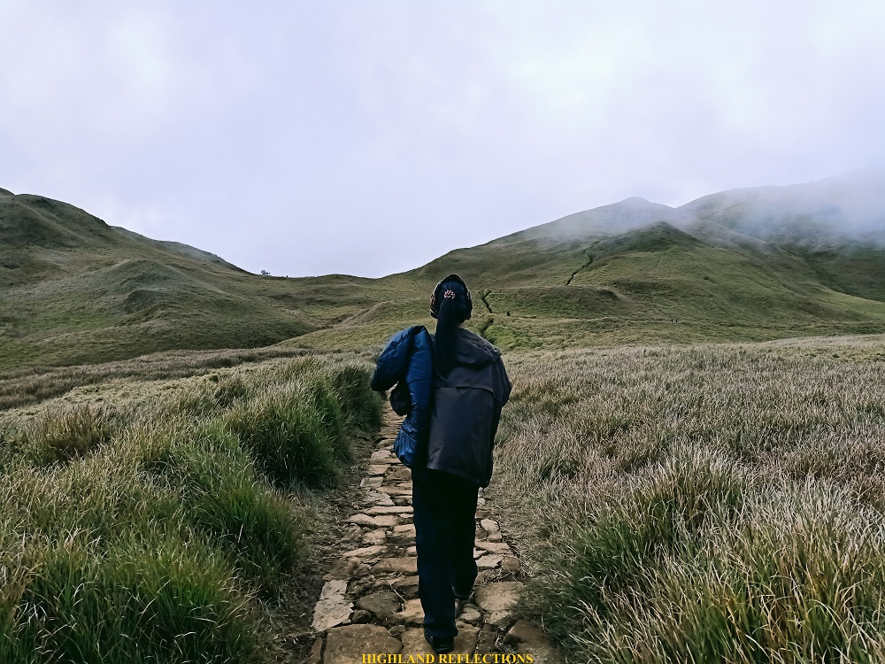
Alas, as we exited the mossy forest, Mt. Pulag’s grassland revealed herself in her full glory. Although the biting wind made the hike unbearable, the clear view surrounding us made the hike up much, much more enjoyable than it should have been. Surrounding the grassland is a complete vista of the Benguet mountains stretching all the way from south, to west, and continuing up to the north, complemented by the setting sun, illuminating our soaked and tired bodies. The most awesome view would be at the southern direction, where Mt. Purgatory, Mt. Ugo, Mt. Ulap, and Mt. Santo Tomas are present.
Jomar was kind enough to lend my mother another rain jacket as we were shivering from the wetness of our clothes being smacked by the cold wind—a recipe for hypothermia.
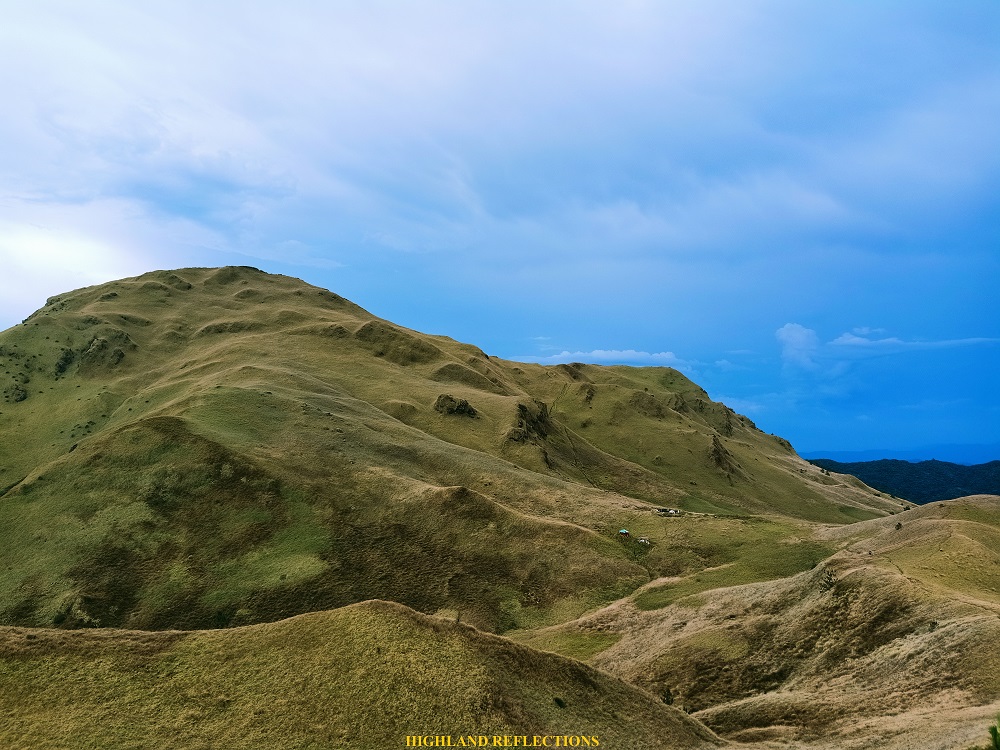
We marched our way through an open path surrounded by bamboo grass. Pulag’s summit looms ahead, where to its right, we could see a faint view of what seemed to be tents set up. We were near the Saddle Camp! Slowly, we marched our way through, descending on to the grassy slopes. The view of the tents got nearer and nearer, and in no time, we were at the vicinity of the Saddle Camp at 5 in the afternoon. After ten hours, we finally made it!
The Saddle Camp is directly a hundred meters below the summit of Mt. Pulag, located 2800 meters above sea level. This makes the Saddle Camp possibly one of the highest campsite in the country! We were lucky to have the campsite all to ourselves again.
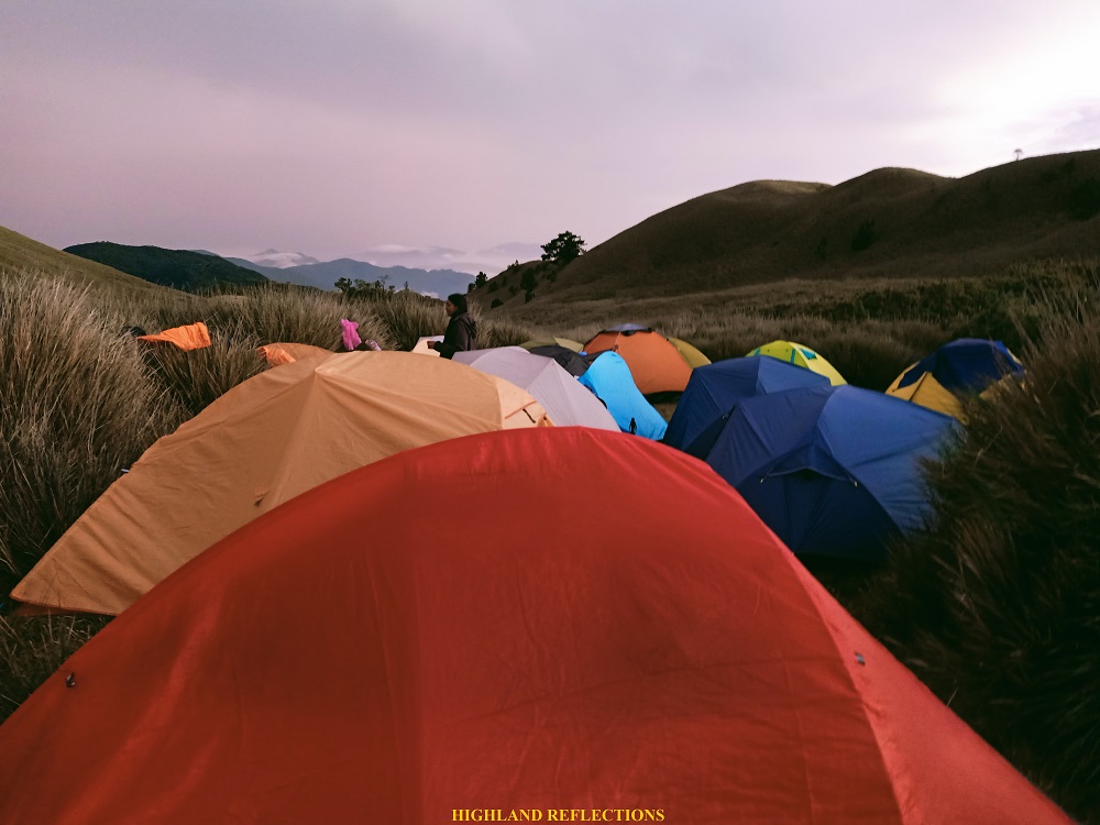

For the night, we huddled inside our tents and forced ourselves to sleep through the biting cold. At 2 in the morning, we heard JM and company laboring to get an awesome Milky Way shot.
Day 3: Summit Bid and Down
At 5:15 in the morning, after waiting for our kapeng barako to boil, we started the summit assault. The entire ascent was straightforward. In just 30 minutes of slow paced climb, we reached the summit of Pulag, where a volume of hikers were already present, taking their snaps at the summit marker. Also present at the summit is the mighty sun which has started illuminating this great marvelous mountain. As there were only two of us, our kind guide permitted us to take photos by the summit marker. This was a redemption moment for mama. She has now officially stepped on the highest summit of Luzon!


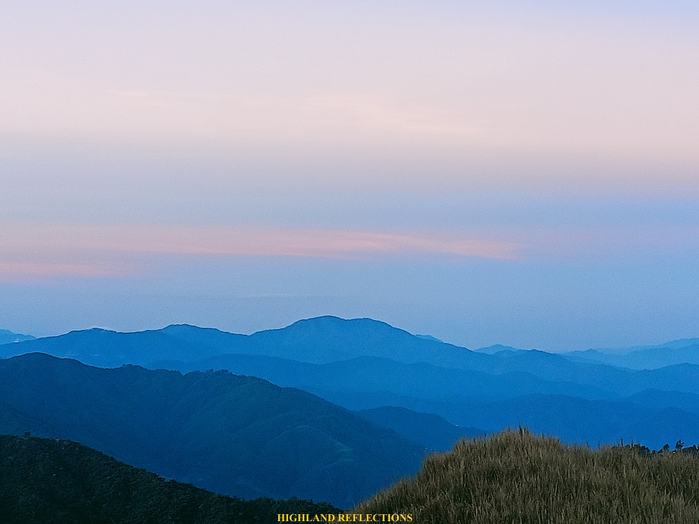
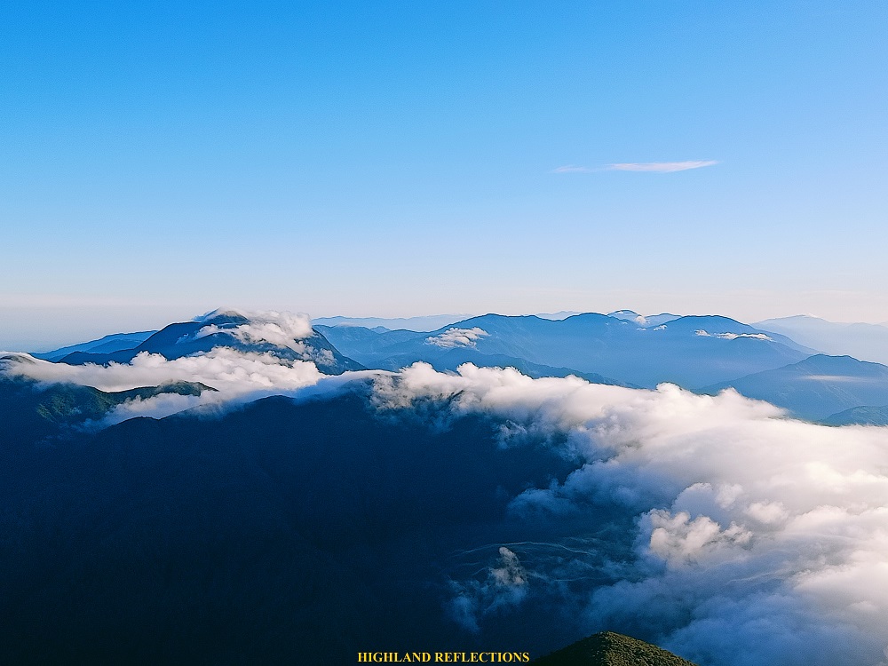
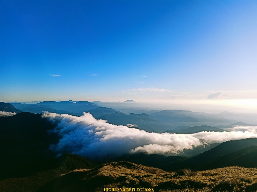
Afterwards, we clambered down to a spot just below the summit where JM and Jay were filming some time-lapse videos. There, a commanding view of Mt. Tabayoc and the nearby Mt. Al-al is present, comprising the island’s 2nd and 6th highest summits. A moving and growing cloud enveloping the Tawangan side of Mt. Pulag was also teasing the view, providing a limited cloudscape.
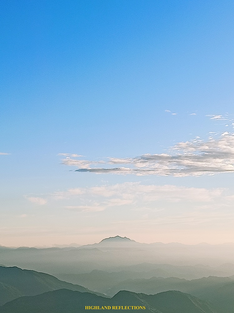
On a side note, my personal success for this summit bid is finally seeing Mt. Amuyao on the horizon! This mountain, located at the borders of Ifugao and Mountain Province (and which I have climbed twice), graces the view especially when there is a sea of clouds panorama at the summit. Being the country’s 11th highest summit, and Luzon’s 4th highest summit, it greets the hikers of Pulag hello as it towers above the clouds as well.
Another awesome view of mountains in the vista is seen behind Mt. Tabayoc. Three mountain peaks comprise this view: Mt. Abao (also known as Mt. Molmog, located in Bauko, which was summitted by a group of hikers on the same date of our Akiki hike), Mt. Kapiligan, and the well-known mountain in Hungduan, Ifugao, Mt. Napulauan. These three are possibly the 7th, 8th, and 9th highest summits of Luzon! Behind these three summits, Mt. Kalawitan, Luzon’s fourth highest summit and the country’s 10th, hides and peeks like a shy giant.
Hence, I have now spotted all the high summits of Luzon from Pulag: Mt. Tabayoc (N), Mt. Timbak (W), Mt. Kalawitan (N), Mt. Amuyao (NE), Mt. Al-al (N), Mts. Molmog, Kapiligan, and Napulauan (NNE).
After the site orientation, we went back to Saddle Camp and packed up our equipment to ready ourselves for the descent in the Ambangeg Trail. We also had our breakfast.
We started the final hike past 8 in the morning. The descent required us to pass through the summit once more, and then down to Ambangeg Trail. Upon reaching the summit, we found no traces of hikers, as the crowd from Ambangeg had already started their descent ahead of us. I took the chance to snap a solo picture at the summit marker.
Then, Mama and I started the long descent to Sitio Babadak via the Ambangeg Trail. Just a few minutes from the summit, we encountered hikers who came from Ambaguio Trail where Gab, another one of my companions in my Bauko Spanish Trail + Mt. Polis hike, was present!
Even the grassland hike felt a little bit exasperating for an experienced hiker like me. We reached Camp 2 around 10 in the morning. There, we took a major rest stop to munch on some snacks. Sadly, there was no flowing water in the water source during our hike, so I decided not to eat. Then, we took the long mossy forest trail en route to Camp 1. Mama did not lose her vigor despite the aching knees. Like in Day 2, we were hiking nonstop, broken only by some twenty second breathers every few hundred meters.

JM and company caught up with us as we were nearing a spring near Camp 1. There, I once again met Gab who was descending alone. All of them left Mama and me behind as we were hiking on a slower pace. Good thing was that Camp 1 was just around the corner, and we reached it after a few minutes. There, we had another major rest.
It was only a short hike after as we exited towards the rough road towards Sitio Babadak. Mama took the chance to take a motorcycle ride to our assigned homestay where we will be cleansing ourselves. I, on the other hand, took the chance to run the rough road.
We reached our assigned homestay at 1 in the afternoon, five hours after starting the hike. The Ambangeg Trail, despite an easy trail, was surely a test of mental fortitude with its 8 kilometer length!
And that concludes our hike up to the Akiki Trail of Mt. Pulag. Given that this is now my third taken trail in Pulag next to Ambangeg and the bloody trail of Tawangan, I am now excited to take the longest and arguably the most beautiful trail of Mt. Pulag—the Ambaguio Trail. I hope I see it the soonest!
Itinerary
Day 1
08:30AM Orientation at DENR Station
11:00AM Jump-off, wait for guides
12:30PM Start hike
03:00PM Eddet River Campsite, rest, set camp
08:00PM Lights off
Day 2
05:00AM Breakfast, take pictures at Eddet River
07:20AM Start hike
11:00AM Marlboro Camp, lunch, rest
01:00PM Resume hike
01:30PM Mossy forest
04:00PM Grassland, continue hike to Saddle Camp
05:00PM Saddle Camp, set up tents
08:00PM Dinner and lights out
Day 3
05:30AM Summit assault
06:00AM Summit, take pictures
07:00AM Back at Saddle Camp, break camp
08:00AM Start descent to Ambangeg Trail
10:00AM Camp 2
12:00PM Camp 1
01:00PM Sitio Babadak, wash-up
11:00PM Back home

hi,
Love your blog. Can you tell me what the name is of the organization you walked with?
best regards
Lis
LikeLike
I was with an organizer I personally know. He doesn’t have any formal tour group/org, and just organizes hikes for the sake of it.
LikeLike