Since 2018, I have always wanted to try hiking the Bakun Trio, a 3-day hike climbing the surrounding mountains of the municipality of Bakun, Benguet, namely, Mts. Lubo, Kabunian, and Tenglawan. So when my friends, Fara and Rex, invited me to hike Mt. Tenglawan via an alternative trail back in the summer of 2022, I immediately agreed and tagged my best bud JM and his partner Leniva. On we went to the northern town!

The Bakun Trio hike was traditionally done from Barangay Poblacion, day hiking the three mountains each day. However, when the pandemic hit the country and tourism was closed, the reopening of Bakun tourism brought a new exciting venture: the alternative trail to Mt. Tenglawan via Barangay Sinacbat was opened. This trail is located east of Mt. Tenglawan, in contrast with the southern location of Barangay Poblacion. As of this writing, Barangay Poblacion is still closed, but I am hopeful for its opening some time in the future! The characteristics of the new trail are as follows:
MT. TENGLAWAN VIA SINACBAT TRAIL
Jump-off point: Brgy. Sinacbat, Bakun, Benguet
LLA: 1,943MASL
Days required / Hours to summit: 1-2 days / 2-4 hours
Specs: Minor climb, Difficulty 4/9, Trail class 1-3
Features: Carrot Peak, Pine Forests, scenic views of Benguet, and coastal communities of Ilocos Sur
Source: https://transitpinas.com/tenglawan-bakun-benguet/
(I altered the difficulty level based on my own subjective experience of the mountain)
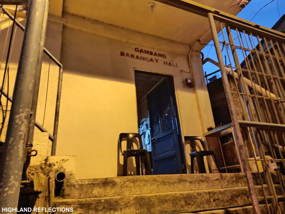
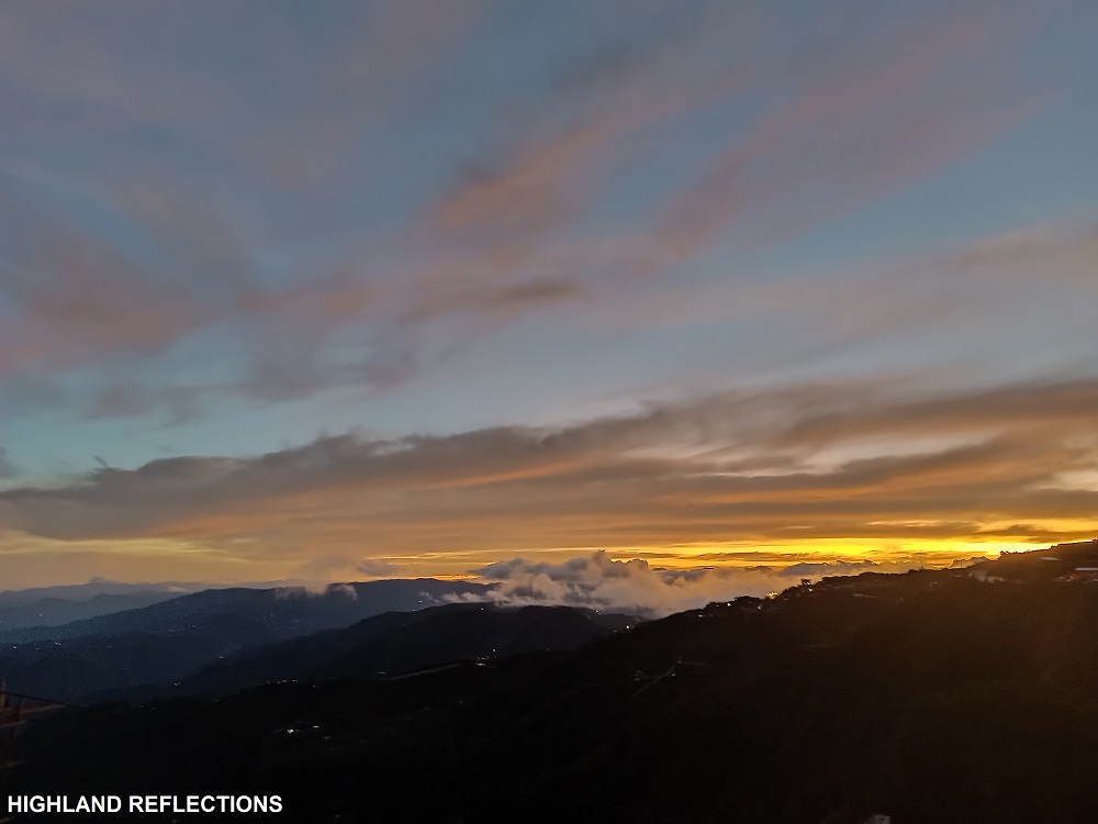
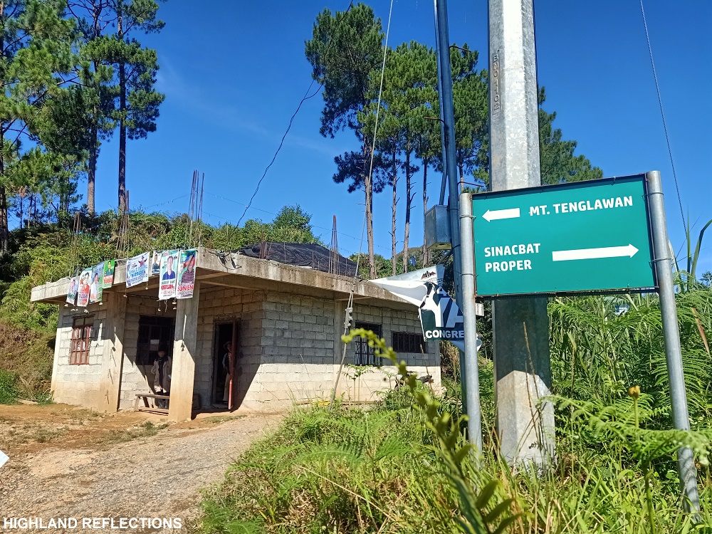
Before going to Barangay Sinacbat, we registered at the Bakun Tourism Office in Barangay Gambang, located at the junction of Halsema Highway and the Kapangan-Kibungan-Bakun Road. The view here already rewarded us with the silhouettes of the Cordillera mountains and the early morning sky. Afterwards, we went on our van ride going to Sinacbat.
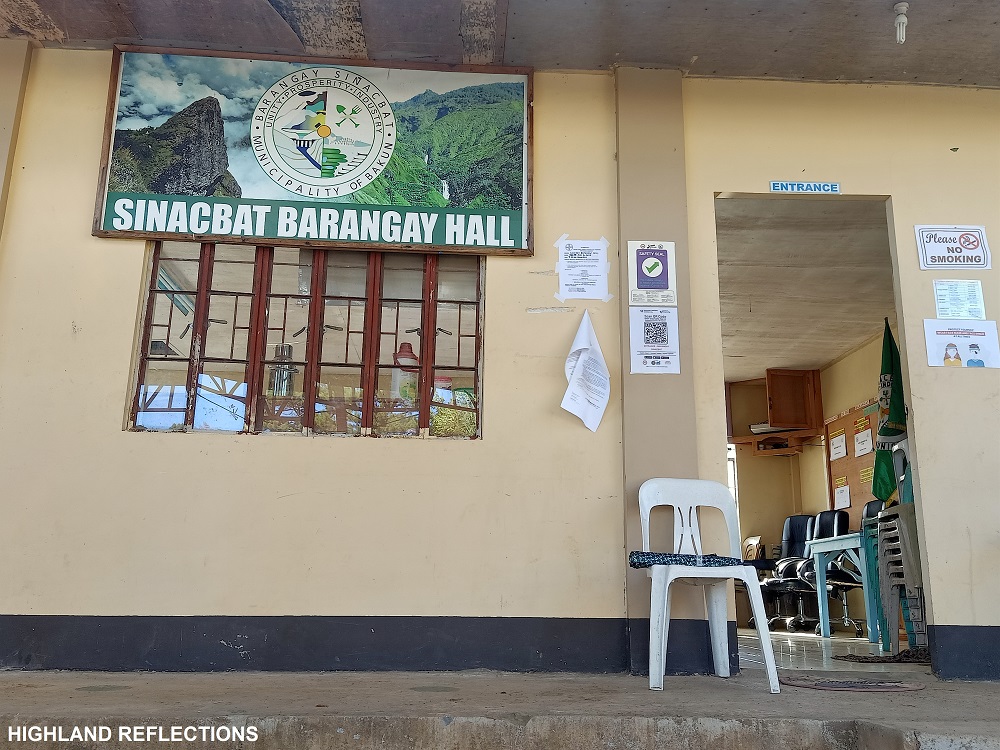
The ride on the way to Brgy. Sinacbat passes through the same road going to Barangay Poblacion, but detours on a right turn somewhere along the Kapangan-Kibungan-Bakun Road. From the junction, it took us almost 2 hours as the van driver was unfamiliar with the territory. We reached the area around 7:30. We were welcomed by the barangay officials. The barangay, it seems, is nestled at a faraway farming community, and upon checking my map, we were actually quite near Mt. Namandiraan in Cervantes, Ilocos Sur.
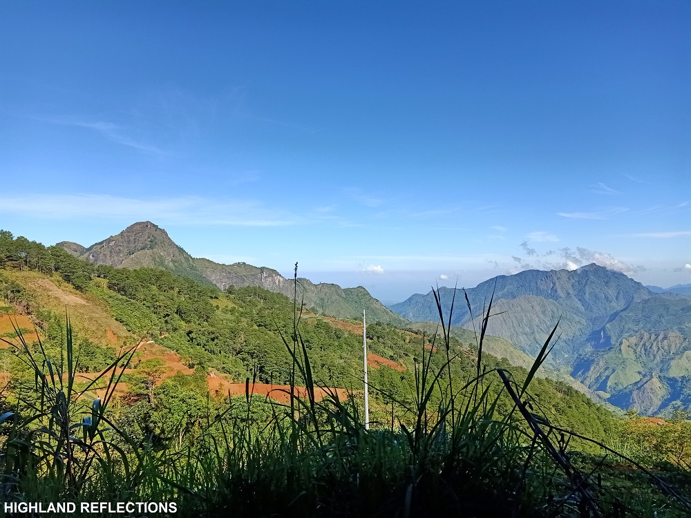
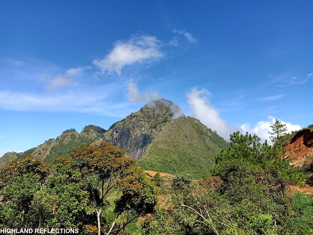
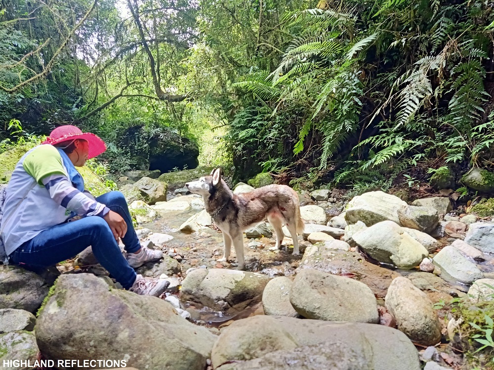
We started the hike around 8 in the morning. The first part involves an hour of walk on a cemented road going to Sitio Lupunan. Upon arriving at the Sitio, we had some coffee and ice cream break outside of a sari-sari store. The trail after the Sitio was a rough road that gives off an awesome view of the neighboring Mt. Kabunian. To our front, Mt. Tenglawan dominates the entire view, towering over us.
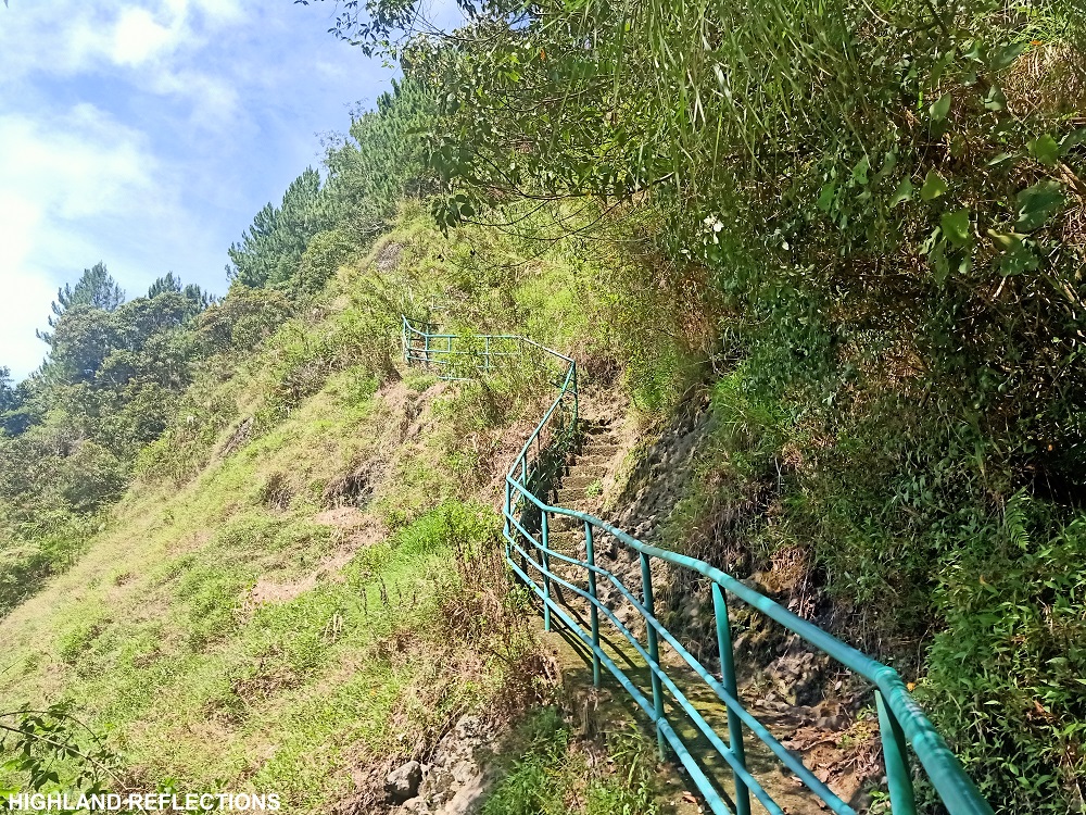
As we were nearing the slopes of the towering Mt. Tenglawan in front of us, we exited towards a descending trail to our left. This trail converges with the trail coming from Barangay Poblacion. The first landmark here was the “Hagdan ni Bulilit”, a set of cemented stairs leading to the steep pine forest of Mt. Tenglawan. This leads to a jungle forest with a water source called by locals as bathtub. We had a long rest here.
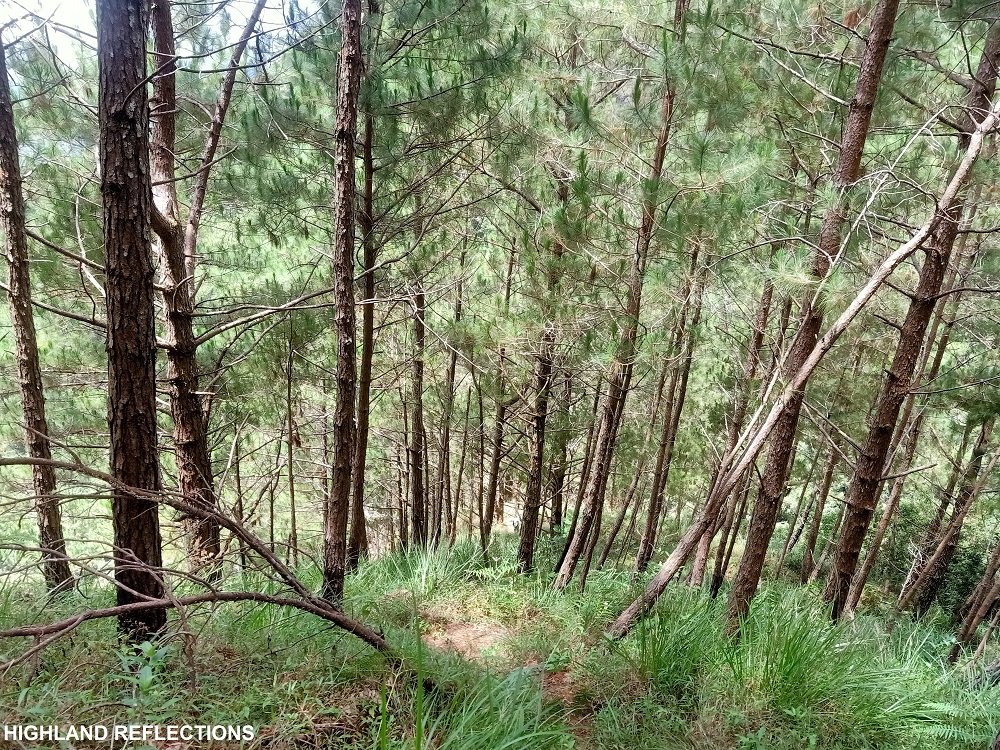
The trail after the bathtub was the final steep assault before reaching the summit. This trail was filled with pine trees. We slowed down our pacing here as we adjusted our lungs to the cardiac workout. After a few minutes, we reached the campsite of Mt. Tenglawan. From here, the trail slowly transforms into a mossy forest, where pitcher plants can be seen. Some limatiks were also present in the trail, although not as aggressive and not as plentiful.

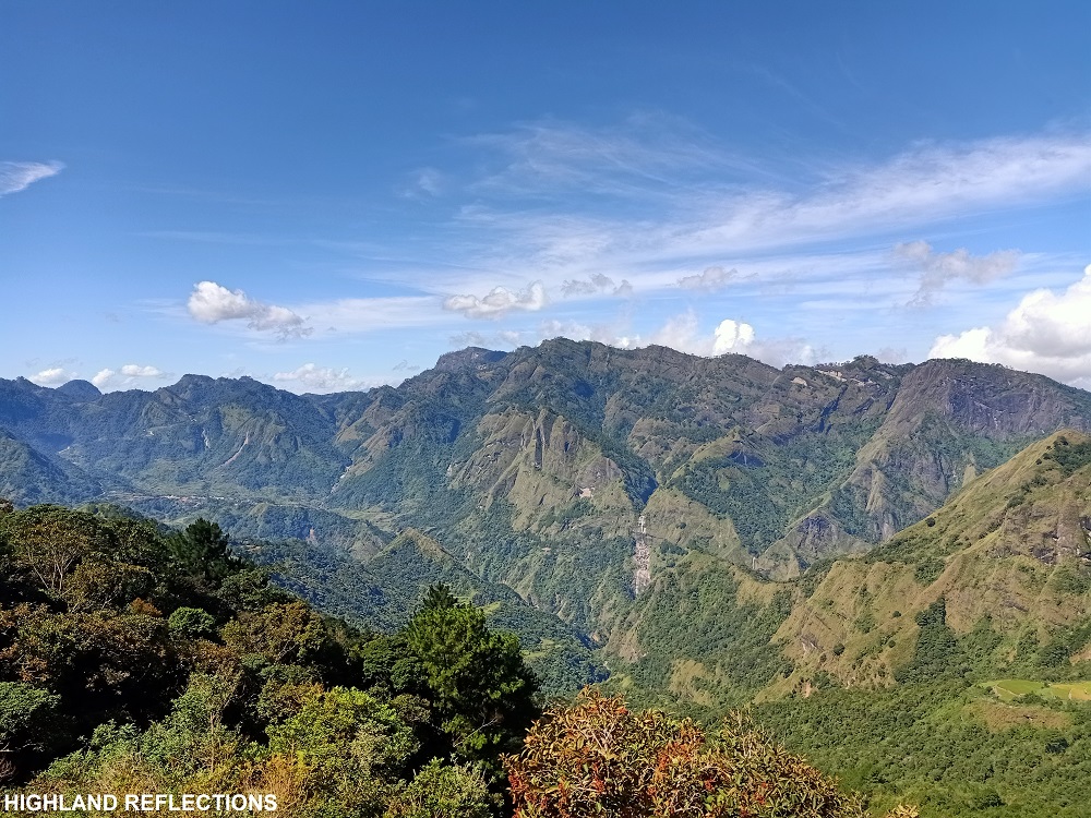
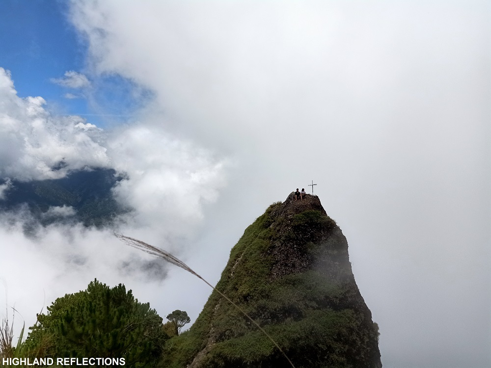
Past the mossy forest, at 11:30 in the morning, 3.5 hours after starting the hike, we finally reached the 1943masl summit of Mt. Tenglawan. We were sadly welcomed with white fog surrounding the summit, as we arrived quite late to catch the clearing. At the northern side of the summit is the protruding Carrot Peak, which we climbed on, and took pictures at.

The horn-like form of the Carrot Peak alludes to the rich stories of the Kankana-eys. Mt. Tenglawan serves as a sacred mountain among the locals, believed to be where the devil god Insaking resides. The Carrot Peak, when seen from Sitio Lupunan, seems to resemble a devil’s horn, possibly enticing the belief systems of locals to allude to Mt. Tenglawan as the devil, and as an antithesis to the supreme god Kabunian, which is the namesake of the neighboring mountain.
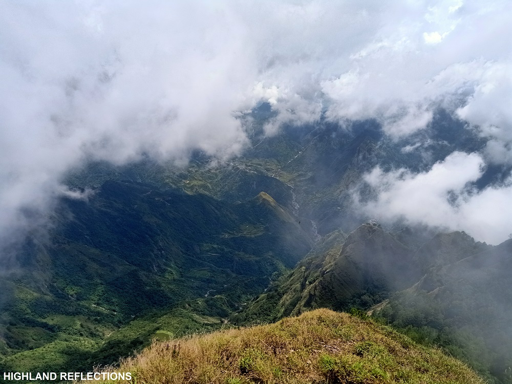
Insaking, fortunately, gave us a small clearing, maybe as a reward for our bravery to come to this faraway enclave. Afterwards, we descended and went back to Sinacbat proper, arriving there around 4 in the afternoon after having been delayed by a heavy downpour at Sitio Lupunan.
Hoping that I could do the Bakun Trio in the future!
Itinerary
04:30AM Registration at Brgy. Gambang (Bakun Tourism Office) in Halsema Highway
07:30AM Barangay hall of Sinacbat, prepare
08:00AM Start hike
08:30AM Sitio Lupunan
10:00AM Water source, rest
10:30AM Start of final assault
11:30AM Summit, take pictures
01:00PM Start descent
04:00PM Sinacbat, wash-up
10:00PM Baguio City

Nice read!
Kaya kaya ng beginner to?
LikeLike
Kaya naman. Basta prepare lang before the hike. Yung trail papuntang summit, matarik na paakyat.
LikeLike
Compare po kaya parang mas daraitan po ba o mas parang irid?
Iniisip kong pumunta kaso isang taon na kong walang ahon eh haha baka kasi mabigla.
LikeLike