Mt. Apo. The Grandfather of Philippine Mountains. The highest summit in the Philippines. Summitted within a day.
Last March, 2022, I was finally able to climb the highest mountain in the Philippines. Located within the borders of Davao del Sur and Cotabato, Mt. Apo is every Filipino outdoor-person’s dream to climb. With the many trails available to climb the southern titan, I took the Santa Cruz Trail located in the town of its namesake in Davao del Sur. The hike up the mountain, as I recall, was filled with both pleasant and exhausting moments. Nonetheless, I was welcomed by Apo in relatively good condition.
Here is my story of climbing the highest mountain in the Philippines!
Serendipity: Events Leading to My Solo Attempt in Apo
The mission to climb up the Philippine rooftop was filled with serendipitous elements. Originally, I was planning to climb Mt. Apo during the Ber months of 2022, as I was already scheduled to hike Mt. Hamiguitan, another mountain in Davao Region, in March. Sadly, a week before our climb, the park management of Mt. Hamiguitan informed us that they will be extending their closure for another month. We were left saddened.
Two days before my flight to Davao, I was already considering rebooking my flight. But with a mere tickle of my adventurous mind, the thought of dayhiking Mt. Apo suddenly crossed my consciousness. And in a virtually fortuitous encounter, one of my friends in the hiking community, who happens to have backpacked Mindanao in the past, gave me his personal contact (who goes by the name of Joe) in Mt. Apo!
With only little resistance inside my head (since I was considering if this was a practical thing to do), I contacted Sir Joe, who was, by the way, introduced to me as one of the prominent guides in the Santa Cruz Trail. After negotiating for the required fees, and judging if it was within my budget, I wholeheartedly (and insanely) agreed! Sir Joe took care of all the necessary documents and payments on the same day.
With my permit approved, I told myself that there was no turning back. I will now be face to face with Mt. Apo himself!
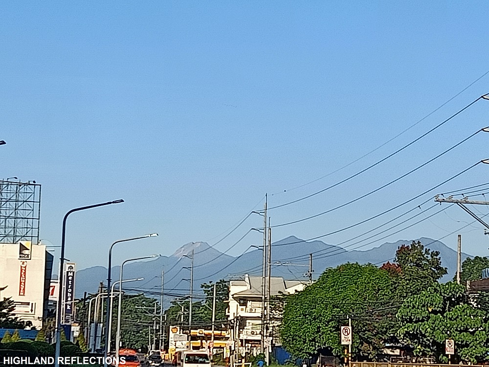
The day before the climb, I went on with my scheduled flight from Manila to Davao. Arriving at Davao airport past six in the evening, I met with my friends who had other plans for that weekend (I will be meeting them two days after my Apo hike to climb Mt. Megatong in Davao del Norte). We then boarded a taxi going to Ecoland Terminal, where I rode a bus going to Santa Cruz.
I alighted by what the locals call as “terminal” in the town of Santa Cruz. I was confused since I felt like I was on the side of a highway and there was no visible terminal nearby. Since there was an open carinderia, I decided to eat dinner as I was famished coming from my delayed flight.
Sir Joe, then, appeared with his motorcycle. After eating dinner and warming up with each other, Sir Joe brought me to his house. I stayed there for the night and got some little rest.
Santa Cruz Farmlands
With only two hours of sleep, I woke up feeling dizzy and still wanting to sleep. Sir Joe offered me a cup of coffee. Minutes later, our habal ride arrived. Well, I’m not quite sure if it’s appropriate to call it a habal since the tricycle was basically an e-trike. But anyway…
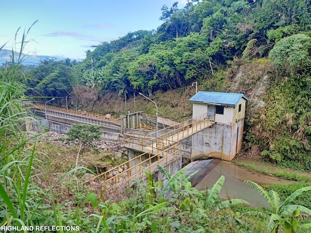
The habal ride from Sir Joe’s house up to the jump-off point in Brgy. Kapatagan took us traversing a 40-kilometer road in a span of an hour. The habal then entered an unpaved road that ends beside a hydroelectric power plant. This was the trailhead of the Santa Cruz Trail, registering at an elevation of 1,015+ MASL. It was 3:37AM.
Without any formalities and reminder sessions, we started walking.
The first part of the hike involves a steep ascent to Sitio Colan. Sir Joe was kind enough to let me enjoy a slower-than-usual pacing without pressure. After twenty minutes, we reached the community, where the head of the tourism unit was waiting for us. Thinking that I was about to rest in the Sitio, I was shocked that we continued hiking and got past the Sitio after Joe talked with the officer! I asked my kind guide to halt for a moment so that I could prep my equipment and put on some extra clothing.
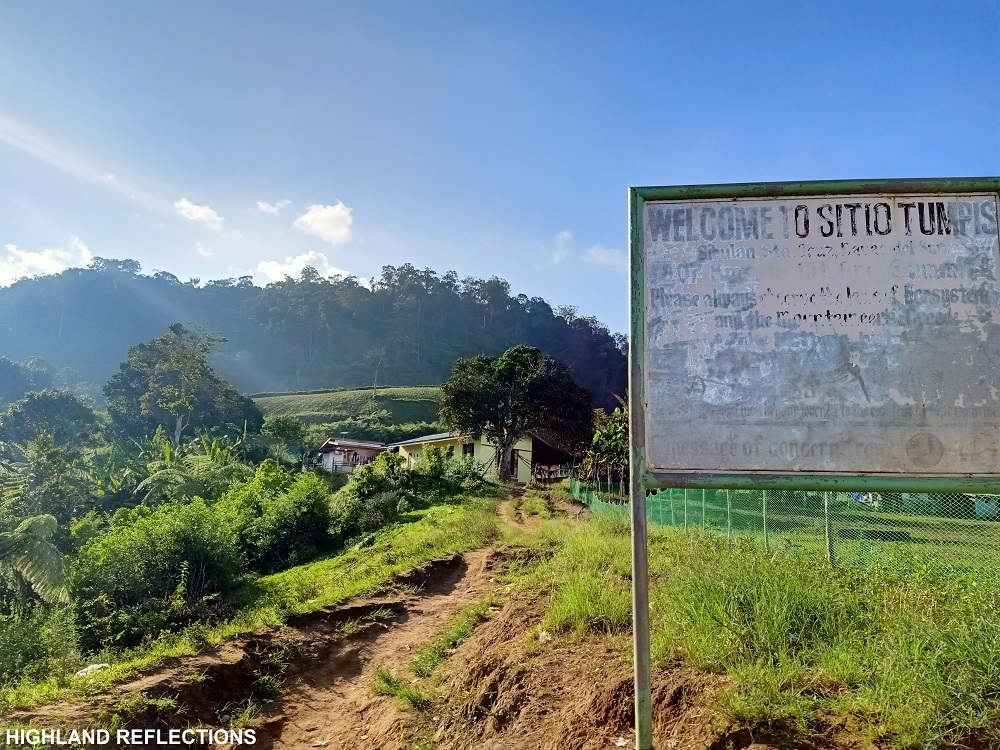
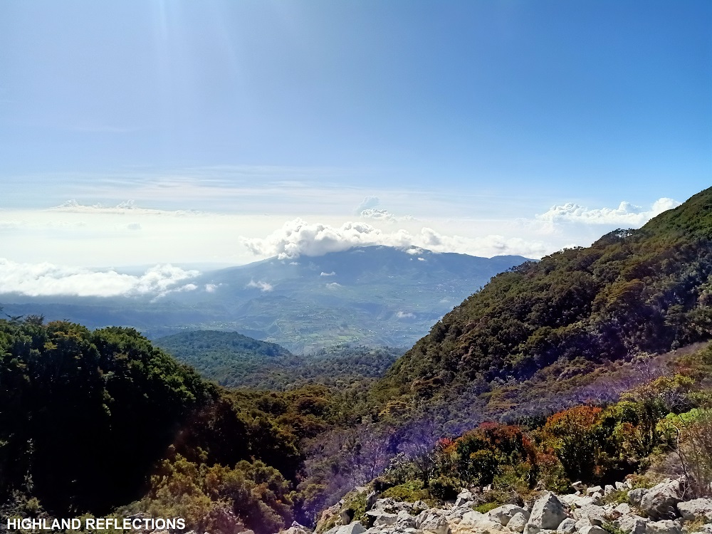
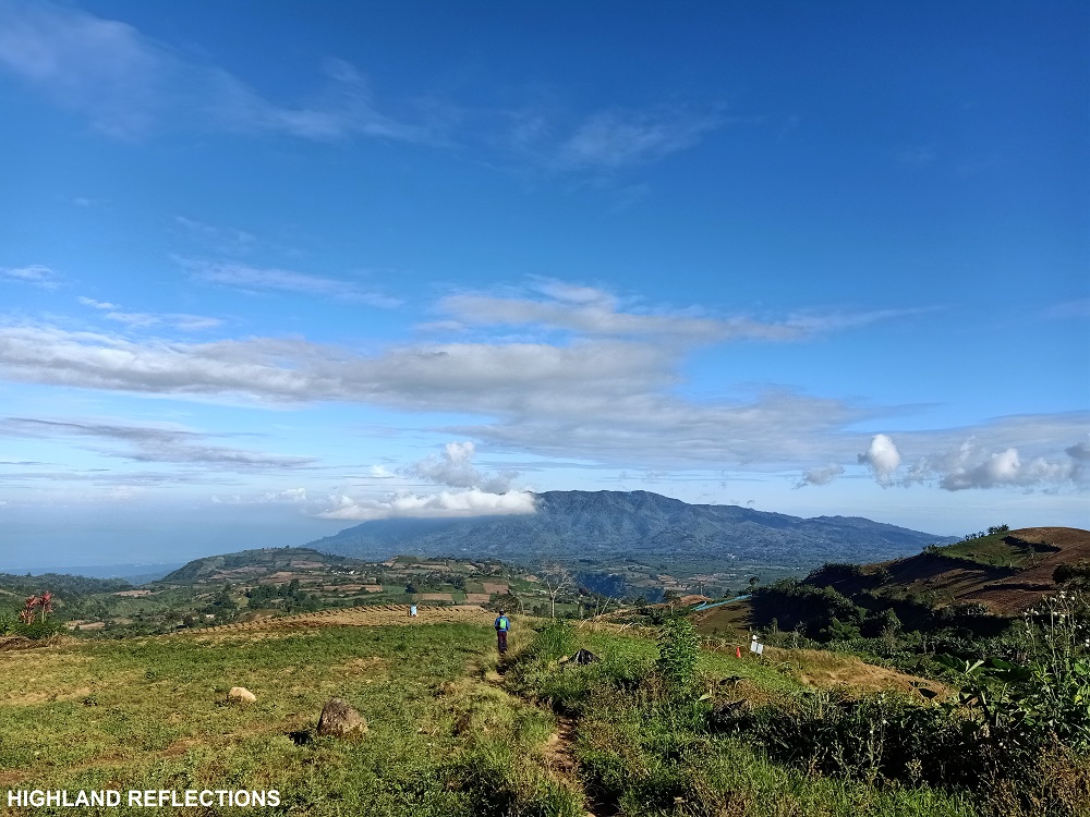
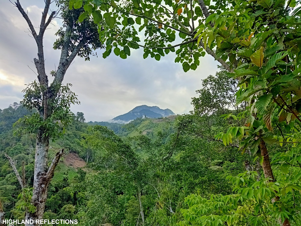
It was a pleasant upward walk past Sitio Colan. After an hour, we reached Sitio Tumpis, another farming community at the base of Mt. Apo. There were already farmers tending to their crops as early as four in the morning. Past Sitio Tumpis is a thick grassy section that leads to the entrance to the forest of Apo.
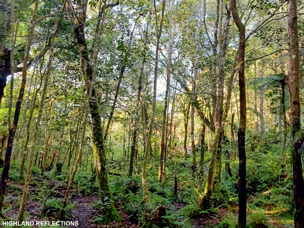
Apo’s Second Layer: Verdant and Wild Forest
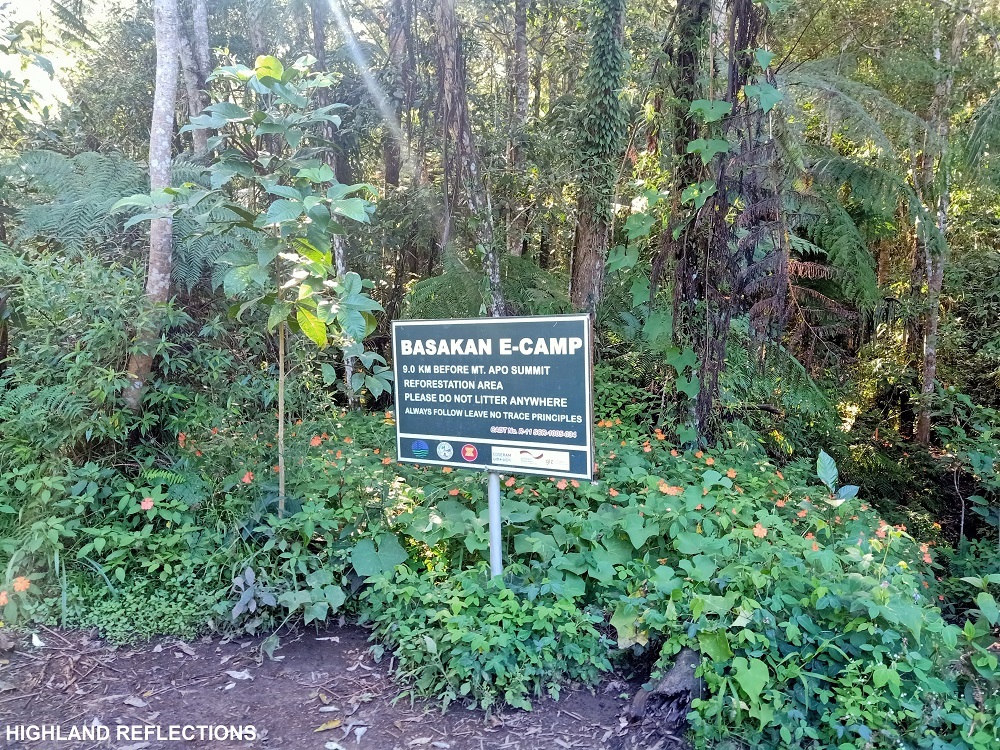
The initial portions of the forested trail were very steep and mildly muddy. This was the most uninteresting part of the hike as there was no magnificent view yet. The steepness, then, dissipated as we passed through Basakan E-Camp, in which a signpost was inscribed with “9.0KM before Mt. Apo summit.” Long way to go!
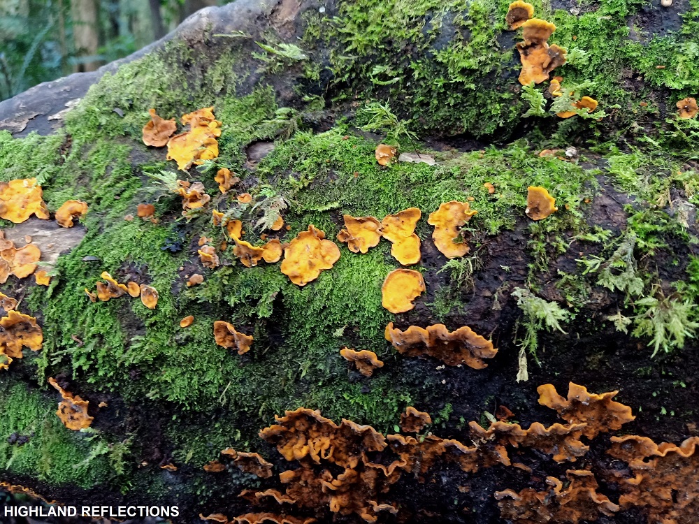
Past Basakan is where the mossy forest starts. Although much of the trail was ascending, it was not as steep compared to the earlier parts, and some portions were flat. As sunlight slowly caught up, the forest surrounding me revealed its natural beauty. Different species of trees and plants were scattered everywhere. Most of the trunks of the trees were covered with small moss—not as dense as that of the thick mossy forest that we know of, but just enough to make the forest more verdant!
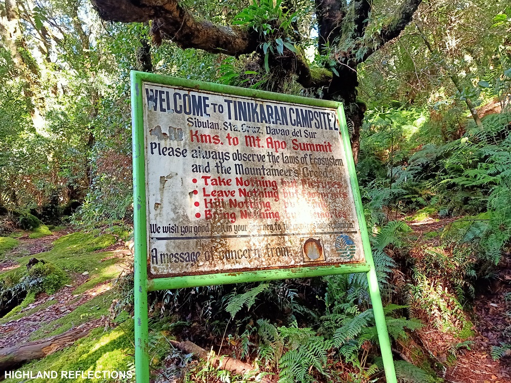
With almost no breakfast, my stomach was signaling me bouts of hunger. My body was also growing weak by the minute. Luckily, at around 6:30 in the morning, three hours after we started the hike and gaining a thousand meter elevation, we reached Tinikaran Campsite I (2,080+ MASL), a wide camping area in the middle of the mossy forest with an available water source, where tinikaran trees environ the place. When doing a 3-day itinerary, this campsite serves as a stopover and camping site for the first day.


Sir Joe informed me that prior to our arrival in the campsite, a troupe of Philippine long-tailed macaques were having a meeting around the camp. We had our breakfast here. Surprisingly, the temperature here was colder than I expected!
We continued the hike past seven in the morning. The trail past Tinikaran Campsite was on a steep section of the forest, with the chaotic sprouting of roots serving as foothold. After thirty minutes of ascent, we reached Tinikaran Campsite II. Here, the surroundings, even the ground floor, was covered in thin moss. I rested here and took some pictures.
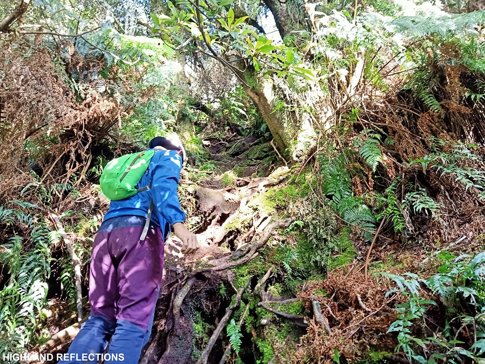
Past Tinikaran Campsite II is a short forested section containing some fallen trees that we needed to make our way through, leading to the entrance to the third and upper layer of Mt. Apo: the boulderface.
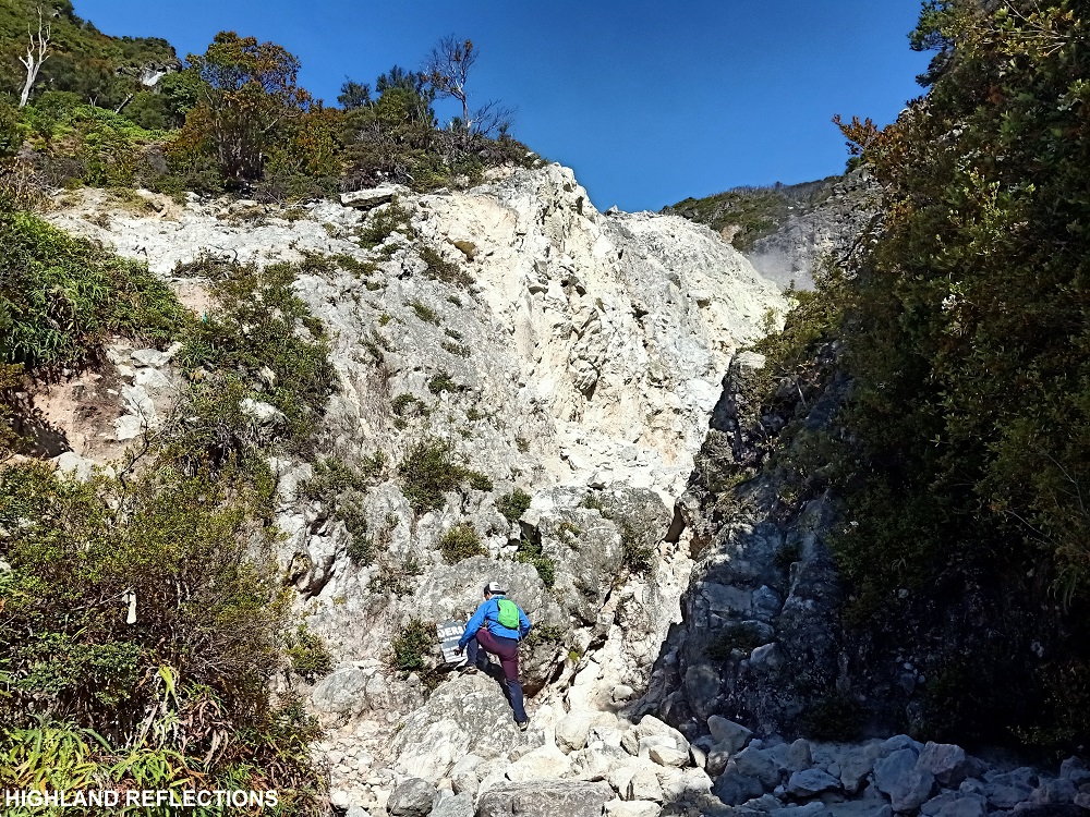
Boulderface: Sunny and Stinky
We exited the forest towards what seems to be a dried riverbed. We followed this gulley-like path, stepping on boulders covered in white sand. Most portions were steep that we needed to use our hands to make our way up. After a few minutes, we emerged towards an open area where the surroundings was composed of greyish to white boulders. In front of us, smoke was continuously spewing upwards.
This was now the true start of the boulderface.
I slowly made my way up the steep path surrounded by white boulders and wild berry plants. The first landmark that I needed to reach was a T-rex head-like giant boulder a few hundred meters above the trail. En route to this is a short section that, unluckily, was on the path of the sulfuric gas that I spotted on the entrance to the boulderface. It really did smell like rotten eggs! With only a towel to fight off the stink, I made my way up with a heavy pant.
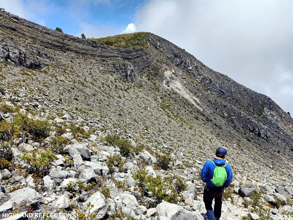
As I reached the giant boulder, I rested for a bit and savored the shade it provided. The next parts of the trail were all comprised of giant greyish-to-white boulders. Now this is where the true adventure to Apo begins! From where I was resting, I could already see stacks and stacks of boulders all the way to the top, culminating on what seems to be a giant wall of boulder. From where I was, I could also spot another wall at the back of the initial boulder wall. Both of these walls were so high from where I was, it felt like I was at the mercy of titans.
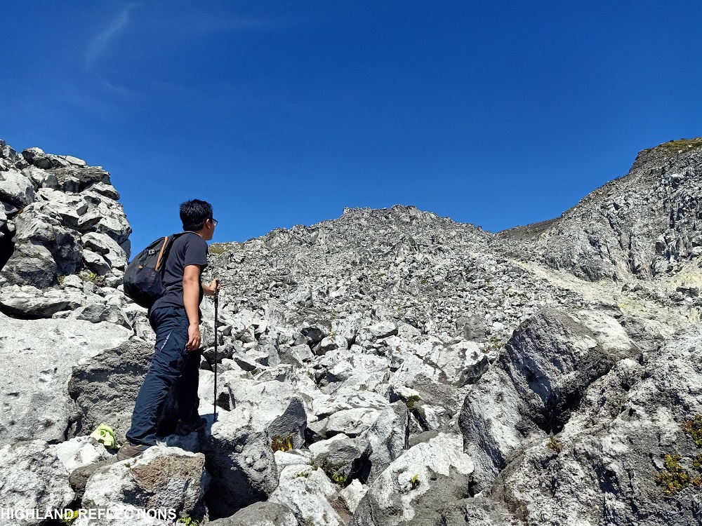
With a trail-less path, I made my way up by leaping on boulders, making sure each step had a stable foothold. After an exhausting 30-minute ascent, I rested once again and ate some snacks. Sir Joe and I, then, deviated from the Santa Cruz Trail and went left to a short section of the Kapatagan Trail. This was because, according to him, the Kapatagan boulder section was shorter than that of Santa Cruz’. Being at the mercy of my kind guide, I followed him at the maze-like boulders of Apo.

At the Kapatagan Trail, I was welcomed once again by a spewing sulfuric gas coming from a vent. I guess this was Apo’s way of welcoming me! Past the sulfur vent is the White Sand E-Camp, indicating that I was now nearing the summit. While resting at the e-camp, Sir Joe introduced me to his good ol’ friend, the 80-degrees—a wall of boulder with an intimidating steep trail which we needed to pass through en route to the summit. I laughed in disbelief. Wala naman akong choice!
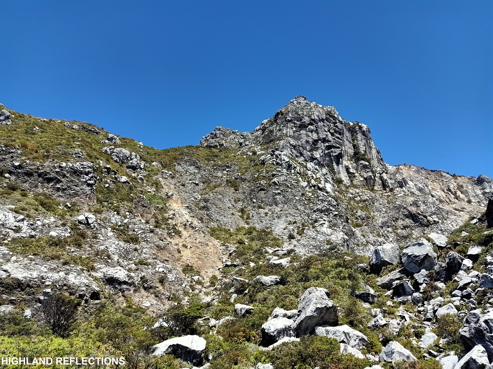
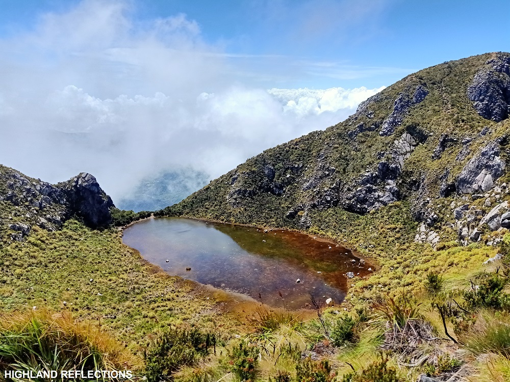
Surprisingly, the “80-degrees” wasn’t that steep, as there were established footholds at the side of this wall of boulder. Past that steep portion is the final assault towards the crater lake, in which the trail was surrounded by shrubs and grasses. After a few pushing minutes, I reached the magnificent old crater lake of Mt. Apo—a body of water surrounded by the tall boulder walls comprising Mt. Apo’s summit area.
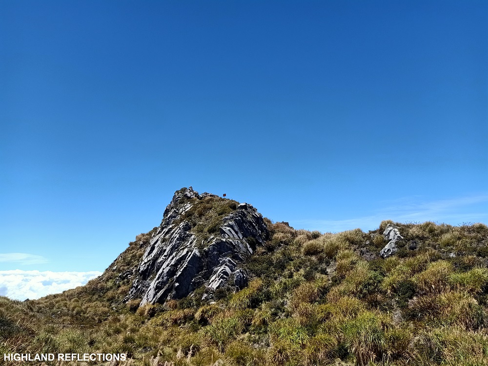
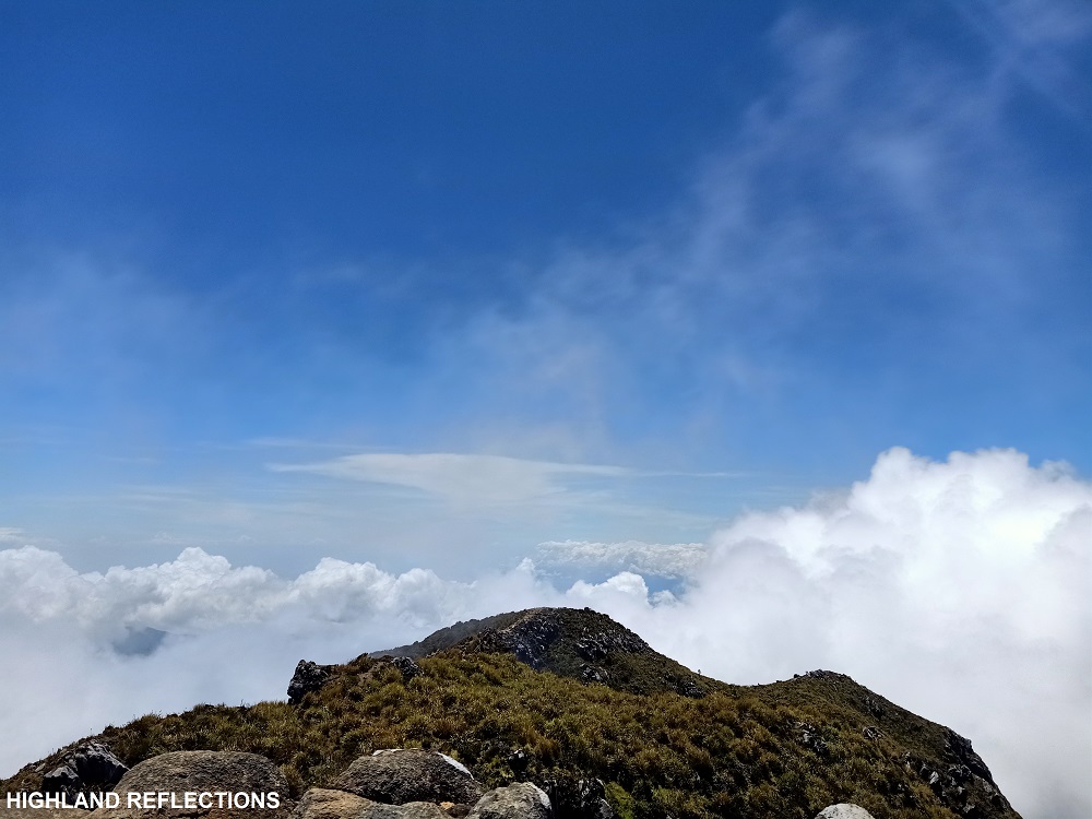
Since I requested to Sir Joe that I wanted a summit “with a signage”, he led me to what is deemed as Apo’s “Center Peak”. The trail starts off at the right side of the crater lake, taking up a steep ascending trail on the grassy slopes of the boulder wall. The topmost portion is a ridge-like trail leading to the Center Peak. This was surrounded by short grasses, much of which are burned, turning them into black. This was, according to my guide, remnants of the fire that broke out at the summit a few years ago.
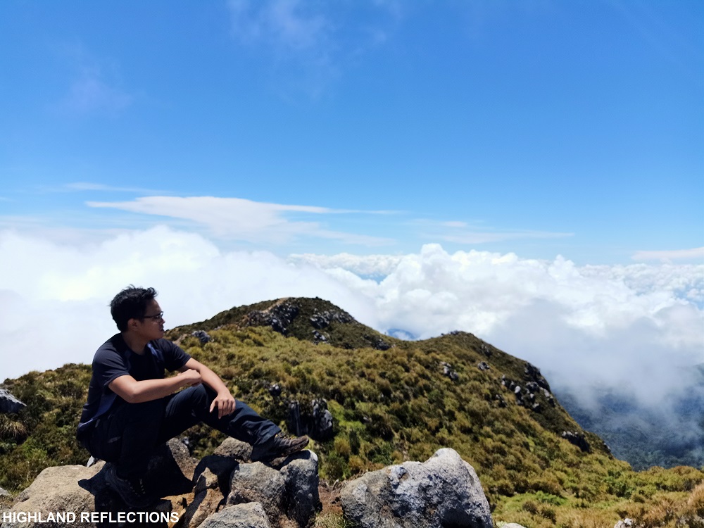
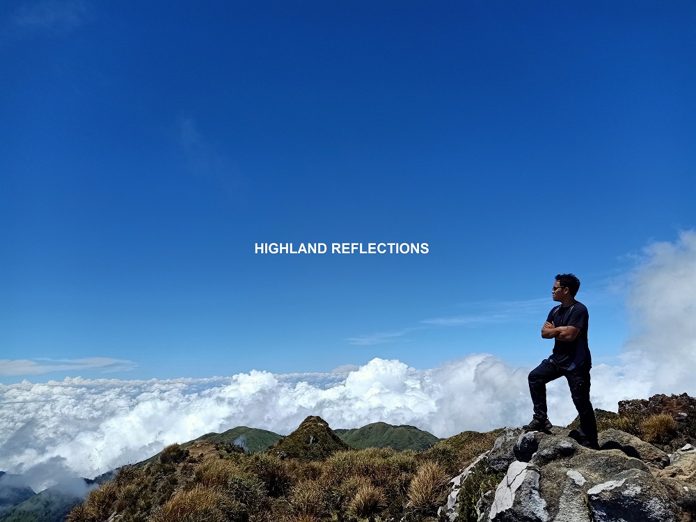
As I was nearing the Center Peak, I was presented with the summit area of Mt. Apo, where pillars of boulder walls were dotted along a circled area. What made the view much more spectacular was the presence of clouds surrounding the entire summit area. Sea of clouds atop of Mt. Apo? Rare and surreal! What an opportunity! I was beyond grateful.
Accomplished at 2,954 Meters
At 10:50am, almost seven hours after starting the hike, I have reached the summit of Mt. Apo. I was now at the country’s highest point!
I thanked God for the safe ascent and the spectacular view.
What was it like atop of the Philippine Rooftop? Well, just like what I have felt in Pulag two years prior to this climb, I had this mixed feelings of awe and gratitude. The awe was felt two ways: one was of course, for the view that Apo has given me, and the humbling feeling of standing atop of it, even if I was at the mercy of its titanic elements. Two was for the deep sense of amazement with how everything that I have done has led to this moment; twenty plus years of decision-making, leading me to this very moment of accomplishing a hard-earned goal. The gratitude, was of course, for God and the universe for letting me see this geological wonder. Truly, it was a one-of-a-kind experience. What made it extraordinary was how I summitted Apo within a day!
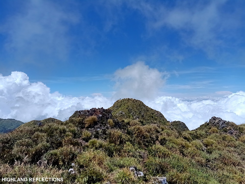
Anyway, Sir Joe informed me that for them, the Center Peak is the true summit of Mt. Apo. However, climbers would also go to what they call as the Kidapawan Peak which was on the northwestern side of the Center Peak, as this was contested to be the true summit of Apo. There were also many subsidiary peaks surrounding the area, one of which was the Santa Cruz Peak, which was supposed to be my destination for this climb. However, I requested to Sir Joe that I wanted a peak with a signboard, and luckily, he also wanted me to reach the “true” summit of Apo! Hence, we’re here at the Center Peak.
After snapping some pictures at the signboard, Sir Joe and I ate our lunch, consisting of rice and a garlicky viand of canned afritada. As I was eating, I appreciated the views surrounding me. It felt like I was in a garden in Olympus, or in Skypiea where the vast array of Shandian, Skypiean, and Birkan kingdom was surrounded by compact clouds.
I wondered what the view would have been without these clouds. I would have wanted to spot the Mindanao mountains like Kitanglad, Kalatungan, and Matutum from this spectacular vantage point, as well as of course, Celebes Sea. Luckily though was that I was able to spot Samal Island from a small clearing.
At 11:30PM, we started the descent. Both of us did not want to leave the summit, as the view was just majestic. But as they say, what goes up, must come down!
Slow, Tiring Descent
Leaving the summit, I had a last glimpse of the sea of clouds and terrific boulder pillars before descending to the crater lake. When we reached the bottom of the boulder wall, I had several pictures snapped at the entrance of the lake. I let a final glimpse once again, this time, at the trail going to the Santa Cruz Peak. My curious soul wondered what view I would get from there.
We descended once again the 80-degrees part of the trail. Instead of going to the Kapatagan Trail, Sir Joe brought me to the actual, Santa Cruz side of the White Sand E-Camp. Here, I rested for a few minutes at the shade of a giant boulder as the punishing heat of the sun was at its peak during this time.

Having no choice but to soak myself in the light of the mighty sun, I continued the descent. It was another series of hopping on stable boulders, but this time, on a descending fashion. From the Santa Cruz boulder trail, I had an awesome view of the boulder walls surrounding the entire area, where to my left is a boulder ridge which we can also take on the way down.
It was an exhausting descent, exacerbated by the punishing heat of the sun. Prior to reaching the entrance of the Boulderface, we spotted again some Philippine long-tailed macaques, roaming around the area, some of which were hanging out on the trees. Some were making their way through the trail and then hiding inside the canopy of wild berry plants.
Past 1:30 in the afternoon, after two hours of starting the descent, I finally reached the tree line where the tinikaran forest is located. Without much rest, I continued the pursuit and reached Tinikaran Campsite II before two in the afternoon, and Tinikaran Campsite I at around 2:15PM. Here, I had a much needed rest. I ate some snacks before continuing the descent after thirty minutes.
Since the trail past Tinikaran Camp I was on a flat to gradually descending trail, I requested if we could fasten our pace, and so we did. Confident with my pacing, I was sure that I would be able to finish this day hike at around 4pm.
But alas, as we got past Basakan E-Camp and onto the steep descending part of the montane forest, my pacing gradually slowed and I felt weakness in my legs. Thankfully, I was able to reach Sitio Tumpis without any cramps or injuries, but my legs and feet were sure as hell aching. It was 4pm. We rested by a store and ate some snacks again.
The last push going to Sitio Colan involved a painful walk. From time to time, I was turning my head to my back to catch a glimpse of Mt. Apo. Past 4:30 in the afternoon, I was able to reach Sitio Colan, where Sir Joe logged out my name and where I paid some of the remaining fees that were due. Then, we took the descending trail which passes through the hydroelectric powerplant. Here, I was once again looking at Mt. Apo from afar, appreciating the view before leaving its premises. From there, it was only a 10-minute walk going to the main road where we waited for our habal ride.
It was 5:30 in the afternoon, almost 14 hours after starting the hike.
Mt. Apo: complete!
The Day’s Conclusion
We returned to Sir Joe’s home and got there at around 7 in the evening. He was kind enough to let me sleep for another night at his home before I return to Davao City the following day. I had my skin burned from the punishing sun while hiking Mt. Apo. I considered them my battle scars for a successful dance with Apo Sandawa’s trail.
As I recall the day’s events, I couldn’t help but be grateful to the universe for letting me undergo a one-of-a-kind experience atop the Philippines’ highest mountain. Climbing the country’s highest was no joke, and doing it on a dayhike was an insane feat. But hey, pushing boundaries and doing the impossible are what define us as humans. We just need to be prepared to take the unknown and leap into action when the situation calls for it.

Thank you for calling me, Apo. Hoping to see a different side of you next time!
Itinerary
02:30AM Habal ride to Brgy. Kapatagan
03:40AM Start hike
04:00PM Sitio Colan
04:40AM Sitio Tumpis
06:30AM Tinikaran Camp I, rest, breakfast
07:15AM Resume hike
07:45AM Tinikaran Camp II
08:00AM Boulder entrance
10:00AM White Sand E-Camp
10:30AM Summit, lunch
11:30AM Start descent
01:30PM Back at Tinikaran Camp II
02:00PM Tinikaran Camp I, rest
04:00PM Sitio Tumpis
04:40PM Sitio Colan, log out
05:30PM End of hike

i was a little sad because of not being able to see photos from this hike, and i’m already imagining how astonishing the sea of clouds would be, but yeah! thanks for another great blog sir clem!
LikeLike
Photos are in my fb profile! Hahaha
LikeLike
Hi! can you please share the contact details of your guide? Planning to hike solo. Thanks
LikeLike
You may contact his fb profile: Laag Ni Joe
LikeLike
I am planning to hike Mt. APO in Dec, thx for all the information. I enjoy reading it very much.
LikeLike