Ah, the Cordilleras. The northern haven of mountain folks. The place that welcomed me in many of my hiking pursuits in 2018 and 2019. The region that felt like home and paradise.
After two years of not being able to go to my favorite place in the Philippines after the pandemic started, I was finally able to go back on a relaxing trip to Maligcong, Bontoc, Mountain Province!
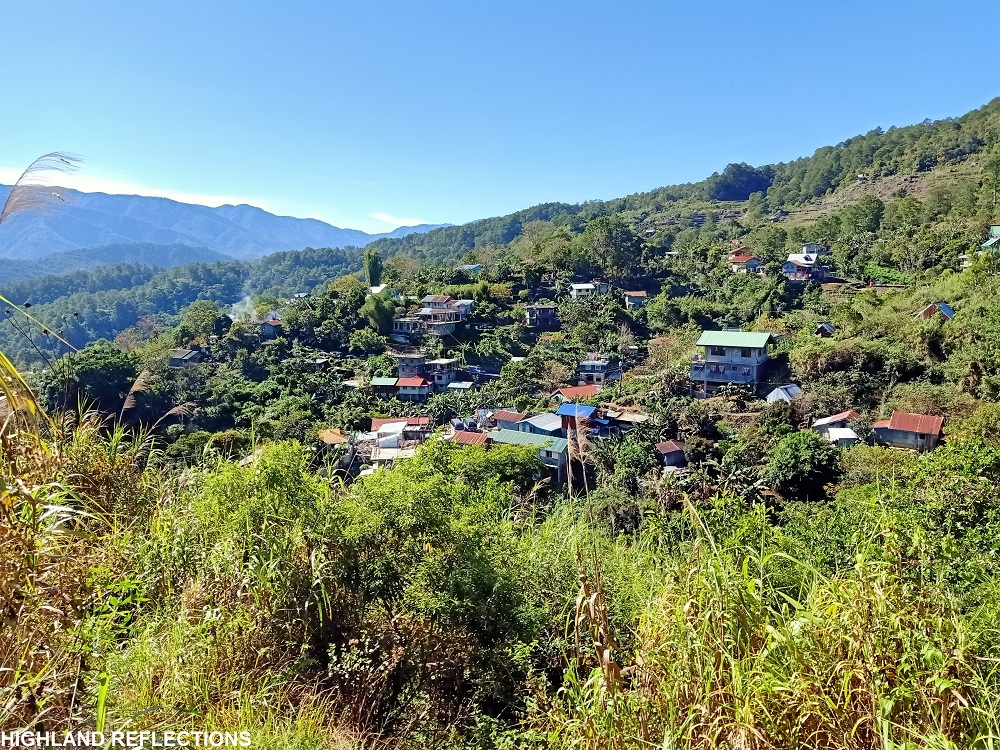
Northwards to Maligcong
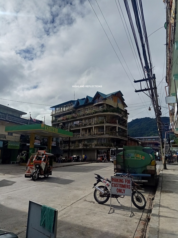
The adventure up north started when we arrived in the capital of Mountain Province, the municipality of Bontoc, in the morning of one Saturday in February, 2022. This town has been the cultural and political center of the Cordilleras and is one of the most urbanized municipalities in the region. This is evident in the establishments at the town center in Barangay Poblacion with its post-war buildings and establishments in the area.
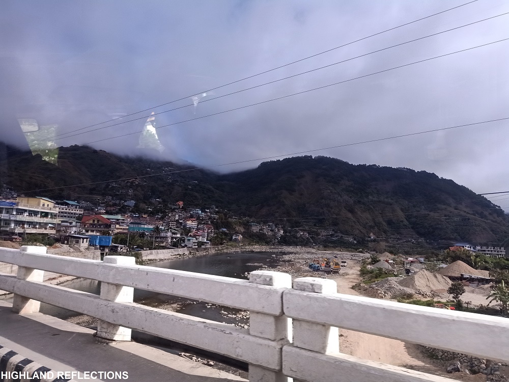
One of the few things that amazes me with Bontoc’s Poblacion is how utopic its location is – a town submerged in a bowl surrounded by titanic mountains from every angle, reminding me of fictional kingdoms like Wakanda. At almost 800+MASL, you wouldn’t feel like you are in a mountainous town since it is practically so submerged geographically that you’ll only notice the buildings around you.
This is not the case, however, for Barangay Maligcong. Situated north of Barangay Poblacion, Maligcong is a highland farming community known for its underrated rice terrace structures. More than this, the community is also known to adventurers as a place of peaceful respite, especially if one wants to avoid the crowds in Sagada and Buscalan (during our stay in February, 2022, Maligcong was crowded since Sagada still had very stringent requirements during that time).
But despite being a place to relax and find comfort, a trip to Maligcong would not be complete without taking the challenge to hike up to the two prominent mountains in the community: Mt. Fato and Mt. Kupapey!
The Vehicular Ascent from Poblacion to Maligcong
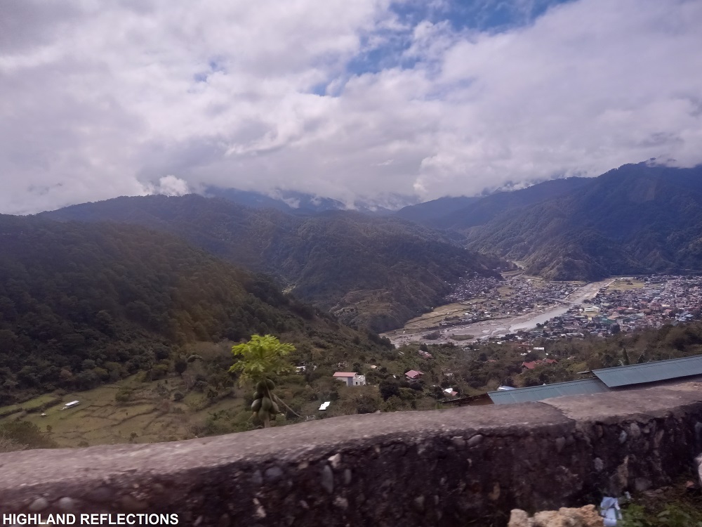
After getting my tummy stuffed with pansit batil patung at one of the eateries in Poblacion, we went northwards on an ascending road to Maligcong. The contours of this road were very sharp and our van’s wheels were screeching just by the very friction of forcing our vehicle to go up. Despite this gut-wrenching predicament, we were rewarded with a view of Poblacion seemingly far below now! The whole town was surrounded by walls of mountains and rivers.
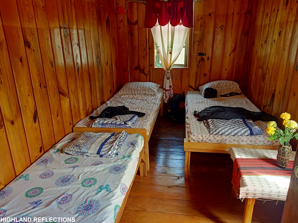
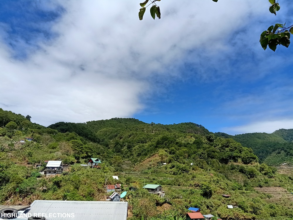
After around thirty minutes of vehicular ascent, we arrived at our rented homestay. The house was surprisingly modern, with a living room where one can sit on a sofa and watch television, a kitchen with sets of cooking utensils and a refrigerator, and spacious bedrooms complete with beds, pillows, and blankets. Our comfort room even had an installed heater perfect for the cold weather!
After putting down my stuff in one of the rooms in the homestay, I immediately reclined on a hammock, where I already had a view of nearby Maligcong Rice Terraces, and above it, Mt. Kupapey, which we would be hiking the next day. Turning left of the terraces is another pine tree-filled slope which comprises the lower reaches of Mt. Fato, which we would be hiking later that afternoon.
Since we had all the time to ourselves, we took the chance to rest and savor the relaxation brought by the mountainous wind.
The Search for Mt. Fato’s Bato
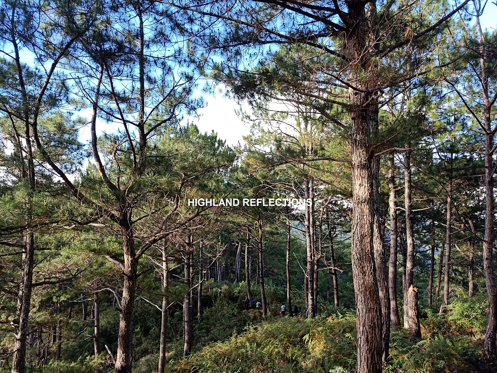
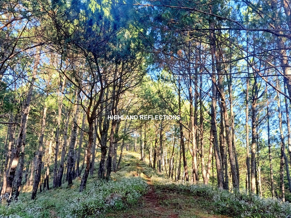
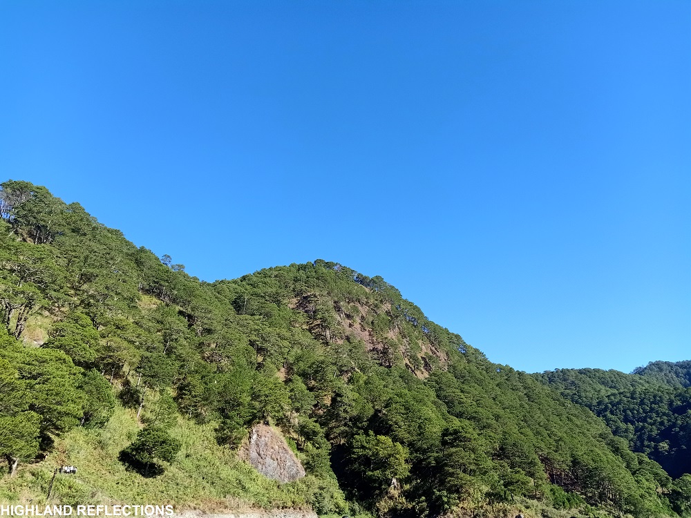
The mountain that we hiked on our first day in Maligcong was Mt. Fato, located at the western side of Maligcong. Mt. Fato is known for its countless pine trees, but the most prominent landmark in the hike is the large rock at the summit. This is actually where the mountain’s name came from—the word “Fato” is the local pronunciation of the Tagalog word “bato” which means rock. On top of this rock, one can have a three hundred and sixty degree view of the surroundings.
Based from my own observation, here are some of the specs of the hike to Mt. Fato:
Jump-off point: Sitio Favuyan, Brgy. Maligcong, Bontoc, Mountain Province
Elevation: 1,630+ MASL (STRAVA recorded)
Specs: Minor climb, 2/9 difficulty
Trail class: 2-3
Days required / Hours to summit: 1 day / 1-2 hours
Features: pine trees, rock formations, view of Maligcong
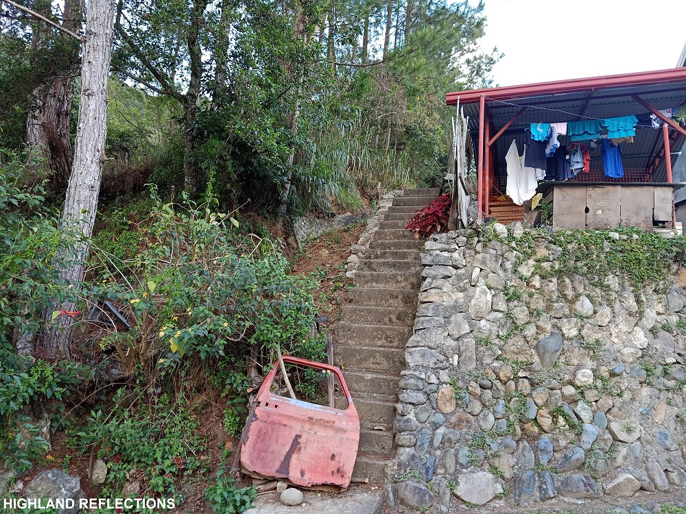
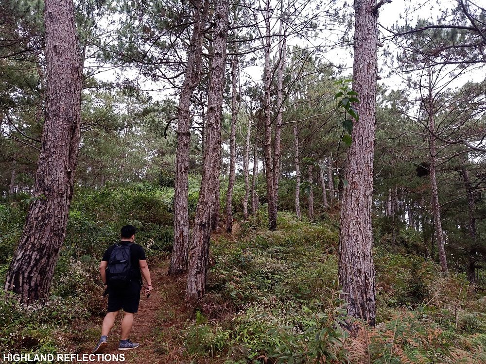
We started the hike at 2:30 in the afternoon. The trail started at a cemented stairway a few meters away from our homestay. We passed by the side of a small farmland before entering a straightforward ascending trail filled with pine trees on the side. Since I was with a group of casual travelers, I asked permission from our guide to expedite my pace, which he luckily granted.
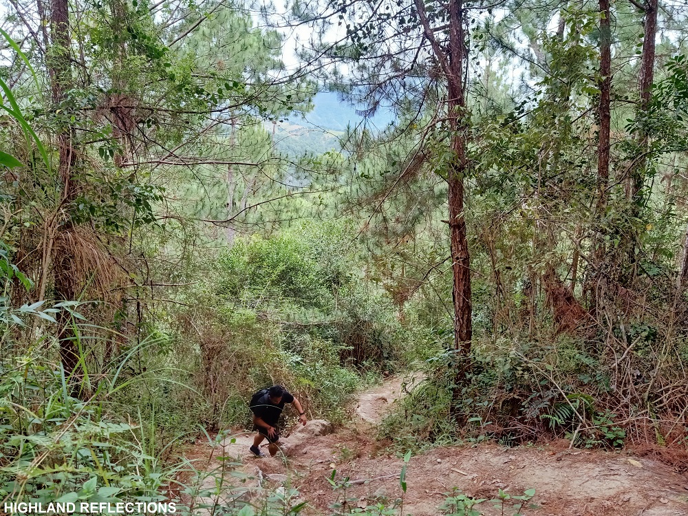
As I was gaining more elevation, pine trees became much more abundant and reddish dried pine leaves were making their presence felt along the trail. Different shrubs also dot the surroundings. When I reached the top-most part of the slope, the trail turned left and extended on a flat footpath still surrounded by numerous pine trees. After a few minutes, I reached the last two-minute assault going to the summit of Mt. Fato. The trail was slightly muddy. At 3:30PM, I reached the summit area, exactly one hour after we started the hike from the homestay!
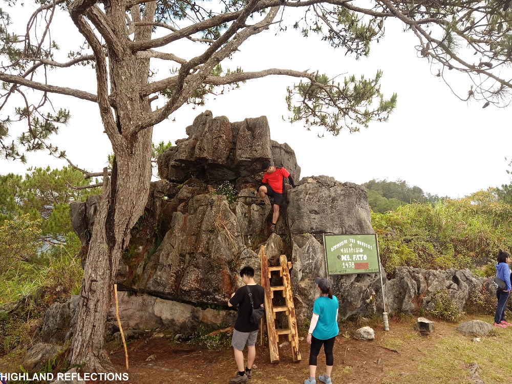
The summit area is dominated mostly by what seems to be limestone boulders. This was complemented, of course, by the presence of pine trees. The most prominent boulder in the area, which sits beside a lone pine tree, serves as the actual summit. Below the boulder is a marker that reads “Discovering the Wonders of Maligcong, Mt. Fato, 1438 MASL” (I wish they update the elevation since the summit seems to sit at 1,630+ MASL).
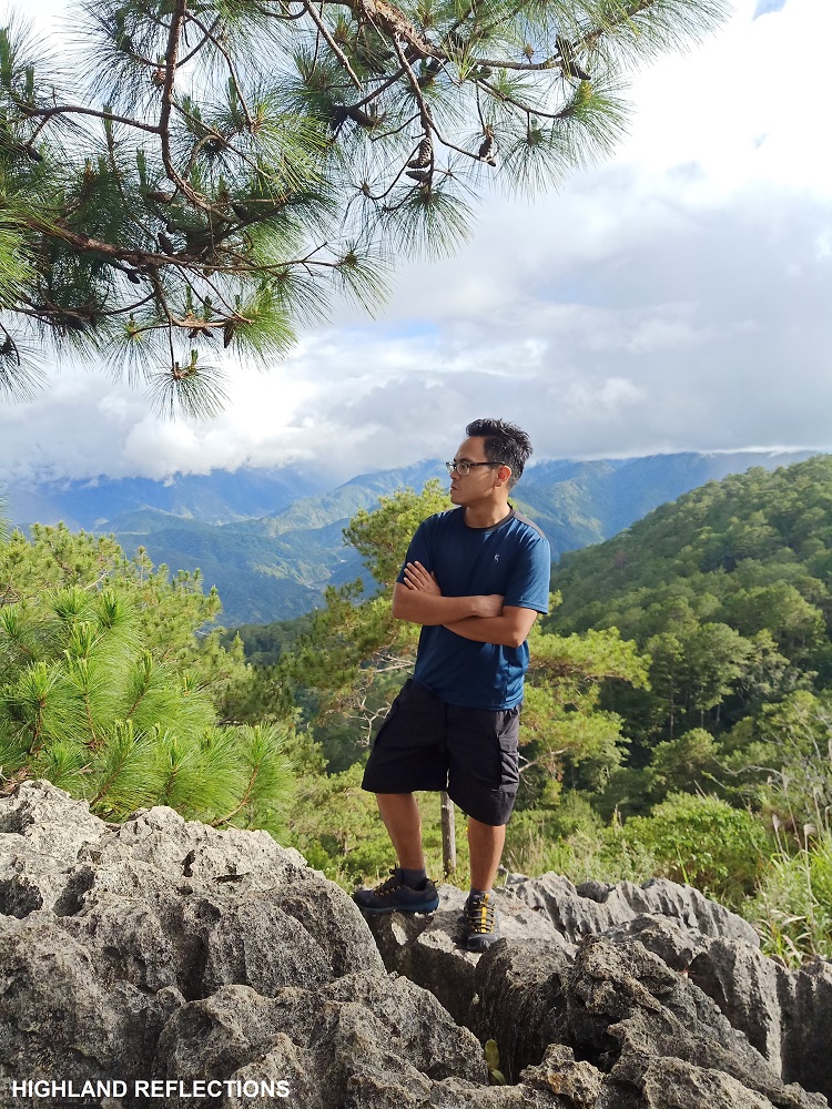
As our companions arrived, we took turns taking pictures at the different angles of the summit. Of course, I braved climbing the huge summit boulder and savored the view on top!
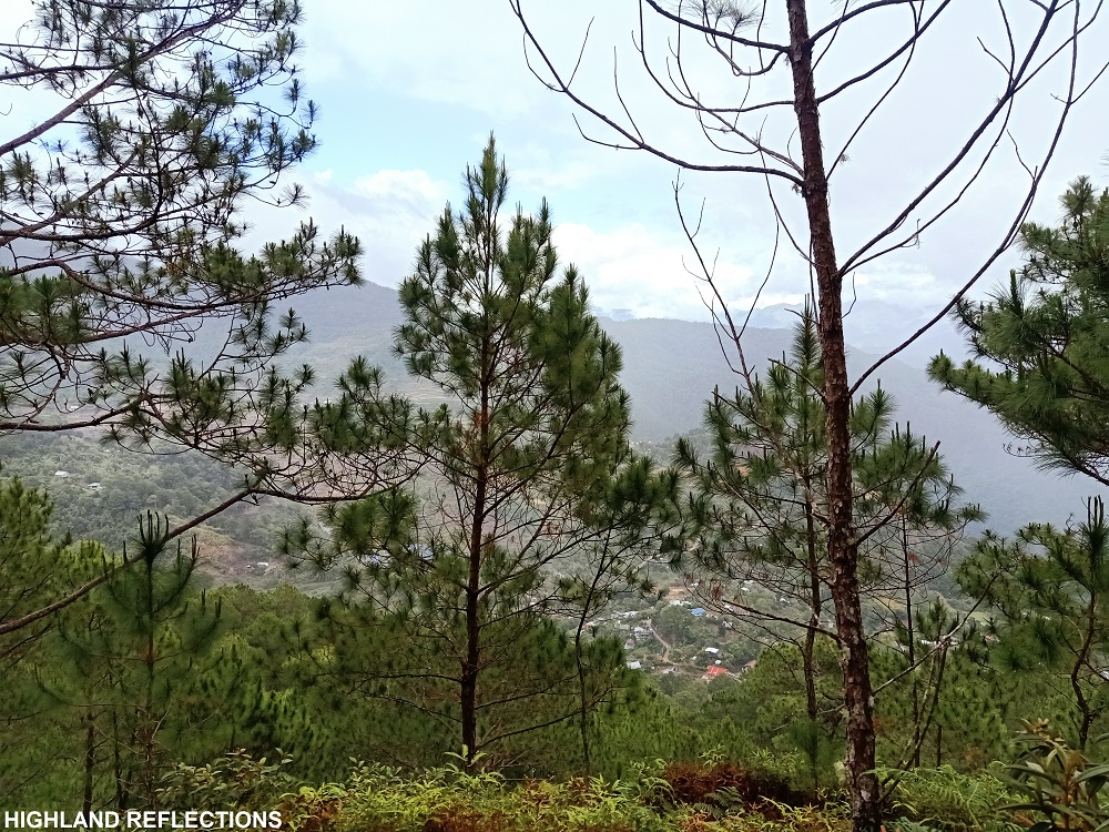
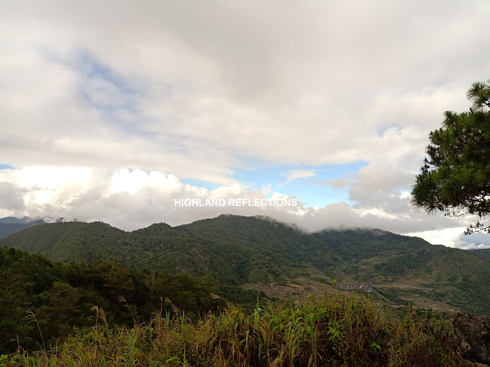
Time for a mandatory site orientation: the most prominent view on top of the boulder is at the southern direction where greens of contouring mountain slopes rest up to the horizon. This seems to be the slopes near Bontoc and Mt. Kalawitan. To the west, I spotted a faraway community. I speculate that it is the renowned town of Sagada! In the northern direction are the Maligcong Rice Terraces and the mountain slopes where Mt. Kupapey can be found, where its summit is being smothered in clouds. The view at the eastern direction is being obscured by tall pine trees.
As the place was starting to get too crowded, the team decided to start descending after taking a group picture at the summit. In the first half of the descent, I tagged along with the rest of the group. There, I was able to reappreciate the numerous pine trees surrounding me. What a sight to behold. Afterwards, I expedited my pace once again and reached our homestay forty minutes after starting the descent.
As nighttime came, the temperature dropped. Shivering, we shared a serving of a heartful and boiling nilagang baboy for dinner and fresh, sweet mangoes that they bought in Poblacion for dessert. I slept early afterwards, knowing that there is still another hike the next day.
Chasing Sunrise in Mt. Kupapey
At 3 in the morning, we woke up to the sound of our alarms. We got up early to catch the majestic sunrise at the summit of Mt. Kupapey. We shared breakfast over a boiling sopas and unlimited coffee.
The second hike for this trip was Mt. Kupapey. The name of the mountain means “butterfly” in the local language. According to our guide, some of them have spotted giant butterflies in the summit, hence the name. Just like Mt. Fato, the trail of Kupapey is characterized by a straightforward ascent. The view, however, was more rewarding. We were excited to find out.
Based from my observations and recording, here are the specs of Mt. Kupapey:
Jump-off point: Sitio Favuyan, Brgy. Maligcong, Bontoc, Mountain Province
Elevation: 1,607+ MASL (STRAVA recorded)
Specs: Minor climb, 2/9 difficulty
Trail class: 2-3
Days required / Hours to summit: 1 day / 1.5-2 hours
Features: pine trees, view of Maligcong Rice Terraces
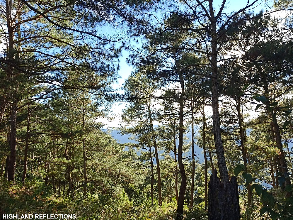
At 4:20 in the morning, we commenced the hike. The first part of the hike involves a descent coming from our homestay on a paved road. The trail then commences at the back of a house where we needed to cross a steel bridge and a short cemented pathway at the edge of a plantation field. Then, the ascent ensues. In the midst of the dark sky, we were ascending a straightforward path with giant pine trees on the side. I was all sweaty at this point despite the temperature being low. Since it was dark, I needed to tag along with the group so that we wouldn’t lose track of everyone in the team.

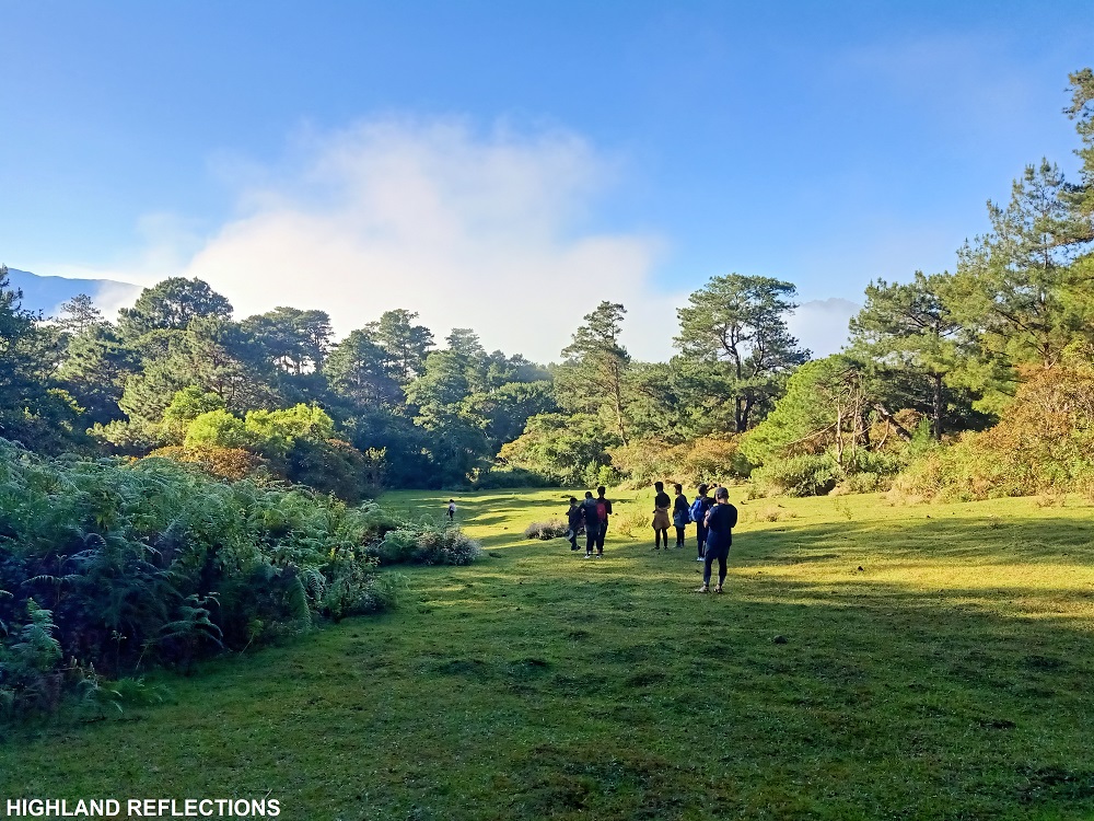
After more than an hour of continuous ascent and rounds of five minute breathers, we exited to a very wide grassy area. The place was so wide that you can set up a stage and organize a concert there! It was such an ideal place as a camping area but sadly, the government of Maligcong does not permit hikers to camp on its slopes. At the other side of the grassy field is the continuation of the trail inside a pine forest. This was now the final assault to the summit of Kupapey.
At the end of the assault is a crossroad (or crosstrail?) where to the right leads to the view deck summit of Mt. Kupapey, and to the left is a “Spanish trail” which according to my guide leads to (1) other communities outside of Maligcong and (2) a traverse trail to Mt. Fato. Right we went! It was past around 6 in the morning.
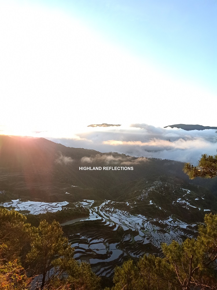
We found the view deck already jampacked with people once we arrived. Despite this unpeaceful precedent, everyone solemnly sat along a downward slope, staring at the eastern direction and waiting for the sun to rise in its majesty. It was like a cinema filled with people watching an awe-inspiring film of how the blazing Ra gave hope to the land. And as the first ray of light came, the waters on each terrace got reflected, revealing the layered land below us.
Maligcong Rice Terraces wasn’t in front of us. It was below us.
As the sun shone up in the sky, the blazing colors of the pine trees surrounding us were revealed. But it didn’t distract us from the marvelous view we were witnessing below—man-made structures turned into architectural wonders. Nestled along the slopes of the terraces, we had a view of the three sitios of Maligcong—Favarey on the left, Fang-orao in the middle, and Favuyan (our homestay’s place) on the right. As we were viewing and taking pictures, clouds seemed to play with us, covering the view from time to time.


At around 7:30, we decided to start the descent after snapping numerous pictures at the summit area. Along the descent, we took a left turn that shortly goes directly to one of the terraces. This area is directly below the summit of Kupapey, and gives a much nearer view of the surrounding terraces. I didn’t know the view would get much more magical!

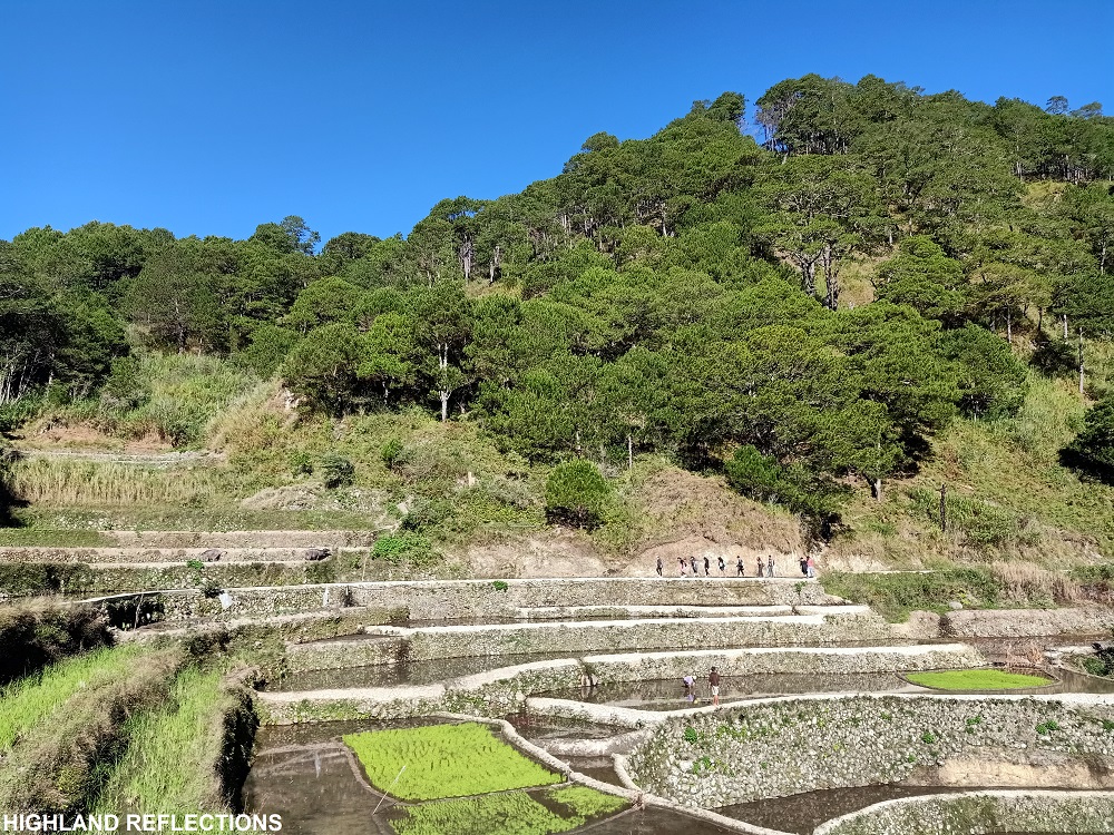
After snapping some photos, we walked along the cemented edge of a plantation terrace. Some of our companions got a bit scared as it was a six feet drop on our left side. Then, we emerged at the original trail once again and continued the descent. Since the sun was now up, the hike on the way down became hot. I went ahead and finished the entire hike past 9:30 in the morning. Mts. Fato and Kupapey: complete!

Upon arriving at our homestay, our van driver, who also happens to be a former chef, cooked for us some delicious omelets for breakfast. We then cleansed ourselves and packed up our things. Past twelve noon, we started the long journey on our way home. Along the way, we had a short stopover at the view deck of Banaue Rice Terraces in Ifugao. What better way to end the trip than seeing in person what I’ve always read in my elementary books!
Magical Maligcong
I had such a wonderful weekend in Maligcong. All the stress in my body and mind had dissipated after my visit in the Bontoc countryside. I had the urge to stay there for a week and just relax inside the homestay doing nothing! With fresh food and unlimited servings of coffee, Maligcong is a place for relaxation without leaving the comforts of home.
Oh, to be an urban person longing for the romance of the rural!
Of course, it was such a nice treat to be back to my favorite trail scenery—pine trees! Mts. Fato and Kupapey served as undemanding and chill hikes. Despite its easiness, its straightforward ascending trail still poses quite a workout! I would love to try the traverse trail soon and maybe explore some of the off-beaten paths in the area.
I am hoping to see Maligcong the very soonest!
Itinerary
Day 0
10:00PM Pick-up in Malolos City
Day 1
06:30AM Welcome Banaue Arc, take photos
08:30AM Bontoc proper, breakfast, buy supplies
10:30AM Alicia’s homestay, rest
02:30PM Start hike to Mt. Fato
03:30PM Summit of Mt. Fato, take pictures
04:30PM Start descent
05:10PM Homestay, rest
09:00PM Lights out
Day 2
03:00AM Wake-up
04:20AM Start hike to Mt. Kupapey
05:45AM Summit view deck, wait for sunrise
07:30AM Start descent
08:30AM Terraces view deck
10:00AM Homestay, wash-up
12:00PM Start ride going home
02:00PM Banaue Rice Terraces view deck, late lunch
11:59PM home
**
Special thanks to Lakbay Landea for this event! For affordable hikes to Maligcong and other relaxing trips around Luzon, you may contact them via their Facebook page!
Special mention, of course, to Alicia’s Homestay. They are both on Facebook and Agoda!

Exploring Maligcong’s treasures on Mt. Fato is a true adventure, and your blog beautifully captures the essence of the journey. Thanks for sharing! For more incredible travel insights, I’d recommend checking out WildKamp.ph – they’ve got a wealth of information on unique destinations like this
LikeLike
Thanks for sharing this wonderful journey! Seems like the mountains are calling me again for an ascend…haha…
LikeLike