The outbreak of the COVID-19 has halted all hiking activities in the country. For more than six months, we have been locked up in our houses and communities to lessen the transmission of the virus. With traveling and safety protocols gradually getting eased by the government in October, several mountains have already opened in the Southern Tagalog and Central Luzon areas since. With nine months of no hiking activity, my whole body was just craving for an outdoor hike. Luckily, the Malolos-based organizer whom I joined in my second Mt. Pulag hike (undocumented in this blog) invited us to travel in the rural town of Doña Remedios Trinidad (DRT) in Bulacan. We went to the newly-hyped Tila Pilon Hills. Joining me in this hike is my mother and several of her friends who were regular joiners of the travel group.
Tila Pilon Hills was opened to the public and got mainstream in 2019 together with other destinations in DRT. With the town located near the famous Biak-Na-Bato National Park in San Miguel, Bulacan, tourism in DRT has been gradually booming relative to its neighboring town, with more travelers from the Metro recognizing this easily accessible place. I noticed back then that travelers from Bulacan are the only ones aware of this then-hidden gem in the provincial gateway to the North.
Since there are still no hiking specs for this destination, might as well take the chance to create one:
Elevation: 235+ MASL (STRAVA-recorded, still unofficial)
Specs: Minor climb, difficulty 1/9
Trail class: 1-3
Days required / hours to summit: 1 day / 30 minutes to 1 hour
Features: scenic view of Sierra Madre mountains DRT, Bulacan, roped segment assault prior to the summit, view of grassy knolls
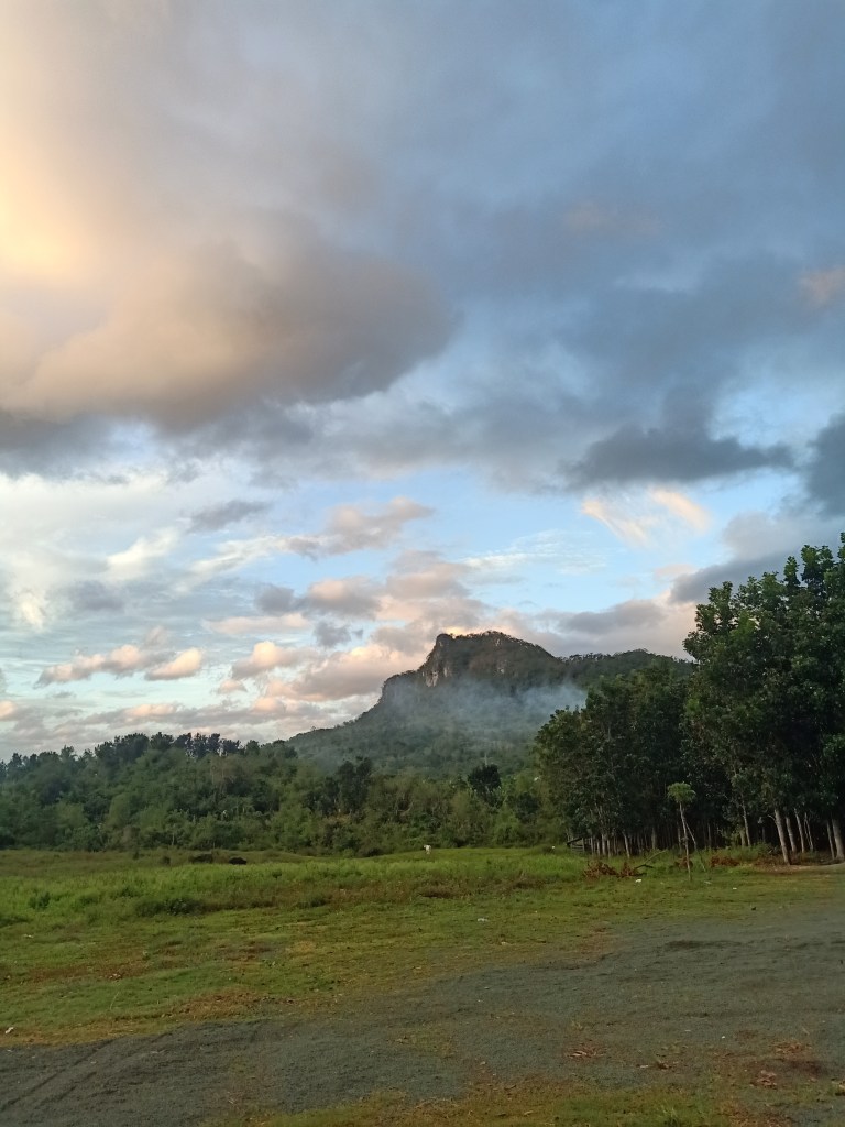
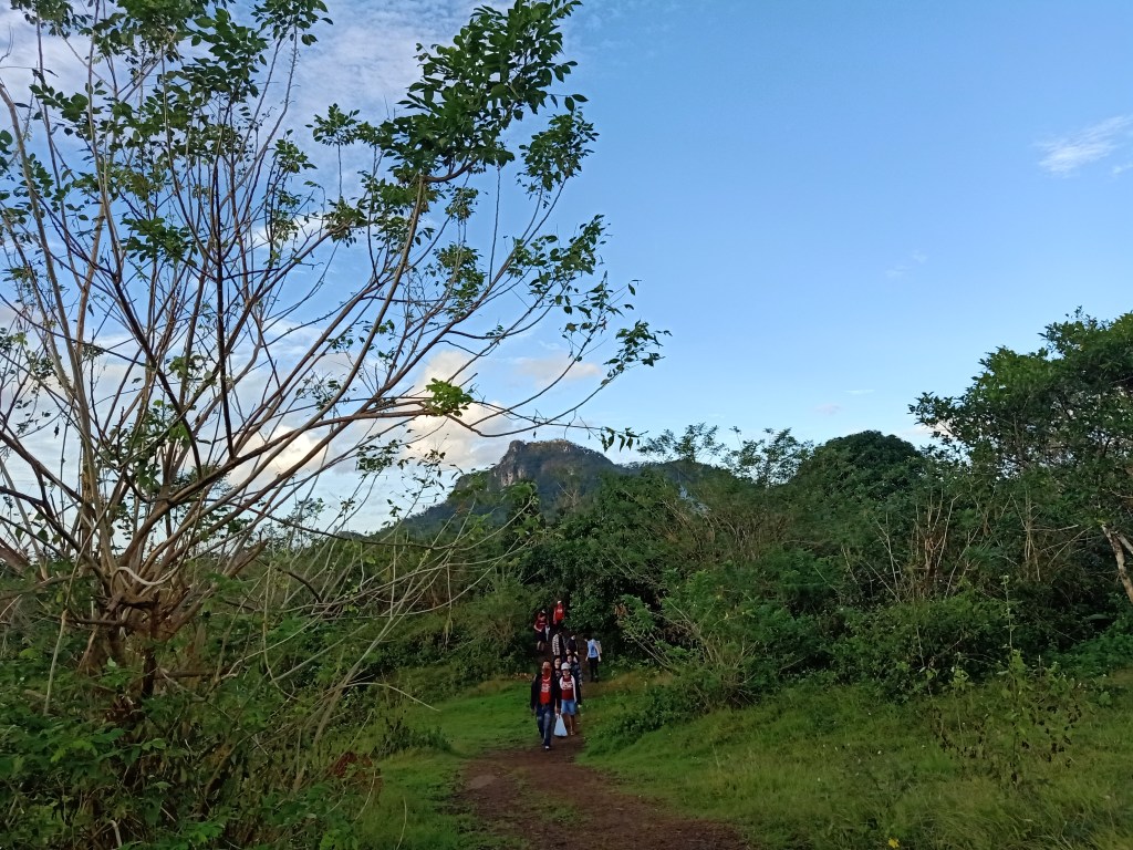
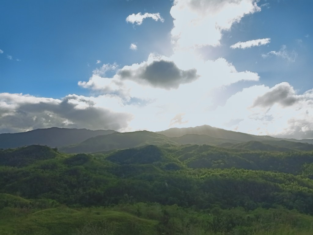
For this hike, we met and departed at Malolos City around 3:30 in the morning. Making our way northeast of the province, our van driver got lost along the way. We went towards Pandi, Bulacan instead of heading straight to the town of Angat. Once we reached Angat, it was only a matter of time to reach the town of DRT. As we entered this rural town, several mountain slopes appeared in the distance, still in pitch black as the sky is turning to almost like a navy blue. The sun slowly rose and as its light illuminated the whole surroundings, we reached the jump-off point of Tila Pilon in Barangay Kalawakan. It was six in the morning.
We had our bathroom breaks upon arriving at the jump-off point. Several vans were already in the area, most of them, I reckon, were Metro Manila-based organizers. At this parking spot / jump-off point, mountains can already be seen in all angles. To our west is a prominent rocky peak called Mt. Mabio, a mountain that borders the town of San Miguel and DRT. Opposite of that direction (eastward) is Tila Pilon and the higher, forested mountains behind it. We met with our guides and started the hike at exactly 6:30 in the morning. Note that guides are mandatory for this place, although I was not able to ask for their rate.
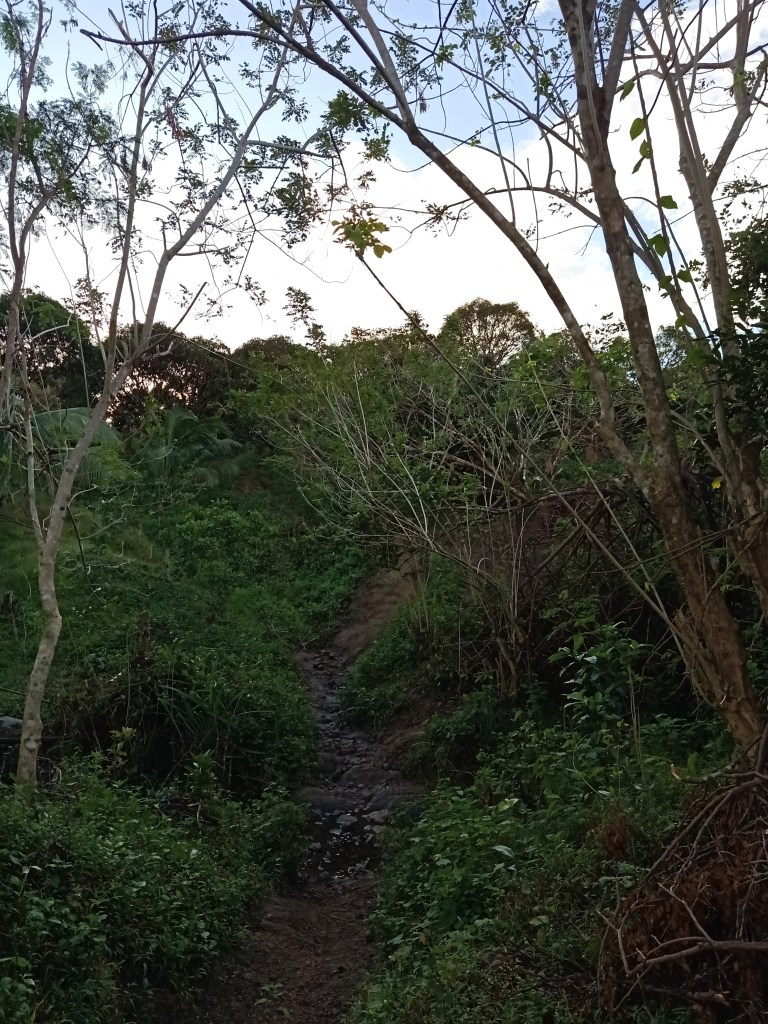
The hike starts at a garden-like trail where to the side is a plantation of different crops and vegetables. The trail was mostly flat and had different muddied portions. Sometimes, the trail rolls into a mixture of easy and beginner-friendly ascents and descents. There were also fruit trees surrounding the place, but the guide forbade us to pick. Just after a few minutes of walking, we ascended towards a road where patrols were… well… patrolling the place. Several houses and sari-sari stores dot the place. Here, the patrols check and confirm the number of participants the guide has under his/her care.
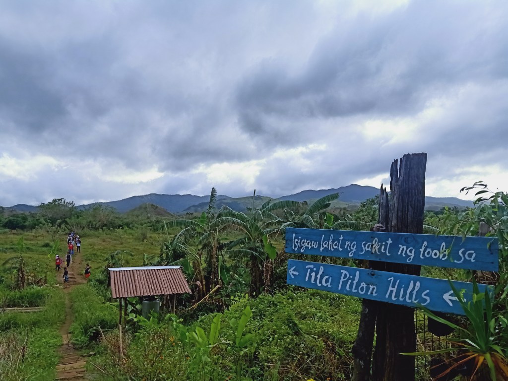
The trail continues at the other side of the road. Here, some mild ascents ensue. Fallen trees were present since we hiked a week after the onslaught of Typhoon Ulysses, in which the eye of the storm directly passed through this town. Some trails were also obscured due to this, so the locals made alternative paths. Since I had no hikes for nine months, I was really taking the time to enjoy this almost newly-found yet old feeling again of walking side-by-side with nature. Of course, my pacing was a bit faster than the rest so I had to wait for them and had quick stopovers.
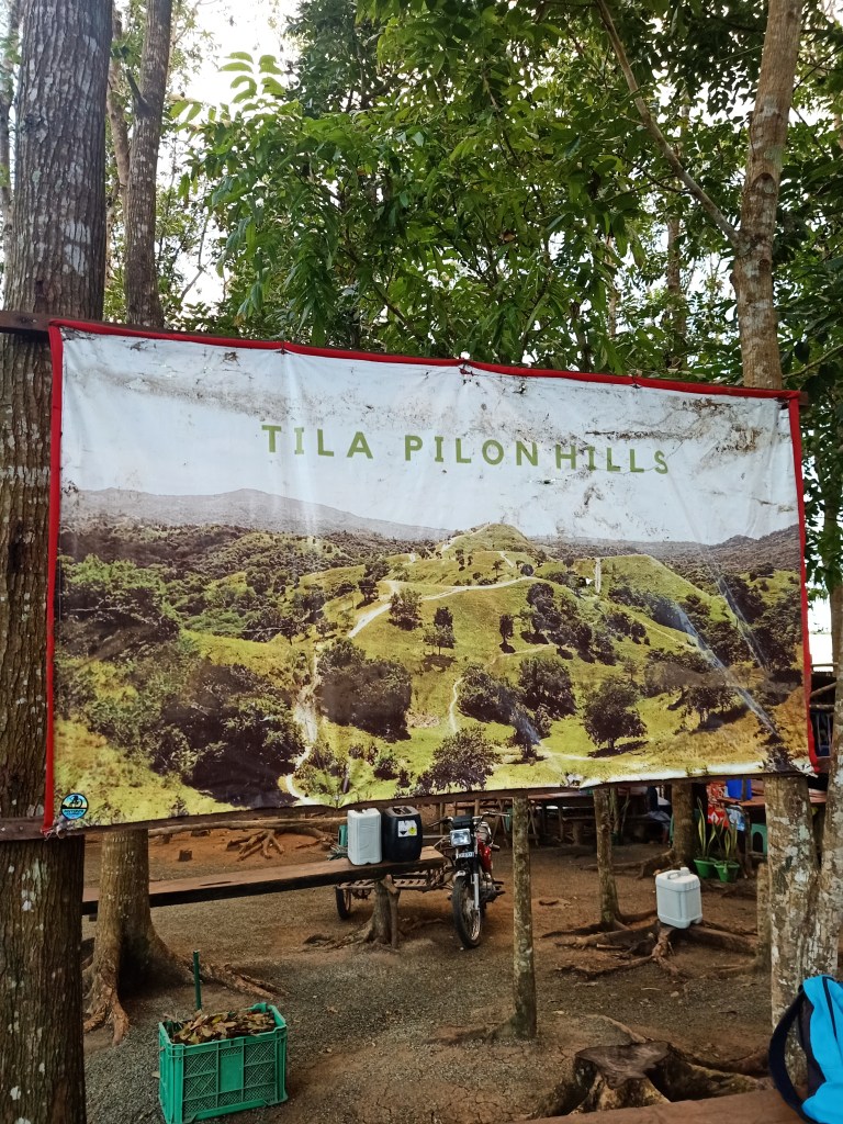
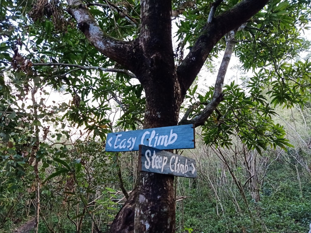
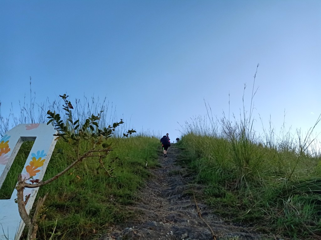
Thirty minutes after we started the hike, we reached a part where the trail forked: one trail leads to a shorter but steep trail, the other leads to an easier but longer one. Both trails can be used for ascent-descent, sort of like a rosary trail. Thankfully, my companions opted for the steeper but short trail since I was really itching for a ~real~ ascent (ahon). In less than a minute, we reached the ridge base of this steep assault, where a giant signboard of “TILA PILON HILLS” was erected (or just simply put?) along its slopes.
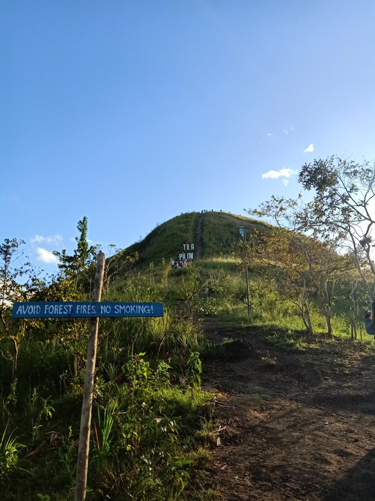
This sixty degree steep assault stretches for almost twenty meters going towards the summit. A rope was installed along it to assist hikers. Since my whole body was just itching for that sweet, sweet climb, I informed my guide that I will be going ahead, leaving my companions behind. With his approval, I went past beyond a group who was taking pictures with the sign and started the ascent. Without using the rope, I made my way up and made a few second stops since I was panting from the assault. Upon reaching the summit filled with quite a number of tourists, I savored the view while still panting from the assault I just did.
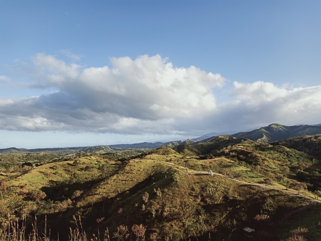
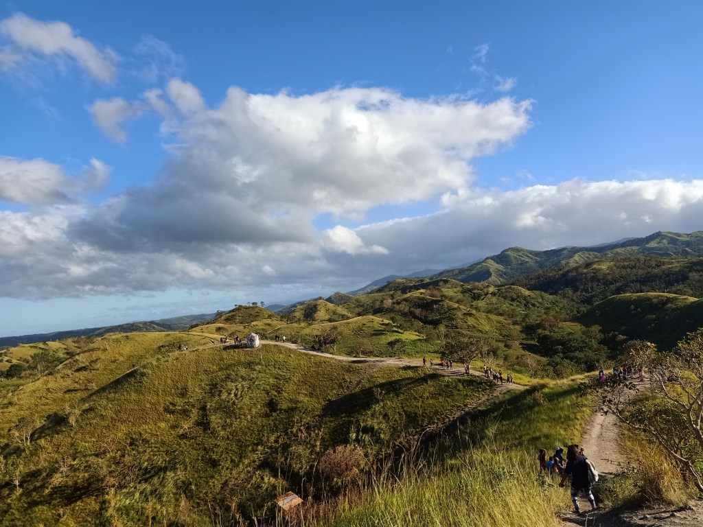
The view at the summit provides a three hundred and sixty degree view of the surrounding, the most prominent would be the eastern and western views. To my southwest, Mt. Mabio was still there, dominating the whole view. To its right is a prominent two-pointed mountain which was Mt. Susong Dalaga. Beyond those mountains, Mt. Arayat and the Zambales Mountain range, in which I can only assume as Mt. Pinatubo, can be seen in the horizon.
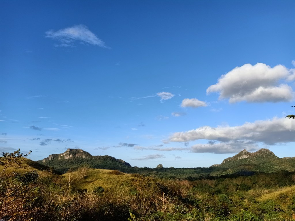
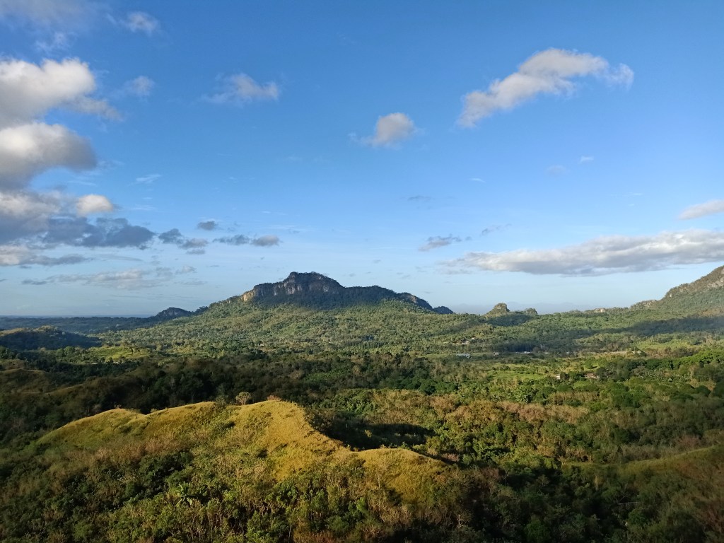
To our north is the direction of Mt. Manalmon (cannot be seen from Tila Pilon) and the destination we went to after hiking Tila Pilon, Talon Pari Falls. To our northeast, eastern, and southeastern view, the towering mountain ranges of DRT can be seen, as well as the continuation of the hills of Tila Pilon. Behind those hills are several prominent mountains way higher than the one we were standing on. The highest is at the southeast direction, a pointy peak can be seen towering the whole area. This mountain is the highest known peak of DRT, Mt. Silad, also known to hikers and locals as Bulacan Peak or Mt Tanawan.
Since there were still quite a lot of people, I decided to watch my companions negotiate the steep assault. One by one, they successfully climbed towards the summit, with me taking pictures as they use the rope while ascending. Luckily, the large crowd went ahead to the grassy knolls so we had the summit to ourselves. There, we took pictures and savored the view.
We descended on the easy trail at the other side of the summit. Here, we took a few turns to take pictures. Afterwards, we decided to go straight down the easy trail and not check the other portions of the grassy knoll anymore. This easy trail circles the lower slopes of the summit and leads straight to the fork. Once we reached the fork, it was only a walk in the park to reach the jump-off point. We finished the hike at 8:40 in the morning, two hours after starting the hike. Although merely a hill, I still consider this an achievement and a summit conquered!
After settling and resting, we rode our way towards Talon Pari Falls, located five kilometers away from Tila Pilon. Before going there, we made a stopover to pay some fees and hired guides going to Talon Pari. The two guides, riding a motorcycle, led us going to the place. Upon reaching the dirt path, we parked our van and went on a ten-minute hike going to the falls. This ten-minute hike requires hikers to cross a river and then ascend, then descend again towards the falls. Upon reaching the falls, we settled at some cottages and savored the view.
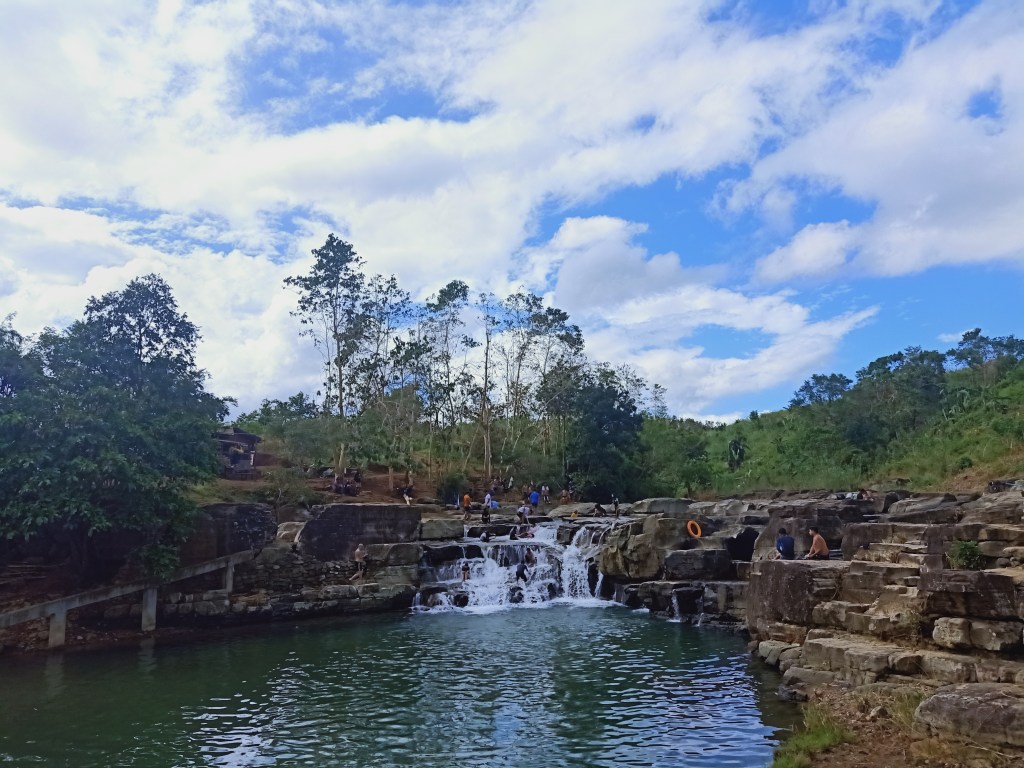
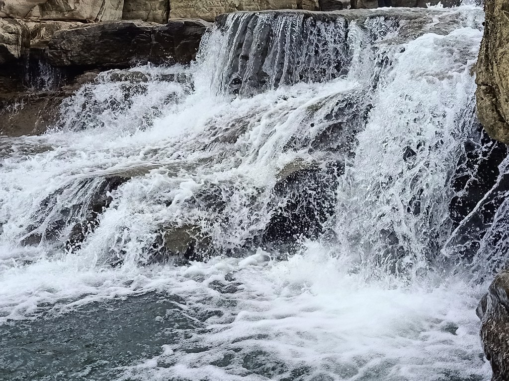
Talon Pari isn’t really a grand, high waterfall typically seen in other mountains. This one is a mere cascade where tourists can freely sit along the rocky slopes of the falls. The river where the water falls is at least 5 to 6ft deep. We took the chance to sit on the rocky slopes of the falls and give our backs a massage from the strong flow of the water. We decided to leave at twelve noon since more and more people were arriving.
Our last trip of the day was at Digo’s Hills still located in DRT. We passed by this en route to Tila Pilon. We went here in search of a coffee variant called “talbak.”
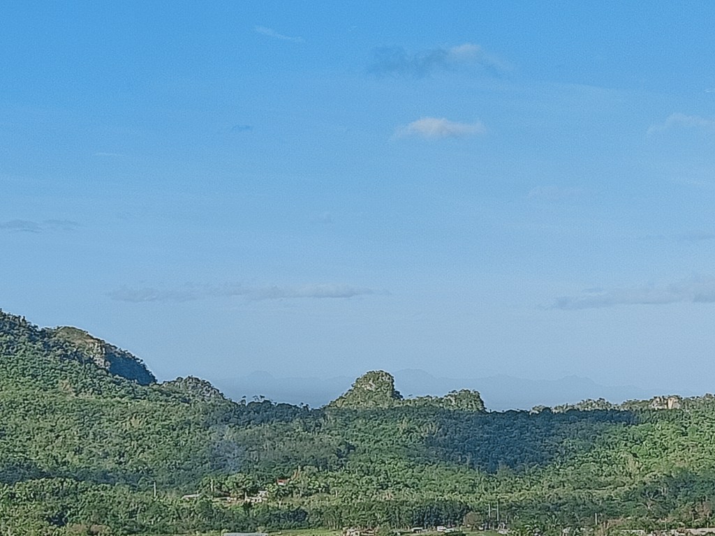
Aboard our van, we reached Digo’s Hills coming from a short ascent from the side of the road. Digo’s Hills was unlike Tila Pilon. Here, the summit itself is the parking spot, and there was no hiking involved. The place is merely a plateau where the caretaker of the place resides and where he installed some picnic tables, a sari-sari store slash cafe, and some makeshift picture spots made from wood. It was a simple landmark, but nonetheless a great vantage point for mountain viewing. There, we bought talbak coffee grounds for 250PHP. While they were buying, I took the chance to savor the view, with Mt. Mabio nearly in front of us. Mt. Silad’s mighty presence can also be seen on the opposite direction. We also spotted Tila Pilon from here! Opposite of it, Mt. Arayat can be seen clearly, and to its far left, I spotted Mt. Natib and Mt. Mariveles in Bataan, although my camera was unable to capture it since it was already too far.


After buying, we went straight home, passing by the towns of Angat and Baliuag. From there, it was only an hour before reaching our town of Malolos. It was three in the afternoon when we reached home.

Upon cleansing myself and resting, I pondered where and when my next hike will be.
Itinerary
03:30AM Departed Malolos City
06:00AM Arrived at Tila Pilon, prepare for hike
06:30AM Start hike
07:00AM Start assault
07:10AM Summit, enjoy the view
08:00AM Start descent
08:30AM Jump-off, tidy up
09:00AM Departure, go to Talon Pari Falls
09:30AM Arrival at Talon Pari Falls, swim, and relax
12:00PM Departure
03:00PM Home
