The Mt. Mariveles range is a gigantic, dormant volcano south of Bataan. The entire mountain complex is huge, taking almost the entire land area of the southern part of the province. With such a large area covered, it is no surprising that Filipino mountaineers and outdoor enthusiasts have taken a liking for the mountain. A prominent destination within the mountain complex is Tarak Ridge, which I have hiked in 2018. Tarak Ridge is said to be a perfect entry for those wanting to transition to major hikes. Another destination in Mt. Mariveles is Pantingan Peak, said to be the highest point in the entire volcanic range, located on the western portions in the town of Bagac. I was fortunate to have climbed this peak in 2023 on a grueling, 19-hour Pantingan Peak to Tarak Ridge traverse!
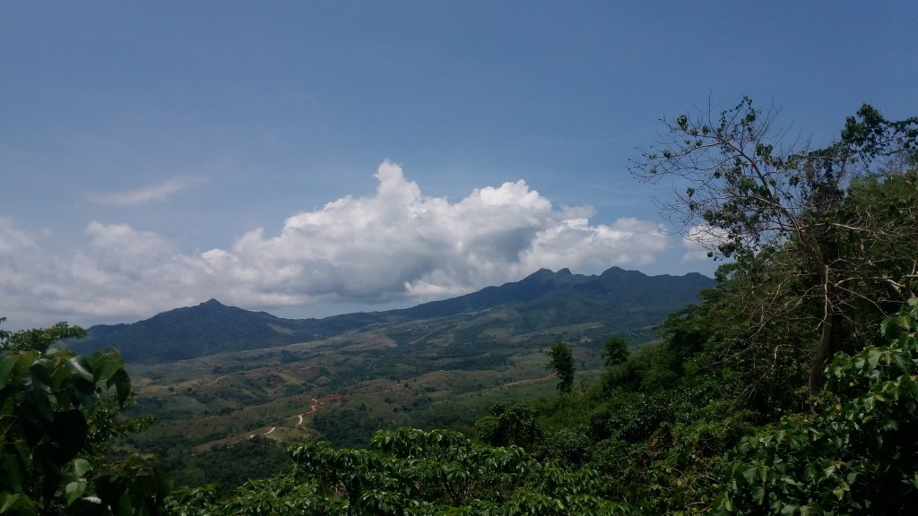
Opposite of the Pantingan Peak—on the eastern side of the mountain range—there lies a smaller mountain long thought to be a parasitic cone to Mt. Mariveles. This conjoined mountain is called Mt. Limay, popularly known to hikers as Mt. Cuyapo. Given its direct connection to the larger Mt. Mariveles, local hikers became interested in not just climbing it, but in creating a traverse trail to Tarak Ridge, akin to that of the ‘PanTarak’ or Pantingan Peak to Tarak Ridge traverse on the opposite side of the mountain range.
This became fully realized around 2016 when hikers finally explored what is to be known as the Mt. Cuyapo to Tarak Ridge traverse, or the CuyTarak Trail. At that time, they have christened this traverse route as the ‘Saitama Trail’, probably owing to how formidable the trail is much like the character Saitama in the Japanese anime series One Punch Man. Indeed, local mountaineers have had a consensus that its difficulty level using the Pinoy Mountaineer scale is 8/9, similar with that of the opposite Pantingan-Tarak traverse. With this, the characteristics of the trail are as follows using the Pinoy Mountaineer specs format:
MT. CUYAPO TRAVERSE TO TARAK RIDGE (CUYTARAK)
Jump-off point: Duale, Limay, Bataan
Exit Point: Alas-asin, Mariveles, Bataan
Specs: Major climb, difficulty 8/9, trail class 2-4
I was able to try the CuyTarak Traverse around February of 2026, almost ten years after the first exploration of the trail. For this hike, I joined an organized event together with some strong day-hikers and trail runners. Our adventure began at a McDonald’s in Limay, Bataan where we had our breakfast and bought our packed lunch. Then, we went to Barangay Duale in the same town and started the hike at four in the morning.
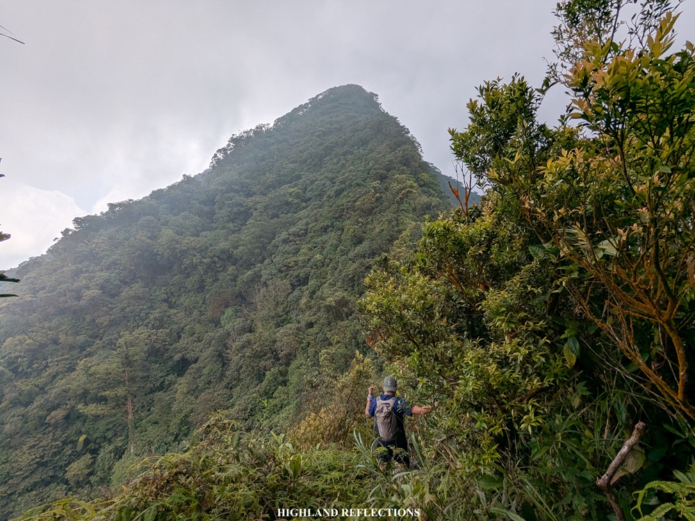
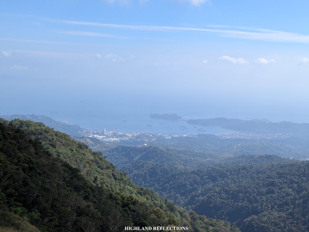
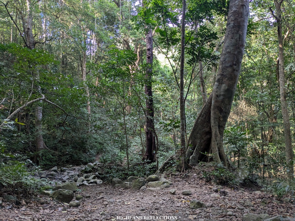
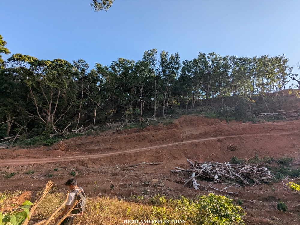
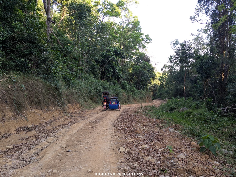
The initial parts of the hike passes through some wide rough paths that are used by locals living in the area. A lot of forks are encountered here so it is best to have a guide to not get lost. Past these local pathways, we entered the forested areas of Mt. Cuyapo. The trail and the forest here was highly reminiscent of Mt. Arayat, where the steep upward trail is dotted with large rocks and tree roots. Behind us, we had an awesome view of Limay and Mariveles emanating their bright orange lights in the dark.
Unfortunately, because of nonstop work and a lack of rest prior to this hike, I suffered from leg cramps and acid reflux early on. I pushed on with the help of the assigned sweeper, knowing that our van driver already took off to go to the town of Mariveles. The last time I experienced this much leg and stomach pain was back in our Mt. Palali hike in 2018. But I knew that I was stronger and filled with more experience for this hike. I carried on in spite of the pain.
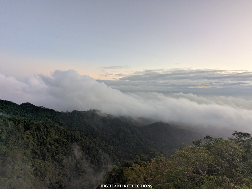
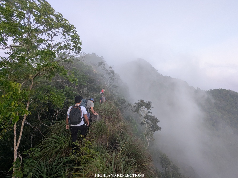
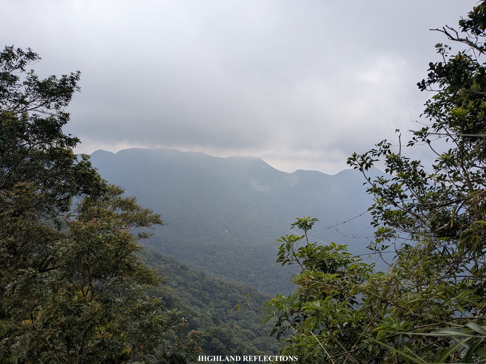
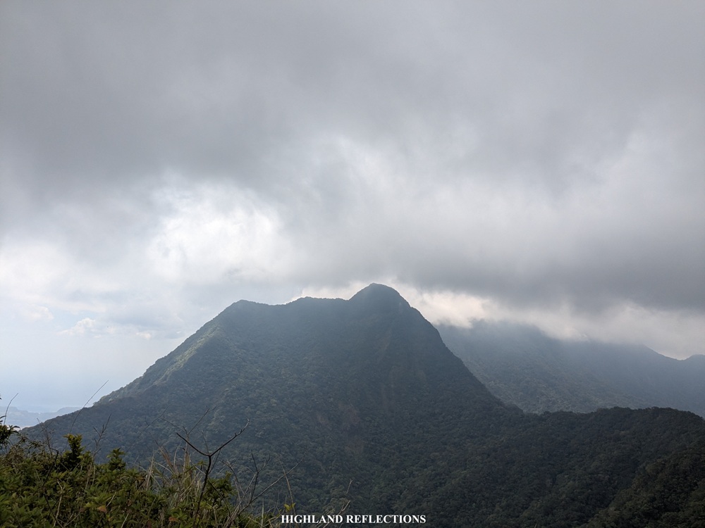
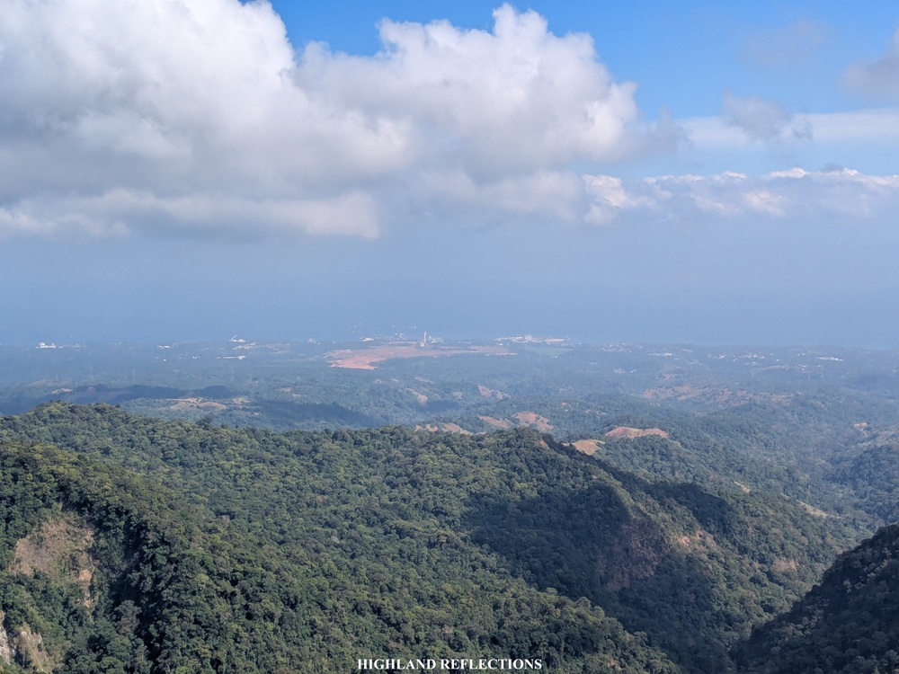
At six in the morning, the surroundings became more visible with the sunlight. This was a relief when we reached Mt. Cuyapo’s famous ridgeline. Although this ridge is only short in distance, crossing it is quite perilous given its very narrow width with both sides leading onto a steep drop. The knife edge-like ridge also had some boulders blocking the way and these were mostly blocked by very thick grasses. Caution must really be exercised when passing this ridge. Still, despite the difficult predicament, we were enjoying the view of clouds dressing up the lush layers of ridges and mountain slopes of the eastern side of Mt. Mariveles.
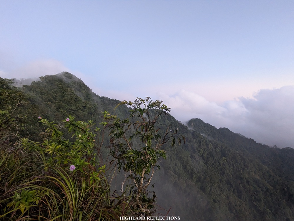
Past the ridge was the continuation of ascent to the summit of Mt. Cuyapo inside the thick forest. As we were about to reach Mt. Cuyapo’s summit, our guide detoured us to a shortcut that led us to the traverse trail. Looking at my GPS map, we were actually just a few meters below Cuyapo’s summit! Still, I had no choice but to accept the guide’s decision since I was ascending really, really slow due to my acid reflux. It was 6:30 in the morning.
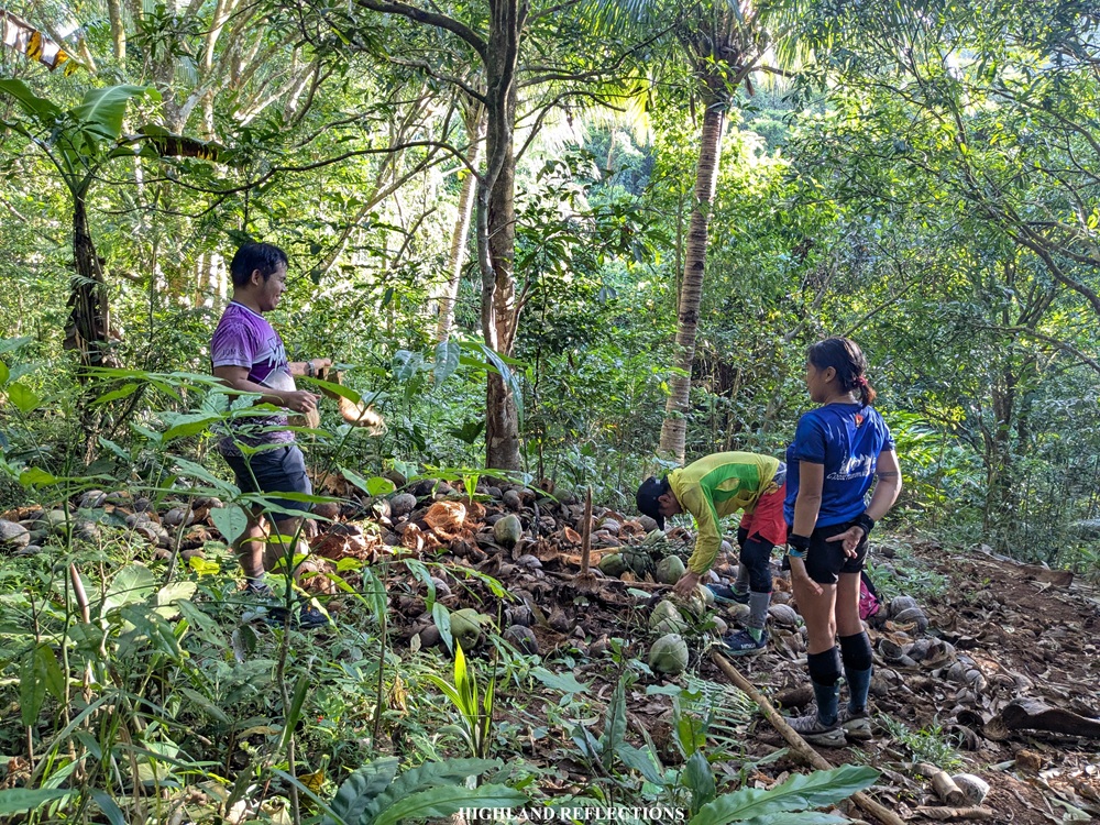
With no time to spare, we continued with the hike onwards to Tarak Ridge. From Mt. Cuyapo, we descended a very lush forest teeming with wildlife. Good thing was that as we were taking this trail, my body had adapted to the pain brought by the cramps in my legs and the acid in my stomach. At around 7:10 am, we reached a spot called ‘Bukohan’ where we took some rest, drank some coconut juice, and munched on some meat from the coconuts harvested by our guide. Then, we continued marching.
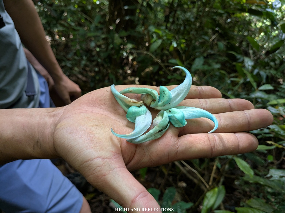
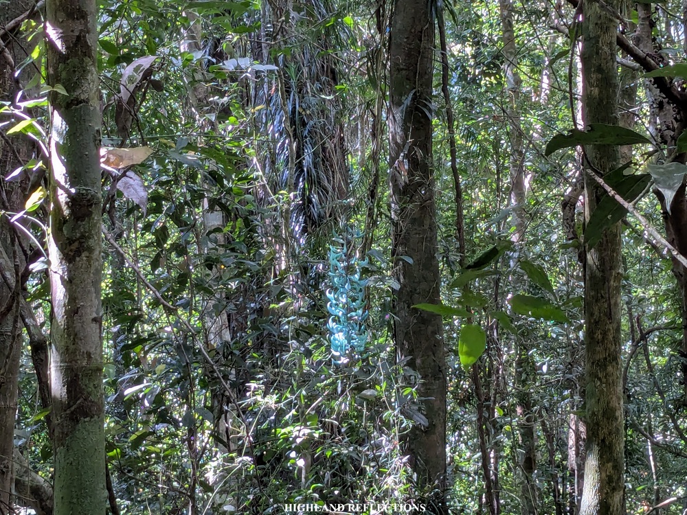
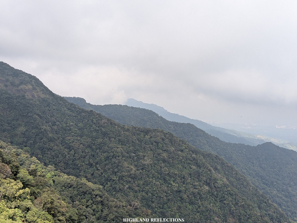
Past the Bukohan is a long, rolling trail inside the forest connecting Mt. Cuyapo to Mt. Mariveles. The trail inside the forest had a mix of gradual ups and downs and some flat trails in between. Along the way, the guide pointed me to a jade vine (Strongylodon macrobotrys) hanging from a tree in the distance. It was my first time seeing this elusive plant in the wild! I consider this my most significant accomplishment for this hike.
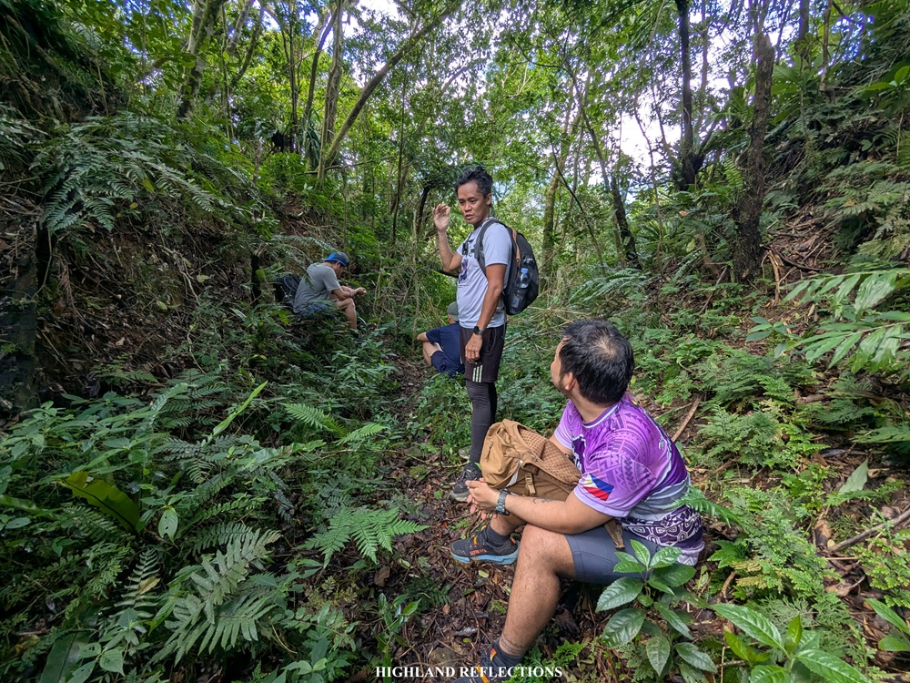
At 9:30, after a continuous trek, we arrived at Oliver’s River, which was called Kato’s River by the local guide. This was the last water source before ascending to the peaks of Mt. Mariveles onwards to Tarak Ridge. The next water source, which was Papaya River, was around six hours away according to our guide. There, we took the chance to rest, eat brunch, and refill our water containers. Since I was with a group of strong day hikers, we continued the hike just shortly after.
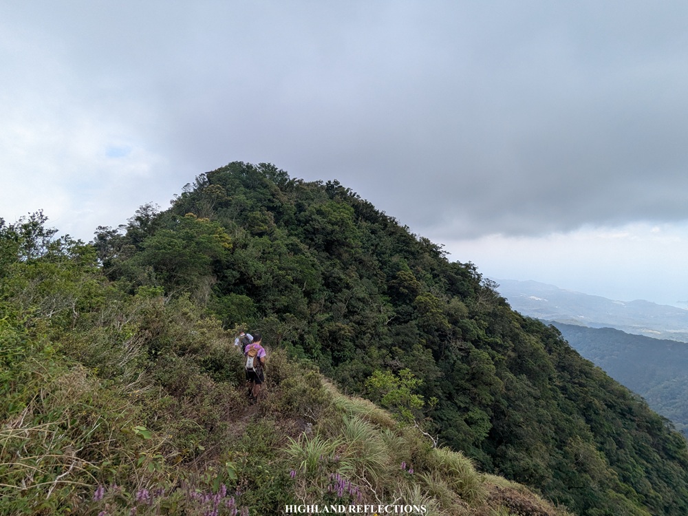
Past the river is a continuous ascent up some boulders. Along the way, we encountered some landslides blocking the trail before finally entering a single-file path inside the forest. Here, we found ourselves ascending nonstop. In no time, I reached a saddle flanked in between two high peaks to the left and right, with the vast forested caldera of Mt. Mariveles visible up front. We took the leftwards trail, climbing through a steep, almost knife-edge ridge filled with mossy trees. The ascent here was nonstop! Although the trail was magnificent with its orange and green-covered moss, and the view to the right would sometimes open for a glimpse of the wide, forested caldera of the mountain complex, the ascents were long, technical, steep, and unforgiving. The hike was now becoming a test of grit and endurance.
At 11:30, we finally reached Oragon Peak, which was a small clearing on top of the ridge that we were climbing. At Oragon Peak, we could see the next set of peak that we needed to climb—Vintana Peak, and it looked a tad bit higher and steeper! We also had a view of the vast caldera of Mt. Mariveles and on the opposite side, the lofty Pantingan Peak looms in the distance!
I realized then that although the CuyTarak hike is quite technical and long, it is still a bit easier than its PanTarak counterpart. Coming from a near-1300 meter climb up to Pantingan Peak, the PanTarak Traverse requires a 400-meter highly steep and dangerous descent to the forested caldera of Mt. Mariveles. From the caldera, one has to negotiate multiple rounds of steep ridge trekking before reaching El Saco Peak, and Tarak Peak. For CuyTarak, once you reach Oragon Peak, there is no need to descend to the forested caldera, as hikers would only need to trek on top of Mt. Mariveles’ ridges before reaching Vintana, El Saco, and Tarak Peak. Don’t get fooled by this comparison though, the hike up to Mt. Cuyapo and the connecting trail to Oragon Peak still makes the CuyTarak Traverse a very strenuous hike!
Past Oragon Peak, we negotiated a downward-then-upward trail onwards to the next peak. Much like the trail to Oragon Peak, the trail here was muddy and quite technical that we needed to hold on to some thorny plants and sharp grasses. It’s the kind of the trail that you’d curse for its difficulty but still be in awe with its majestic, moss-filled beauty. At 12, we reached Vintana Peak which was inside the mossy forest. There, we had our lunch.
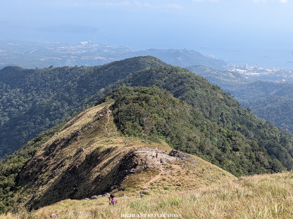
The five of us in the sweeper group continued with the last push to Tarak Ridge. From the spot where we had lunch, we walked on top of the long ridge of Vintana Peak, still with steep drops on both sides but teeming with mossy forest, before finally arriving at El Saco Peak. We wasted no time and made a left turn towards a very steep descending trail that leads to the view deck just below the peak. At the view deck, we had a beautiful view of the imposing Bataan Peak to our right. Behind it is Pantingan Peak. To our front, we could see Tarak Peak and Tarak Ridge way, way below us! Some of our companions were shouting their hellos from Tarak Peak! We snapped some pictures here.
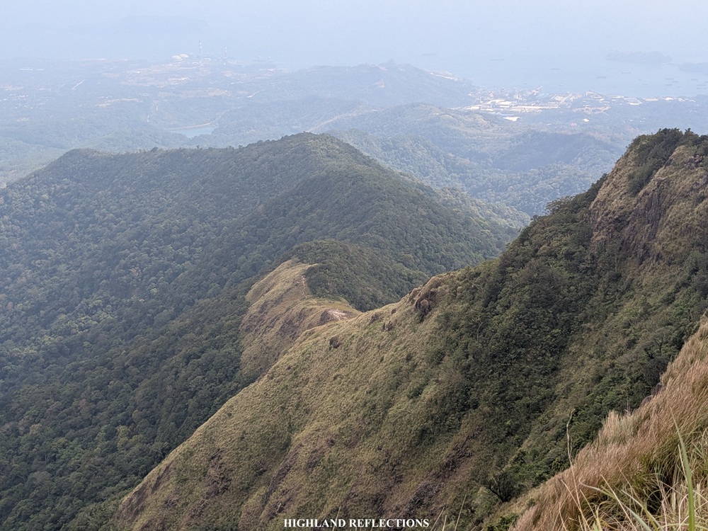
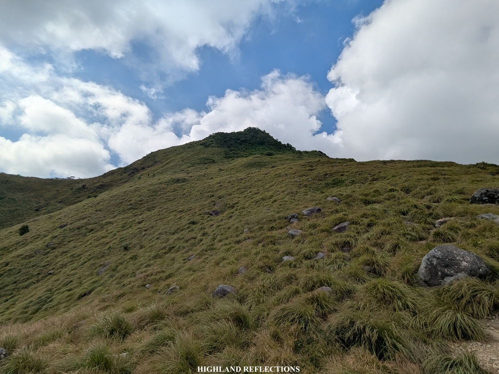
From El Saco Peak we continued with the descent to Tarak Peak. To our left, I was tracing the mountain ridges that we needed to cross on the way here. I spotted Mt. Cuyapo hiding behind one of the ridges of Mt. Mariveles. With the continuous descent, we finally arrived at Tarak Peak around 2:10 in the afternoon. There, we rested for a bit and took some pictures by the summit marker. From Tarak Peak, we continued with the descent to the grassy and windy Tarak Ridge, which we reached at 2:30 in the afternoon.
We wasted no time and continued with the descent. From Tarak Ridge, I descended nonstop to Payapa River for about an hour, stepping on rocks and large tree roots to make my way down the dusty path. After my two-minute break in Papaya River, I continued with the last push. The trail to the end point was still filled with gradual ascents. Then finally, after the nonstop walk, we exited the forest towards the grassland. There, we found the organizer and the sweeper waiting for us. We descended together, reaching Nanay Cording’s house at five in the afternoon. I finished the entire traverse in 13 hours despite the cramps and acid reflux. Not bad!
And with that, I have finally completed three of the five primary trails inside Mt. Mariveles. The only two left are the Bataan Peak trail and the Paniquian river trail of Tarak Ridge. However, since I was not able to reach the highest point of Mt. Cuyapo, I’m planning to go back soon. Hopefully, I get to be in a much better condition next time!
Itinerary
02:30AM McDo in Limay, breakfast
04:00AM Start hike
06:00AM Mt. Cuyapo Ridge
06:30AM Mt. Cuyapo Summit
07:10AM Bukohan
09:30AM Oliver’s/Kato’s River, rest, early lunch
09:50AM Resume hike
11:30AM Oragon Peak
12:00PM Lunch along the trail
12:30PM Resume hike
01:00PM Vintana Peak
01:30PM El Saco Peak
02:10PM Tarak Peak
02:30PM Tarak Ridge
03:30PM Papaya River
05:00PM Nanay Cording’s house, end of hike
