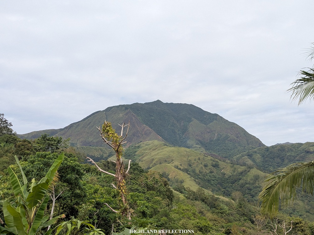
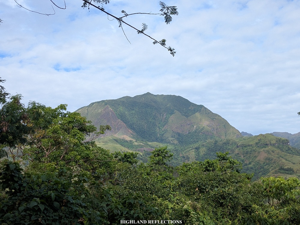
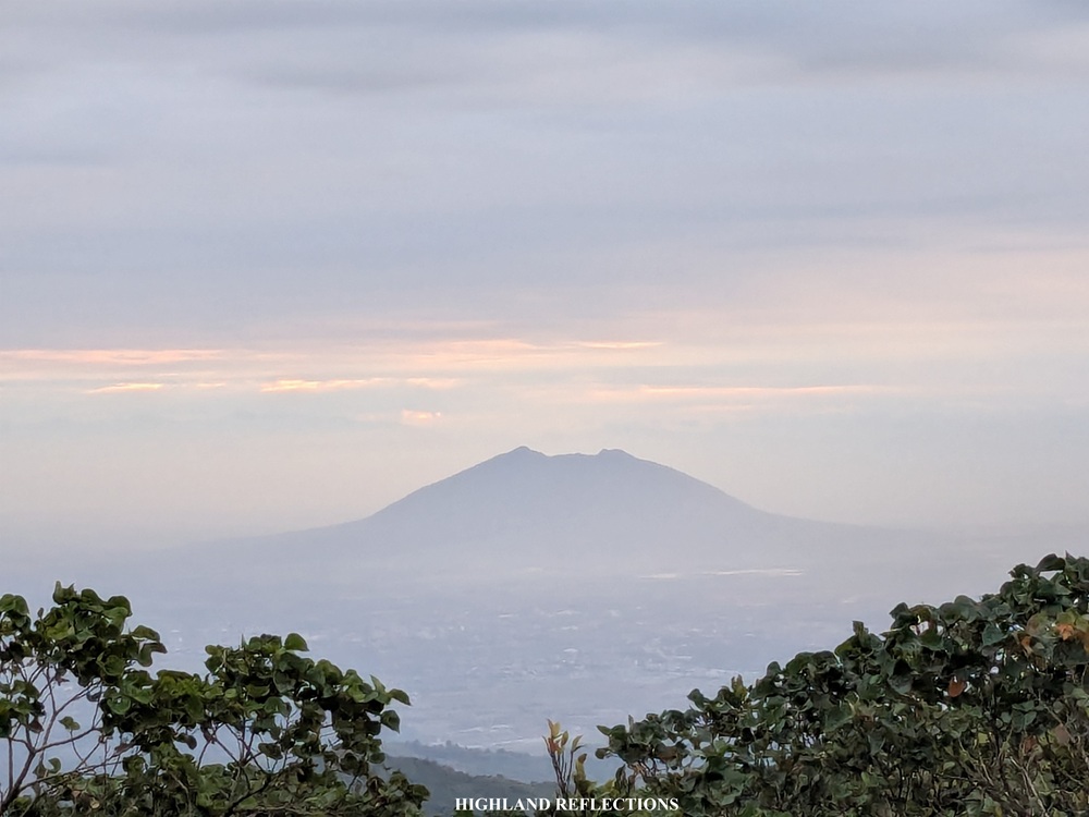
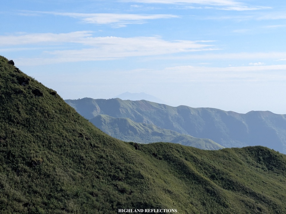
When traversing the North Luzon Expressway northwards on a clear day, two mountain systems are visible. To the right is the solitary Mt. Arayat, standing tall around the plains of Pampanga. To the left is the Cabusilan Mountain Range containing several mountains such as Mt. Pinatubo, Mt. Tayawan, Mt. Cuadrado, among others. With the many peaks inside the Cabusilan Mountain Range, one stands tall among the others. This prominent mountain, visible from Bulacan and Pampanga with its dome-like shape, is Mt. Negron, officially the highest peak of the province of Pampanga.
Mt. Negron, or ‘Sky Dome’ as I have been fondly calling it, is one of Mt. Pinatubo’s satellite vents. Prior to the cataclysmic 1991 eruption, Mt. Negron was only second to Pinatubo in terms of elevation. Today, it has dethroned Pinatubo as the highest peak in Pampanga, as Pinatubo lost around 300 meters of elevation after the eruption. Given its proximity to the venerable Mt. Pinatubo, it is not surprising that the two mountains are intertwined in the collective consciousness of the Aetas—the caretakers of the Cabusilan Mountain Range. Mt. Negron is known to them as ‘Apung Abu,’ possibly owing to their memories of ash fall when Pinatubo was still violently active. Today, it is called as Negron as it casts a dark silhouette at night over the Aeta’s ancestral domains.
In 2024, the trail to Mt. Negron was officially made public due to the combined efforts of local mountaineers and Aetas. The trail to the summit of Mt. Negron, known as the Pasbul Talunasan Trail, is a 35-kilometer out-and-back trail starting in Barangay Camias in Porac, Pampanga. The trail crosses several rivers, forested community paths, wild ‘sagingan’ trails on steep slippery lahar slopes (which we cursed both on the way up and down), some roped segments at the side of some boulders, and a thick, almost ‘uncleaned’ mossy forest with a lot of undergrowth. The trail is technical and can even be labeled as ultra difficult. Using the Pinoy Mountaineer specs, here are the (subjective) characteristics of the hike:
MT. NEGRON (via PASBUL TALUNASAN TRAIL)
Jump-off point: Pasbul Aeta Community, Camias, Porac, Pampanga
Days required / Hours to summit: 1-2 days / 10-14 hours
Specs: Major climb, difficulty 8/9, trail class 2-4
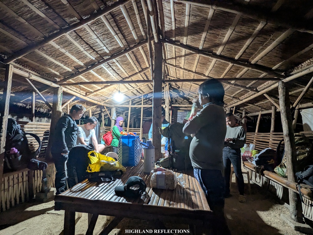
For this hike, I joined an event by ILocanang Gala with Rochelle as our organizer, together with some familiar faces from her team: Khael, Rainer, Lei, and Ryan. We were also joined by some strong, experienced hikers who are regular joiners of ILocanang Gala. We took the brunt of Mt. Negron’s very wild trails on an overnight hike. According to our local contact, Travis, we were the third group to have done an overnight hike to Mt. Negron since its opening in 2024, and, upon finishing the hike, the first group to successfully reach the summit in a two days and one night schedule!
Here is my narration of climbing the Sky Dome!
Day 1: Venturing Into the Domain of the Aeta People
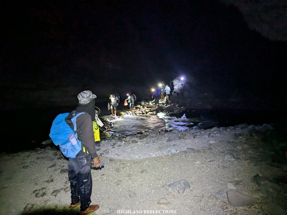
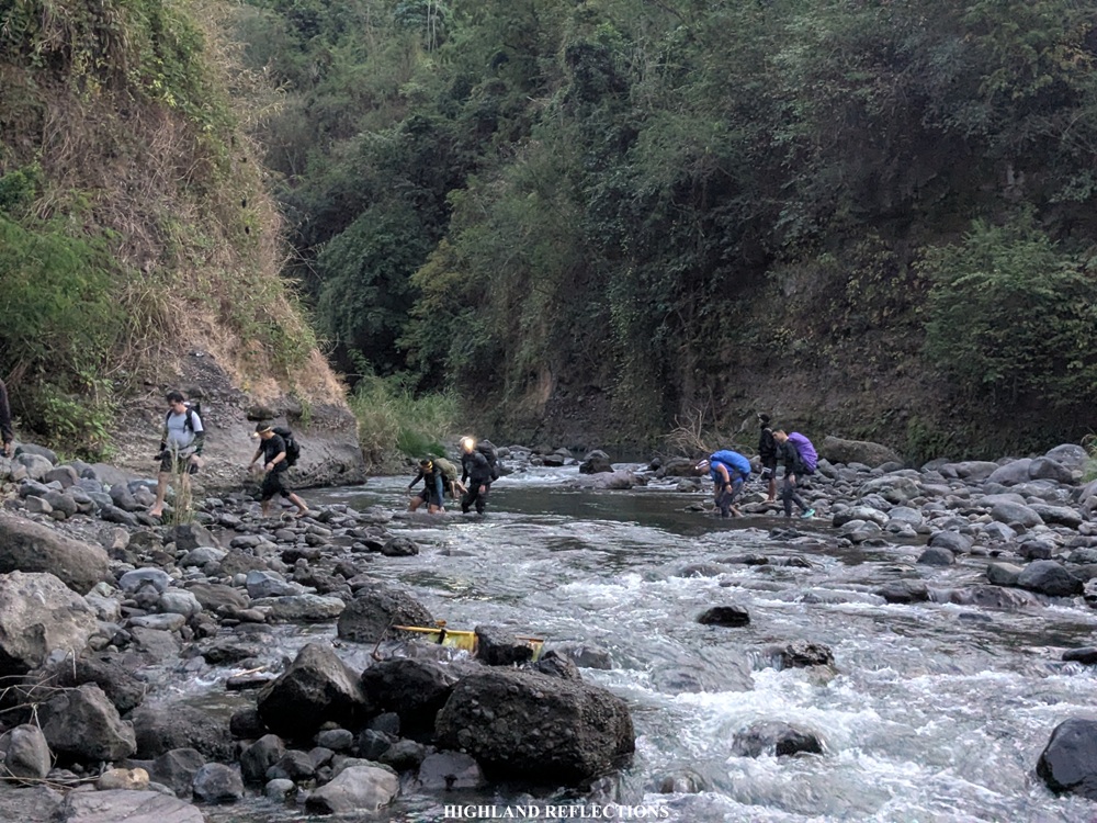
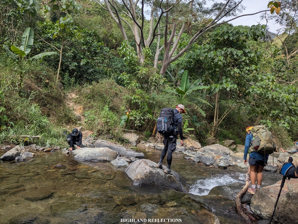
We started the long hike at around 4:30 in the morning. From the community, we descended towards the river, which we had to follow and cross for around seven or eight times in the wee hours of the morning. Since we hiked at the end of January, no rains increased the river’s waters, and the deepest parts of the river crossing only submerged our legs above knee-level.
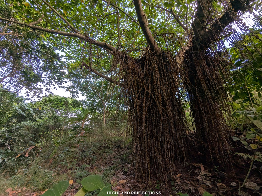
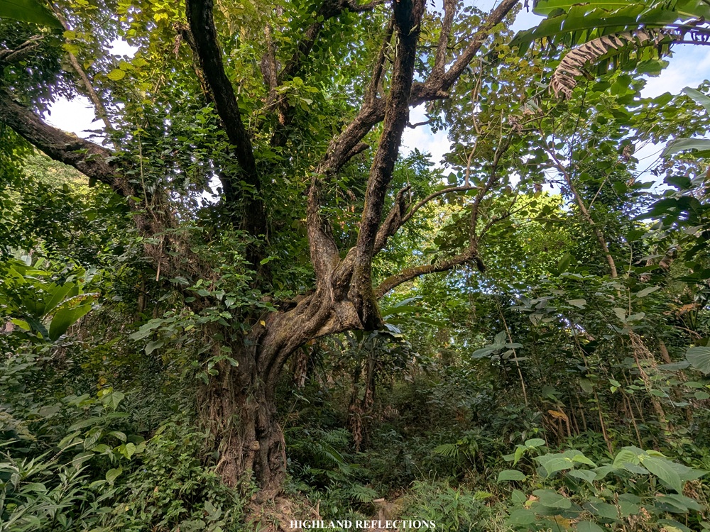
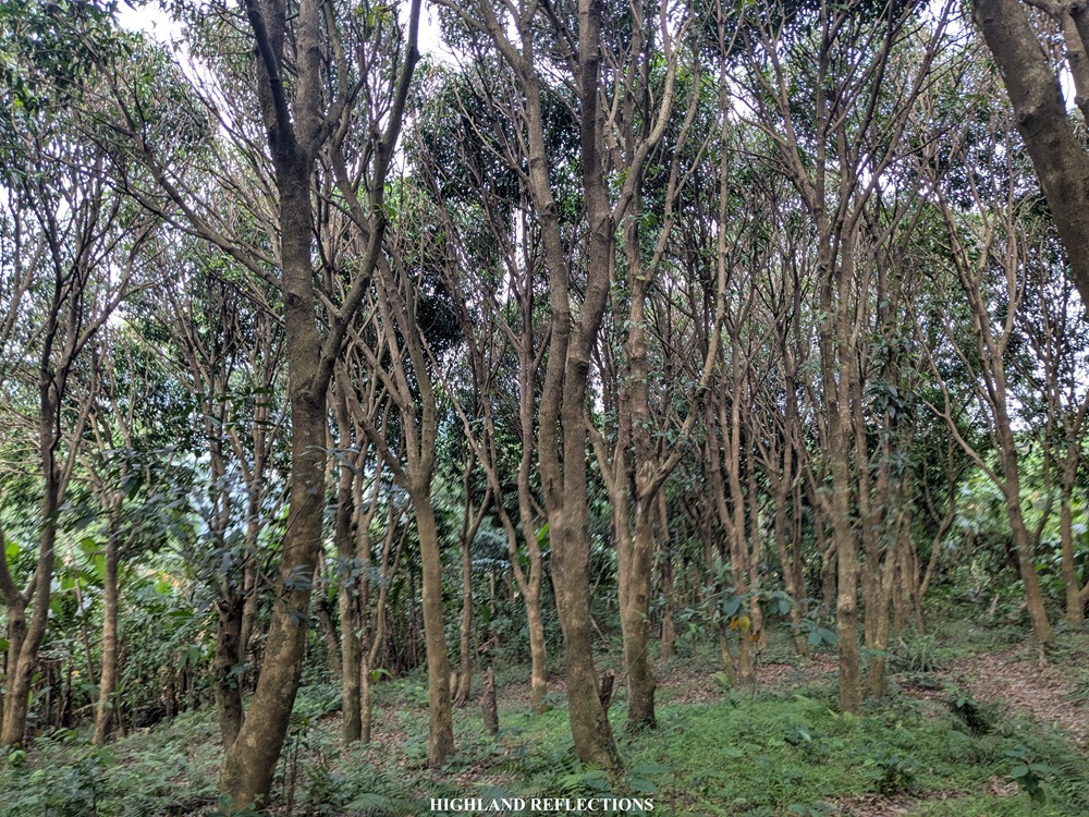
It was 6:30 in the morning when the series of river crossings ended. The trail past the river passes through a lowland forest inside a valley surrounded by rocky mountains on both sides. The trail here reminded me of Sapang Uwak’s forests where some flowering plants, burdocks, and figs can be seen along the way. There was an abundance of water sources here too! Several Aeta communities and houses are also present. With the long walk inside the forest came some monotonous moments of boredom. To keep my mind occupied, I was removing the many, many common burdocks that were sticking to my clothes!
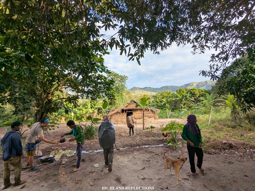
We reached the first Aeta house as the clock ticked before 8 in the morning. Here, we were offered brewed coffee by the local Aetas; the beans, according to them, were locally grown. We also took the chance to rest and eat some snacks as we’ve already covered 7.7 kilometers! Past the first house, we continued with the very long walk inside the lowland forest. About a kilometer from the first house, we encountered another house in the middle of the forest that offered us grilled white corn. An old Aeta lady was weaving some dried vines during our short stay there.
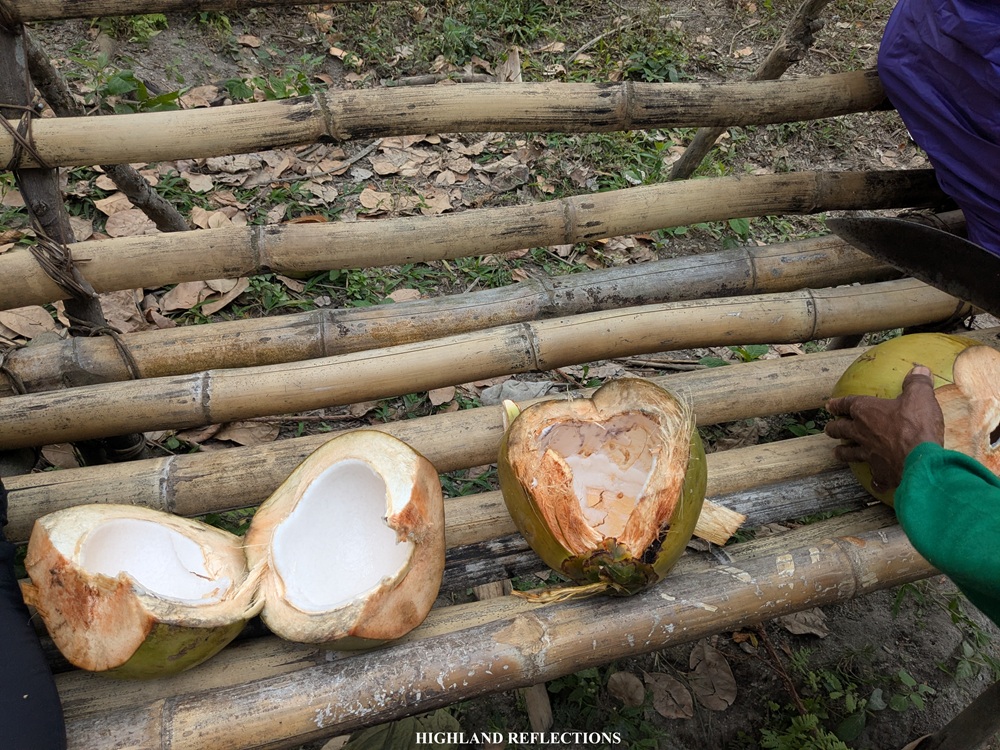
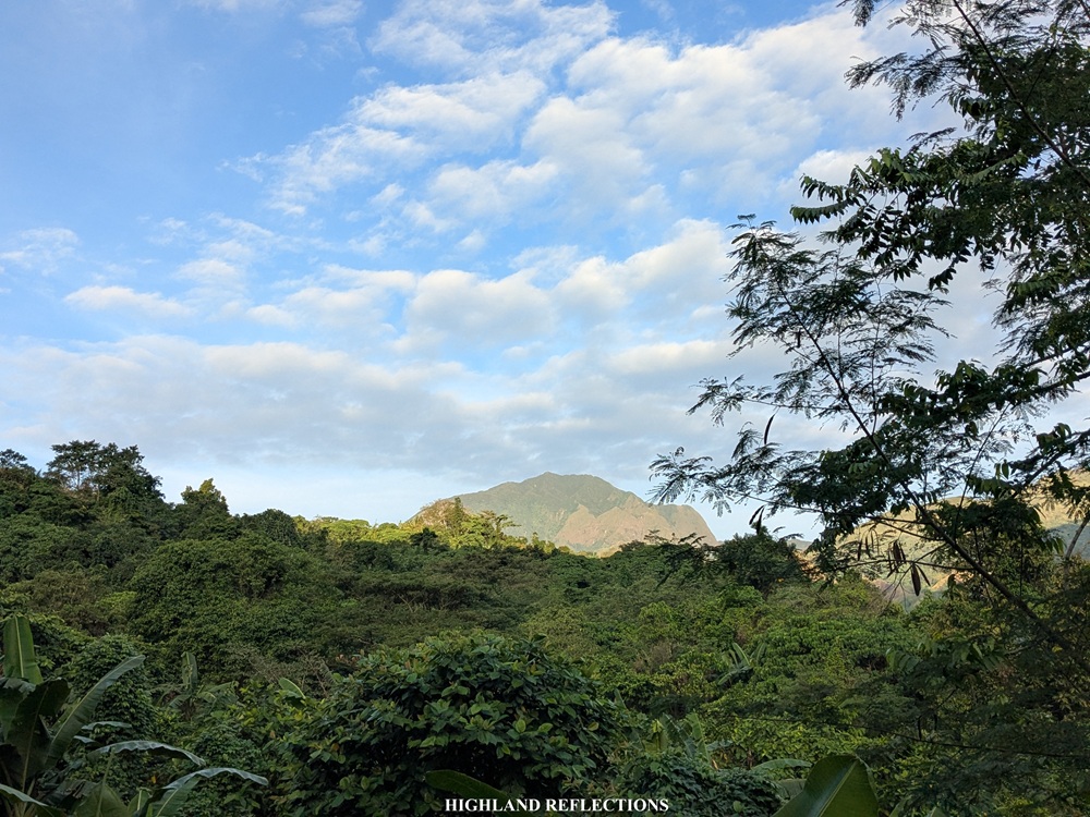
Another round of long walk took us to another house with a sweeping view of Mt. Negron. Here, we drank some fresh coconut juice and ate coconut meat harvested from the trees nearby. Of course, we paid for the coconuts. At this point, I realized that there is such an abundance of foodstuff within this forest that we were taking!
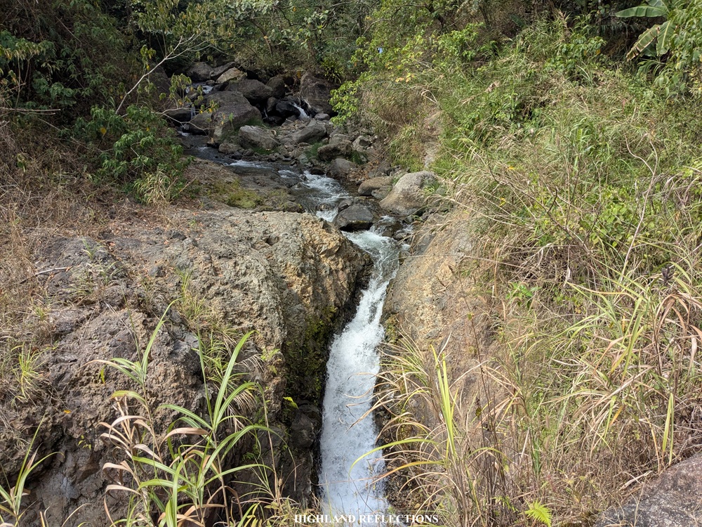
We needed the fuel from the coconut as the trail after the third house was where the trail started to be difficult. The trail continues inside a lowland forest until finally descending towards an exposed grassy slope. This descending trail continues inside a forest until finally reaching another river that we needed to cross. Given the somewhat long distance of the descent, we dreaded the thought of climbing this on the way back the next day! Past this river, we passed by the top of a waterfall and crossed another river before reaching Camp 1. It was 11:30 in the morning.
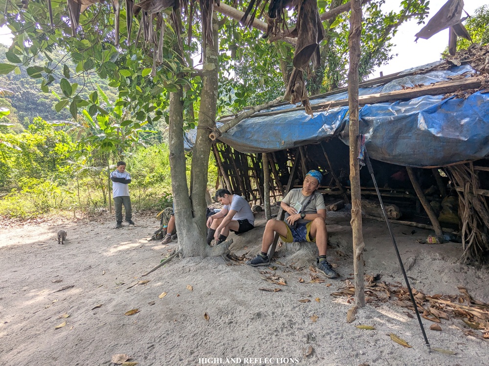
Camp 1, according to some sources online, is the house of the barangay captain within the area. It is located around 11 kilometers from the jump-off point. Since it was noontime, we took a long rest here and had lunch. It was at this point when I felt the tiredness accumulating in my body. All of us shared our thoughts of how makunat, masakit, and mahapdi the trail is! Yet, unbeknownst to us, we weren’t even in the worst part of the trail. We were about to find out past Camp 1!
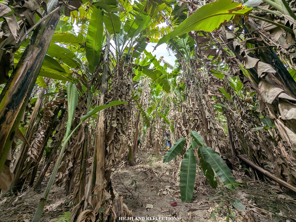
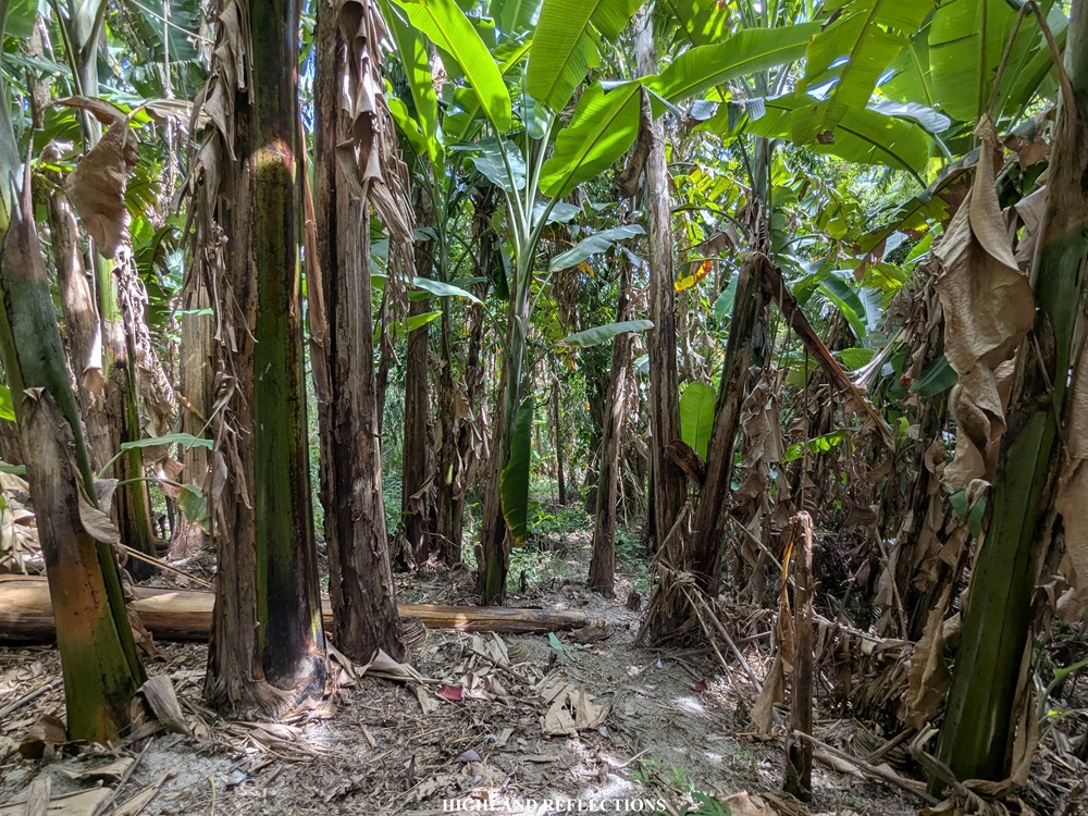
We resumed the last push at 12:30 pm. Past Camp 1, we entered the lowland forest once again before reaching the part of the hike that we were warned about by our local contact—the torturous sagingan area! This infamous area just directly below Mt. Negron is a lahar-filled slope dotted with numerous banana trees, and is the last push before reaching the campsite.
The sagingan area starts at a constantly ascending lahar slope that is slippery even when dry. Ascending this was quite punishing, so we had to slow down our pacing. The ascents then were broken off by a gradually inclined trail before leading to a very narrow knife edge with steep drops on both sides. Snapping a photo here was quite an impossible feat since we needed to concentrate to not fall, and, importantly, we needed to keep going to avoid the heat of the sun! The ridge ends at a dried river bed where the trail turns left.
Past the ridge, we crossed the last river prior to the campsite and rested at an area with sleeping nooks made from an assemblage of dried leaves. It was around 1:30 in the afternoon. We took a long, well-deserved rest after getting punished by the gnarly trail inside the sagingan area. While resting, however, we found out that one of our companions was missing! Our lead Aeta guide—Tatay Roy—and his team had to search for our missing companion, prompting us to stand-by at the resting area for about three hours. Fortunately, our companion was found by Tatay Roy resting in Camp 1 after being lost in the sagingan area.
Upon our companion’s arrival, we continued with the last push going to the campsite past four in the afternoon. After the resting area is the last portion of ascent on the sagingan slope before exiting towards the grassland. Just a little bit of pushing the tall grasses and covering some meters of distance took us to Camp 2, located 15 kilometers from the jump-off point, sitting at around 900 meters above sea level. It was five in the afternoon when we reached the campsite, just forty five minutes after starting the hike from where we rested.
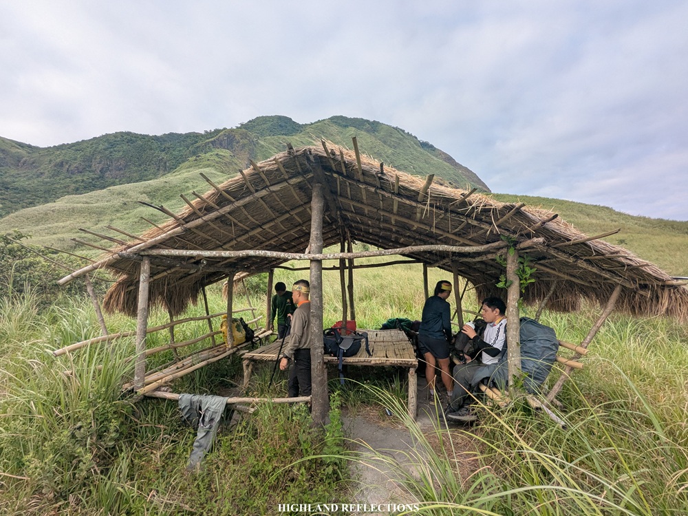
At the campsite, there is an open-air kubo where we cooked and ate our food. At the rear part of this kubo, Mt. Negron rises prominently. According to Tatay Roy, before the 1991 eruption, this campsite used to be an Aeta community where he lived and had fond childhood memories of. They even called this area as Sitio Landas ng Naligaw, literally meaning ‘path of the lost’. With the wide grassland plateau where the campsite is located, it is not hard to imagine setting up a community here.
We had such an eventful first day for our Mt. Negron hike. In between each of the landmarks I described in this blog is a variety of forest and grassland sections that is really, really difficult to specifically recall and describe given how long the trail is. Given this long distance that we needed to cover just for our first day, I was, for the lack of a better word, exasperated. Mt. Negron is truly a test of endurance.
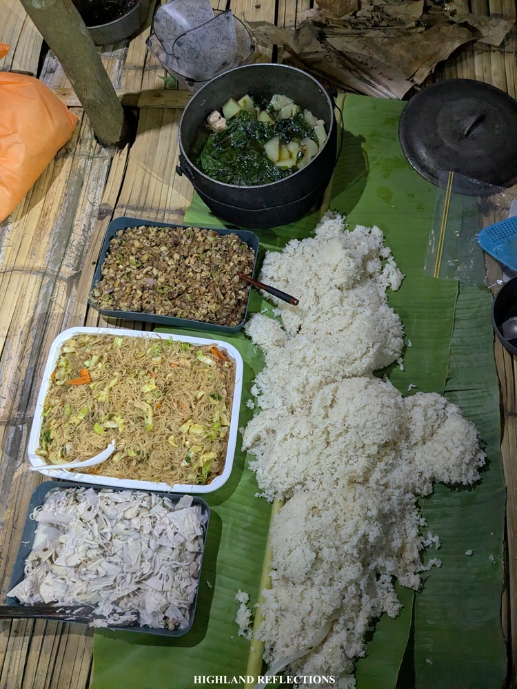
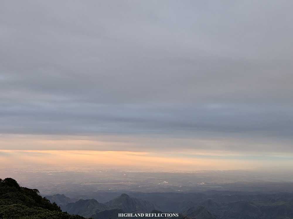
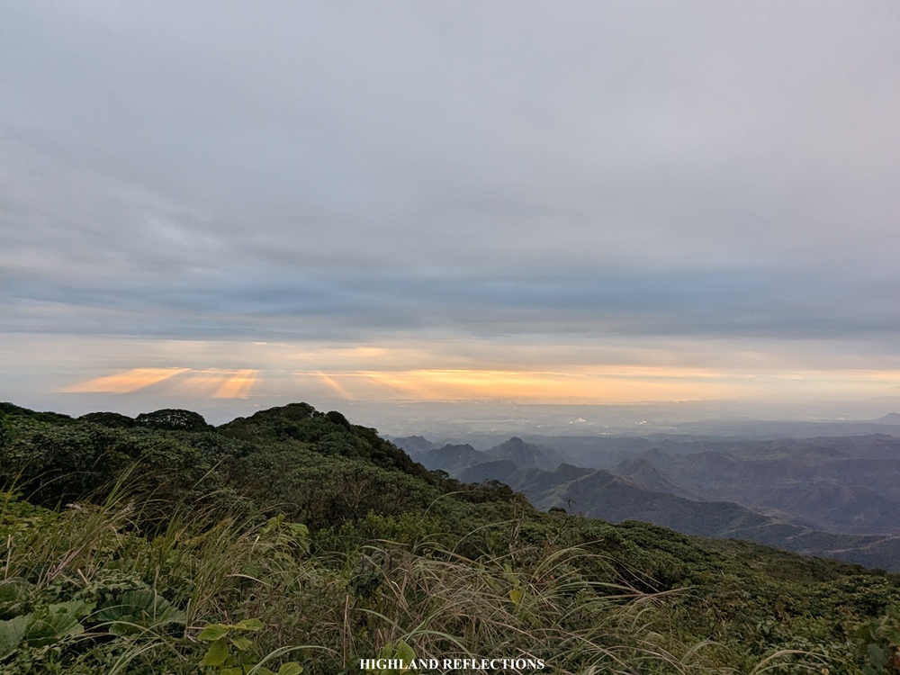
That night, we had a sumptuous dinner made up of rice, sisig, ginataang langka, fried chicken skin, pancit bihon, and chicken tinola. We stuffed our tummies to our heart’s content! On the horizon, we had a view of the city lights emanating from the lowland municipalities of Pampanga.
At nine in the evening, we finally called it a night. We took the well-deserved sleep and rest as we would have a long day ahead of us.
Day 2: To the Summit and Back
Gusts of Amihan wind woke us up at three in the morning. Although we were supposed to start the summit assault at 3:00 AM, we took the time to prep ourselves and eat breakfast at the kubo. Our guides also took some time to prepare their breakfast. I strapped my light pack filled with water and trail food afterwards.
At four in the morning, we started marching towards the summit. The first portion briefly descends to a water source before climbing the face of a grassy slope at the left side of Mt. Negron, to which we quickly gained elevation. From below, we could see the flashing lights of the kubo, and on the horizon, the city lights from the different municipalities in Pampanga. Along the way, we passed by the base of a giant boulder and then ascended a steep roped segment leading to a cliff marked by some protruded rocks.
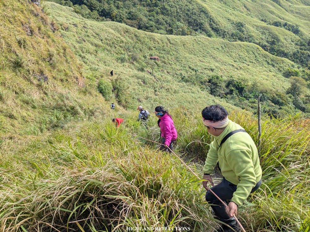
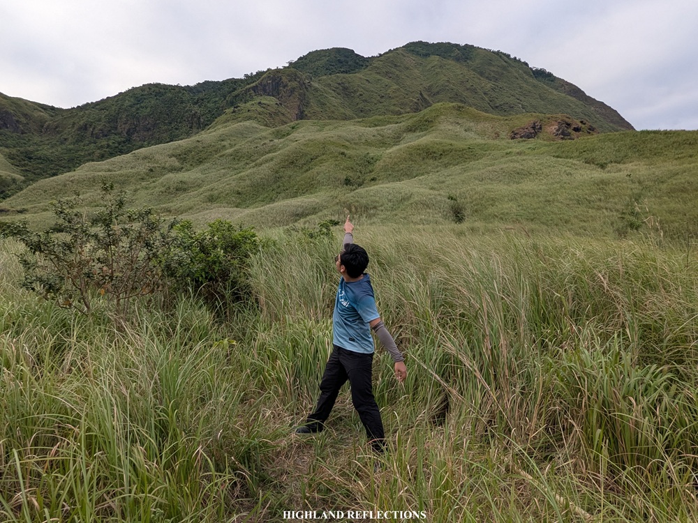
Past the protruded rocks is the continuation of the ascent before making a right turn onwards to Mt. Negron. From this vantage point, I could see the silhouette of the gigantic slopes of the dome-shaped mountain in front of us. It’s as if we were approaching a giant’s head coming from its shoulder! The grassland slope took us to a ridge with steep drops on both sides. The trail here was claustrophobic as the grasses were tall and dense! The only way to get through is to look down and locate the cleared path.
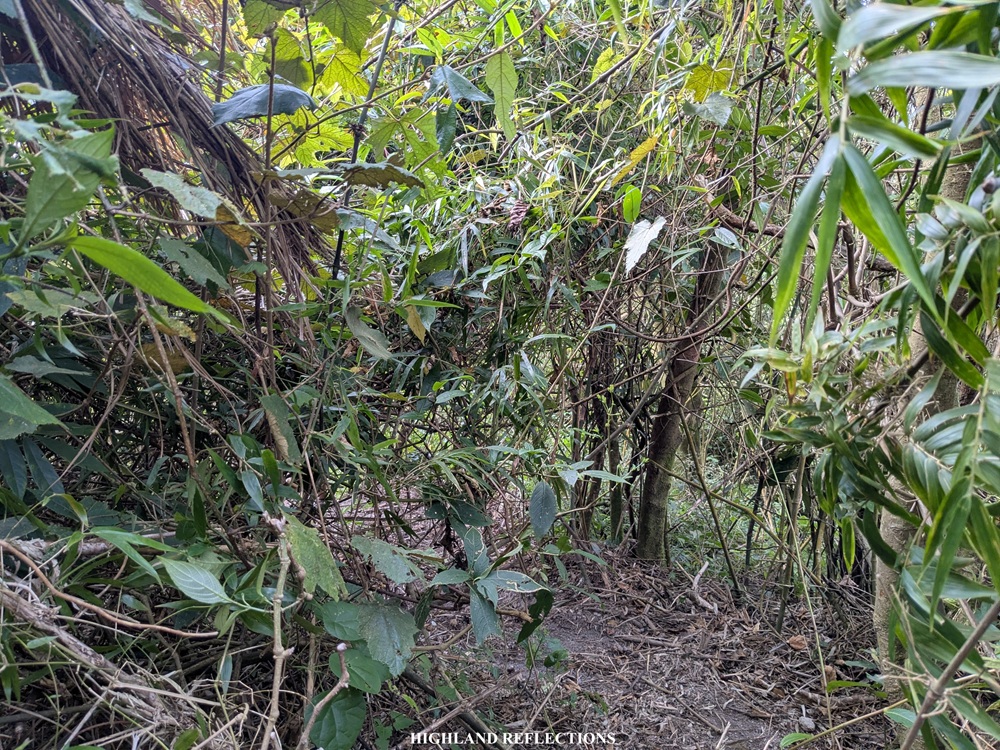
Past the grassy ridge, we finally entered the forested section of Mt. Negron’s upper slopes. This forested section is filled with a thick undergrowth and an assemblages of vines that sometimes block the trail, requiring us to crawl underneath just to get up. The ascents here weren’t that steep, nothing crazy like the ones in my previous hikes in Mt. Arayat. At the upper portions of the trail, the trees were blanketed in some thin moss, making everything in our surroundings verdant and lush. What’s unique about this trail, however, is that the ground is blanketed in lahar! This is probably the only mossy forest in the country where the forest floor is made up of volcanic sand.
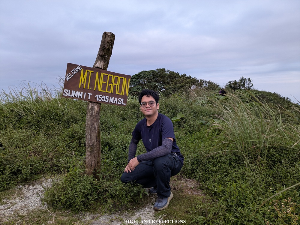
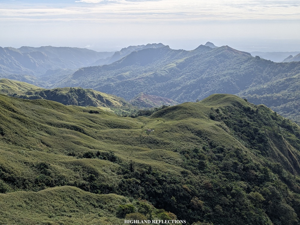
We climbed on and on and on with take fives (five seconds, literally) every few hundred meters. Then finally, at 6:30 in the morning, two and a half hours after starting the hike and after covering 17.5 kilometers from the jump-off point, we finally reached the summit of Mt. Negron! At the summit, we were greeted with clear views despite the grey, ominous high clouds above. The views were surreal! As we were savoring the view, we snapped some pictures at the signage marker in the middle of the summit area.
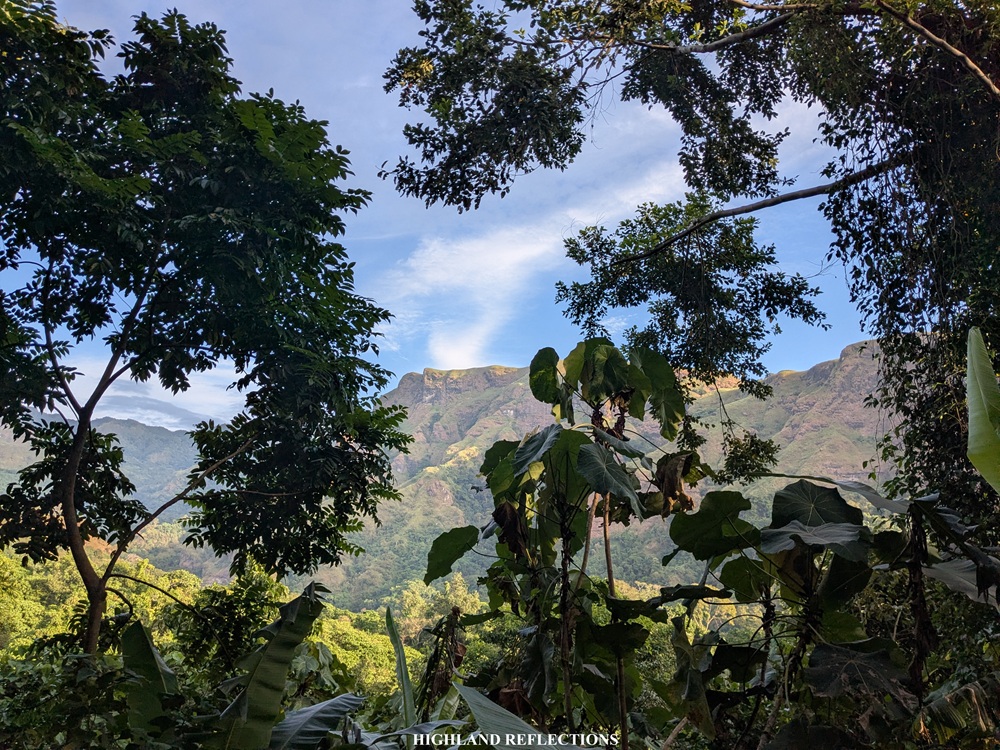
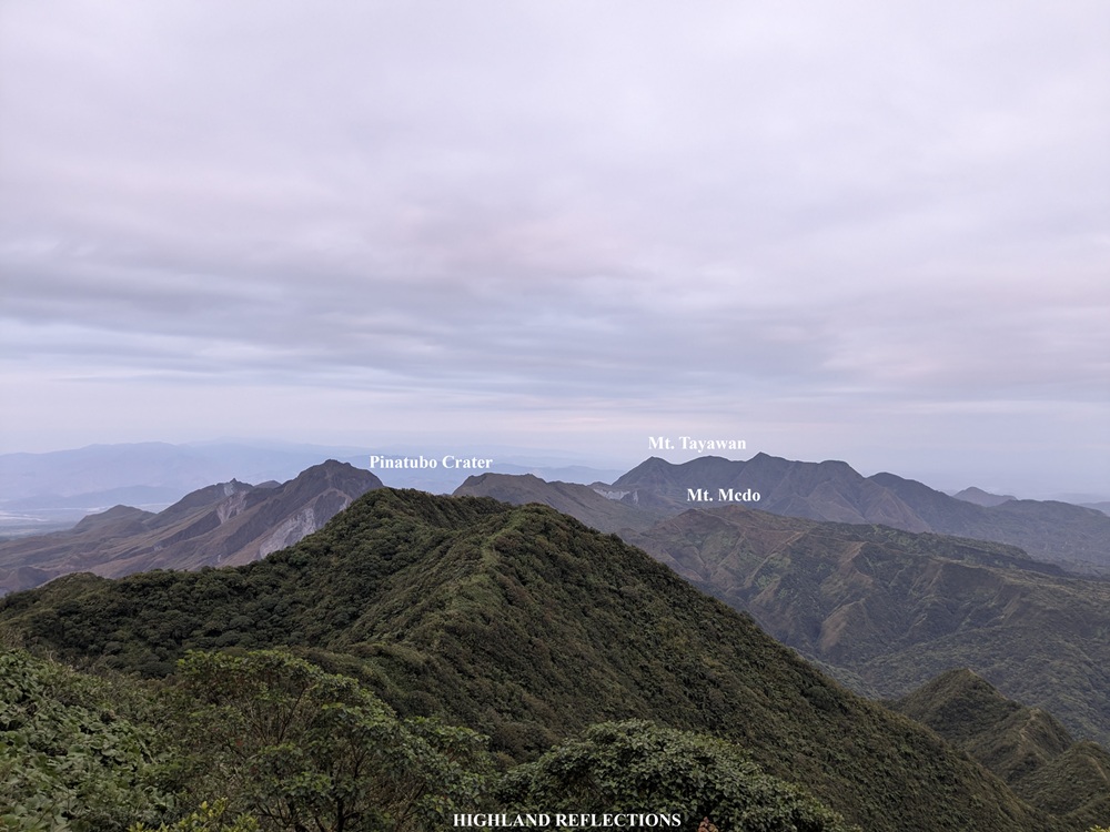
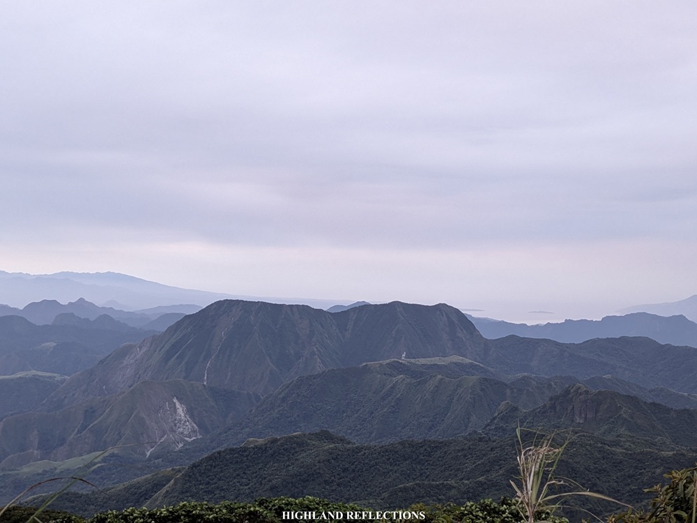
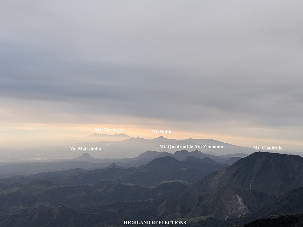
Perhaps what I was most excited (and curious) about was whether Mt. Pinatubo’s crater lake is visible from the summit, given that the iconic volcano sits right beside Mt. Negron. Apparently, it is not—the 1,450 meter crested peaks of Pinatubo blocks the view of the crater lake. Still, I was thankful as the clear view gave us some views of the volcanic complex—from the peaks of Pinatubo to the nearby 1200-meter Mt. Mcdo in the Sapang Uwak side, and the faraway 1450-meter Mt. Tayawan at the northern side of Pinatubo. In the distant horizon, a faint outline of the Cordillera Mountain Range and Sierra Mountain Range is visible. Past Pinatubo in the northwestern direction is the mountain range of Cabangan, Zambales.
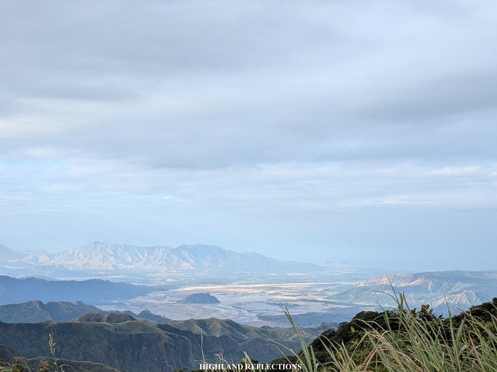
On the eastern direction is a sweeping view of the Pampanga lowlands with the solitary Mt. Arayat towering above them. At the southeast, Manila Bay and the wetlands of Pampanga and Bulacan are visible and are illuminated by the orange rays of the morning sun. I reckon that my house was probably somewhere in that direction!
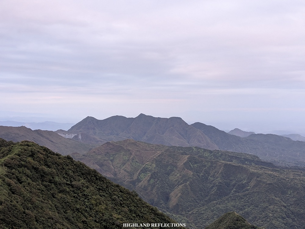
Turning south, we had a panorama of the rest of the Cabusilan Mountain Range. The nearby 1300-meter mountain wall that is Mt. Cuadrado dominates the entire view. Mt. Cuadrado is perhaps the fourth highest mountain in the Cabusilan Mountain Range next to Negron, Tayawan, and Pinatubo. Past Cuadrado are multiple peaks where Mt. Zamatam, Mt. Quadrant, and Mt. Balikabok—peaks of the southern part of the Cabusilan Mountain Range—are found. At the periperhy of this mountain range is a hat-shaped hill—this is Mt. Malasimbo in Dinalupihan, Bataan! Past the Cabusilan Mountain Range are two prominent mountains that seem to have similar elevations as that of Negron and Cuadrado. These are none other than Mt. Natib in Orani, Bataan, and behind it is the gigantic Mt. Mariveles.
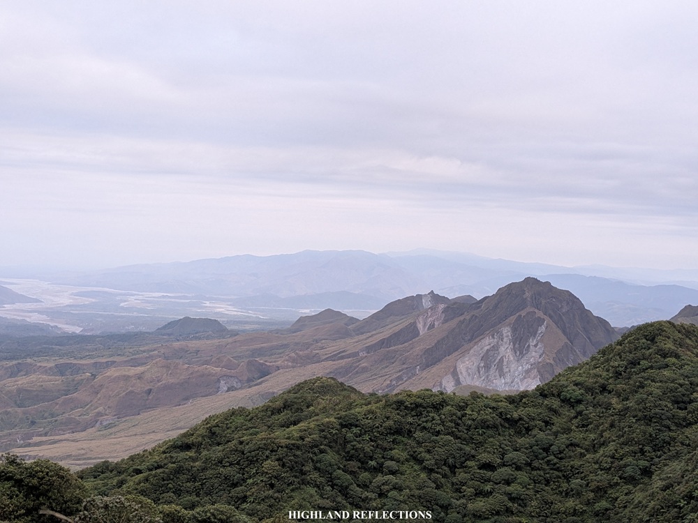
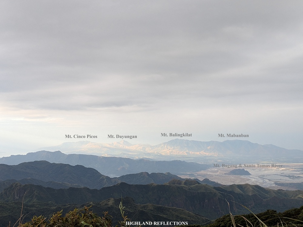
Completing the view is the Cawag Coastal Mountains in the southwestern direction—with the ridges of Mt. Cinco Picos, Mt. Dayungan, Mt. Balingkilat, and Mt. Mabanban traceable from where we were. Just beside Mt. Mabanban, Capones and Camara Islands are visible together with the vast West Philippine Sea. Nearby is Santo Tomas River with its lahar-filled landscape. In the middle of the river is the solitary Mt. Bagang.
The temperature atop of Mt. Negron was so cold and windy that it made us all shiver! Coupled with the winds of Amihan, we were enjoying the cool mountain breeze that feels entirely different from what we would usually get in the Central Luzon lowlands (cue: Simoy by Rob Deniel).
After an hour of chitchatting and snapping pictures at the summit, we decided to return to the campsite. Of course, since we were now blessed with sunlight, we took the chance to snap some photos at the protruded rock that we encountered earlier. The view here was surreal! We could literally trace the mountain slopes that we had to pass through en route to the campsite—going back to Barangay Camias really looked like a long ordeal.
We returned to the campsite to cook and stuff ourselves a heavy breakfast, which we needed as we still had 15 kilometers ahead of us for that day. At 11:30 in the morning, we started the long descent, taking us to the sagingan trail just a few minutes after starting. Taking this trail in the middle of the day brought me in misery again!
Then, after two hours of descent, we reached Camp 1. At the camp, we took our time to get some long rest, as the next portions of the trail on the way back was on an ascending section. We took this trail after the much-needed rest at the campsite, and it was a punisher! At first, the trees protected us from the afternoon sun. However, the last few portions of the ascent were on a grassy ridge.
Luckily, after the long ascent, we encountered the house where we ate some buko a day prior. Here, the residents gave us some fresh, sweet papayas, which I happily munched on after that hot, tiring ascent that I just did (we paid the locals for their harvest). Afterwards, we continued with the nonstop push going to the end point. We reached the first Aeta house we encountered yesterday and there, we ate and paid for some freshly harvested coconuts once again. It was around four in the afternoon. We were hiking for more than five hours!
Past the house, we marched on nonstop—and this time, it was really nonstop. We were pressed for time since we didn’t want to spend a long time crossing the rivers at night. Alas, it was six in the evening when we reached the river crossing area. Along the way, we saw some Aeta families having their dinner at the side of the river. Some of them were also hunting by swimming underneath. Such way of life is entirely different from ours. It took us an hour to negotiate all seven (or eight?) river crossings. We rested at the last river crossing, with all of us going nonverbal due to exhaustion.
Finally, at 7:30 in the evening, we reached the Aeta community in Barangay Camias, completing the entire 35-kilometer hike! It took us eight freaking hours of total nonstop walkathon just to descend from the campsite! That night, we had a well-earned dinner of chicken tinola prepared by the local Aetas. After everyone was done washing up, our tired bodies headed home. It took me multiple days to recover from this hike!
Mt. Negron is such an arduous mountain to climb. Yet despite its difficulty, I think it is the most perfect hike to see the beauty of the Cabusilan Mountain Range and the volcanic complex surrounding Mt. Pinatubo. Even in the lowland parts of the trail, the forests were very enjoyable to walk into, and the Aetas had such an abundance of food sources everywhere you look. Coupled with this long walk is the exciting feeling of inching closer and closer to Mt. Negron as you see it from the trail. And of course, seeing the stunning vista of mountains on top is such a rewarding feeling. It is no doubt one of the best mountains to hike in Central Luzon!
How difficult is Mt. Negron compared to its neighboring mountains? After all, a difficulty level of 8/9 doesn’t give you the full picture. For one, some of my companions have likened the hike to the Mt. Tapulao traverse trail. Personally, I find it similar with the Batad-Mayoyao Traverse of Mt. Amuyao, as it has the same trail distance (~35 kilometers) and same level of accumulative elevation gain (~2,500 MASL) with Mt. Negron. Some would also compare Mt. Negron’s difficulty with the PanTarak and CuyTarak hikes in Mt. Mariveles, and as someone who has finished PanTarak, I slightly agree—only that PanTarak is more technical, while Mt. Negron is longer.
Still, no matter the comparisons, the only real way to know is to try it for yourself! After all, what can be seen inside the domains of Apung Abu, as what I have described in the blog above, makes it entirely unique and different from the mountains I have mentioned. I hope, just like our climb this January 2026, the mountain welcomes you in good spirits.
Climb Mt. Negron!
Itinerary
Day 1
04:00AM Pasbul Aeta Community
04:30AM Start hike
04:45AM Start of river crossing
06:00AM End of river crossing (KM 4)
06:45AM First water source (KM 5)
08:00AM First Aeta house (KM 7.7)
08:30AM Second Aeta house
09:30AM Third Aeta house / Bukohan, long rest
10:00AM Resume hike
11:00AM Camp 1 (KM 11.8), lunch
12:30PM Resume hike
01:00PM Start of sagingan
01:45PM Last river crossing, rest and regroup
04:15PM Continue hike
05:00PM Camp 2 / Kubo, set camp
08:00PM Dinner
09:00PM Lights out
Day 2
03:00AM Wake-up call
04:00AM Start of summit assault
06:30AM Summit
07:30AM Start descent
09:00AM Boulder, take pictures
09:30AM Back at campsite, breakfast
11:30AM Start descent to jump-off
01:30AM Camp 1
02:45PM Bukohan, rest
04:00PM First Aeta house, rest
06:00PM Start of river crossing
07:30PM End of hike
