When in SOCCSKARGEN, chances are, you’ve probably seen a mountain shaped like a Hershey’s Kisses chocolate. This iconic cone-shaped mountain, which stands mightily above the vast plantations in South Cotabato, is none other than Mt. Matutum!
As it is such an imposing figure, spotting this mountain from South Cotabato is a guarantee, and seeing it is already a goal in itself when you are traveling in the southern part of the Philippines. However, for hikers, reaching the tip of the mountain is another story. I embarked on the mission to climb to its summit last December of 2025!
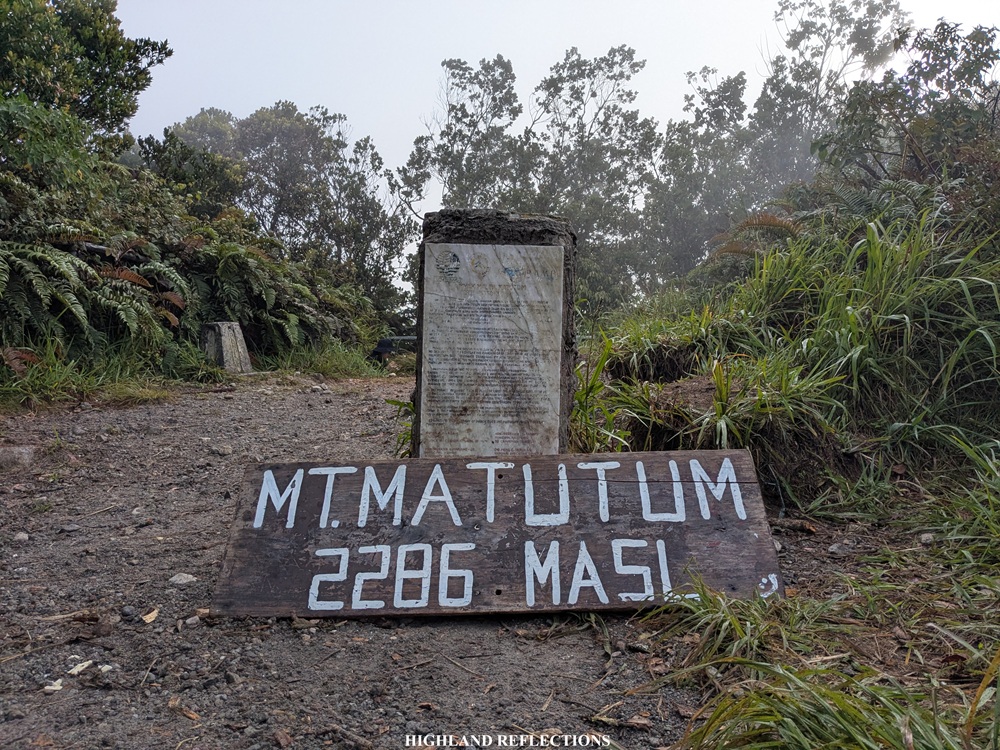
Mt. Matutum, with an impressive elevation of 2,286 meters above sea level, is an active stratovolcano located in Tupi and Polomolok, South Cotabato. It is a mountain that holds cultural significance to the Blaan people as they reside in its foothills. In fact, the Blaan celebrate an annual tradition and event called the “Amyak Maleh,” meaning to “climb and plant” in the local language. Here, the locals conduct biking, running, hiking and tree planting activities that promote environmental conservation within the area. Such activities are a testament of the Blaan’s love and appreciation of Mt. Matutum.
In hiking the pointy mountain (in fact, ‘Matutum’ means ‘pointy’ in the local language), I joined an event by Mindanao-based organizer, Soxlander Adventures. There are two trails that can be taken in climbing Mt. Matutum named after the sitio where the jump-off points are located: the Glandang Trail in Brgy. Kablon in the town of Tupi, and the Keumang Trail located in Brgy. Palkan in the town of Polomolok. We took the Glandang Trail for his hike. This trail involves a straightforward 1,300-meter ascent that is divided into two phases.
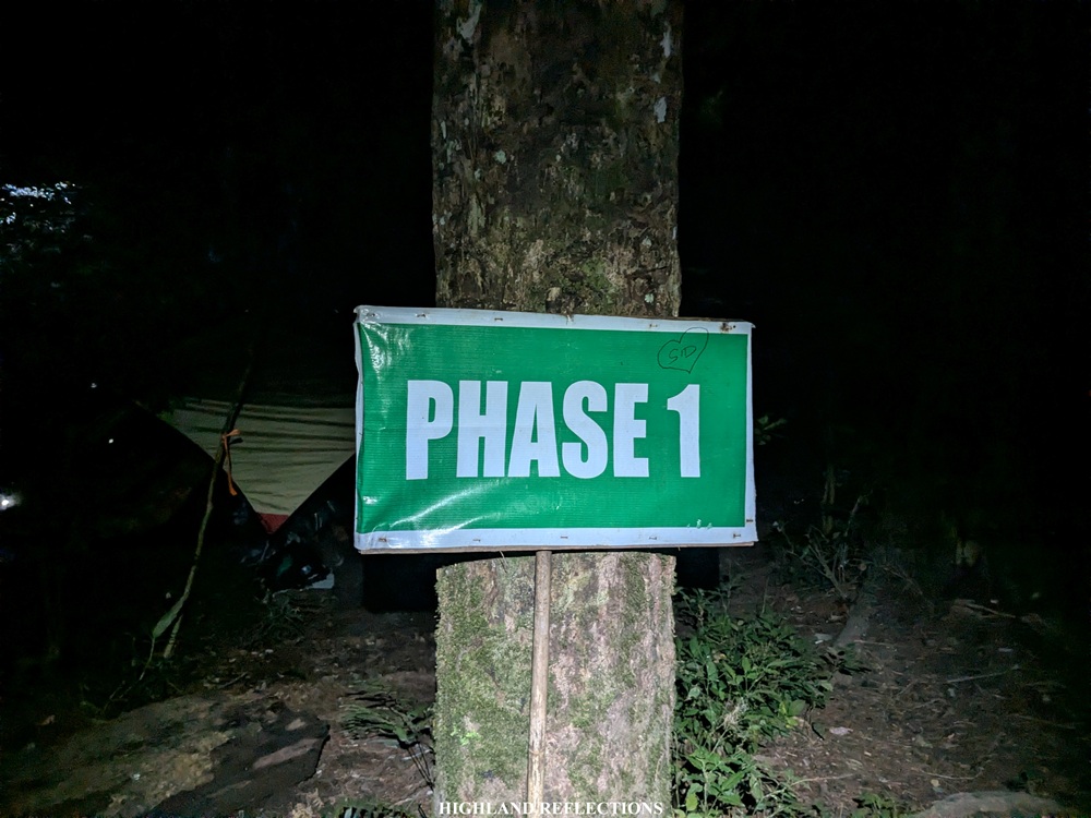
Phase 1 starts at around 1,035 meters above sea level. This trail initially crosses local farmlands before entering the lowland and montane forests of the mountain. It terminates at a campsite around 1640+ meters above sea level around four kilometers from the jump-off point. Past the campsite is Phase 2—a trail with a denser forest and a steeper incline that requires some manageable acrobatics to climb, culminating at the summit of Mt. Matutum. At the summit, one can explore the mountain’s three peaks to get a view of the lowlands and surrounding mountain ranges from afar before starting the straightforward descent.
According to Pinoy Mountaineer and my own observations, the characteristics of the Glandang Trail are as follows:
MT. MATUTUM (GLANDANG TRAIL)
Jump-off point: Sito Glandang, Brgy. Kablon, Tupi
Days required / hours to summit: 1-2 days / 4-6 hours
Specs: Major climb, Difficulty 5/9, Trail class 3
Mt. Matutum, specifically its terrain and trail difficulty, reminds me of Mt. Arayat and Mt. Makiling in Luzon. Due to these similarities, there is a comfort in knowing that I am about to embark on a hike that is similar to the ones closer to my home province. As an frequent traveler, I cannot help but to make references of my place of origin when I am in a distant place. Despite the similar terrain, however, Mt. Matutum has its own charm and personality distinct from other mountains in the country. The sense of novelty and unfamiliarity is something that I highly welcomed in my adventure in this majestic mountain.
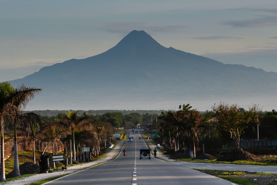
I was fetched by the organizer in Davao City around 9:00 pm a day before our hike. Then, we made our way to Tupi, South Cotabato, fetching other joiners for this hike along the way. Before reaching Sitio Glandang, we passed through winding roads in the middle of what I can only assume as pineapple plantations, reminding me of the iconic photos of Mt. Matutum on the internet where it towers above provincial roads and pineapple plantations!
We reached Sitio Glandang past one in the morning. I was still reeling from the lack of sleep and accumulated tiredness from work and my long journey from Malolos to Davao to South Cotabato. Despite the weariness, my entire system was filled with sigla, gana, and zest upon strapping my day hike pack when we started the hike at around 1:30 in the morning. From the jump-off point, we could see the silhouette of Mt. Matutum towering above us. Clouds seem to be rolling above its summit.
The initial parts of the hike already greeted us with some manageable ascents through local farmlands. Since we were climbing continuously, we quickly gained elevation, prompting us to have a view of the glimmering lights emanating from the lowlands in Kablon. The trail, then, slowly transitions into a forested trail. In the horizon, I spotted the crescent moon in an upturned position casting its light in the dark sky, reminding me of the sinister-looking moon in Soul Eater. Of course, I felt a sense of awe since it’s quite rare to spot the moon this vividly when hiking. It’s as if Artemis herself approves of our entrance to the wilderness.

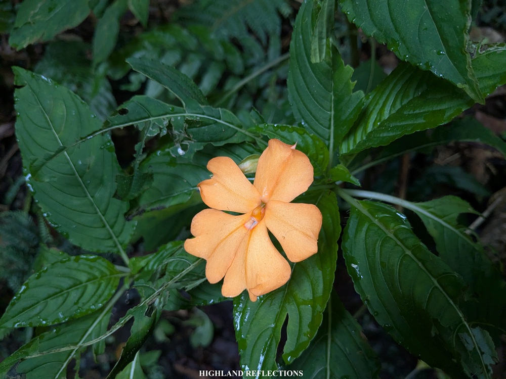
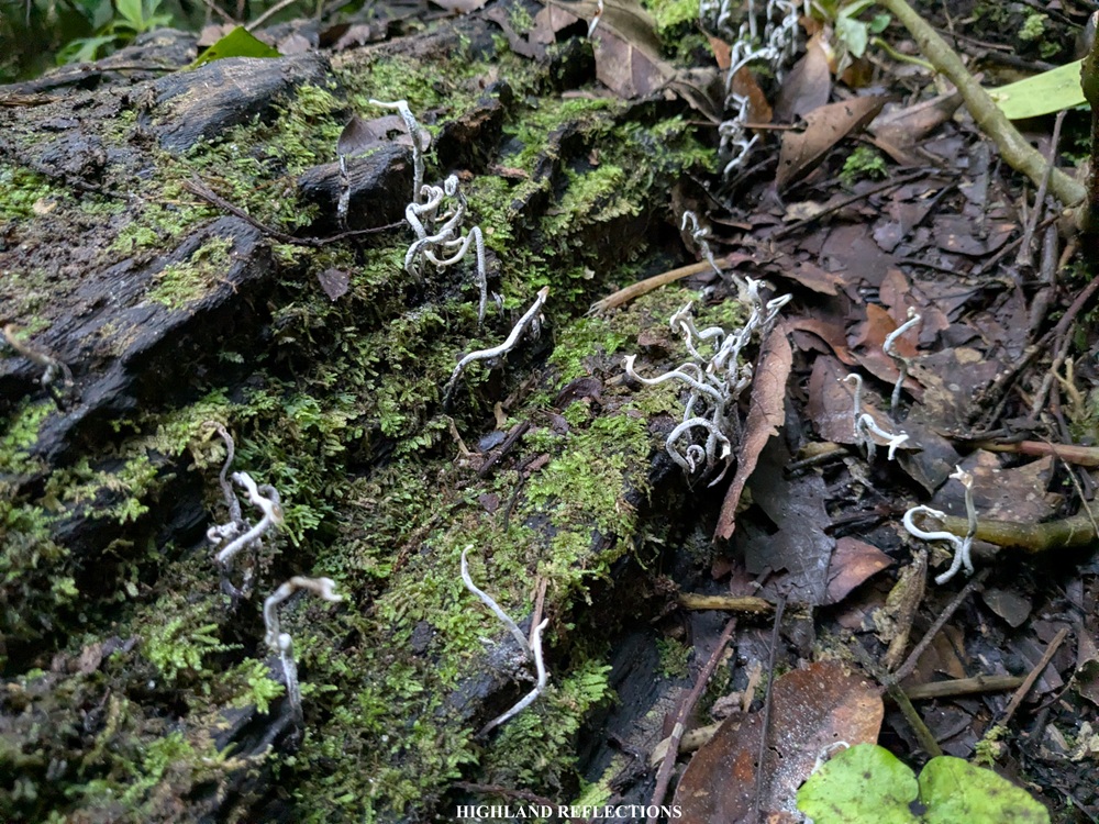
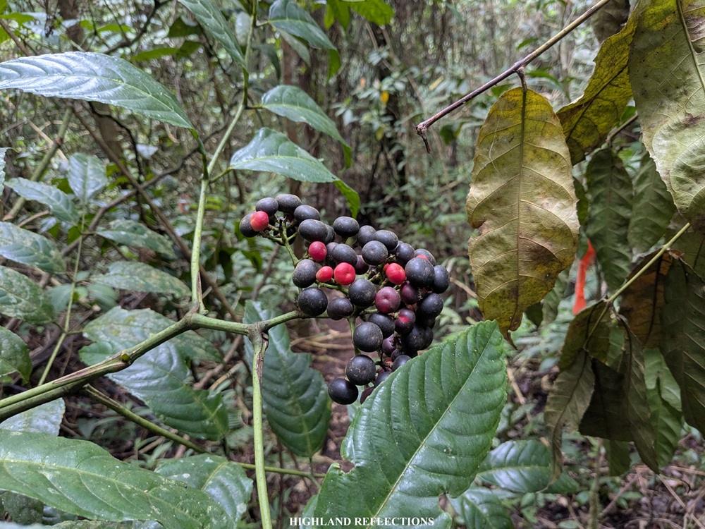
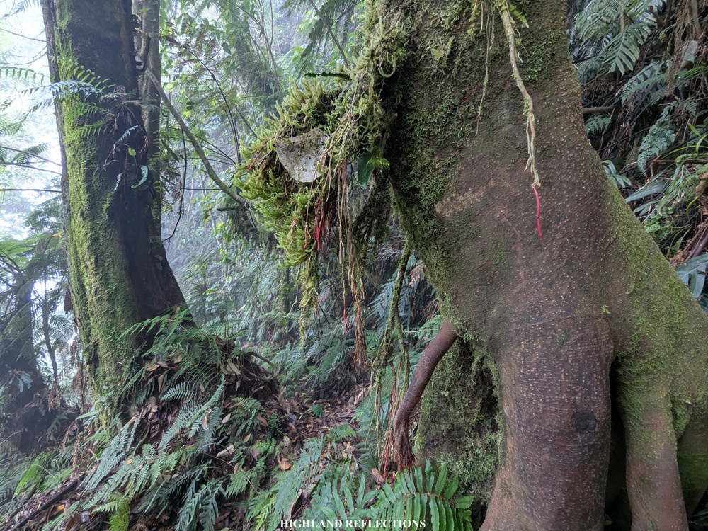
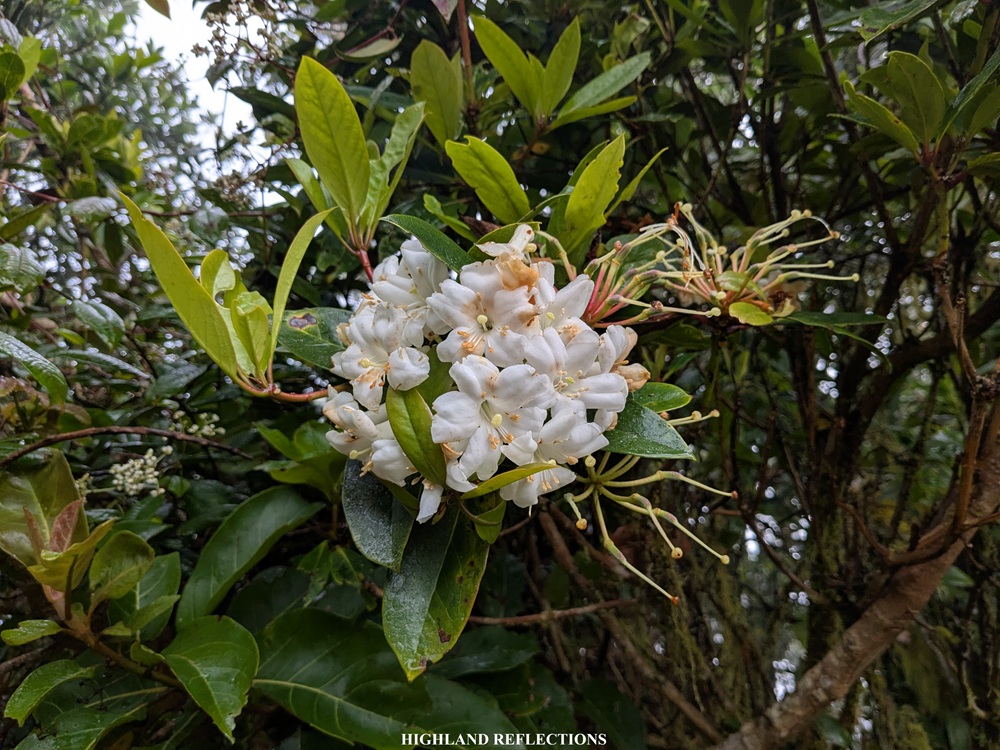
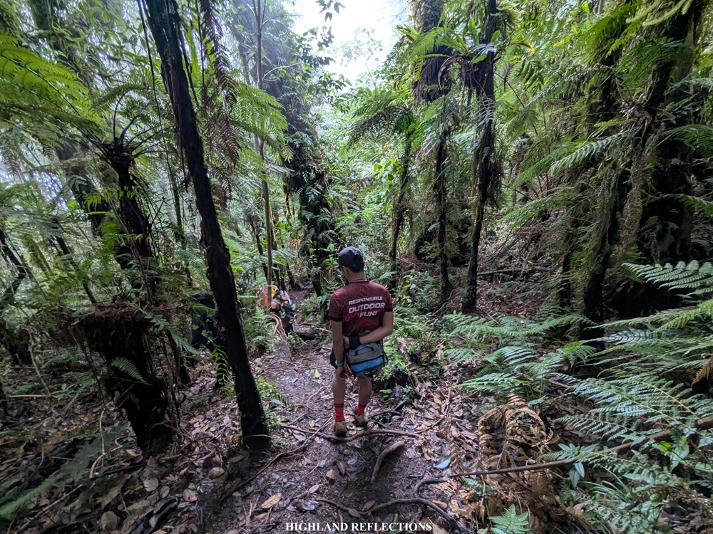
The ascents inside Mt. Matutum’s forest were straightforward. Despite the dark environs, I could feel the density of the forest surrounding me. I knew then that I was surrounded by wilderness and diversity. Flowers and mushrooms of different species, as well as gigantic trees, can be spotted along the trail. We rested at an area inside the forest one hour since we started climbing. Past this area, the ascent continues.

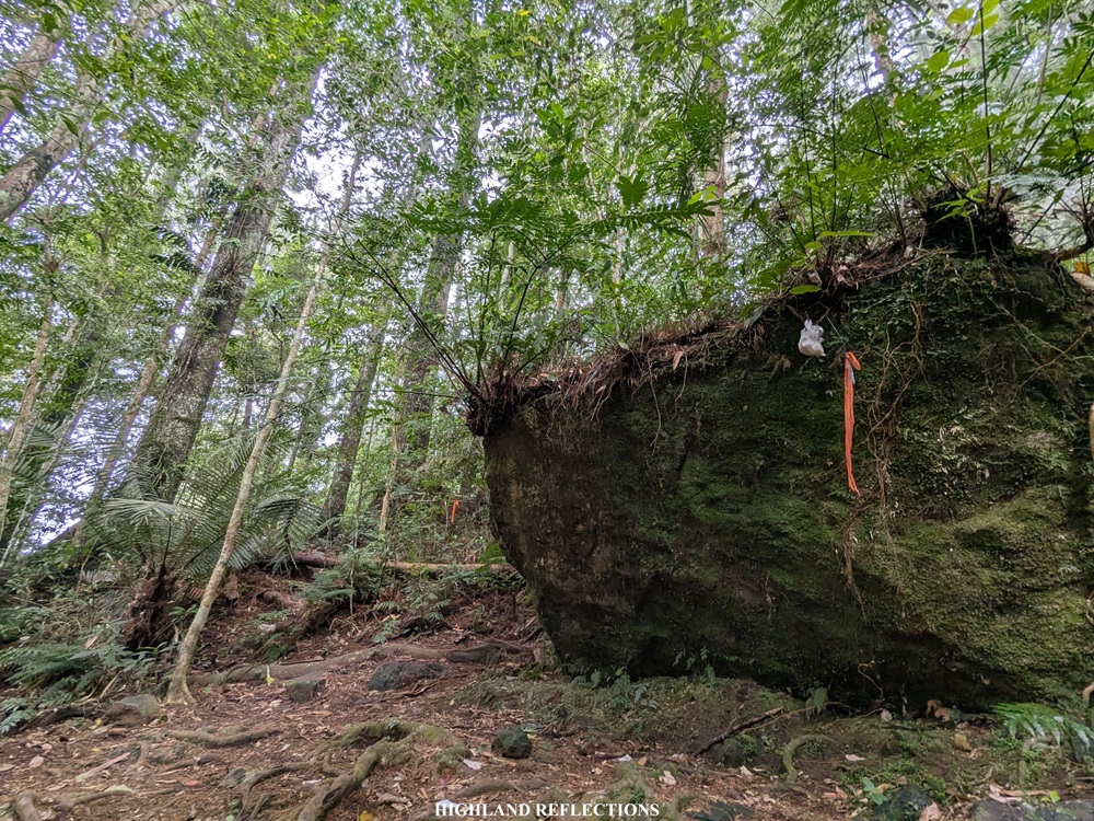
Two hours into the hike, after covering four kilometers and climbing more than 650 meters of elevation, we finally reached the campsite, marked by a giant boulder perched in the middle of the forest. We took a long rest here as a reward for covering the first phase of the hike, munching on our trail foods and getting the chance to take some power naps.
With our bodies recharged, we continued the hike to Phase 2 at around four in the morning. From the campsite, the trail got steeper and the forest got more dense. It was the kind of trail that required us to get some take-five rests every now and then with how steep it was. Still, the ascents were manageable and not as punishing as that of Mt. Arayat’s Quad Peak Trail or Mt. Madjaas’ trail going to the summit. Climbing it was quite enjoyable especially with the cooler air in the mountain’s upper reaches. From time-to-time, I got glimpses of the lowlands seemingly way, way below us.
As we were getting closer to the summit, however, we felt the steepness getting sharper and sharper. The slopes that we needed to tread on was right directly above us, and there was this dread that anytime soon, the soil could erode and those gigantic trees could fall onto us anytime if they chose to. Still, I was putting my confidence in the mountain’s temper, as I knew its deities were kind enough to protect from harm those who enter their abode.
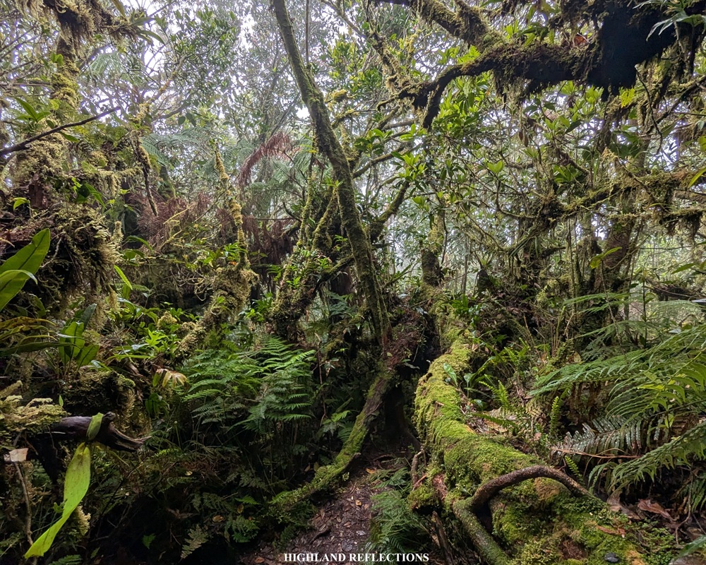
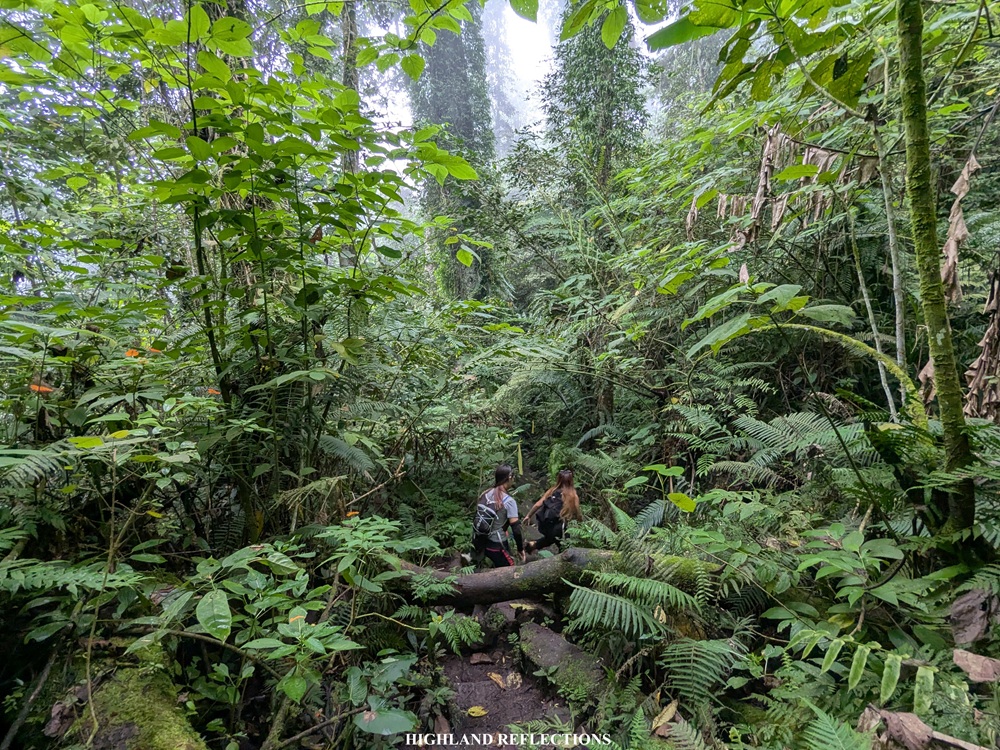
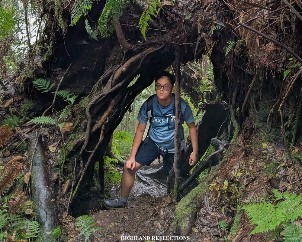
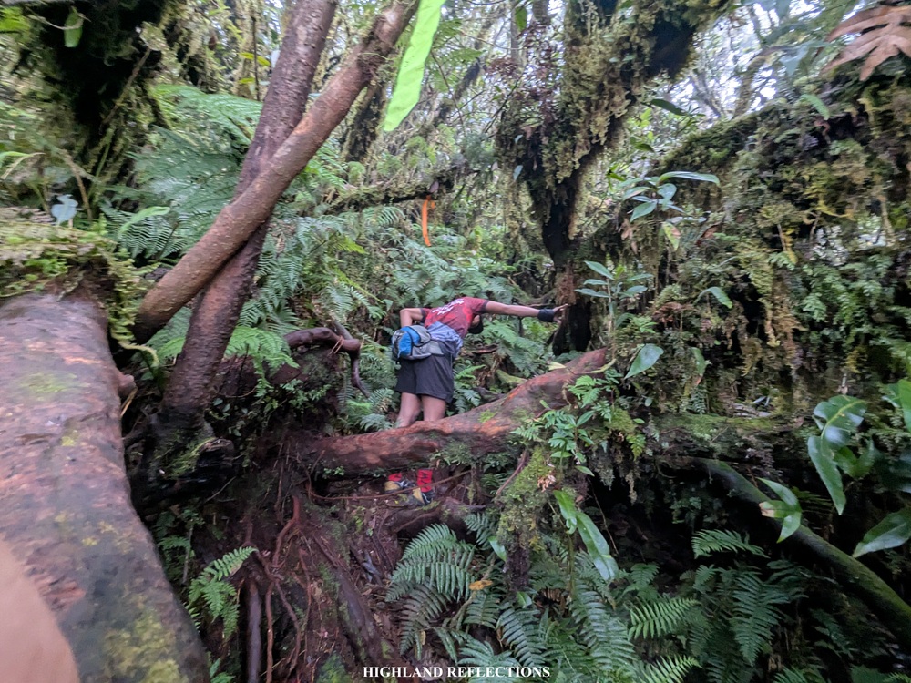
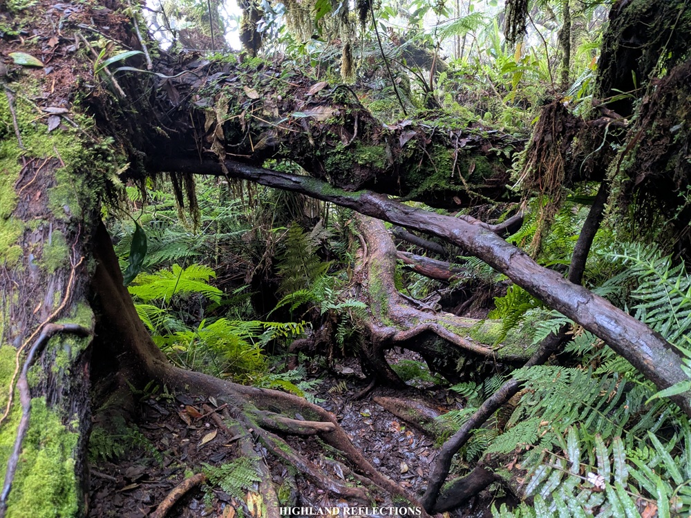
Still, the dread did not stop me from appreciating the greenery surrounding me—the trees and rocks were now blanketed with moss and the wilderness was now more evident. However, the obstacles on the trail became a bit more difficult to negotiate as we needed to either duck under low-hanging branches, crawl on boulders and roots, or swing from one point to another. Aptly, this area is called by some as a monkey trail given the acrobatics that we needed to do just to climb up!
And then finally, at 6:30 in the morning, after five hours of near-continuous ascent, we reached the summit of Mt. Matutum! Accomplished at 2,286 meters above sea level! Atop, we were met with gushing winds and a foggy environment, so we didn’t have any views to appreciate. Still, we were content with what we had—a small cleared area in the middle of the mossy forest barred by metal pipes. In the middle is a wooden plank and a marker engraved with some inscriptions where we snapped some photos.
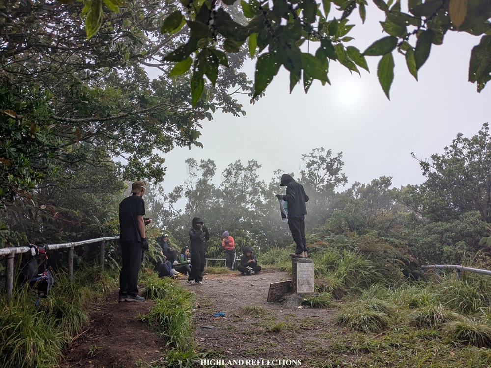
This summit area is also called as Peak 1. On a clear day, one could spot the South Cotabato lowlands and the mountain range containing Mt. Melibengoy, Lake Holon, and Lake Sebu in the distance. Past the summit, one could go to Peaks 2 and 3 where Mt. Apo—the country’s highest mountain—can be viewed. However, given the fog, we opted not to go to Peaks 2 and 3, and just decided to stay under the watchful eyes of the mossy trees in the area where we took some rest and ate our trail food.


After an hour of staying at the very cold and windy summit, we started the descent. Climbing down was straightforward. No flat grounds, no switchbacks, no fusses—just you, the plants, the trees, the rocks, and the steep downward trail. The trail requires you to deeply engage with it, requiring full attention to every available step and to every branch that you can use as support. Still, like as mentioned, the trail was manageable and not too demanding to take unlike those in other high difficulty mountains. We reached the campsite an hour and thirty minutes after starting the descent from the summit. We took some long rest here.
After thirty minutes of rest, we continued with the descent. From the campsite, the trail going back to the jump-off point was runnable. We seized every opportunity to brisk walk and run on the path, with the forest protecting us from the heat of the morning sun. This made for such an enjoyable descent where my sweat, my breath, and my entire being became one with the fresh mountain air. Alas, at 10:45 in the morning, almost nine and a half hours after starting the hike, we reached the jump-off point.


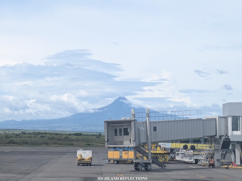
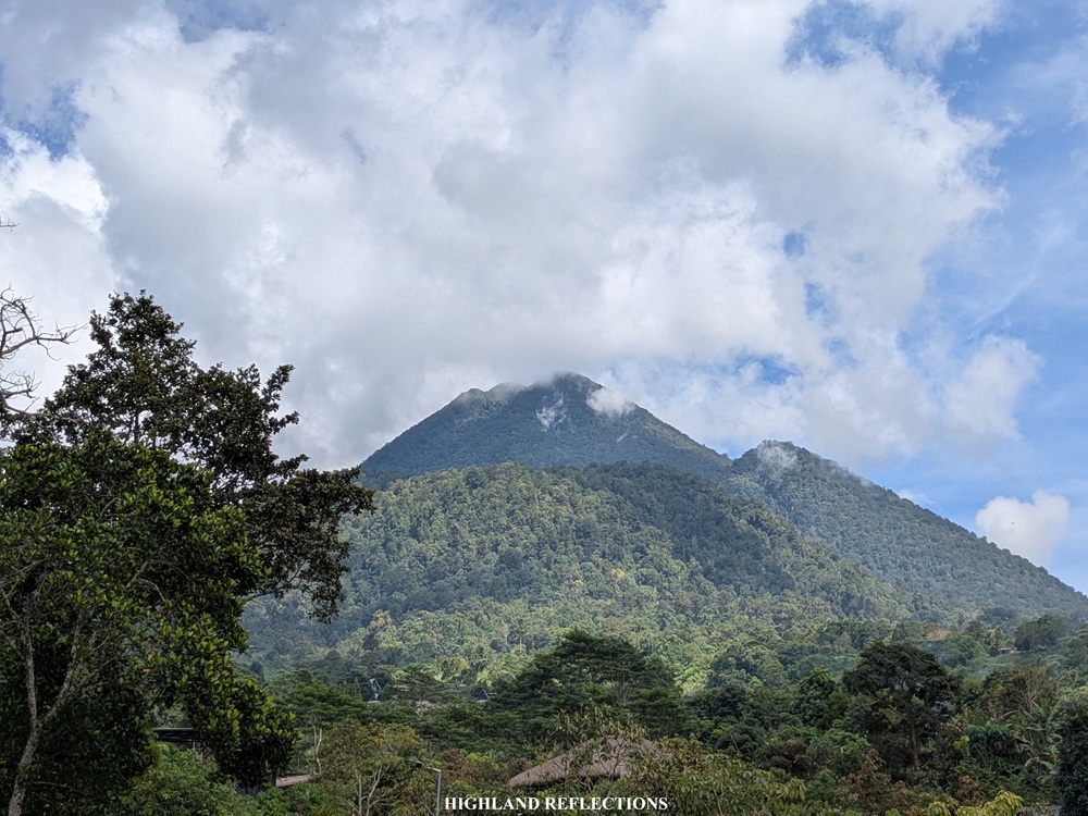
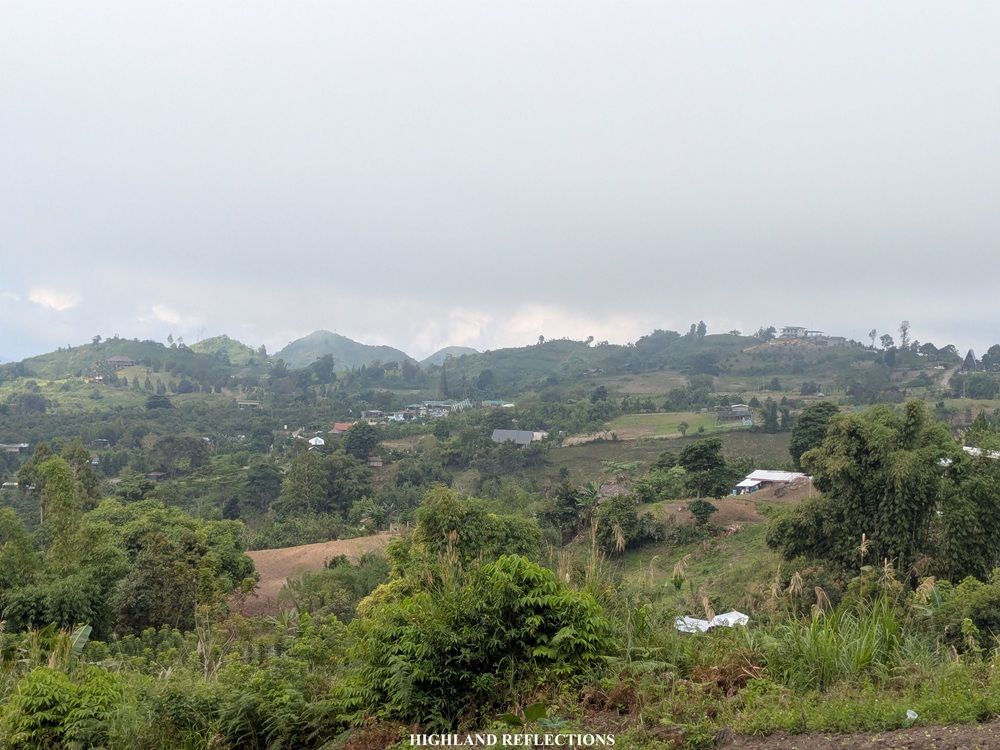
That noon, after washing-up and preparing for our return to the city, I was looking closely at Mt. Matutum. The clouds gave way for me to see the top of the mountain from below, with its three, W-shaped peaks now visible (see second photo in this blog). The heavens granted my wish once again by allowing me to see Mt. Matutum one more time from the comfort of our vehicle as we were returning to General Santos and Davao City. Then, perhaps to bid good bye, I saw Mt. Matutum the next day from the seat of my airplane as I was about to embark on my flight to Manila (see first photo in this blog). I was very grateful to have seen its iconic beauty despite not getting views on top!
I am glad to have finally climbed one of the most revered mountains in Mindanao. Backstory: the first time I got a glimpse of this mountain was way back in 2021 during our Mt. Kalatungan hike in Bukidnon, where I saw Mt. Matutum in the horizon from the fifth highest mountain in the Philippines. I knew, then, that it would be one of my target mountains to climb in this region. And, then, finally, on a random weekend in December of 2025, four years after seeing it for the first time, I finally got to fully experience its beauty. With this successful climb, I can’t wait to return to Mindanao to hike some of the highest and most enchanting mountains in the country!
Amyak maleh!
Itinerary
01:30AM Start hike in Sitio Glandang (1,035+ masl)
02:40AM First rest stop (1,370+ masl)
03:30AM End of Phase 1; Campsite, rest (1,642+ masl)
03:55AM Resume hike
06:35AM Summit Peak 1 (2,286+ masl)
07:45AM Start descent
09:05AM Campsite, rest
09:30AM Resume hike to jump-off point
10:50AM Jump-off point, wash-up
02:30PM General Santos city

One thought on “Mt. Matutum (2,286+ MASL) | South Cotabato’s Iconic Mountain”