At the geographic center of the Philippines lies the island province of Marinduque, known to many as the Heart of the Philippines. The province’s name is said to be derived from the local term malindig, which means ‘to stand tall.’ It may have also possibly come from the Visayan term maalindog—someone who is graceful, elegant, and beautiful. These etymological origins aptly describe not just the province of Marinduque, but also the highest mountain in the island—Mt. Malindig.
Standing at an elevation of over 1,157 meters above sea level, Mt. Malindig rises prominently at the southern tip of Marinduque. The mountain is both a natural and cultural landmark in the province of Marinduque, standing as a gigantic guardian towering above the province.
There are two main trails within Mt. Malindig. The first and primary trail leads directly to the mountain’s highest point, located in its northern section and accessed via Barangay Sihi (subjective difficulty rating: 3 to 4/9). The other trail leads to the wondrous Makulilis Peak, situated on the southern face of the mountain located in Barangay Dampulan in the town of Torrijos. We hiked the out-and-back trail to Makulilis Peak before hiking the trail to Mt. Malindig’s summit the next day.
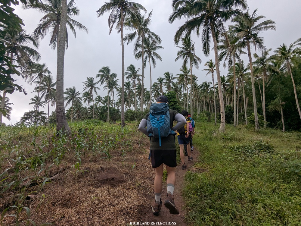
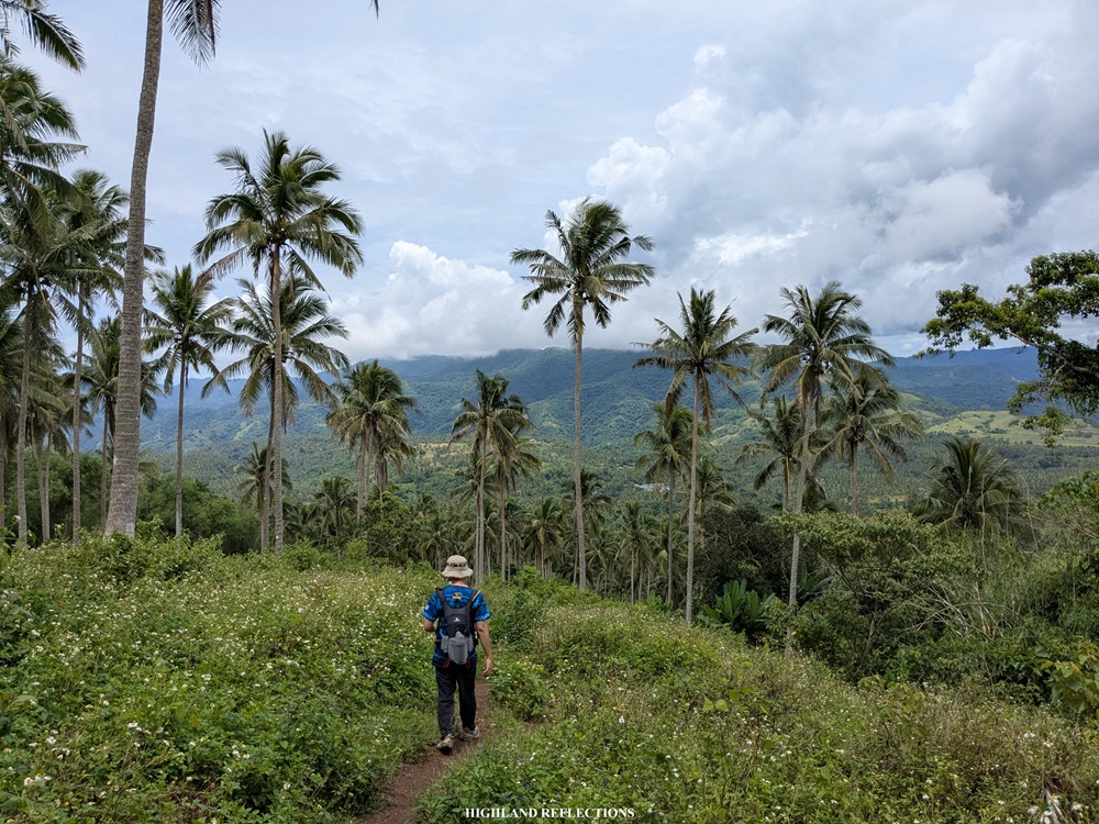
The trail to the highest point of Mt. Malindig is divided into three sections, each featuring a mix of gentle and steep inclines. The first part winds through coconut and fruit plantations tended by locals living in the area. The trail then opens up to a grassland slope where residents graze cattle and horses. Finally, the uppermost section leads into an enclosed forest, with parts of the trail blanketed in lush, green moss.
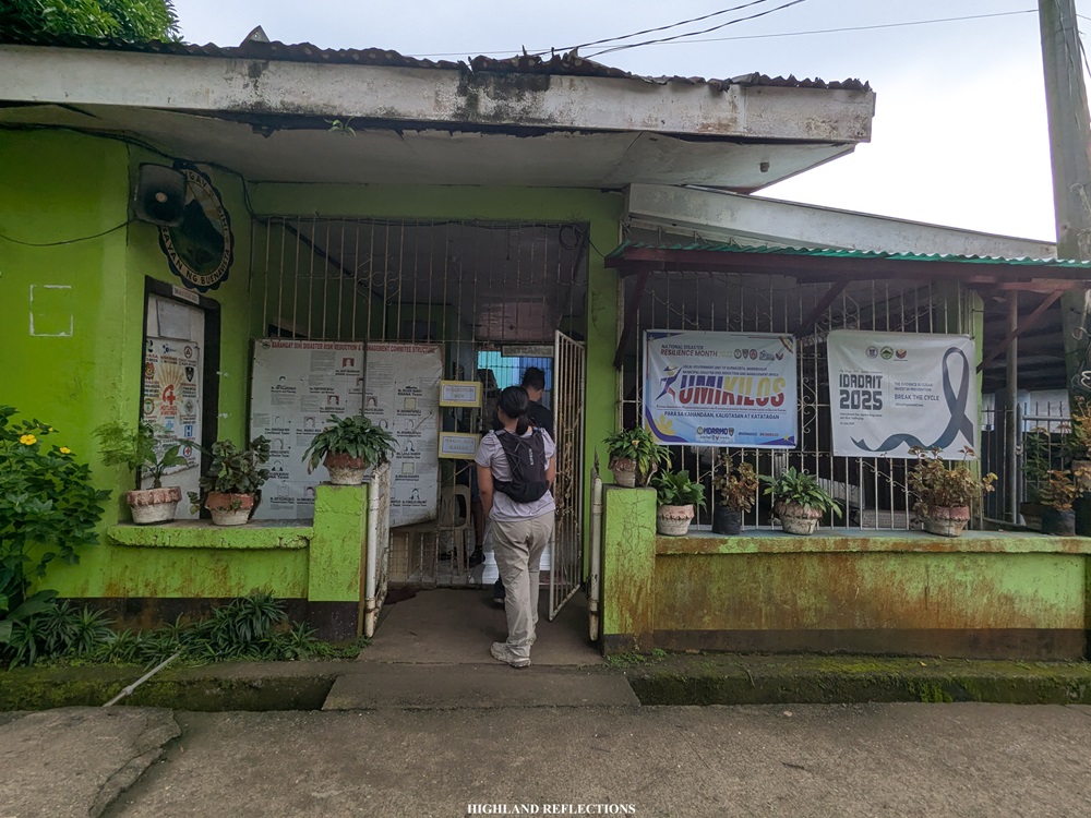
In hiking Mt. Malindig, I joined a Makulilis Peak and Mt. Malindig two-in-one event by Tara G? led by organizer Gie Masangkay. After hiking Makulilis Peak the previous day and spending the night at Briones’ Homestay in Poctoy White Beach together with the other joiners for this event, we went to the barangay hall of Sihi past six in the morning. There, we registered, secured permits, and met our guides. One of the guides was Sir Ruel Estrella, whom hikers may contact when planning to hike Mt. Malindig and Makulilis Peak.

We started the hike at around eight in the morning. Our starting elevation was around 380+ meters above sea level.
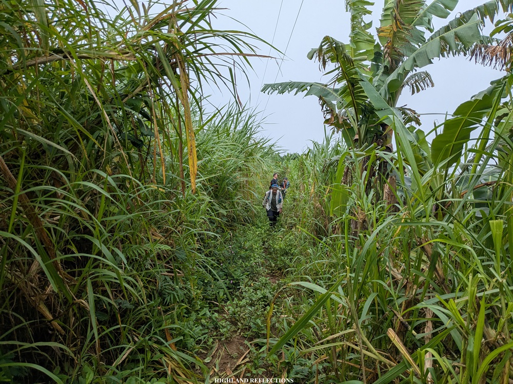
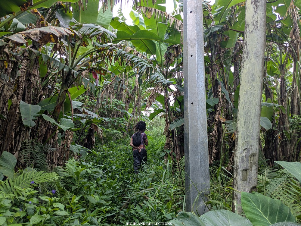
From the barangay hall, we entered into a trail at the side of the road where some residential houses are found. Past these houses is an area with an abundance of coconut and other fruit-bearing trees, where the trail can get extra muddy, as it is where horses and cows also pass through. We gradually gained elevation as we were taking this part of the trail. I can imagine how heavy the air would be if we took this trail under the heat of the sun.

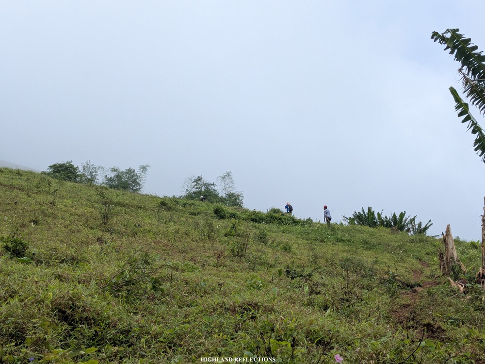
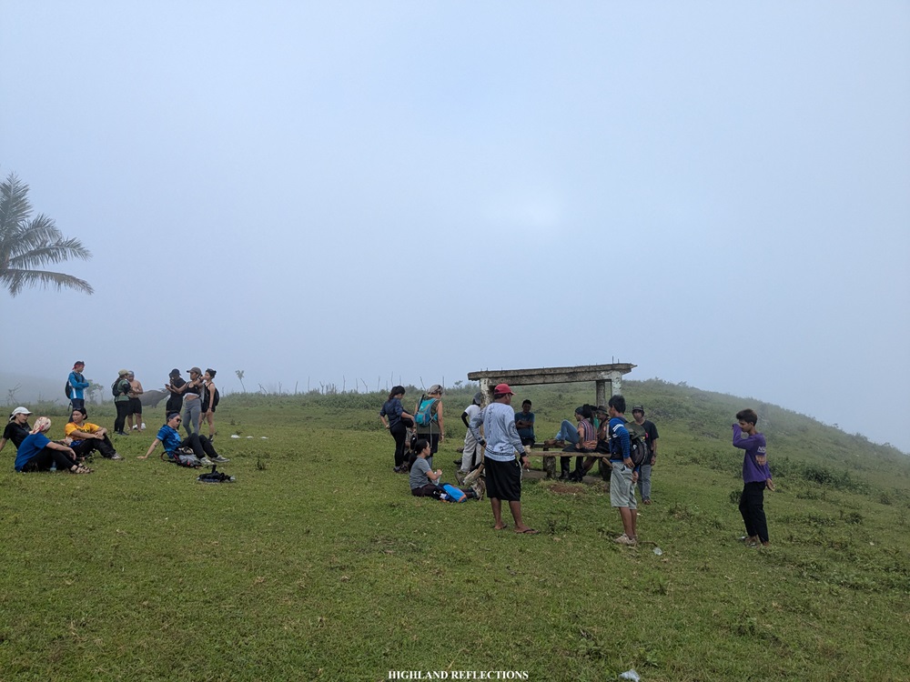
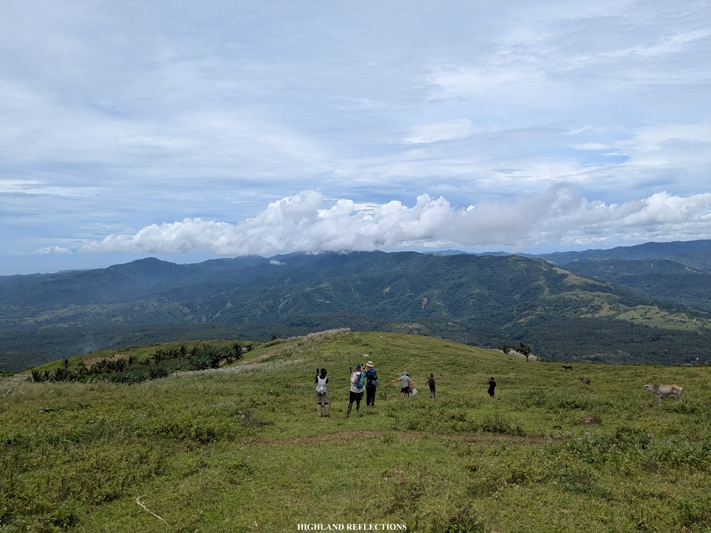
We, then, emerged into a grassland area. From the trail, we made a sharp left turn towards a steep pasture leading to a cemented waiting shed around 720 meters above sea level. All of us in the group took the chance to rest here after getting our legs shocked from the first 300+ meters of ascent! We were welcomed by military personnel manning the waiting shed. Since the hike permit from the barangay goes through them, we needed to seek their approval to push through with the summit assault, to which they did.
During our ascent, fog enveloped the entire surroundings, saving us from the punishing heat of the sun. The downside of this, of course, was that we weren’t able to view the expanse of Marinduque from this vantage point. Fortunately, we would get views of Marinduque and Sibuyan Sea on the way down. More on that later!

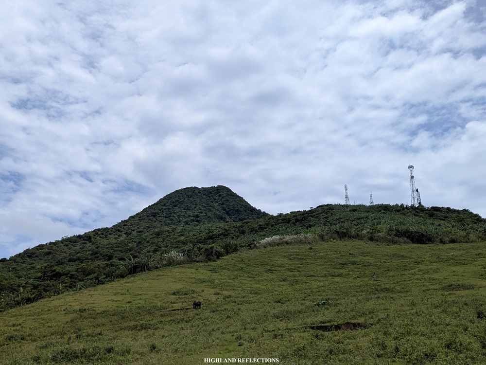
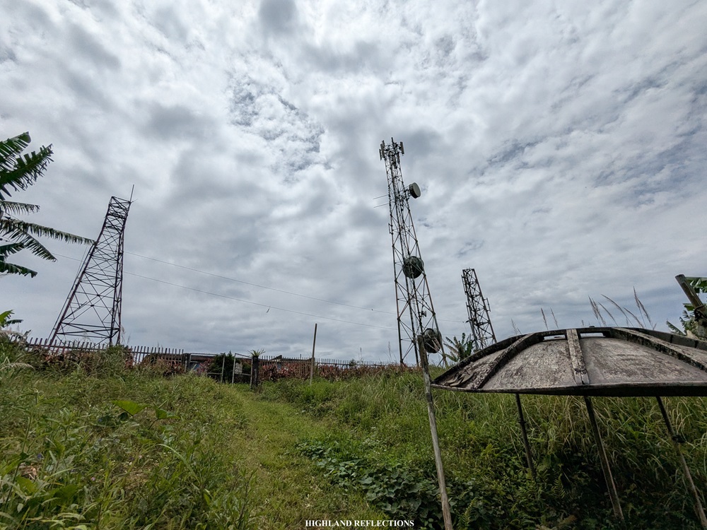
After stuffing my tummy with the trail food that I brought, I continued with the rest of the group in the bid to push through the summit. From the waiting shed, the summit and the radio towers below it can already be seen.
From the waiting shed, we passed through the last few hundred meters of pasture before entering an area filled with overgrown grass dotted with a few electrical towers. It was at this point where I slowly regained my energy, with my entire body entering into a state of flow!
Trees slowly filled the entire surroundings as we were taking the ascent. Then, we reached the radio tower outpost at around 900 meters above sea level. This marks the entrance to the enclosed forest on the way to the summit.

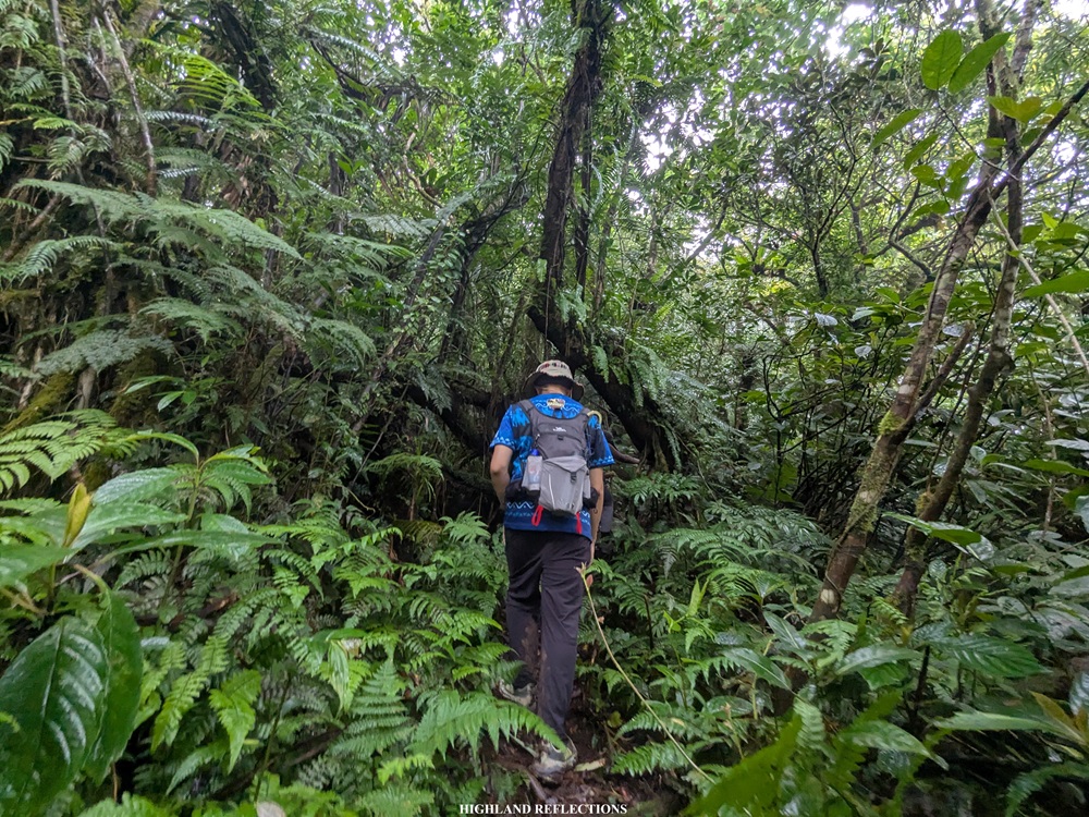
The trail past the outpost followed a steep path, reminiscent of the lush forests of Mt. Hibok-Hibok and Mt. Makiling (I just realized, while writing this, that I haven’t written a blog entry for my Mt. Hibok-Hibok hike!). The ascent continues for a few hundred meters before finally reaching the summit of Mt. Malindig, which we arrived at shortly after ten in the morning. While the summit offers no panoramic views, the dense forest surrounding it more than makes up for it. It’s as if the mountain invites hikers to appreciate what’s within, rather than what lies beyond.
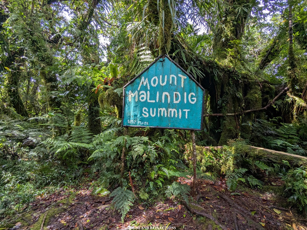

At the summit, we took turns snapping pictures by the summit marker. I also took the chance to eat some snacks before going down. At around 10:45 in the morning, we decided to descend. I was finally able to tag along with the lead group after getting left behind during our previous hike in Makulilis Peak!
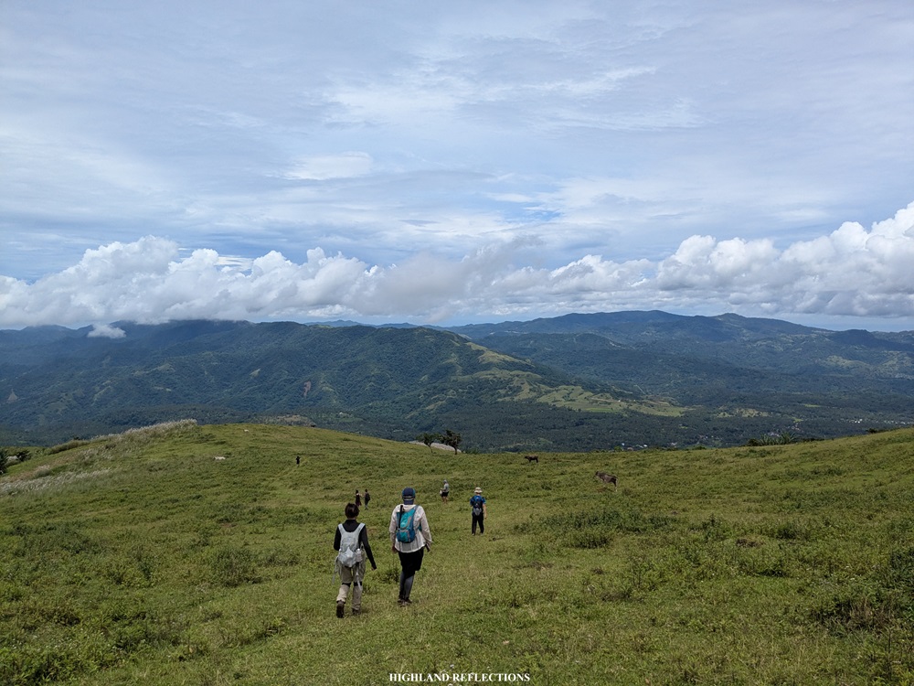
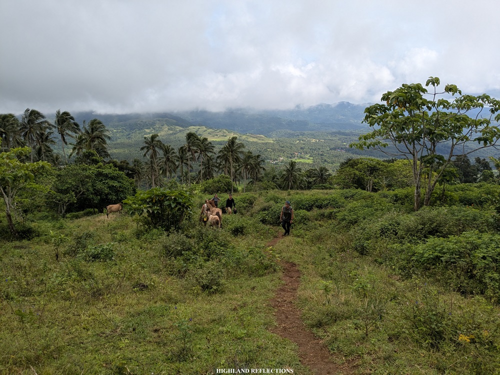
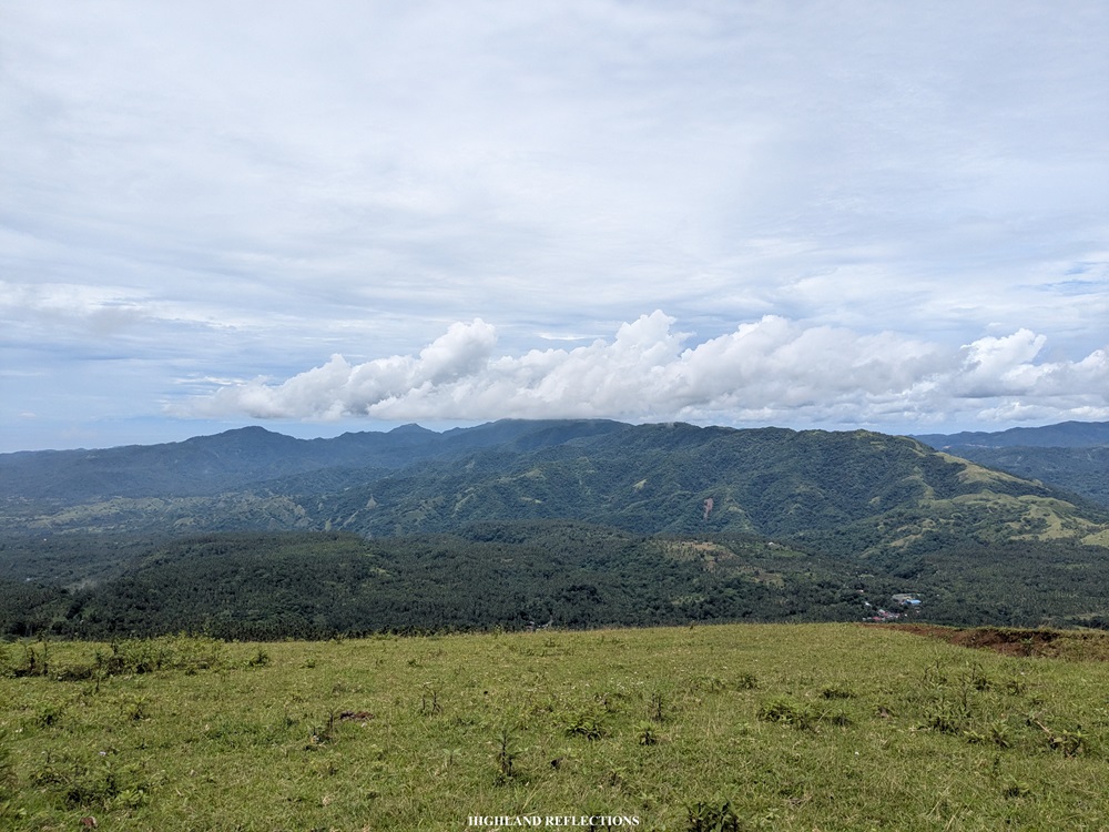
We emerged from the forest into the pastoral area around 11:30 in the morning. By then, the morning fog had already lifted, giving us an expansive view of Marinduque and the Sibuyan Sea. In front of us stretched the rolling terrain of the island, with the coastal town of Buenavista to the left. Just beyond the town lay the vast, blue Sibuyan Sea, dotted with the beautiful Tres Reyes Islands—Gaspar, Melchor, and Baltazar, named after the Three Kings from the story of the Nativity.

We took the chance to rest at the waiting shed and savor in the views. Some of my companions snapped some pictures with the panoramic vista.

We continued with the last push going down. From the waiting shed, almost every one of us took the chance to run on the trail. Along the way, I chanced upon a yellowish and grey snake that slithered across the trail. According to some of my companions, this may probably be a rat snake, or a juvenile Philippine cobra. I was both terrified and awed upon realizing how close I was to such a creature!
Finally, at around 12:15, we were finally at the vicinity of the barangay hall, completing the entire out-and-back hike in four hours! Sans the heat, the trail was very manageable to take on. It would probably be a different story if we took the trail completely under the heat of the sun. The weather during our hike was highly in our favor!
That afternoon, we celebrated with a hearty lunch consisting of sinigang and kaldereta prepared by Gie’s coordinator from Rabas Outdoors, Arnold (who was also our reliable coordinator during my Bakun and Kibungan hikes in 2023). Then, we went home before Super Typhoon Nando hit the country.
I had such a memorable weekend in Marinduque!
On my way home, I felt a deep sense of accomplishment and gratitude for stepping into my 41st out of the 82 provinces of the Philippines—literally hitting the halfway mark! There’s no better way to celebrate this milestone than by being in the very heart, the very geographic center of the country. And of course, topping it off with a hike to the province’s highest peak was the perfect cherry on top.
Marinduque, I’ll definitely be back!
Itinerary
08:00AM Start of hike (380 masl)
09:00AM Waiting shed, rest (720 masl)
09:40AM Radio tower outpost (900 masl)
10:15AM Summit, rest (1,157 masl)
10:45AM Start descent
11:30AM Waiting shed, rest and take pictures
12:15PM End of hike, wash-up
02:30PM Start ride on the way home
