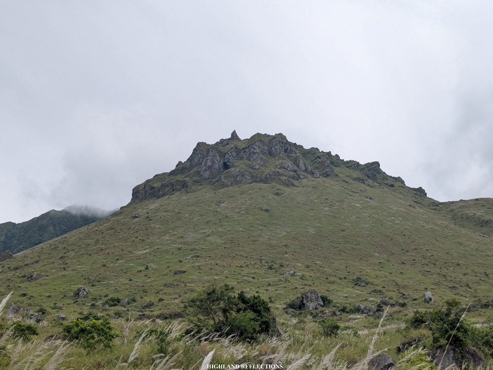
Have you ever been in a place that feels like you’re on the set of How to Train Your Dragon or Game of Thrones—where, at any moment, dragons might hover in the sky and circle the boulders crowning the mountain peak before you—and as a puny human surrounded by otherworldly, gigantic landscapes, you feel a mix of awe and fear at being in the presence of such elements? This is what hiking the Makulilis Peak of Mt. Malindig feels like.
Makulilis Peak is a hiking destination found at the southern face of Mt. Malindig, the highest mountain in the Province of Marinduque. The way up the highest point in the Makulilis Peak trail involves a challenging hike up a 3-kilometer path. This short but terrible hike takes around three to five hours to ascend, owing to the very steep and near-vertical slope on the way to the summit. Thus, some hikers give this a difficulty rating of 6/9, which I agree with!
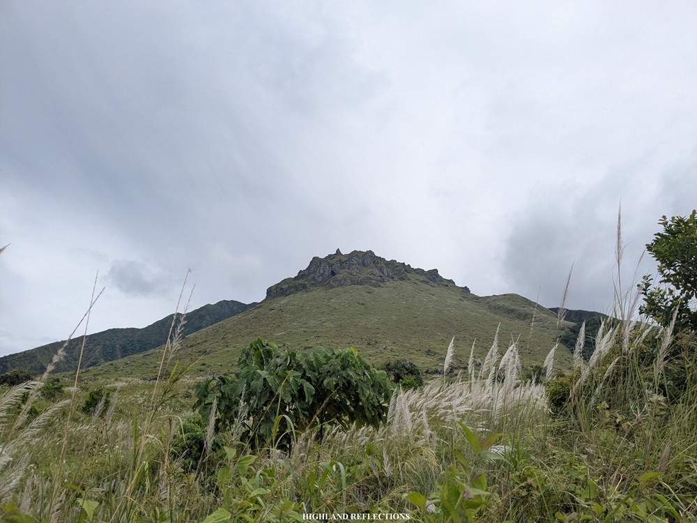
Although it is not the highest point within the mountain complex, Makulilis Peak became well-known for its dramatic view of boulders crowning its upper areas. Interestingly, it was formerly known as ‘Maculiglig,’ which meant ‘a place filled with crickets,’ an allusion to the sound of crickets that locals hear within the area.
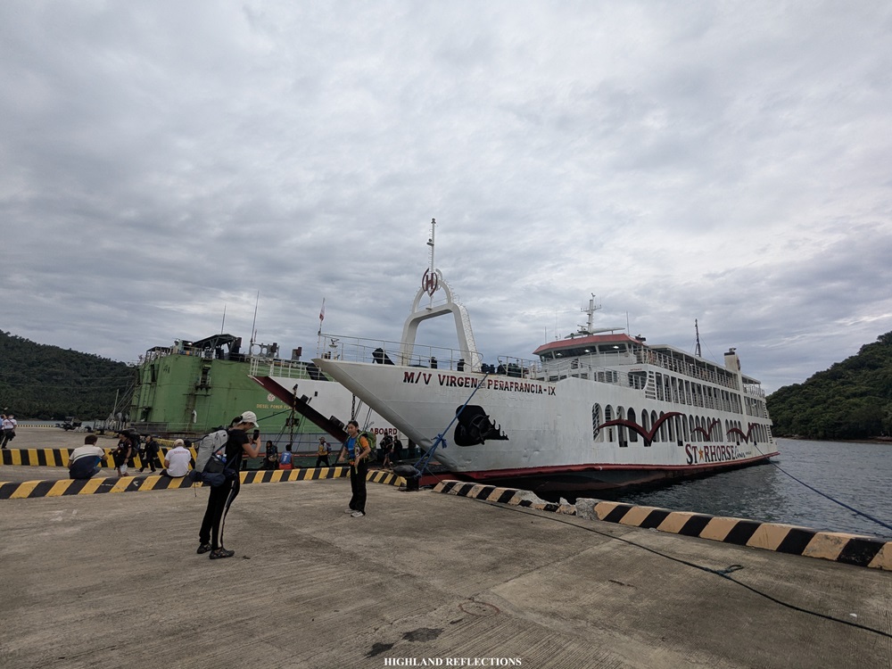
In hiking Makulilis Peak, I joined an overnight two-in-one event by Tara G? led by organizer Gie Masangkay, where we also hiked to the highest summit of Mt. Malindig the day after hiking Makulilis Peak. I was with 30+ other hikers who were also eager to visit Marinduque’s pride. For this event, we rendezvoused at the Dahalican Port in Lucena City, Quezon past midnight, and boarded a ferry that took us to Balanacan Port in Mogpog, Marinduque. We arrived there at around 6 in the morning, stepping on to my 41st province visited in the Philippines!
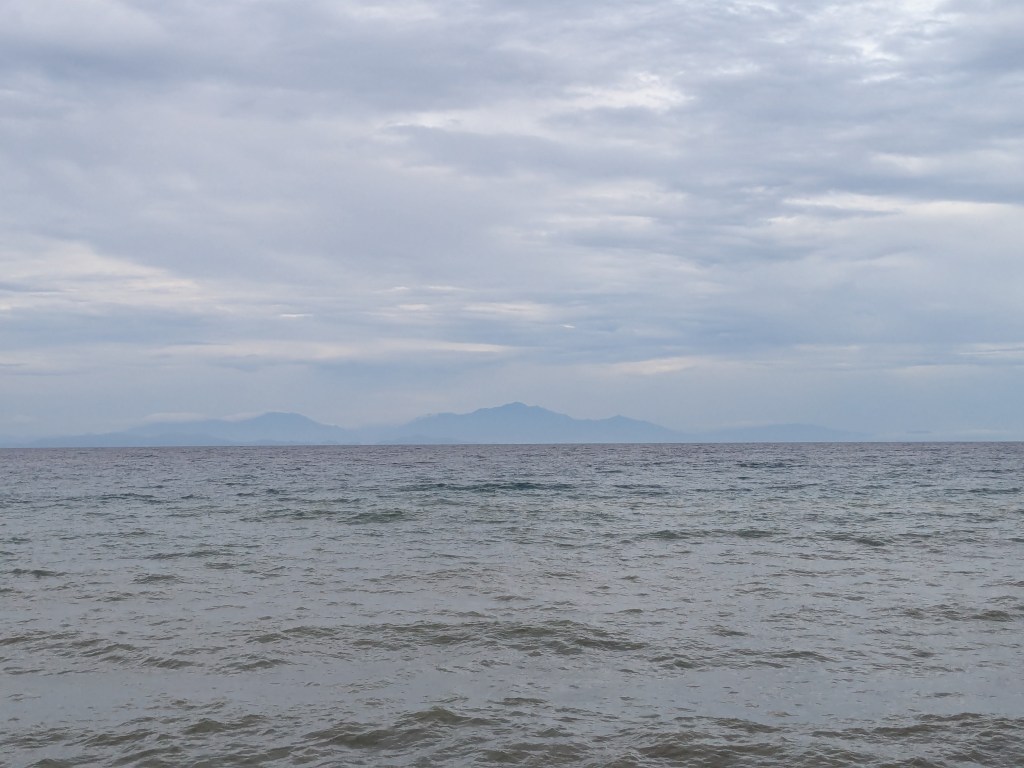
I was at the heart of the Philippines! In the distance, the Mt. Banahaw mountain complex to the north and Mt. Halcon to the west are visible on the horizon.

We boarded two jeepneys that took us to the town of Buenavista to have breakfast, where I ordered a ‘hap/hap’ plate of pancit and rice drizzled with dinuguan and two pieces of longganisa. This was such a much-needed breakfast before taking on the challenging hike!
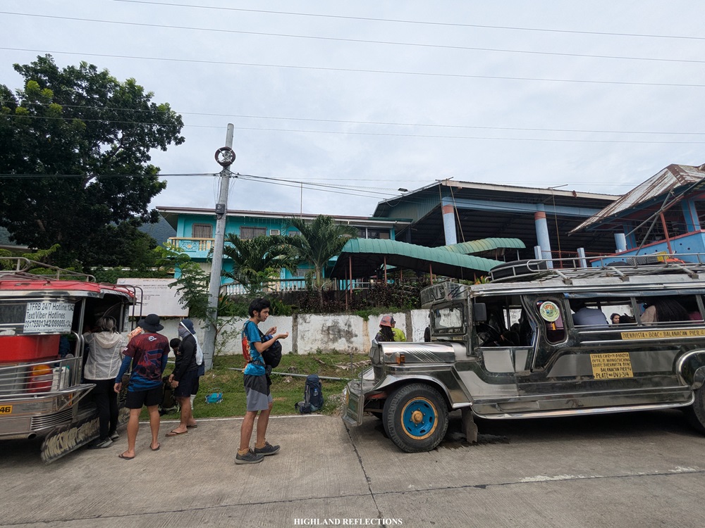
Our jeepneys, then, took us to the barangay hall of Dampulan in the town of Torrijos to register. Then, we backtracked for a little to reach the jump-off point, which was located obscurely at the side of the highway surrounded by a lowland forest. We started the hike at around 9:40 in the morning. Our starting elevation was around 80 meters above sea level.
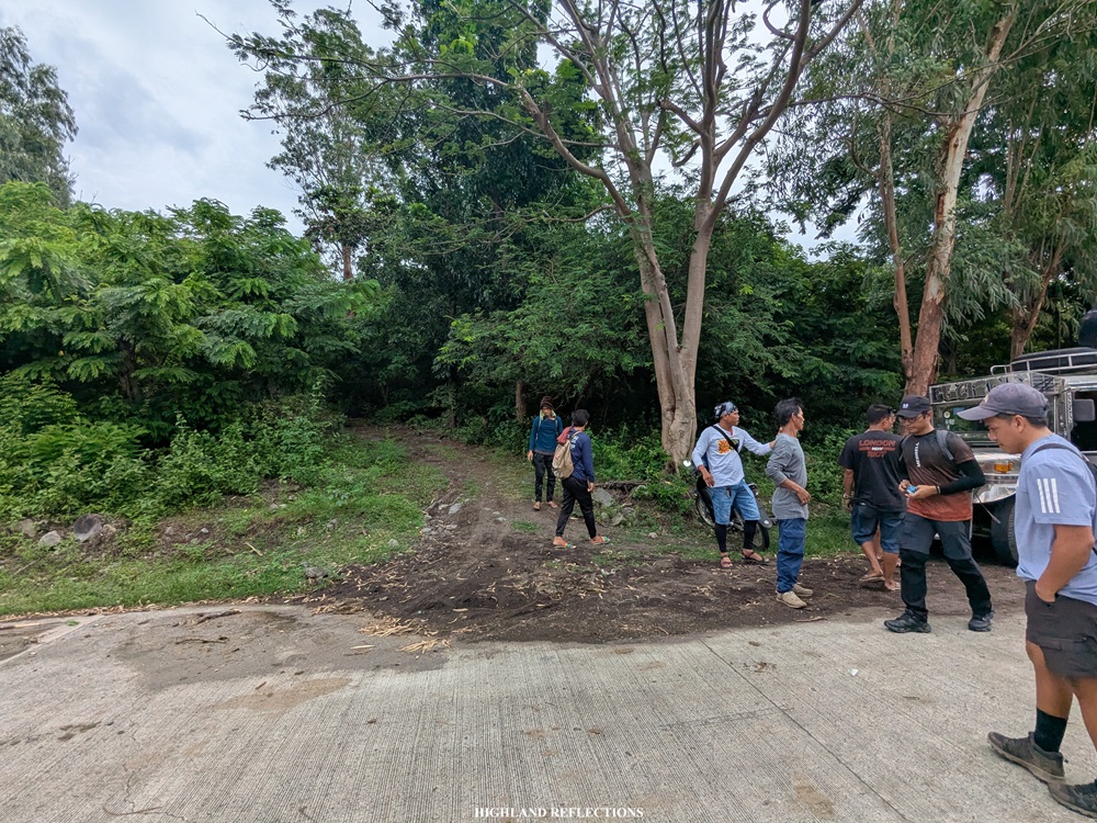
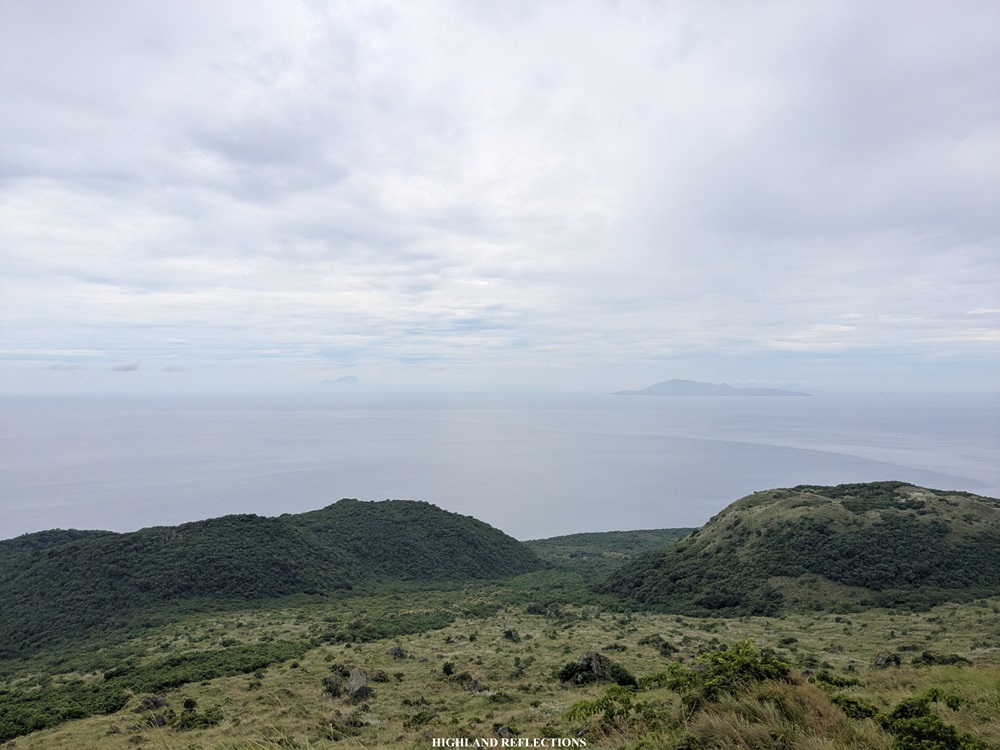
The first portion of the hike passes through a short section of a lowland forest, some sections of which are confusing to navigate through without a guide. In less than an hour, we emerged at an open area with a magnificent view of Makulilis Peak in front of us and Sibuyan Sea at our backs. We could see the southern face of the mountain that we would pass through on the way up! However, despite the beautiful view, the air was quite heavy despite the clouds blocking the sun. I can only imagine how difficult the hike would be if the weather was sunny! In the distance, we spotted the nearby Elephant Island.


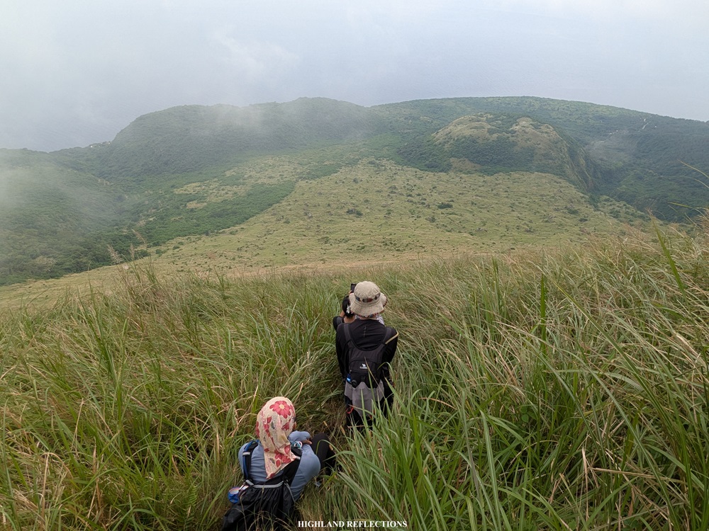
We inched our way closer to the base of the grassy slope. The lower reaches of the grassland were still quite easy to tread on. However, upon reaching around 400 meters above sea level, we felt the brunt of the climb as the grassland slopes got steeper and steeper. I found myself resting at around 600 meters above sea level when I reached a boulder at the side of the trail where I could sit down.
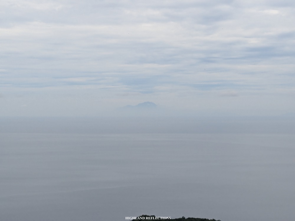
In the horizon, we could see the prestigious Mt. Guiting-Guiting in Sibuyan Island.
Legs burning and heart pumping, pushing through with the remaining portions of the hike was, for a lack of a better term, punishing! As I was approaching the base of the boulder crown of Makulilis Peak, I felt excitement and uncertainty creeping in, the latter for which was whether what lied beyond these boulders.

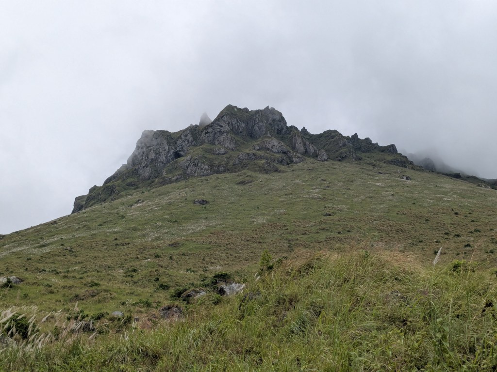
We finally entered the boulder areas past 800 meters above sea level. At this point, we thought that the terminal point of the hike was close by. Little did we know that the peak was still way, way above us!
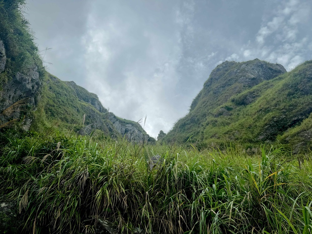
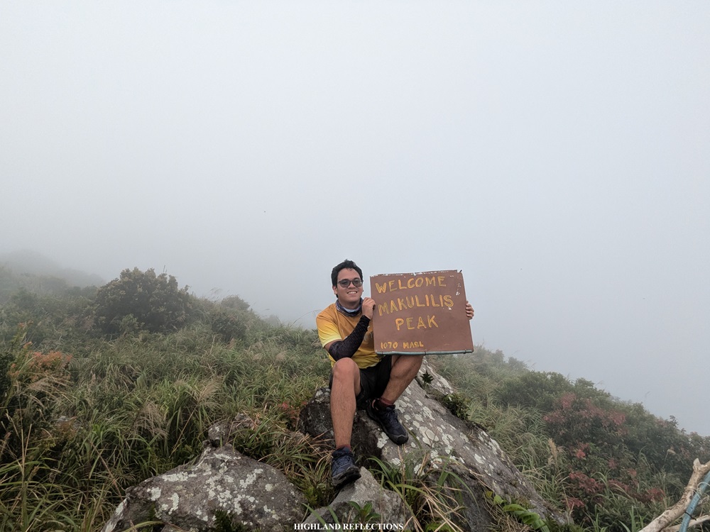
We continued our way up the very steep trail, now surrounded by gigantic boulders and tall grasses, quite reminiscent of some portions in Mt. Guiting-Guiting. Somewhere along the trail was a long roped segment. The rope was strategically placed since the soil in that portion was quite slippery to tread on. Past the roped segment, the final portion involved climbing up some more boulders dotted along the trail until finally reaching the edge of the summit area. It was 1:30 past noon when we reached Makulilis Peak, almost four hours after starting from the jump-off point!
Three kilometers covered in four hours? You can imagine how steep the trail was for me to climb that long.

Atop the peak, fog enveloped the rocky and grassy area. The boulders below and the slopes that we passed through, as well as Sibuyan Sea, were all supposedly visible. Still, I was contended with what I had. Although I would have loved to see the views and imagine dragons hovering above me, I made the most of the accomplishment of reaching this fog-covered peak. I snapped some pictures and munched on my trail food before tagging along with some of my companions on the way down.

While going down, I chatted with some of my companions before getting left behind. I felt the brunt of the trail’s steepness, resulting to exhaustion and some long lone moments during the descent. At some parts, I was using my STRAVA map to make sense of the grassy trail! My mind was all foggy from the tiredness and hunger.

Around 4:30 in the afternoon, I finally reached the forest line. I was musing if I should push through the last forested section of the hike alone or wait for some of my companions. Since I surmised that the ones at the back were still far away, I decided to enter the forest. Lo and behold, after covering a hundred meters, I was already lost! I decided to go back to the grassland area to wait for my companions. Luckily, a couple of hikers arrived.
The three of us tried another path inside the forest. However, we were already lost after just covering a few meters inside the forest. We tried navigating and followed the direction going towards the highway; however, we found ourselves inside the trailless forest. After more than thirty minutes of bushwacking and navigating the forest using our maps, we finally found and exited the trail successfully! The rest of the group was waiting for us, while the sweeper group had not arrived yet. We were thankful to have exited the forest before darkness caught up.
And that was it! Makulilis Peak was truly a challenging day hike—a short but terrible hike at that one! As an avid hiker, seeing the crowned peak was truly one for the books!
That night, we spent the evening at Briones’ Homestay in Poctoy White Beach within the same town. We stayed there for the night before hiking the easier trail going to Mt. Malindig’s highest summit the next day.
Itinerary
06:00AM Balanacan Port, ride jeep going to Torrijos
08:00AM Buenavista, breakfast
09:00AM Dampulan barangay hall, register
09:40AM Start hike (80+ masl)
10:10AM Grassland, start ascent (190+ masl)
12:30PM Start of boulder area (800+ masl)
01:30PM Makulilis Peak (970+ masl)
02:00PM Start descent
05:30PM End of hike, overnight at Poctoy Beach
Our guide for this hike was Sir Ruel Estrella. You may contact him through his Facebook account.

One thought on “Makulilis Peak (965+ MASL) | Mt. Malindig’s Southern Crown”