At the heart of the Zambales Mountain Range lies the coastal mountains of Cabangan, one of the municipalities of the province of Zambales. These mountains, separated from the rest of the larger Zambales Mountain Range by two lahar-filled rivers (Bucao River to the north and Santo Tomas River to the south), are filled with lowland forests and grassy terrains that provide an expansive view of both the land and seascapes of western Luzon.
In the mountain range’s northern portions is the 23-kilometer Cabangan Ridge Loop Hike, more popularly known as ‘Cabangan Hexa,’ a loop trail that traverses six peaks in the northern ridges of the mountain range: Mts. Tabulhik, Matulipok, Capbhukan, Naparel, Bubungan, and Susundalaga. This hiking trail is a contrast to the easier Mt. Mariglem trail, a beginner-friendly hiking destination in the southern portions of the Cabangan Range. The Cabangan Hexa also complements the more difficult Cawag Hexa hike, another coastal mountain range in the town of Subic in the same province.
Here are the characteristics of the hike using the Pinoy Mountaineer format:
CABANGAN RIDGE LOOP / CABANGAN HEXA
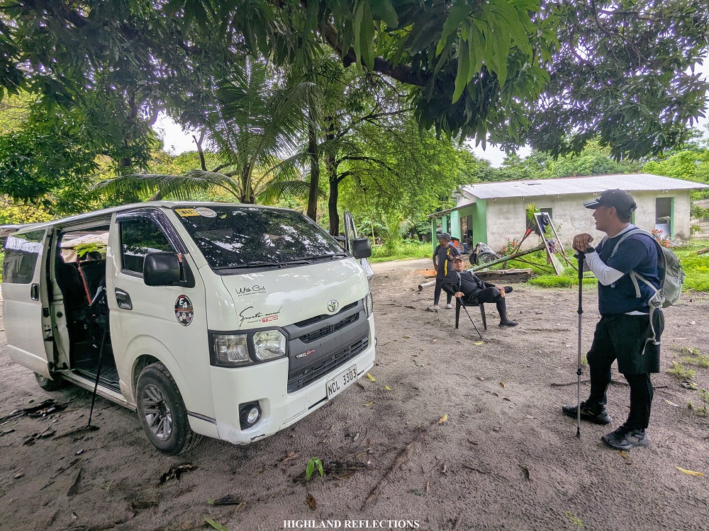
Jump-off point: Cadmang-Reserva, Cabangan, Zambales
Highest elevation: 817+ MASL (Mt. Matulipok)
Specs: Major climb, estimated difficulty 6/9 (subjective)
Trail class: 2-3
Average hours to finish the hike: 12-15 hours
Features: Grassy terrains, view of the West Philippine Sea and Zambales Mountain Range
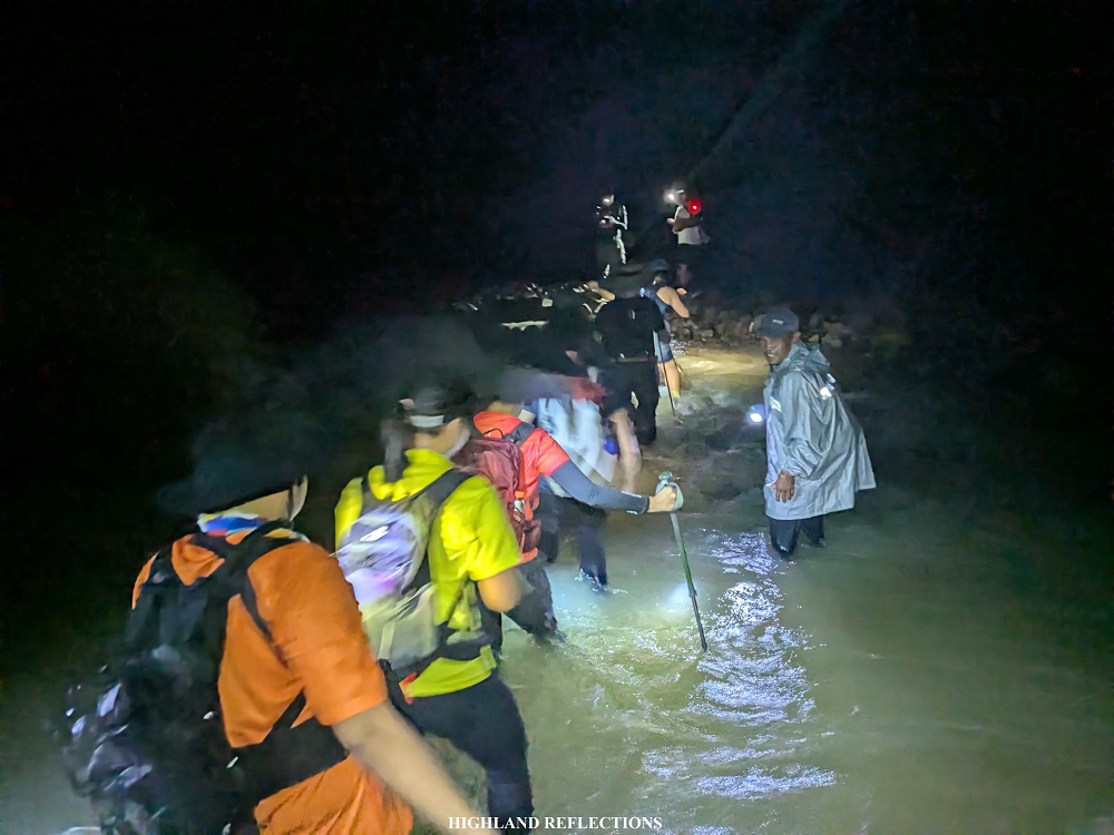
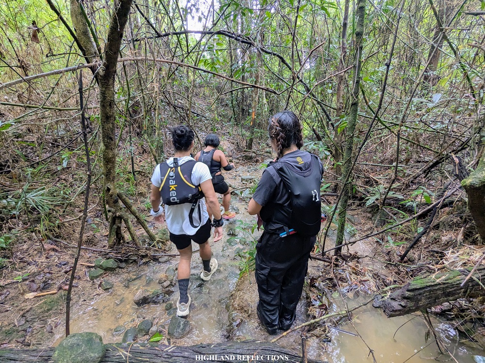
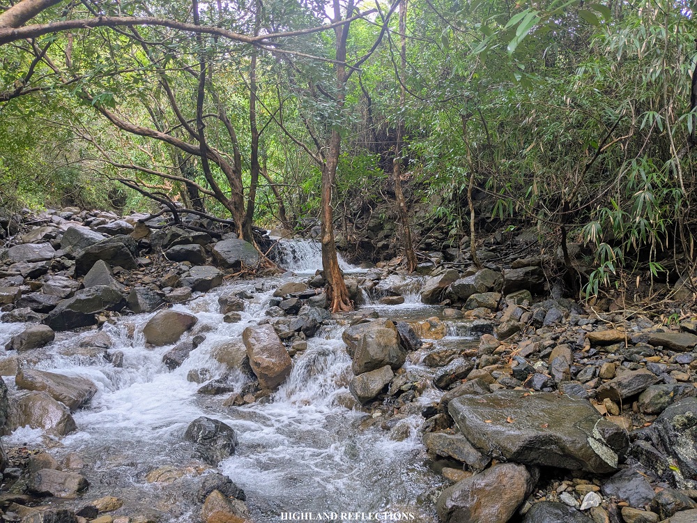
The hike starts at one of the houses of the guide within Barangay Cadmang-Reserva. This area, just like in Mt. Mariglem, is sprinkled with lahar sands. From this area, on we went to a 9-kilometer community path that crosses through the Cabangan River multiple times, reminiscent of the multiple river crossings en route to Mt. Irid in Tanay, Rizal. What’s interesting about this path is that it occasionally passes through grassy fields with groundwater discharge, making parts of the trail wet.
I wasn’t able to count the number of times we crossed the Cabangan River in the dark. What I can remember is that, upon starting the hike at around 2:40 in the morning, we were already required to cross the river near the start of the hiking trail, and that some of the deepest portions of the river was at least knee-deep. Even as we entered into a lowland forest around two hours after starting the hike, the river just keeps appearing, until finally, we were met with an upward trail. Our endurance was tested here.
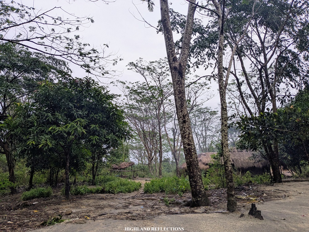
The ascent inside the forest just went on and on until finally reaching a cleared area and a water source. A few minutes of hiking after this, we encountered an Aeta community located 700 meters above sea level. It was around 6 in the morning. The kids in the community were already awake and giving us some curious stares as we were resting. Interestingly, despite being located at the upper slopes of the mountain around 8 kilometers from the barangay proper, the community is filled with the same lahar sand, although the plastics scattered around the community and the nearby forest was definitely an eyesore. I hope they do something about that.
The community marks the entrance to the upper portions of the mountain range filled with tall grasses. From the community, it took us only a short hike before reaching the junction in the middle of the grassland – turning right goes directly to the first peak, while turning left leads to the rest of the five peaks for this hike. We went to the right to visit the first peak!
From the junction, a short, five-minute trail leads to the summit of Mt. Tabulhik, the first destination for the day. It was 6:30 in the morning, almost four hours after starting the hike! My STRAVA recorded less than 9 kilometers of distance from the jump-off point up to the summit of Tabulhik. I was in disbelief that it took us that long just to reach the first summit of the day!
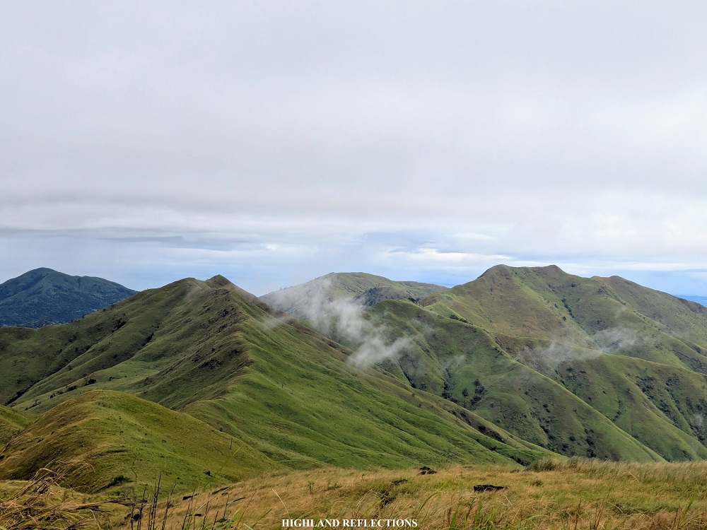
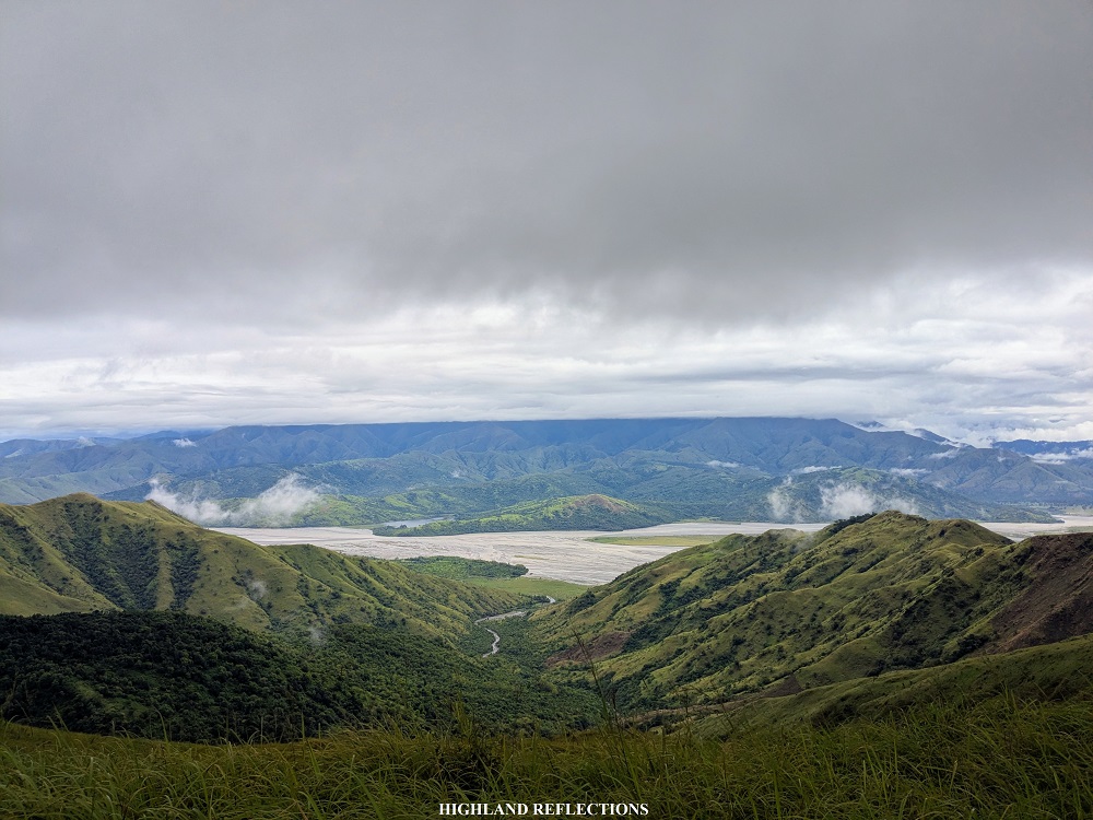
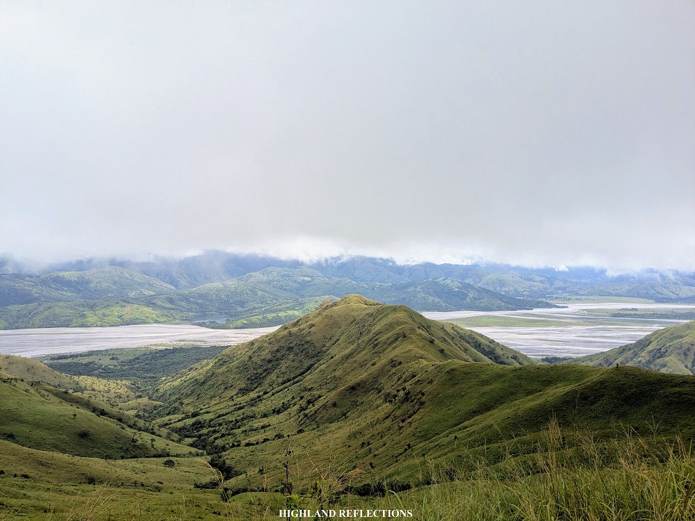
At Mt. Tabulhik, we were graced with beautiful views of the surrounding mountains. Just directly below in the northern direction is the expansive Bucao River filled with lahar fields. Beyond it are the towering mountains of the Zambales Mountain Range where Mt. Tapulao – the highest mountain in Central Luzon – is located. Towards east, the sun is rising, with Bucao River extending towards the horizon and into the valleys near Mt. Pinatubo.
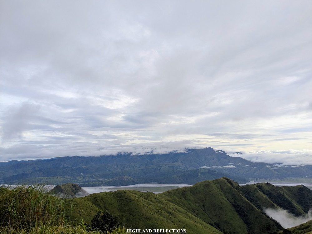

Towards south, I was finally able to spot the highest mountain in the Cabangan Range, the 1300-meter Mt. Lunitan with its forested slopes. Up to this date, only locals have climbed this mountain and is not yet open to the public. Towards west, the second mountain of the loop hike – Mt. Matulipok – can be seen. Beyond it, of course, is the West Philippine Sea.

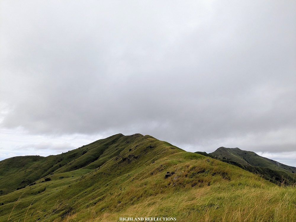
After a few minutes of munching on our trail food and snapping pictures by the summit marker, we continued with the rest of the hike. There was still a long day ahead of us. From the summit of Mt. Tabulhik, we returned to the junction and went on to the other trail onwards to the second mountain. From the junction, we were already greeted with some ascents along a grassy slope. The grasses here were dense! We needed to push our way through some portions in order to move forward.
It took us almost thirty minutes of nonstop walk along a grassy slope to finally reach the summit of Mt. Matulipok. With an elevation of 817+ MASL, it is the highest point in the entire ridge hike (contrary to what the summit signages indicate, where the 4th and 5th summit are the highest). Despite being the highest among the six peaks, the summit of Matulipok has the most basic view, as it provides almost the same vista as that of Tabulhik. We rested here for a bit, snapped some pictures at the summit marker, and went on to the third summit.
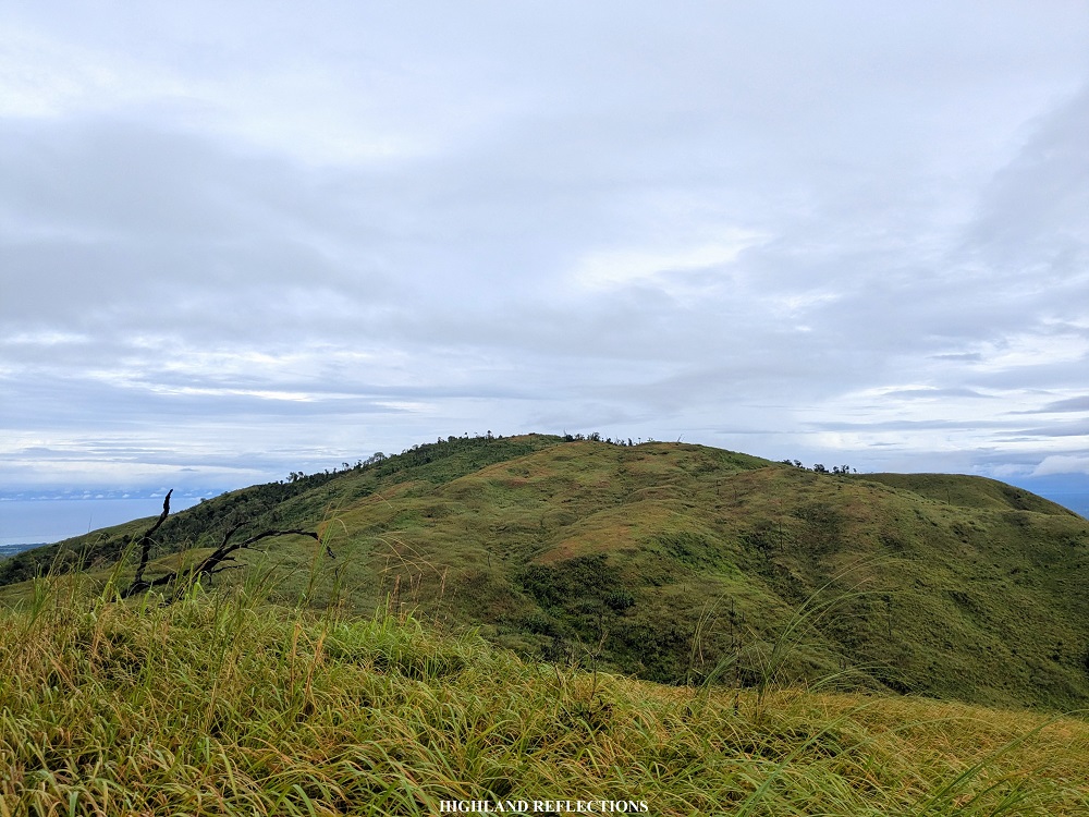
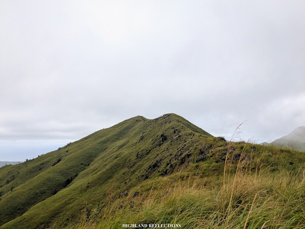
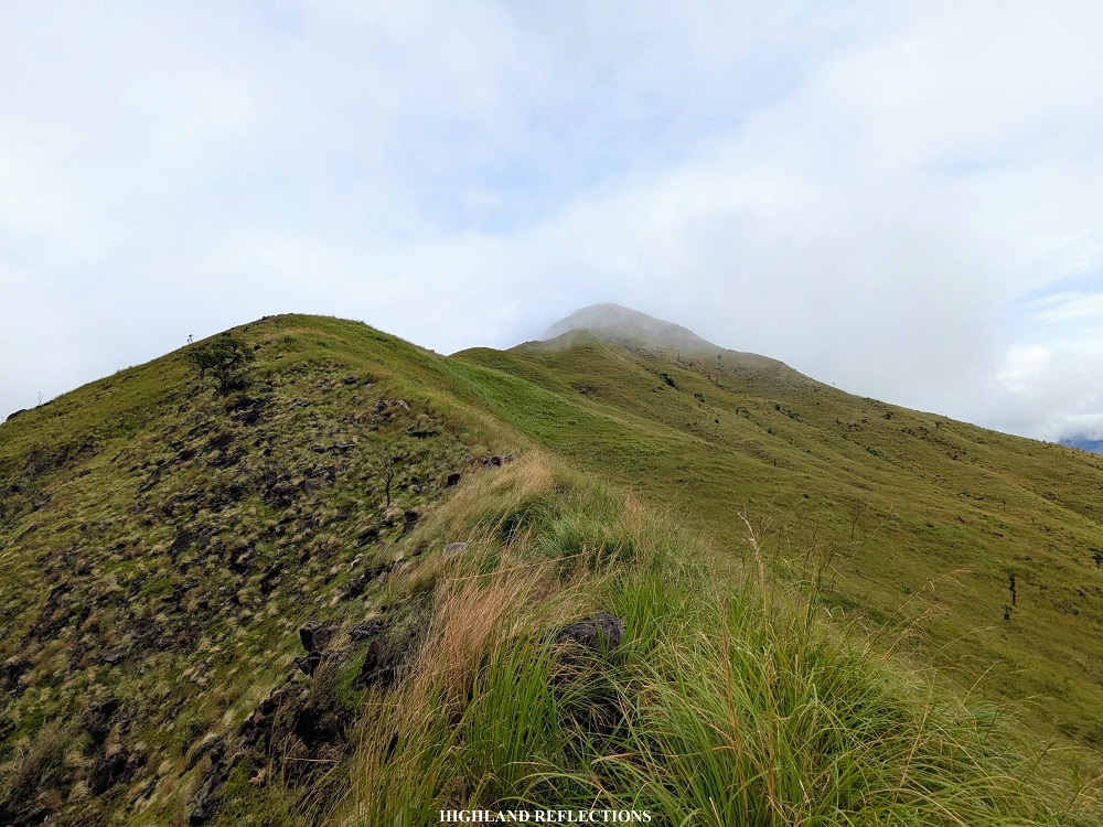
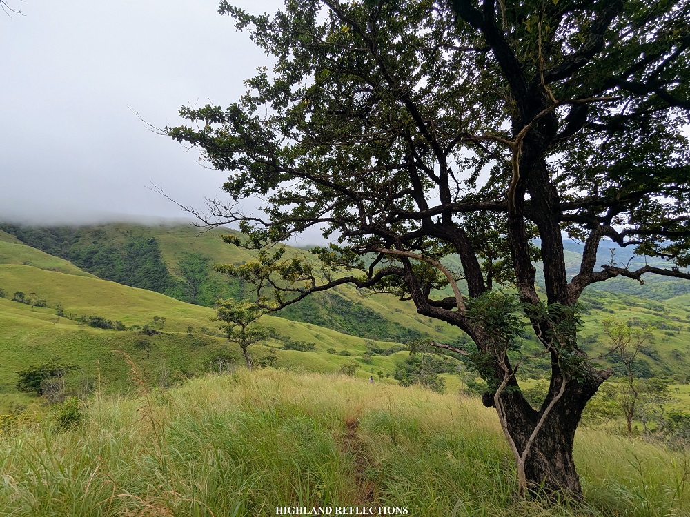
The route to the third summit passes through some sections of a forest at the upper portions of Mt. Matulipok. The trail here was gentle and provided an enjoyable walk, save for some thick undergrowth portions. Just after less than thirty minutes of hiking, we emerged onto a view deck providing a magnificent view of the fourth and fifth summit in the distance! We were at Mt. Capbhukan, the third summit for this hike. Mt. Capbhukan isn’t actually a mountain peak. It’s more of a view deck at the edge of Mt. Matulipok’s slopes before descending to the ridge that connects Mt. Matulipok and Capbhukan to the fourth peak – Mt. Naparel.

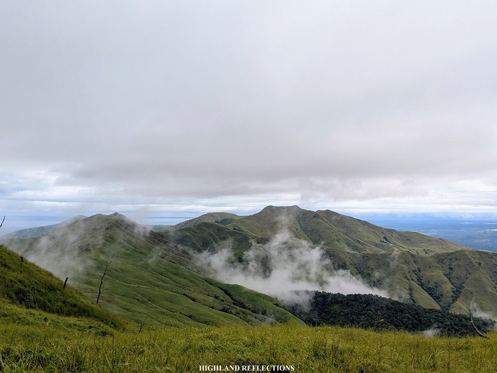

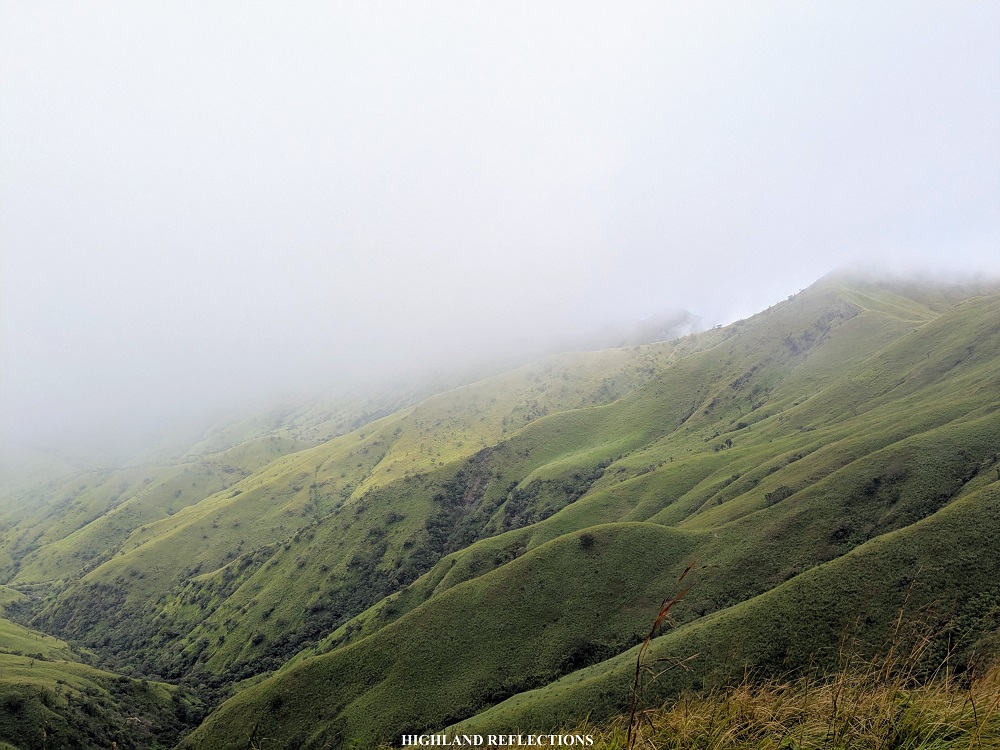
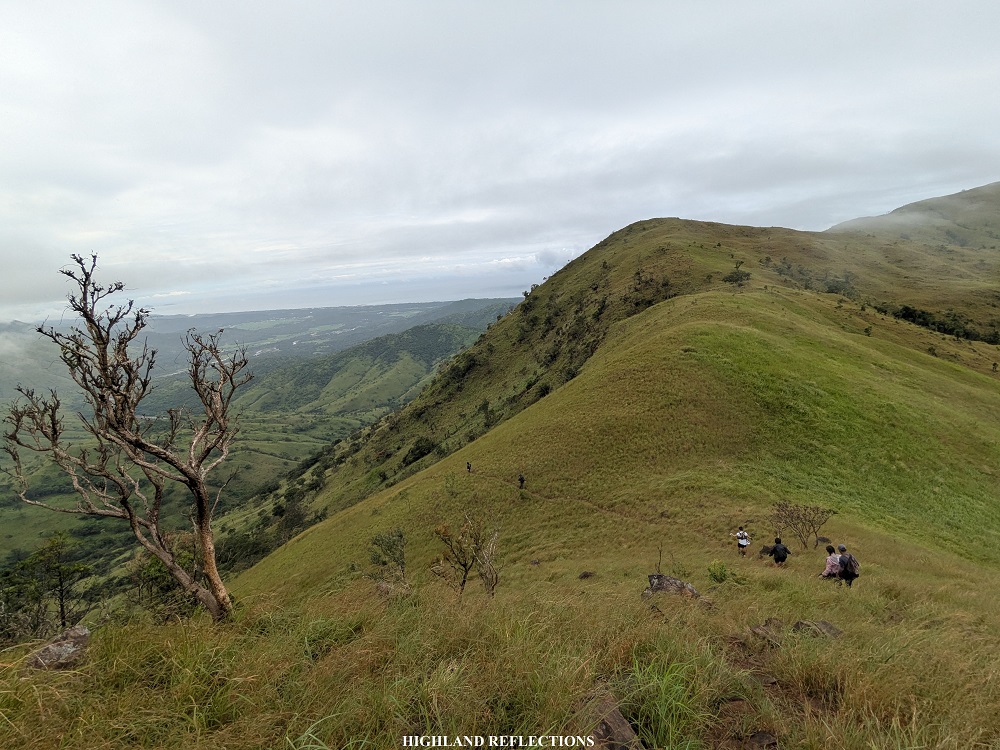
I didn’t spend too much time in Capbhukan as I wanted to finally get some nice views onwards to Mt. Naparel. From Capbhukan, we descended onto a grassy ridge connecting the two mountains. The view here was stunning! To our front is of course, Naparel and the fifth summit, Bubungan. To our right, we got a more expansive view of Bucao River and the lahar fields. Just directly below us are the grassy slopes of the ridge, reminiscent of Mt. Tugew in Kayapa, Nueva Vizcaya. The views were surreal!
The ridge was a long one. It took us some long minutes before finally reaching the base of Mt. Naparel. From the base, we had to climb some smaller hills and some upward knife edges. From there, I finally saw one of the peaks of Naparel, which, upon reaching it, made me realize it wasn’t the highest peak yet, as there was another higher slope in front of me! That slope, apparently, seems to have a waiting shed on top of it.
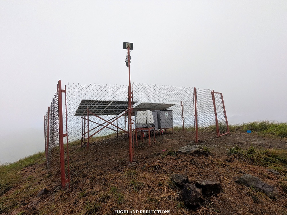
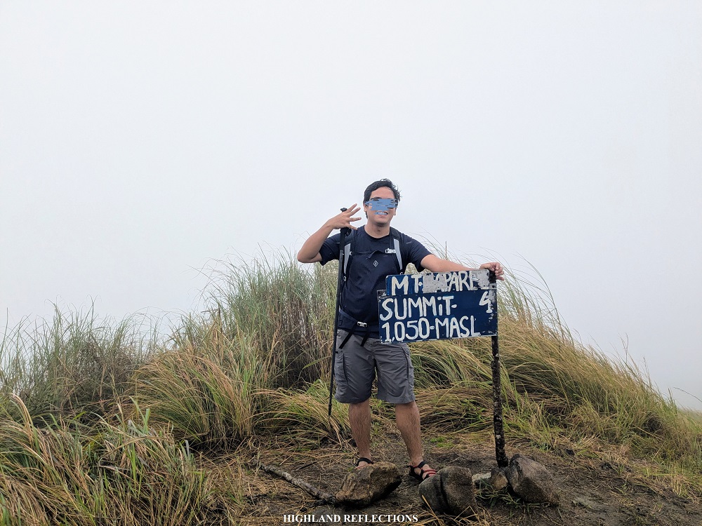
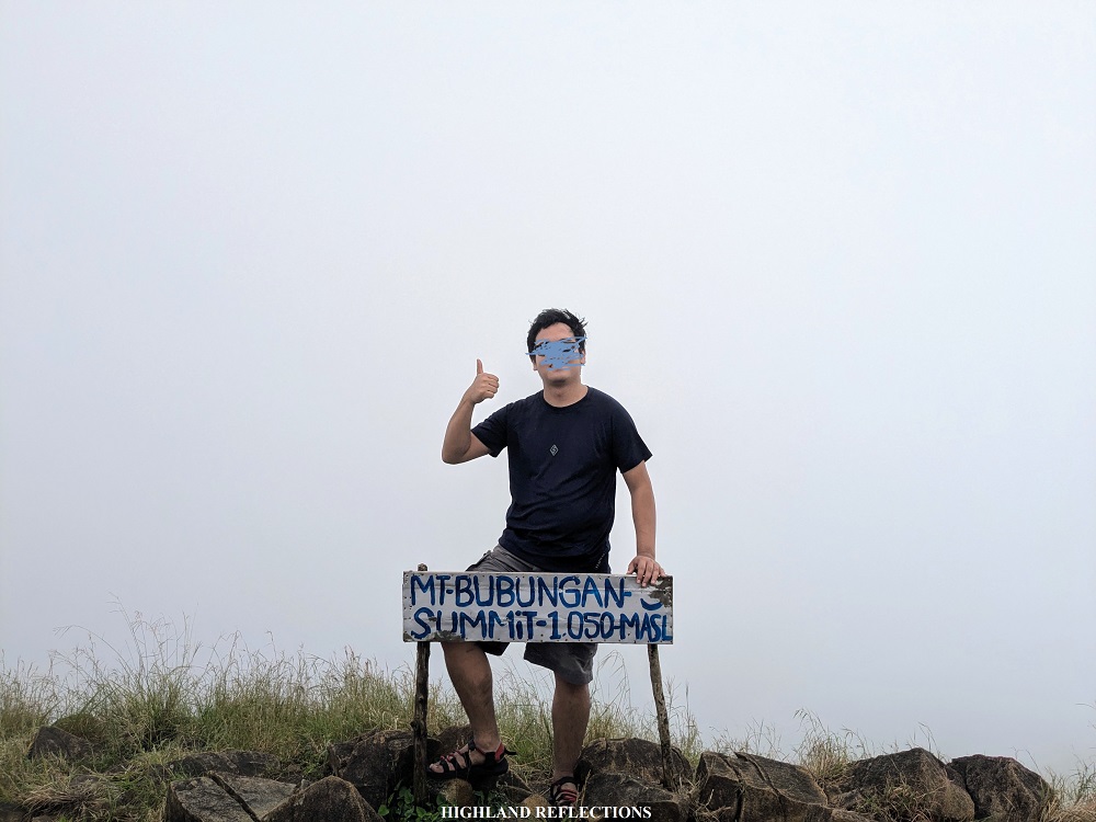
Upon reaching the higher slope, I was surprised by two things: the structure atop wasn’t a waiting shed, but what seemed to be solar panels surrounded by fences, and second, the actual summit was still a few meters away from that area. I had to climb another hill just to reach it! A few minutes from the fenced solar panels, I finally reached the summit of Mt. Naparel at 9:15 in the morning, almost an hour starting from Capbhukan. The peak has an elevation of around 700+ masl, contrary to what the signage indicates of having 1050+ masl.
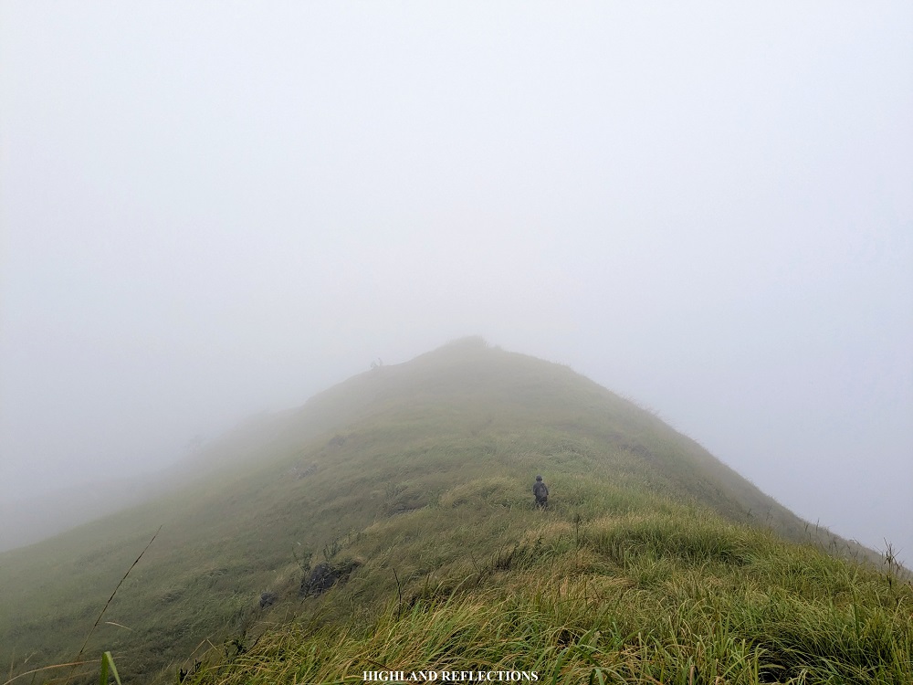
Fog already enveloped the surroundings when I was making my way up Mt. Naparel. At the summit, I took the chance to eat some trail food and get some short rest before proceeding to the next part. Then, I went on to the fifth summit. From Naparel, one would encounter a junction. Going straight goes to the fifth and sixth summit, while there was a sharp left turn that leads to an exit point to the barangay. According to our guide, this was a critical point in the hike, as those who cannot finish the hike can exit via that junction. However, I have read some sources online that the descending trail there was steep.
On I went to the trail to the fifth summit. Just like the trail in between Capbhukan and Naparel, the trail to Mt. Bubungan was on a grassy ridge. In no time, I was finally ascending the slopes of Mt. Bubungan. According to our guide, this was the steepest part of the hike, and it was true! The ascent here was more pronounced than in any other part of the hike. Good thing was that the fog and the high clouds were shielding me from sunlight, else, it would have been a very punishing ascent. Some boulders dot the slope face of Mt. Bubungan, which, again, reminded me of Mt. Tugew.

Before reaching the summit of Mt. Bubungan, I had to cross a narrow knife edge ridge akin to that of the ‘walk of fame’ portion of Mt. Guiting-Guiting prior to reaching its summit. At the end of this ridge is the highest portion of the mountain, where the peak of Mt. Bubungan (750+ masl) is located. It was 10:45 in the morning, taking me almost an hour and a half from the Mt. Naparel. We’ve traversed almost 16+ kilometers at that point!
I took my lunch at the summit of Mt. Bubungan. There, I munched on my chicken burger to replenish all the protein and carbs that I’ve been shedding for this hike. I also slept for a little as I was a bit drowsy due to the lack of sleep for this hike. Then, past eleven in the morning, on we went to the last portion of the hike.
From Bubungan, we had to descend some very steep slopes before reaching the connecting ridge in between Bubungan and Susundalaga, the sixth peak for this hike. I followed our guide and three companions in front of me as we made our way down some grassy slopes where the fog slowly disappeared, until finally ascending shortly towards the sixth summit. At around 11:45 in the morning, we were at the summit of Susundalaga, the final summit for this hike. We’ve already covered 17.5 kilometers at this point!
Interestingly, from Susundalaga, there was another gigantic, 650+ meter mountain slope to our front which I think can also be hiked. When looking at topographical maps, this is the second to the last layer of mountain in the Cabangan Range just beside Mt. Calib-ungan and Mt. Katung-uhan before it recedes to the coast. Judging from its distance from Susundalaga, it would probably take an hour to reach it. I would have loved to check it out, but we were ready to descend from Susundalaga.

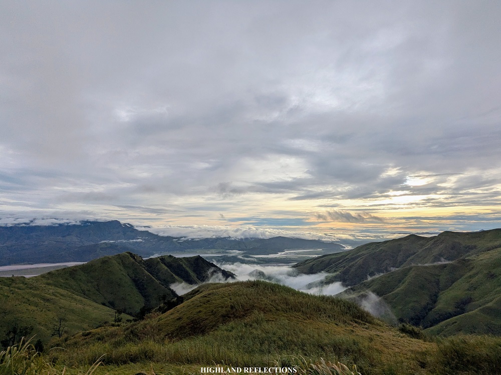
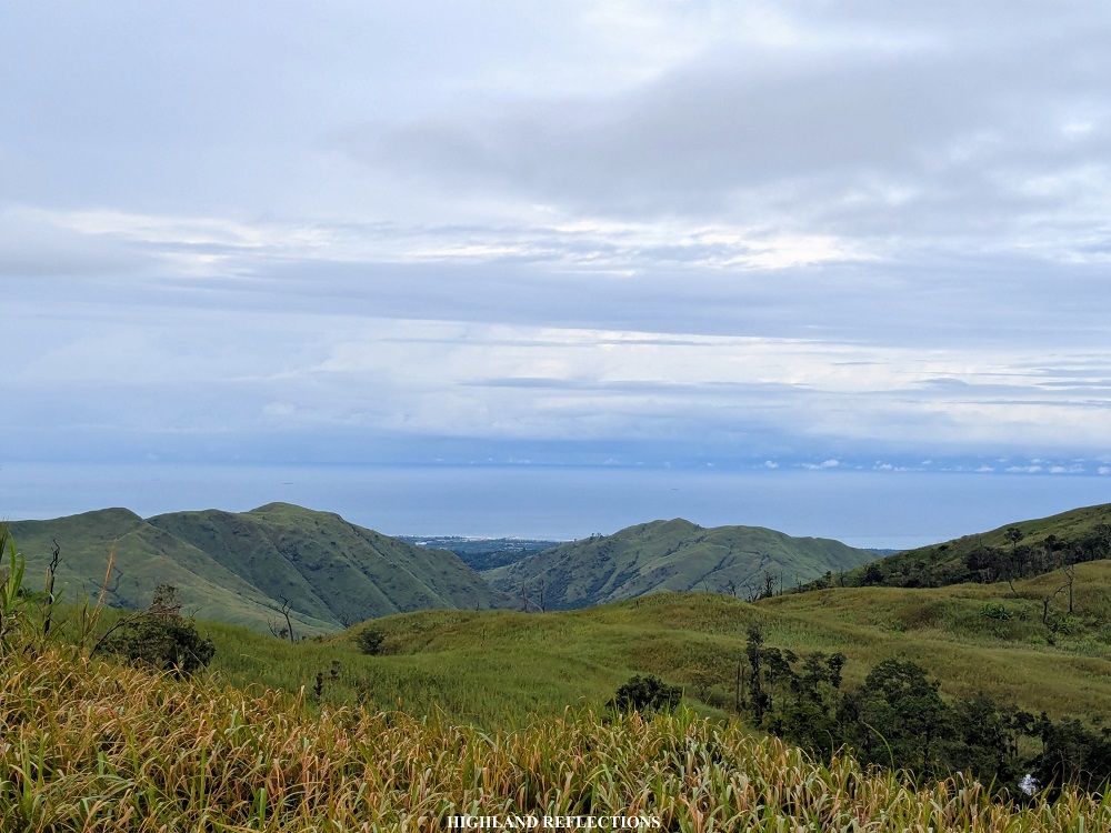
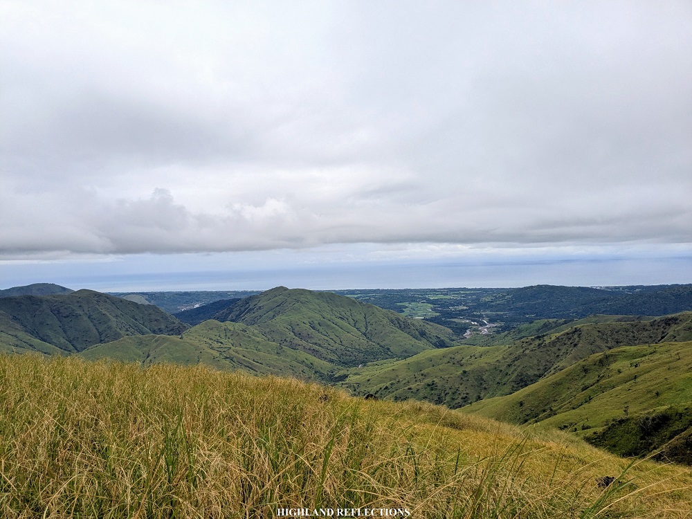
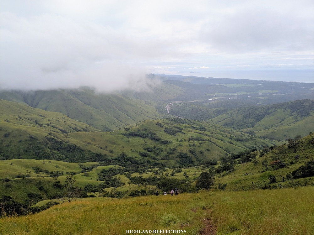
We did not spend a long time in Susundalaga. From the peak, we made a left turn towards the face of the mountain range going down. From there, it was a straightforward 350-meter descent along a carved path on the grassy slope. The view here was magnificent! The entire valley below the mountain range was visible, surrounded by the green grassy layers of mountain ranges. I would have loved trail running this spot if I wore shoes for this hike (I wore sandals given the many river crossings both at the start and end of the hike). We could also spot where the barangay is located, and it seemed very far!

At the end of the descent is where we encountered the first of the three rivers before reaching the end point of the hike. Here, we rested for some long bit. Some of my companions dipped in the flowing water to cool down. Then, we continued the long hike going back to the jump-off point.
From the first river, it was a looong walk on top of a hill filled with dense cogon grasses! It was probably the densest part of the entire hike. I can’t even see my feet with how thick the undergrowth was. I was using my trekking pole to sweep away the grass.
Finally, I reached the second river together with some of my companions. This was perhaps the hardest to cross as the current was so strong that it was resisting my legs from making any motion. Thankfully, I was with some companions who helped in crossing the river.
From the second river, we covered around two kilometers of dirt path inside a lowland forest, reminiscent of the last sections of the Olango Trail in Mt. Guiting-Guiting. It was at this point where I felt the tiredness in my body, as I was probably exasperated from the length of the hike, and that I could already feel some blisters on my feet due to the friction between my skin, the sandal straps, and the lahar sand. Still, I persevered.
Finally, we crossed the third and final river before reaching the rough roads inside the barangay. At 2:30 in the afternoon, we were at the vicinity of the wash-up areas, marking the end of the hike. Cabangan Hexa: Done! I washed-up in one of the comfort rooms in the area and waited for some of our companions to arrive. I joined with some of my companions who were sipping a hot cup of Sumiyaki coffee from UCC.
At 5:30 the rest of the team finally arrived. We went home afterwards, stopping by the town of Subic to have some much-awaited and well-deserved dinner.
**
It was such a fun experience hiking the six peaks of Cabangan. Although some compare it to the nearby Cawag mountains, I think the mountains of Cabangan have their own charm to it, given the presence of lahar in the area and its proximity to both the Zambales Mountain Range and the Tri-Cabusilan Mountain Range where the venerable Mt. Pinatubo is located. I hope the guides there would open the trail to Mt. Lunitan to finally uncover the highest mountain in Cabangan. ‘Til then, we will be enjoying the grassy ridges of the northern Cabangan ridge!
Note: You may contact Dido Caballic on Facebook in hiking Cabangan Hexa. He is one of the prominent mountain guides in Cabangan. For organized tours, you may join an event by Tara G?
Itinerary
02:00AM Cadmang-Reserva, prepare
02:40AM Start hike
06:10AM Aeta community
06:30AM Mt. Tabulhik (KM 9), breakfast
07:30AM Mt. Matulipok (KM 10)
08:00AM Mt. Capbhukan (KM 11)
09:15AM Mt. Naparel (KM 14)
10:45AM Mt. Bubungan (KM 16), lunch
11:15AM Resume hike
11:45AM Mt. Susundalaga (KM 17.5), start descent
02:30PM Cadmang-Reserva (KM 23), wash-up
06:00PM Start ride back home10:00PM Home
