Mt. Napulauan is one of the grandest and toughest mountains to climb not just in Ifugao and the Cordillera Region, but in the whole of Luzon. I was fortunate to experience its majestic mossy forest trail back in 2019 when we did a one-day traverse from the traditional Hungduan Trail in the town’s Poblacion, to the steep Balentimol Trail which showcases two grand waterfalls along its trail. Since then, I have been curious as to what lies ahead of the long-established but lesser known trail of Mt. Napulauan—the Hapao Trail—which boasts of a lengthy mossy forest trail culminating in the UNESCO-recognized Hungduan Rice Terraces in Barangay Hapao. Luckily, Rochelle (Ilocanang Gala), the organizer that I have been joining in my past climbs, organized a traverse to Hapao Trail climb in the summer of 2025.

The Hapao Trail is the longest among the three trails of Mt. Napulauan, stretching for almost 13-kilometers on the northern parts of the mountain. In its upper reaches is a thick mossy forest that is perhaps one of the grandest in the country. If taken as a trail to descend the mountain, the Hungduan Rice Terraces can be spotted from its slopes, and then as mentioned, will be the final leg of the entire traverse. They say that these rice terraces are among the cleanest in the country owing to the sustainable practices implemented by farmers in the town. Another attraction within the trail is the Bogyah Hotspring, located just beside the rice terraces, and can be visited as a side trip along the trail.
The Hapao Trail warrants the same difficulty level as that of the two other trails (difficulty 7/9 using the Pinoy Mountaineer scale). Although not as steep as the Balentimol Trail, its length can tire out even experienced hikers. It’s also important to note that much of the trail is on a descending manner (again, when taken as a descent trail). Combined that with its length and you have a very challenging trail. Still, the attractions that can be spotted within the trail are in themselves very rewarding, and they very much outweigh the challenge posed by the mountain!
Our adventure started when we made a left turn at a junction in the Poblacion of Banaue en route to Hungduan. Upon entering the road to Hungduan, I could already see a lofty mountain ahead of us, in what I can only assume as our destination for the next two days—Mt. Napulauan. As our vehicle traversed the zigzags, we were rewarded with a nearby view of the Hungduan Rice Terraces to our right. We were already glimpsing at what we were to see the following day!
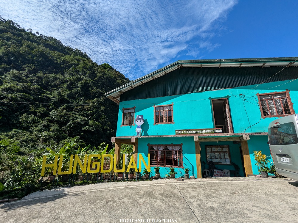
At 8:30 in the morning, we reached the Hungduan Tourist Information Center, where we registered and met with our guides (one of whom was Sir Joseph Madiwo, one of the pioneer guides in Hungduan). I was so delighted to have finally returned to the town after six years. When we did the Hungduan-Balentimol Traverse on a one-day hike back in 2019, we were soaked in the rain and the town was covered in fog, so we didn’t see much of what we saw during this hike. And since our climb back then was a one-day hike, we only saw glimpses of the town when everything was still dark. Hence, my entire system was filled with delight upon seeing what the town looked like.
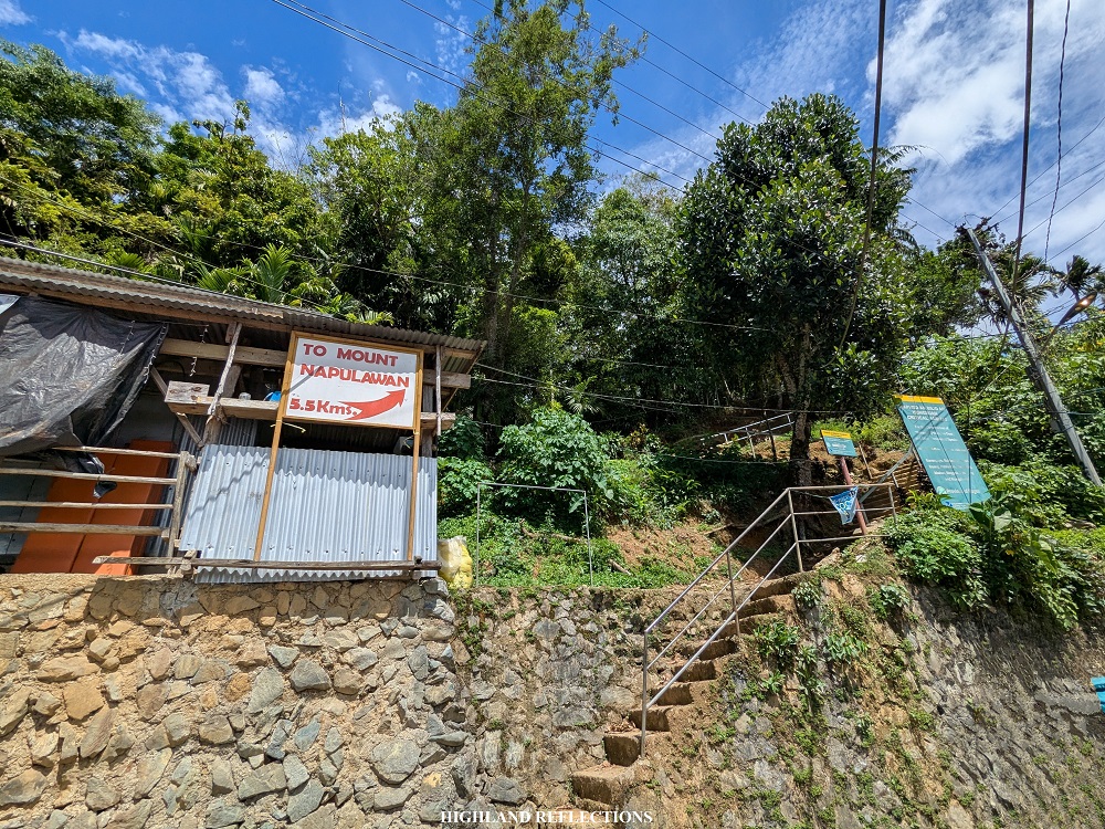
Although the town is a rewarding destination in itself, we did not go there for a casual visit. We were there to enter the mossy domain of one of the grandest Philippine mountains. At 10 in the morning of that Saturday in May, 2025, we started the nonstop ascent to the summit of Mt. Napulauan via the Hungduan Trail, where the trail starts on a steep cemented pathway at the side of the road (1,120+ MASL) in the town’s Poblacion. As with any other hiker who has taken this mountain, we were welcomed by the (mildly) irritating signage telling you that the summit is 5.5 kilometers away from the jump-off point. Although this signage is accurate, the difficulty and sharp incline of the trail makes the hike feel longer!
Since our hike was during the summer of 2025, the first three hours was a punisher. After passing by some residential areas, we took on an exposed trail filled with cogon grass, shrubs, and ferns. I was shocked with the trail’s steepness! Back in 2019, we were taking this trail all covered in fog, so we were not grunting from the heat unlike in this hike. We also had some light packs back then. This time, however, I was carrying with me a full pack all while crawling my way up a trail exposed to the heat of the sun.
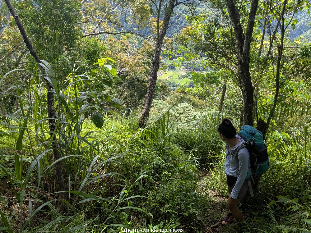
Still, the delight in me did persist, as the heat came with views of the mountain ranges surrounding Hungduan. Although I have no means to name these mountains that I was seeing (since most of them are not really climbed by hikers like us), I was still enjoying the views from the trail.

One thing I noticed during our hike was that the shrubs became a bit thicker compared to when we took on the trail in 2019. Another notable change was that Ny-o camp, which can be reached two hours after starting the hike, has now disappeared into the thick foliage, and was apparently non-existent at this point.
With the heat of the sun scorching me for almost two hours, the tiredness caught up with my body, leaving me almost behind of my companions. Fortunately, I reached the water source along the trail (1,600+ MASL) past 12 noon. There, I took my packed lunch and refilled my water container.
After finishing my lunch, I continued with the hike to push through with the summit camp around one in the afternoon. From this point on, I was alone in the trail. Luckily, there were no forking paths going to the summit, so I was confident in navigating the trail. It was just me and the forest bonding with each other for three and a half hours.
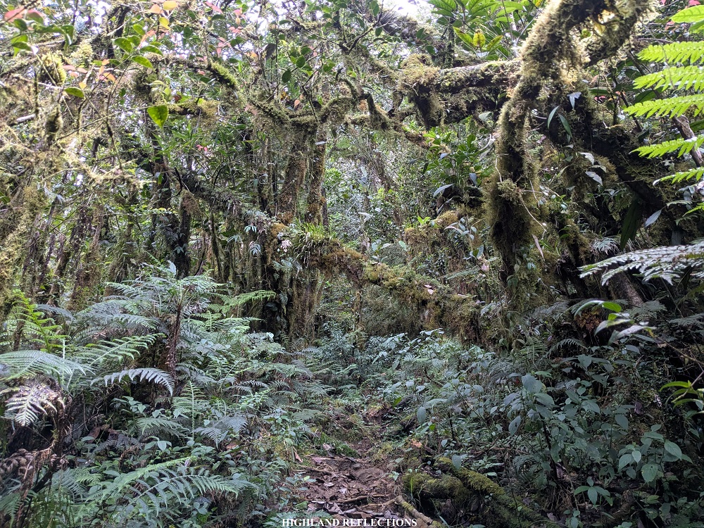
After the water source, the surroundings slowly transitioned from a typical rain forest to having moss covers. This started when I reached an elevation of 1,900+ masl within the forest. The ascent was nonstop, making me rest every few hundred meters of distance that I covered. Good thing was that we took this climb during the summer, so there was no blood-sucking limatik that we encountered. Mt. Napulauan is one of those mountains notorious for its presence of limatik! During our hike in 2019, we encountered several of them past the water source, but they were basically nonexistent at the upper reaches of the mountain.

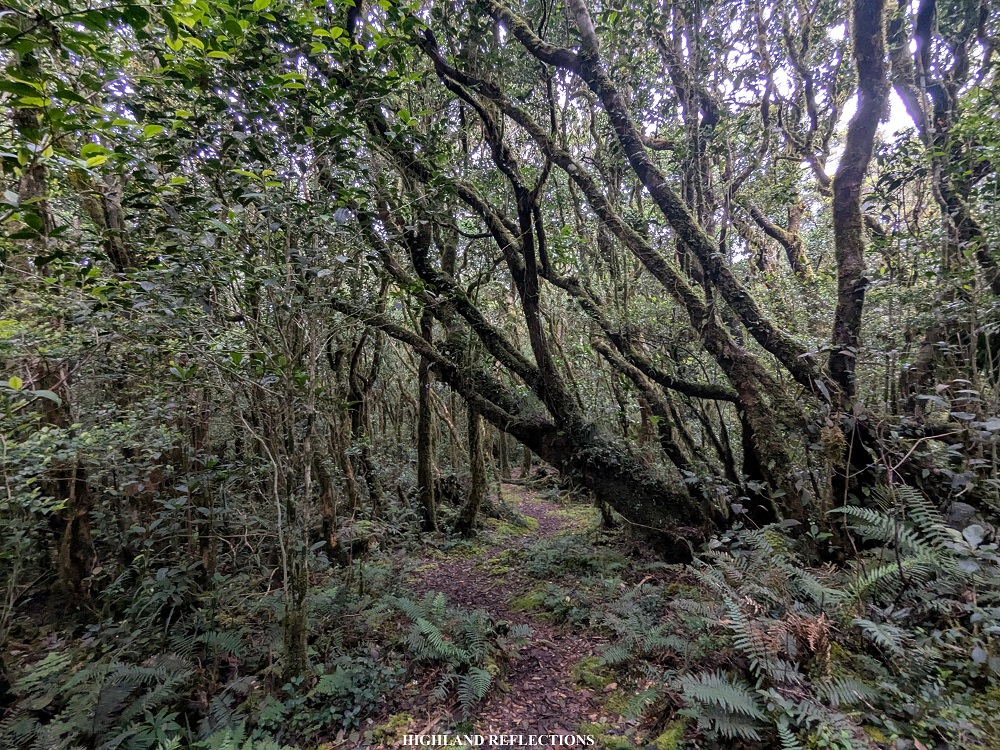
Since I was alone for the entire ascent, I had three things that kept my head busy: One, I was keeping track of my current elevation every thirty minutes. It was fun seeing my STRAVA GPS go from 1600 to reaching 2000 meters above sea level, then, going higher and higher. Another thing that kept me busy was remembering all of the notable spots within the trail. There was a part where the entire ground was covered in moss, and that it was so soft that you would slightly bounce while walking on it. There were also some parts where branches of trees would crisscross each other, forming chaotic structures that was equally terrifying and awe-evoking, reminding me of some classic horror story visuals. There was another spot where the trail was in between two large trees, and passing through it felt like entering a new dimension. It’s kind of obvious at this point that I was reliving the child-like wonder that I had when I first took this trail in 2019. Another thing that kept me busy was, of course, my own musings and anxieties.
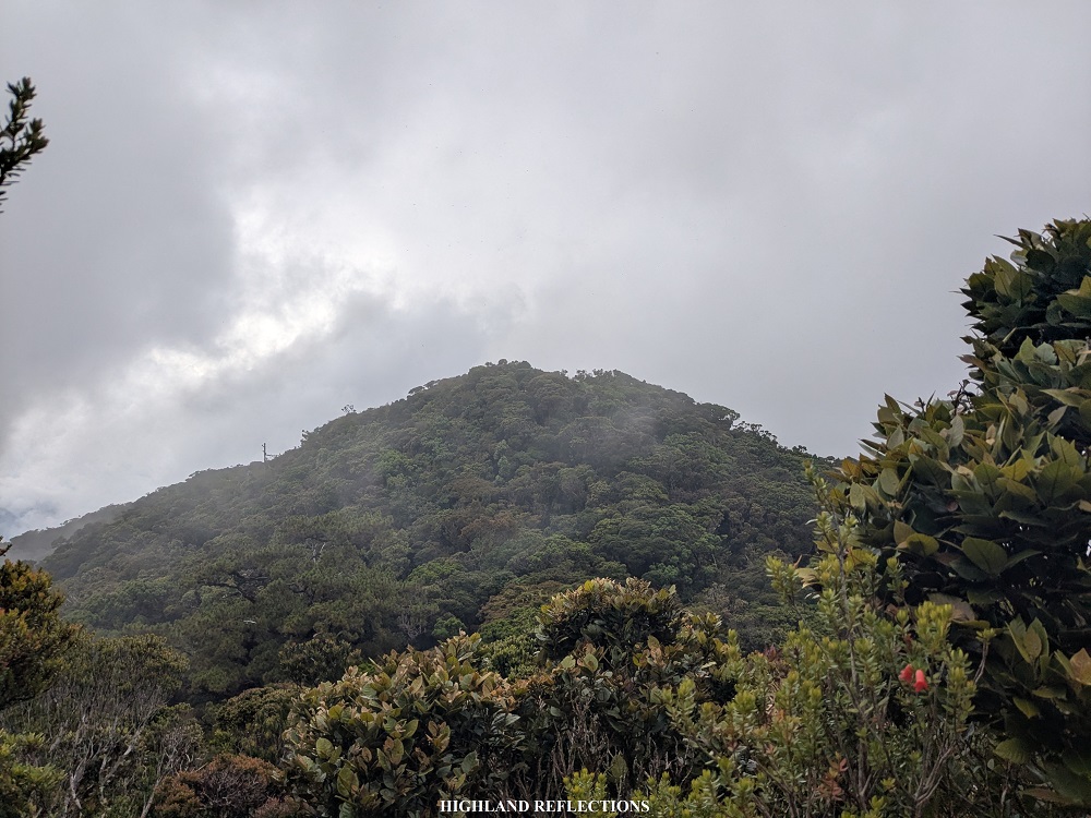
In no time, I reached the upper reaches of the mountain. When I started to notice that the trail was flat, and that the trees gave way to an open area inside the forest blanketed in moss, I knew I was close. There was a point in the trail where you could see the summit from the trail, and you would think to yourself, “that’s still the summit? It looks far!” But in actuality, it was just a short descent-then-ascent before reaching it.
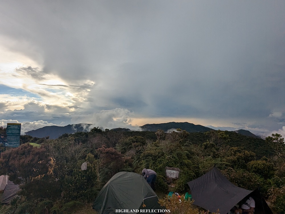
It was 4:30 in the afternoon when I reached the summit. I finally made it up top! The summit is a small open area where tents can be pitched, surrounded by bonsai-like trees. By the time that I arrived, our companions had already set up their tents. God, it was good to be back.
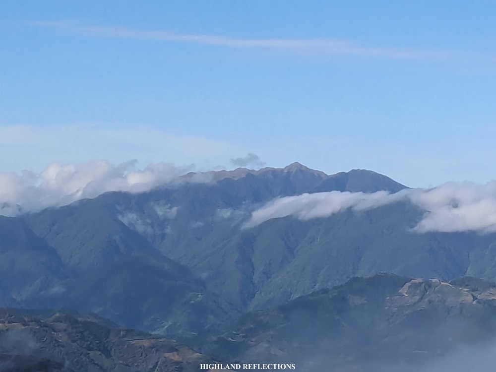
Being at the summit did not just feel good because I was on it, but also because I was finally able to see the nearby and faraway mountains from atop! The most notable mountain that I spotted that afternoon was Mt. Amuyao in the northeastern direction. It was clearly distinguishable as it towered over its neighboring mountains. Its distinct shape, which I have seen from Mt. Pulag multiple times, was also the reason why I easily spotted it.
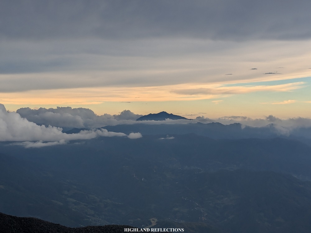
Turning towards left of Mt. Amuyao, particularly in the northern direction, I spotted a nearby dome-shaped mountain that seems to be much higher than Mt. Napulauan. It can be no mistake that this is Mt. Kalawitan in Sabangan and Bontoc, Mountain Province! To the left of Mt. Kalawitan, a view of Mt. Napulauan’s nearby slopes is visible. In the western direction, a mountain slope conjoined with Mt. Napulauan can be spotted, in what I can only assume as Mt. Kapiligan, one of the unexplored high summits of Luzon.

On the south and southwest direction, some cumulonimbus clouds were blocking the view of faraway mountains. I would be able to see them the morning of the next day.

That night, we had our well-deserved dinner. Afterwards, we slept. We needed this rest as we would be taking the longer Hapao Trail the next day.
The following day came. Our companion’s drones were circling up the sky, waking me up in the process. It was such a good day to wake up, as I saw the surroundings complemented by the blue sky on top of us.
In the south and southwest direction, I spotted our highest mountain in Luzon, Mt. Pulag. To its right, a dome-shaped forested mountain can be seen. This was Mt. Tabayoc, the second highest mountain of Luzon. Turning right of it was another high mountain with a pointy peak—Mt. Timbak, Luzon’s third highest mountain! It was such a treat seeing the three highest mountains of Luzon, together with the two other high peaks—Mt. Amuyao and Kalawitan—from another high peak here in the Cordilleras.
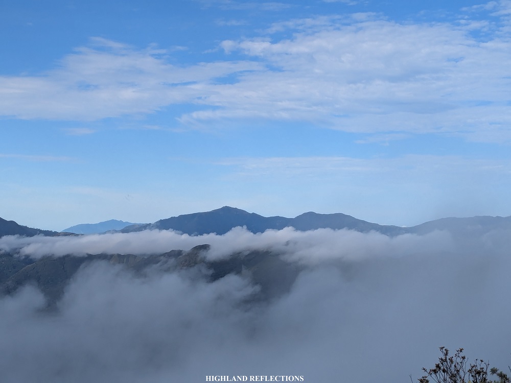
There were other notable mountains that I spotted from the summit. In between Tabayoc and Timbak, a view of a faraway lofty mountain can be seen. With its distinct geographical shape and drawing from its location, it was most probably the 2000-meter Mt. Santo Tomas in Tuba, Benguet, which towers above Baguio City. To the direction of southeast, there was a small clearing where the valleys in Nueva Vizcaya can be seen. One mountain that stood out here is Mt. Palali in Quezon, Nueva Vizcaya.

After savoring the views on top of Napulauan, we had our breakfast. Then, we broke camp. It wasn’t muttered into words, but I think all of us were very excited to take on the Hapao Trail.
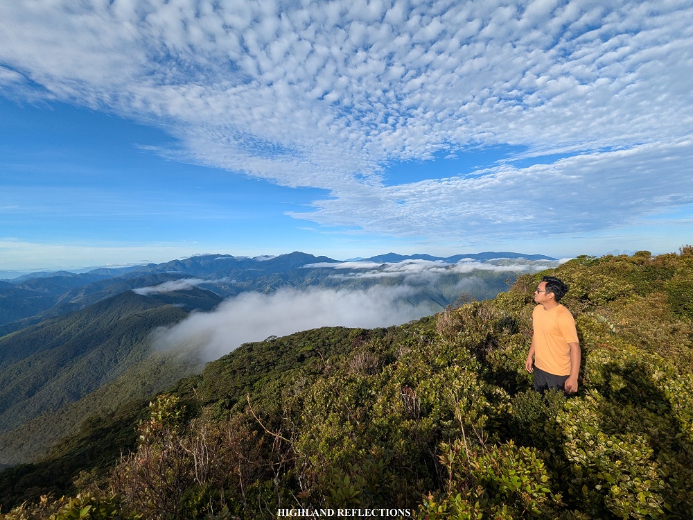
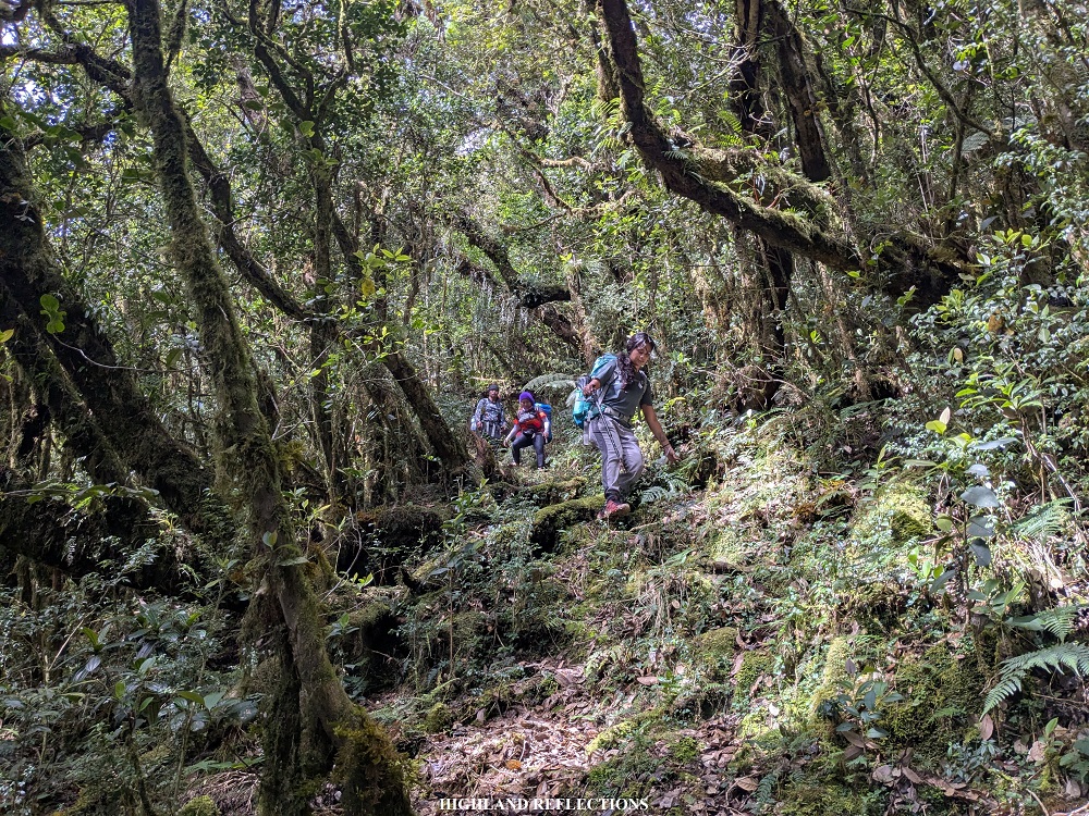
We started the descent at 8 in the morning. The start of the trail is at the rear part of the summit. Just shortly after entering the mossy forest, we encountered a forked path. The trail to the left leads to Balentimol Trail, while the trail on the right follows the Hapao Trail. Right we went!
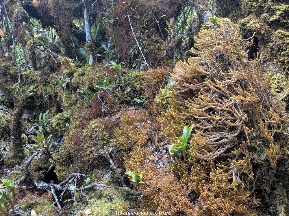
As I have mentioned in the earlier parts of this blog, the mossy forest in the upper reaches of the Hapao Trail is surreal. The immaculate forest was covered in thick yellow green mosses. It also helped that the trail was not too steep yet, so we were enjoying the up-and-down walk. Our guide, Sir Joseph, said that the trail remains walkable despite hikers seldom visiting the trail. According to him, when they revisited the trail after the lockdown due the COVID-19 pandemic, the trail was still very clear! Still, it had some challenges, as we would sometimes encounter fallen trees blocking the trail.

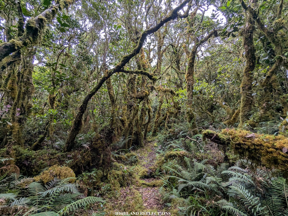
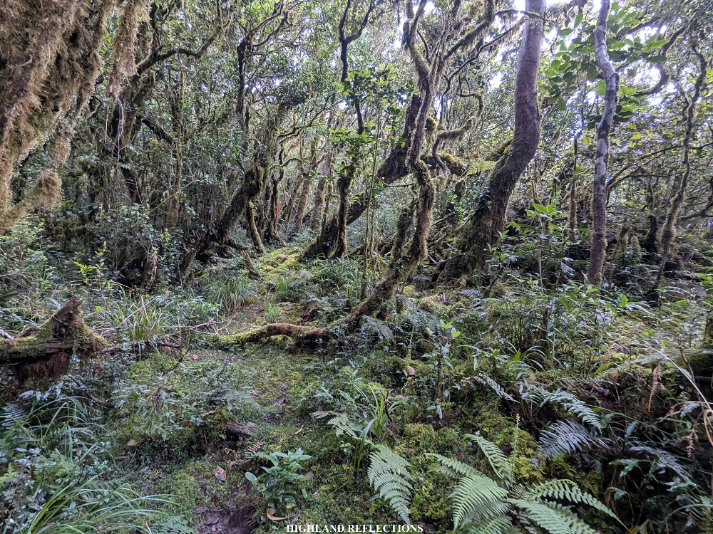
Another challenge brought by the trail was its length. After three hours of continuous up-and-down walking, covering more than five kilometers of distance, we were still above 2000 meters above sea level. The trail seems to cover a ridge north of Mt. Napulauan before making the right turn towards the descending slope en route to Hapao Rice Terraces. Despite the length, we pressed on with the descent. Some parts slowly became challenging to descend due to its steepness.
Luckily, at 11:30 in the morning, we finally exited the mossy forest and onto a trail filled with shrubs and cogon grass (1,850+ masl). At that point, I could already see the Hungduan Rice Terraces and the main road in Hungduan way, way below us! I could feel awe and dread mixing inside me, the latter of which was the thought that, after three and a half hours of continuous descent, we were still high up on the mountain!
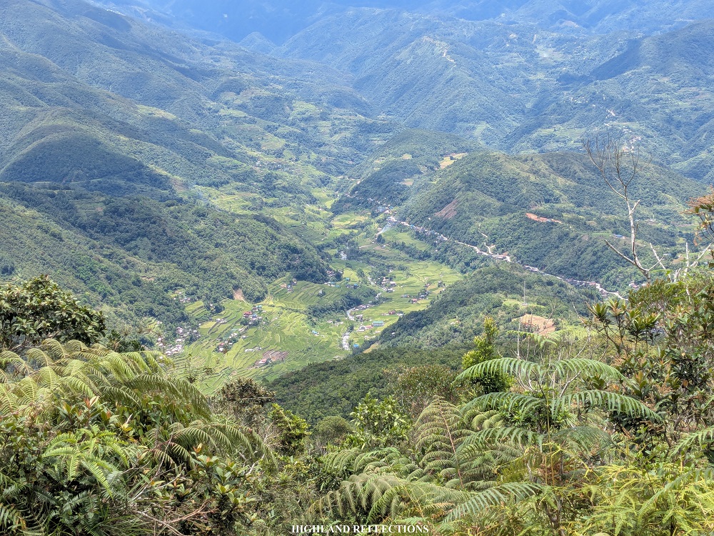

With my mind feeling the awe and dread, my feet continued with the descent along the grassy trail. Just like yesterday, these portions provided views that were a feast for the eyes. What struck me from this vantage point (more than the rice terraces below us) was that I could spot the gigantic Mt. Amuyao in the horizon, towering over the nearby mountains in Ifugao! “What a lovely sight,” I said to myself.
As we continued on with the descent, I savored the strong mobile data connection the open trail provided. The sun showered us once again with its warm sunlight.

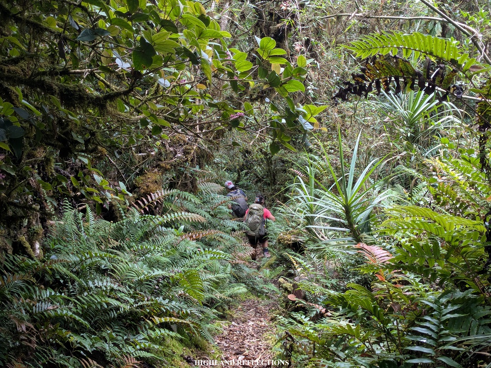
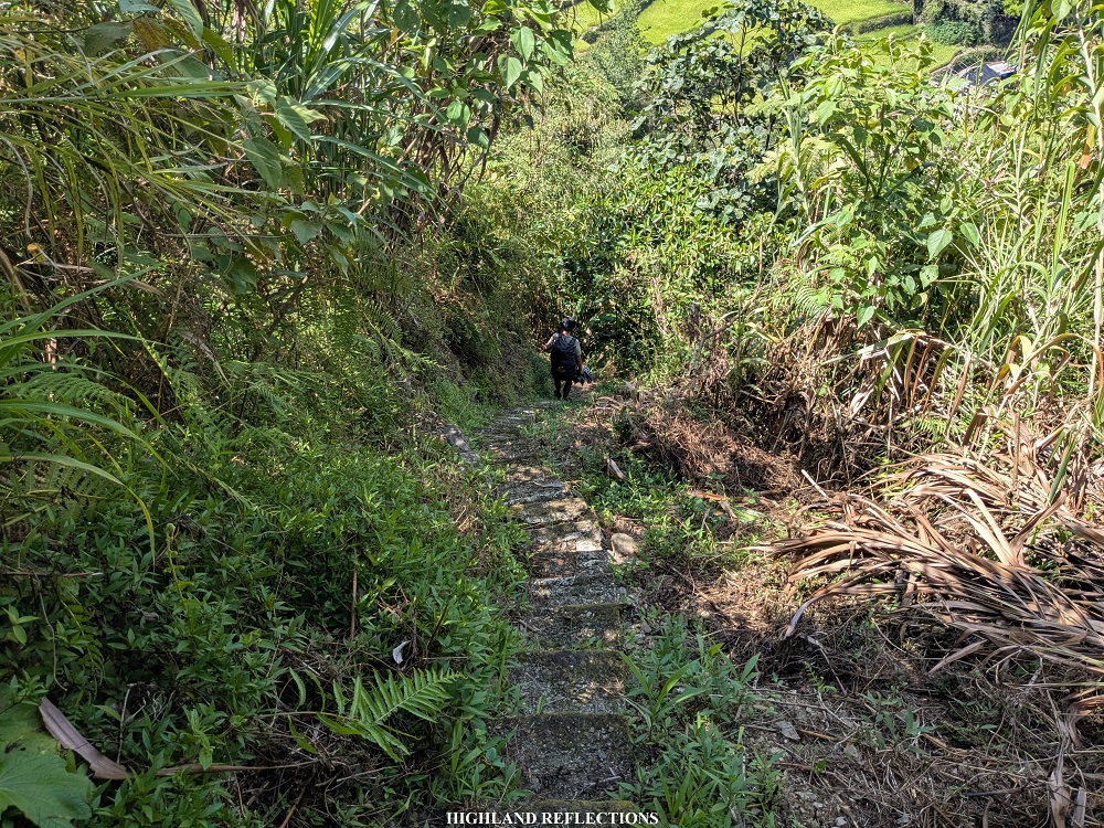
After an hour of descent, we finally had a glimpse of the nearby rice terraces. The last few portions of the descent was on a steep trail inside the forest, followed by a continuous cemented staircase.
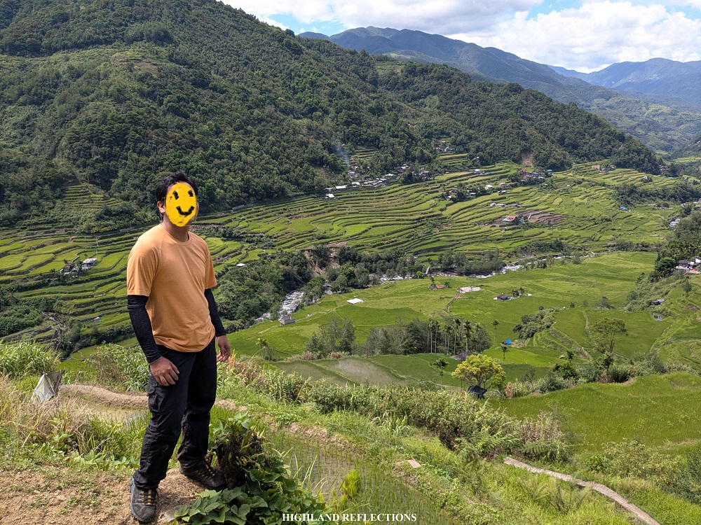
At one in the afternoon, we finally arrived at an area just beside the rice terraces. About twenty meters to the left of this exit point was a bale (a nipa hut; its owner seemed to have gone somewhere else on that day) where we stayed for a while, ate our lunch, and refilled our water bottles. We sat down on some wooden platforms at the side of the hut, providing an expansive view of the rice terraces carved along the bottom of the mountain range in front of us!

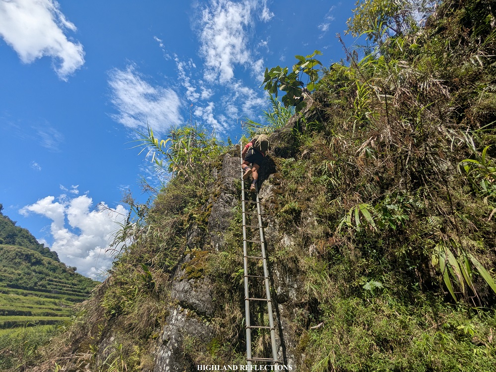
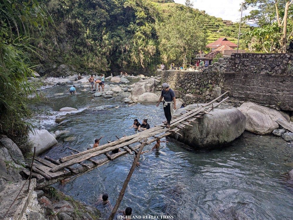
After having an ample 45-minute rest, we continued with the last few portions of the hike en route to Bogyah Hot Spring. From the nipa hut, we descended onto a staircase path that led to one of the cemented dikes of a nearby rice terrace. This led to a final descent to a steel ladder placed at the side of a boulder before reaching the vicinity of the hot spring resort.


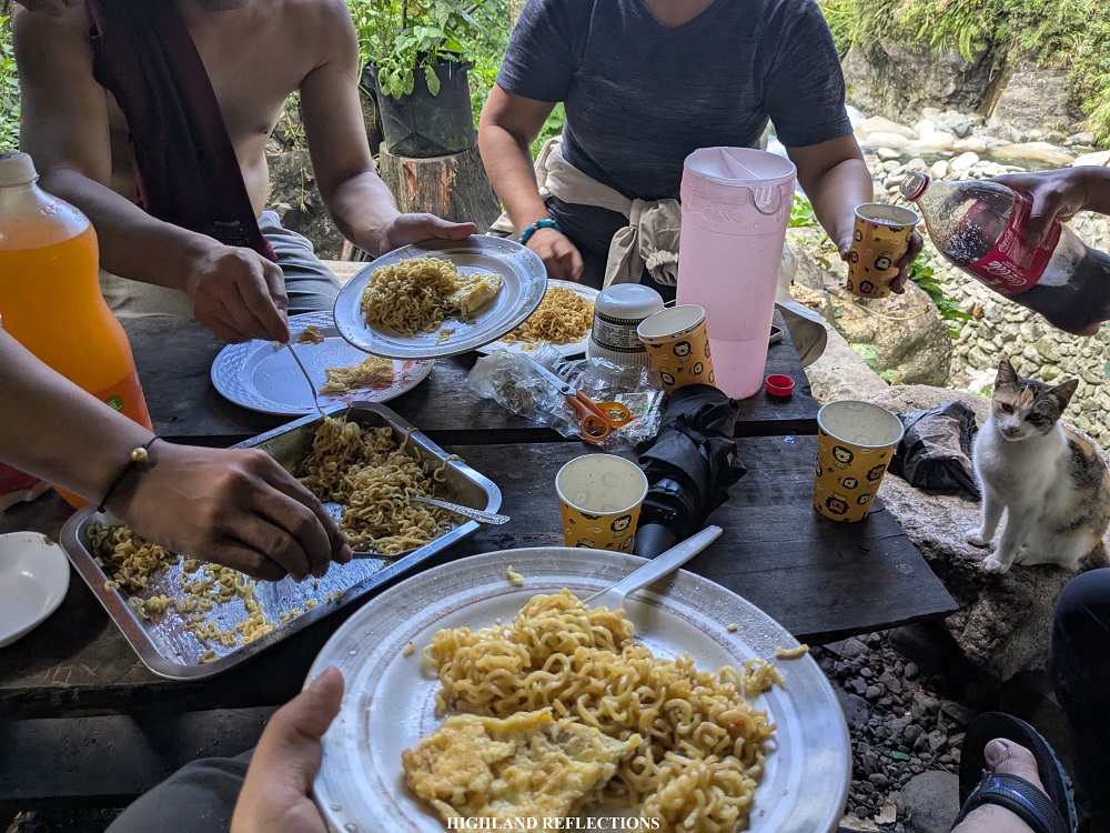
At the resort, we joined a crowd of local and foreign tourists enjoying the hot spring and a portion of the Hapao River nearby. As I was famished from the descent, I went to a nearby store past the river to have some snacks, which turned out to be a banquet of instant pancit canton and sodas with some of my companions for this hike! Afterwards, we returned to the vicinity of the hot spring and river, where some of our companions were already enjoying the warm water. I decided not to join them since I did not have extra clothes with me.

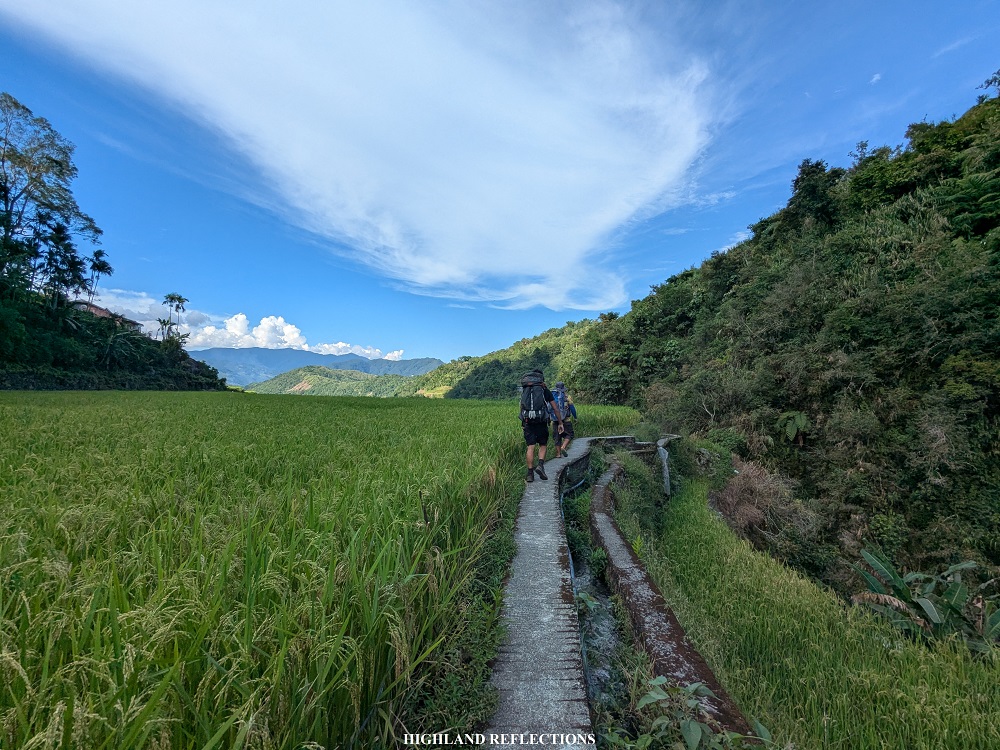
Past three in the afternoon, the team decided to continue with the last portions of the hike. From Bogyah hot spring, it was still a 40-minute walk before reaching the main road. We passed through some of the cemented dikes of the rice terraces, where we had a nearby view of the rice planted on each terrace, ready to be harvested. We also passed by some community paths before reaching the exit point. Since the trail was very easy to walk on at this point, I wore my slippers as my socks and shoes were already smelly from the excessive sweat!
At around 4 in the afternoon, we reached the main road where our van driver was waiting for us. I took the chance to wash-up while my companions were still resting.

And that was it! We completed the Mt. Napulauan Traverse via the Hungduan and Hapao Trails! Special thanks to Rochelle for this event, and, of course, to my co-joiners for this hike: Bettina, whom I have been with in my Mt. Purgatory (2018) and Mt. Pulag via Akiki Trail hikes (2022) in the past, Kevin Manual of Pinoy Mountaineer, Kuya Lei (special thanks to him for cooking some of the food during our stay at the campsite), and to the rest of the team!
This was such a fulfilling hike. As with any mountain up north, Mt. Napulauan provided the classic, raw Cordillera experience—getting engrossed into some of the best mossy forests in the country, coupled by an immersion to some off-beaten paths and awe-evoking rice terraces, all while being surrounded by some of the highest mountains the Philippines has to offer. Looking forward to going back to Ifugao and the mountains of the Cordillera for more adventures!
Itinerary
Day 1
08:30AM Hungduan Tourism Center, orientation and preparation
10:00AM Start hike in Poblacion via Hungduan Trail (1,120+ MASL)
12:00PM Water source, lunch (1,600+ MASL)
01:00PM Resume hike
02:00PM Start of mossy forest (1,900+ MASL)
04:30PM Summit, set camp (2,642+ MASL)
07:00PM Dinner
08:00PM Lights out
Day 2
05:30AM Wake-up call
07:00AM Dinner, break camp
08:00AM Start descent to Hapao Trail
11:30AM End of mossy forest (1,850+ MASL)
01:00PM Hapao/Hungduan Rice Terraces, rest
02:00PM Bogyah Hot Spring, wash-up and merienda
03:00PM Start hike to exit point
04:00PM Exit point, wash-up
05:00PM Start journey back home
08:30PM Jollibee Solano, dinner
02:00AM Home
