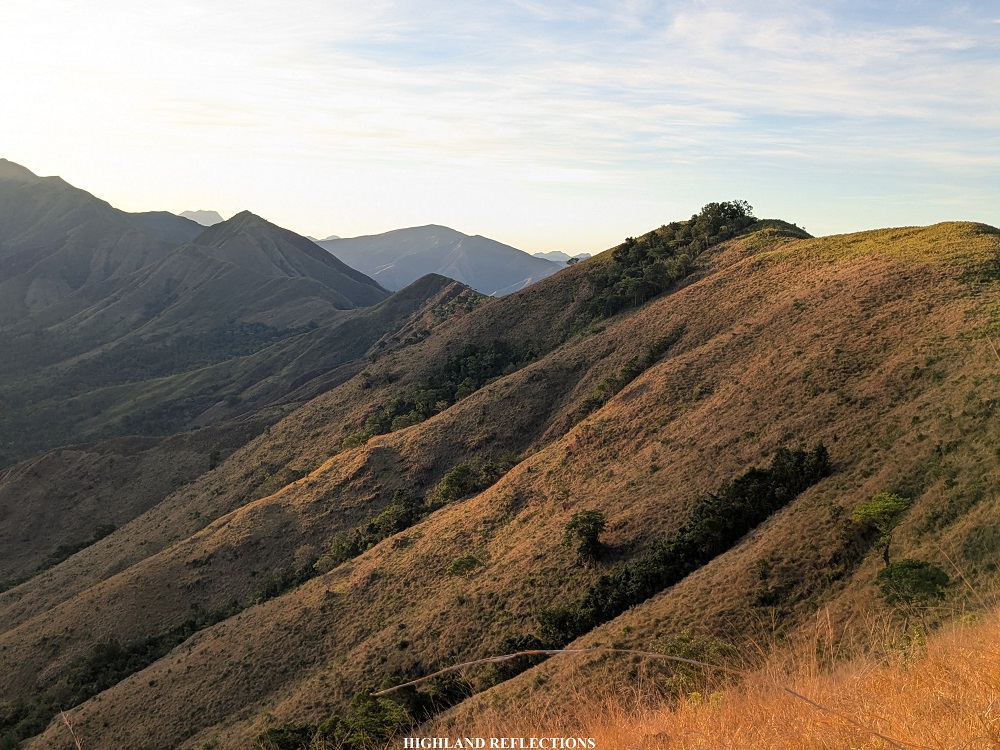
On the southern fringes of the Cabangan Mountain Range, and located at the central portions of the larger Zambales Mountain Range, lies Mt. Mariglem, a beginner-friendly mountain with trails passing through barren, grassy ridges. Since it opened to the public as a hiking destination in 2023, Mt. Mariglem became a hit to the hiking community, owing to its magnificent vista of the surrounding mountain ranges, as well as a view of the vast expanse of the West Philippine Sea, which can be clearly seen from the mountain’s slopes and summit.

Using the Pinoy Mountaineer format, here are the hike’s characteristics:
MT. MARIGLEM
Jump-off point: Sitio Maporac, New San Juan, Cabangan, Zambales
Specs: Minor climb, difficulty 3/9
Trail class: 2-3
Days Required / Hours to Summit: 1 day / 2 hours
Features: View of the Zambales Mountain Range and West Philippine Sea
In hiking Mt. Mariglem, I was invited by my long-time college friend and hiking buddy, JM, who was with his churchmates for this hike. The event was organized by Juumar, the same organizer whom we joined in some of our previous climbs.
Our journey began when our organizer fetched us in Malolos City at around 10 in the evening. Just after four hours of continuous ride, we reached Sitio Maporac after taking a gravel road at the side of a river ten minutes after making a right turn from the highway. We alighted at what seems to be wash-up areas. We registered here and made last-minute preparations. We were glad that we were the first ones to arrive there, so we were all motivated to go the summit! It would be a great pleasure to avoid the crowd, as social media reels often show that the summit has a large crowd and a queue on weekends.
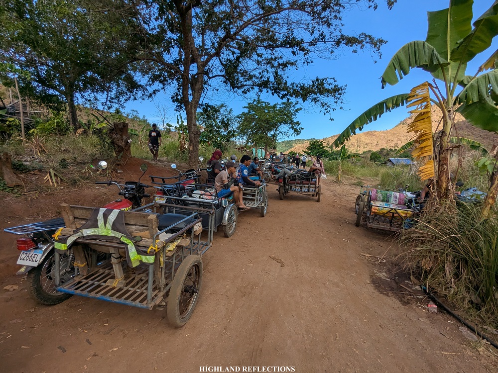
To start the hike, we rode a kolong-kolong for about fifteen minutes going to the trailhead, which was located around three to four kilometers from the wash area. Through the darkness, we passed through bucolic sceneries and pastoral lands via a rocky road, all while being watched by the silhouettes of the Cabangan Mountain Range. When we reached the jump-off point, we alighted and paid 100 pesos per individual to the kolong-kolong drivers. It was three in the morning.
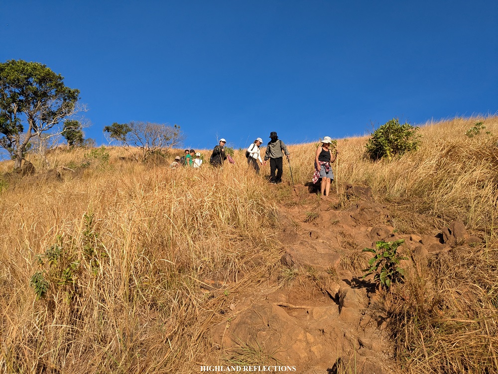
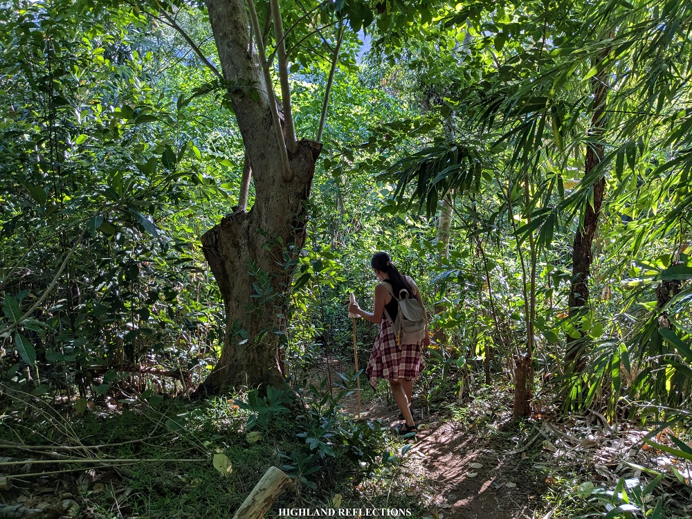
The trailhead was located around 80 meters above sea level. With such a low elevation and an anticipated moving time of around two hours, it was expected that we would be facing a constantly inclined trail. And I was correct! Right from the start, we were greeted with a constantly ascending trail along grassy slopes and on dusty, lahar-sprinkled paths. I was taking the time to climb up, as we were with beginners for this hike. Everyone was sweating buckets even that early in the morning!
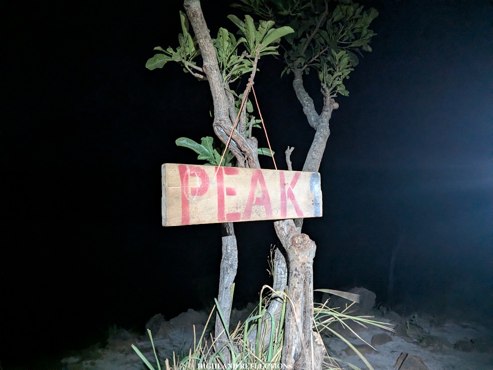
The entire 500-meter ascent was divided into “Peaks,” or, more appropriately, by stations (I would like to use the term “stations” since these trail markers cannot be considered as peaks; “stations” are also used by old-school mountaineers, and is more appropriate, given that a ‘peak’ is the highest point on a mountain). There are five stations, with the fifth station as the summit, and the first station just located a hundred meters from the jump-off point. We reached this point after around twenty minutes of hiking.
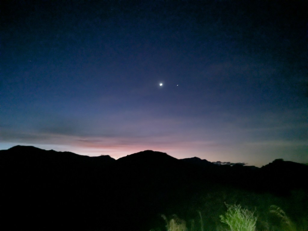
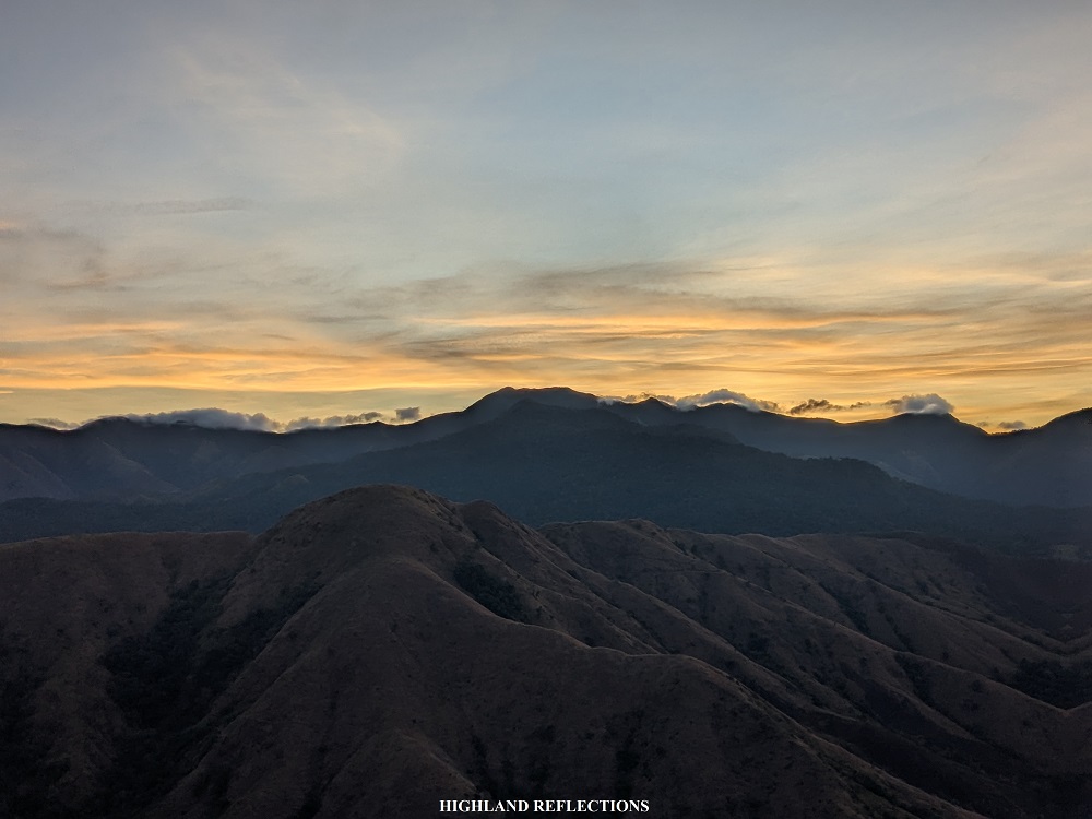
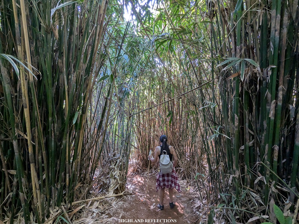
After the first station, the ascent continues. We were taking the entire clmb with darkness surrounding us. On the horizon, we would occasionally spot flashing lights inside the clouds above. Down below, the city lights of Cabangan proper and the surrounding towns are visible. This was, for me, a very poetic predicament, as the name “Mariglem” is a cognate of the Tagalog word “madilim,” which means “dark.” This name was perhaps due to the silhouette that the mountain casts over the community when darkness falls, or just as when the sun is about to rise in the early hours of the morning.
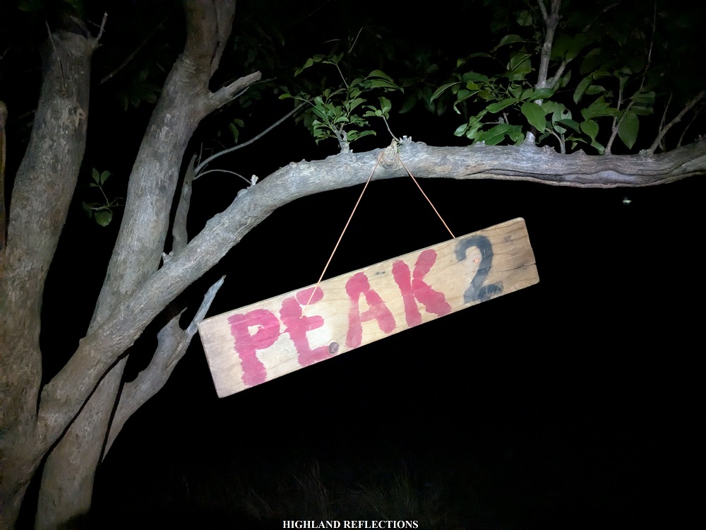
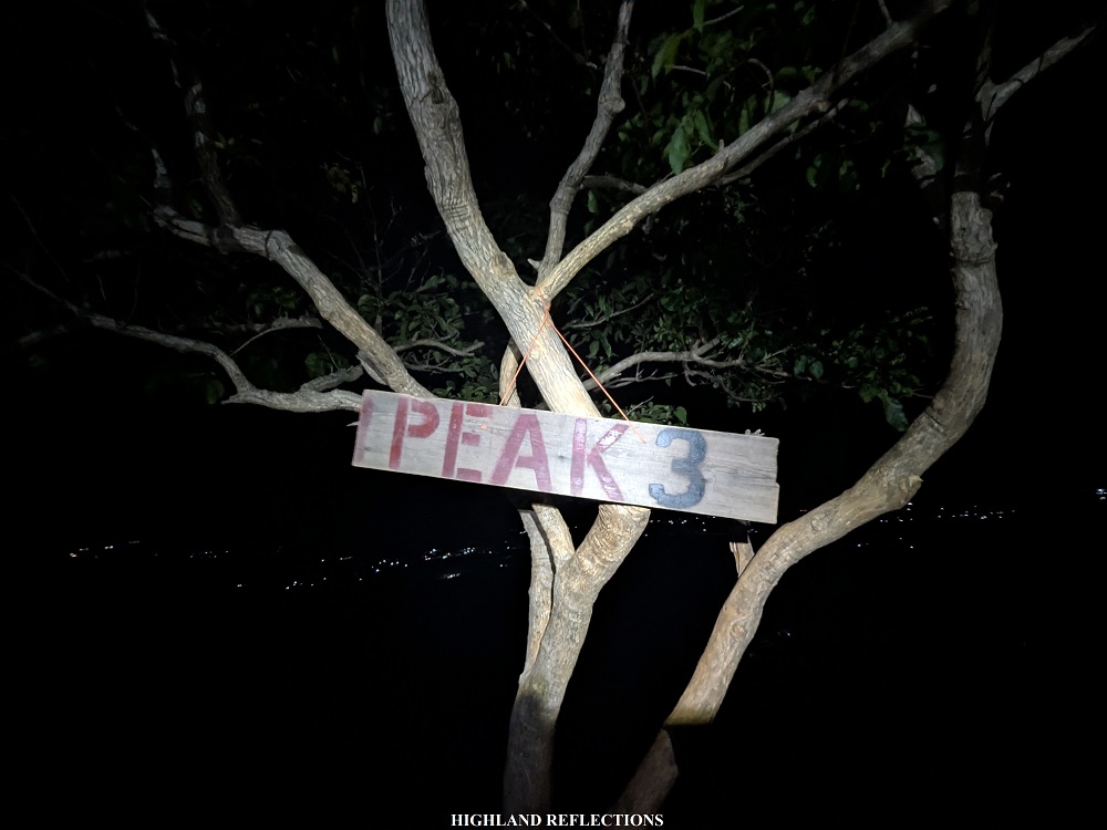
We were going at a snail’s pace hiking the mountain. We reached Station 2 at 3:50 in the morning, Station 3 at 4:15, and finally, Station 4 at 4:40. The ascent was nonstop, with minimal to no flat ground. Now I know why some first time hikers think that this mountain is not beginner-friendly. But let me tell you, this is what a mountain is ought to be—inclined, steep, and brings discomfort! It is an essential part of the hiking experience, beginner-friendly or not.
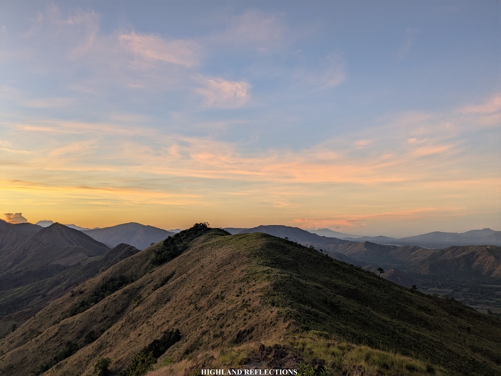
From Station 4, we could already spot the summit of Mt. Mariglem. Perhaps due to the darkness, the summit brings an illusion that it seemed distant and much, much higher than what it’s supposed to be. But alas, just after ten minutes of gradual walk, we were at the vicinity of the summit area. It was 4:55 in the morning, almost exactly two hours after we started the hike!
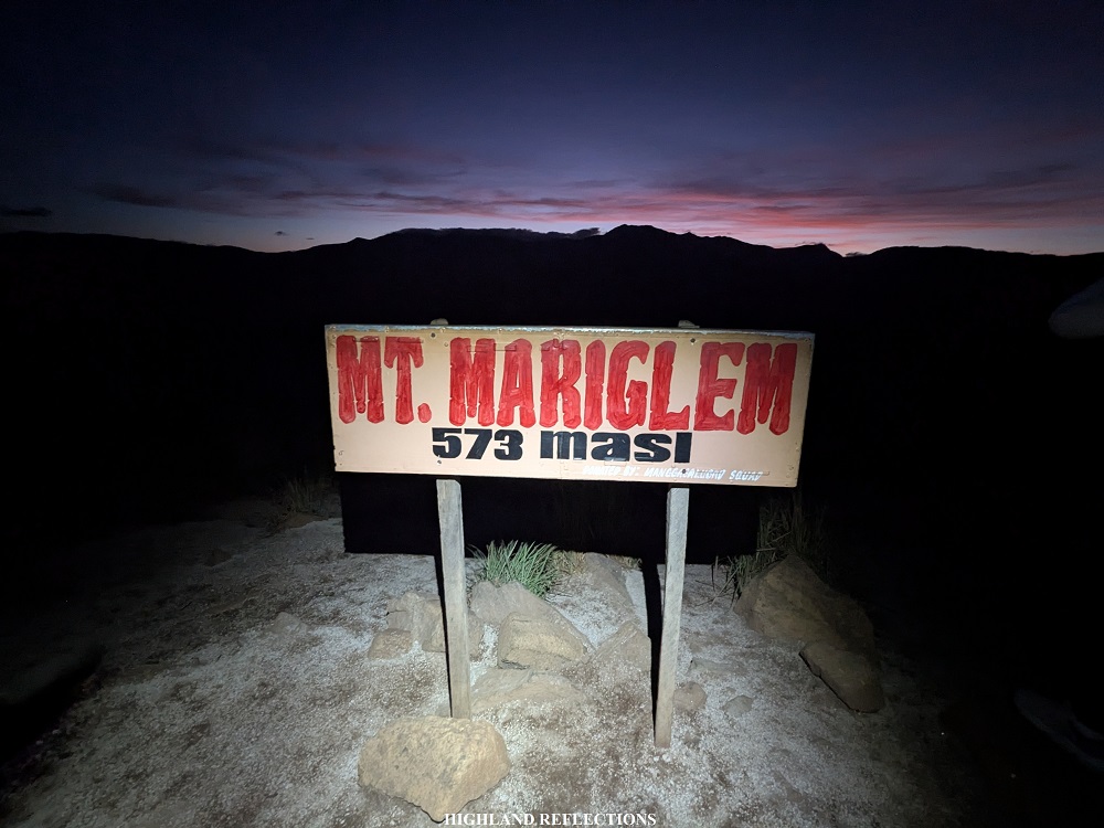
We patiently waited for the sun to rise in the east, where the silhouette of Cabangan’s highest point—around 1,300 MASL—is located. By 5:15 in the morning, there was enough light coming from the sun, allowing us to take pictures by the summit marker. At 5:20, it was bright enough to appreciate everything in our surroundings.

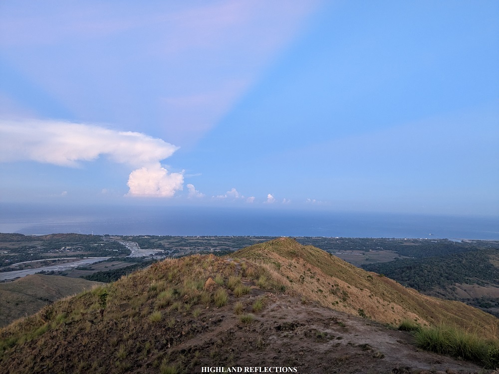
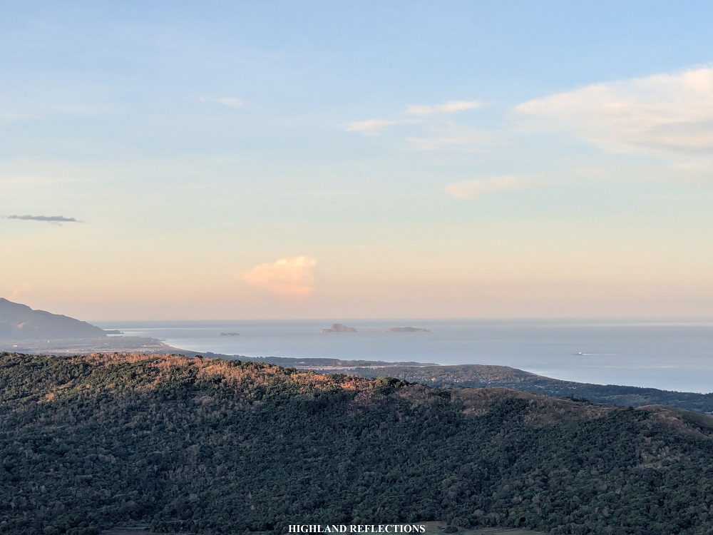
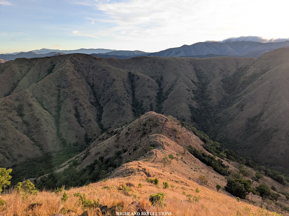
To orient yourself with the views surrounding the summit, we start at the northern direction, where the signage is located. Beyond the signage is where the descent trail is located, ending at Agbobotilya/Maligha River below. Behind the river is another layer of mountain range, with its surface all covered in cogon grass. Beyond this, layers and layers of mountain ranges can be appreciated, most of which are still within the Cabangan Mountain Range, while the slopes beyond them is where Mt. Tapulao—the highest mountain in Central Luzon, located in Palauig, Zambales—is located.
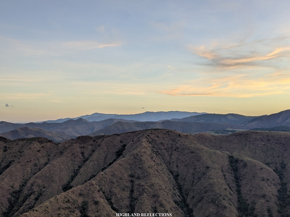
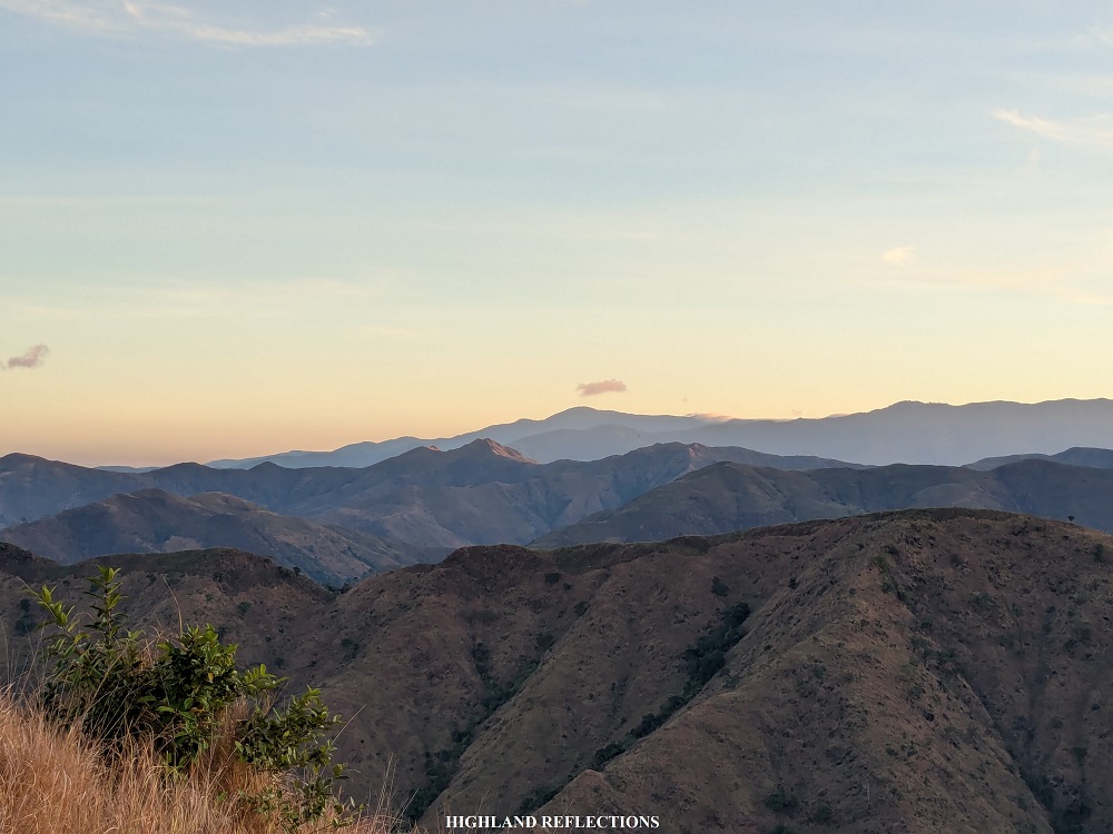
To the east, one can appreciate the higher slopes of the Cabangan Mountain Range. Beyond the Cabangan Mountains, Mt. Negron —the highest mountain in Pampanga—peeks in the distance. In the south southeast direction is another mountain range where Mt. Kapigpiglatan and Mt. Pimmayong are located.

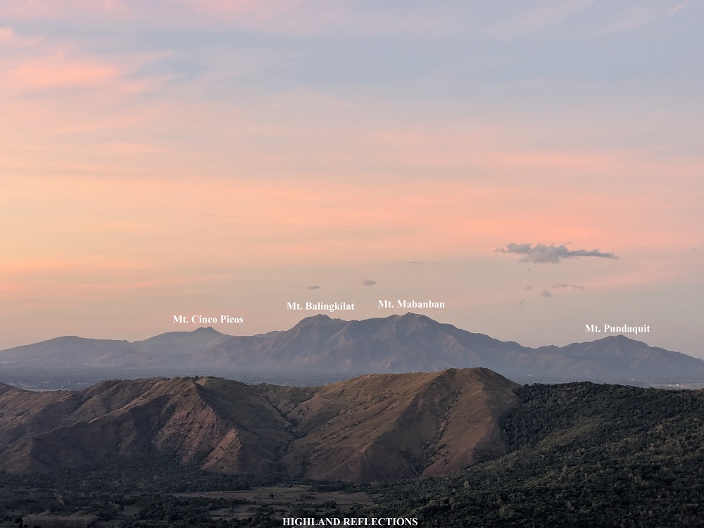
Towards south, the Cawag Coastal Mountains were saying their hellos. Prominent in this mountain range is Mt. Pundaquit in San Antonio, Zambales, which I hiked back in 2012; Mt. Mabanban, the second highest mountain in the Cawag Coastal Mountains; Mt. Balingkilat, the highest point; and lastly, the pointy peaks of Mt. Cinco Picos. Further south, a faint view of Mt. Natib in Northern Bataan can be viewed. Completing the view to the west is, of course, the West Philippine Sea.
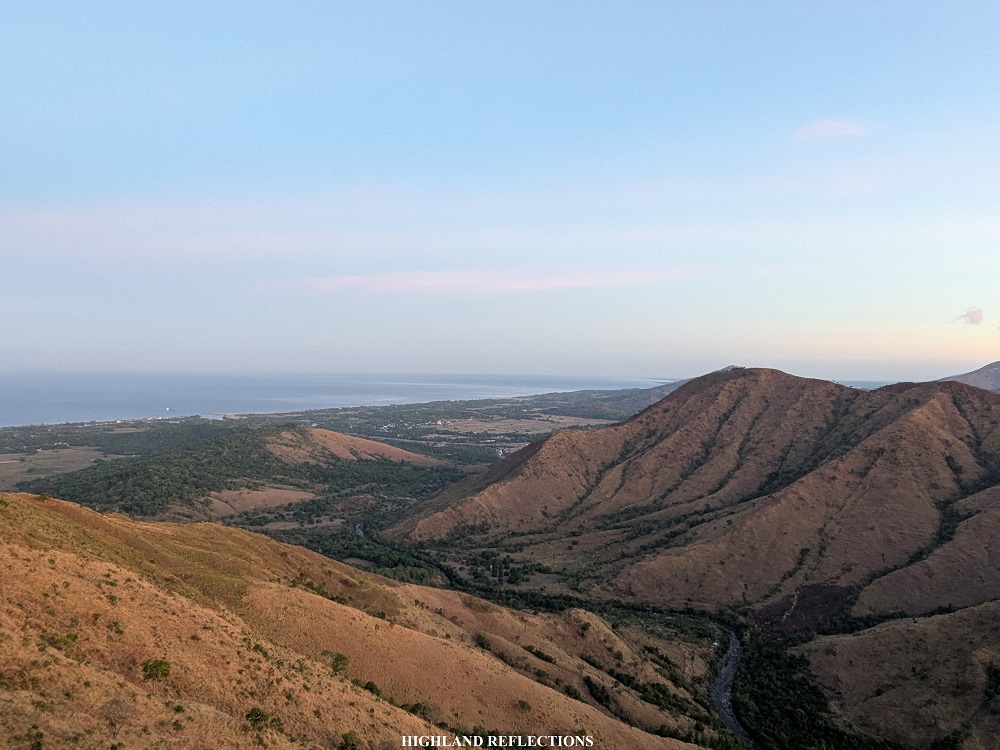
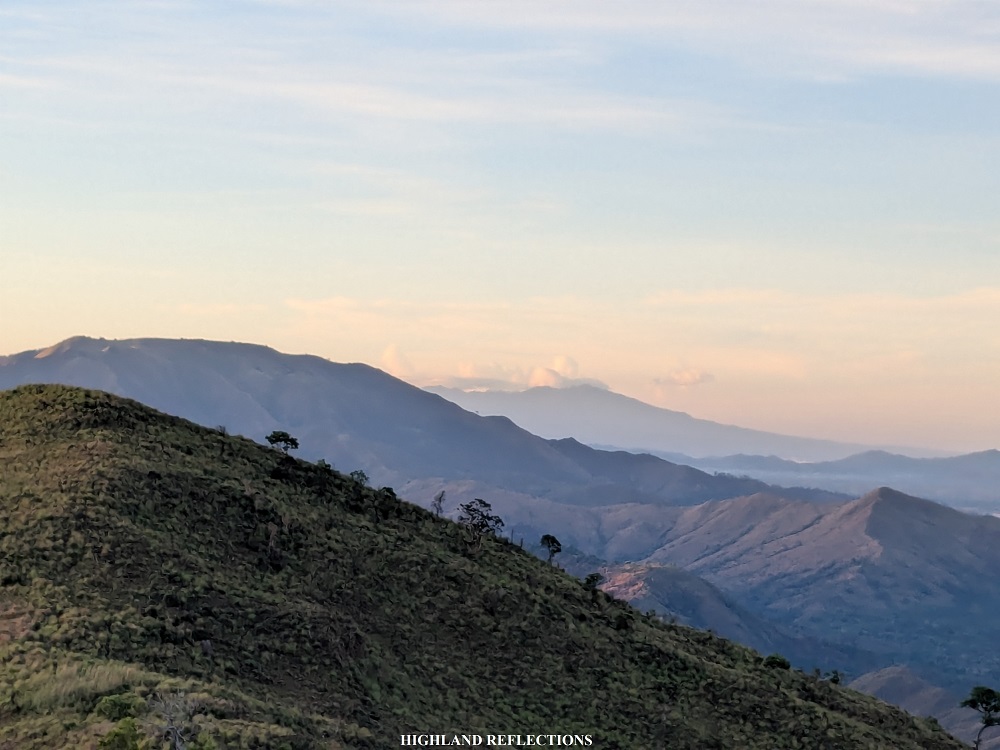
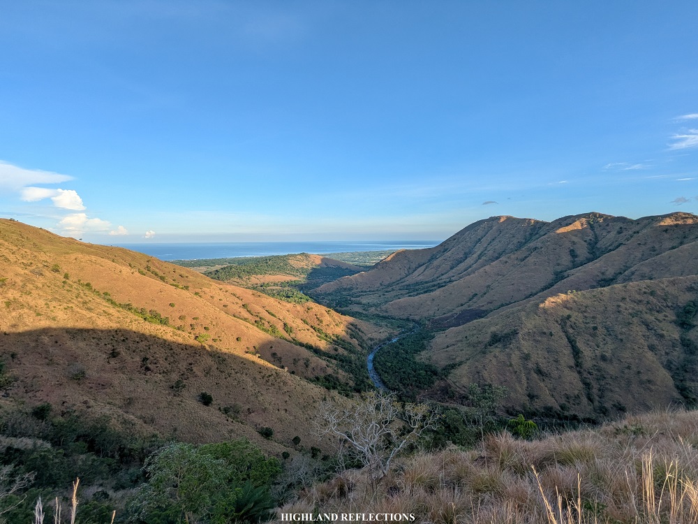
When the crowds started to appear, we decided to start the descent past six in the morning. As sunlight was starting to brighten our surroundings, we had a magnificent view of the valley stretching on the eastern side of the mountain range. This was such an eye candy, as it compensates for the scorching descent along the grassy and rocky slopes of the northern face of Mt. Mariglem!
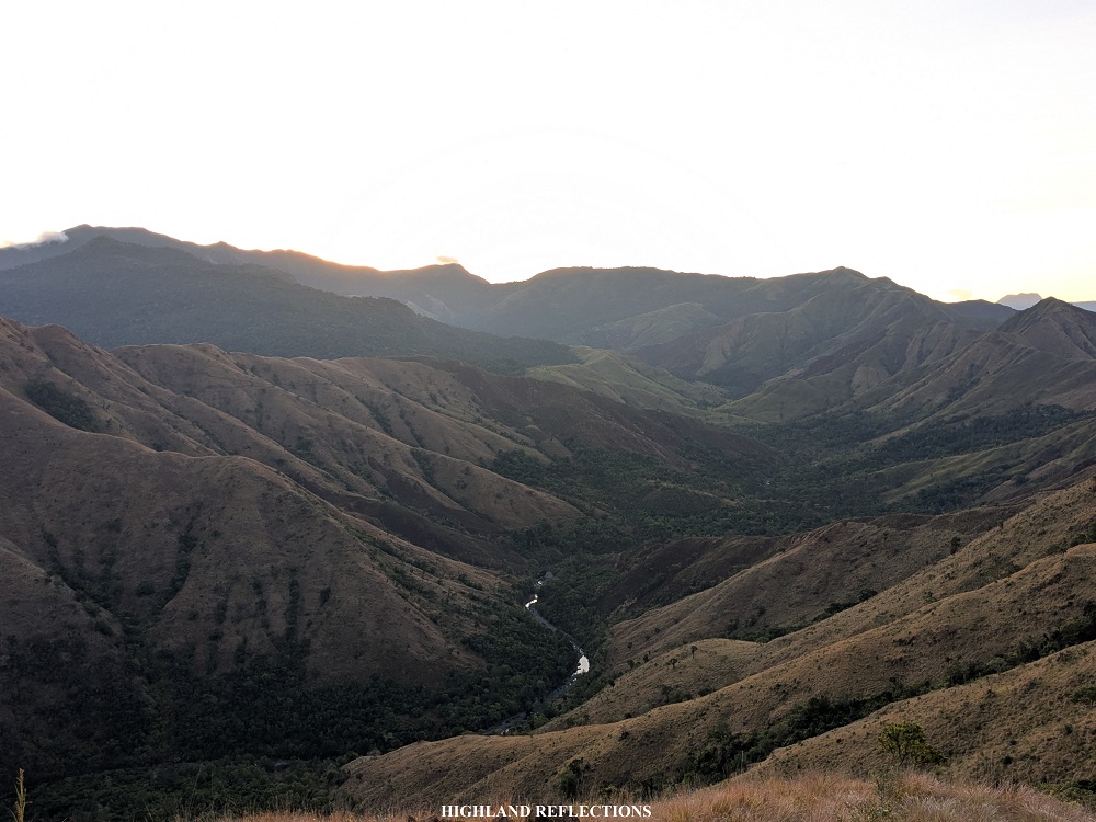

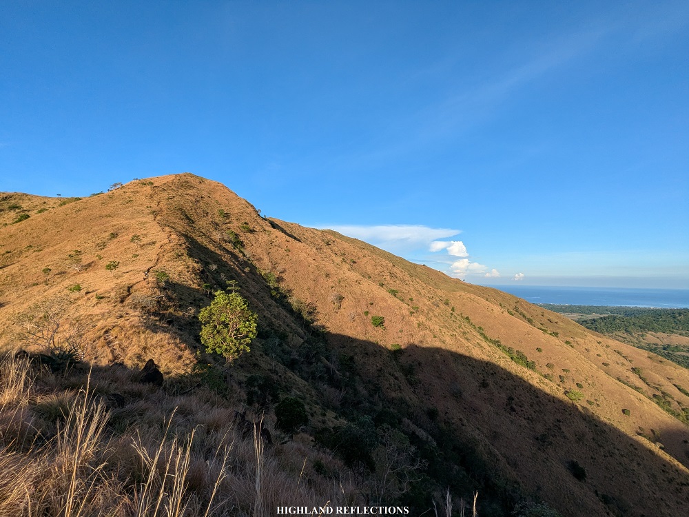
As the clock ticked at around 6:30, we reached a point where the trail diverges into two: going straight leads to a very steep descent towards the river, while going right leads to a longer but less steep trail. As we were with beginners, our guides opted for the trail to the right. Some parts of the trail here were reminiscent of Mt. Balingkilat’s rocky trail, where some portions were tricky to navigate (our beginner companions were guided on the way down).


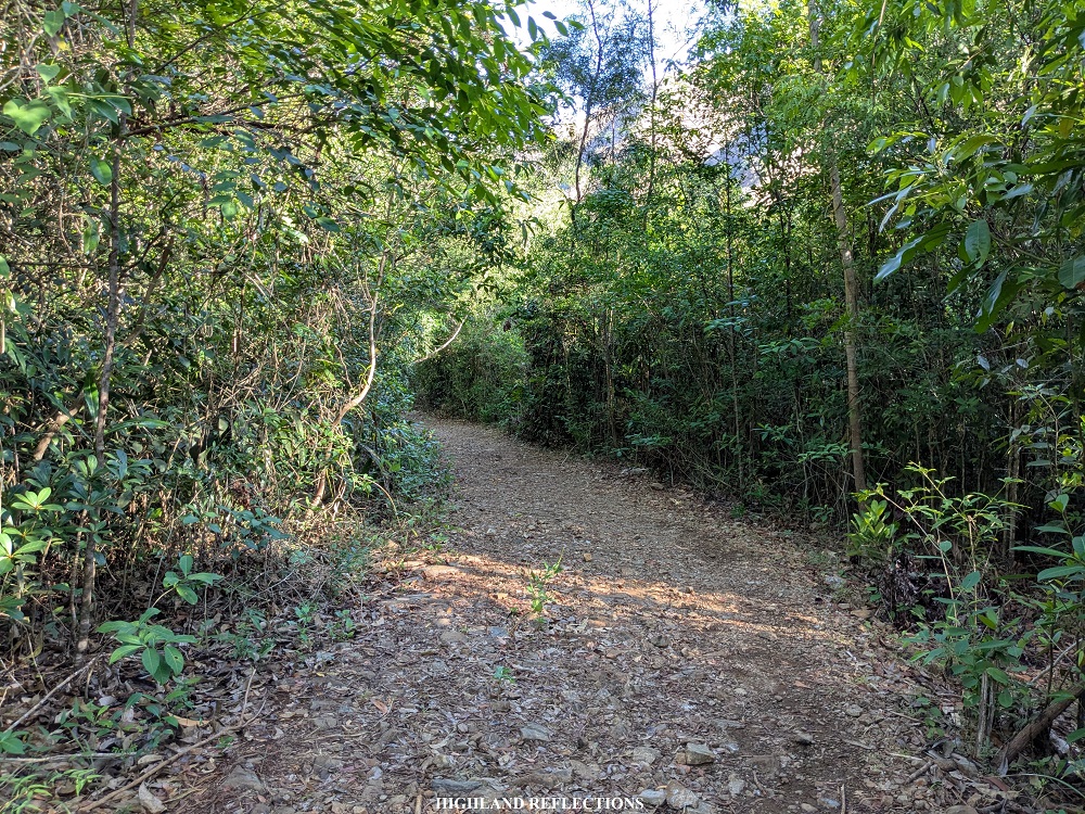
Just shortly after the right turn, we found ourselves inside a lowland forest, filled with shrubs, and sometimes, thickets. Reaching this point was such a relief from the scorching descent we just did! At 7:20 in the morning, we were at the bottom-most part of the trail marked by a rough, rocky road around 1.5 kilometers away from the trailhead where our kolong-kolong dropped us.
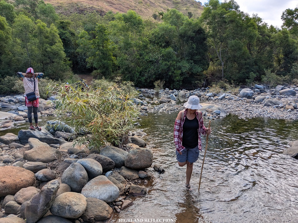
We turned left of the road, the path leading us back to the trailhead. Just a few hundred meters away is where Maligha River is located. Some kubos and local stores were stationed here. However, given the murky waters, we decided to just sleep and take some rest before moving to the other river station, located a few hundred meters from Maligha River.
Apparently, despite flowing from the same river system as Maligha River, this section was called by locals as Agbobotilya River. Here, the river seems cleaner, and there were much more huts. We decided to take a dip here together with the crowd coming from Mt. Mariglem!

By 10 in the morning, we decided to call it a day. From Agbobotilya River, the kolong-kolong motorcycles were stationed just a few hundred meters, requiring us to cross the river one last time. Upon reaching where the kolong-kolong motorcycles were, we started the return to the wash-up area. Honestly, I would have wanted to just walk the three to four-kilometer rough road on the way back. But sometimes, energy preservation is much more important than my pride! As we were the first to hike for that day, we were also the first to be back at the wash-up area. We cleansed our dust-powdered bodies and readied ourselves for the ride back home.
Once everyone was complete, we left the area and had our celebratory lunch at Bonita’s Kitchen, one of the roadside restaurants in Cabangan, where we ordered their famous sisig and halo-halo. Afterwards, we opted not to go Liwliwa Beach, and went straight home, stopping by shortly at the San Narciso junction to buy their famous mango shake. I also bought a kilogram of fresh mangoes!
We were home by five in the afternoon! On the way home, I was staring at the mountain range comprising Mt. Kapigpiglatan while we were traversing Zambales. When we reached Pampanga, I lost myself counting the many peaks of the Cabusilan Mountain Range, where Mt. Negron, Mt. Pinatubo, Mt. Zamatam, and many more mountain peaks are located. All I could think to myself back then was that, with so many peaks waiting to be discovered within the Zambales Mountain Range, it feels truly exciting to know there are destinations within the range waiting to be discovered. I’m glad to have checked off one of the hundred, perhaps, thousand peaks within the range—Mt. Mariglem!
Itinerary
02:00AM Sitio Maporac, prepare for hike
02:30AM Start kolong-kolong ride to trailhead
03:00AM Trailhead, start hike
05:00AM Summit, wait for sunrise
06:00AM Start descent
07:30AM Maligha River, rest
08:45AM Start hike to Agbobotilya River
09:00AM Agbobotilya River
10:00AM Start hike on the way back to the trailhead
10:15AM Trailhead, ride kolong-kolong to wash-up area
10:30AM Wash-up area
11:00AM Wash-up area, start ride on the way back home
12:00PM Celebratory lunch at Bonita’s Kitchen
01:30PM Stopover at San Narciso junction to buy mangoes
05:00PM Home

3 thoughts on “Mt. Mariglem (573+ MASL) | Day-hiking Cabangan’s Dark Mountain”