The author stands in solidarity with the Aeta people(s) in their right to be compensated and be free from exploitation, especially in the growing tourism industry within their domains surrounding Mt. Pinatubo. I hope that their voices be heard and their needs be met. A big shout-out to the local and national government — stop the exploitation, listen to their plight, and create sustainable programs for our IPs!
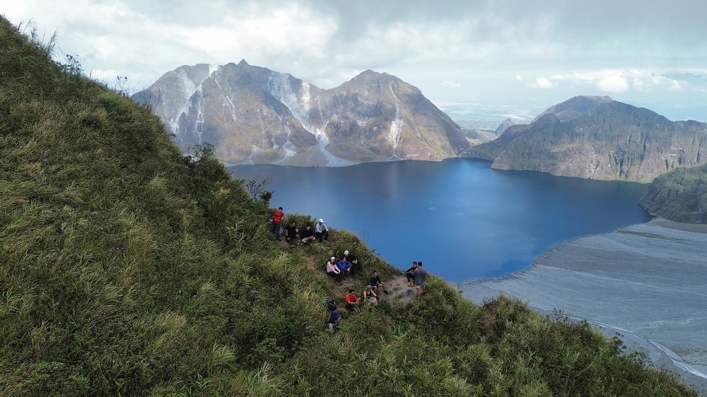
Owing to its ethereal beauty formed from the aftermath of the infamous 1991 eruption, Mt. Pinatubo has been dubbed by many as a beautiful disaster. Its crater lake, which sits at the center of a vast caldera, is surrounded by steep, towering mountain walls that drop jaws and elicit awe from those who see it.
There are multiple trails to take in Mt. Pinatubo. Three of these are located in the Province of Pampanga: The Sapang Uwak trail, the Delta-5 trail, and the Inararo trail. Of these three, I have only tried the Inararo Trail, which offered a long trek on lahar landscapes before merging with the latter parts of the Delta-5 trail. The Delta-5 trail, on the other hand, is infamous for its long river trek, and was often combined with the Sapang Uwak trail to form a near 40-kilometer loop. These three trails offer challenging routes for hikers who would want a rawer experience and to avoid the touristy Capas Trail in the Province of Tarlac — a beginner-friendly option offering access to 4×4 jeepney ride to the base of the crater, tourist facilities, and viewing platforms along the northern side of the crater.
Since the Delta-5 trail has been indefinitely closed and had only been opened sporadically in the last few years, I opted for an overnight hike via the Sapang Uwak trail in the summer of 2025. The trail starts at the barangay of its namesake, and crosses some of the forested mountain slopes in the Porac side of Mt. Pinatubo.
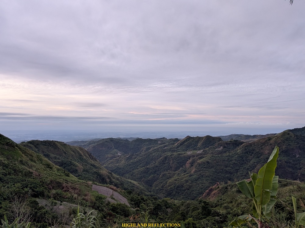
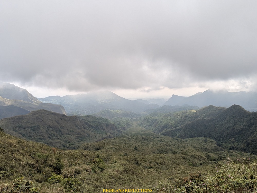
The hike to Sapang Uwak brought us through dense lowland jungles and thorny paths which can sometimes get unrewarding due to its sheer length and exposure to the sun. The trail before reaching the caldera, however, is where all the reward can be reaped after the long walk, as it provides views of the mountain ranges surrounding Mt. Pinatubo, and from there, the caldera can be reached after an hour of hiking.
With these, Sapang Uwak can be characterized as follows:
MT. PINATUBO via SAPANG UWAK (Back Trail)
Jump-off point: Sitio Banaba, Sapang Uwak, Porac, Pampanga
Specs: Major climb, difficulty 7/9
Trail class: 2-4
Days Required / Hours to Crater: 1-2 days, 6-8 hours
Features: View of Pinatubo’s crater, view of Mt. Negron, campsite at Mt. Mcdo
Here is my narration of my overnight, backtrail hike in Mt. Pinatubo via Sapang Uwak!
Day 1: The Long and Unrewarding Push to McDonald’s
Our first day started at 5:00 am when we made our first step towards the 13-kilometer path to the campsite located at the summit of Mt. Mcdo — a mountain just beside the eastern caldera of Mt. Pinatubo.
The trail starts at a rough road at the rear part of Barangay Sapang Uwak, which already sits at an elevation of almost 700 meters above sea level. After covering a kilometer of uphill hiking, we decided to have our breakfast at some wooden platforms at the side of the trail, providing an expansive view of the lowlands of Pampanga, and in the horizon, Mt. Arayat.

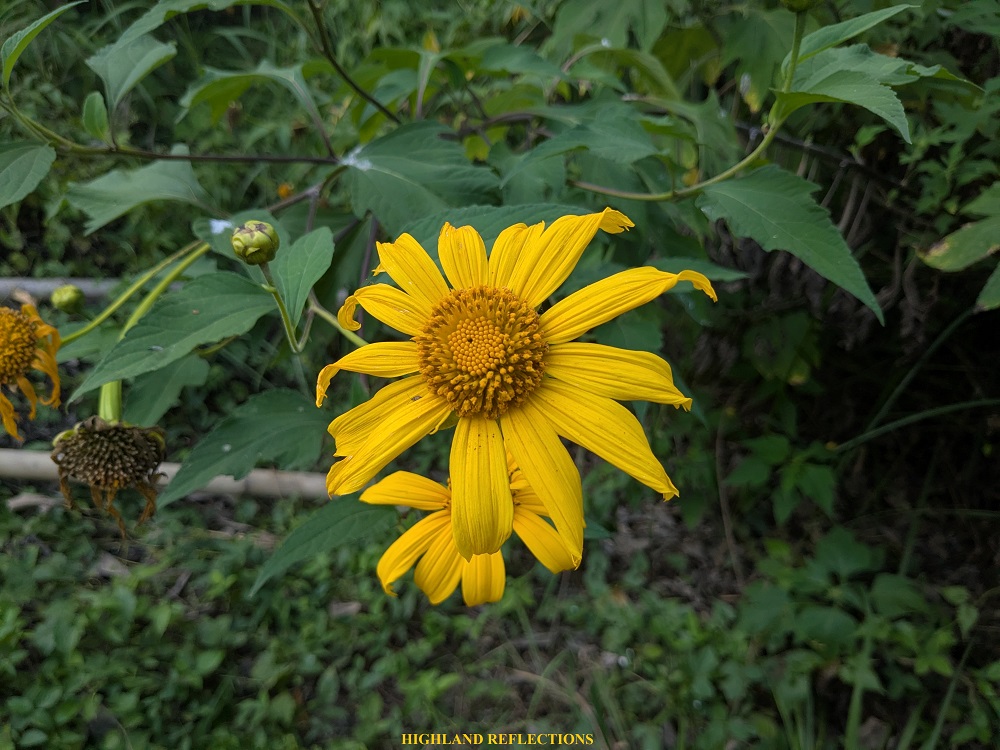
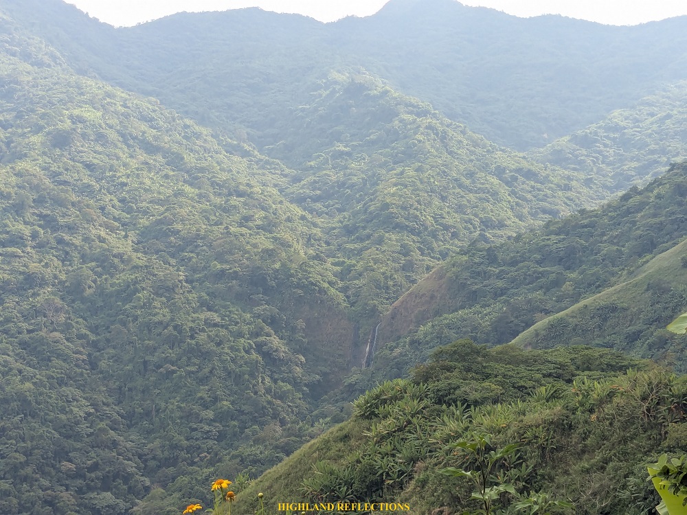
The trail afterwards continues on an ascending rough path, mostly used by local Aetas, and doubling as a trail to another famous destination in the area, Miyamit Falls, which can be viewed from afar at the left side of the trail. The initial parts can also be an access point to go to the Delta-5 trail, the junction of which is somewhere at the right side. Then, the trail narrows down into a single-file path filled with common sunflowers before entering the dense forest.
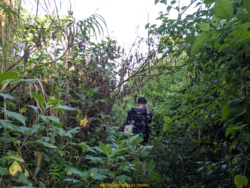
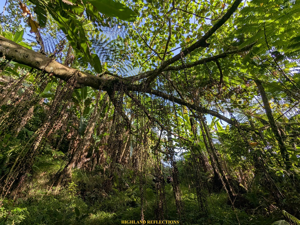
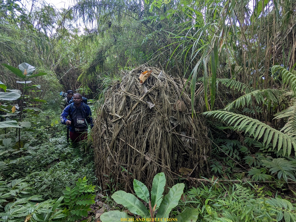
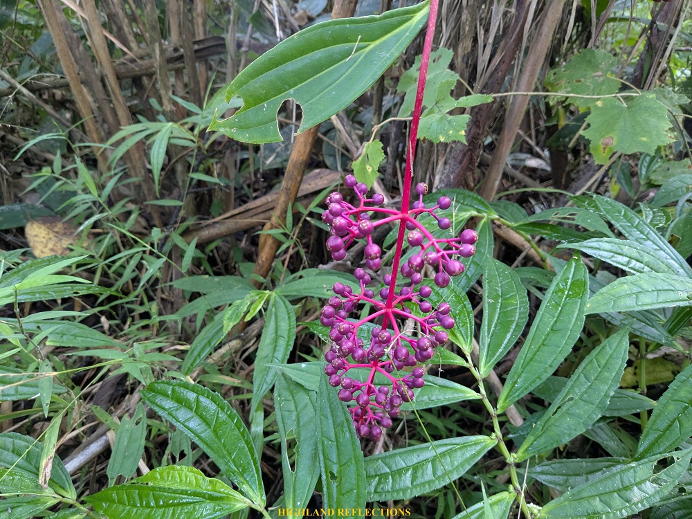
Once we entered the forest, our Calvary started, and we were at the mercy of the trail’s length and monotonous views. Despite this, I tried to savor the forest’s features, the most striking of which is the abundance of figs that are hanging in clusters along the trail. There were also some hunter traps explicitly set at the side of the trail. Several colorful flowers were also scattered along the path, one of which is the lovely Medinilla, which I often spot when doing major hikes!

After covering eight kilometers of rolling terrains in a span of three hours, we reached the only water source within the trail (there was another one near the campsite, but it was so far that only guides can reach it). However, because our hike was during the dry season, the creek was dry, so our Aeta guides had to fetch us water a few meters away from the trail. While waiting for our water bottles to be refilled, we took the chance to rest and eat our trail food, as we were exhausted from the non-stop hike under the heat of the sun.
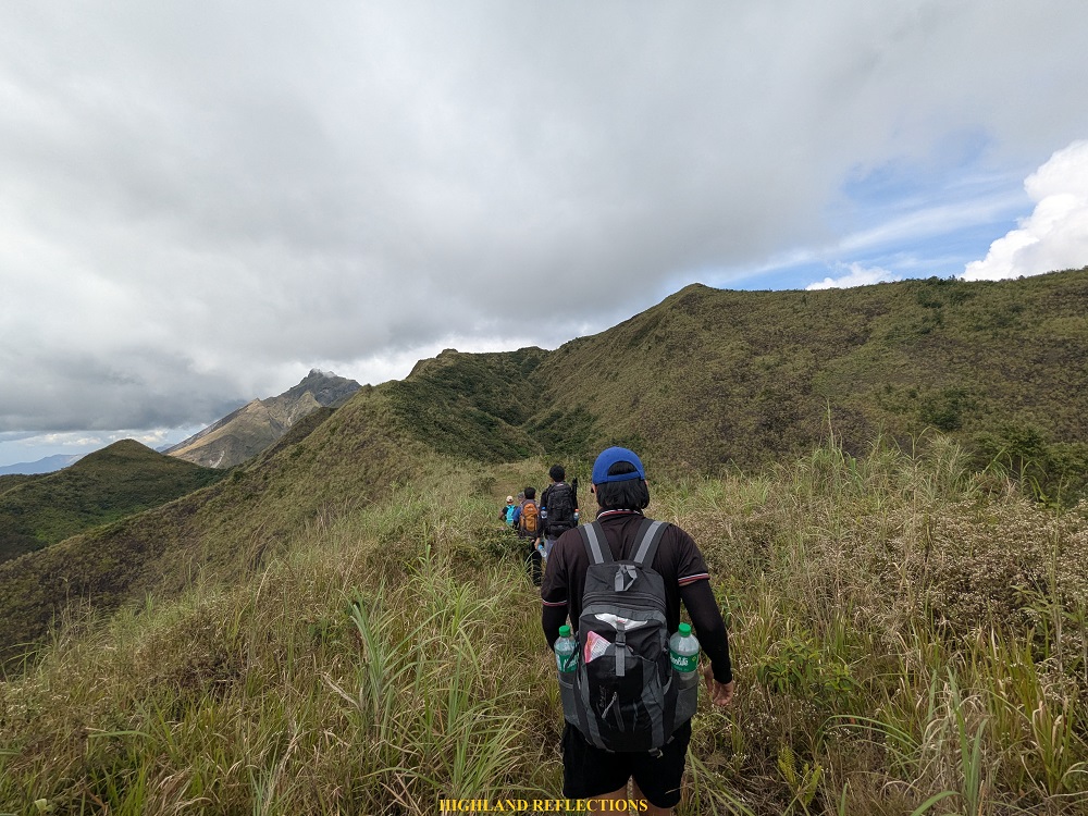
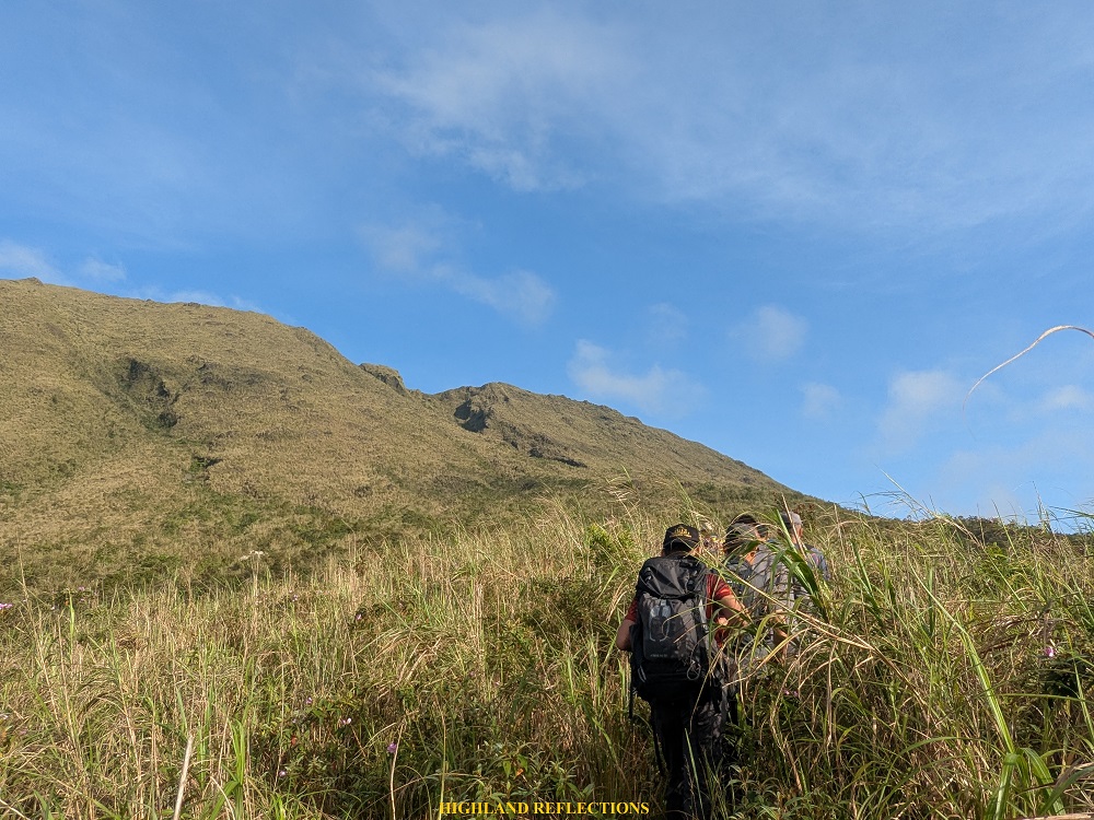
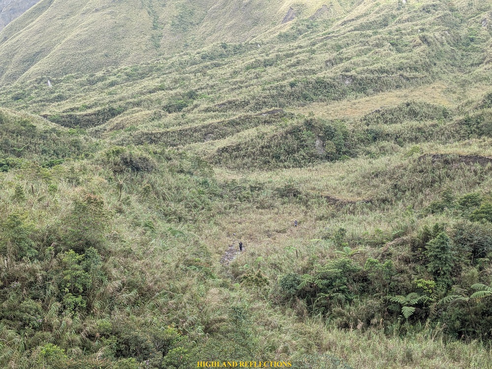
Once we received our water bottles, we continued with the hike. We still had five kilometers left to cover before reaching the campsite summit of Mt. Mcdo. It was at this point that I felt exasperated and weakened from the lack of sleep and heavy meal. In spite of the tiredness, I continued marching on under the summer sky inside Pinatubo’s forest. Then, we exited the forest, and found ourselves on a trail filled with dense cogon grasses and thorny plants. My arms and hands were already getting scratched at this point, which, coupled with hunger and tiredness, made me all the more violent towards the plants (kidding, I was trying to keep calm since I knew those thorny plants had more ways of hurting me).
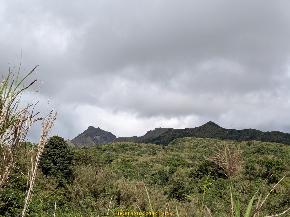
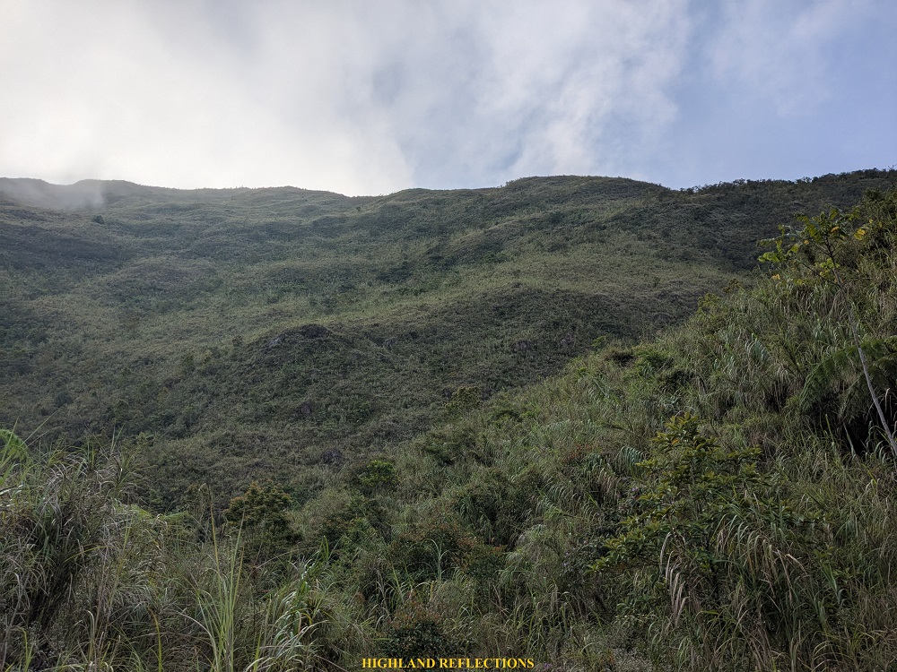
What made me motivated to push through was the view of Mt. Mcdo’s summit, which I can see on top of the tall cogon grass. To my left, I was also getting glimpses of the gigantic, 1,584-meter Mt. Negron, the highest mountain in Pampanga. And then finally, I exited the cogon grass and reached an open ridge, providing views of Mt. Negron and the rest of the Cabusilan Mountain Range to the south. It was such a satisfying feeling to finally be done with the dense trail! This spot was only five minutes away from Mt. Mcdo’s summit. We took pictures and savored the magnificent panorama in front of us.
After taking pictures, we pushed through with the final assault to Mt. Mcdo’s summit area. Just after five minutes of ascent, we reached the shoulder of Mt. Mcdo, which was just twenty meters below of its actual summit, where we set up our tents. It was 11 in the morning, six hours after starting the hike! Fun fact: Mt. Mcdo was called as such since this was where Aetas received reliefs in the form of McDonald’s meals when Former President Gloria Macapagal-Arroyo was doing her outreach in that area.
The campsite at the shoulder of Mt. Mcdo was an open area exposed to the punishing heat of the sun. Despite the wind, our tents were getting soaked in sunlight, making it hot to stay inside it. After taking my lunch, I stepped out of my tent and savored the surrounding view as I couldn’t stand the heat inside.
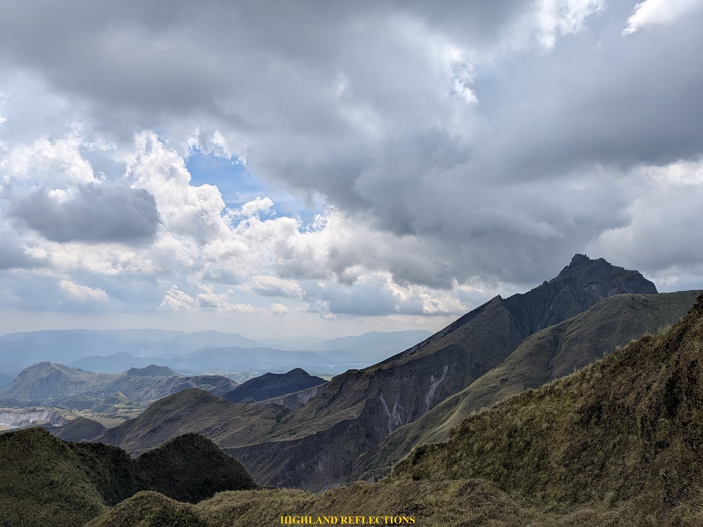
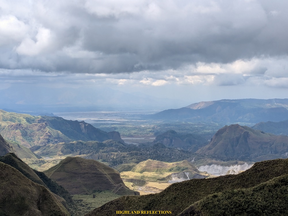
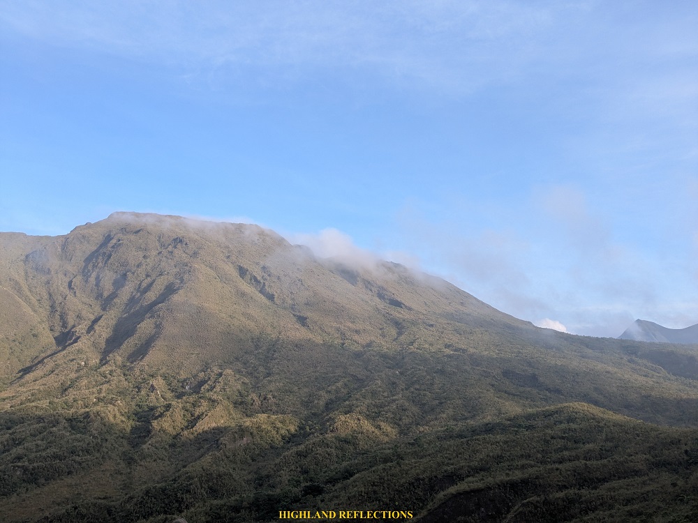
The most prominent view was in the western direction, where a steep drop descended into a grassy expanse that linked up with the eastern caldera of Mt. Pinatubo. On the caldera’s left flank stood a sharp, pointed peak, rising to an estimated elevation of over 1,450 MASL.

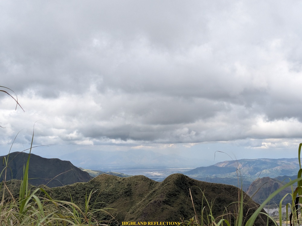
Shifting my perspective to the south and southwest, lahar-carved valleys spread across the landscape. On the horizon are the mountains of San Narciso and San Marcelino, Zambales, where Mt. Kapigpiglatan and Mt. Pimmayong are located. These mountains are further complemented by the Santo Tomas River meandering through lahar valleys. Somewhere in this valley is where the famous Mapenuepe Lake is located. Further in the horizon, a faint outline of the Cawag coastal mountains is visible.
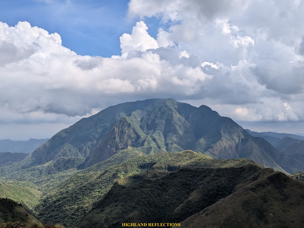
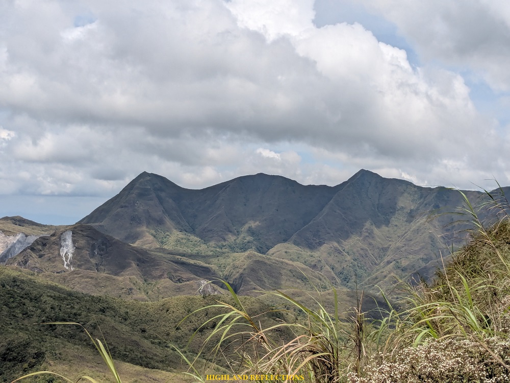
To the southeast, the imposing presence of Mt. Negron dominates the skyline. Its dome-like structure always strikes me in awe. With an elevation of 1,584 meters above sea level, it is the highest mountain in Pampanga, and can easily be spotted on a clear day from Bulacan and Pampanga. I’ve had my sights set on climbing it ever since its trail was opened in 2024. Turning eastward, the mountains we had passed earlier came into view, and beyond them, the Pampanga lowlands and Mt. Arayat can be appreciated in the distance.
As fog blanketed the entire campsite around 4 in the afternoon, I decided to retreat to my tent and catch up on the sleep I had missed before the hike. A few hours later, around seven in the evening, our organizer woke me for dinner. After sharing a few stories and laughs during our ‘socials,’ we called it a night.
Tomorrow would be the day for the crater assault and our descent back to the jump-off point.
Day 2: Crater Assault and the Long Descent Back to the Jump-off Point
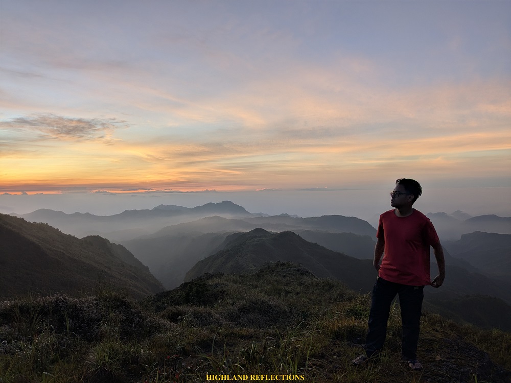
We woke up at 5:20 in the morning, just as the sun began to rise in the east. Its warm glow was slowly lighting up the dark blue sky, casting its magic over the mountaintops of Central Luzon. The morning sun was complemented by the crisp mountain air. All of these complemented the silhouette of the Sky Dome, Mt. Negron. Its warm, orange hues gradually lit up the dark blue sky, casting a soft glow over the landscape. When we were done basking in the morning magic, we had our morning coffee and rituals to prepare for the crater assault.


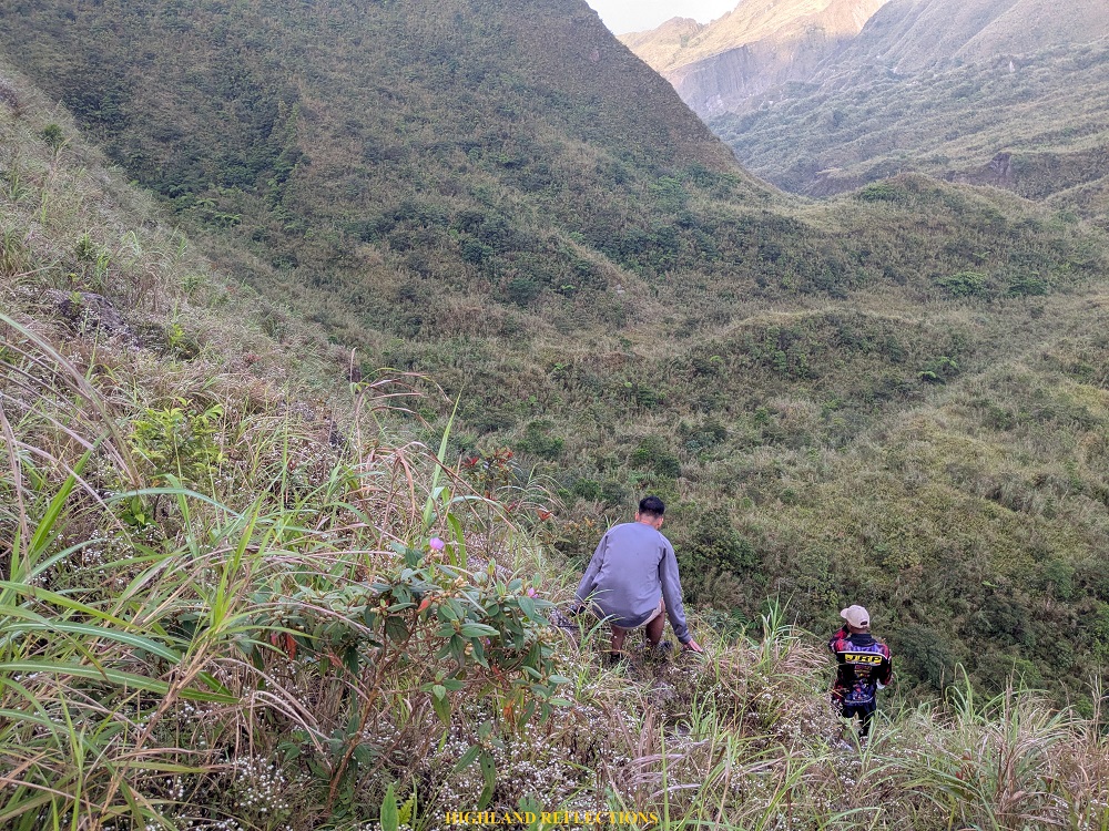
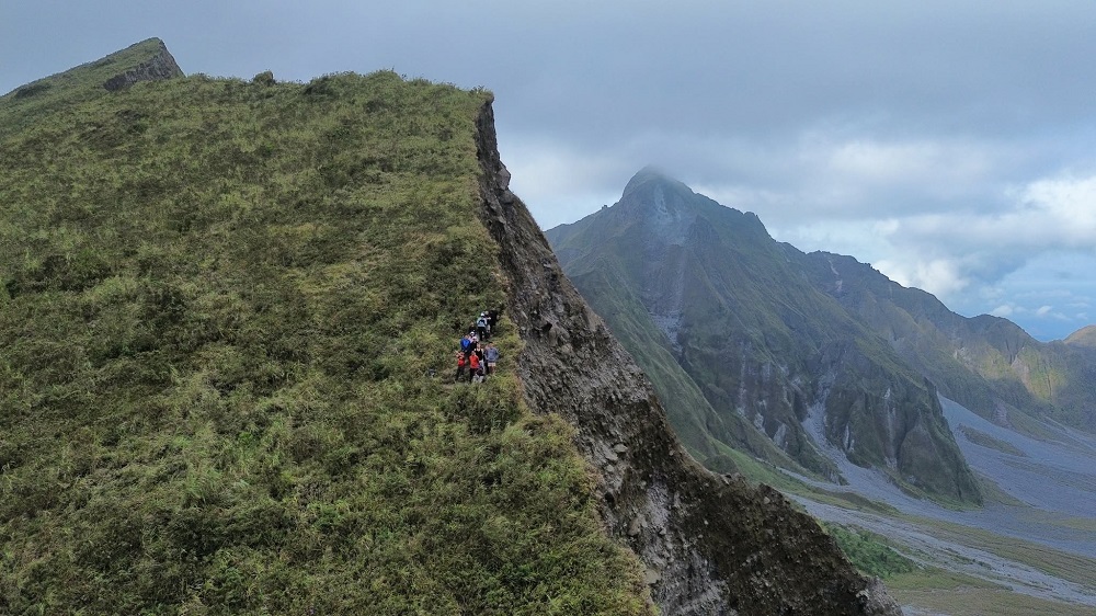
We began our bid for the crater a little before 7 in the morning. The trail followed the side of Mt. Mcdo’s shoulder, where a steep 200-meter descent greeted us. The initial section led us down a sharp drop through a dense forest. After descending about a hundred meters, the trees gave way to an open trail, and that’s when we saw what lay ahead: a narrow path carved along the face of a mountain wall. One misstep here could lead to a fatal fall!
The steep descent ended at what appeared to be a dried riverbed strewn with scattered rocks. We paused here for a quick five-minute break as our bodies were still rattled from the challenging descent we just did. After catching our breath, we pressed on.
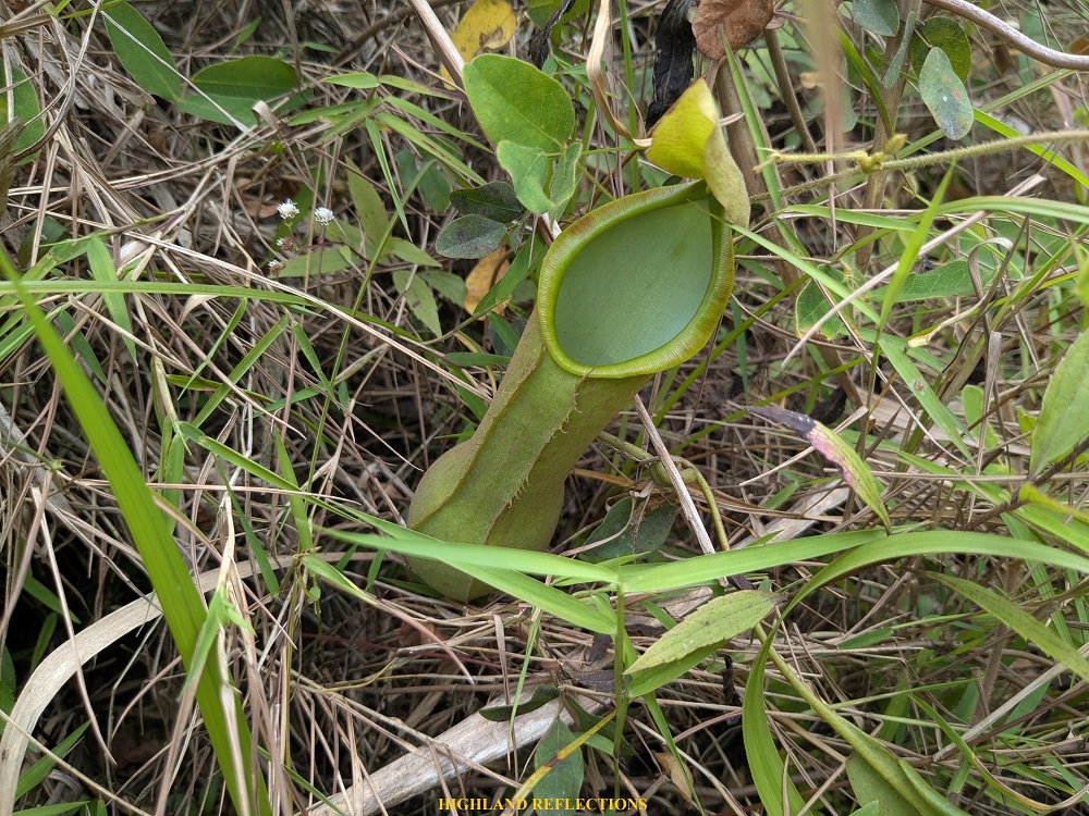
The next stretch of trail led us along an open, grassy ridge at the side of the crater, filled with pitcher plants and dotted with volcanic rocks. Instead of climbing steeply, the path gently traversed to the right of the caldera. The final portion of the trail involved some light rock scrambling, followed by an easy walk across the side of the caldera that offered beautiful views of Mt. Mcdo and a vast expanse of Mt. Pinatubo’s forested slopes. The trail ended at a saddle tucked between two peaks, which provided views of the expansive crater lake of Mt. Pinatubo. It took us more than an hour to reach this vantage point. The crater was still as jaw-dropping as before!
Staring at the crater brought me back to my musings when I first gazed upon the crater from this angle. As written in my Inararo Trail blog:
My first glimpse of the entire crater coming from the trail left me awestruck, and I was honestly, honestly lost for words when I gazed upon the expansive crater lake, surrounded by titanic jagged peaks. The view was surreal! Even my photos uploaded in this blog cannot capture the expansiveness of what I was seeing.
True enough, the photos uploaded in this blog cannot do justice to what I was seeing in person. That said, I believe the Inararo Trail/Delta-5 viewpoint—just less than a hundred meters to the right from where we stood, though unreachable due to the dense foliage between—offered a far better angle as it seems nearer to the crater compared to the Sapang Uwak view point. Still, both were on the edge of the caldera with deep drops below, providing a thrilling experience knowing that you are literally at the edge of a volcano’s caldera!
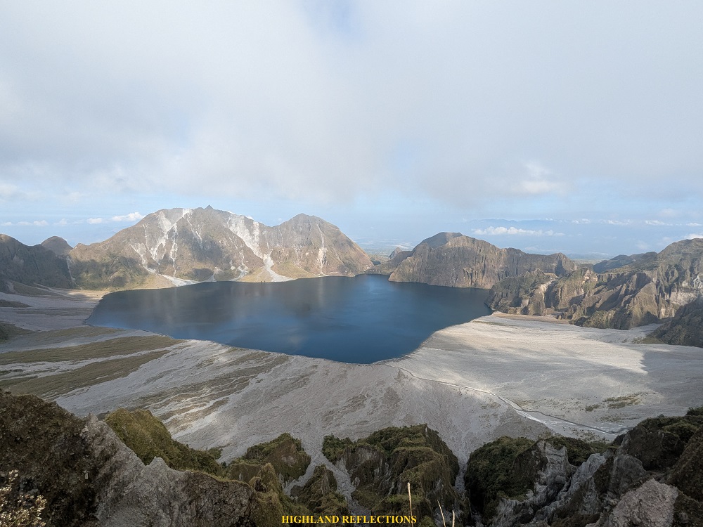
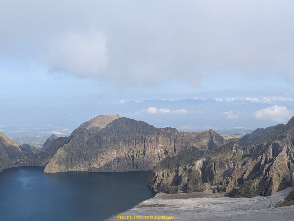
In front of us stretched the turquoise waters of the crater lake, with the rest of Mt. Pinatubo’s caldera circling around it. Beyond the crater, I could see the valley nestled between the mountains of Cabangan, Zambales and the mountain range that houses Mt. Tapulao—the highest mountain in Central Luzon. To my right, a section of the caldera appeared to have been scarred, possibly by a landslide. Beyond that, the three peaks of the 1,400-meter Mt. Tayawan loomed, which, surprisingly, has not been climbed despite its close proximity to Mt. Pinatubo.
After taking some pictures, we decided to return to the campsite. Motivated to take breakfast, we hiked fast to reach the base of the mountain wall of Mt. Mcdo. Upon reaching it, we steadily climbed the steep trail, with us catching our breaths and appreciating the view after every few meters of steep ascent. We successfully reached the campsite after around twenty minutes of ascent. It was a little before ten in the morning. We munched on our breakfast and broke camp.

It was twelve noon when the team decided to start the long descent to return to the jump-off point. I wasn’t in high spirits starting the descent, as I knew it was a long hike ahead of us. Still, I chose to let my feet do their job as my mind dealt with irritation from the thorny plants I had to push through on the way back. Upon covering five kilometers and reaching the water source, I let the guide fetch us some water once again. I took the chance to rest and eat some trail food to replenish the lost carbs on the long walk.
Continuing on with the hike, I marched steadily, with my exasperation getting the best of me. At this point, I was already lagging behind the lead group since I was getting gassed with the length and monotony of the trail, as well as the heat of the atmosphere. Good thing was that our organizer, Whe, was able to catch up. Since I was familiar with Whe given that I joined his Camp Utopia and Mt. Isarog events just a few months before this hike, I wasn’t hesitant to interact with him. This uplifted my spirits. Who knew a little interaction would boost up the remaining strength I had for this hike.
After my mini socials with Whe, I left him to expedite my pace. I was able to catch up with the lead group resting at a shaded part of the trail. I tried to tag along with them so as to not get caught up with my thoughts, which was mostly about my irritation with the heat, my dry throat needing cold water, and whether the jump-off point was still far. Since I have not had any major climb in the last four months, I was lagging behind a few reasonable meters from them.
Finally, we made it to the wooden view deck a kilometer away from the jump-off point past three in the afternoon. We took the chance to eat our merienda here and get some ample rest before the last push. At this point, the soles of my feet were already aching, and my entire system was close to giving up (although I knew I still had a lot in the tank due to my past major climb experiences, but the tiredness from the long hike was just undeniable at this point). After resting, we pushed through with the final stretch of the hike.

Just a few hundred meters from the view deck, we reached a house at the side of the rough road that sells buko juice. This, apparently, was the end of the hike; there was no need for us to return to the point where we started because the kolong-kolong motorcycles were stationed here! We climbed aboard the kolong-kolong and started the descent to the community where we could wash-up. The 8-kilometer ride was all thrills, as our Aeta driver was speeding up on every descent down the cemented path, with views of the expansive Pampanga lowlands below. What an experience!
The Aeta guide brought us to what Google Maps say as ‘W Camp’ where some public bathrooms could be used (just make sure to tell the guard stationed at the campsite of your intentions). After washing up, we waited for our companions who arrived at six in the evening. At seven, we were on the way home, where we had a celebratory dinner at Aling Lucing’s in Dau, Pampanga.
Mt. Pinatubo via Sapang Uwak: Done!
I’m happy to have finally done the Sapang Uwak hike of Mt. Pinatubo, which I have been aiming to climb for a long time! Entering the domains of the Aeta people, where the forests and rivers are covered in dusty, volcanic lahar, is such a unique hiking experience that cannot be replicated in any area of the Philippines. You just know that once you enter the Cabusilan Mountain Range, you’ll get these raw, humid treks that will surely make your legs ache and your sweat glands cry. Your entire system will surely feel the heat in these mountains!
Visiting Sapang Uwak also made me more excited to try the Delta-5 trail in the future once it opens. I hope I get to satisfy my curiosity as to how the Sapang Uwak and Delta-5 trail get connected at the upper reaches of Pinatubo’s caldera!
I am also very happy to have finally seen Mt. Negron up close, which I have only seen often when in a high vantage point in Bulacan. I am eager to try taking its 36-kilometer trail, which, according to some sources online, is one of the most difficult hikes in Central Luzon!
I can’t wait to head back to the lahar kingdom of Apu Namalyari!
Itinerary
Day 1
03:00AM Arrival at Sapang Uwak, prepare
05:00AM Start hike
05:45AM View deck, breakfast
08:00AM Water source, rest
11:00AM Mt. Mcdo campsite, set camp, rest
07:00PM Dinner
08:00PM Lights out
Day 2
05:30AM Wake-up, take sunrise pictures, breakfast
07:00AM Hike to crater
08:00AM Crater, take pictures
09:00AM Start hike going back to Mt. Mcdo
10:00AM Mt. Mcdo, breakfast, break camp
12:00PM Start descent
04:00PM End of trail, ride kolong-kolong
04:30PM W campsite, wash-up
07:00PM Ride back to Manila, dinner along the way
For overnight hikes in the Sapang Uwak and Pampanga Trails of Mt. Pinatubo, you may contact my organizer for this hike: Trail Makers Philippines.
