When going to the towns in the western part of Benguet such as Kibungan and Bakun, hikers who have been there would tell you of their encounters with village paths carved alongside steep mountain crags and rice terraces, forming jaw-dropping vistas that are perhaps some of the most beautiful in the entire country. However, to reach these two towns, one would have to pass through Kapangan, a quiet town that is often slept-on in terms of its raw beauty despite having similar sceneries with that of Kibungan and Bakun.
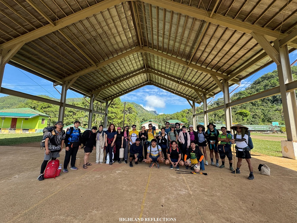
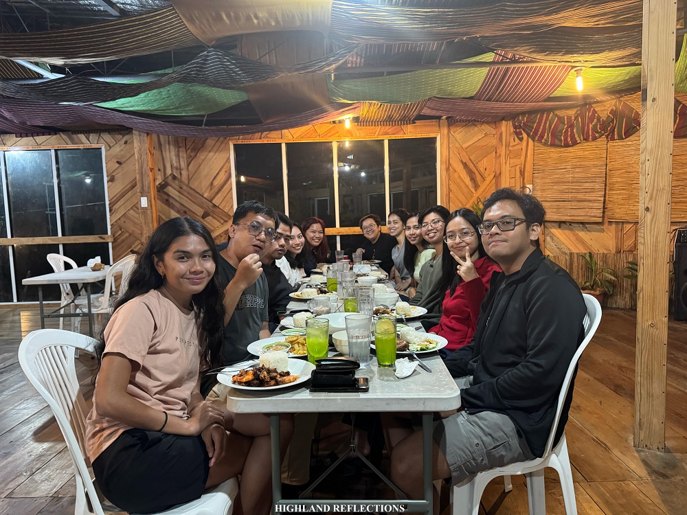
Last December 21-22, 2024, I had the opportunity to go to the town of Kapangan to have a serene year-end hike to Camp Utopia (also named as Badol Camping Grounds) together with my girlfriend, Pat, and my college friends: JM, Sam, and their significant others, Leniva and Franz, as well as Dan. We were also joined by psychology influencer and content creator, Your Millennial Psychologist, Riyan, and her significant other, Grace, as well as two of Franz’ workmates, Eliz and Dyem. We were also with other regular joiners and teammates of our organizer, such as Mommy Jen.

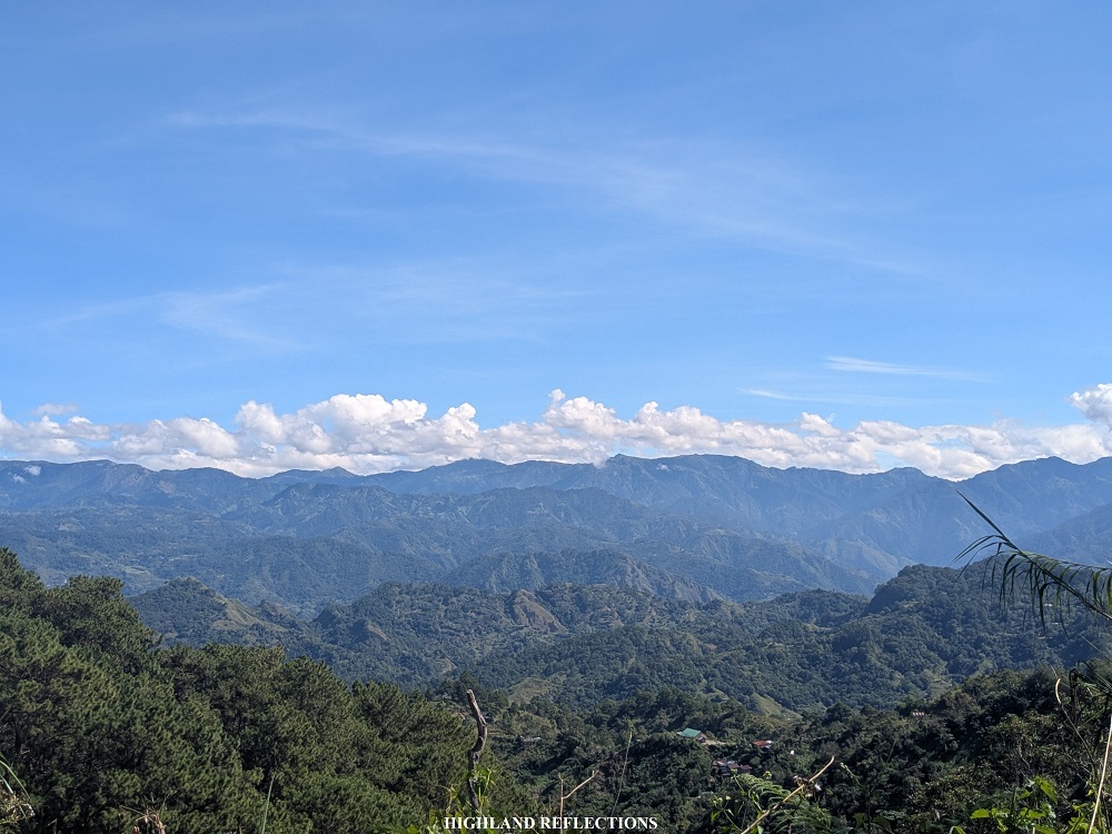
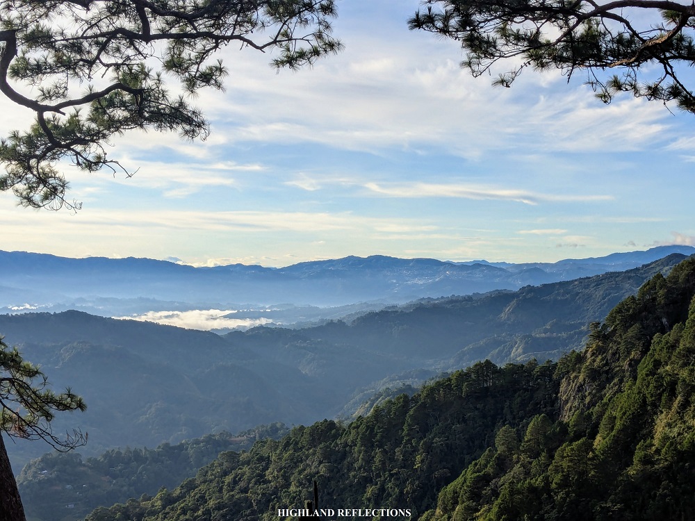
The trek to Camp Utopia immerses hikers into the classic Cordillera milieu—village paths, pine trees, and a vista of never-ending mountain ranges in the horizon. Interestingly, Camp Utopia is no stranger to the events of Philippine history. This area served as headquarters for Filipino and American soldiers led by Major Bado Dangwa during the time of World War II. It was at that time when they christened the place as “Camp Utopia,” perhaps owing to the serenity and magnificence of the place.
Using the Pinoy Mountaineer format, here are the specs of the hike:
CAMP UTOPIA (BADOL CAMPING GROUNDS)
Jump-off point: Sitio Liteng, Sagubo, Kapangan, Benguet
Days required / Hours to campsite: 1-2 days / 2-3 hours
Specs: Minor climb, Difficulty 3/9, Trail class 2
Features: Pine forest campsite, Manpey-as Falls, view of Kapangan
For this hike, we joined an event by Trail Makers Philippines, led by Whe Buenaventura Tabago I, the same organizer that I joined in my Mt. Isarog via Panicuason Trail hike in October. After fetching us in Bulacan around 12 midnight, we made our way up north to Baguio City, where we had a brief stopover and coffee break so that Whe could buy the necessary ingredients for our camp food. Then, we made our way to Kapangan via the Governor Bado Dangwa National Road (formerly Acop Kapangan-Kibungan-Bakun Road). This was my third time taking this scenic road, the first and second of which were during my Kibungan Traverse and Bakun Trio attempt last year. Along the way, we had a breakfast at a roadside eatery.
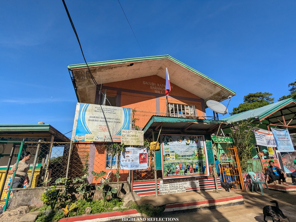

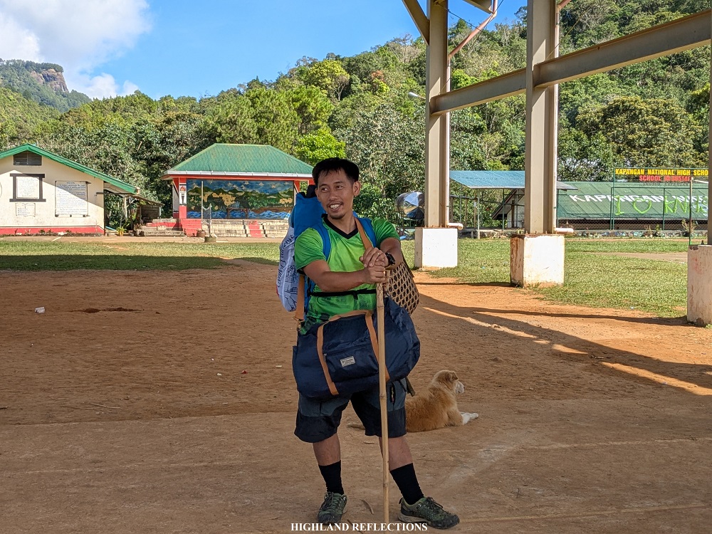
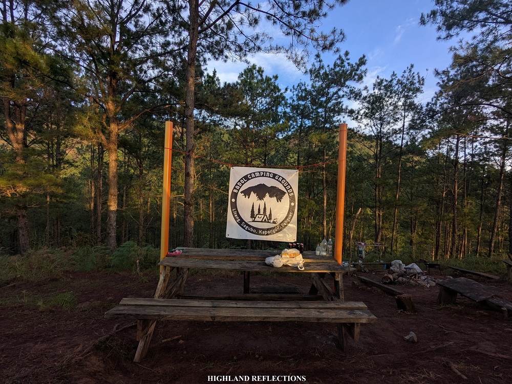
We reached the barangay hall of Sagubo around 9:30 in the morning. There, we met with Sir Weisser Coilan, the caretaker of the campsite. His family owns the entire land area covering Camp Utopia, which was first acquired by his grandfather. After sorting out our equipment, we had a mini orientation at the basketball court of Kapangan National High School. Sir Weisser pointed at a faraway rocky cliff behind the buildings of the high school. Camp Utopia is located way past that cliff!

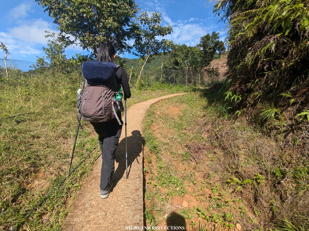
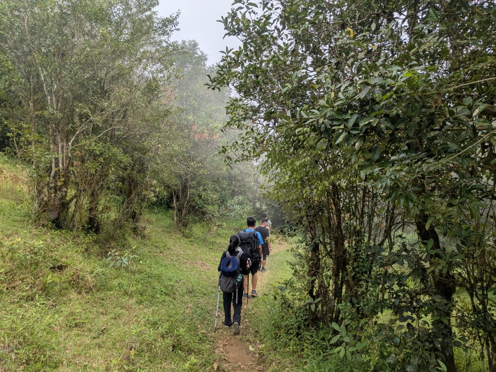
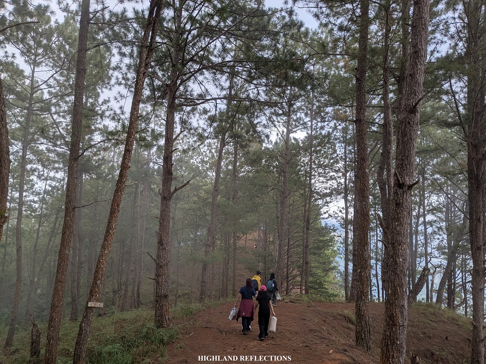
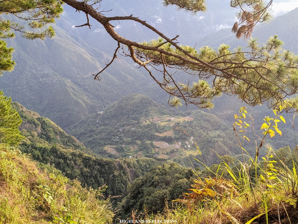
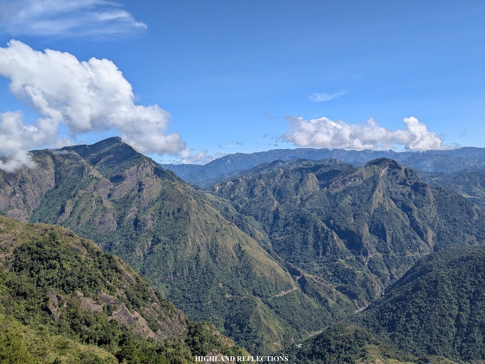
The trail starts at the rear part of the Kapangan National High School. The initial parts run on some cemented village pathways at the side of some residential houses and farmlands. Afterwards, we had to bear the brunt of the midday sunlight as we needed to ascend an exposed rocky road. We grabbed the opportunity to rest at some waiting sheds or some shaded parts of the road. Luckily, the road provided a beautiful panorama of the mountains near Kapangan.
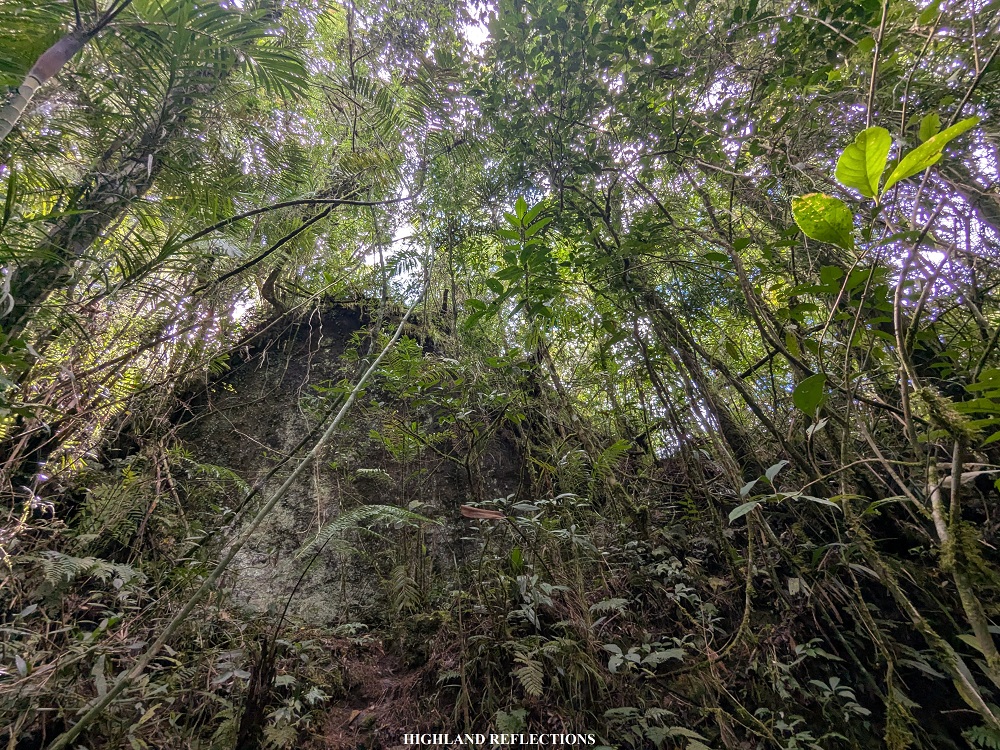
For this hike, we used waiting sheds as markers for the trail. The exposed rocky road had four waiting sheds. After the fourth waiting shed, the trail becomes a single-file path that runs on a ravine. Luckily, despite the trail being exposed, the afternoon fog covered the entire surroundings, saving us from the heat of the sun. After some rounds of uphill hiking, we encountered the fifth and sixth waiting sheds. Pat and I decided not to rest here and continue the climb. The surroundings here seem to be inside a closed canopy forest, with some trees and shrubs covered in thin moss.
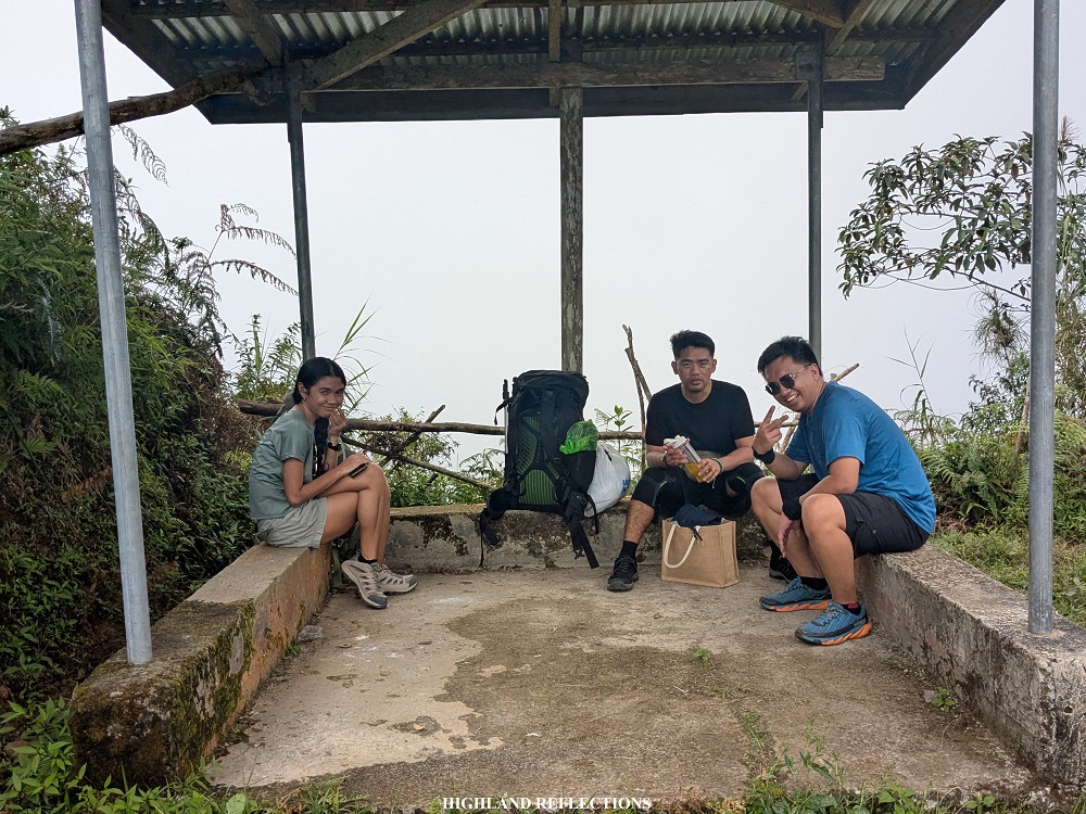
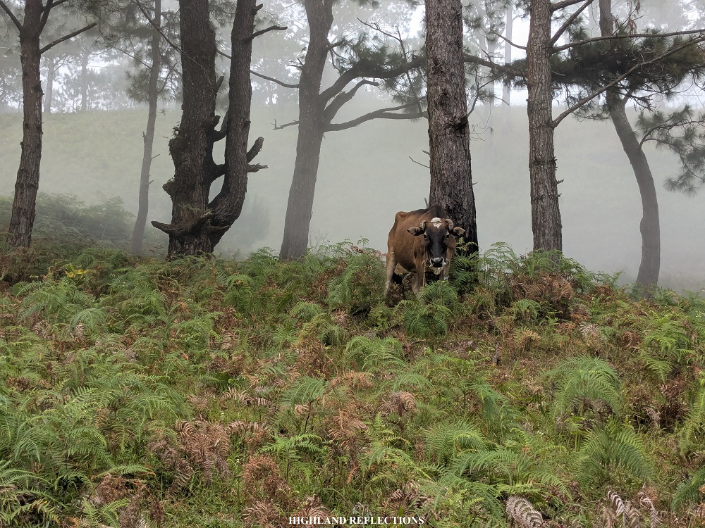
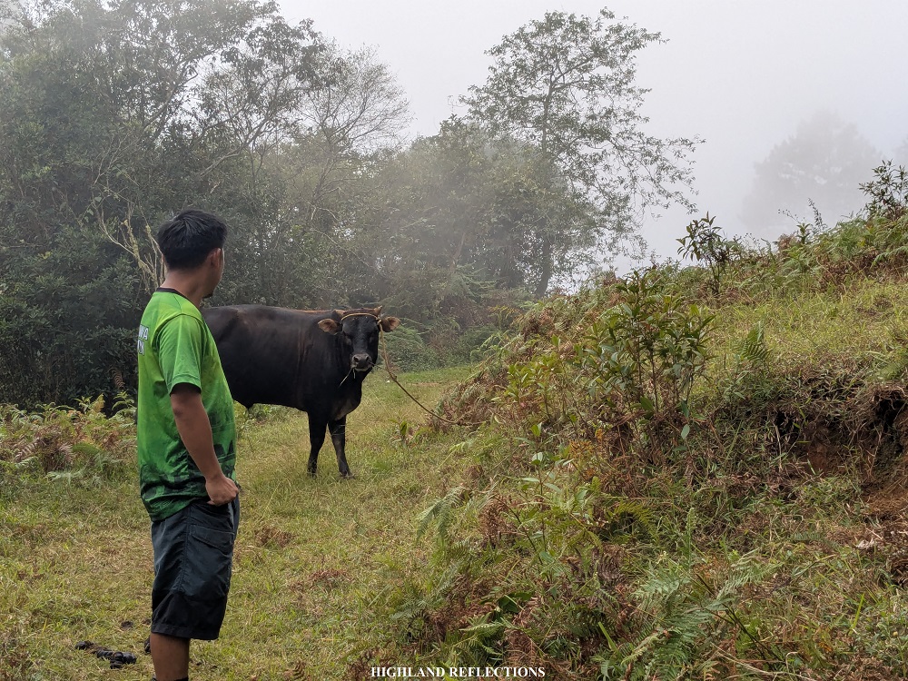
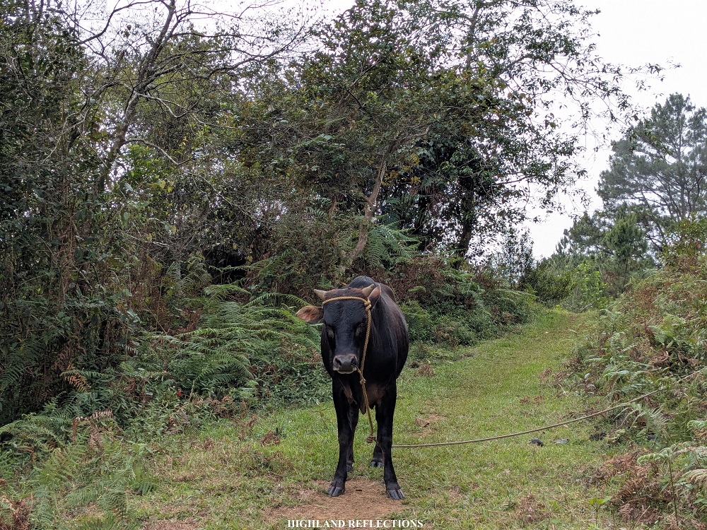
After covering three kilometers from the jump-off point, we reached the seventh and last waiting shed, two hours after we started the hike. The waiting shed was in the middle of a pine and shrub area where some cows were roaming. After having our lunch, we had to pass through an area guarded by a very curious cow who was eager to approach us as we were passing. Luckily, it wasn’t aggressive, and was perhaps only interested in our salty, Sodium-filled sweat.
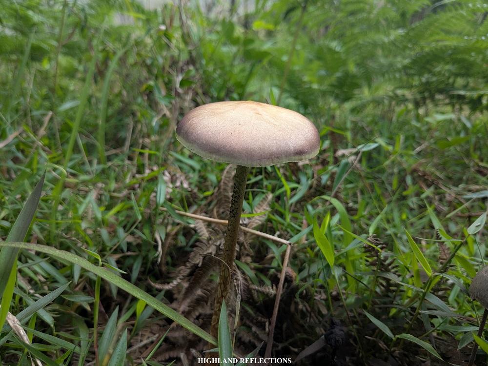
The trail past the curious cow had a mixture of rolling terrain inside of what, again, seems to be inside a closed canopy forest. Some very small limatiks were making their presence felt here. Along the trail, there were some dilapidated houses that seem to be abandoned.
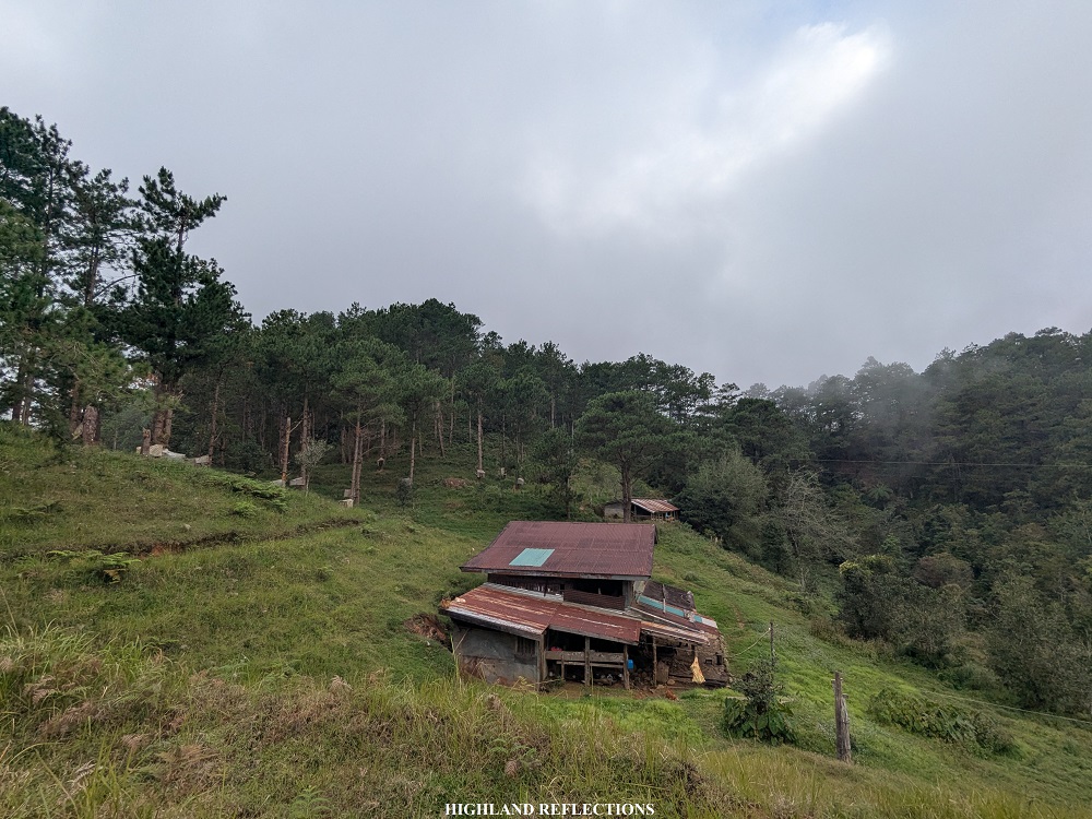
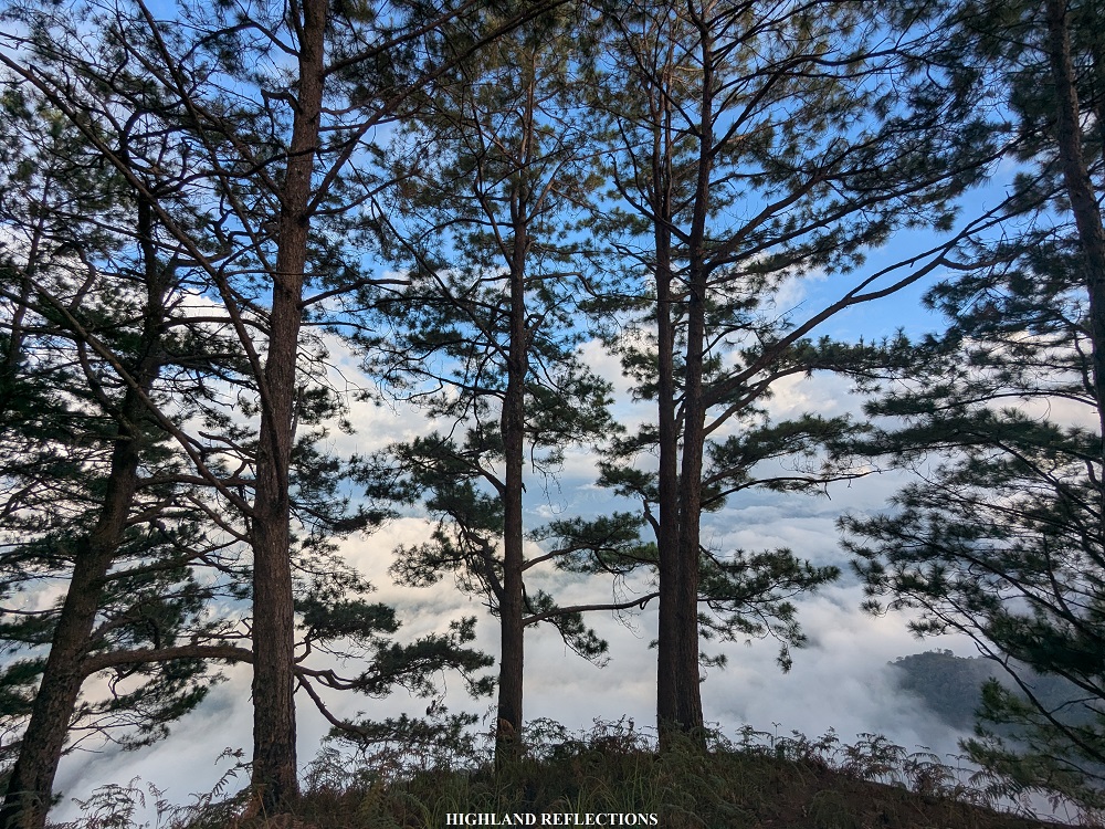
As we were nearing the campsite, pine trees started to dominate the entire surroundings. After covering almost two more kilometers from the last waiting shed, we reached a wooden house complete with a backyard in the middle of the pine forest. Sir Weisser informed us later that day that this was their family house. I thought, “How I wish I could have my own house in the middle of nowhere!” My companions probably had similar thoughts!
Past that house, we continued with the last push. The trail here was on the side of a pine forest ravine. After a five-minute descent-then-ascent, we reached the vicinity of Camp Utopia! It was 1:50 in the afternoon, three hours after we started the hike.
The area surrounding the campsite was such a serene place. We set camp near a cliff blocked by barbed wires to prevent tents from rolling down. Within the vicinity is a wooden table and makeshift campfire area. Past our camping area is a downward slope that can accommodate more tents. At the end of this slope is a makeshift wooden kitchen and five restrooms where Whe and his teammates set up camp. The entire area was complete with camping facilities! Kudos to Sir Weisser for this magnificent place!
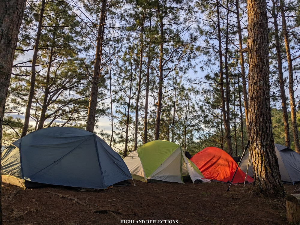
After setting our tents, we had the entire afternoon to socialize and get some rest. We basked in the cold mountain air while sharing stories and exchanging laughter. It was then that I felt grateful for such moments, as this year (2024) was filled with some of the most stressful events in my life, and I suppose, in everyone’s lives in that campsite. Such still moments allowed me and Pat to slow down our fast-paced lives.
It was also a nice change-of-pace from the usual major climbs that I’ve been chasing for the past years.
Before the sun disappeared into the darkness, we took the opportunity to cleanse ourselves at the river near the campsite. The trail going there was on a steep, muddy forest past the comfort rooms. We also took the chance to refill our water bottles, as there seems to be problems with the water supply at the campsite.
We had dinner late in the evening. Whe cooked us some delicious servings of kare-kare, chicken afritada, sinampalukang manok, and pork adobo. Afterwards, we had another social session by the campfire. Our peaceful gathering was complemented by the expanding universe, showcasing its beauty high up the sky. We were in awe. Who needs a five-star hotel when we have more than five billion stars above us?
We returned to our tents and called it a night.
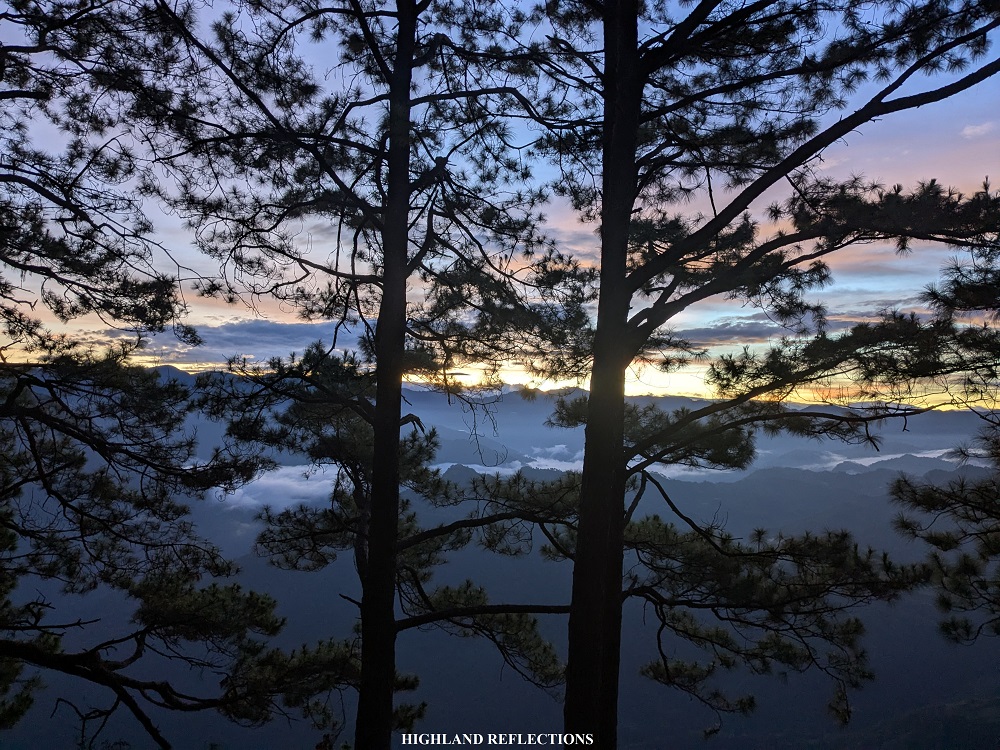
Morning came. As the ravine was facing east, the morning’s golden hour was visible from our campsite.
It was exactly 6 in the morning when I woke up, and I could already see the sun’s rays penetrating the sky. I opened my fly sheet so that Pat could see it once she wakes up. Around 6:30 in the morning, everyone was awake, enjoying the rising sun in the horizon, goldening the pine trees and the mountain ranges surrounding us.
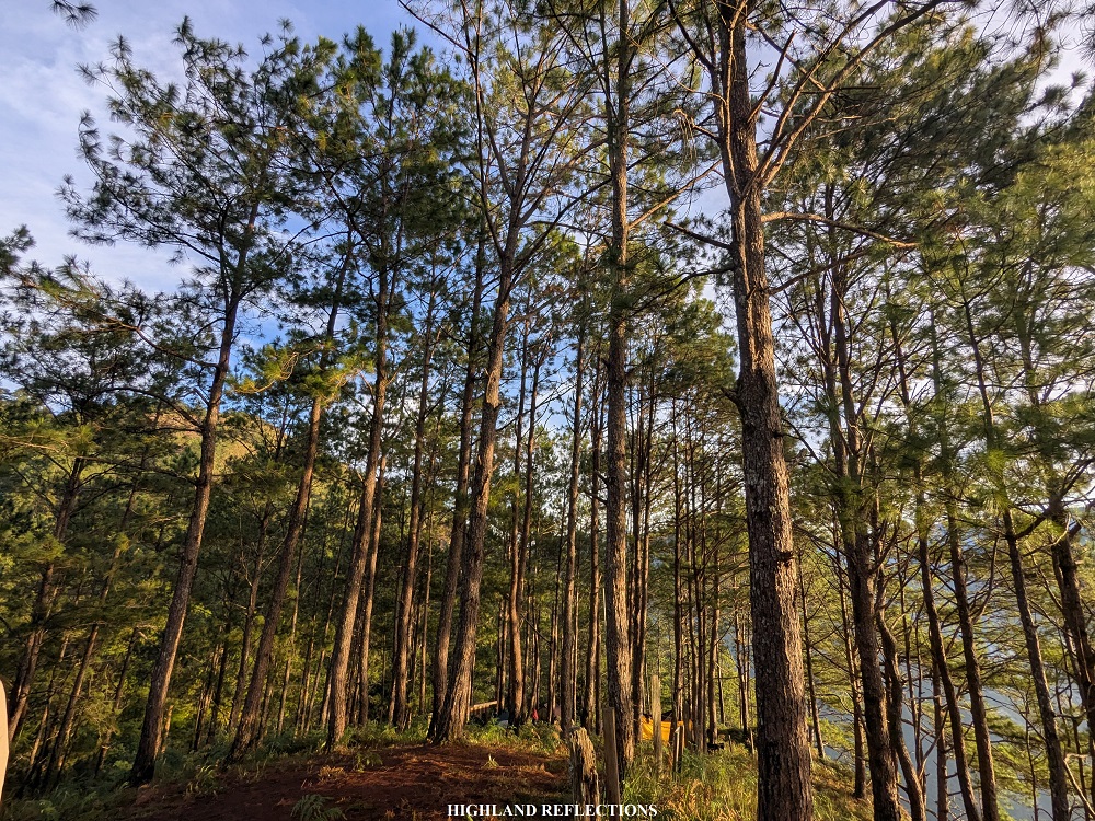
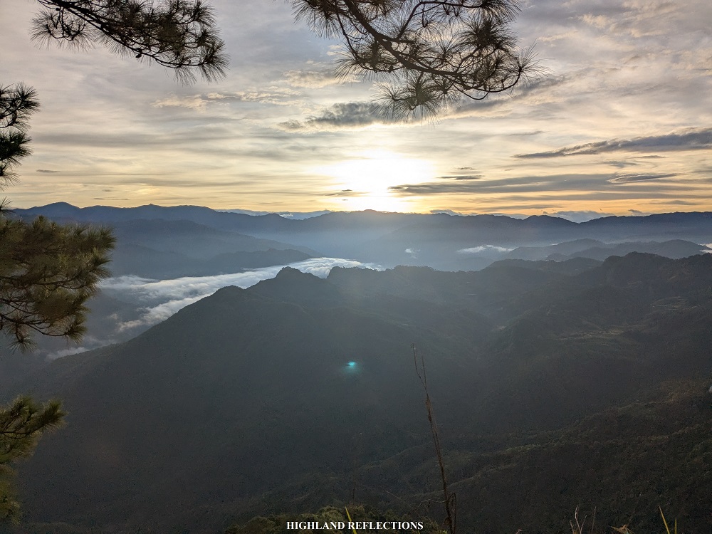
As everyone was busy with their morning musings, I took the chance to snap some shots past the barbed wires (caution must be exercised here as the drop here would be high if you fall down). Afterwards, Pat and I joined JM and company at the pine forest slope near Sir Weisser’s family house. There, we had a photoshoot session, posing with the pine trees as back drop. Once my turn was over, I sat down on a log to appreciate the view. In the horizon, we could spot La Trinidad—Benguet’s capital.
I decided to return to our tent where Pat, Dan, and Mommy Jen were exchanging stories. I munched on my cup noodle breakfast and sipped my morning coffee as the others decided to join in the social session. At 10:30, we had our brunch, consisting of chopsuey, sweet ham, hotdogs, scrambled eggs, and fried fish, courtesy of Whe.
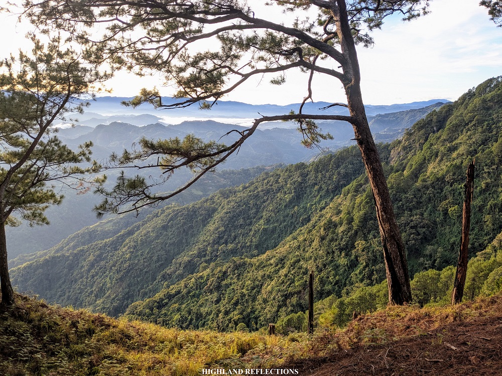
After breakfast, I tagged along with Whe’s regular joiners to go to the view deck atop of Manpey-as Falls, one of the attractions near the campsite. Pat and my college friends decided not to join since they probably wanted to enjoy the campsite more.
It took us about 10 minutes of descent from the campsite to reach the view deck. Interestingly, the view deck provides a panorama of the surrounding mountains above the waterfalls.
Here is a bird’s eye view of Manpey-as Falls, drone shot by @jmtntco:
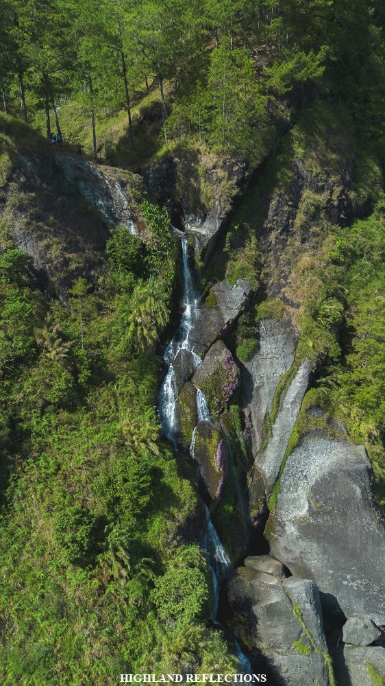
There were two picturesque spots in this area. The first one was on a puddle just before the water gushes downwards to the waterfalls. The two boulders at the side of the puddle acts like a gate, making for a nice photo spot.

The second spot was on a cliff above the right side of the waterfalls. This was where I took most of my pictures, as it provided a view of the two mountains that I wanted to spot from Camp Utopia: Mt. Dakiwagan and Mt. Amanayao! These two mountains have piqued my curiosity when a co-joiner from our Kibungan Traverse hike last year told me stories of his thru-hikes in Kapangan and Kibungan in the past, where he would occasionally pass by the slopes of the two mountains.
Of the two, Mt. Dakiwagan is perhaps the more well-known among Baguio mountaineers. Dakiwagan is dubbed as the ‘Santa Claus Mountain’ due to the Santa Claus face-like shape formed along the mountain’s crag surface when viewed from Governor Bado Dangwa National Road (not visible from the picture above since it was the rear part of Dakiwagan). There have been previous successful attempts to reach its summit, so mainstreaming this mountain among non-Cordilleran hikers is quite possible.
Another fun fact: Dakiwagan is also the name of the bus transit that ply the route from Baguio to Kibungan.
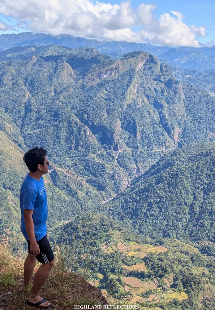
On the other hand, Mt. Amanayao is a towering mountain beside Mt. Dakiwagan. This near-1800 meter mountain serves as a border between Kapangan and Tacadang, where the majestic Crying Mountains of Kibungan are located. According to Sir Weisser a few have summited Mt. Amanayao in the past. I’m hoping that efforts will be made to recon the trail there again!
Here is a drone shot of Mt. Amanayao courtesy of @jmtntco:
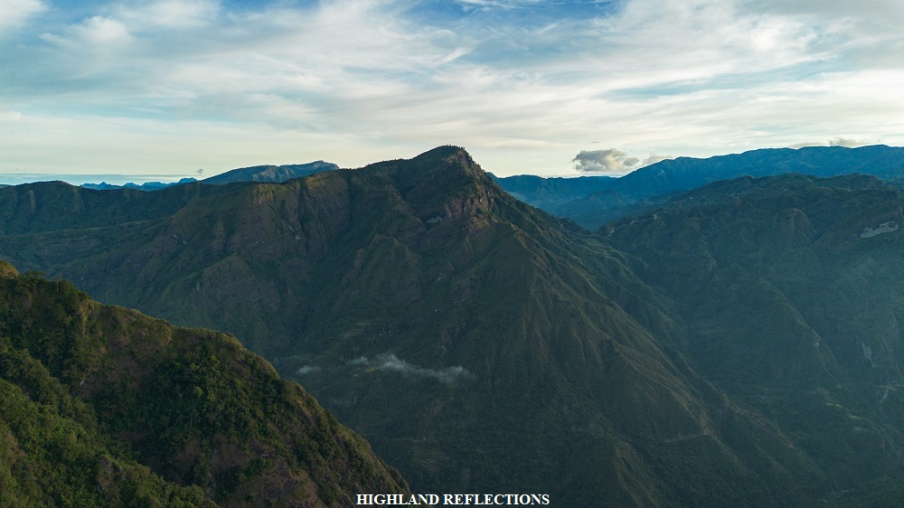
Just below us are some rice terraces and a small village. In the horizon are mountain ranges in the town of Atok. According to Sir Weisser, the summit of Mt. Pulag (or perhaps Mt. Timbak) is visible from this view point. In the southern direction, the rough layers of houses and buildings of La Trinidad can be spotted.

There are other attractions near the campsite, such as the 1500+ meter Sammy’s Peak at the rear part of Camp Utopia. However, during our hike, we were prohibited to go there due to some land disputes. Since there are other 1500+ meter peaks in the area (the campsite sits at around 1370+ MASL), it is possible to create another trail going to some of those peaks. There is also a downward trail that goes to the bottom of the Manpey-As Falls from the campsite. Although I would have loved to go there, we only had a limited time at the campsite.
Interestingly, when looking at topographical maps, Mt. Mugong in San Gabriel, La Union is quite near, although going there might take an entire day.
After basking in the panorama at the view deck, I decided to return alone at the campsite, where my companions were having their social sessions. I decided to rest for a few minutes before breaking camp. Upon packing all of my stuff, Pat and I decided to go ahead even without a guide, since I was confident in navigating the easy trail.
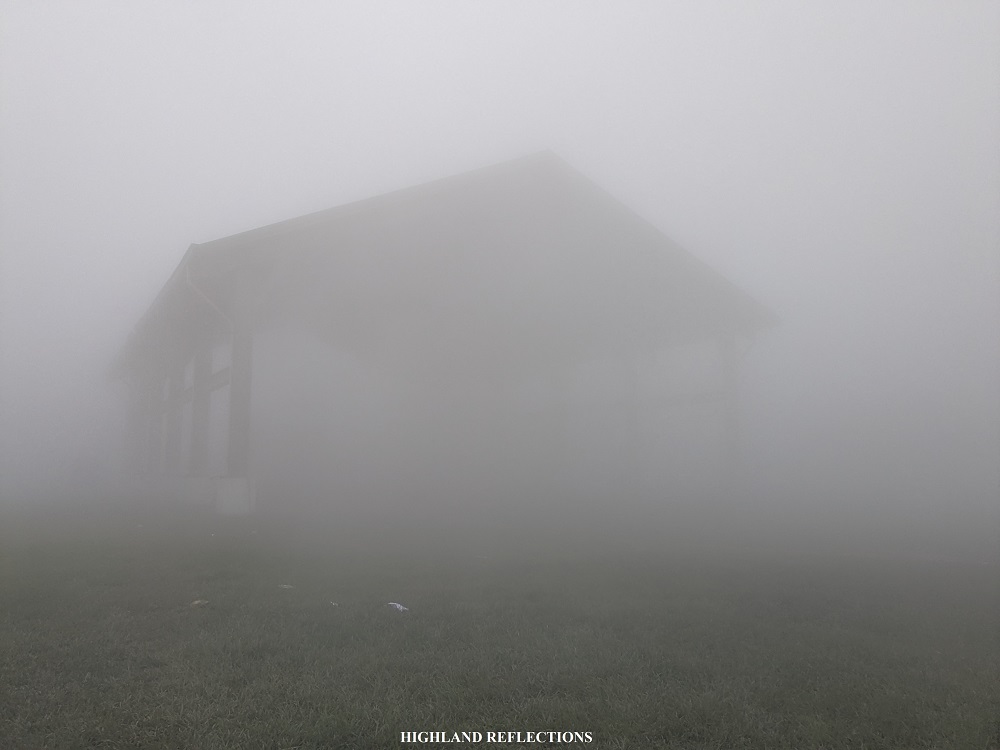
Our straightforward, nonstop descent was only broken by the curious cow that we encountered in the trail. Luckily, it wasn’t aggressive, so all we had to do was distract it while passing through. Then, we continued with our continuous descent, stopping by once or twice to munch on some snacks. We were back at the jump-off after two hours of continuous descent, where we were welcomed by a thick fog covering the entire community.
After washing-up, we started our ride back home. We had a celebratory dinner at Lepan Cafe just before the sun set. We were back home by around twelve midnight.
It was my pleasure to have finally seen what the town of Kapangan has to offer. My visit to Camp Utopia only made me more curious and interested about the mountains standing within the town. Besides Mt. Dakiwagan and Mt. Amanayao, another mountain that is in my radar in the town of Kapangan is Mt. Pokgong in Barangay Sablan, which seems to offer a moderately difficult trail!
But of course, more than my curiosity is my fulfillment and enjoyment of staying at Camp Utopia. Its name perfectly describes what the place offers—a peaceful paradise found in the middle of the Cordilleras.
Itinerary
Day 1
05:30 AM Baguio City, buy supplies
06:30 AM ETD for Kapangan
07:30 AM Breakfast along the way
09:30 AM Sitio Liteng, Sagubo
11:00 AM Start hike
01:00 PM Lunch along the trail
02:00 PM Camp Utopia, set camp
03:00 PSM Free time, socials
10:00 PM Lights out
Day 2
06:00 AM Wake-up call, view sunrise
07:00 AM Free time
09:30 AM Breakfast
10:00 AM Manpey-as Falls view deck, take pictures
11:00 AM Return to campsite, break camp
12:30 PM Start descent
02:30 PM Sagubo, wash-up
04:00 PM Start ride back home
06:00 PM Cafe Lepan, dinner
12:00AM Back home
