Considered as one of the Southern Tagalog classics among Filipino hikers, Pico de Loro is a well-known mountain on the fringes of the Mt. Palay-Palay/Mataas na Gulod Protected Landscape. As the highest point in the entire province of Cavite, and the namesake of a popular resort nearby, Pico de Loro provides a panoramic view of the entire Manila Bay all the way to Bataan as well as the surrounding terrains of the Mt. Palay-Palay and Mataas na Gulod Mountain Range. The mountain is also home to a diverse set of wildlife—from colorful birds such as the Brahminy Kite (which we spotted at the summit!) and the Luzon bleeding heart, to venomous and non-venomous snakes like the Philippine cobra and rat snake. Hence, the hike inside the forests of Pico de Loro is an immersion into a protected forest teeming with diversity!
Pico de Loro is also no stranger to the events of Philippine history. As Pinoy Mountaineer writes:
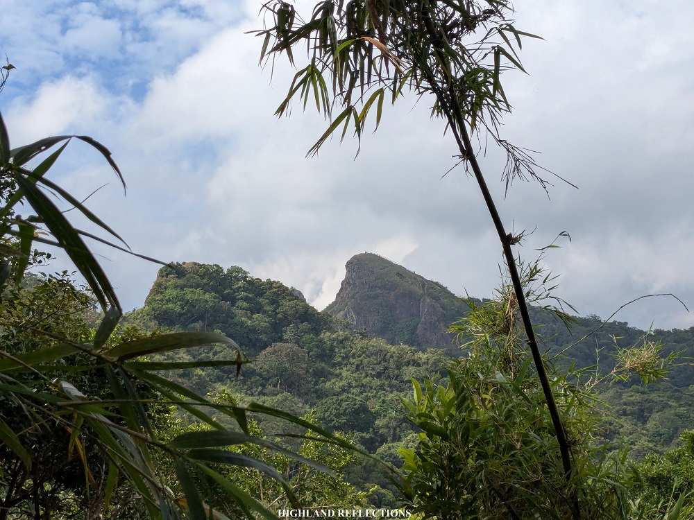
Centuries ago, the Spaniards aboard their galleons to Manila Bay noticed the form of a giant parrot, perched in the forested mountains in Cavite. They named it “Pico de Loro” – “Parrot’s Peak.” Today, mountaineers who visit Pico de Loro discover that it is as enchanting as its name. High on Cavite’s highest point, they could behold the rocky tower that the Spanish sailors once saw as the parrot’s beak, and they could gaze towards South China Sea where the galleons once sailed, all the way to the historic island fort of Corregidor.
Such historical feat complements the natural beauty of the mountain’s forest. With a beginner-friendly trail, the hike up to the summit can be completed in just a span of 2-3 hours on a relaxed pace, making it a perfect half-day hike for those who would want a nearby mountain adventure near Metro Manila.
As a beginner-friendly mountain, Pico de Loro had piqued my interest back in 2016 when we were still college students discovering the beauty of the outdoors. As broke college students who needed to save our everyday baon to climb some of the Southern Tagalog mountains down south, DIY style, we placed Pico de Loro high in our bucket list. Sadly, it was in the same year when Pico de Loro closed to the public to rehabilitate, as mass hiking brought about environmental destruction to the mountain. This meant heaps of trash and vandalism at the monolith near the summit.

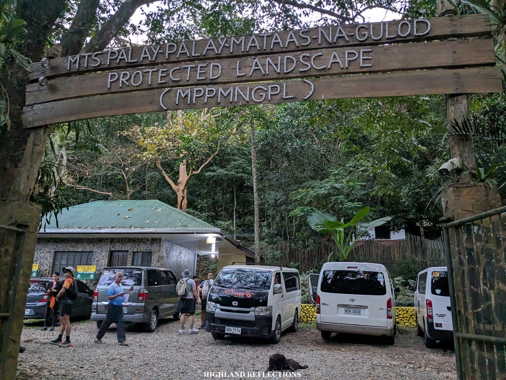
It took around seven years before the mountain opened its trails to the public. In 2023, the Protected Area Management (PAMB) Office of the Mounts Palay-Palay/Mataas na Gulod Protected Landscape opened a new trail complete with a new system for Pico de Loro. To preserve the mountain’s beauty, hikers can only book their hikes on Fridays and Saturdays. I surmise that the remaining days of the week is for the mountain to recover. Online registration is also required via their website (you may visit their website at https://mppmngnp.com/ to register). No walk-ins are allowed. Guides are also mandatory.
For this hike, I and my mom joined an event organized by TakeFive Outdoors, one of the most well-trusted hiking tour group in the Philippines. We met with their team in Quezon City around 3:30 in the morning before taking the ride to Naic, Cavite where we had our breakfast. Afterwards, we went to the jump-off point in the town of Ternate, located at the DENR-PAMB park office beside the Ternate-Nasugbu Road. The office was complete with necessary facilities, making the area akin to that of a resort. There, we had a mini-orientation conducted by the officials of DENR-PAMB. We started the hike at seven in the morning.
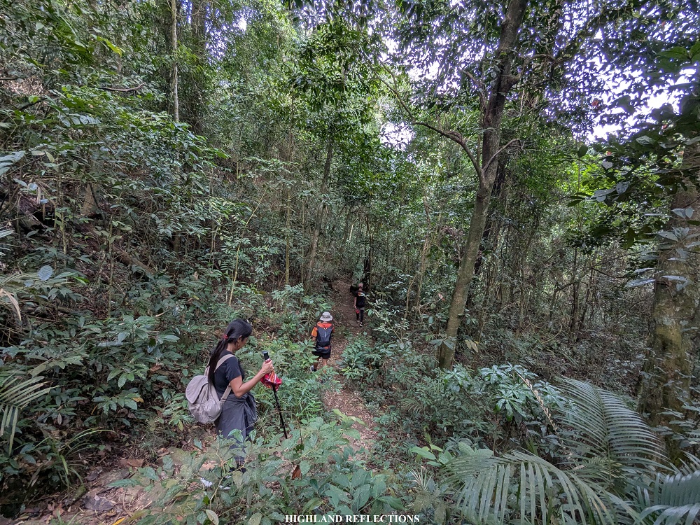
The hike started beside the offices where some gazebos are arranged in an amphitheater-like area. This leads to a cemented path at the side of some brooks; the path transforms into a carved footpath where rock ledges are installed to make the hike easier (though very hard to step on, adding more impact to the knees; a natural footpath would have been better despite the possibility of muddiness during rainy season).
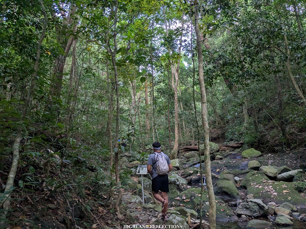

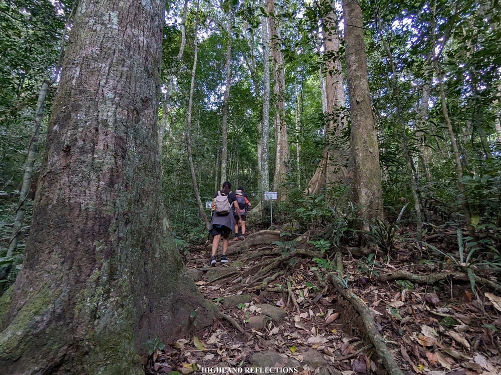
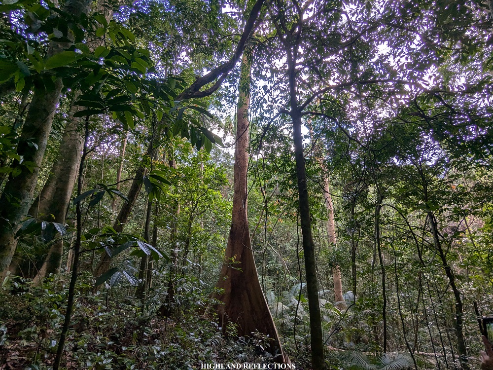
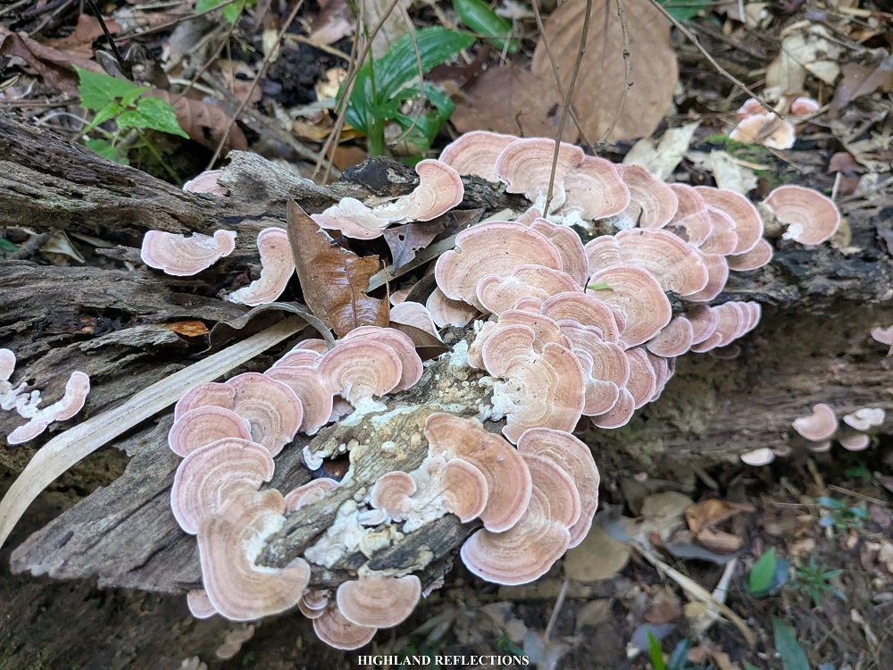
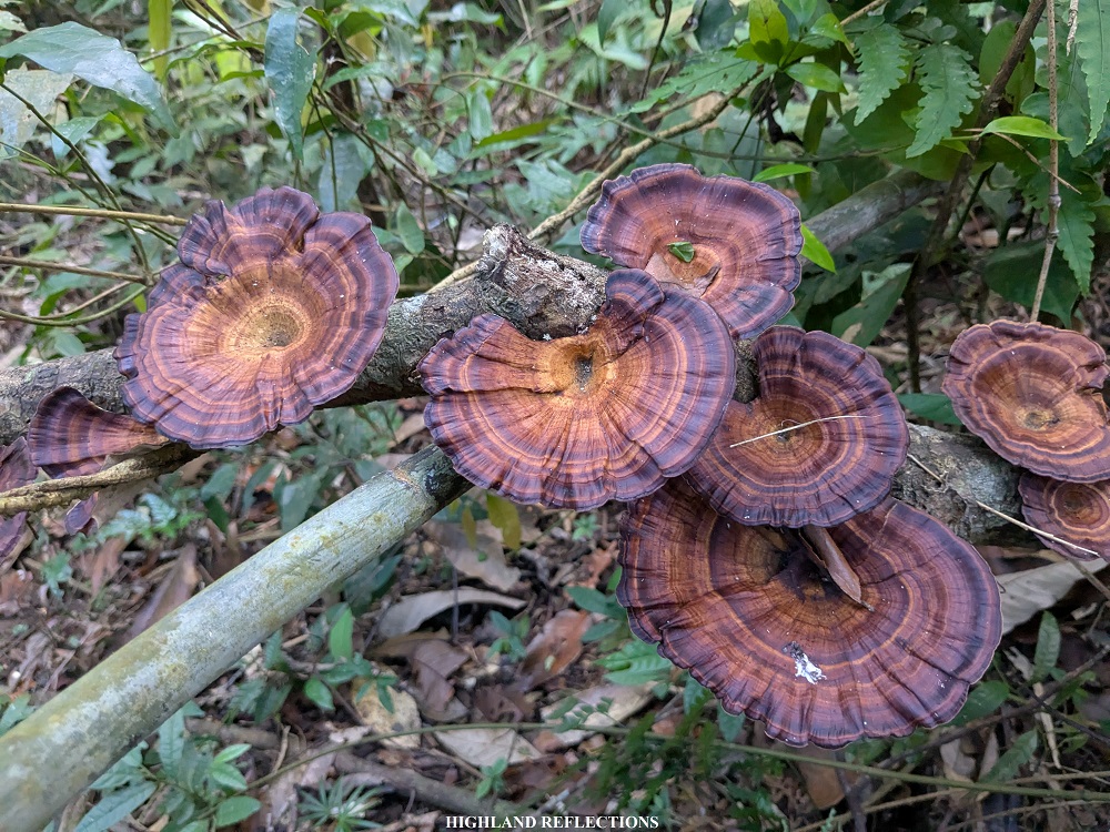
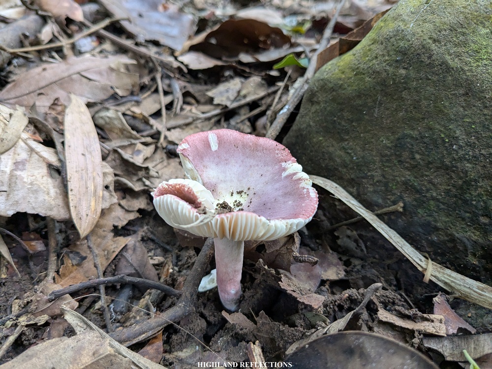
Even early on in the hike, we were already greeted with old-growth trees that thrived into amazing sizes. With the combination of towering trees and boulders scattered along the trail, this entire section was highly reminiscent of the trails in Tarak Ridge and Mt. Arayat. Wildlife was also abundant, as there were a variety of mushrooms spotted within the trail. The entire ascent was on a gradually inclined path which was relaxing to take.


An hour and a half after the hike, we reached an area where a metal platform was erected serving as a view deck. Here, we had a commanding view of the terrains of the mountain range, as well as the parrot-shaped summit of Pico de Loro to our right. It looked very far, but it was actually just a short, 30-minute hike from where we were!
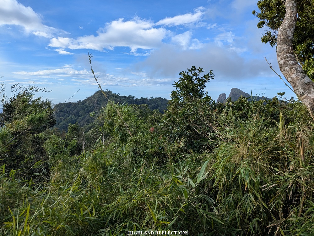
Past the view deck, we had to negotiate a steep ridgeline that descends and ascends before reaching a bamboo forest. These bamboo trees were a signal that we were near the summit area. Just after fifteen minutes of quick-paced hiking from the view deck, we reached the summit campsite that provides a vista of the towering summit of Pico de Loro, as well the magnificent views surrounding it. The peak resembles that of revered colossal statues in ancient times. It was such a sight to behold!
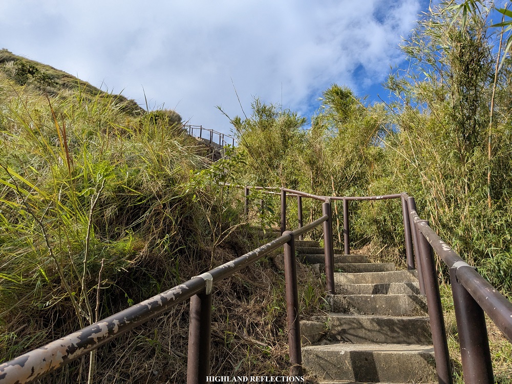
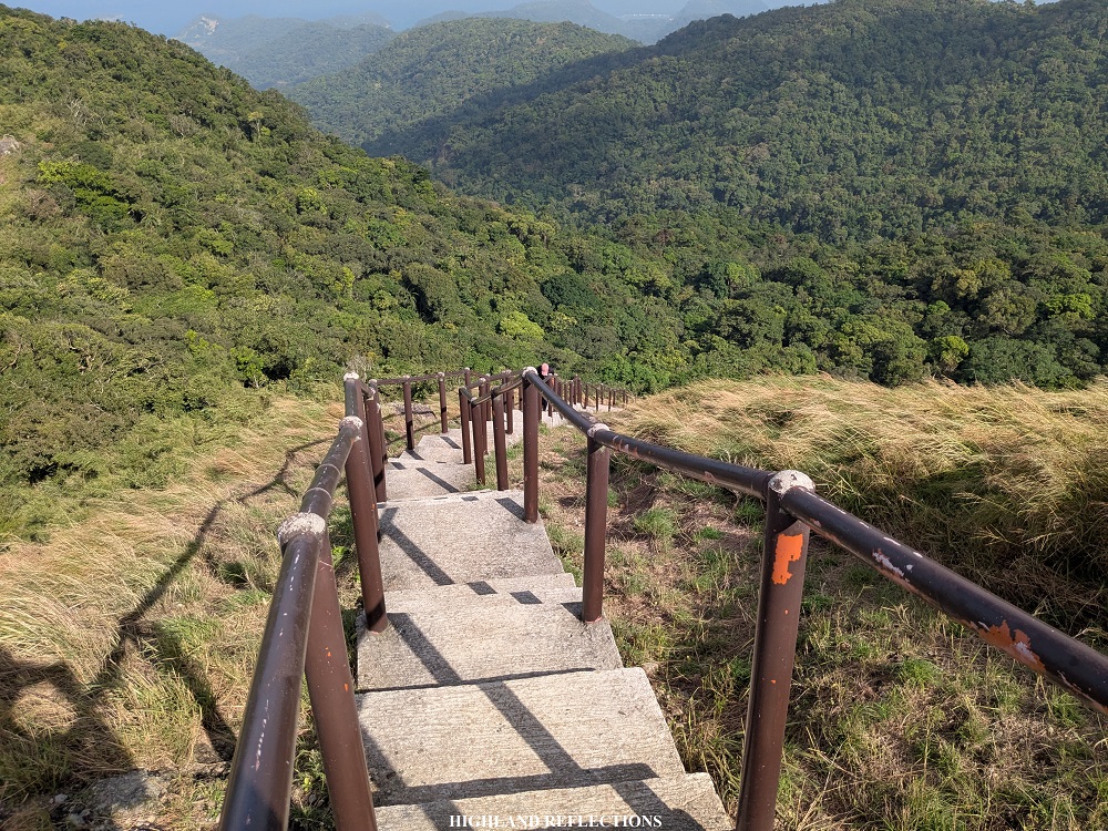
After snapping some pictures at a picturesque spot a few meters away from the campsite, we pushed through with summit assault. From the campsite, it was a steep, technical 5-minute assault up to the summit. The first few parts run on some 60-degree footpath inside a forest. Ropes here are installed for beginners. Past the forest is a short grassland section where a cemented staircase was installed to prevent soil erosion.
As I was climbing the cemented staircase, the gusts of wind were blowing fiercely, battering my body, and making the ascent a bit struggling. Still, it was a welcome respite from the sun’s rays.
Past 9 in the morning, I reached the summit of Pico de Loro at 664+ MASL! I relived all the desires that I had during college to climb this mountain, whispering to myself that I am proud of this long-time achievement. I finally reached its summit!

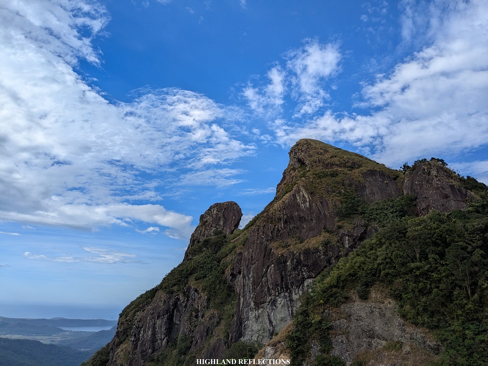
At the summit is a newly-installed signage inscribed with the name and elevation of the mountain. However, the most iconic landmark in the summit area is the monolith, which was long thought to be the beak of the parrot head shape of the mountain, hence why it is called as Parrot’s Beak. Before its closure in 2016, hikers were allowed to strike a pose atop the monolith, where pictures were snapped from the summit. However, after its reopening in 2023, the park management prohibited hikers to climb the monolith to preserve its natural beauty. I savored the view of the monolith from afar.
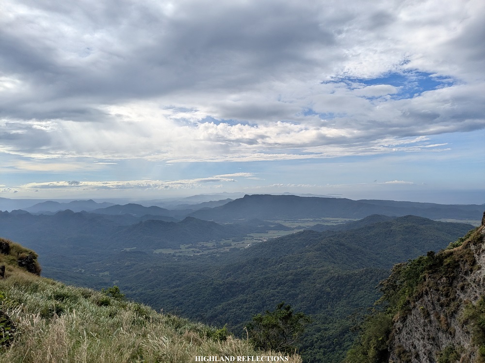
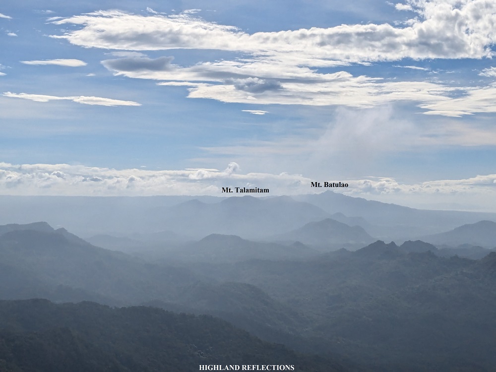
Past the monolith, which was in the southern direction, is a view of the low terrains of the mountain range near Pico de Loro. To the right of the monolith (southwest), a faint view of Lubang Island can be seen. To the left of the monolith (southeast), Mt. Batulao and the three summits of Mt. Talamitam (Lantik, Talamitam, and Apayang) can be spotted. In the same direction, the nearby Mt. Marami and Mataas na Gulod is also present.

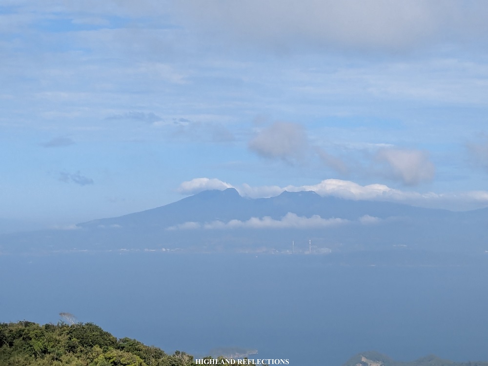
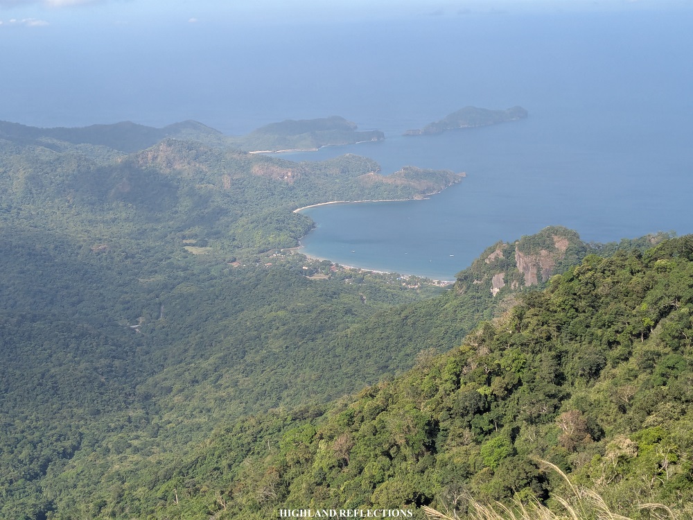
To the north, the orange wings of two Brahminy Kites were circling above the trees of the nearby mountain slope. Its bright, majestic color make it seem like they were phoenixes! Past the mountain slope is Manila Bay and Corregidor Island. In the horizon is a view of the gigantic Mt. Mariveles in Bataan. The skies were clear that day that I could distinguish some of the different spots in Mt. Mariveles: Tarak Ridge was dwarfed by the towering Bataan Peak to its left and Vintana Peak to the right. To the west, of course, was the expansive West Philippine Sea. Just below the mountain, we could spot some of the beaches and coves within the Ternate and Nasugbu area.
We only had a short picture session at the summit before immediately descending. As I was with my mother during this hike, we took the time to descend the mountain, passing by the same spots that we hiked on the way up. With the relaxed pacing, I was able to appreciate the diversity of the forest around me.
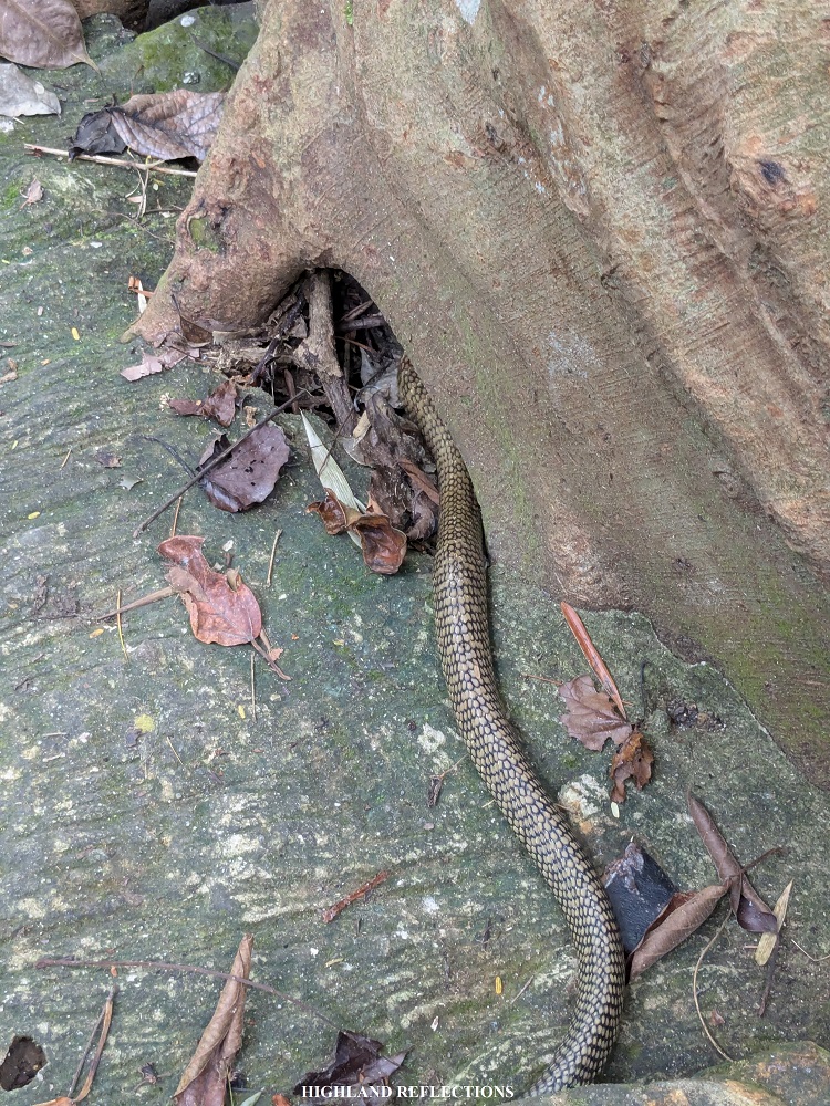
Upon reaching the cemented part near the DENR-PAMB office, my guide spotted the head of a rat snake at the side of the trail. As someone who was eager to see some snakes for this hike, I grabbed the chance to snap some photo and record a video as it was retreating towards a tree root. This marked the end of our hike in Pico de Loro! It only took us a total of five hours to complete the hike—literally just a half-day hike!
We left the vicinity at around 12:30 and had our lunch at a nearby eatery. Afterwards, we had to brave through the Cavite traffic, reaching Quezon City at around 6 in the evening. With such a hassle, I’m just glad to have finally crossed off Pico de Loro off my personal list of hiking goals. Young me would proud.
Itinerary
03:30 AM Meet-up at QC
05:00 AM McDo Naic, breakfast
06:00 AM MPPMNGPL DENR-PAMB Office, orientation
07:00 AM Start hike
08:30 AM View deck
08:45 AM Summit campsite, take pictures
09:00 AM Summit, take pictures
09:40 AM Start descent
11:30 AM Back the PAMB office, wash-up
12:30 PM Lunch at Ternate
06:00 PM Back in Manila
