Mt. Isarog stands as one of Bicol Region’s revered mountains. With an elevation of 1,966+ MASL, it is the second highest mountain in the region, next to Mayon Volcano, and the highest in the province of Camarines Sur. With steep trails and a mixture of montane and mossy forest, hiking Mt. Isarog provides a physical challenge typical of any major hike in Bicol Region. Its gigantic, semicircular crater contains lofty peaks and steep ridges that can be accessed via the towns surrounding the mountain: Goa, Tigaon, Ocampo, Pili, Naga City, Tinambac, and Calabanga.
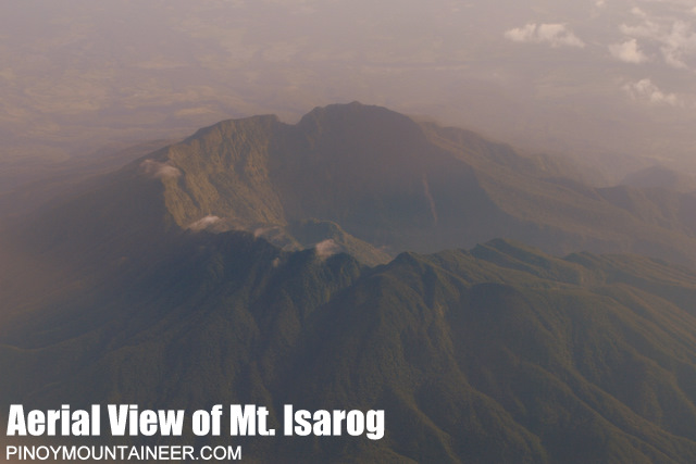
Thus, with multiple peaks around the crater, there are multiple trails to take in climbing Mt. Isarog: there is the difficult Goa Trail in Goa, which accesses the northern part of the crater (1,911+ MASL); at the opposite (southern) part of the crater lies Patag-Patag Trail and Peak (1,891+ MASL) in Tigaon, the lesser known Pitong Kulod Trail and Peak (1,800+ MASL) in Pili, and the subsidiary PLDT Ruins Peak (1,513+ MASL) in the town of Ocampo. There is also the Hiwacloy Trail in Goa, which, instead of going to one of the peaks on the crater, goes inside the valley formed through the breached crater at the eastern part of the mountain. However, the highest point of Mt. Isarog is via the Panicuason Trail (1,966+ MASL), located in Naga City. This was where we climbed for our two-day Mt. Isarog hike last October, 2024!
Here are the (updated) specs of the Mt. Isarog via Panicuason Trail hike:
MT. ISAROG (via PANICUASON TRAIL)
Jump-off point: Panicuason, Naga City, Camarines Sur
Days required / Hours to summit: 2 days / 8-10 hours
Specs: Major climb, Difficulty 6/9, Trail class 3
Features: View of Magayon Trio, Naga City, and Lagonoy Gulf; montane and mossy forests
For this hike, I joined an event by Trail Makers Philippines. Accompanying me in this event were Cristine, one of my friends in the hiking community since 2021; Khael, whom I joined with in our Mt. Mandalagan climb last August, 2023; and, Ryan, who I just met in Mt. Al-al last June, 2024. Of course, there were other joiners in the group, but I was with Cristine, Khael, and Ryan for the entire climb.
Our adventure started in Naga City. We arrived at the queen city of Bicol Region around 7 in the morning. Since our organizer, Whe, needed to buy some supplies in the market, I took the chance to have my first ever bowl of kinalas—Naga City’s heartwarming bowl of noodle soup akin to that of Iloilo’s La Paz batchoy. Scouring over Google Maps for the nearest high-rated kinalasan, I spotted Aling Cely’s near the Cathedral. Without considering Cristine, Khael, and Ryan, off I went to Aling Cely’s, which, I found out was featured in FEATR, one of my favorite vlogging channels in YouTube!

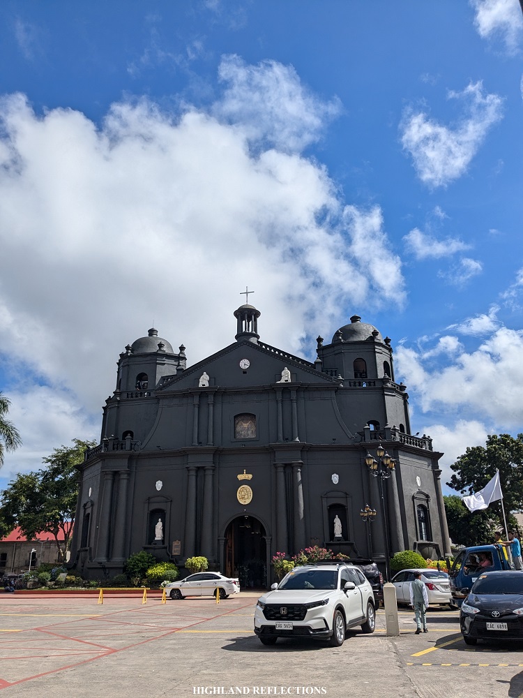
Afterwards, I went to the nearby Naga Metropolitan Cathedral, which boasts of a black façade and Baroque architecture. Although I wanted to appreciate the interiors of the church, there was a wedding ceremony during that time, and I didn’t want to be a weirdo there taking pictures while on my slippers. After marveling at the architecture of the cathedral, I explored the market area and plaza of Naga City. The place was bustling!
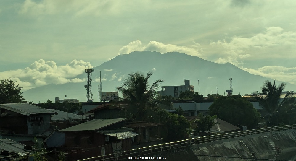
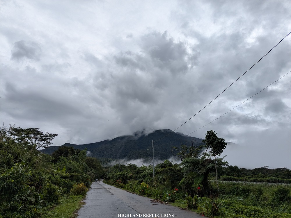
At around 10, off we went to Barangay Panicuason where the jump-off point is located. The end of the road here is where Camp Maria Aurora is located, where our van parked and where we would be washing up the next day. Although not the jump-off point (though I think it should be), the hike started here. Outside of the camping area is the rough road that continues until the cemented part of the Panicuason Road. Despite being at the foot of Mt. Isarog, the road already sits at around 410+ MASL, providing an expansive bird’s eye view of Naga City. In front of this road, Mt. Isarog’s cloud-covered western side looms.
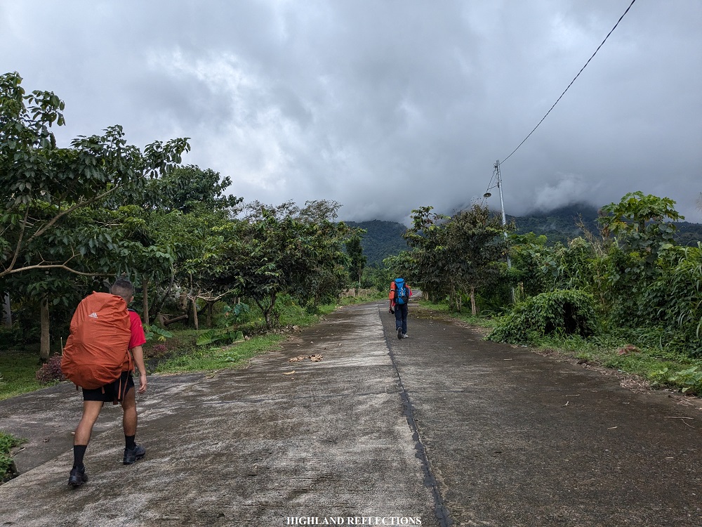
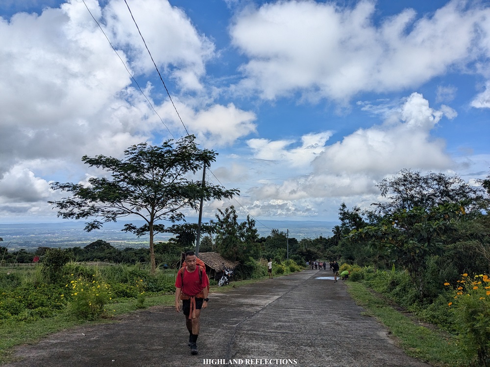
After a kilometer of gradual ascent on the cemented road, we arrived at the gate of the trailhead, around 510+ MASL. Here, several abandoned staff houses dot the forested area. To the right is the cemented trail going down to Malabsay Falls. To our left is the Panicuason Trail going all the way to the summit of Isarog. Left we went!
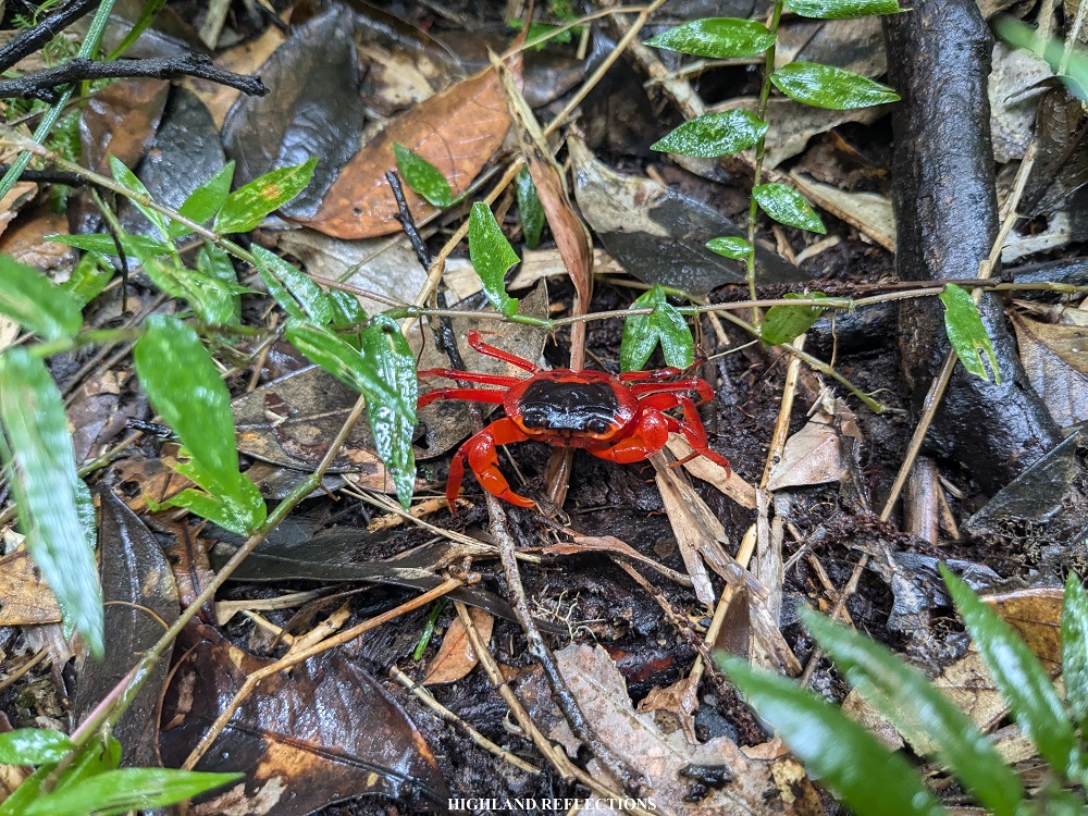
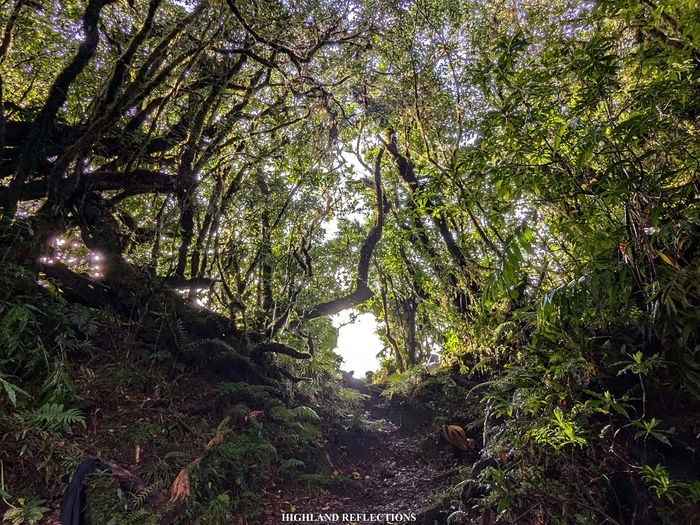
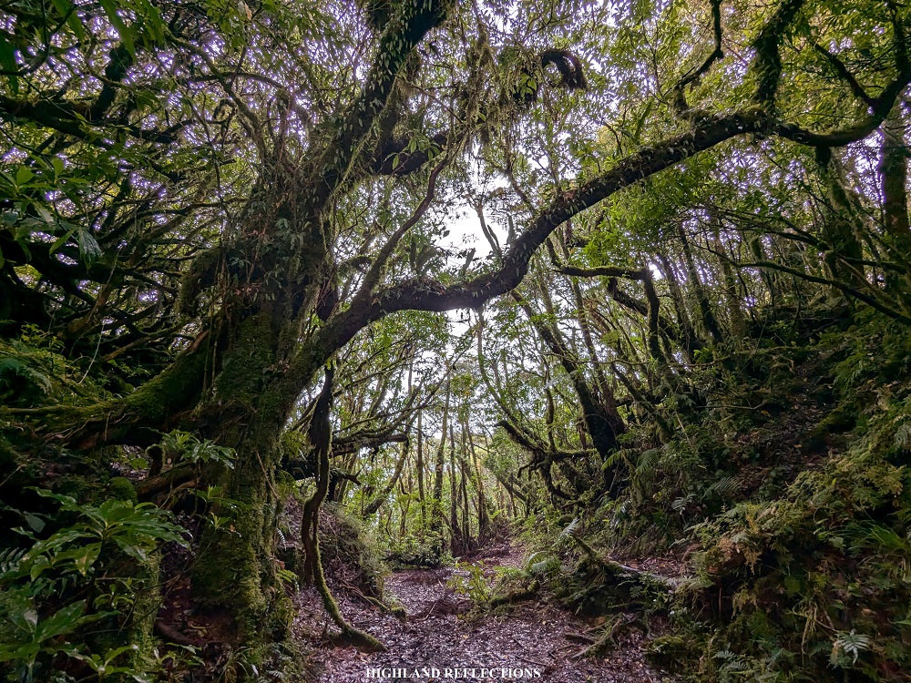
The initial parts of the trail was on a gradually inclined path inside Isarog’s lowland forest. The trail wasn’t too steep, and I was enjoying every minute of immersion I had with greenery surrounding me. After an hour, we encountered portions of the trail where we had to duck beneath bamboos. Some of our companions who were lagging behind spotted a Philippine pit viper in this area! Then, the uphill trail continues before reaching Camp 1 (935+ MASL), the first of the four campsites inside the trail. It was one in the afternoon, almost two hours after starting the hike.

Since the four of us were leading the hike, we decided to regroup in Camp 1. There, we took the chance to munch on some trail food and exchange stories of our past hiking experiences. I’m glad to have some companions for this hike! The rain started to pour when our other companions arrived.
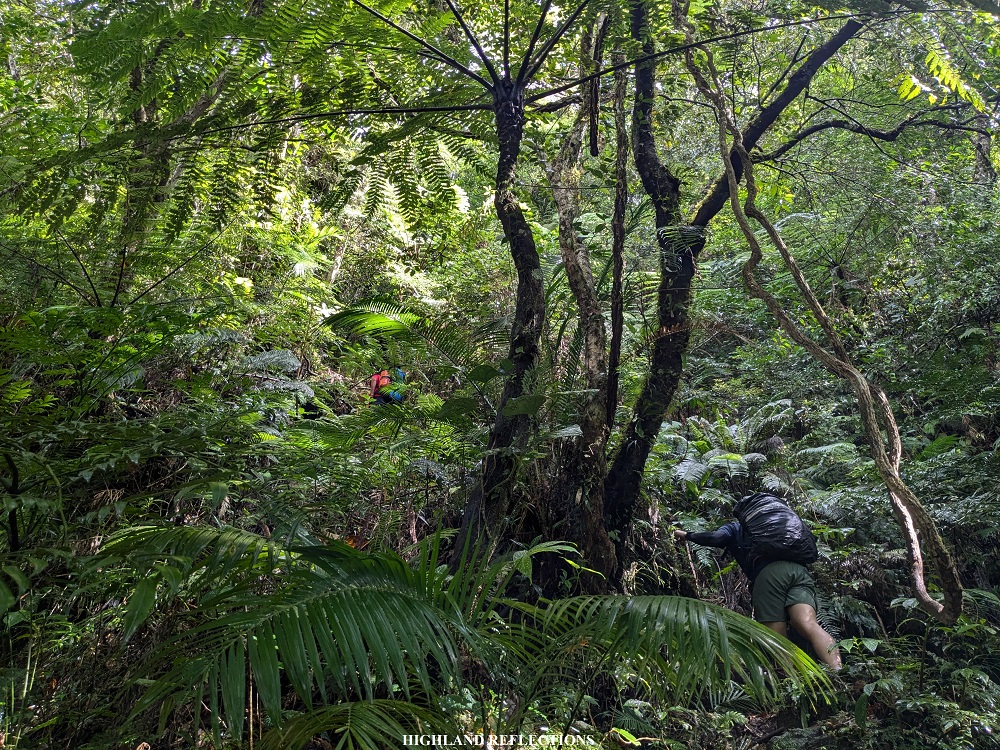
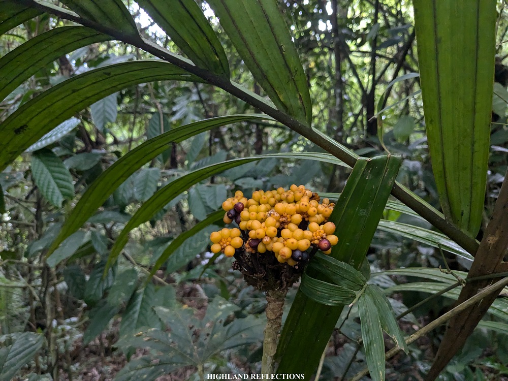
The trail got steeper past Camp 1. With the rain came the limatiks (mountain leeches), which were attaching themselves to my clothes and skin every few meters. The rain stopped as we were ascending the steep portions past Camp 1, one portion of which required rope for assistance. After more than an hour of hiking, we reached Camp 2 (1,200+ MASL), where we had another round of rest before pushing for Camp 3. Continuing, the distance between Camp 2 and Camp 3 was quite short (1,345+ MASL). The ascent to Camp 4, however, was relatively longer, taking us an hour’s worth of workout! The forest in between each camp was typical of any Bicol Region mountain—lush, thick, and teeming with diversity.
It was four in the afternoon when we reached Camp 4 (1,560+ MASL), almost exactly five hours after we started the hike. There, we pitched our tents. The campsite was relatively spacious despite the thickness of the forest. It also had a nearby water source where some of our companions washed-up and refilled their water supplies. As we were resting, the sun’s rays illuminated the campsite, a perfect way to end our first day in Isarog.
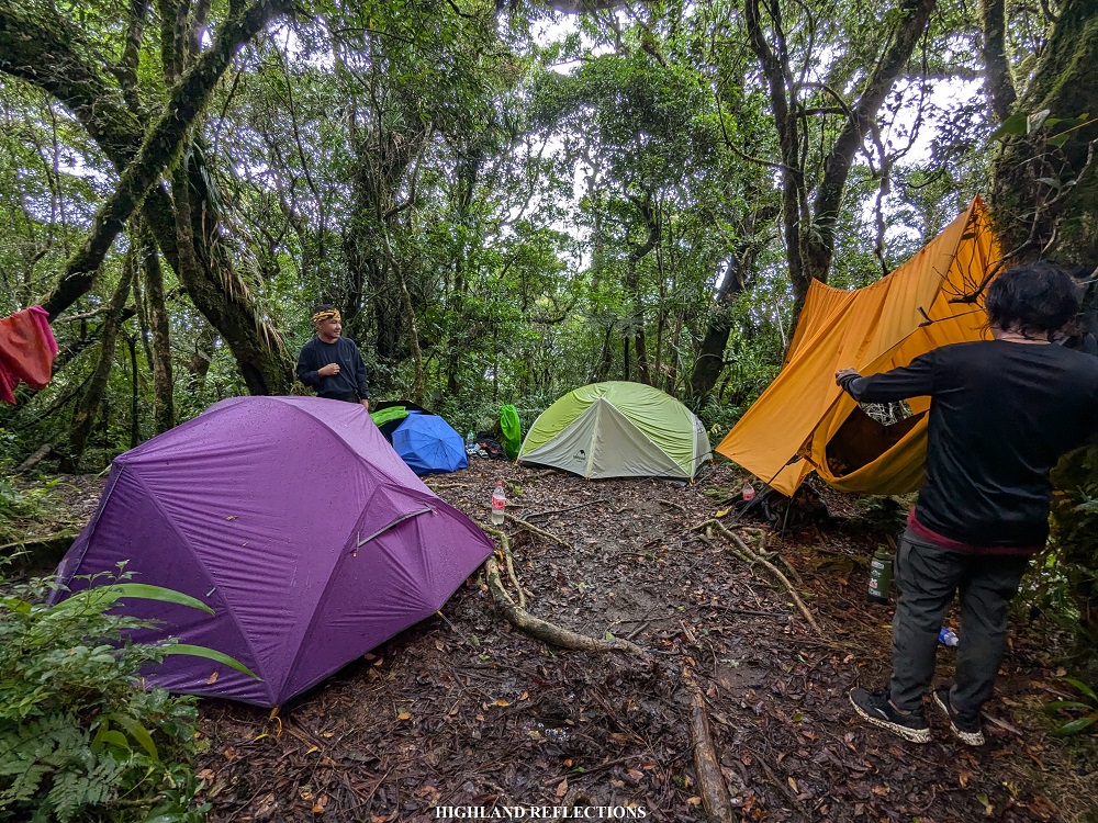
We had dinner at around 8pm. Whe cooked us comforting bowls of sinigang na baboy and tasty adobo and chopsuey. Sleep came early afterwards, a blessed relief for our tired bodies.
Our alarms rang at 3:30 in the morning. Due to the mildly cold weather and drizzle at the campsite, most of us didn’t have the energy to do the summit assault… save for me, who had already drank my chocolate drink and prepped my summit assault pack at around 4 in the morning. I was having a hard time convincing my companions that the skies were clear despite the drizzle.
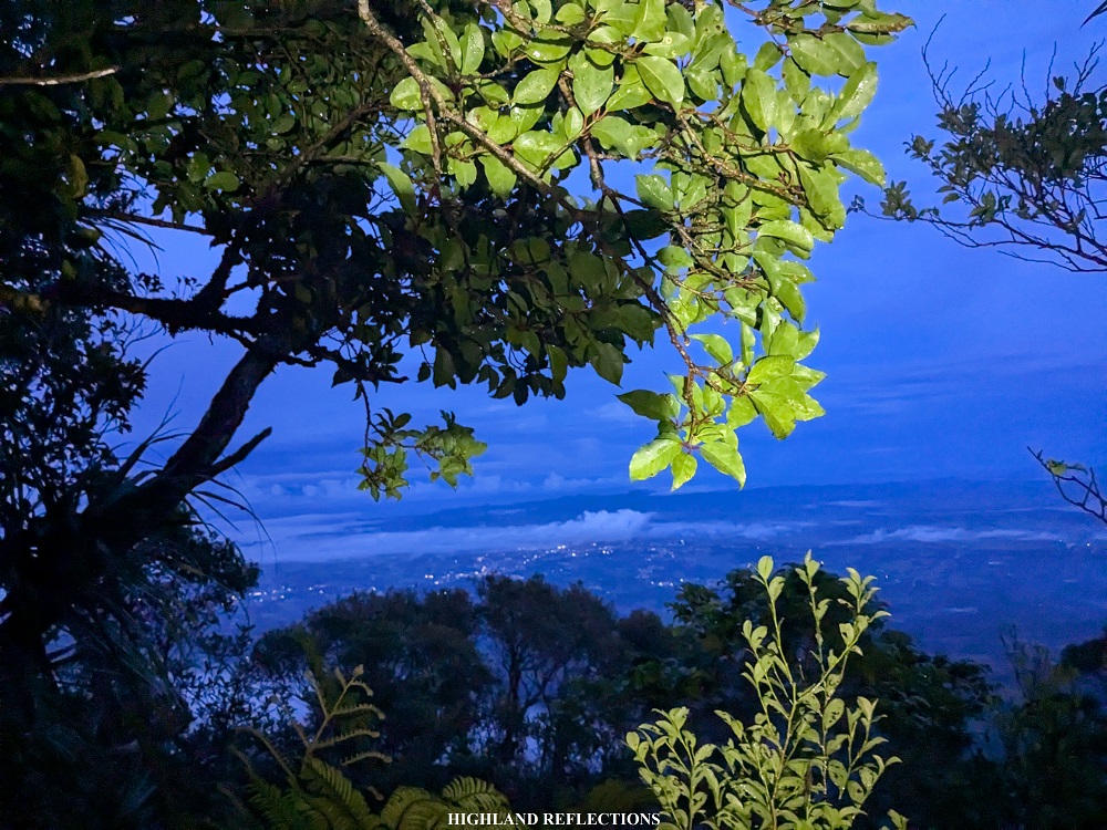
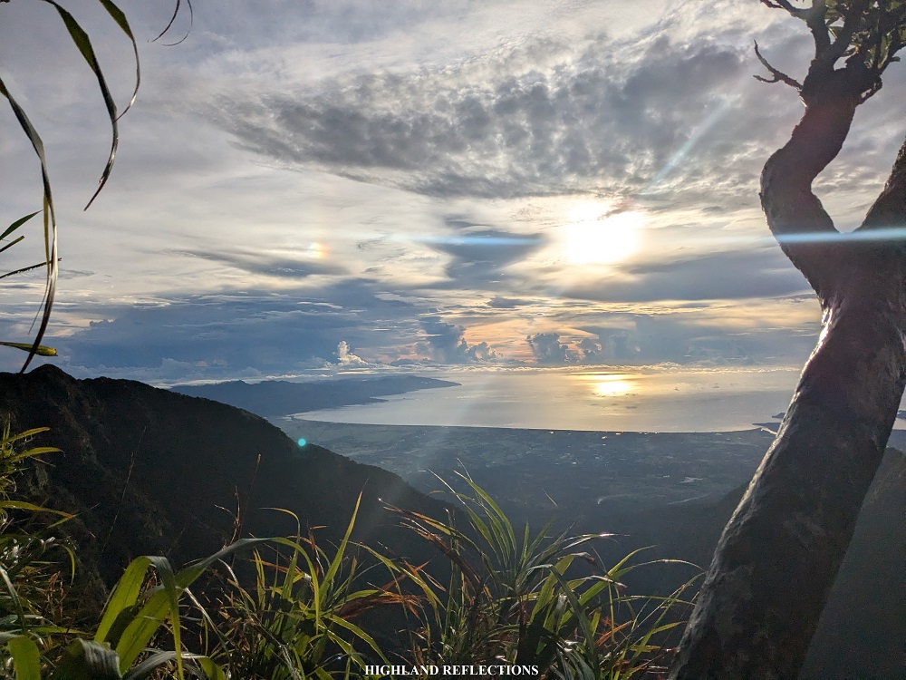
Finally, at 5 in the morning, we started the summit assault. The trail past Camp 4 runs on a steep forested section, reminiscent of that of Mt. Madjaas’ steep trail going to the summit. Halfway through the hike, we spotted Naga City, with its city lights illuminating the indigo sky of the dawn. As we were nearing the summit, trees started to become covered in moss. We reached the summit around 6:15 in the morning, more than an hour after leaving Camp 4!
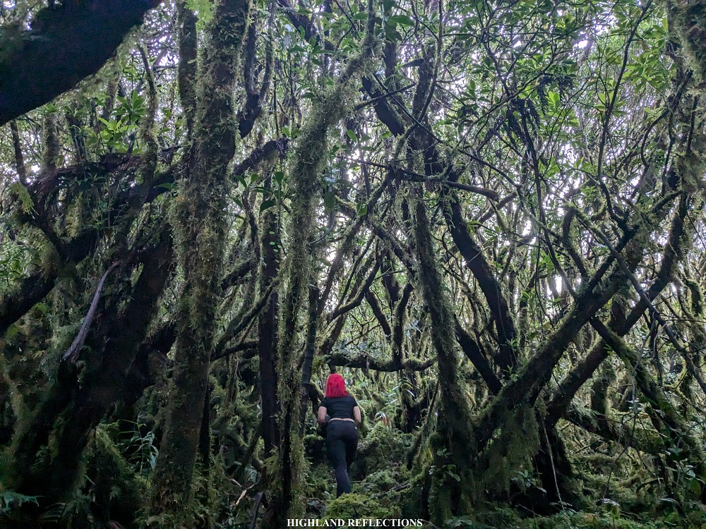
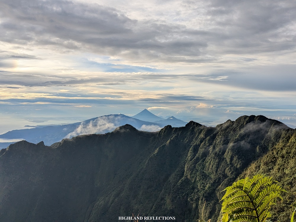
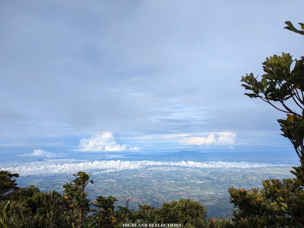
Mossy trees surround the entire summit area. The view deck is located a few meters below the summit, where a small opening provided a magical view of the expansive crater rim and breached crater of Mt. Isarog. Beyond the southern crater, we had a clear view of the Magayon Trio in Albay: Mayon Volcano, Mt. Malinao, and Mt. Masaraga! It was my first time seeing Mayon Volcano this clear. It does, indeed, have a perfectly-shaped cone. What a majestic sight to see! Beyond the breached crater is the rest of the province of Camarines Sur ending at Lagonoy Gulf, where the sun is starting to rise above the Pacific Ocean.
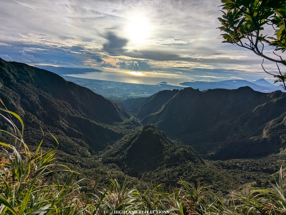

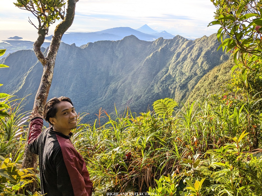
Since the summit area lies on the crater ridge of Mt. Isarog, it’s common for hikers to mistake the view deck as the summit. Just this 2024, two German hikers discovered that the true summit of Isarog is at the right side of the view deck. While my companions were taking the pictures, I inspected the area. It was full of trees contouring in every direction, creating a claustrophobic monkey trail. When there was no trail to follow anymore, I halted and snapped some pictures on what I can only assume as the highest point of the summit ridge. My companions followed in checking the area. We climbed one of the trees there where we had an open view of Naga city and the surrounding crater rim of Mt. Isarog!
We decided to descend after an hour of enjoying the majestic views provided by Isarog. All of us felt grateful for the clear views despite the cloudy sky above us. We reached the campsite in just less than an hour and had our breakfast.
After breaking camp, we started the descent past ten in the morning. Just as we were about to reach Camp 3, strong rain poured. Limatiks were attaching themselves to my rain coat. Luckily, none of them made a bite. Throughout the descent, I was with Ryan, as Tin and Khael were advancing. Luckily, they waited for us in Camp 1 despite the nonstop rain. With the nonstop rain came our nonstop descent! I only had a water break before continuing the final push.
Past Camp 1, I decided to tag along with Khael and Cristine as my legs were now accustomed to the downward movement. The trail past Camp 1 was now less slippery and less steep. Since the trail was mostly dry, we reckoned that it was only raining at the higher reaches of the mountain!
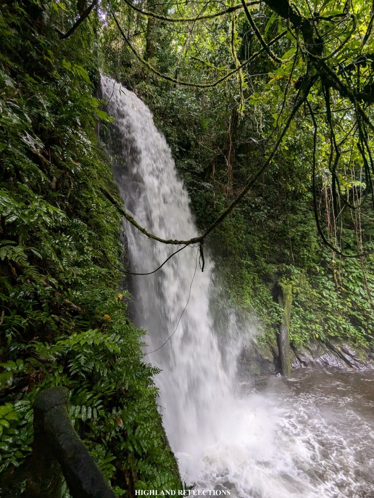
We reached the trailhead around one in the afternoon, after three straight hours of nonstop, no-rest descent. The four of us paid a visit to the nearby Malabsay Falls, descending a cemented flight of stairs for about five minutes. The waters gushing downward was quite strong during our visit that the guide prohibited us to bathe at the lagoon below the falls. We only snapped some pictures and decided to go the exit point afterwards.
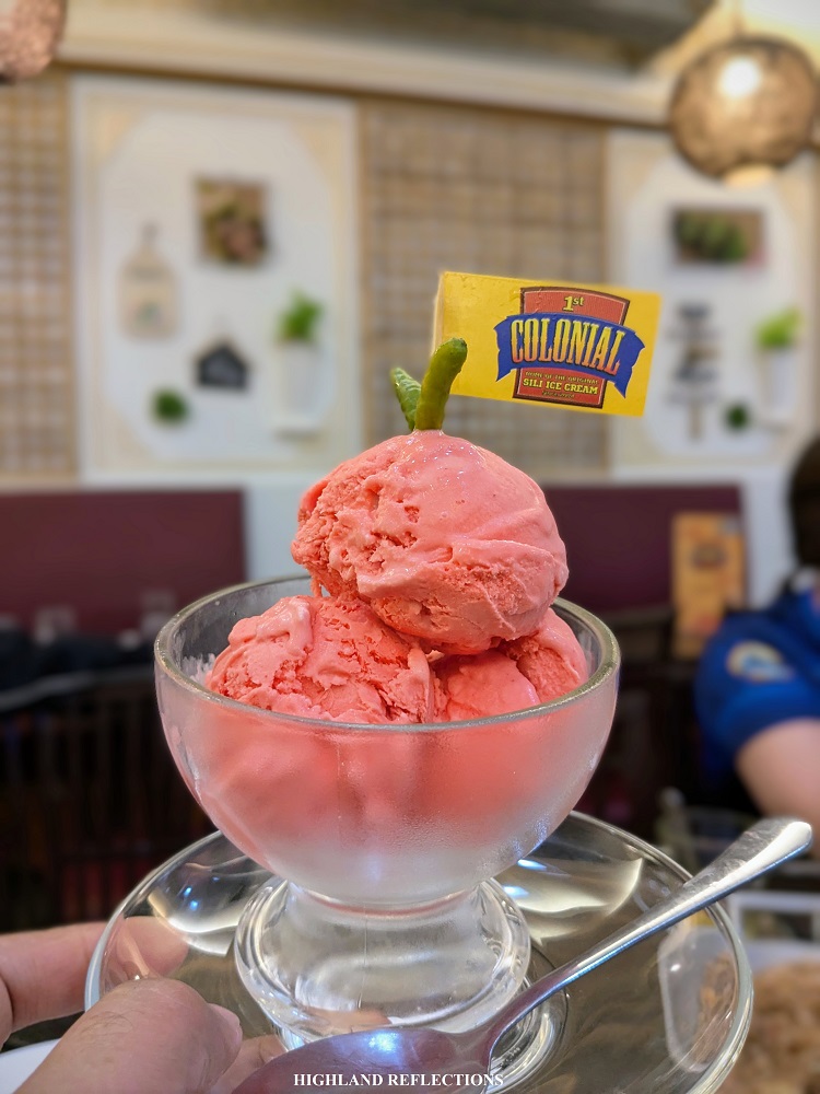
It only took us a quick descent on the cemented road before reaching Camp Maria Aurora where our van parked. There, we washed up and prepared for the long ride going back to Metro Manila. Once everyone had arrived, we bid good bye to Mt. Isarog. We had a celebratory dinner at the 1st Colonial Grill in SM Naga city, where we shared some hearty Bicolano dishes such as laing, tinutungang manok, Bicol express, over a serving of tinapa rice. We also tried their famous sili ice cream, which was surprisingly delicious and creamy!
**
Mt. Isarog is my third Bicol mountain next to Mt. Bulusan and Mt. Labo. In fact, I was able to spot Mt. Isarog during our Mt. Labo hike last June, 2024! It was so poetic to have hiked the highest of Camarines Norte and Camarines Sur successively! I am hoping to try some of the other major mountains in the region. Would I be back in Camarines Sur to try the Mountain of the Rising Sun in Iriga City, or should I go to Albay to finally cross off one of the mountains in the Magayon Trio? Or should I explore some of the underrated peaks of Camarines Norte? Will I be able to go back to Sorsogon soon? Only time will tell. See you again, Bicol!
Itinerary
Day 0
09:00PM Meet-up at Greenfield District
Day 1
07:00AM Naga City, breakfast
10:00AM Panicuason, prepare
11:00AM Start hike (410+ MASL)
11:30AM Gate (510+ MASL)
01:00PM Camp 1 (935+ MASL), regroup
02:30PM Camp 2 (1,200+ MASL)
03:00PM Camp 3 (1,345+ MASL)
04:00PM Camp 4 (1,560+ MASL), set-up camp
08:00PM Dinner
Day 2
03:30AM Wake-up call
05:00AM Start summit assault
06:15AM Summit, take pictures
07:30AM Start descent back to campsite
08:00AM Campsite, breakfast, break camp
10:00AM Start descent back to trailhead
01:00PM Trailhead, visit Malabsay Falls
01:15PM Back at the jump-off, tidy-up
04:00PM Departure to SM Naga
05:00PM SM Naga City, celebratory dinner
03:00AM Back in Metro Manila
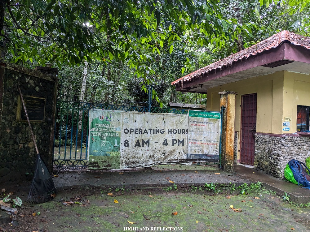
In hiking Mt. Isarog via Panicuason Trail, hikers must secure a permit at the DENR Office in Naga City. It is encouraged that permits must be pre-arranged days before the climb so as to avoid getting delays in your group’s itinerary.

One thought on “Mt. Isarog via Panicuason Trail (1,966+ MASL) | Into the Jungle of Camarines Sur”