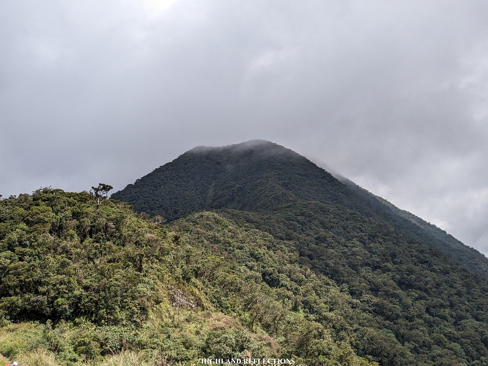
If you have been to the grassland summit of Mt. Pulag, you may have noticed a gigantic forested mountain nearby. This mountain, which acts like a younger brother to Mt. Pulag, is a lesser known mountain called Mt. Al-al, also named as Mt. Panotoan in some geographical maps. Flanked by Mt. Pulag to the south and Mt. Tabayoc to the north, Mt. Al-al is a mountain filled with an enchanting mossy forest teeming with diversity. Its trail, which can be accessed a few meters away from the jump-off point of Kabayan’s four lakes and Junior Pulag, is a must-see for casual hikers and peak baggers alike! Its most enticing feature is that it is one of the highest mountains in Luzon, standing at 2,695+ meters above sea level.
MT. AL-AL / MT. PANOTOAN (via Ballay Trail)
Jump-off point: Ballay, Kabayan, Benguet
Days required / Hours to summit: Half day / 1.5-3 hours
Specs: Minor climb, difficulty 3/9 Trail class 2-3
Features: mossy forest, 360-degree view at the summit, Luzon top 10
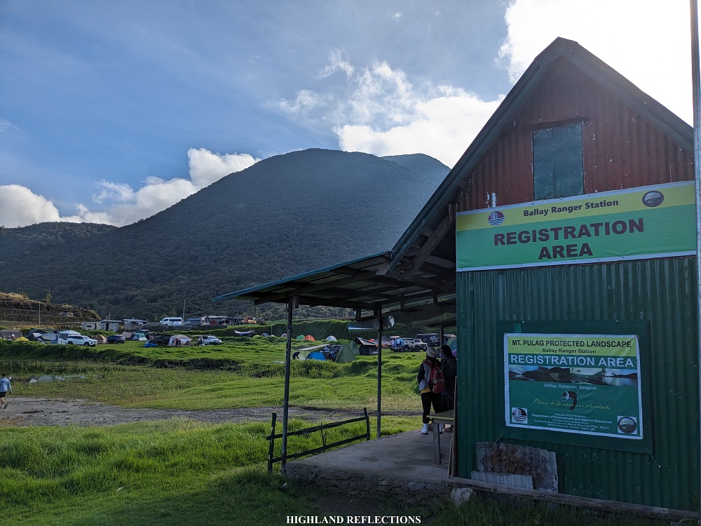
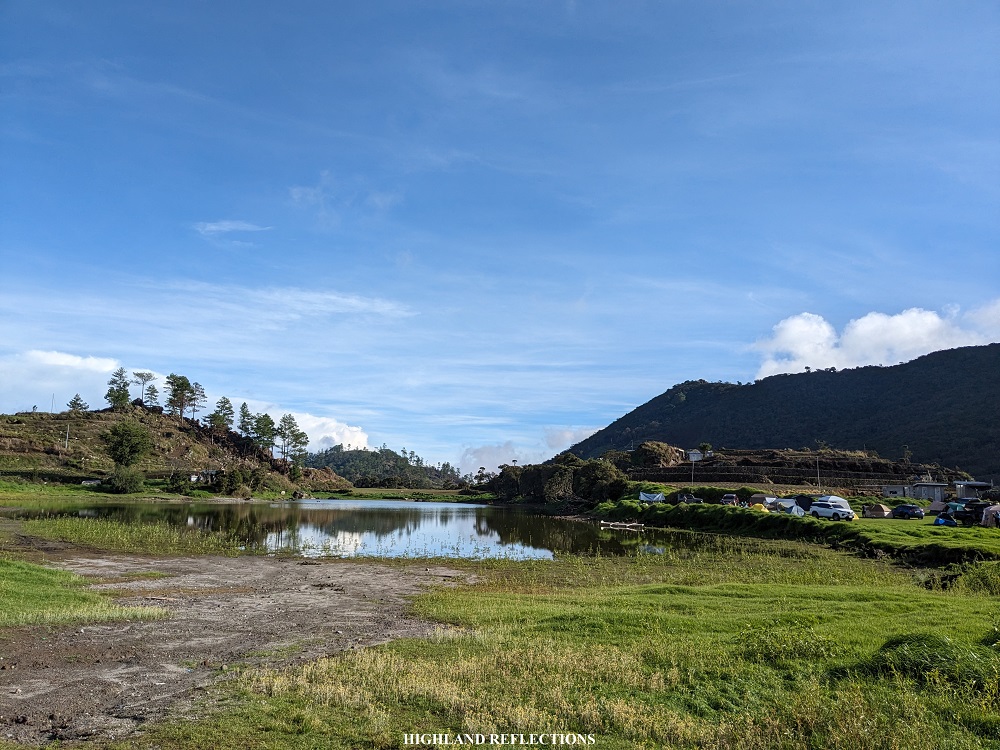
In climbing Mt. Al-al, I joined an organized event by Lilang Gala. The team left Manila at around 9 in the evening, reaching Baguio City at around 2 in the morning to have some breakfast. We were able to reach Ballay Ranger Station in Kabayan, Benguet around 7 in the morning. This ranger station is located directly beside Lake Tabeyo and at the base of Mt. Tabayoc, the second highest mountain in the Luzon. There, we met our contact person and guides, and had a brief orientation before the climb. Afterwards, we climbed aboard a truck that brought us to the jump-off point, which was just a kilometer away from the ranger station, located somewhere past the jump-off points for Lake Ambulalakaw and Junior Pulag.
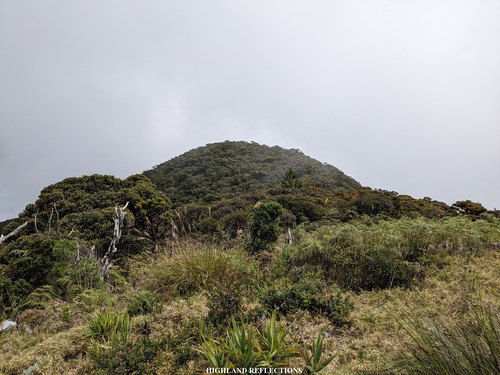
The jump-off point (2,315+ MASL) is marked by a yellow waiting shed at the right side of the road. From there, we already had a commanding view of Mt. Al-al and its peak. Since we were already in high elevation, the entire ascent only took us 400 meters of elevation gain!
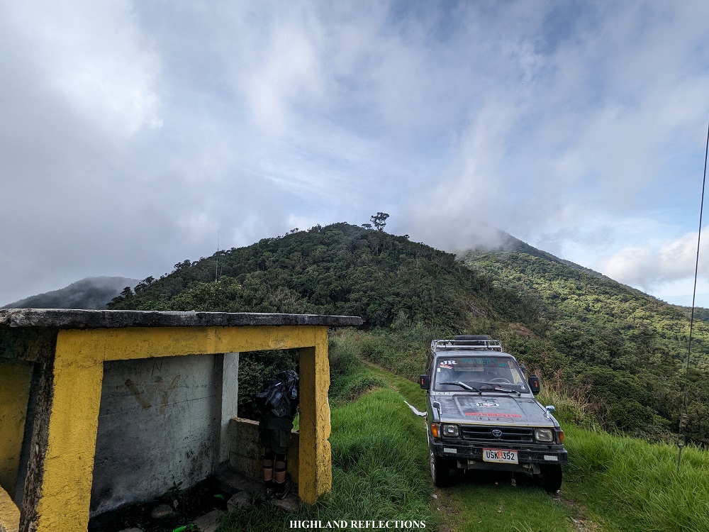

The first part of the hike already greeted us with a round of steep ascent, making me pant early on in the hike. Even as we were punished by the ascents, however, all of us were in awe of the mossy surroundings. This is not surprising, as Mt. Al-al is directly connected to the mountain range containing Mt. Pulag’s Tawangan Trail, known for its jaw-dropping mossy forest. Of course, given this, it is also not surprising that there are limatiks (mountain leeches) within the forest. Luckily, none of us got bitten for this hike!


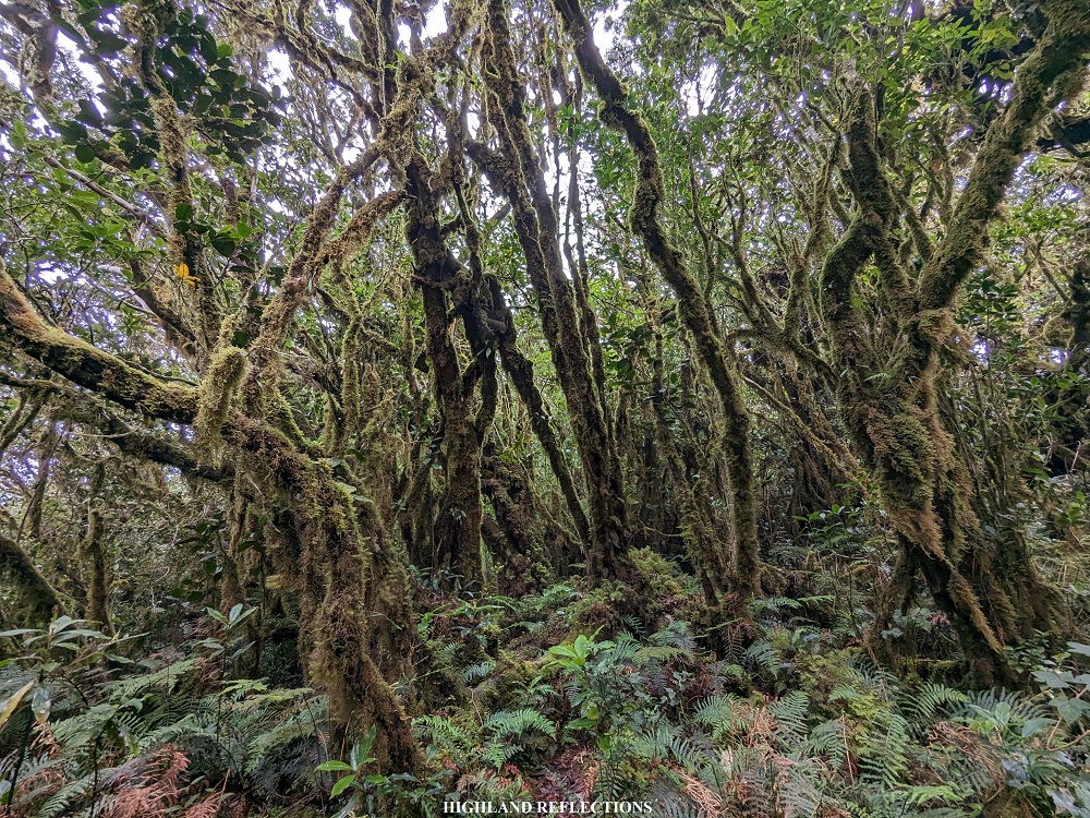

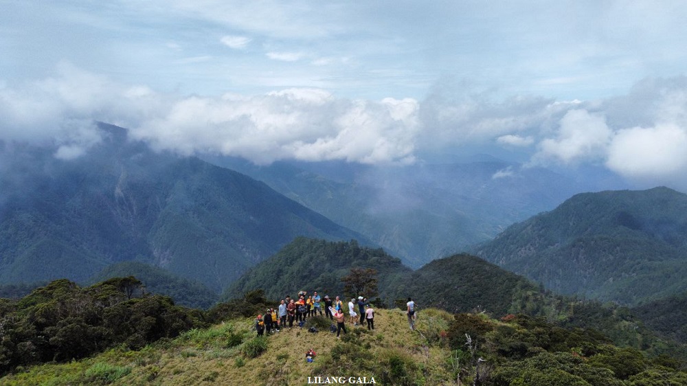
The trail occasionally transitions from flat to gradually ascending and vice versa, all within the alluring beauty of the mossy forest. We had to stop to take pictures of the surroundings several times. Just after an hour and a half of continuous hiking with minimal breaks, we reached the highest point of Mt. Al-al (2,695+ MASL) located in the middle the trail and obscured by the thick mossy trees surrounding it. Since the highest point is within the trail, we needed to get moving forward and descend for a few meters to reach the viewpoint of Mt. Al-al (2,660+ MASL), which is also considered as part of the summit area.
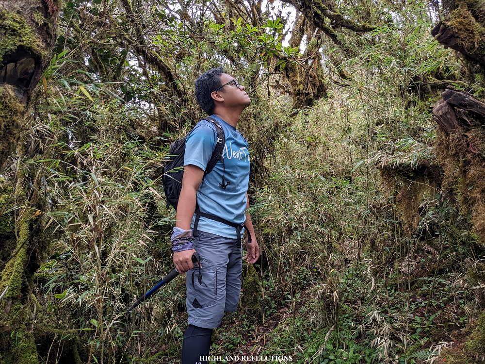
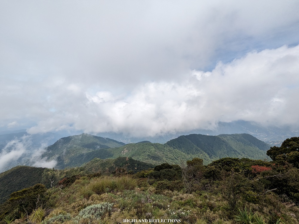
This viewpoint is the farthest that hikers can go unless the connecting trail to Mt. Pulag gets reopened again. It provides a relatively 360-degree view of the surrounding area, and is filled with bamboo grass. The most noticeable object at the viewpoint is an old, dead, embedded tree trunk. According to our guides, the mountain got its name from this tree, as “Al-al” means ‘old tree’ in the Kalanguya language.
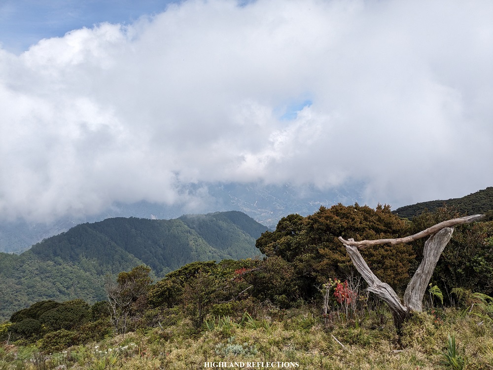
Since we started a bit late, we only had a limited view atop Mt. Al-al. Clouds were now dancing and covering the peaks of the surrounding mountains nearby. The most magnificent view was in the southern direction, where Mt. Pulag—Luzon’s highest mountain—dominates most of the view. The portion of Mt. Pulag that was visible from Mt. Al-al’s vantage point was its Akiki side. You could trace the entire slope where the Akiki trail is carved from where we were!

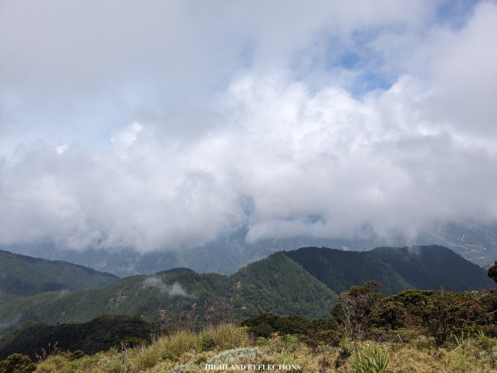
Turning left, which was westwards, an obscure and cloud-blocked portion of the Tawangan side of Mt. Pulag is visible. Opposite of Mt. Pulag, in the northern direction, a supposed view of Mt. Tabayoc is visible. However, given the foggy surrounding during our hike, we were not able to see it. The last view available is at the eastern direction, where the old dead tree stands. Here, we were able to spot the cloud-covered Mt. Timbak, Luzon’s third highest summit. I was wondering what other mountains could have been visible on a clear, sunny day!
We spent an entire hour at the summit as we wanted to relish the entire place, given the long ride it took us to get. When the clouds covered the entire summit, we went down, reaching the jump-off point after just an hour. We returned to the ranger station in Ballay and washed-up. Afterwards, we drove back home and had our celebratory dinner in Baguio City.
Mt. Al-al’s Elevation
Due to the proliferation of new models of online mapping, some have claimed that Mt. Al-al is the 4th highest mountain in Luzon, making it higher than Mt. Kalawitan and Mt. Amuyao. Pinoy Mountaineer records Mt. Kalawitan and Mt. Amuyao with elevations of 2,714+ MASL and 2,702+ MASL respectively. However, online maps such as Google Maps and Open Street Map, which are used by tracking applications, seems to put Mt. Kalawitan and Mt. Amuyao only at 2,660+ MASL and 2,690+ MASL respectively.
Clearly, there seems to be a disparity with old elevation readings provided by established bloggers and by new online mapping models. For now, two things are certain: (1) the elevation of Mt. Al-al seems to sit at 2,695+ MASL as this was the common and average elevation that we recorded during the hike; (2) Al-Al, Amuyao, and Kalawitan can be considered as the 4th to 6th highest mountains in Luzon, with no certainty when it comes to their ranking. Hence, further verification and re-testing must be conducted to confirm Mt. Kalawitan, Mt. Amuyao, and Mt. Al-al’s respective elevations. This can be an exciting endeavor to us, the new generation of Filipino hikers!
Itinerary
Day 0
10:00PM Meet-up
Day 1
02:00AM Baguio City, breakfast
07:00AM Ballay Ranger Station, briefing
08:30AM Start of hike
10:00AM Summit, photo ops
12:00PM Start descent
01:00PM Back at the jump-off point
02:00PM Back in Ballay, tidy-up
07:00PM Baguio City, dinner
