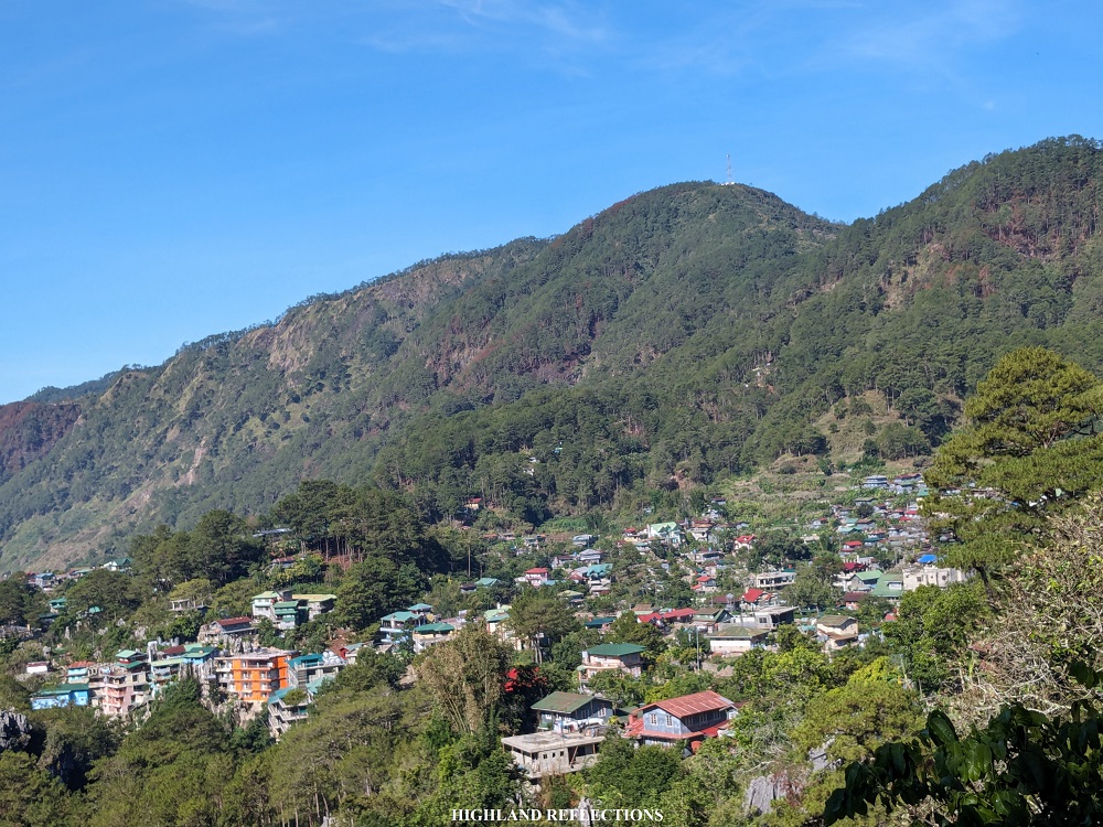
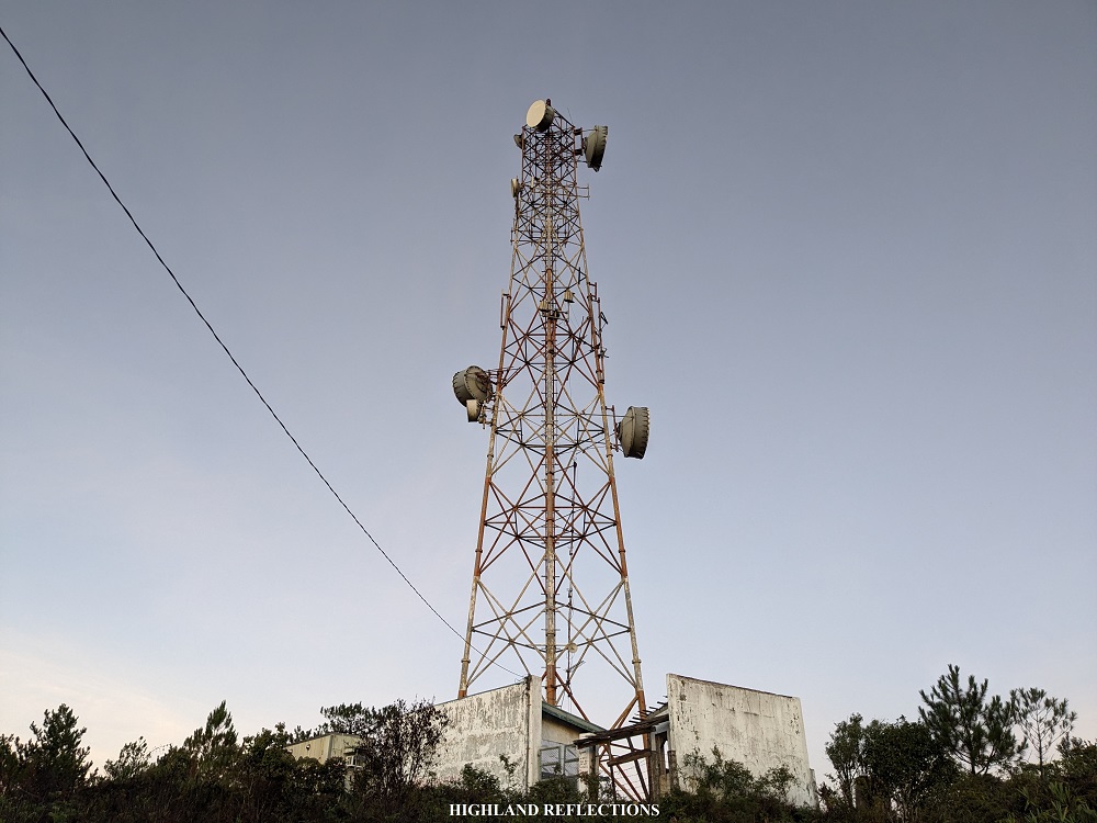
One of the most underrated activities in Sagada is a hike up to the town’s highest point, Mt. Ampacao. The trek up to Mt. Ampacao involves a manageable walk on a beginner-friendly trail inside a magnificent pine forest, leading to a picnic site right before the final assault to the summit. Atop the summit is a cell site tower providing expansive views of the town of Sagada and the gigantic mountains within Mountain Province, Ilocos Sur, Kalinga, and Abra.
Although traditionally climbed from Barangay Ambasing via a rough road inside a pine forest, my guide took me to an alternative jump-off point near Lake Danum, traversing the mountain from north to south, passing through pine-forest hills and ridges before reaching the picnic site, and eventually, the summit. We took the rough road to Ambasing on the way down.
The characteristics of the hike are as follows using the Pinoy Mountaineer format:
MT. AMPACAO TRAVERSE
Jump-off point: West Road/Sagada-Besao Road, Barangay Patay, Sagada, Mountain Province
Exit point: Ambasing, Sagada, Mountain Province
Days required / Hours to summit: Half day / 1-1.5 hours
Specs: Minor climb, difficulty 2/9, Trail class 1-3
Features: view of Sagada, pine forest, cell site tower, picnic area
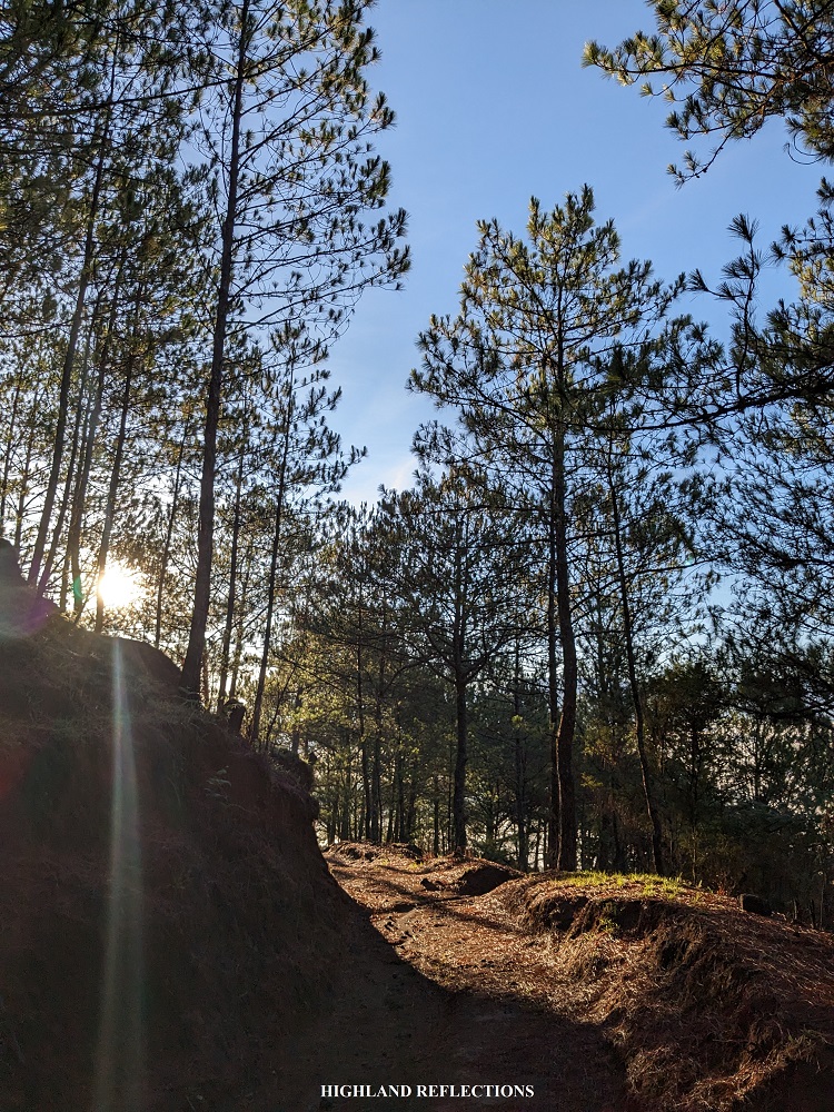
After fetching me from my homestay in Residential Lodging, my guide, Francis, and I started the hike past four in the morning. The trailhead was an obscure path on the left side of the road. From the get-go, we were greeted with some few ascending slopes inside a pine forest. There were some diverging paths here and there, so a guide here was really necessary. While checking my STRAVA map, I saw that some of the paths lead to Lake Danum.
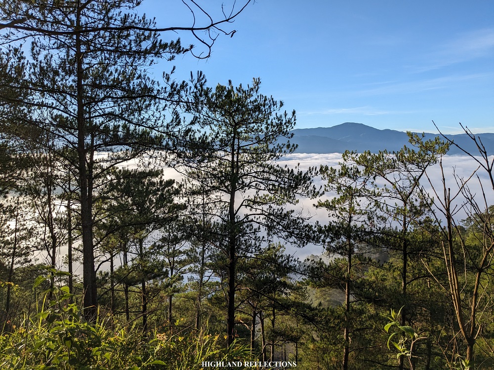
Since the jump-off point already sits on high elevation (1,710+ MASL), there were minimal ascents during the hike. After the short barrage of ascent from the jump-off, we found ourselves on a beautiful pine forest ridge. From here, we could see the street lights of Sagada below to our left. The cold morning wind kept my body temperature regulated, making me comfortable with the hike.

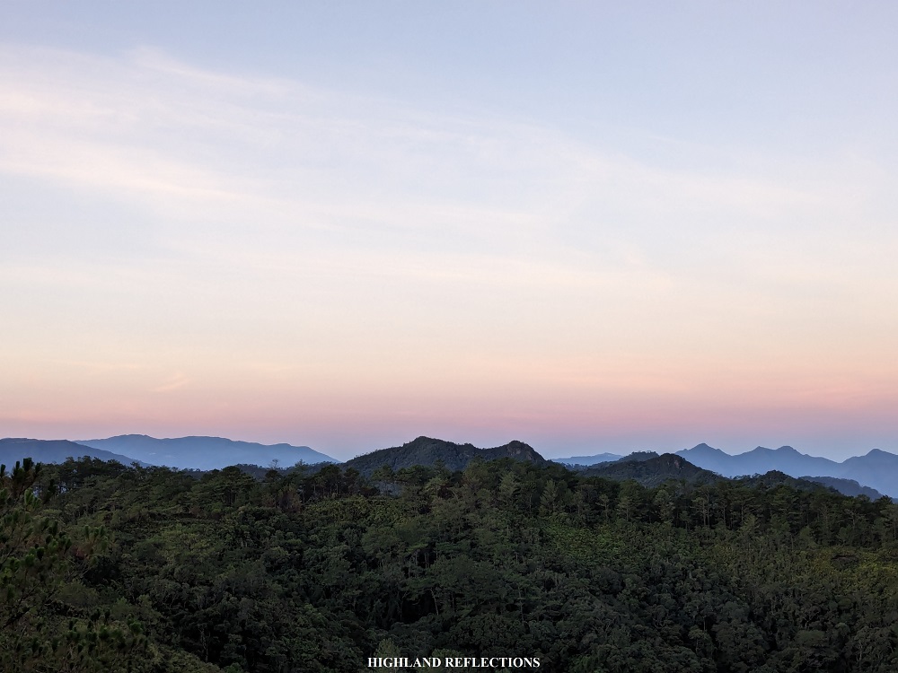
The entire first half of the trek took us climbing up and down four rolling hills dotted with pine trees. Upon reaching the end of the fourth hill, we exited towards the picnic site (1,750+ MASL), which was an open area just below the summit, marked by a cell site tower.

As we reached the picnic site, the sun burst up the sky and started illuminating the surroundings. Since I wanted to see the views from the summit, I trail ran all the way to the bottom of the summit’s hill. Here, we encountered a rarely used dirt path that could maybe fit in a few motorcycles. I surmise that this was the connecting trail going to the town of Bauko. The trail to the summit is on the left side of the dirt path.
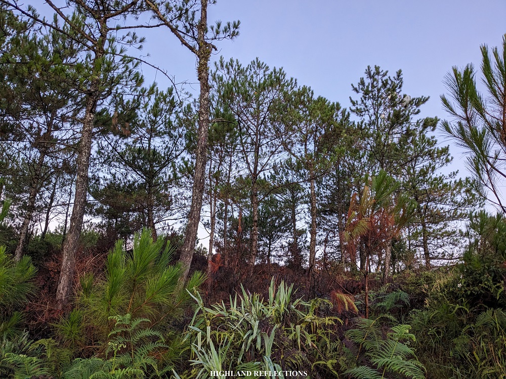
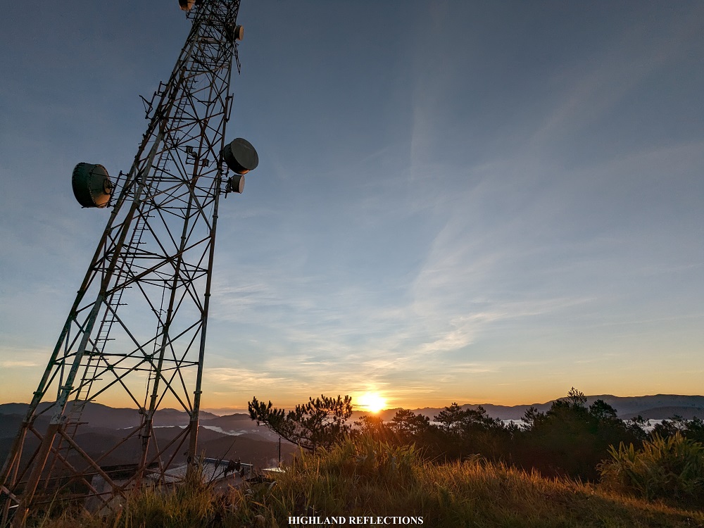
The last assault to the summit was inside a montane forest, taking almost 20 minutes of steep ascent before reaching the top. At the summit area, the cell site tower sits on top of a plateau surrounded by pine trees. According to my guide, the tower was once used by a big telecommunications company here in the country. However, the tower is now only used for radio broadcasting. The actual peak is at the back of the cell site tower compound. I was able to reach that area at 5:20 in the morning, almost more than an hour after starting the hike.

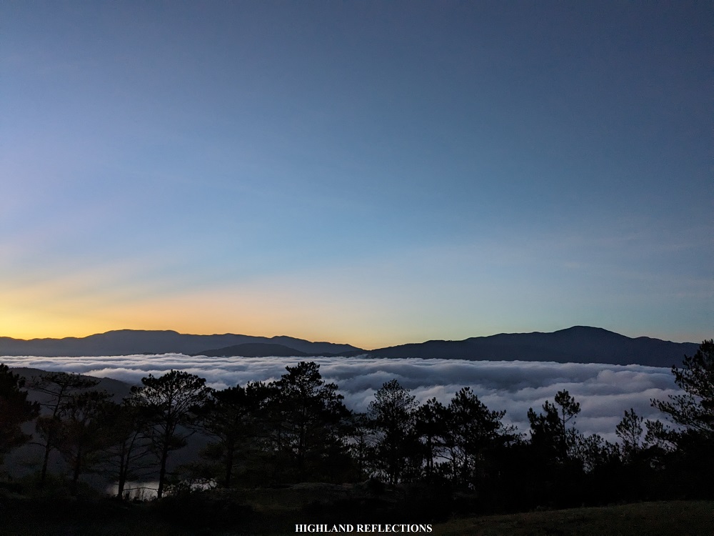
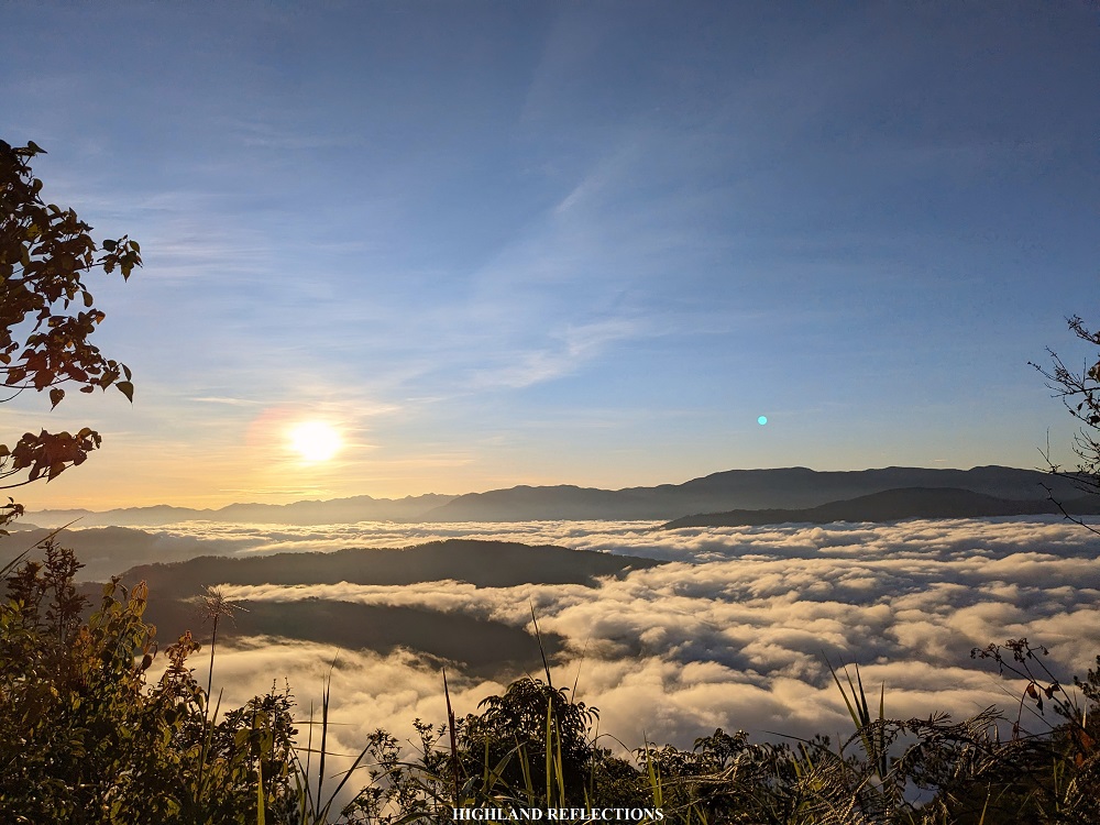
The view at the summit was magnificent! The entire eastern portion of the mountain is dressed by a picturesque sea of clouds, complemented by the rising sun. Above these clouds, we could spot Marlboro Hill, the most well-known hiking destination in Sagada. Past Marlboro Hill, we could see layers and layers of mountains. My guide pointed northeast and informed me that the mountains of Maligcong (Mt. Fato and Mt. Kupapey) can be seen. However, I can’t seem to spot them as I was dazed by the sun’s rays. On the southeast, the country’s 10th highest mountain, also considered as Luzon’s 4th highest, which was Mt. Kalawitan, can be seen.
In the northern direction, we could see the four pine forest hills that we passed through before reaching the summit. Behind these hills is a gigantic mountain called Mt. Sisipitan. My guide informed me that experienced mountaineers and foreigners know the mountain, and is rarely climbed due to the presence of some insurgents. Still, the mountain enticed my curiosity as I was informed that Mt. Sisipitan contains a beautiful mossy forest.

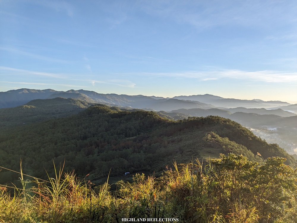
In the northwest, we spotted the town proper of Besao below.

Continuing with the sightseeing, perhaps the most intriguing viewpoint would be in the expanse of the western direction. Here, the Quirino skyline (a town in Ilocos Sur, not to be confused with the Province of Quirino) is dressed in a sea of clouds as well. Near the Quirino skyline, I was able to spot the pointy Tirad Peak in Gregorio Del Pilar, Ilocos Sur, which I climbed back in February of 2020!
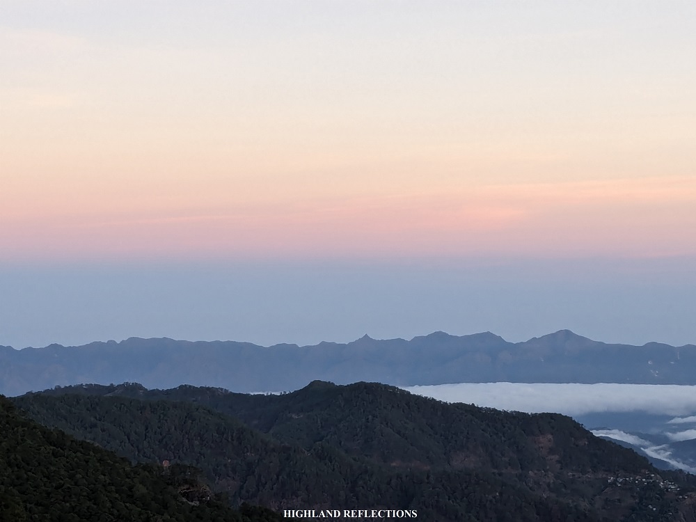
In the southwest, more and more mountains appeared in the expansive vista. The most prominent among the mountains in this direction is the revered Mt. Namandiraan in Cervantes, considered as the highest mountain in Ilocos Sur. I was able to climb this mountain back in June, 2023, taking its highly difficult trail on a two-day itinerary. With its prominence, you could discern that it was indeed higher than the summit that I was standing on, even if it was faraway.
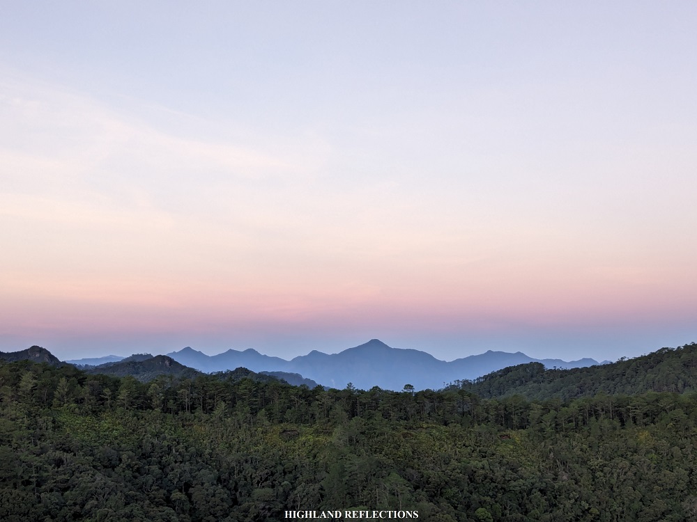
Lastly, the southern direction provided views of Mt. Nentingle, the highest peak in the Mt. Am-o mountain range containing the Spanish Trail in the town of Bauko, Mountain Province.
It was such a treat seeing this 360-degree view from the highest point of Sagada. After snapping some pictures, my guide and I decided to go down. Upon reaching the picnic site, we took some more pictures as the entire area was illuminated by the golden rays of the sun. Afterwards, we started descending via the rough road going to Ambasing. It took us almost less than 20 minutes on the 200-meter descent as we trail ran the entire rough road. I was at my homestay past 6 in the morning, completing the entire traverse for almost two hours only on a moderately fast pace!

Mt. Ampacao is, indeed, a beginner-friendly hike. Although it’s not as highly commercialized as Marlboro Hill, Mt. Ampacao offers a good vantage point to see what surrounds the small town of Sagada. Its mixture of pine and montane forest, and a splash of grassland all cramped up in a relatively short hike, is worthy of getting some visits from tourists and seasoned hikers alike. I really hope more and more people rediscover the mountain’s hidden charm. This way, the mountain may be taken care of, and perhaps, halt the disputes surrounding the cell site tower.
Note: When climbing Mt. Ampacao, directly state your intentions to your guide that you want to reach the cell site area. Most Mt. Ampacao tours end on the picnic site since I assume that guides do not want to bring inexperienced hikers to the summit, as the trail passes through a very steep path in the final assault. You may try to coordinate this with the tourism office of Sagada so that they could find you a guide willing to bring you to the tower.
Itinerary
04:00AM Start hike (1,710+ MASL)
05:00AM Picnic area (1,750+ MASL)
05:20AM Summit, take pictures (1,889+ MASL)
05:45AM Start descent
05:50AM Picnic area, take pictures
06:00AM Start descent to Ambasing
06:15AM Ambasing (1,530+ MASL), end of hike
06:20AM Back in homestay
