A less popular hiking destination in the town of Kibungan, Benguet is Mt. Kilkili located in Barangay Palina. The mountain, long thought to be a dead volcano due to its conical shape when viewed from Sitio Tanap (the jump-off point of Kibungan Cross Country and Kibungan Circuit), sits on the borders of Kibungan and Bakun. It is a worthwhile side trip when coming from a hike in Bakun, Benguet, or after doing a Kibungan Circuit hike. The climb up to the summit only involves fifteen to thirty minutes of hiking! Surprisingly, the trail is also quite established.

The characteristic of the hike are as follows:
MT. KILKILI
Jump-off point: Palina, Kibungan, Benguet
LLA: 1834+ masl, 200m elevation gain
Days required / Hours to summit: 1 day / 30 minutes
Specs: Minor climb, Difficulty 2/9, Trail class 1-2
Features: View of Kibungan mountains and villages
This hike was a side trip of our Bakun Trio attempt. Instead of hiking Mt. Tenglawan on the third day, due to logistic difficulties, we did not push through, and instead, opted for hiking Mt. Kilkili, which was just 20 minutes away from Bakun Poblacion.
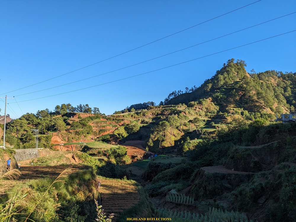
We were fetched by an FX Tamaraw around 5 in the morning. Along the road, we passed by Barangay Dada, the jump-off point of our Mt. Lobo hike two days ago. A silhouette of Mt. Tenglawan can also be seen in the nearby horizon, imposing its gigantic height on Bakun Poblacion below. We alighted at a roadside after twenty minutes. Since there was now limited morning sunlight, we did not need our headlamps for the hike.
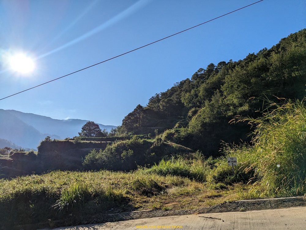
The jump-off point was an obscure path at the side of the road where an inconspicuous sign that reads “To Mt. Kilkili” is installed. Surrounding the jump-off point are pine tree slopes and wide potato plantations at the opposite side of the road.
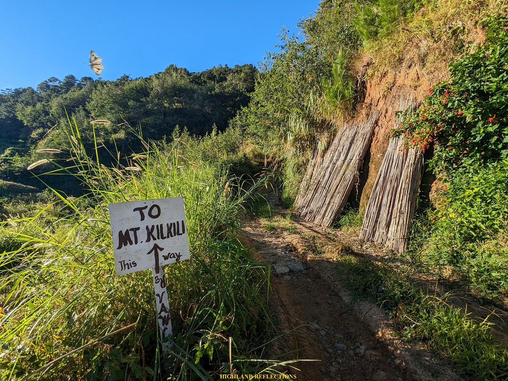
The initial parts of the hike was a short but wide pathway that leads to a very small grassland where the trail can nowhere be found, as it is hidden on the left side of the forested slope, surrounded by overgrowth. This was the start of the ascent all the way to the summit of Mt. Kilkili. Although there were thick undergrowth of bushes, the trail was fairly established, and was surprisingly cemented! I surmised that this was really once a popular local hiking destination back then.
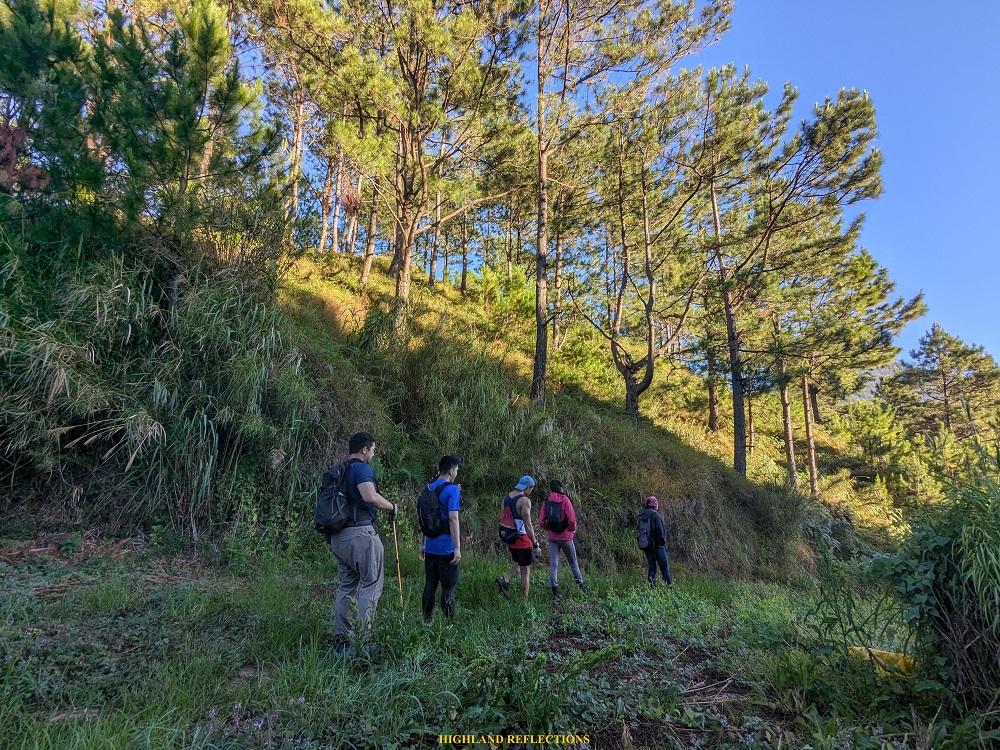


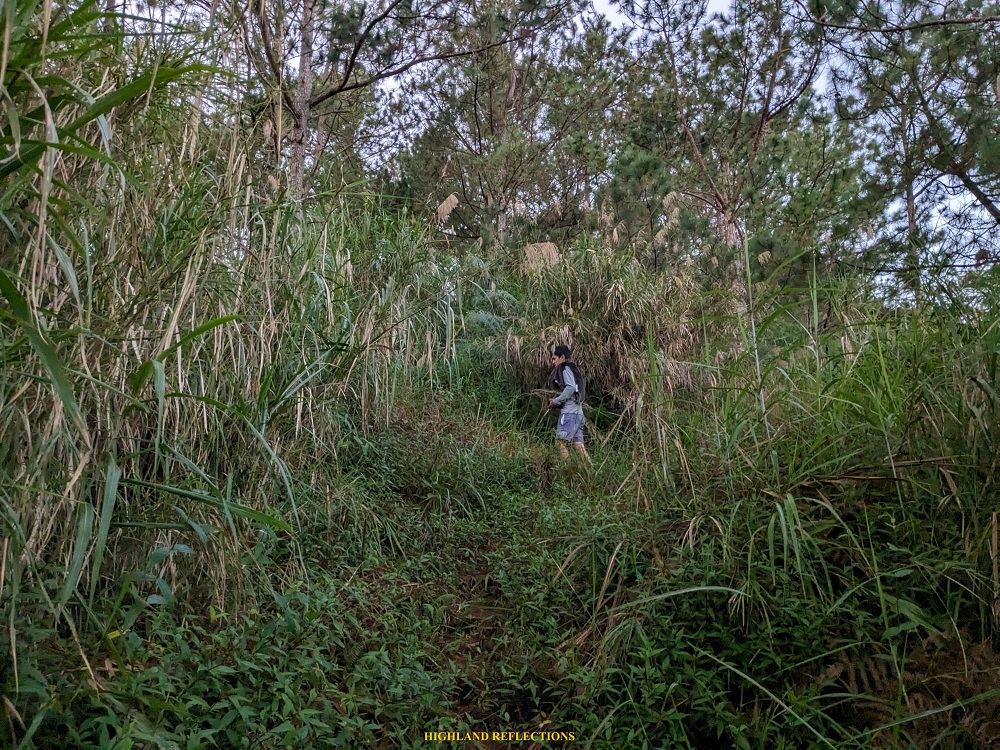
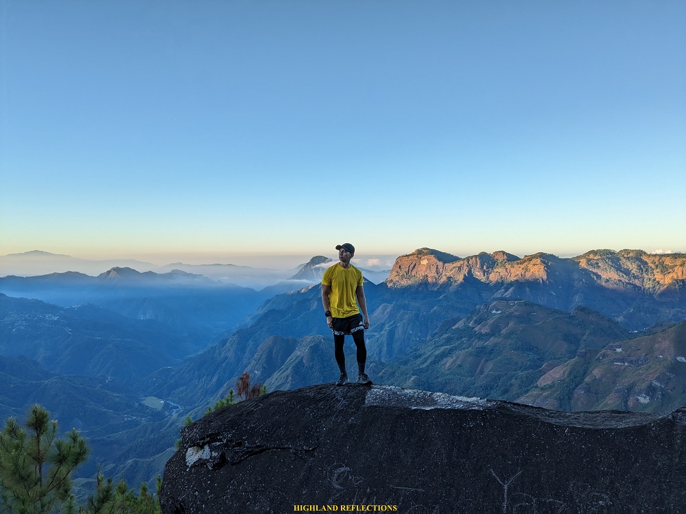
After just minutes of continuous ascent, we found ourselves on a flat trail inside a montane forest surrounded by pine trees. This flat trail is already the summit area of Mt. Kilkili. The end point of this trail reaches on a boulder area at the edge of the mountain, where an awesome panorama of the Kibungan mountains can be seen! Directly in this view is Mt. Tagpew, the third summit of the Kibugan Circuit hike. Gearing our view towards the left are the other rocky, pine-tree filled mountain range comprising Mt. Oten and Mt. Tagpaya!
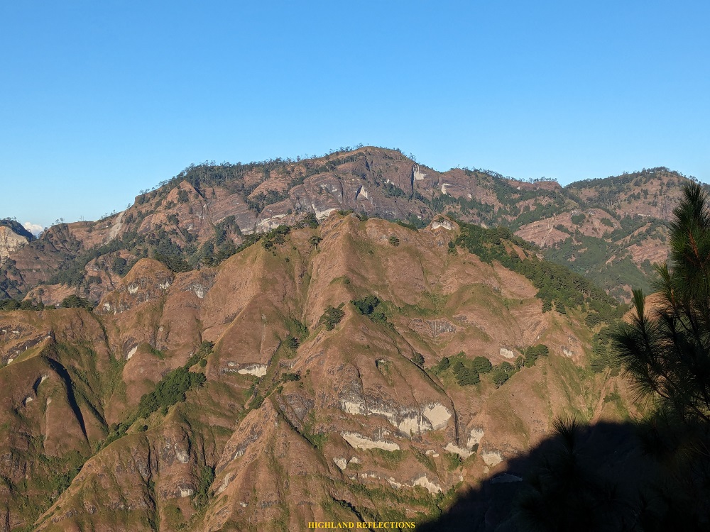
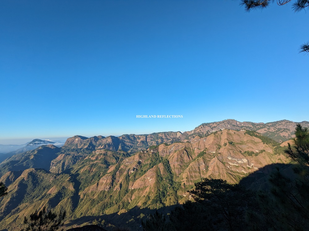
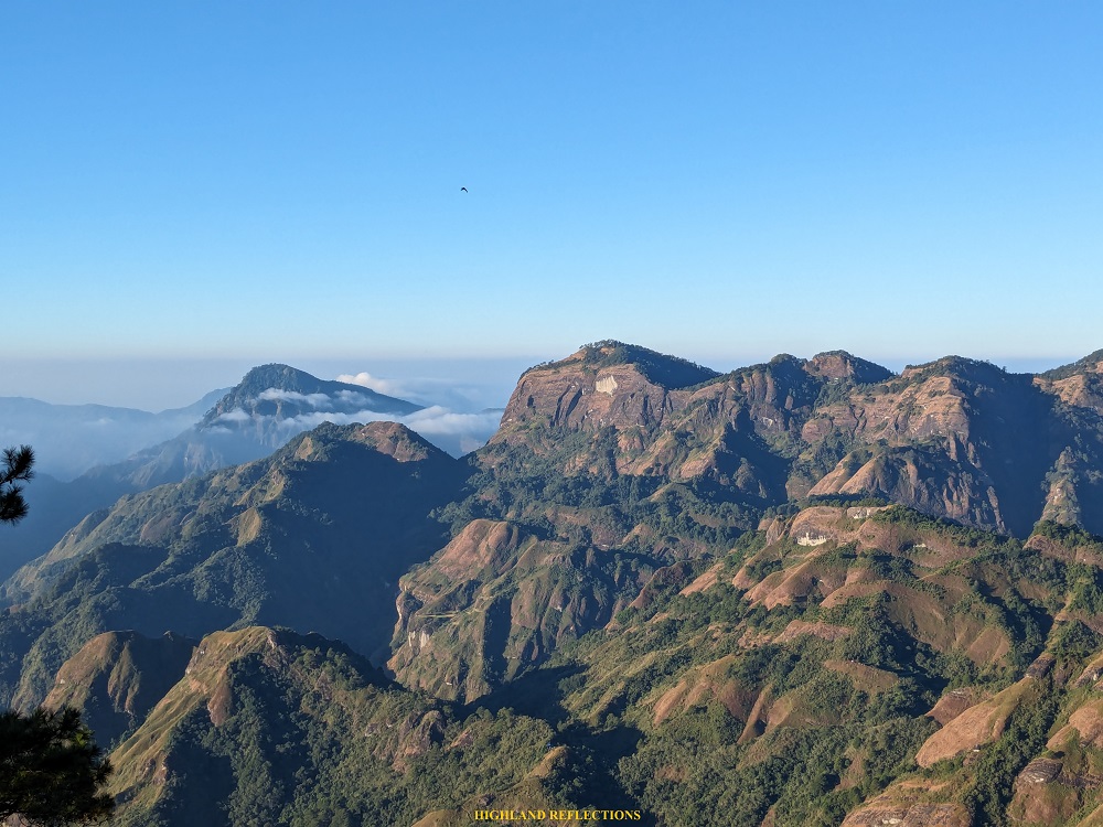
From this viewpoint, we descended around 10 meters to reach another boulder viewpoint. Here, we were able to get a vista of the northern direction, where Mt. Tagpaya, the first mountain in the Kibungan Traverse can be seen! In the far horizon, I was also able to spot Mt. Santo Tomas in Baguio City! The views here were utterly majestic!

We spent an hour on the view deck before descending and returning to Bakun Poblacion. Although only a side trip, Mt. Kilkili surprised us with such an awesome view of the gigantic rocky mountains of Kibungan, Benguet! I hope this gets discovered by other hikers traveling to Bakun and Kibungan. However, I hope the mounds of trash at the summit area gets collected as it may destroy the ecosystem within the mountain.
Itinerary
05:15AM ETD Bakun Poblacion
05:50AM Jump-off point, start hike
06:10AM Summit, take pictures
07:05AM Descent, explore the surrounding farmlands
08:30AM Back in Bakun, Poblacion

2 thoughts on “Mt. Kilkili (1,834+ MASL) | Kibungan’s Dead Volcano”