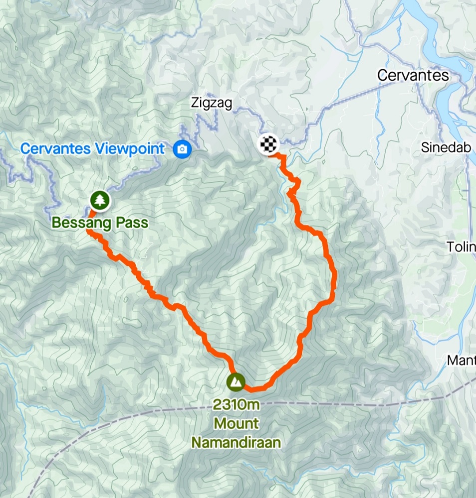
Last June of 2023, I was finally able to climb one of my target climbs in the north: the formidable Mt. Namandiraan. Situated in the town of Cervantes, it is considered as the highest point in the province of Ilocos Sur. The hike up Namandiraan is strenuous and is definitely for those who are geared up for a challenging adventure. The hike starts at the historic Bessang Pass Natural Monument just beside the Tagudin-Cervantes-Sabangan highway, then, passing through community paths and steep pine forest slopes both in the ascent and descent trail. The traverse ends at Malaya Elementary School, also located beside the highway a few kilometers away from the Bessang Pass monument.
MT. NAMANDIRAAN (Traverse)
Jump-off Point: Bessang Pass Natural Monument, Cervantes, Ilocos Sur
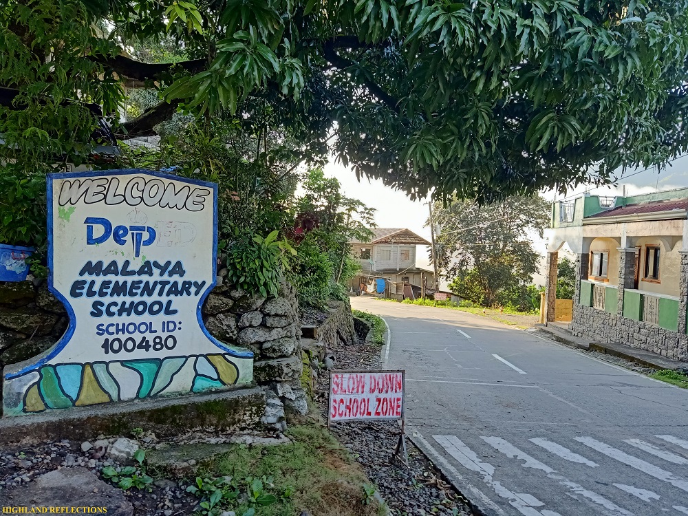
Exit Point: Malaya Elementary School, Malaya, Cervantes, Ilocos Sur
Days Required / Hours to Summit: 1-2 days / 8-9 hours
Specs: Major climb, difficulty 8/9
Features: Highest mountain in Ilocos Sur, mossy and pine forests, wide grassland summit, summit camp
Here is the story of my adventure up Ilocos Sur’s highest point!
Day 1: Cervantes Bound
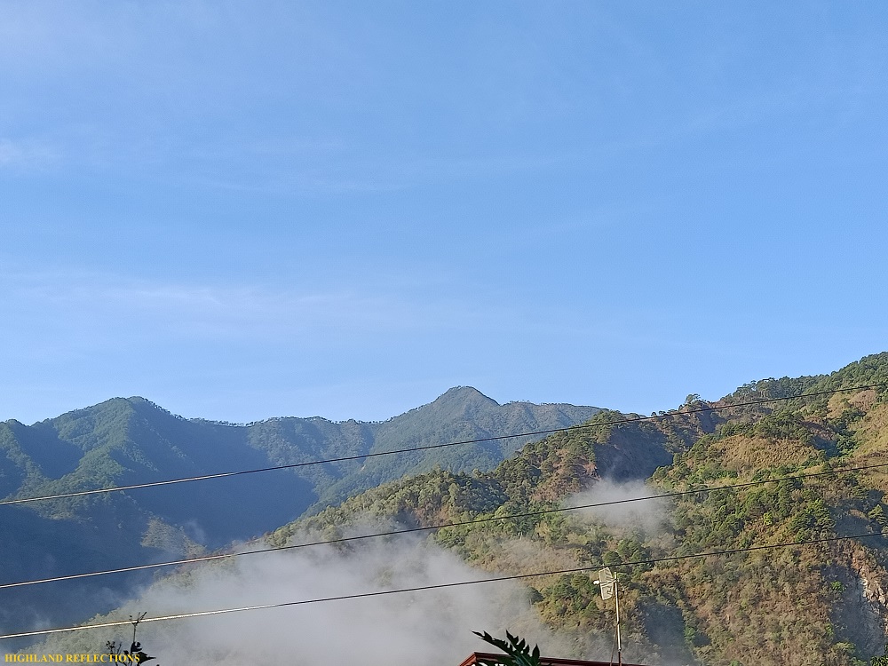
I was woken up by the blue sky and the velocity of our vehicle sometime before 6 in the morning. We were traversing the Tagudin-Cervantes-Sabangan highway, one of the entry points going to the towns in Mountain Province such as Bauko, Sabangan, and Sagada. It was my first time taking this road. Often, when entering the Cordillera Region, we would take the route entering either Baguio or Banaue. I was excited to take another new path up my favorite region, and one that boasted one of the most magnificent vistas in the Cordillera roads!
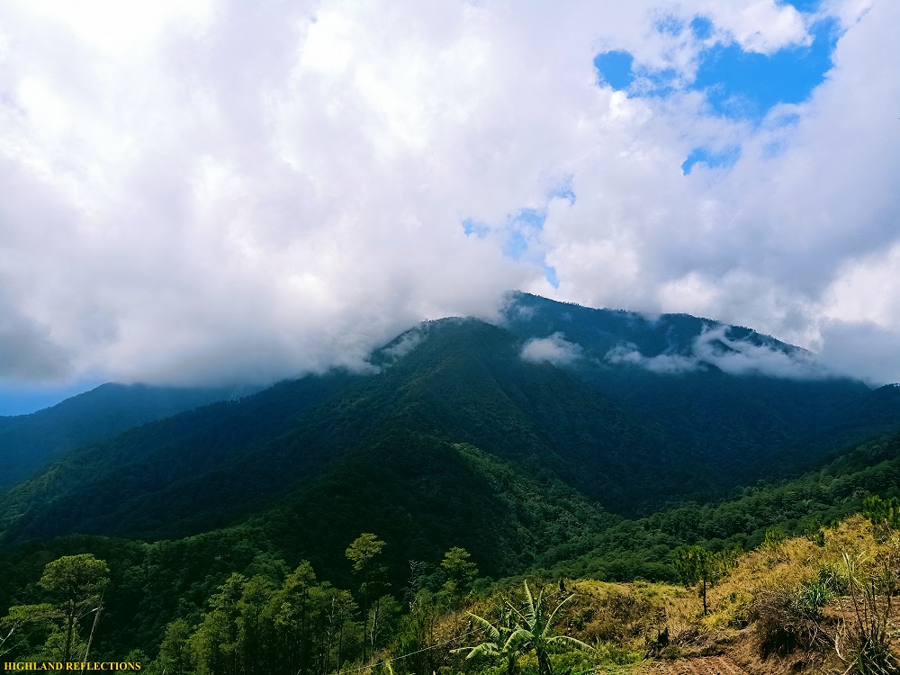
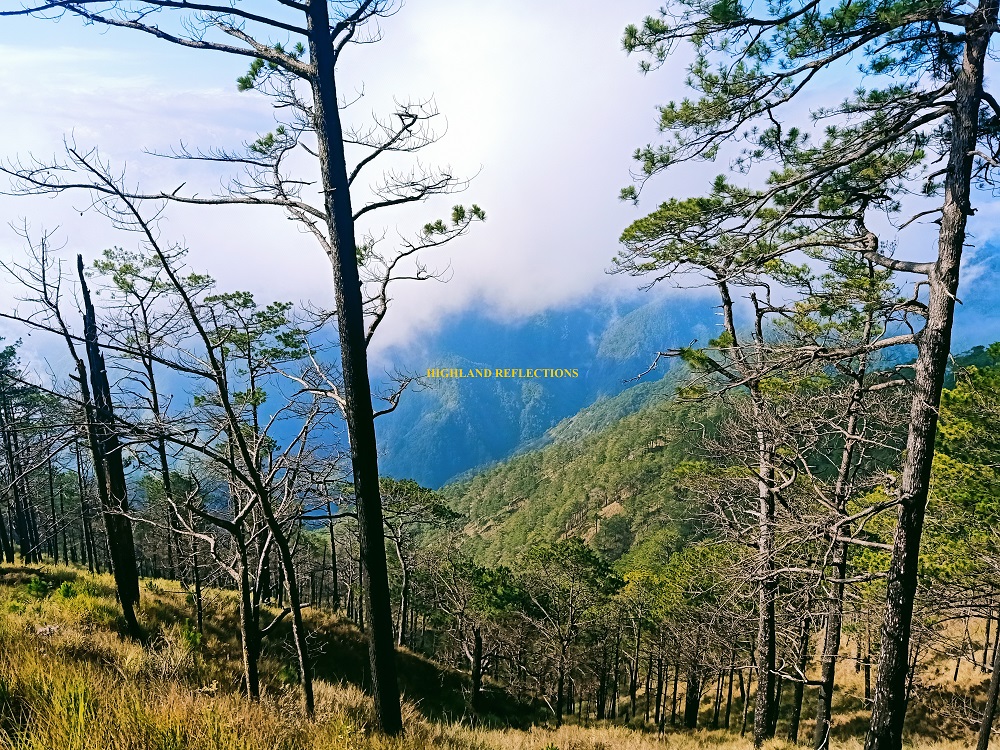
As the sun illuminated the morning sky, the mountains of Ilocos Sur—still part of the Cordillera Mountain Range—revealed herself in her full glory. In some parts of the highway, the mountains towered above us. But in other parts, we were the ones towering over valleys way, way below, covered in clouds. What a magnificent sight!
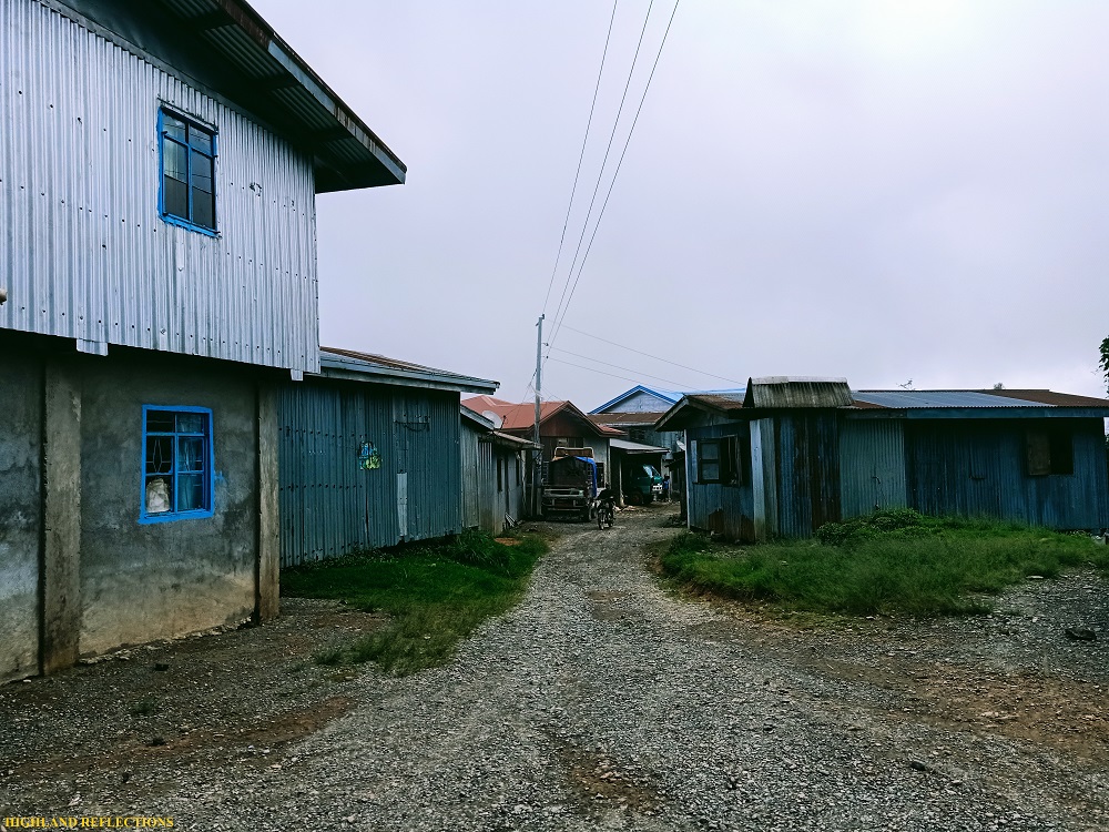
We arrived at a homestay near Malaya Elementary School, our supposed exit point, at around 7 in the morning. There, one of the joiners for this tour was already waiting for us, and luckily, cooked us some breakfast and lunch. The summit of Namandiraan was already visible from there. It looked near, but the guides say it’s an 8-10 hour hike up!
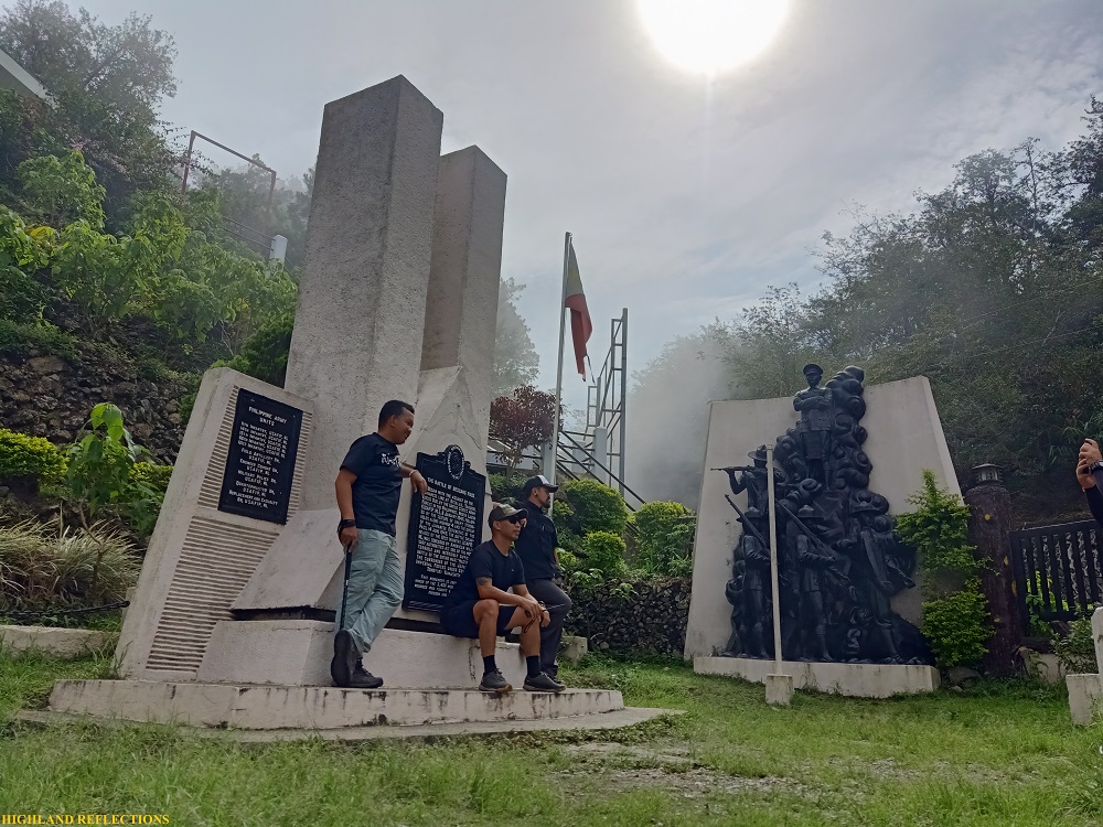
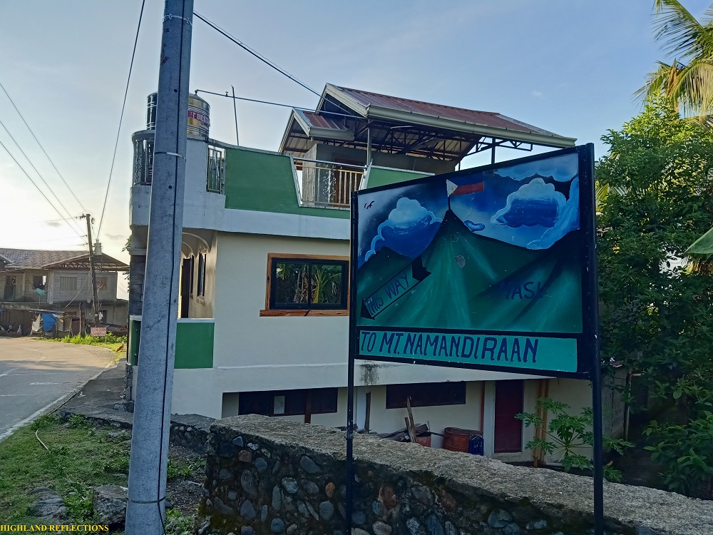
After eating breakfast, we were oriented by Ms. Rufa Fecha, the local coordinator for our climb. We then boarded our van once more and returned to the historic Bessang Pass Natural Monument (1,500+ masl), which we passed by on the way to Malaya Elementary School, located around 15-20 minutes away. This monument commemorates the fallen individuals of the Battle of Bessang Pass, one of the last stands of General Tomoyuki Yamashita in the Cordillera against Filipino and American soldiers. Reflecting on the tragedy that fell on this sacred land, I mustered a short prayer for the departed souls.
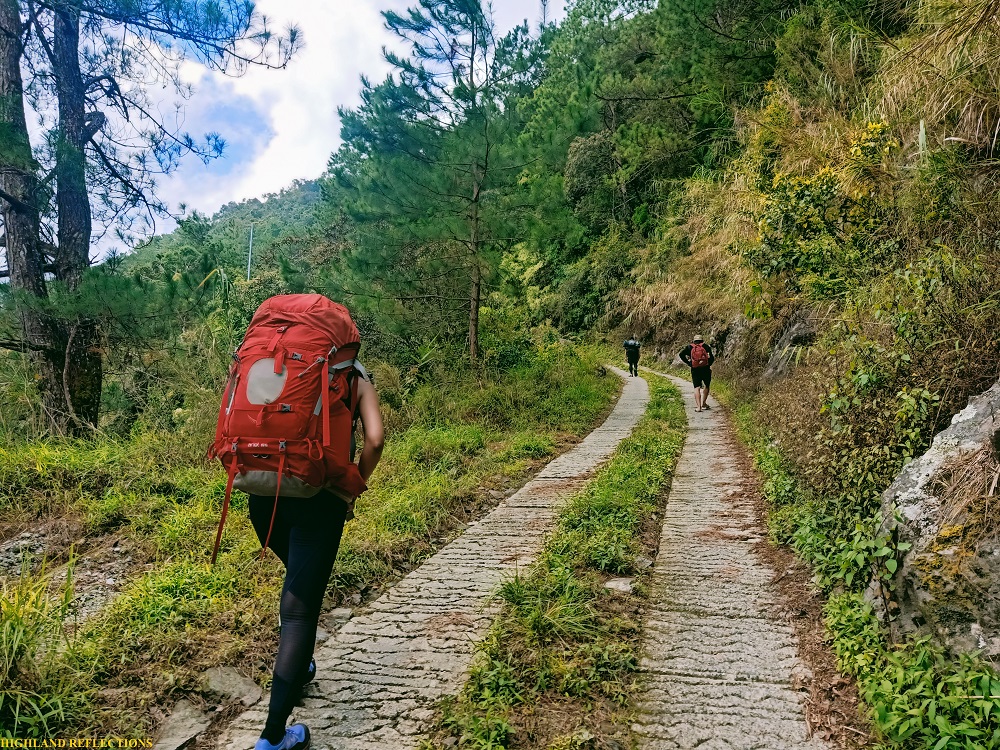
And alas, we started the hike to Mt. Namandiraan at 9 in the morning. The start of the trail is located a few meters away from the monument, characterized by a cemented, ascending road which we took for an hour before reaching Sitio Biwak, a community located 1,850 meters above sea level. Although the ascending road provided us with a scenic vista of the town of Cervantes, fog enveloped the surrounding as we reached the Sitio. There, the locals were going on with their daily lives, not giving us any attention as they were probably used to seeing hikers pass by their community. The children, however, were brimming with curiosity.
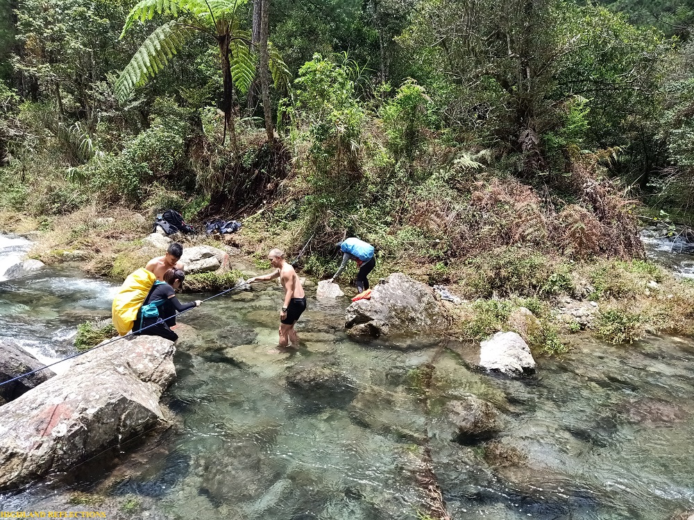
Past the sitio is a 300-meter descent to Ballay River. The descending trail showcased the first round of beautiful pine forest, with its steepness highly evocative of the Akiki Trail of Mt. Pulag. After 20 minutes, we reached the river, which we needed to cross since the water flow was strong and high at that time. Past the river is Ballay Campsite, where we took a long rest and ate our lunch. It was 11:30am, 2 and a half hours after starting the hike. I refilled my water canteens at the river.
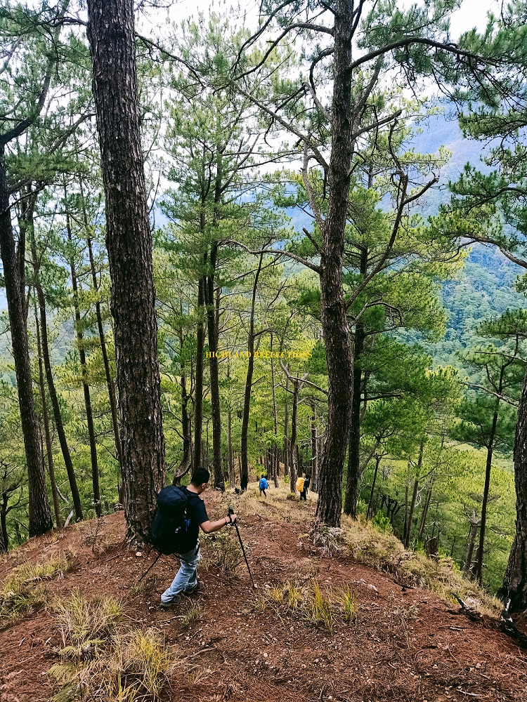
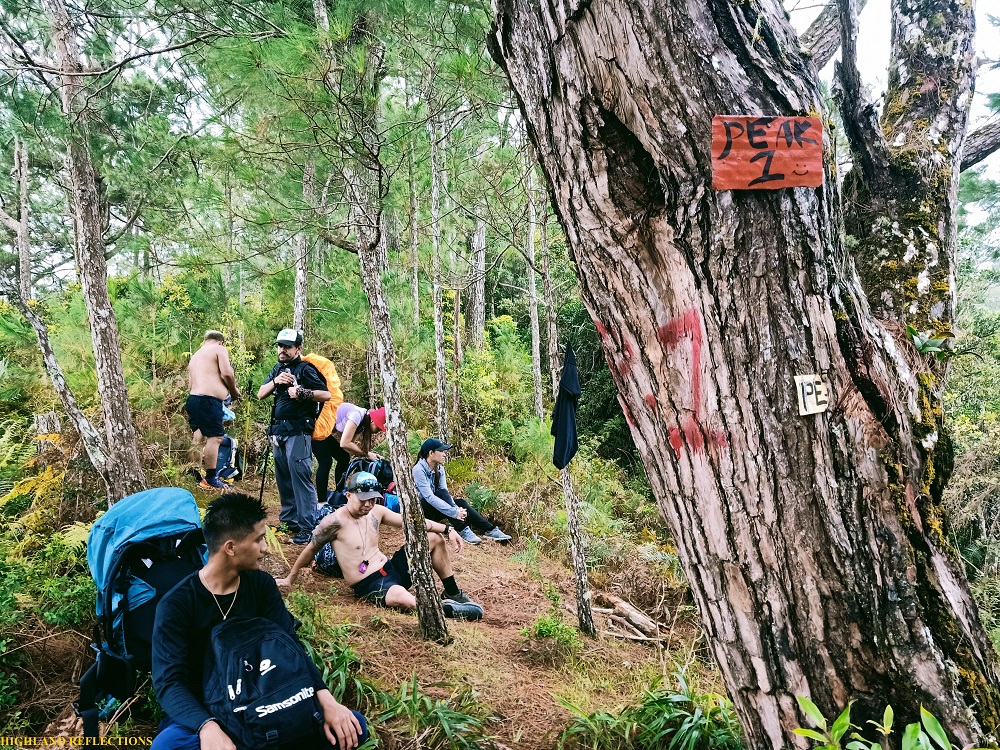
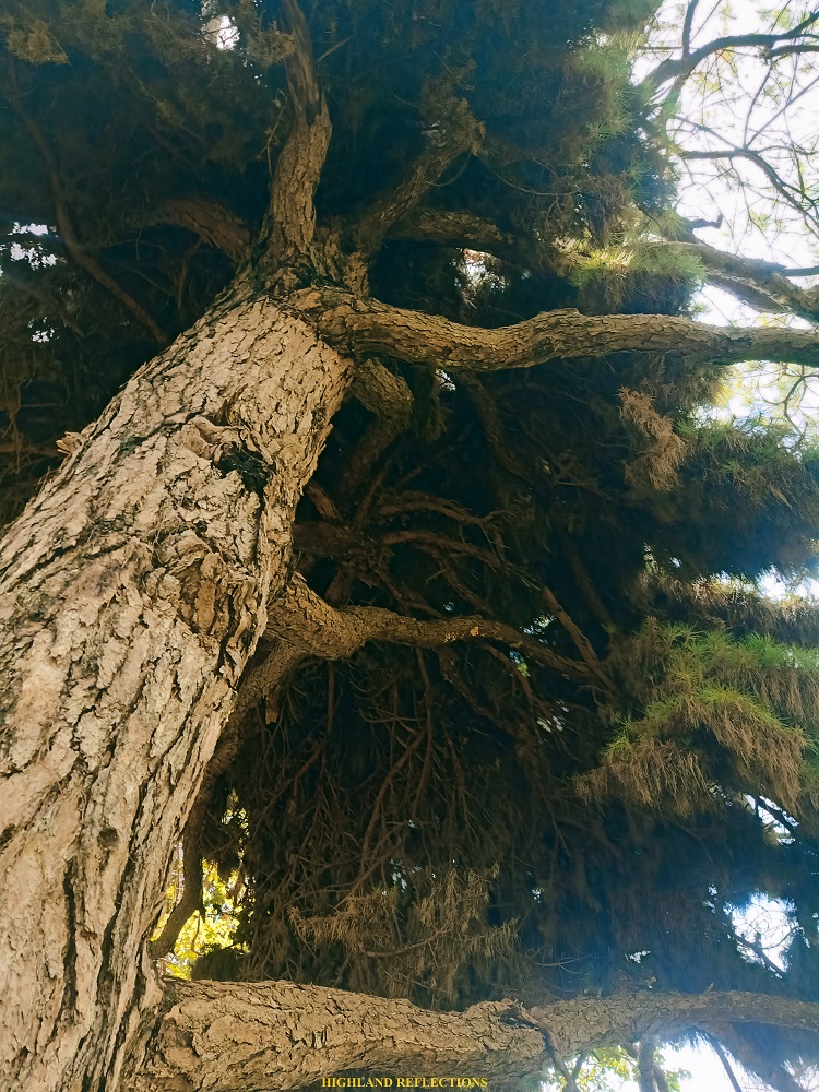
The trail immediately after the campsite was an ascending trail carved along pine forest slopes, reminiscent of the trail past Eddet River in Mt. Pulag. However, Namandiraan had some open ridge trails that would provide views of the surrounding slopes of the mountain range. We also encountered a technical portion that needed rope assistance, as the trail was blocked by a huge boulder and some thick shrubs at the side of a ravine. We reached Peaks 1 and 2 just shortly after (Note: these are view decks rather than actual peaks).
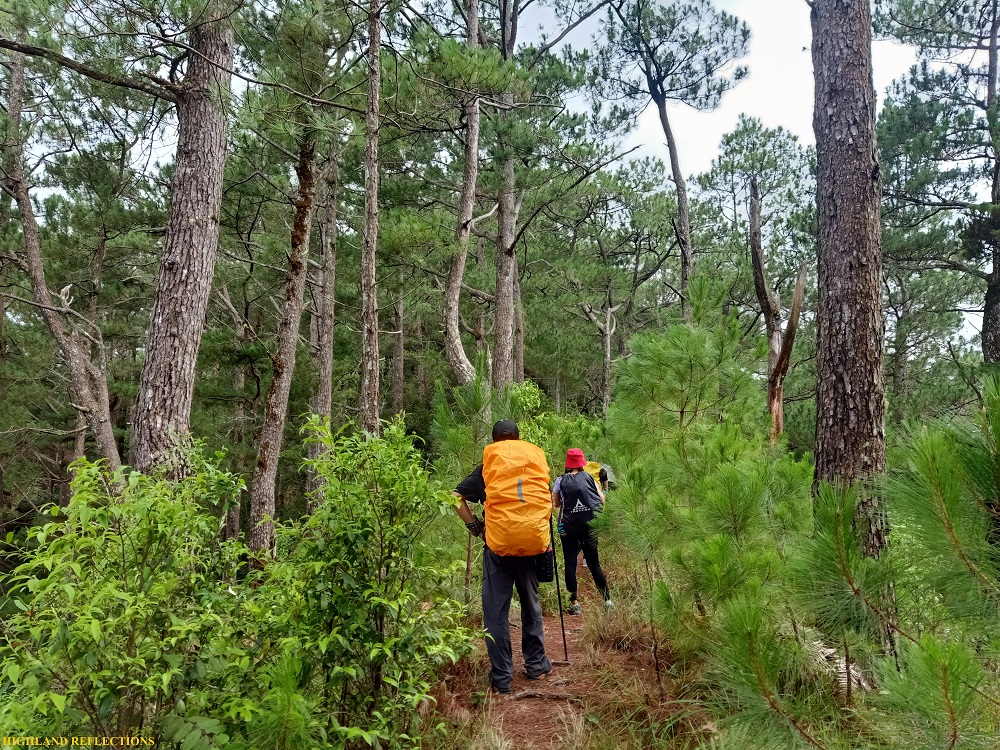
The ascent after peaks 1 and 2 was nonstop. Amidst the enveloping fog, tiredness was seeping in. In no time, we reached peak 3, and just after some nonstop ascent, we entered the mossy forest of Namandiraan. Unfortunately, the clouds decided to bathe us with rain as we were traversing the steep slopes of the forest.
The moss within the forest wasn’t that thick. It reminded me of the mountain that we needed to pass through going to Pat-yay coming from Cambulo in Banaue, Ifugao. The lack of rest area also made the trail highly similar to it! What made Namandiraan’s mossy trail more mentally difficult, however, was the presence of limatiks. I had two bites at the back of my left knee! It was quite difficult to get vigilant of these creatures when it’s raining.
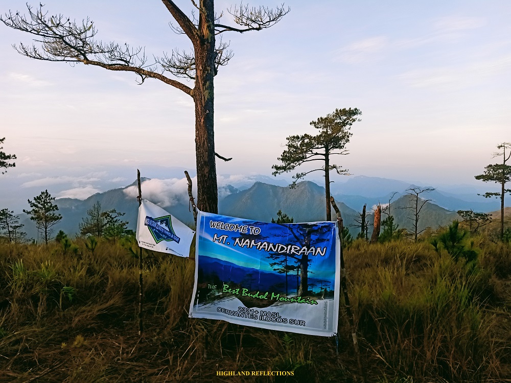
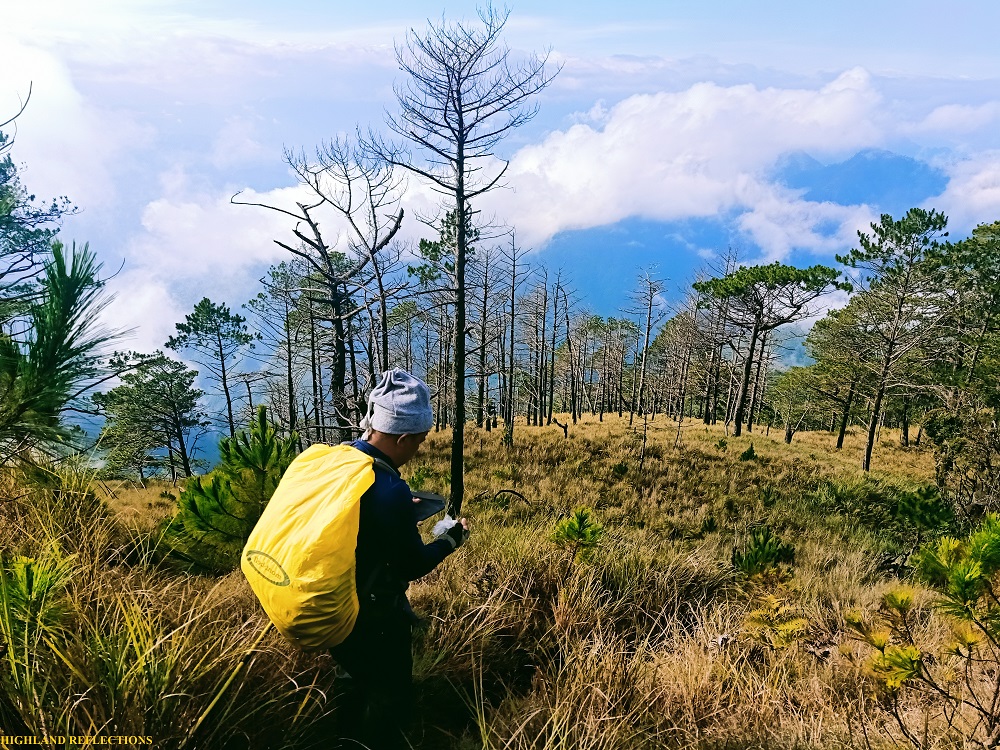
Alas, at 4 in the afternoon, three hours after starting the long push from Ballay River, I exited the mossy forest towards the grassy and pine tree-filled summit plateau of Mt. Namandiraan. The ascent took me 7 hours to complete. Not bad!
Unfortunately (again), I found out that I left the rain cover of my tent back home. Thank God though—after an hour of idling at the summit while holding my umbrella to shield myself from the passing rain, one of the joiners agreed to lend me his extra tent. I immediately assembled it before the passing rain poured again.
I slept before 9 in the evening after a hearty diner of tinola and a short gin session with some of the joiners. That night, the sky cleared for quite a bit, giving us hope that tomorrow morning would be better.
Day 2: The Longest Descent
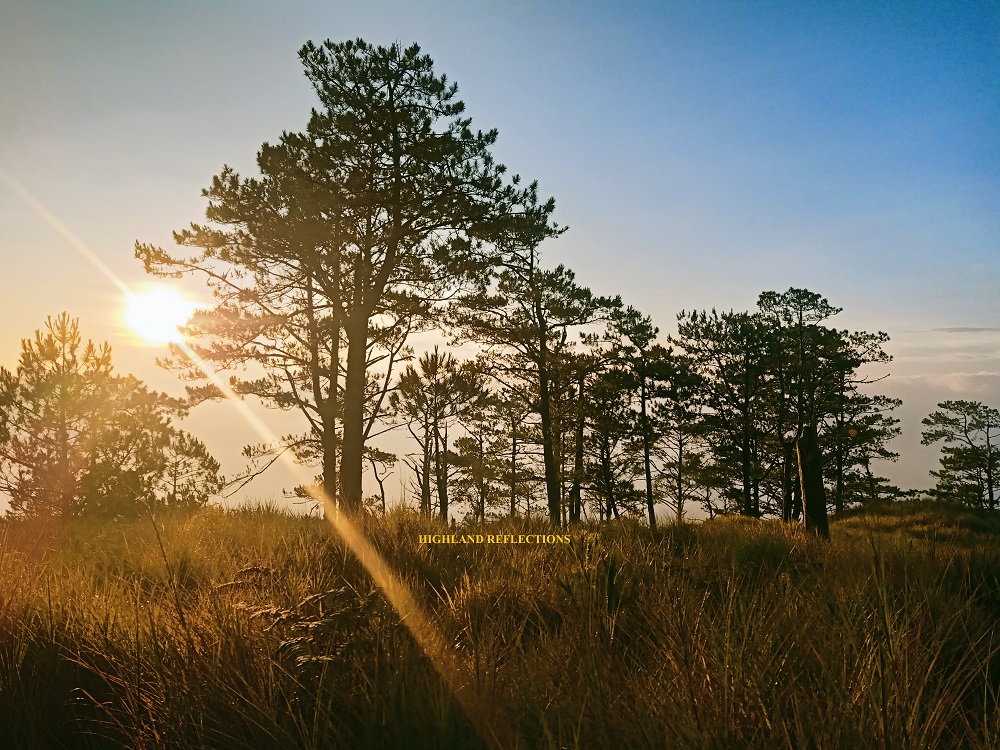
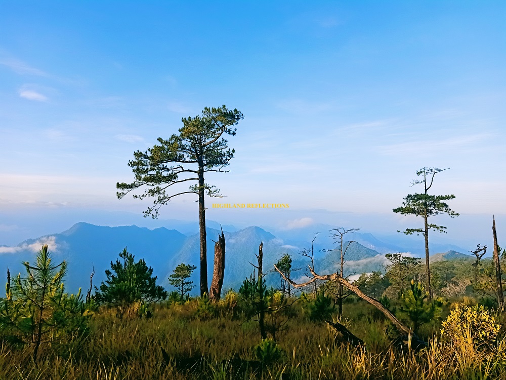
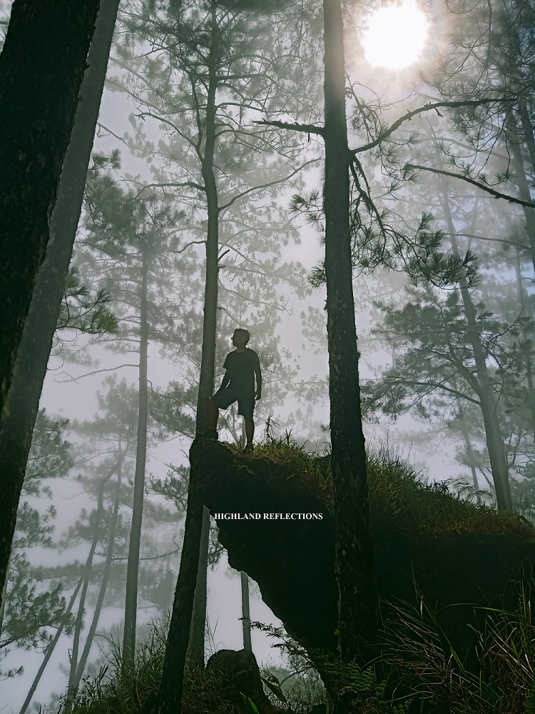
At 5:30am, I woke up to the sound of a drone and loud voices. I immediately got up and came out of my tent. The surroundings were beautiful! The once foggy summit plateau was now bathed by the sun. Pine trees get really mesmerizing when they’re illuminated by sunlight! I was awed at the marvelous sight before me.
I tried to explore the summit area. My favorite spot would be on the southern side where a tarpaulin sign was installed. At the back of that tarpaulin is the view of Cordilleras where the mountains of Bakun, Benguet are visible. I immediately spotted Mt. Tenglawan and Mt. Kabunian with their oddly specific forms. They were all dwarfed by the immense elevation of Namandiraan and its surrounding mountains!
After breaking our fast, we started the descent at 7:30 in the morning. The trail going down, as the guide told us, is longer, and would take the same amount of time as the ascending trail to finish. This was a challenge that I was looking forward to! I was about to get punished.
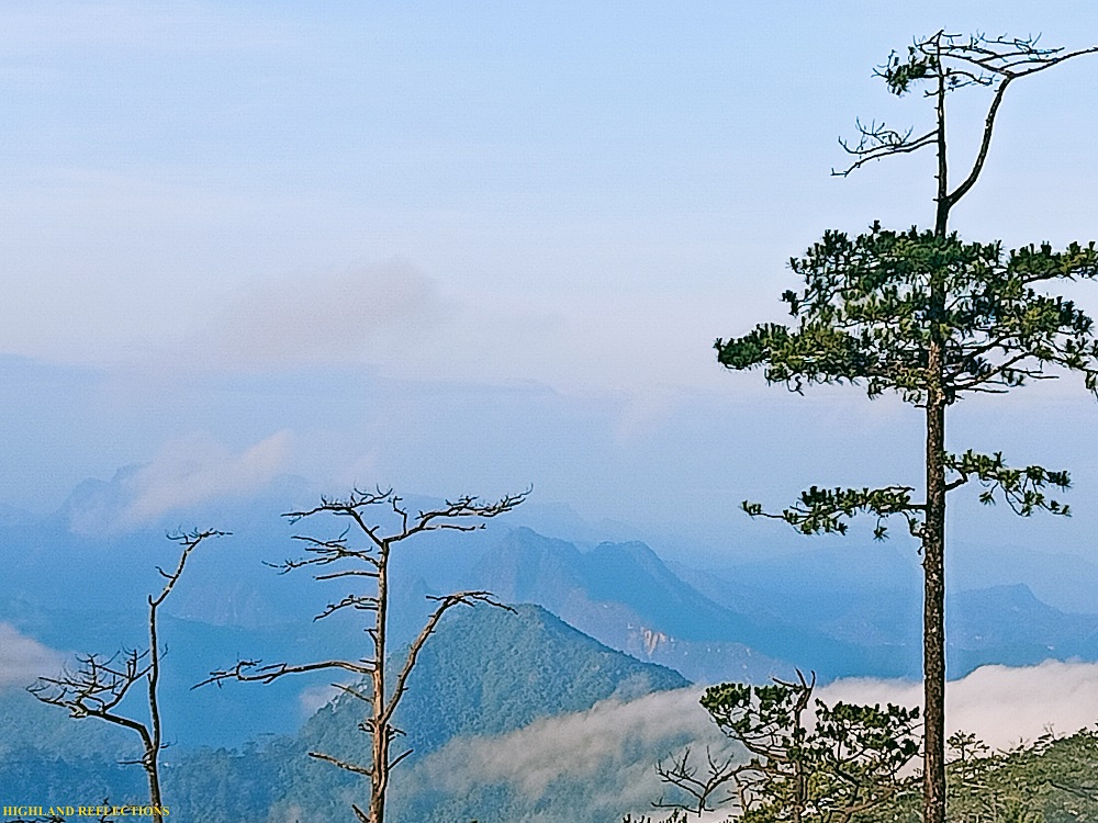
The trail starts off at the southern side of the summit plateau going westwards. The initial parts already rewarded us with views of the surrounding slopes of the mountain, stretching all the way down, all dressed in the magnificent greenery of pine trees. This was what the trail would consist for a large part of the descent. Sometimes, the grasses surrounding the trail were sharp, especially the ones near Kay-ang Rock (1,905m), which we reached after an hour.
Kay-ang Rock is dubbed by hikers as Namandiraan’s version of Mt. Ulap’s Gungal Rock. However, unlike the one in Ulap where Gungal Rock protrudes on a ravine, Kay-ang Rock stands diagonally in the middle of a pine forest. According to local stories, the boulder got its name from a man exiled because of his leprosy condition.
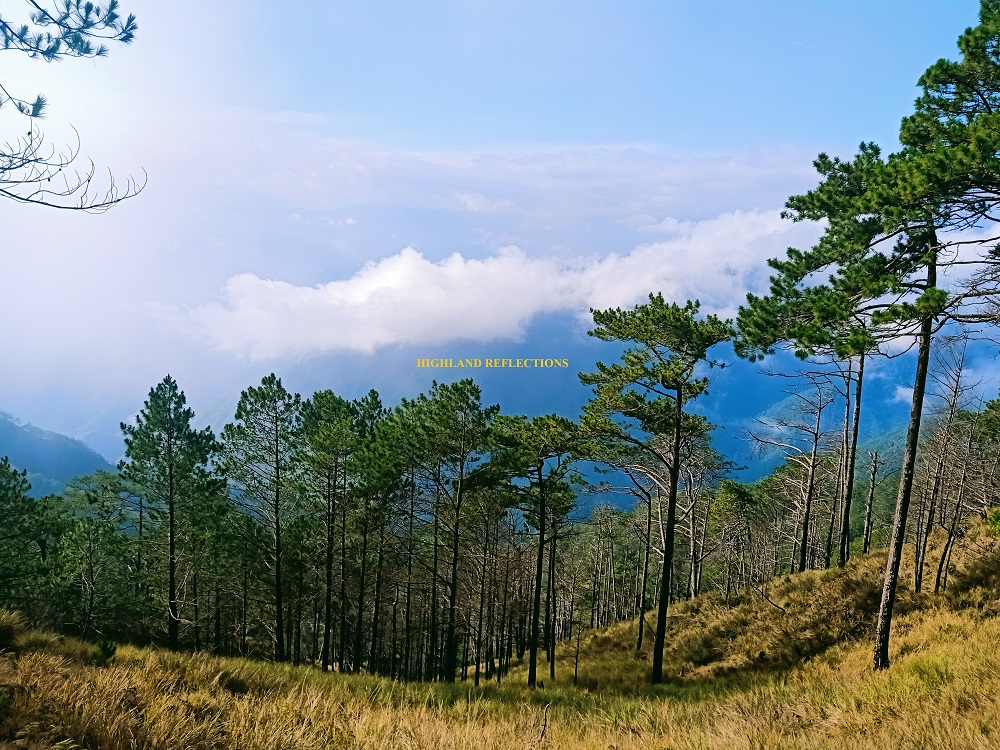
After snapping some pictures at the picturesque spot and taking some ample time to rest and munch on snacks, we continued with the descent past 9 in the morning. It was all pine forest once more. The descent was nonstop, its steepness becoming more pronounced every minute. Still, it was rather enjoyable as it provided views of a stretching valley and river to our right, including the poblacion of Cervantes, with the mountains of Sagada, Bauko, and Sabangan in the background.

The view to our left, however, was the next round of slope that we needed to pass through. We could see a hill filled with pine trees, and we were sure that we needed to pass through that hill as there was no other visible path. Our hypothesis was confirmed when the lead group gave their signal of shouts from that hill.
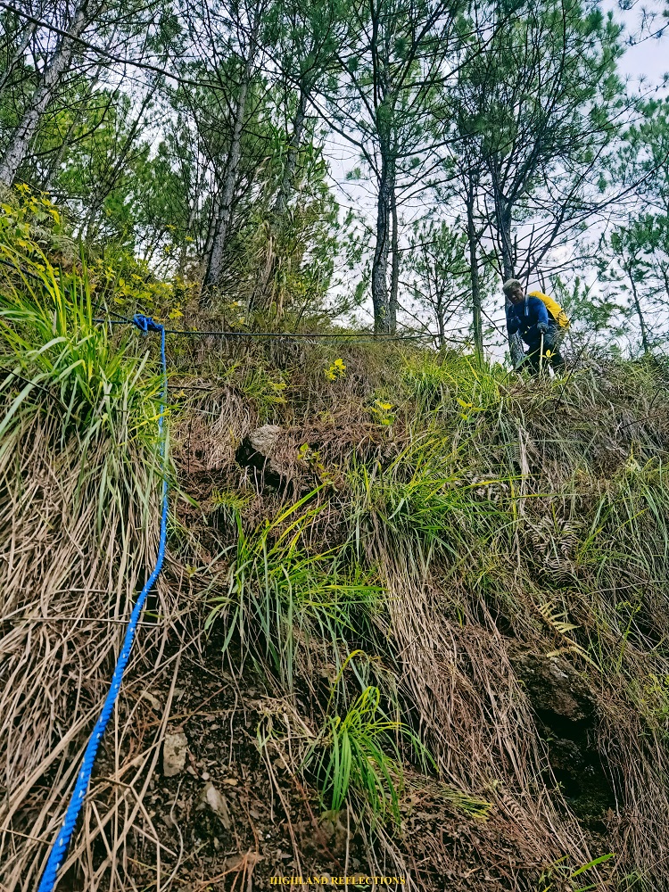
Prior to reaching that hill, however, we needed to negotiate a steep roped segment going down. The trail there was difficult to spot. Initially, we went directly towards a descending slope, only to realize that the steepness was unbearable, and there was no trail to follow. Luckily, after returning to the original trail (ascending, all tired and exasperated), I spotted the blue rope at the side of the trail. It was really difficult to spot!
After the roped segment, a short flat trail ensued. Then, a round of ascent up a knife edge—much of which we needed to take under the scorching midday sun. Upon reaching the uppermost part of the hill (which we spotted earlier!; 1320m), I took a long, long rest. I decided to take my lunch there as I was exhausted from the heat and from the length of the trail! The rest of our companions caught up. It was 11 in the morning.
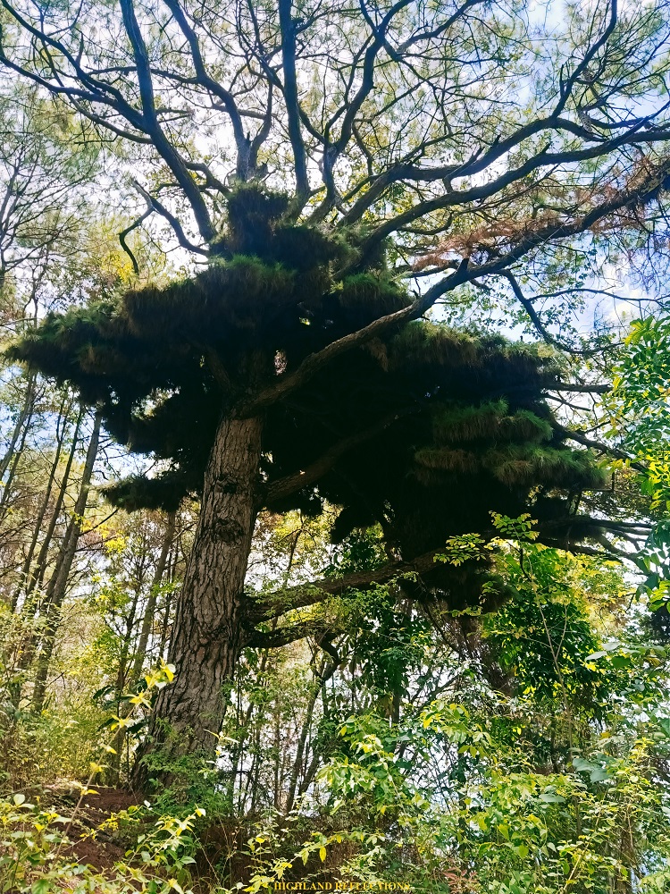
After resting, we took another round of steep descent. This time, I already suffered cramps. Luckily, I was able to push through with the descent slowly. Just after a few minutes, the canopy of trees down below came nearer, and as I reached flat ground, a weird looking pine tree that seems to resemble a giant bird’s nest appeared in front of me. Just shortly past that is the water source (960m), where our companions were taking their lunch. I rested and took the chance to lie down. I checked my STRAVA map. The recording showed that we were quite close to the exit point.
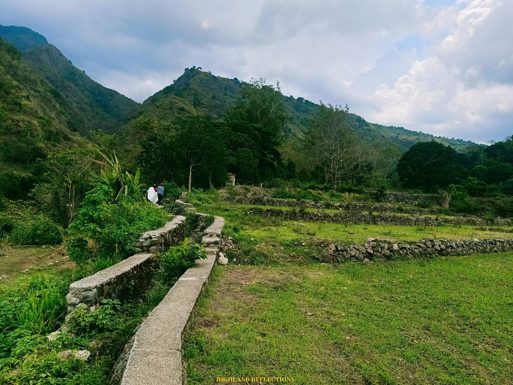
And alas, we started the last push to the exit point past one in the afternoon. We encountered some short section of pine forests until exiting towards a farming community. A guide here is a must as paths would diverge several times, probably used by locals to go to their plantations. After an hour, we reached a hanging bridge above a river, marking one of the last portions of the trail (495m).
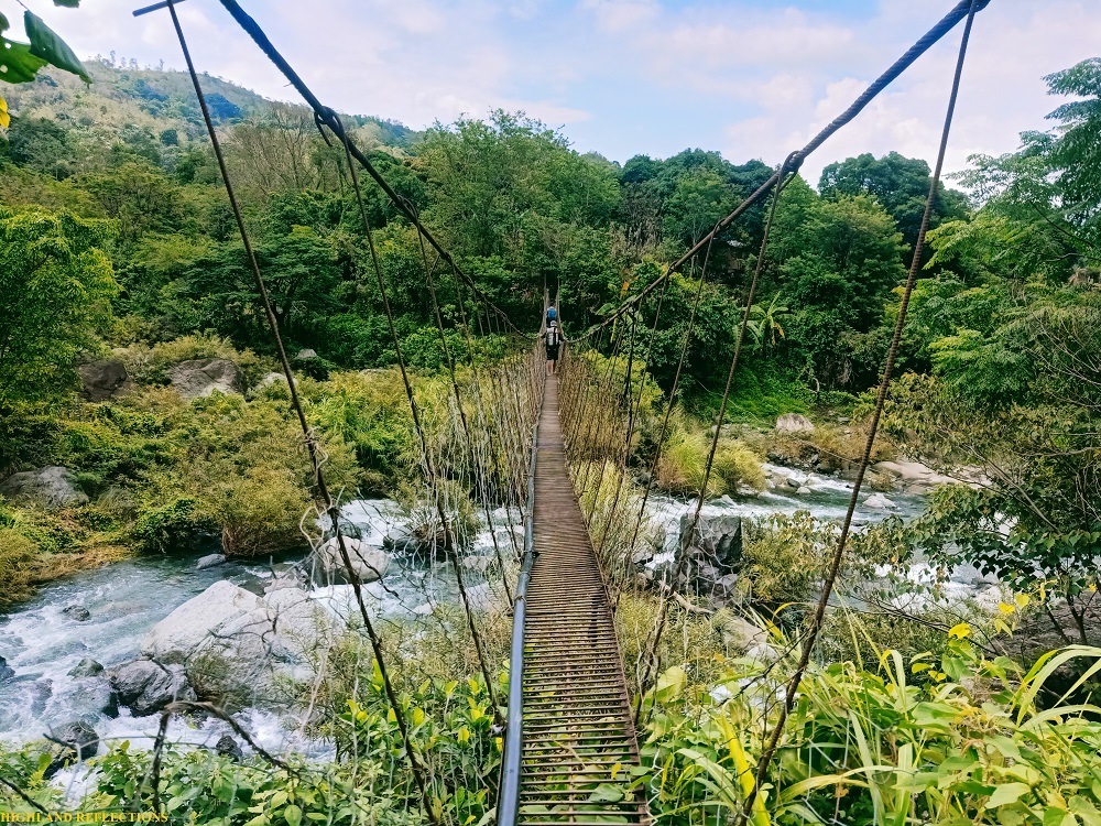
Past the hanging bridge, we passed through short sections of rice terraces, and one last cemented ascending stairway before exiting to the highway, where Malaya Elementary School and the homestay where our van was parked is located (600m). It was 3 in the afternoon, 7 and a half hours after starting the descent. What a challenge! Our whole team was complete at 4 in the afternoon, all safe. We thanked God for the good weather for the entire second day. It rained only when we started to leave at 6 in the evening.
Mt. Namandiraan, being one of the mountains that I have wanted to climb since 2018, proved to be a magnificent and extremely challenging mountain. Its steep pine forest slopes definitely give off the classic Cordillera challenge. Together with its historic significance, the hike up to Mt. Namandiraan surely felt personally significant. I thanked its elements for welcoming me and showing me all of her possible sides, rain or shine.
Itinerary
Day 1
06:30AM Arrival at Malaya Elementary School, breakfast
08:30AM Bessang Pass Natural Monument (1,500m), take pictures
09:00AM Start hike
10:30AM Sitio Biwak (1,850m)
11:30AM Ballay River and Camp (1,520), lunch
12:30PM Resume hike
04:00PM Summit (2,331m)
09:00PM Lights out
Day 2
05:30AM Wake-up call
07:30AM Start descent
08:30AM Kay-ang Rock (1,905m), rest and take pictures
09:00AM Resume hike
10:30AM Roped segment (1,325m)
11:00AM Rest
11:30AM Resume hike
12:30PM Water source (960m), take lunch
01:00PM Resume hike
02:00PM Hanging bridge (495m), swim at the river
02:30PM Resume hike
03:00PM End of hike (Malaya Elementary School, 600m), wash-up
06:00PM ETD to Manila

2 thoughts on “Mt. Namandiraan (2,331+ MASL) | Ilocos Sur’s Highest Peak”