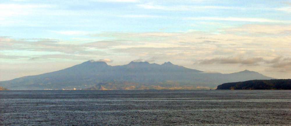
Mt. Mariveles is a dormant volcano south of Bataan. It has long been a goal of mine to climb the highest peak of this mountain—the formidable Pantingan Peak—and do a traverse to the more famous Tarak Ridge. My curiosity for this mountain and its surrounding peaks started when I climbed Tarak Ridge in 2018, but failed to see the several summits of the mountain due to the thick swathe of fog surrounding the western portion of the ridge during our climb. For so long, Mt. Mariveles has made her presence felt whenever I see her on different spots in Bulacan and in Manila (for instance, on a clear day, I would spot Mt. Mariveles while traversing NLEX). Whenever I see her, I just knew that she was inviting me to climb her the soonest. Took me a while, but here I was!
As an enticed human being longing for a summit bid in one of Central Luzon’s major mountains, I was glad to have finally hiked it in March, 2023 when a group of friends posted their event on Facebook for the PanTarak Traverse. Luckily, I had no other plans for the date of the climb so I immediately expressed my interest to the organizers.
Mt. Mariveles, despite being a mountain near the Metro, has so much to offer to those longing for an epic adventure. Sky Biscocho, the mountaineer responsible for the trails inside the mountain, listed this as his personal favorite. Although the well-known Tarak Ridge can reveal many a preview of what Mt. Mariveles offers, it is the hike up to Pantingan Peak where you can truly immerse yourself into what is inside the giant volcano—its expansive caldera covered in verdant and thick forest, and the many peaks surrounding it.
I was both excited and nervous days prior to the climb. The excitement was, of course, due to the thought of finally doing one of my long-time hiking goals. The nervousness, however, was due to the strenuous difficulty of the traverse. PinoyMountaineer rates PanTarak’s difficulty as 8/9. Since I have done some hikes with the same difficulty rating before, I knew that this would be a body-shattering, arduous, and insane hike. According to some info online, the total trail distance is 23 kilometers, and the average time it takes to finish the entire traverse on a regular pacing would be at 18 hours. Additionally, my STRAVA recording showed an elevation gain of 2,400+ MASL!
I went on with the hike with an intrepid spirit.
Ascent to Pantingan
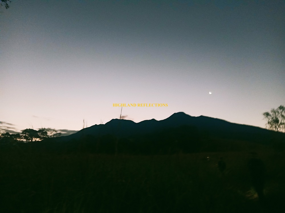
The hike started at 3:30am at the house of our guide in Sitio Gabon, Barangay Saysain in Bagac, Bataan. The first part of the hike was a dusty carabao path that leads to a forest surrounded by bamboos, shrubs, and some dipterocarp trees. This portion of the hike was notorious for the presence of bees. Three of our companions were stung during our hike. Luckily, I was spared. There were some ascents here and there, few of which were steep, but we knew it was still a warm-up of what was next. We took a long rest prior to exiting the forest since some of our companions were lagging behind.
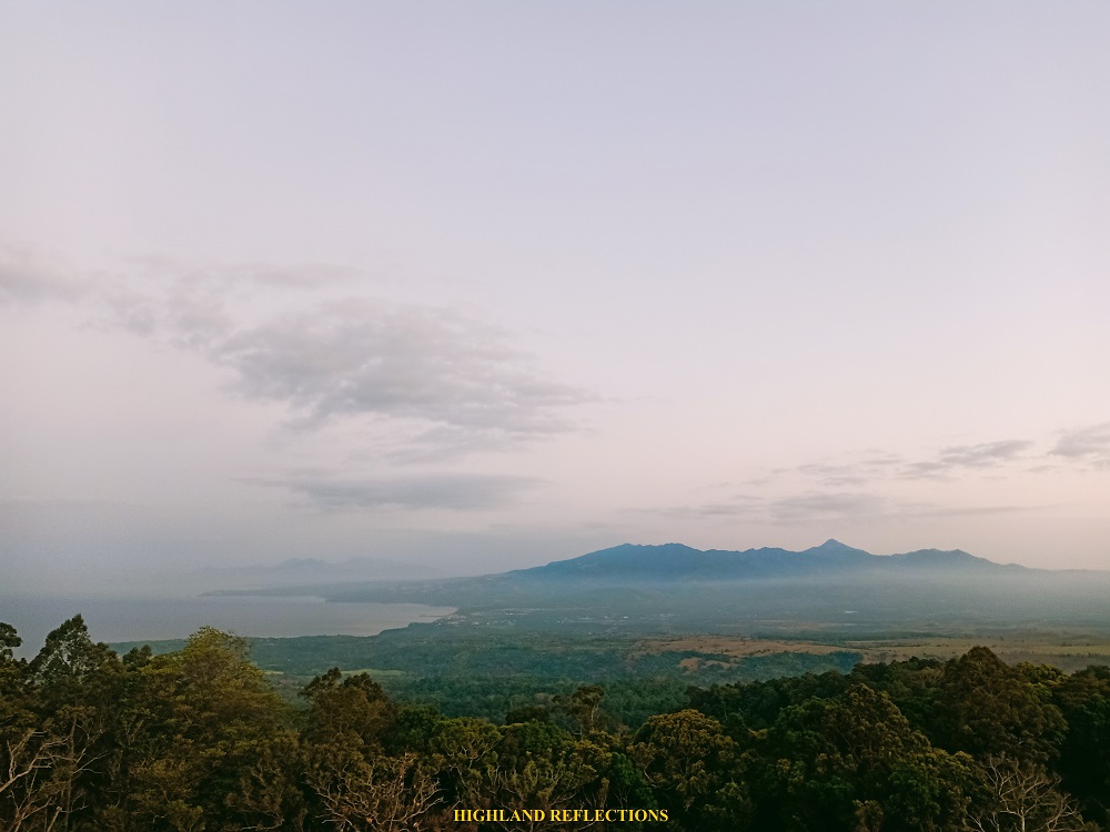
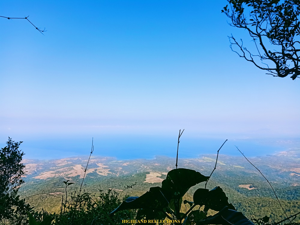
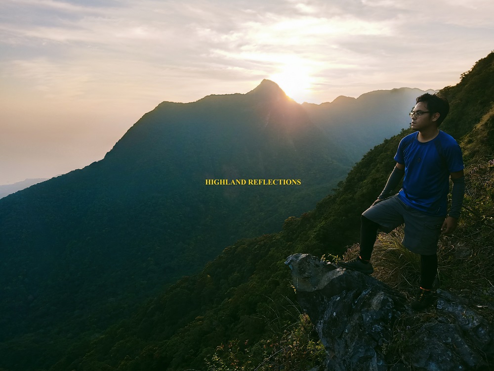
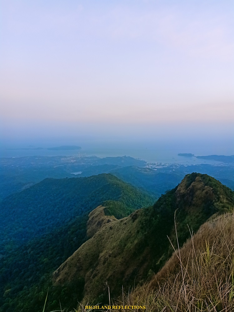
The next portion was a gradual ascent on “Marlboro Country” which was an expansive grassland. There, Pantingan Peak already looms ahead, welcoming us with a hint of sunlight at its rear. Two hours into the hike, we reached Danny’s Gate, which was an area in the grassland dotted with boulders. We had a long rest here as the sight was magnificent! To our left, which was the northern direction, we could clearly see the expansive Mt. Natib in northern Bataan, which I hiked back in April of 2019. To our back, which was the western direction, was the West Philippine Sea.
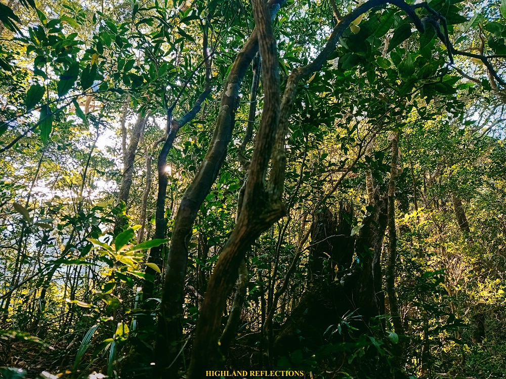
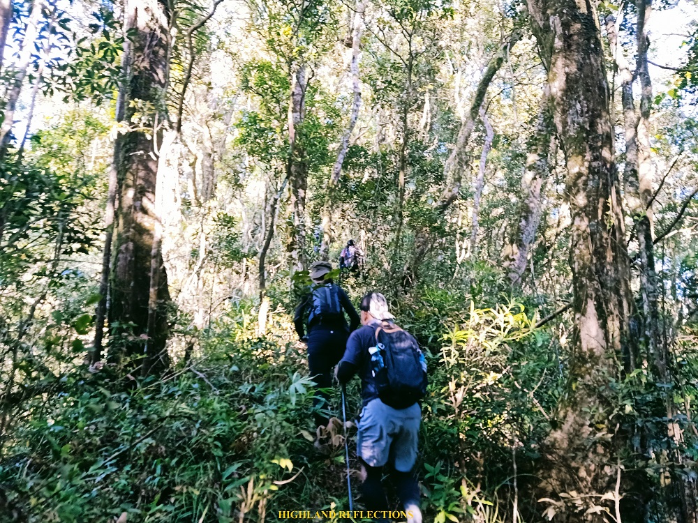
After Danny’s Gate, we entered a dipterocarp forest similar to those of Mt. Arayat and Mt. Malarayat. The ascent was nonstop from this point! I was panting like a dog just to catch my breath every few meters. Still, I was enjoying the acrobatic workout. We had several rests along the trail.
Tiredness seeped in as we were nearing the summit area. Although to our backs, we could see the West Philippine Sea now far below us, the dread of whether we were still far from the summit was stronger. We knew we were close, but because the steepness became more pronounced, and the trail more cramped due to the thick foliage of shrubs and grass, our once intrepid spirits were now displeased with tiredness. At 9am, after 5.5 hours of hiking, we reached the #1 goal of the day, Pantingan Peak!
Pantingan Peak: Is It Really the Highest?
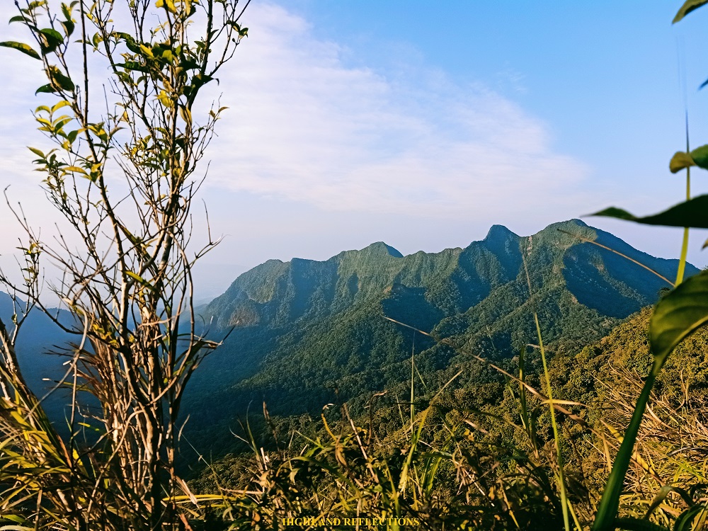
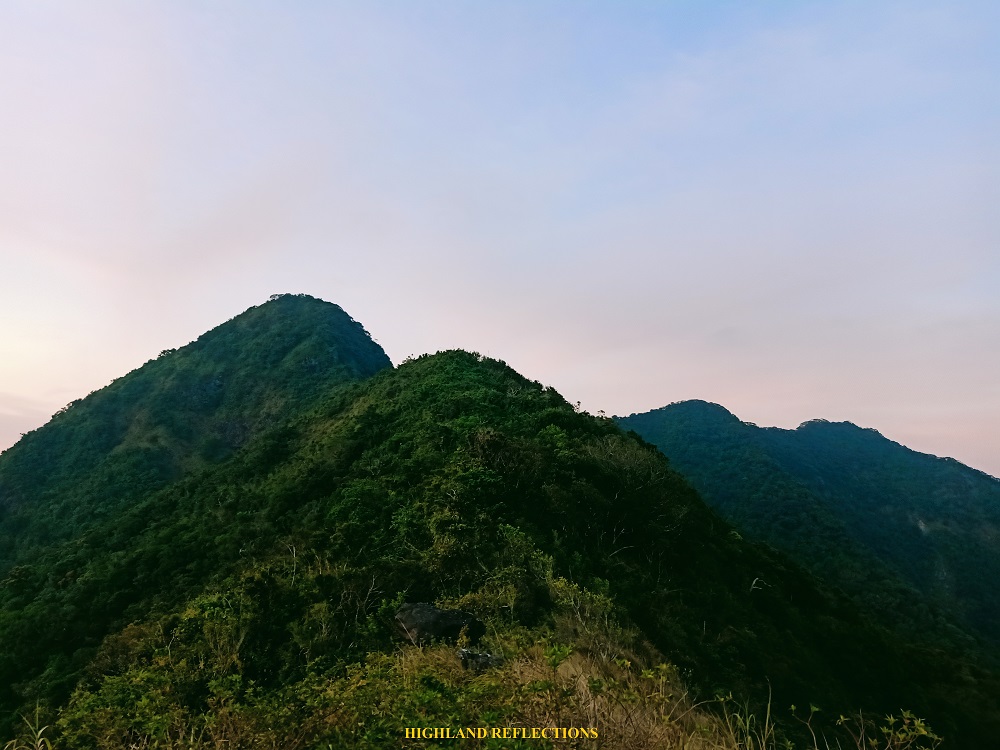
Pantingan Peak has long been recognized as the highest peak of the gigantic Mt. Mariveles, standing at an elevation of 1,388+ MASL. However, due to the many peaks surrounding the caldera of the inactive volcano, there is still an uncertainty on whether Pantingan takes the title of the highest. For one, the imposing Bataan Peak in the southwestern part of the mountain has long been theorized to be higher than Pantingan Peak. Moreover, the ridge to the right of Pantingan Peak, which contains spots such as Mag-Asawang Bato, Garuchas Peak, Baktutan Peak, and Kilabot Peak, are all recorded with an elevation of 1,400+ MASL in several online maps (in Pinoy Mountaineer’s blog, the latter two are probably what Doc Gideon referred to as Dagat-dagatan Peak, which he recorded as being higher than Pantingan as well).
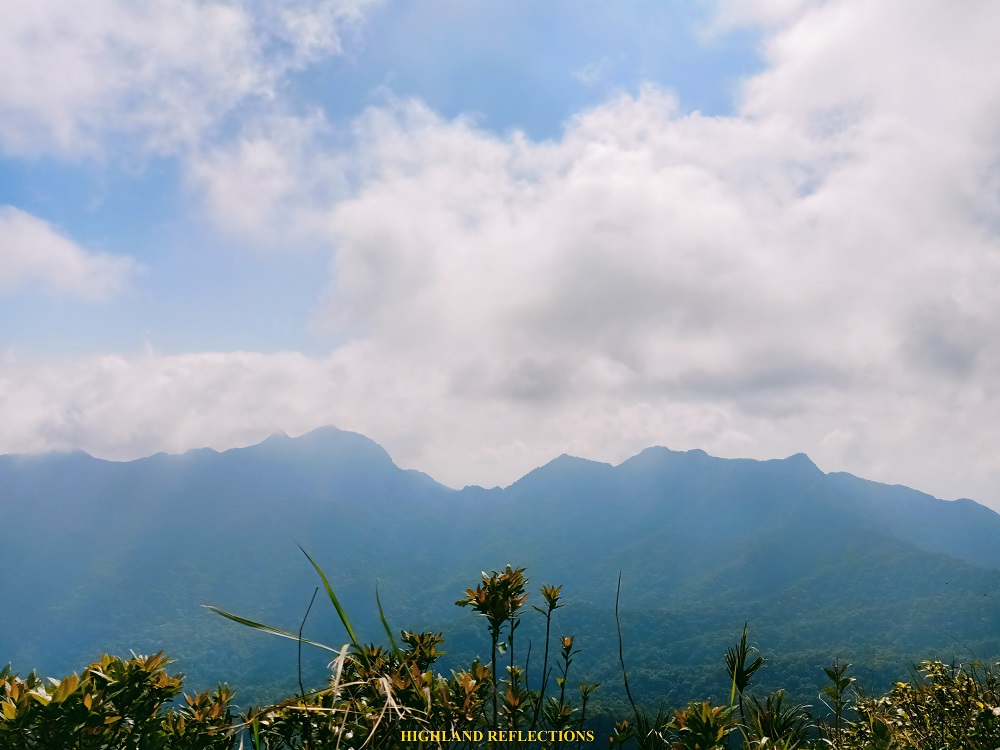
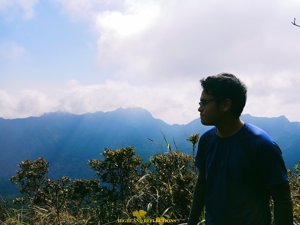
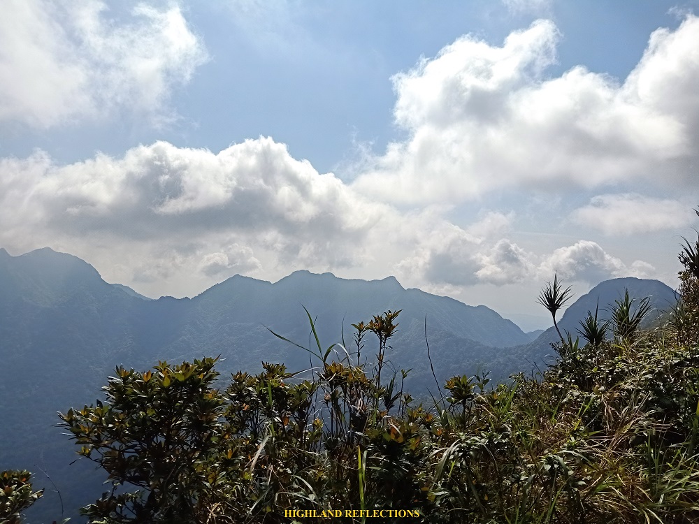
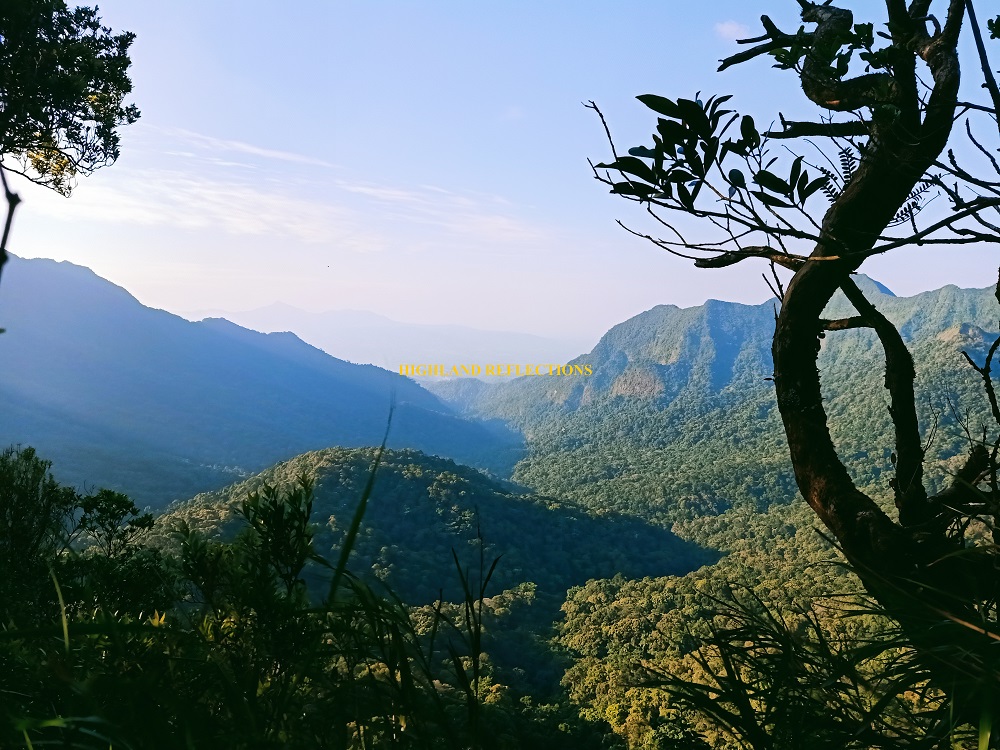
Still, while this controversy is a thing to be solved in the future, or an information left untouched by those who settle with what is, Pantingan Peak is still a worthy destination in itself. The peak offers a sweeping view of the forested caldera of Mt. Mariveles. To our left is the northern portion of the volcano, where the caldera drains, forming a gorge. To our front is the gigantic caldera wall on the other side of the volcano, where several high peaks can be seen. Towards the right, Oragon, Vintana, and El Saco Peaks are visible, giving us a peek of the long day ahead of us. To our sharp right, Bataan Peak is located.
After orienting myself with the different sites within the mountain, I rested with the others from the team and ate some heavy snacks. We had our rest here for about an hour. Past 10am, we decided to go down to the trail within the caldera that connects Pantingan to Tarak Ridge. The adventure was just starting!
Descending the Caldera
The descent to the caldera of Mt. Mariveles was the most challenging part of the entire traverse. Initially, we passed through the ridges of the topmost portion of the caldera, passing through Mag-Asawang Bato, Garuchas Peak, Baktutan Peak, and Kilabot Peak. However, since the trail was overgrown with shrubs, bamboos, and noxious thorny plants that our guide needed to whack through, none of us took notice that we were passing through multiple peaks. For an hour, we had to negotiate this part of the trail while crouching, sometimes even crawling under vexing branches and shrubs. It was exasperating and mentally draining, but it was nonetheless enjoyable.
After an hour, we finally detoured on a somewhat overgrown but fairly established descending trail. At this point, we could see the expansive caldera apparently way below us. It was a straightforward downward 400-meter descent. The trail was expectedly steep. Small rocks and fallen leaves made the trail all the more slippery and dangerous. One misstep could lead to an accidental fall not just on the ravine surrounding us, but on the thorny assemblages of plants around it. I made sure to choose which tree to hold on to for balance. What a torturous bonding with nature!
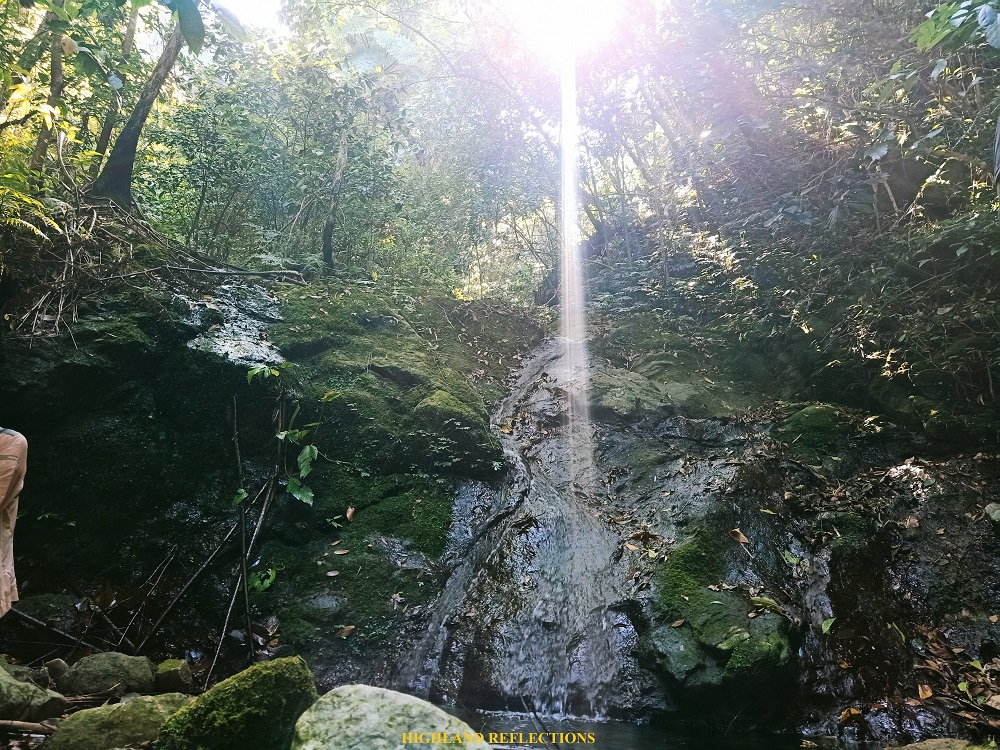
Three hours after starting the descent from Pantingan Peak, a little past 1PM, we reached Bakwat River, which was located inside the forested caldera of the volcano. During the pre-pandemic, those who did the traverse for two days would often end up setting their camps at the cramped space along Bakwat River. I can never imagine setting up my tent here. The area was strewn with boulders, and the river was flanked by two forested slopes on both sides. There wasn’t any cleared area for tents to be pitched. I wonder how they survived an overnight stay at this area.
We rested along the dried boulders of the river and had our sumptuous lunch. We also refilled our water containers at the small waterfall flowing from a slanted boulder. During our stay there, some limatiks made their presence felt, with colors similar with those that I saw in Madjaas—its rear parts are colored in orange, with stripes of black and green. These limatiks have been nettling us since Pantingan Peak!
What was supposedly an hour of rest at the river became an overstay. We were supposed to wait for the last group to arrive before proceeding to the ascent up to Vintana Peak, but as the clock ticked at 2:30pm, there were no signs of our companions arriving anytime soon. Our guide, Ate Beth, decided to push through. Our organizers stayed at the river to wait for the remaining hikers who were lagging behind.
Bataan March: The Last Push to Tarak Ridge
We started the last push to Tarak Ridge filled with uncertainty. The guide who knew these parts of the trail decided to go back and fetch the remaining hikers who were lagging behind. Ate Beth, our guide, assured us, however, that as long as there are tree marks, we were on the right trail. The first part of the hike coming from the river were several ups and downs along dense mountain slopes. After the fourth short descent, we reached a dangerous part where we needed to climb up an almost vertical boulder with limited footholds. Ate Beth claimed that this was supposed to be a roped segment, but since we didn’t have the lead guide with us, we negotiated this treacherous part with our bare limbs.
What followed after the treacherous boulder was a steep slippery ascent. Just like the slopes prior to the river, the path was dotted with noxious plants and dried leaves, making it slippery. At this point, our stopovers were minimal since trail marks, in the form of cuttings on trees, were now easily spotted by our guide. It was a straightforward ascent from this point, which meant that we were already ascending the southern caldera of Mt. Mariveles!
In no time, we reached the uppermost portion of the slope on what seems to be a ridge connecting Bataan Peak and El Saco Peak. According to a certain blog, this is called Mang Rey’s Ridge, in honor of the guide who trailblazed this portion of the mountain. We had an ample rest here before continuing the last push going to El Saco Peak. Since we were approaching the ridge eastwards, the nearly setting sun was on our backs, illuminating the ridge that we were treading on. The looming presence of Bataan Peak on our backs made the hike up more exhilarating, as if a giant was chasing us.
The ridge was narrow and forested. One wrong move could lead to a fatal fall on both sides. Still, it was the most enjoyable part as the ascents were few, and the trail was mostly flat. Sometimes, the view to the left would open, and we would see the vast caldera of Mt. Mariveles being flanked by the peaks on both its western and eastern side. To our front, we could see Vintana Peak’s forested slopes up close. In no time, we entered its domain and ascended its slopes.
At 5 in the afternoon, we reached the summit of El Saco Peak. It was a small, cramped space in the middle of the forest. Here, we had a quick snack session before pushing through with the final descent to Tarak Ridge. Fifteen minutes after the peak was a view deck, which provided an awesome scenery of the setting sun hiding at the rear of Bataan Peak! We took our pictures here. Twilight was upon us.


Past the view deck was a short section with overgrown shrubs, requiring us to crawl past it. We, then, reached an open area strewn with giant boulders on top of a slope providing a view of Tarak Ridge a hundred meter below us! Most of us made the most of the remaining sunlight and took pictures of the beautiful vista.
Since I wanted to catch up with the lead group, I decided to leave my companions who were still taking pictures at the view deck. I descended the forested slopes of the ridge alone. The forest at this portion was surprisingly still dense. In no time, darkness caught up, which made the lone descent quite scary. Luckily, I caught up with another lone hiker who was having difficulties locating the trail. The two of us decided to stick together.
We finally exited towards the grassy part of Tarak Ridge past 7 in the evening. There, we saw the flashing lights of the lead group far below us. It seemed like they were near the forest line at the end of the ridge, so catching up with them would be futile at this point. Still, in the midst of the darkness, we continued descending to try catch up. At this point, we could see the orange lights at the town proper of Mariveles, and in the distance and horizon, Metro Manila.
As we reached the end of the ridge and on the forest, we went on with the descent to Papaya River tired and exasperated. I was reminded of what type of trail Tarak Ridge had at this side of the mountain—one that is strewn with large tree roots, littered with boulders, and sprinkled by dusty, sandy soil. All of these made every step excruciating to the soles of my feet—the same predicament that I suffered during my hike in Tarak Ridge back in 2018.
We reached Papaya River as the clock ticked before 8 in the evening. We were hiking for almost 17 hours at this point. I was surprised with what we saw along the campsite near Papaya River—a tubby grey cat which was trying to be affectionate to us. Since I didn’t know if the cat was lost, and since I wanted to wait for the guide whom we left at the view deck, we decided to stay and wait for the rest of the team. I gave the tubby cat my remaining rice meal.
The decision to wait for the guide was a double-edged sword predicament. On one hand, it gave me ample rest since my senses were already getting overpowered by tiredness and drowsiness. However, we wasted 45 minutes which could have preciously been used to descend.
Once the rest of the team arrived, we immediately continued with the descent. At this point, my pace slowed down and my feet ached due to the friction of the rough surface below me. My senses were also failing me, and it was a good thing that Ate Beth and the rest of the team were present in case my body gave up on me (luckily, it didn’t). We marched on and on, taking every pang of pain with courage and determination to finish the climb. After a final rest inside the forested trail, some of our companions and I decided to trail run the last remaining portion. This was a big help since it awakened my senses.
And then finally, we exited towards the cemented road where some tricycle drivers were stationed, waiting for us to arrive. As with my previous hikes, I decided to walk the remaining portions of the hike. After 10 minutes or so, we reached Nanay Cording’s house, the end point of the hike. Wow. This house used to be a part of the trail, and was almost thirty minutes away from the original jump-off point. Such developments have really occurred at this side of the mountain.
It was 10:30 in the evening. Almost 19 hours after starting the hike. What a day!
After taking dinner and cleansing myself, I and half of the team decided to go home. The other half, including the organizers, were tasked to wait for the remaining members of the team who were still inside the mountain. They would have reached Papaya River at 5 in the morning the next day! Such predicament is a testament of how perilous the hike inside Mt. Mariveles is. While most people would wonder why people take such risks to take on such a precarious mountain, those of us who crave for the thrill of the trail would know why.
Itinerary
Day 0
10:00PM Meet-up
Day 1
02:00AM Arrival at Brgy. Saysain
03:30AM Start hike
05:30AM Danny’s Gate
09:00AM Pantingan Peak, rest
10:00AM Resume hike, descend to Bakwat River
01:00PM Bakwat River, lunch
03:00PM Resume hike to Vintana Peak
05:30PM Vintana Peak
06:00PM El Saco Peak, take pictures
07:00PM Tarak Ridge
10:30PM Nanay Cording’s house
02:00AM Home
