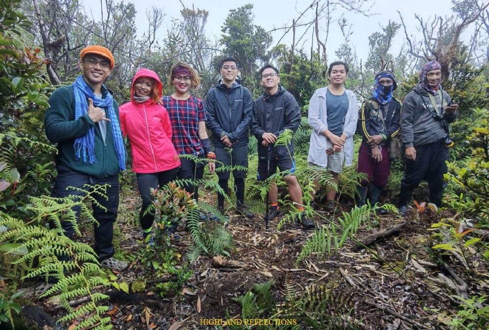
Last 8th and 9th of April, 2023, I was able to climb a rarely visited mountain in the province of Abra—Mt. Manmanoc (locally spelled as “Mammanok” and “Manmanok”). For this hike, I was with my friends Rex, Fara, Cristine, JM, Leniva, Sam, Jose, and Jay. We were also joined by avid hiker, Ans. The event was organized by Nox Taurus upon the request of Rex. The climb was surely one for the books as we were graced by what some consider as the “Rooftop of Abra”.
The Mountains of Abra: An Overview
Abra, being a part of the Cordillera Region, has many underrated, even unnamed mountains to offer. To date, only Mt. Bullagao in Langiden, Mt. Pisusok in Tineg (together with Kaparkan Falls and Apao Rolling Hills), and Mt. Manmanoc in Malibcong have been on the radar of some Filipino outdoor enthusiasts from the Metro. Mt. Manmanoc, standing at an elevation of 2,024 MASL (subject to verification since Nox’ recording is at 2,046 MASL), is acknowledged as the highest among the many mountains of the province.
Manmanoc’s claim to be the highest, however, is negated by online maps. Mt. Bangbanglang (2467m) in Tubo, Abra is recorded as the highest in PeakVisor.com. The mountain is succeeded by Mt. Mausan, Mt. Mengmeng, Mt. Matoni, Mt. Balait, and Mt. Burnay. However, all of these mountains, including Bangbanglang are located in the boundaries of Abra and Kalinga, as well as Abra and Mountain Province (Matoni), and Abra and Ilocos Norte (Burnay). Only Mt. Manmanoc is acknowledged by locals to be purely within the confines of Abra, despite also being very near to Balbalan, Kalinga and Conner, Apayao. Thus, for now, we consider Manmanoc to be the rooftop of Abra. Further explorations on the said mountains, especially Bangbanglang, may disprove Manmanoc’s highest claim in the future.
Mt. Manmanoc: The Mountain of Eagles
Mt. Manmanoc is located in Barangay Mataragan and Barangay Pacgued in Malibcong, Abra—a town that is homonymous with a well-known barangay in Bontoc (Maligcong, which means “surrounded by rice paddies” in the local language). The mountain is occupied and taken care of by the Mabaka subgroup, one of the three main tribes in Malibcong and also the name of the supreme deity of the Itneg people.
According to one of our guides, their ancestors would often tell stories of giant eagles sighted within the realms of the mountain, which they call as “mammanok”. Interestingly, when we were resting at Barangay Pacgued after finishing the hike, we spotted two eagles circling the sky, as if welcoming us to this sacred land of the Itnegs. One of our guides also stated that “manmanoc” meant lofty.
Below are the basic characteristics of the hike:
MT. MANMANOC (Traverse)
Jump-off point: Barangay Mataragan, Malibcong, Abra
Exit point: Barangay Pacgued, Malibcong Abra
Elevation: 2024/2046 MASL (subject to verification)
Days Required / Hours to Summit: 2-3 days / 6-8 hours
Specs: Major climb, difficulty 7/9
Trail class: 1-3
Trail distance: 19 kilometers (STRAVA recorded)
Features: virgin pine forests, mossy forest, rice paddies, local villages
Below is an account of our hike to Abra’s Rooftop.
Day 1
Malibcong: One Hell of a Ride!
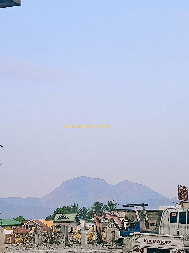
We were in the capital of Abra—Bangued— at 5 in the morning on 8th of April, 2023. Our organizer, Nox, went to the market to buy some supplies. As a first timer in Abra, I decided to check some of the landmarks in the capital. Firstly, we ate our breakfast at Acosta Panciteria, where a view of Mt. Bullagao, Abra’s sleeping beauty, is present. We ordered the local delicacy, Abra Miki. The soup is comprised of miki noodles, pork bits, and egg, bathed in pork and chicken stock broth colored by anato seeds. The richness of the soup was refined by wooden smolders where it is boiled.

Afterwards, we went to the provincial capitol to check the nearby Saint James the Elder Parish, also known as the Bangued Cathedral.
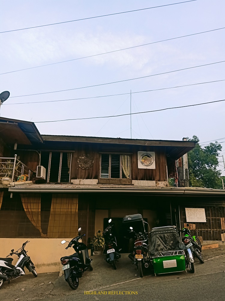
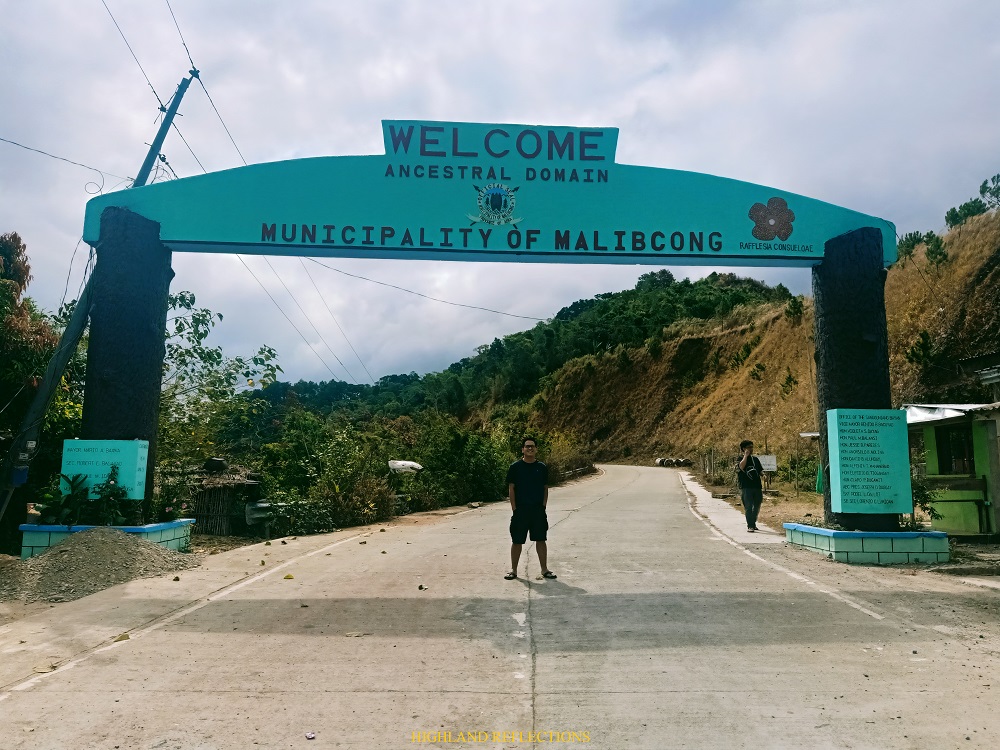
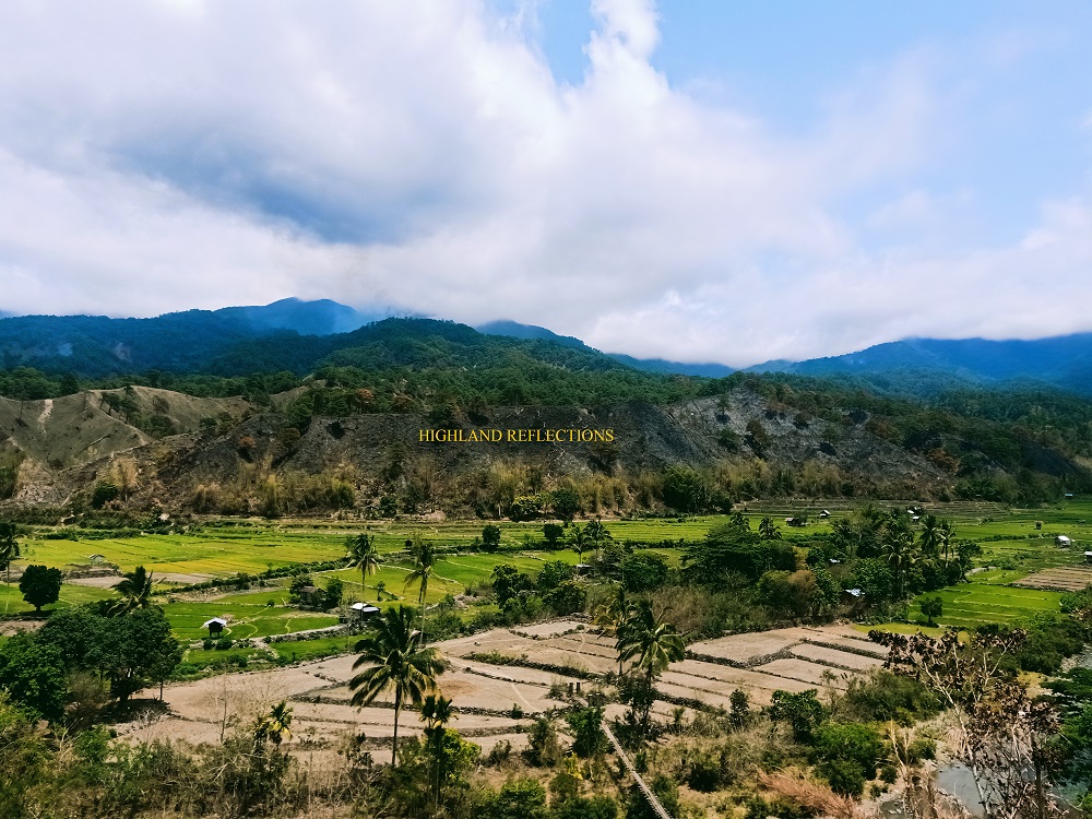
At 7:30 in the morning, we proceeded with the 2-hour ride going to the Poblacion of Malibcong. We passed by the towns of Tayum, Langalilang, and Licuan-Baay, traversing through zigzag roads carved in mountains filled with pine trees and cogon grasses—a typical attribute of the Western Cordilleras. We stopped over at the welcome arch of Malibcong, where an inscription of a species of rafflesia (Rafflesia consueloae) is painted. We, then, proceeded at the Poblacion (town center) of Malibcong, some 15 kilometers away. We reached the town proper at 10 in the morning, almost 2 and a half hours after leaving Bangued. We were welcomed by the tourism officer of Malibcong, Sir Jethro Guiaoan Dao-ayan.
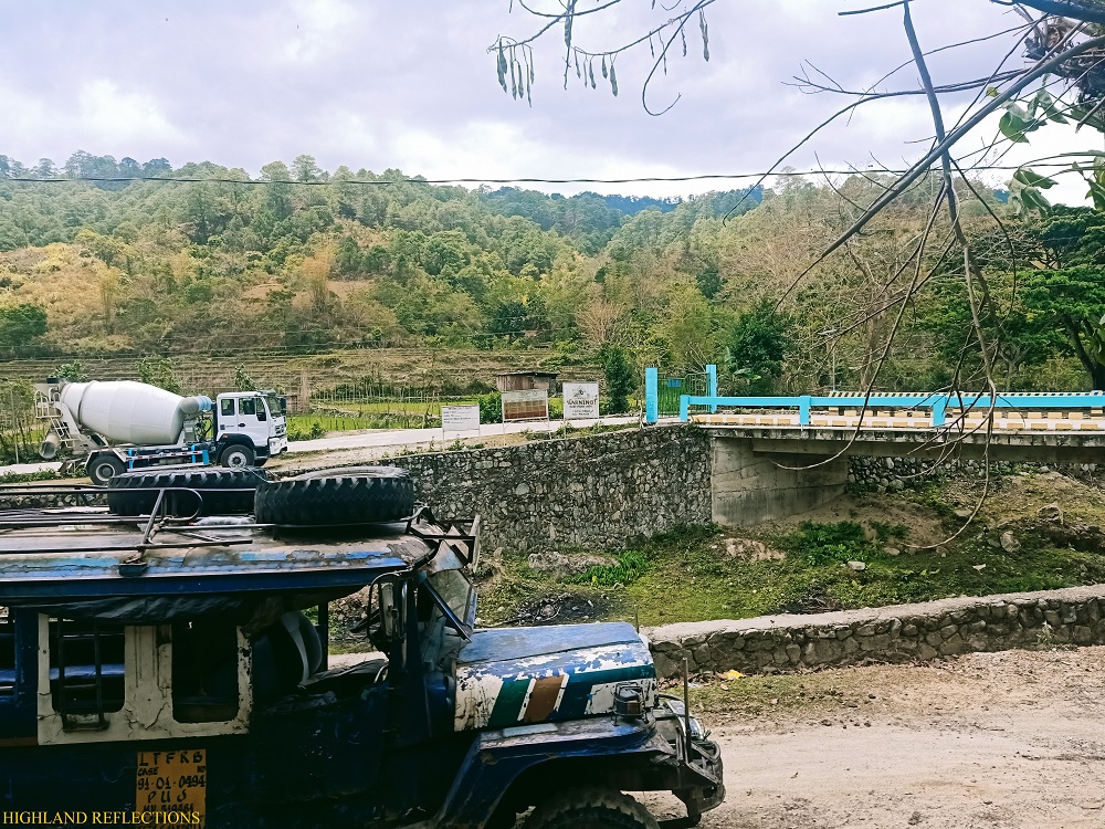
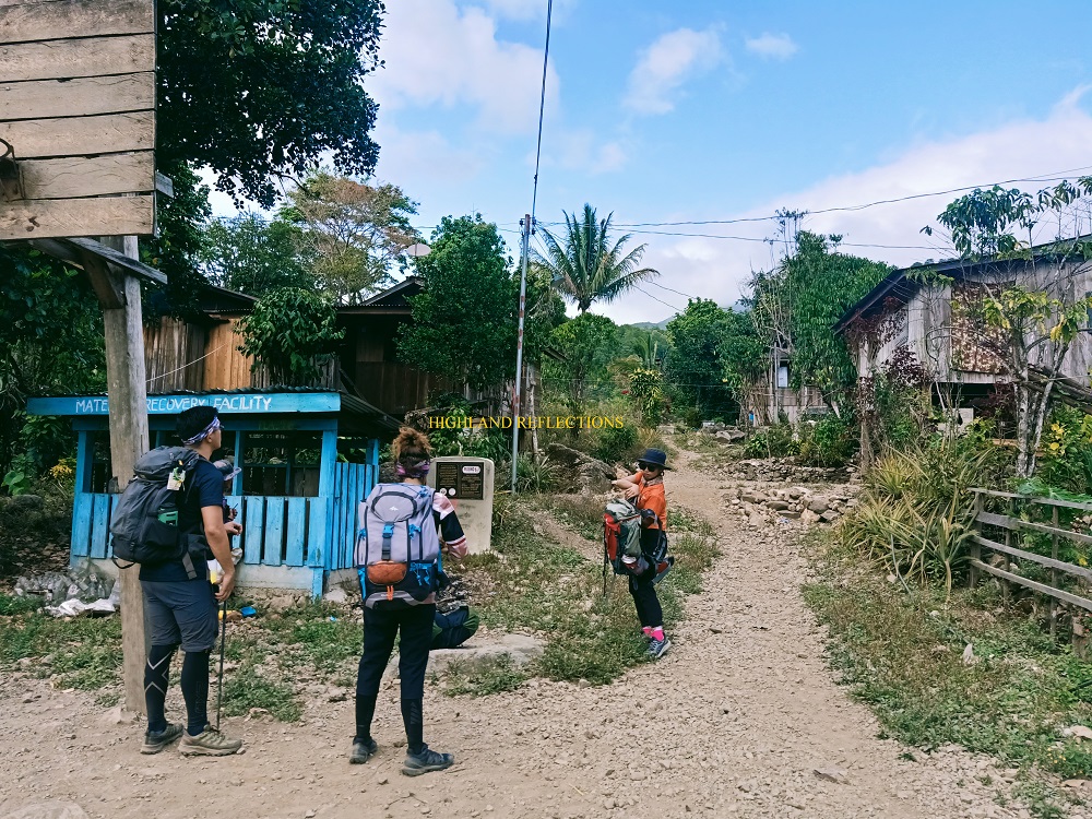
We transferred to a jeepney that took us to Barangay Mataragan, a secluded community 20 kilometers away from the town center. Leaving past 11 in the morning from Poblacion, we traversed through unpaved roads and expansive farming communities and valleys, all surrounded by layers and layers of cordilleras. We reached Barangay Mataragan after more than two hours of bumpy, hellish, and dusty ride. We were immediately welcomed by the barangay captain. He opened his house for us to take our lunch. After some preparations and chitchatting, we started the hike. It was 2:08PM. Our starting elevation is at 650 MASL.

Sitios, Rice Paddies, and Pine Trees
Under the scorching heat of the midday sun, we took the community paths at the foot of Manmanoc. There were some gradual ascents that were quite easy to tread on, but was made difficult due to the exhaustion brought by the heat. After 30 minutes, we reached Sitio Matalibeng (810+ MASL) and then Sitio Putol (845+ MASL) some 15 minutes after. Afterwards, we passed by a short section of rice paddies, followed by quite a long shrubby trail that leads directly to the base of the mountain, taking almost two hours to reach. The last water source is located in the middle of the trail, where we took our first long rest.
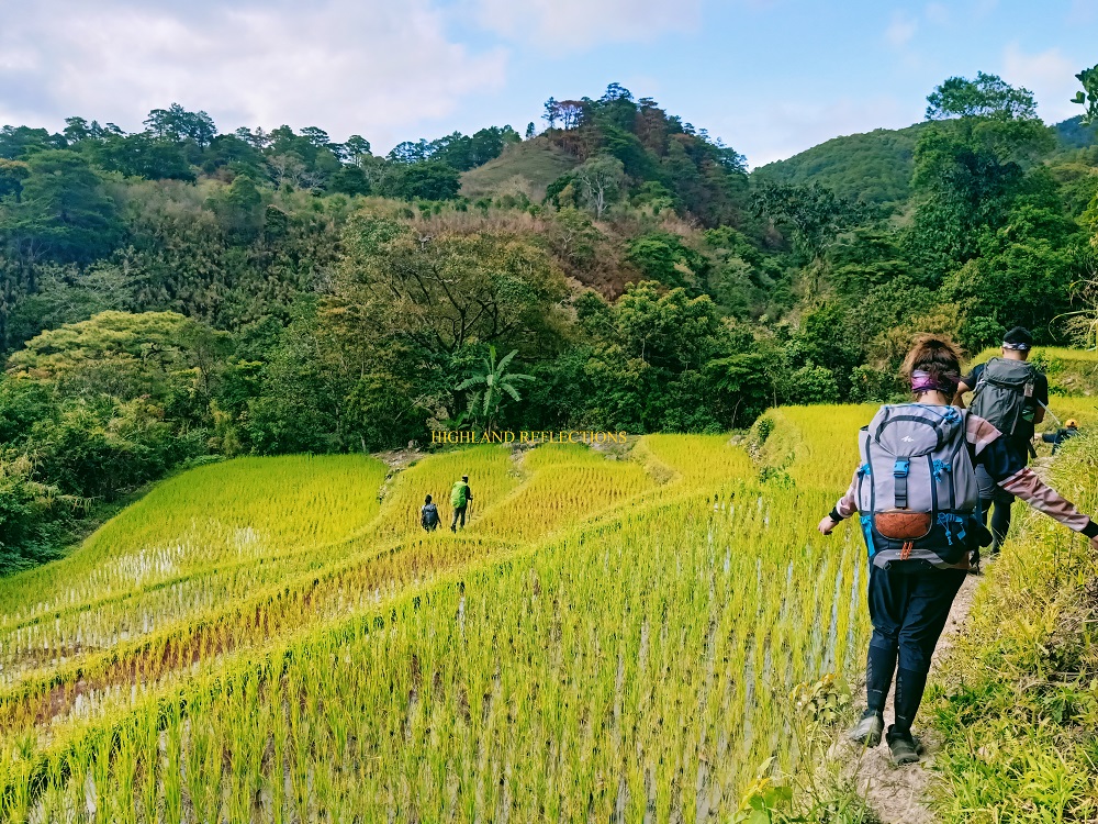

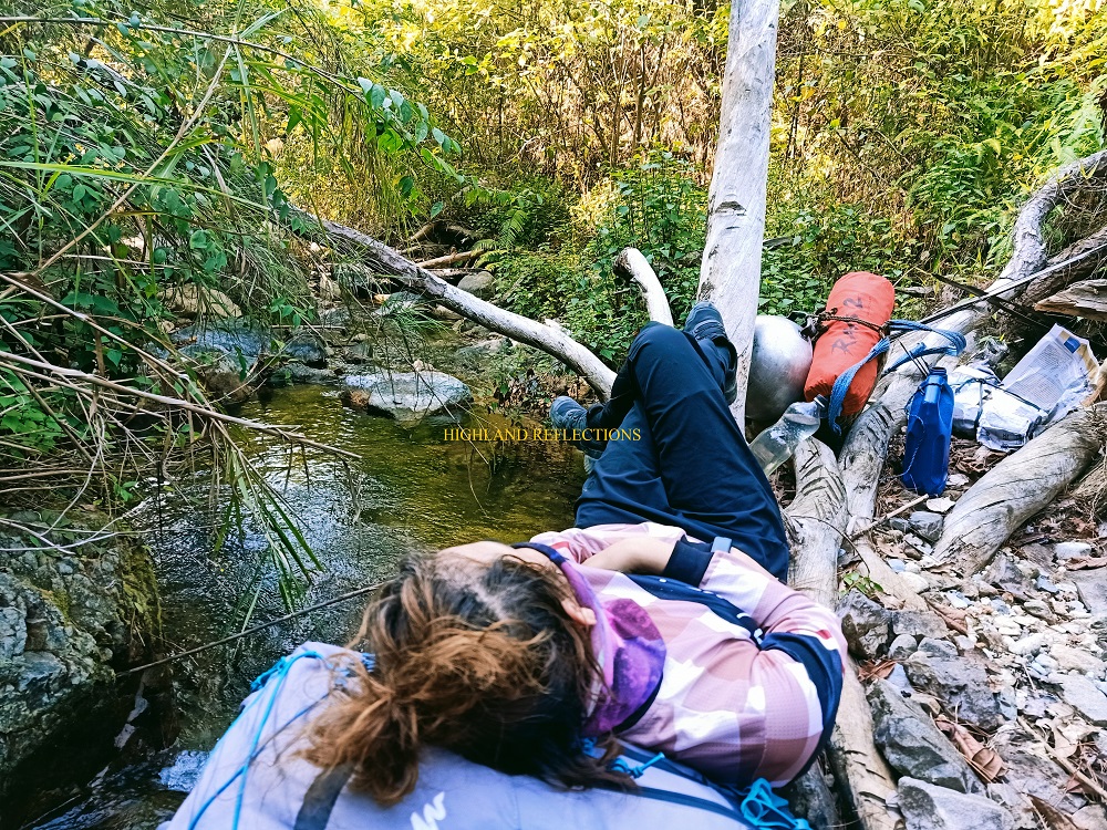
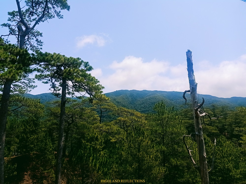
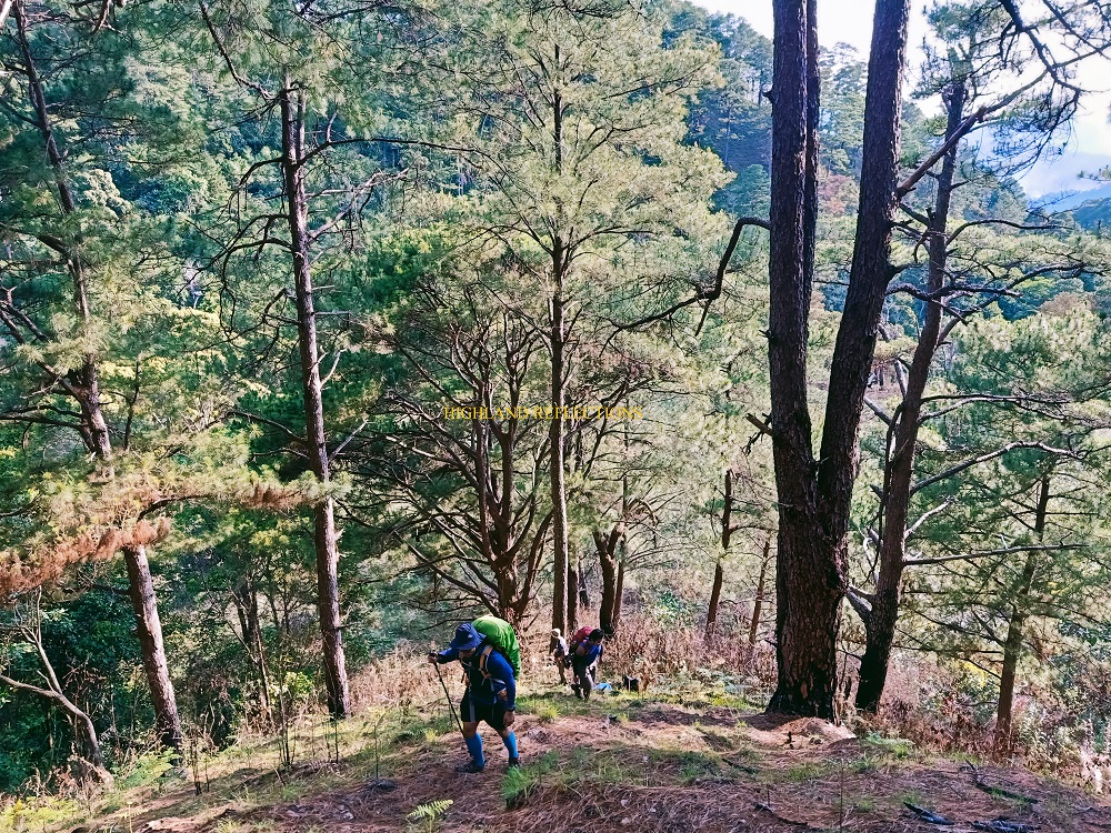
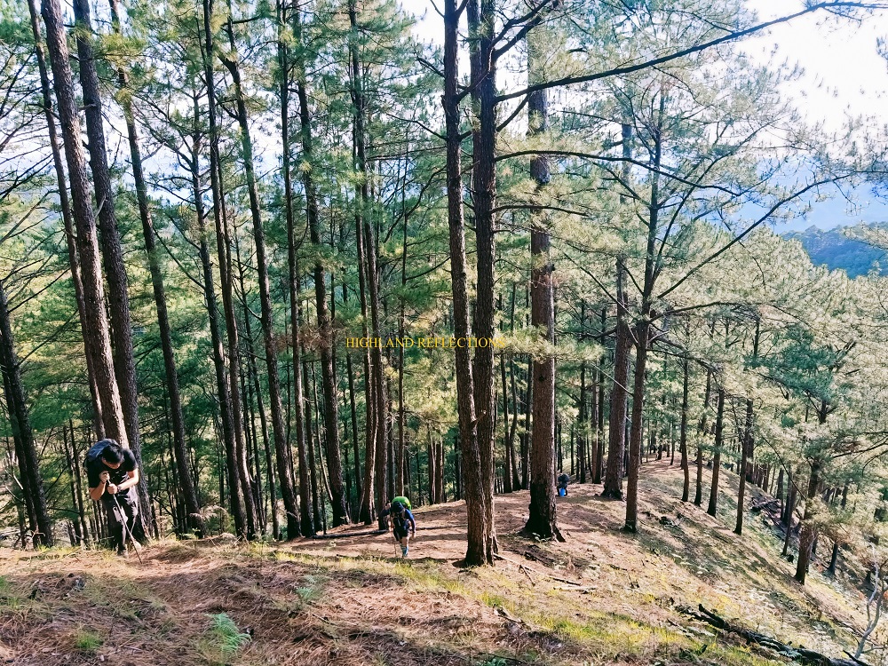
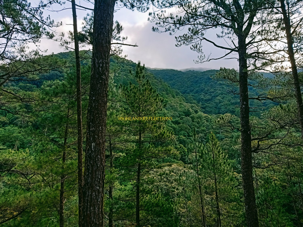
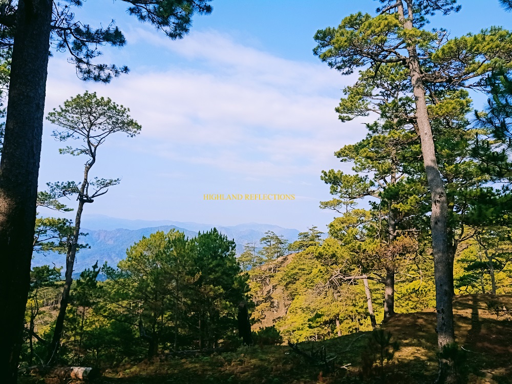
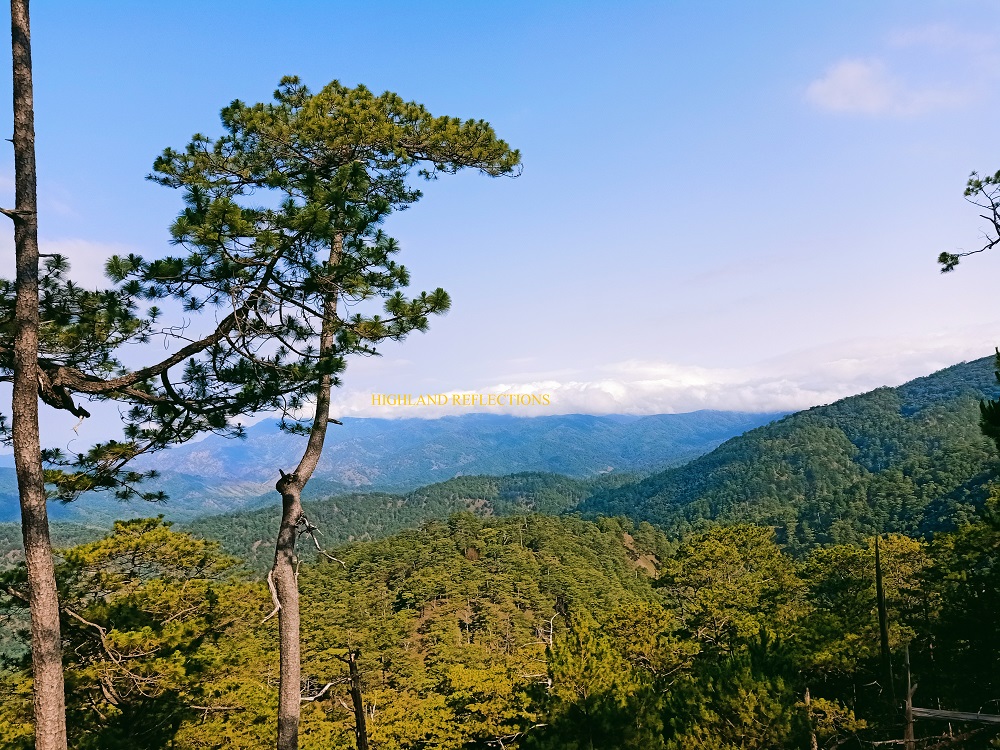
At 1050 MASL is where the start of the steep assault to the campsite starts. Here, the surroundings were filled with numerous pine trees akin to that of Mt. Ulap and Mt. Ugo. The jaw-dropping difference maker brought by Manmanoc, however, was that there were no trails to follow here. We simply ascended on pine needle-filled slopes and mountain ridges, slowly, gradually, and happily, without following a carved trail. We snapped several pictures along the virgin trail.
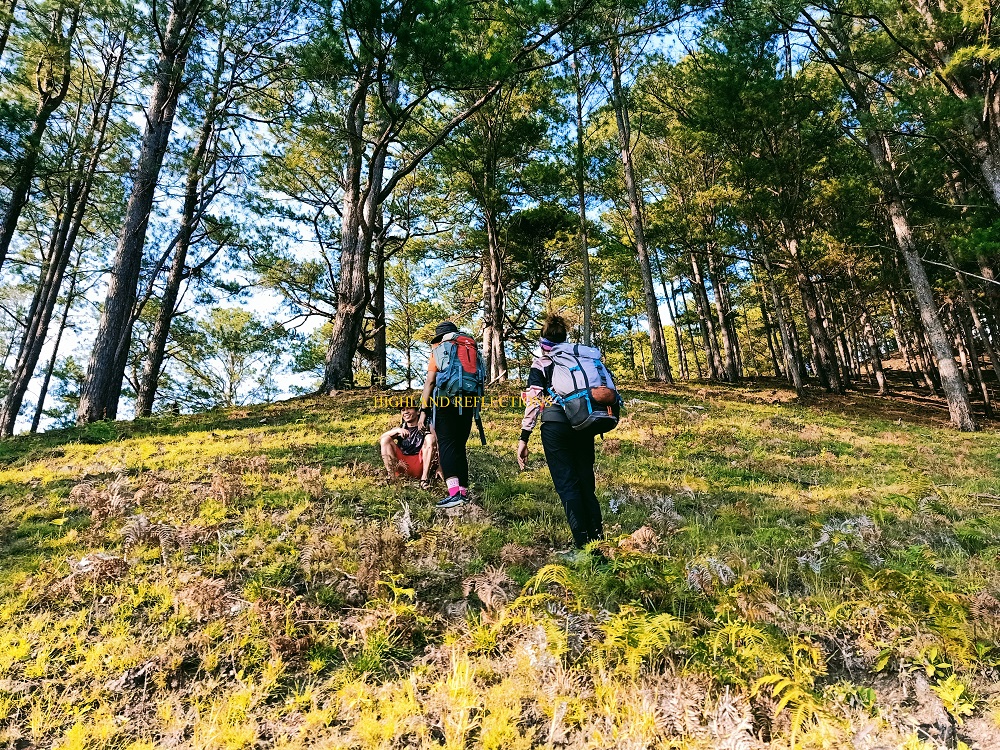
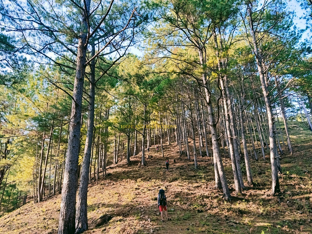
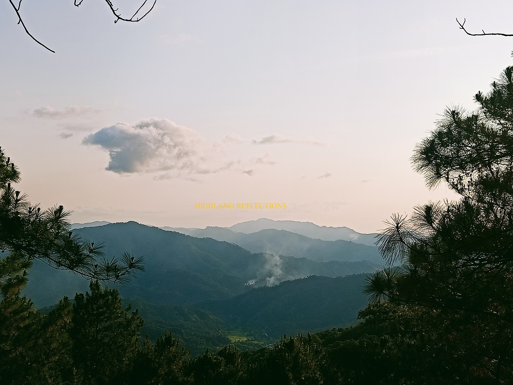
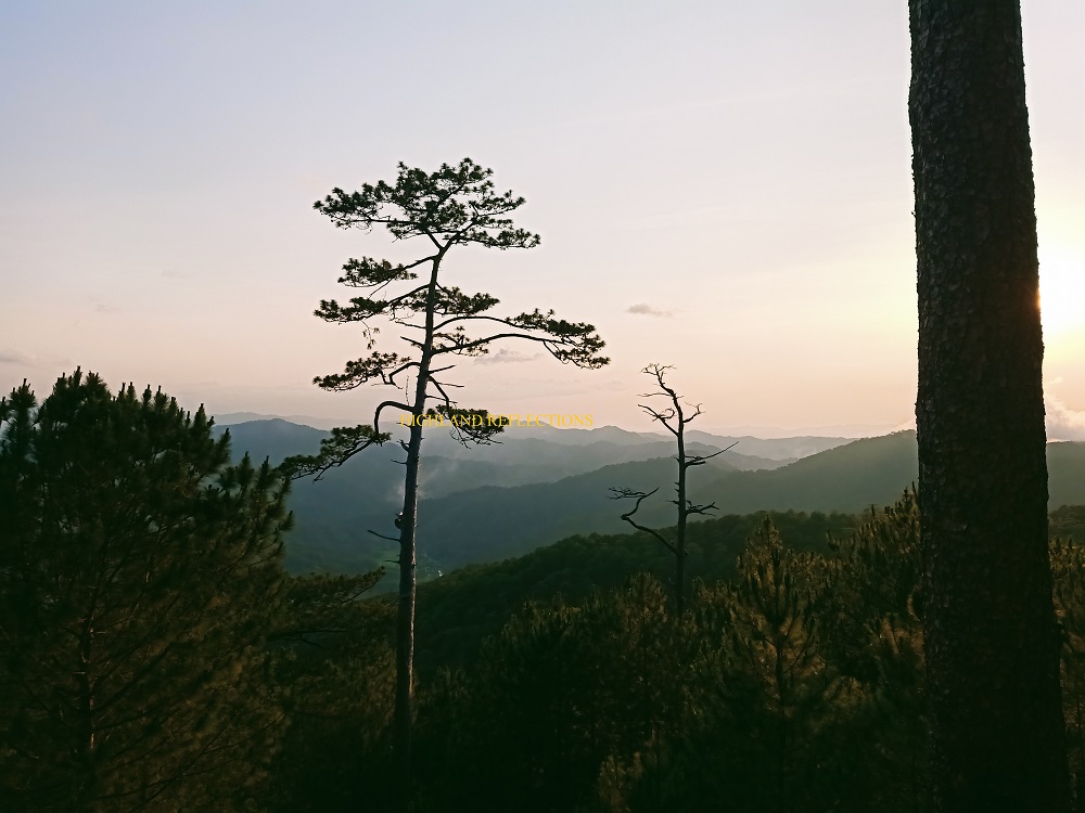
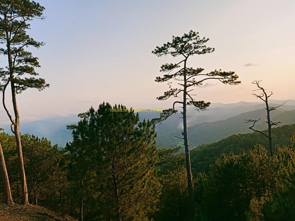
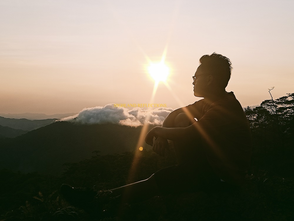
The upper parts of the pine forest ridge provided a view of the cordilleras of Abra, some of which are dressed in clouds and blessed by the setting sun. The atmosphere here struck us with refreshing cold winds. As the sun was setting before 6pm, we stopped over at a cliff where we watched the sun’s denouement and took pictures of the magnificent vista. It was a surreal first day conclusion to an epic excursion in this far-flung mountain!

We reached the campsite, located at 1500+ MASL in the middle of the pine forest, at around 6 in the evening, four hours after starting the hike. There, we assembled our tents and ate dinner by the bonfire.
We slept through the cold and windy night.
Day 2
Only having a cup of coffee to energize and warm our bodies, we started the summit assault past 3 in the morning. The initial parts of the trail pass through rolling hills filled with pine trees. Then, at 1610 MASL, we entered the mossy forest territory, where the ascent was nonstop! The trail here was reminiscent of the assault to the view deck of Mt. Madjaas, or to the mossy forest of Mt. Talinis onwards to Lake Nailig.
An hour and a half later, we reached the shoulder of the mountain at 4:45 in the morning. Here, a small open area where a supposed view of the surrounding mountains is located. Locals call this place as a “Helipad” since, according to them, this was the landing place of military choppers back in the days when insurgency was still rampant in the province. We decided to stay inside the forest some 20 meters away from the helipad as the cold wind was unbearable. We waited for an hour for the first ray of sunlight to appear.
At 5:50, we proceeded with the last push onwards to the summit. Initially, we treaded a narrow trail inside the forest. We encountered a junction, where one path continues to our front, and the other was an ascending trail to our left. We initially took the path to our front but it led to a dense forest with a descending trail.
We, then, of course, took the ascending trail we encountered at the junction. The mossy forest here was more beautiful than the earlier parts! Just after 15 minutes, we reached an open area surrounded by middle-length shrubs blocking the view. The place registered at 2,037 MASL, marking it as the summit of Manmanoc! However, we tried to take the trail at the other side of the summit area where it led us towards a mossy ridge. We encountered a small mossy area where the continuation of the trail was blocked by a trunk.
I was tempted to check what lay ahead of the blocked trail. When looking at our maps, there is a nearby peak connected via a short ridge from where we were. This peak seems to be 10-20 meters higher than the summit that we passed through. However, despite musing over the fact that this could be Manmanoc’s highest summit, we decided to halt and return to the summit view deck as we were limited by time. Our guides also seemed not to want go to the other summit.
Hopefully, future hikers would be bold enough to check the peak. It may very well be Manmanoc’s official summit.
We returned to the campsite after a slippery descent brought by the dried leaves and mossy boulders scatted along the trail. We were at camp by 8am. We had our breakfast and took the chance to relax and bond as Nox was cooking breakfast.
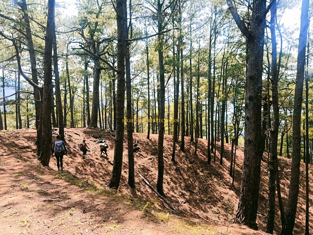
We started the descent at 11:20 in the morning, a bit late than what our itinerary suggested. We backtracked the short section of the pine forest ridge until turning right to a continuous downward slope filled with ashes and burnt pine woods. This section of the trail is called by locals as “Tapgen”, which was another pine forest slope that runs parallel with the trail that we took on the first day, ending at Barangay Pacgued. Although there is now an existing footpath here, the trail was utterly confusing to take on since there were some carved paths that would diverge into two. There were also times when we would detour on nonexistent paths. Fara, Tin, and Rex were kind enough to wait for me and Sir Jose who were lagging a minute behind.

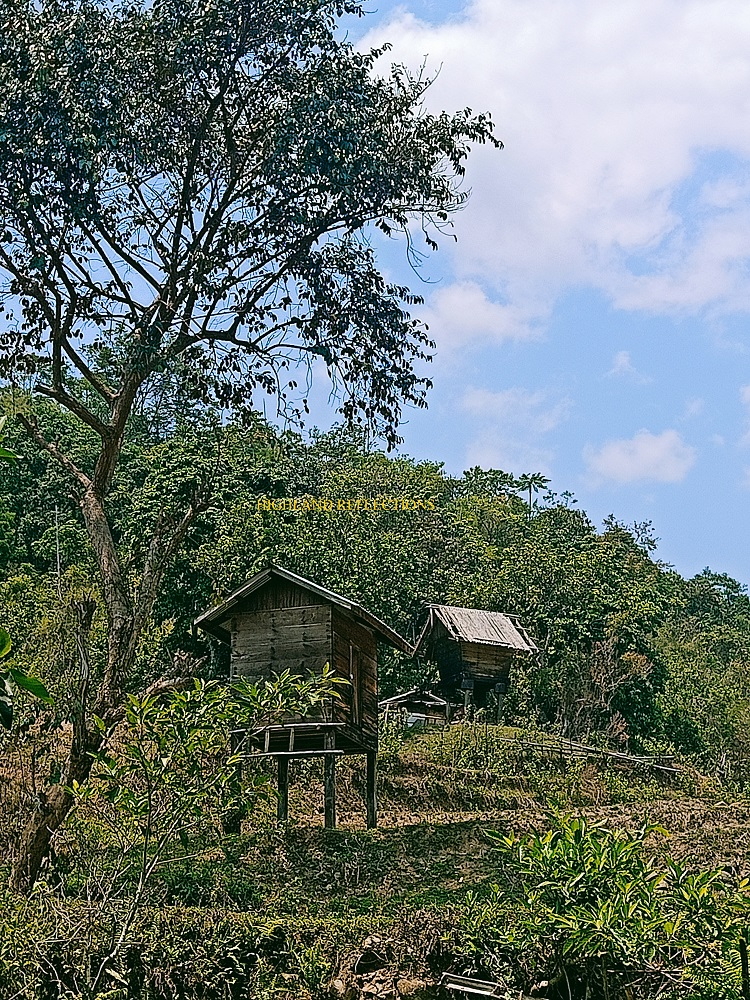
After the confusing pine forest path, we exited through a farmland exposed to the midday sun. We stopped over at the house of the captain of Barangay Pacgued to refill our water canteens. Here, several rice paddies, mini storehouses, horses, and native pigs were present. The last leg of the hike passes through the side of water canals and leads to the main road of Barangay Pacgued. We reached the end point a little past one in the afternoon, almost two hours after starting the descent!

We waited for our companions at the house located at the end point. There, the locals were so hospitable, offering us suman, cold water, some beverages, and some chairs to sleep on. We waited for our other companions for two good hours as they got lost in the labyrinth pine forest. They seemed to have gone to other side of the mountain slope before reaching Pacgued!
Once all of us were accounted for, we ate our late lunch and started the ride back to Poblacion past four in the afternoon. We reached Poblacion just as the clock ticked before 7 in the evening. There, we took our baths at the river. We went straight home afterwards, taking us almost 12 hours only versus the 17 hours on our way to Mataragan.
What a fulfilling hike!
Mt. Manmanoc proved to be a worthy mountain to go to. Its immaculate pine forest slopes, hospitable locals, and clean trails make Mt. Manmanoc a bucket list-worthy hike! Hopefully, when the road that leads to Mataragan and Pacgued gets developed, future hikers would visit this place and put it on the mainstream map.
Only time will tell if and when we will return to this mountain.
Itinerary
This itinerary is directly lifted from Rex Lim’s blog in Transit Pinas. However, I altered some of the information here such as trail distance since we had different STRAVA records.
Day 1
0500 Bangued
0725 Depart for Malibcong
1020 Poblacion
1100 Monster Jeep
1300 Brgy. Mataragan 650 MASL
1415 Start Hike
1430 Sitio Matalibeng Km 1.6 810 MASL
1445 Sitio Putol Km. 2.5 870 MASL
1600 Water source Km. 4.5 1070 MASL
1800 Campsite Km. 6.8 1600MASL
Day 2
0230 Wake up call
0315 Start summit assault
0445 Mt. Manmanoc View deck (Helipad) Km. 10.5 2016 MASL, wait for sunrise
0620 Mt. Manmanoc Summit 2046 MASL Km 11
0700 Start Descent
0800 Campsite, breakfast, break camp
1115 Descend Back
1300 Brgy. Pacgued end of hike
1630 Monster jeep back to Poblacion
1900 Poblacion, Malibcong, tidy up
2100 Depart for Manila

Amazing!!! Wish we could experience this soon, this year!!!! Well-written blog!!!
LikeLike