The mountains of the Philippines possess unrivaled charms that have been witnessed only by some, including me (yey). Numerous times, I have been enchanted with different sceneries our local mountains have to offer, so much so that I have been desensitized through the years since every mossy, rain, and/or pine forest are too much of a familiar scene for me.
In fact, in the past few years dating back to 2018 when I first tasted more difficult hikes in the country, the legendary and mystical mountains in Visayas were not in my radar. This wasn’t until my hiking friends in 2022 invited me for a Holy Week 3-day climb in Mt. Madjaas, the second highest summit in Visayas and the highest peak of Panay Island. Sadly, a week before the climb, I forfeited my chance to climb the legendary mountain due to some draining workload that I needed to finish during the Holy Week.
The thought of not summitting the mountain, despite not being in my bucket list, prompted a strong reactance in my system. Fast forward to November of 2022, Summit Trekkers, the group that my friends joined in their Holy Week climb, advertised a 3-day climb in Mt. Madjaas on the last weekend of January, 2023. I immediately expressed my interest and signed up for the climb. Fast forward to the first month of 2023, I booked my flight to Kalibo and went off to an adventure I didn’t know would be one of my greatest climbs!
Day 1: Culasi and the Farmlands of Kamandiga
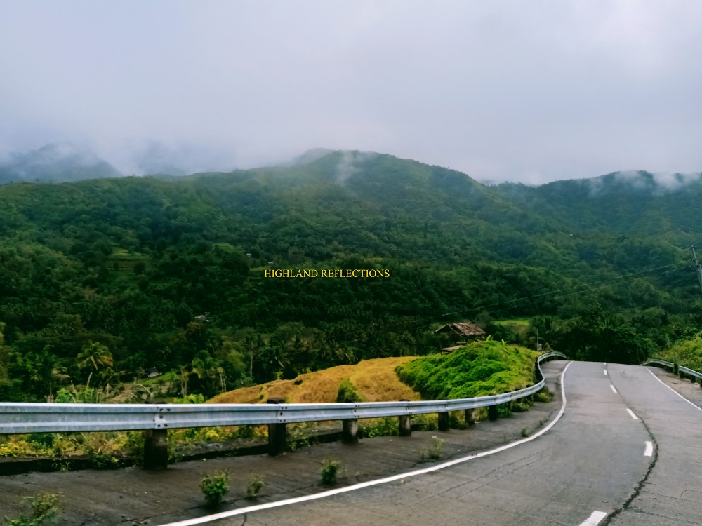
After spending the night in Kalibo, I woke up very early in the morning of January 27th to catch a Ceres bus going to Culasi, Antique. Along the way, I was able to appreciate for the first time Western Panay’s land and seascapes. To my right, Sulu Sea’s frisky waters welcomed me with such delight. To my left, the Central Panay Mountain Range seemed irascible and abashed at the same time as they were covered in dark clouds. Rain poured as we were traversing some parts of the province.
I alighted at the town center of Culasi after two hours, marking this as my first footstep on the province of Antique. I walked past the plaza and went in front of the municipal house of the town. A local welcomed me and assisted me going to the tourism office, which was on the second floor of the building beside the municipal house. There, I met Billy, one of my would-be companions in our three-day excursion inside Madjaas. Being an Antiqueño himself, Billy oriented me about the languages and towns of Antique. The tourism officer, Mr. Sumanting, was also there, and told me the legend surrounding their beloved mountain (which I would write at the last part of this blog). In the distance, the lower slopes of Mt. Madjaas can ben seen—the upper parts being covered by thick white clouds. What a mystical sight!
Afterwards, since Billy and I were the first ones there, we had a breakfast at a nearby carinderia where I ordered a comforting bowl of batchoy.
Rain poured as we returned to the tourism office. The two organizers—Mark and Jao—were already there, together with some joiners from Bacolod City. We underwent orientation from the tourism office and registered at the nearby police station. Afterwards, we rode a thirty-minute habal-habal ride going to Barangay Flores, the jump-off point of Mt. Madjaas. On the way there, we had a magnificent view of the entire mountain range comprising Mt. Madjaas. The exact jump-off point was located at the house of Tatay Josue, the legendary guide who made the trail to Madjaas possible. Prior to his house, our habal-habal passed by beautiful mountain slopes and rice terraces. Despite being at the foot of Madjaas, the mountain vista itself was already rewarding!
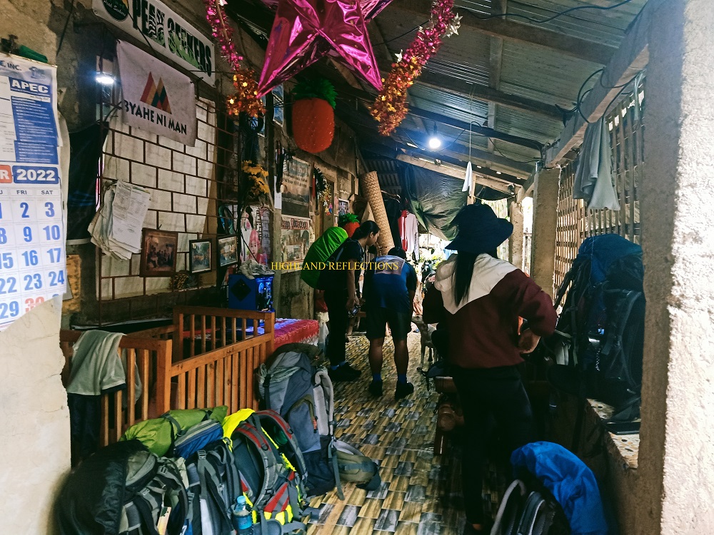
We crashed temporarily at Tatay Josue’s house as we were still waiting for the other half of our team—hikers from Cebu.
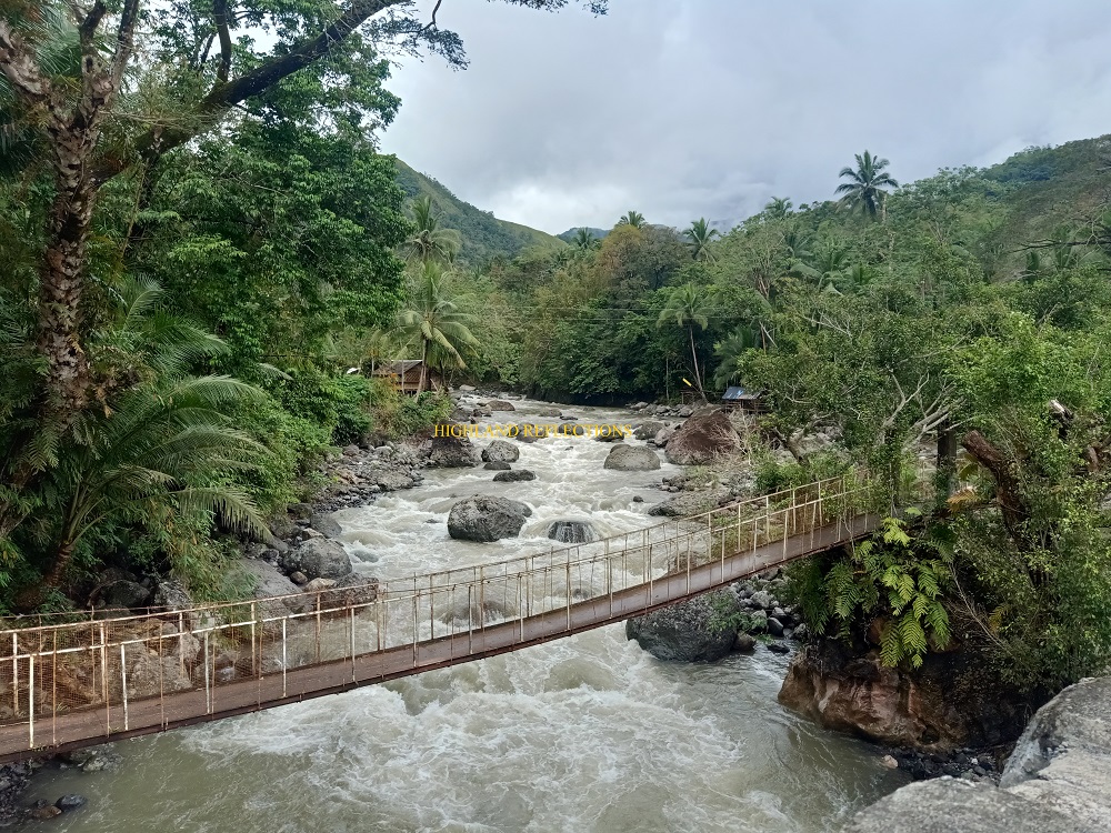
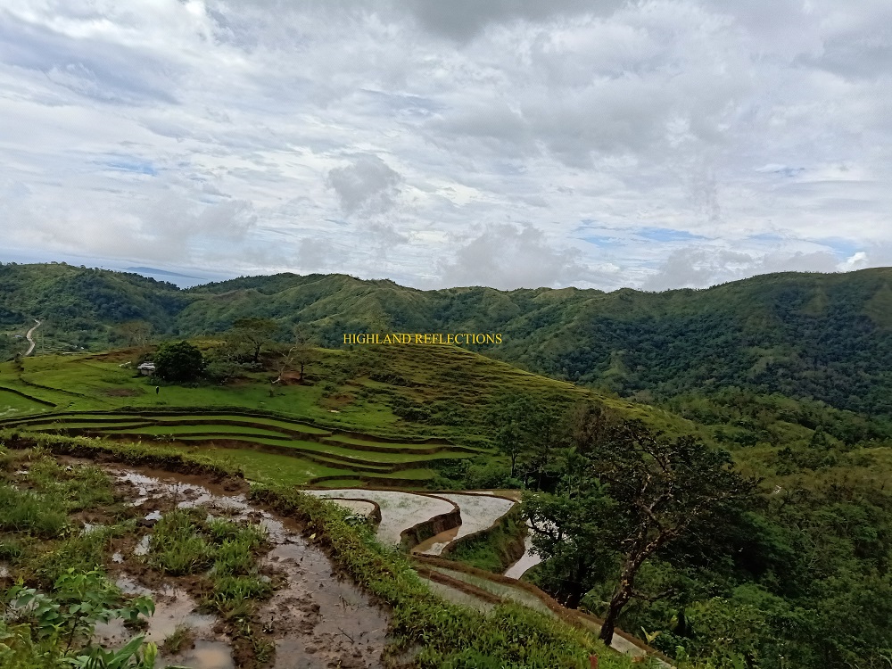
We commenced the hike past one in the afternoon, quite a bit late than our proposed itinerary. From Tatay Josue’s house (250+ MASL), we crossed a cemented bridge constructed above the raging waters of Tibiao River. Past the bridge, the ascent ensued. The trail was carved along and beside farmlands and rice terraces frequented by locals. Since we were still on the lower slopes of the mountain, the punishing heat of the midday sun made the hike already exasperating, despite the sky being covered in clouds! Upon reaching an open ridge with a lone tree, we dropped off our bags and rested. We spotted Kamandiga Village (500+ MASL) a few meters above our location.
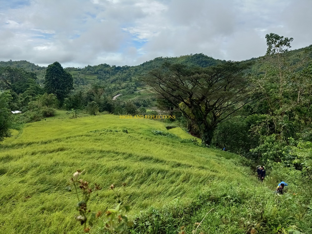
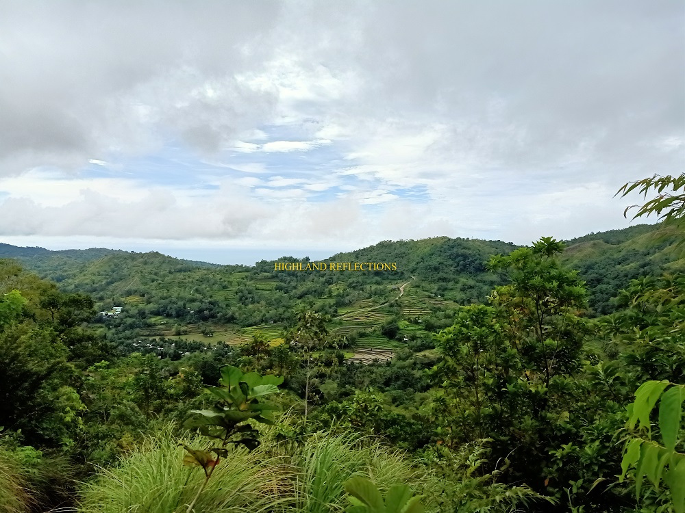
We reached the premises of the village past 2 in the afternoon, more than an hour after starting the hike. The trail prior to reaching the village passes through some of the narrow and extremely muddy rice paddies in the village. Not a lot of people get to witness rice terraces in person, more so if they are outside of the Cordillera Region, so it felt like a privilege seeing these man-made wonders exclusive in Visayas!
Besides the Visayan rice terraces, we spotted Mararison Island near the coast of Culasi. Apparently, the island seems to have a white powdered beach! At a farther distance is Batbatan Island.
We ate lunch and had a long rest in the village. We also refilled the water in our tumblers.
The trail after the village is a straightforward ascent along grassy slopes comprising the lower areas of Mt. Madjaas. The humid atmosphere made the uphill battle more challenging. As we approached the tree line, we rested for a while. A mild rain poured, foreshadowing the weather for our next three days.
The entrance to the rain forest of Madjaas was marked by a view of nearby pine trees seen along a nearby slope, which was weird given that you could hardly see them once you pass through the trail inside the forest. But an even weirder sight near the entrance to the rainforest was what seemed to be a lake almost thirty meters below us to our right, being blocked by thick shrubs. Upon searching for some info about this body of water online, which was all news to me, I found out that it was called as Dinawan Lake, and can actually be accessed from where we were. Amazing!

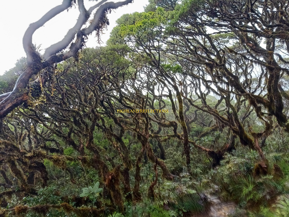
The ascent inside the forest was a long one. Couple this with rain and the mental stress of cute limatiks attaching themselves to you, no wonder why this mountain is classified as strenuous in terms of difficulty! Still, at least we were inside a forest, so my muscles and lungs weren’t tortured with humidity. Eight out of ten times, I would choose the cooler breeze inside a forest over the scorching grasslands!
Twilight was upon us when we reached the junction—the highest point (1,200+ MASL) before descending for two hundred meters towards the campsite. With darkness slowly winning the race against time, we opened our headlamps as we were descending the root-filled trail onwards to Bantang River Camp, sitting at an elevation of 1,000+ MASL. It was past 6 when we reached the camp, five hours after starting the hike. There, I pitched my tent beside the camp’s kubo, ate dinner, and slept. The nonstop light drizzle incessantly tapped the surface of my tent, all while in concert with the gushing river, making it hard to sleep that night.
Day 2: A Cold Mission to Reach the Summit
Still drizzling, we started the summit bid at 2 in the morning. After crossing Bantang River, the steep ascent ensued. This would continue for an hour. The absence of flat ground made the steep assault quite tiring, but the cold atmosphere (which was weird given that we were inside a forest) and light drizzle made it a little bearable. While ascending, a limatik attached itself on my neck. Good thing I wasn’t bitten!
An hour into the hike, I encountered five downward streams with narrow trails in between. On the first stream, I was bold enough to cross it on my own. But the second encounter was too perilous to cross, so I waited some long minutes for a guide to arrive. The third one was much more dangerous since we needed to crawl on the side of a slippery downward boulder. The fourth one was forgettable. The fifth and last one, however, didn’t have much water around it but was the steepest. Two ropes were installed on the short cliff to assist hikers going down the stream.

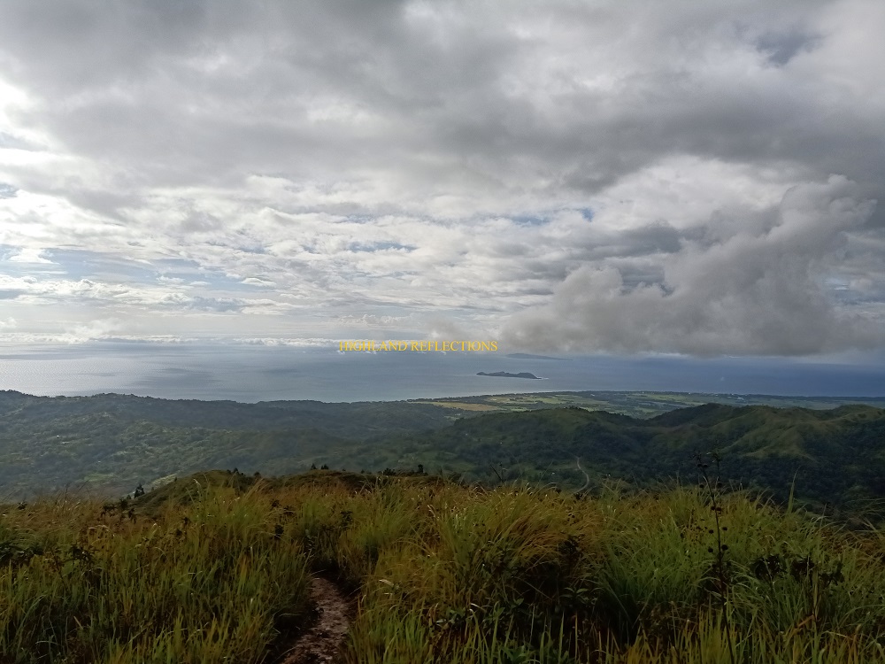
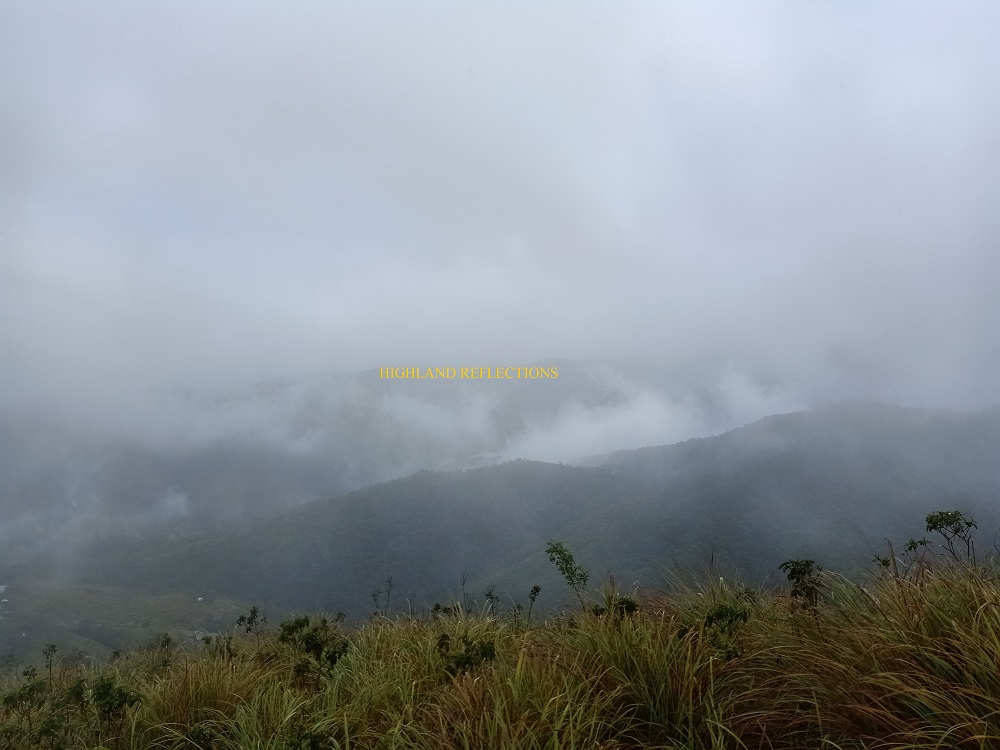
What followed after those five perilous streams was the gushing Libug Falls, which we reached two hours after starting the hike. Even with the pitch black surrounding, we could see its raging waters falling. Some of our companions had their breakfast there. I decided to continue hiking. Past Libug Falls is another round of steep continuous ascent. Slowly, the forested environment turned into a grassy one, and in no time, we were on the view deck of Madjaas (1,830+ MASL). It was five in the morning. The indigo sky still didn’t have any marks of sunlight, but I was sure enough that despite the drizzle and dimness of the surrounding, I could see Sulu Sea from the view deck. It was still a long way before reaching Madjaas’ summit.
From the view deck, the trail descends on the ridge at the shoulder of the mountain. The trail was muddy and slippery. Thirty minutes from the view deck, we reached Camp 3, where the final water source is located. There, I decided to have my breakfast and my water tumbler refilled.
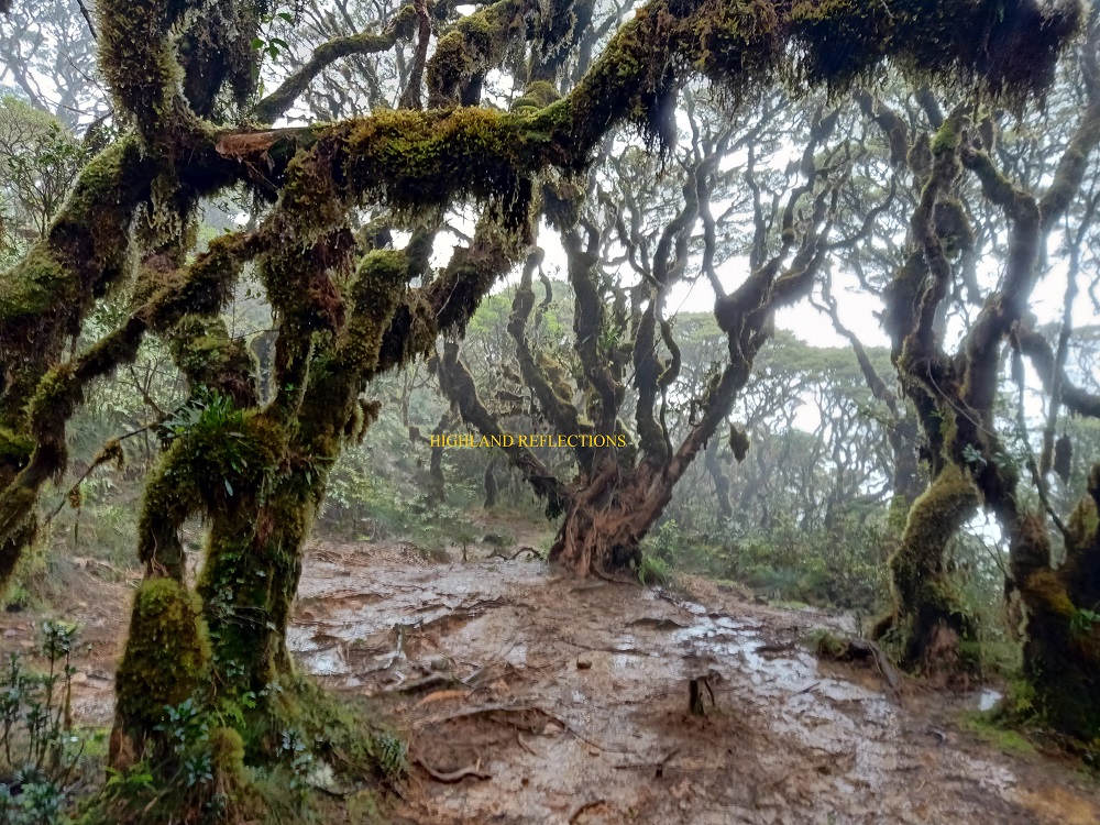
Since I was tailing the lead and middle group, I decided to leave the sweep and went on with the hike. From the water source, I ascended the mossy forest slopes of the mountain’s shoulder alone up until the summit. Twenty minutes from the water source, I reached the bonsai mossy forest of Madjaas. Since I was alone and no one available to take a picture of me, and since I wanted to rush going to the summit, I didn’t bother resting and hiked nonstop. Two more hours to go!
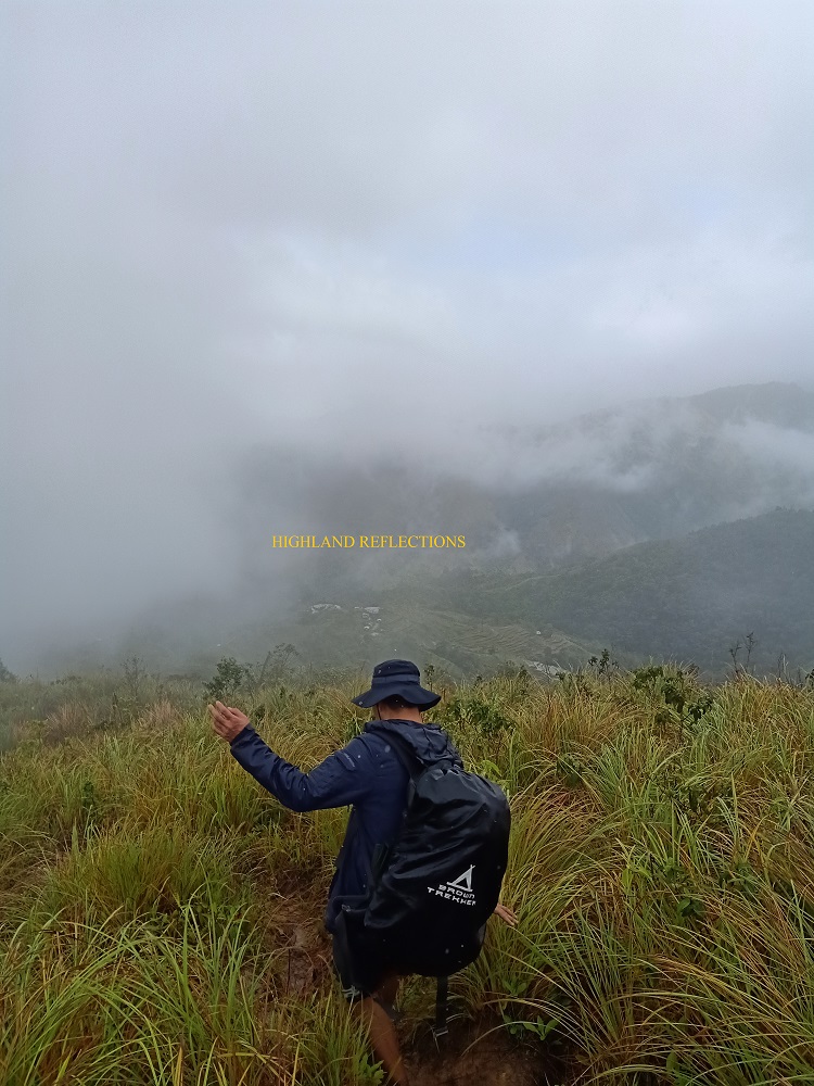
The trail after the bonsai mossy forest was an open area at the side of the ridge. The surrounding was completely shrouded in fog and a howling wind, reminiscent of the weather in my Mt. Guiting-Guiting hike exactly a month prior to this climb. The open ridge trail contained some phantom pits. Since I was alone, I made sure to tread that part very carefully. Then, I entered a mossy forest once more.
The trail was a long one. Truthfully, despite being a nerve-wrecking predicament, I was enjoying the me-time inside the mountain’s enchanting mossy forest. I was at ease since it felt like Madjaas herself was looking out and taking care of me as I was treading her shoulder on the way to her peak. Still, tiredness seeped it, but I made sure to offer some smile in appreciation of the mountain’s allure.
In some parts, I needed to crawl above thick trunks and branches of rattan trees. It was reminiscent of the monkey trail in Mt. Tabayoc (Benguet) and Mt. Labi (Nueva Ecija) in Luzon. As I was nearing the summit, I could already see its silhouette inside the mist. Along the trail, I encountered the lead and mid group descending. They assured me that I was very near the summit. Two minutes prior to the summit, I met Jao and a lone guide. They were the last to depart the summit, so I feared that I would reach the summit all alone. Good thing though was that Jao instructed the guide to accompany me.
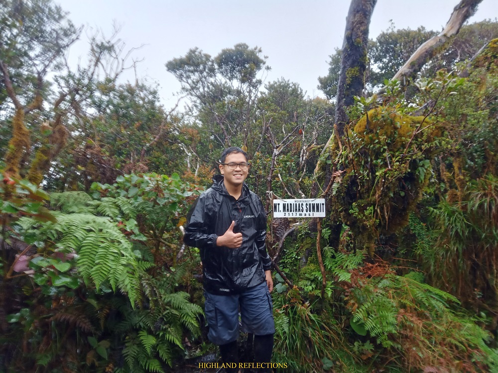
And then finally, I reached the summit of Mt. Madjaas (2,117+ MASL) at 7:30 in the morning, five and a half hours after starting the hike! The small summit area was surrounded by mossy trees, with a summit marker installed on some of the fallen shrubs at the northern side of the summit. On the western side, I could see a view deck. Sadly, the thick fog covered what could have been a magnificent view.
Since it was raining when I reached the summit, I only had my pictures taken (which the guide found a hard time doing as my phone’s lens was constantly getting wet from the pouring rain) and my drink drank before starting the immediate descent. I also texted my mother and my girlfriend to give them an update. Signal was sporadic due to the thick fog.
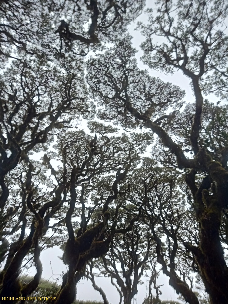
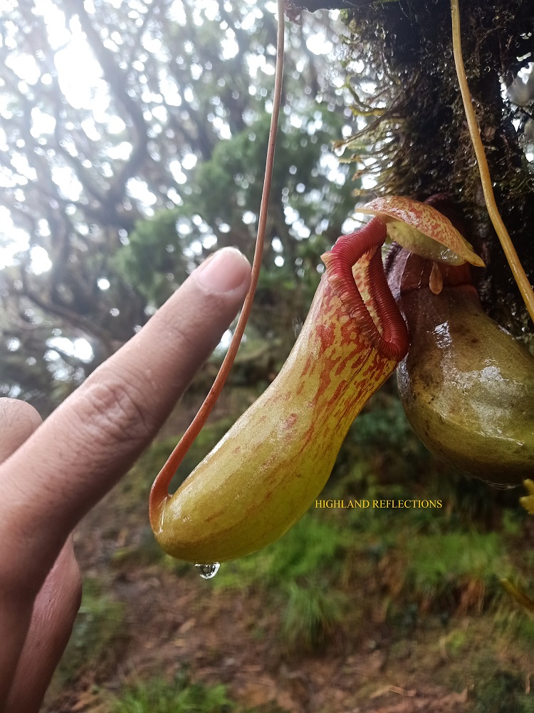
On the way down, I made sure to stopover at the bonsai mossy forest and get some pictures taken. In that area, one can observe the phenomenon called as ‘crown shyness’ where the canopy of each tree gets close to each other, almost touching. The spaces in between each canopy forms a magnificent pattern that is pleasing to the eyes. I also spotted a pitcher plant (Nepenthes ventricosa) in the area.
My guide and I continued the descent. We had a short merienda session at the water source in Camp 3. My guide, then, advanced for a few meters to fetch some rattan meat and wood to be used in our camp later. As he did this, I continued the descent until reaching Libug Falls. There, I waited for my guide since I didn’t want to negotiate the five perilous streams alone.
I reached the campsite at exactly twelve noon, four hours after starting the descent. I completed the summit assault and back in a span of 10 hours. Not bad! I ate my lunch and retired in my tent for the rest of the day. Rain was still pouring nonstop, making it flooded inside my tent. Good thing my sleeping pad was thick enough to let me lie down without getting wet.
I stared at the ceiling of my tent all afternoon. A limatik was crawling on it. Its ventral surface was interestingly all white, while its dorsal surface had a mixture of green, orange, and black patterns.
When evening came, we had our dinner and socials. Interestingly, there were limatiks present inside the kubo, but none of us fell victims to it. Seems like limatiks in Madjaas are of the shy type.
Slept once more with a pounding drizzle and a raging river.
Day 3: Final Descent
Even at 4:30 in the morning, the drizzle wasn’t stopping. The joiners from Cebu were cooking their own breakfast inside the kubo. I was welcomed with such warmth as they invited me in for a hearty breakfast comprising of a tasty humba, meat loaf, corned beef, and dilis. After we ate, Jao, Mark, and the ones from Bacolod had their breakfast. I took the chance to disassemble my tent and pack-up my things for the descent.
We started the descent before 8 in the morning. Since we had to backtrail to Kamandiga Village, we needed to negotiate once more the same trail going to the junction, this time, in an ascending fashion! It was a good decision to give some of my load to a porter as I needed to expedite the descent since my flight back to Manila was on the same day. Without any rest, we reached Kamandiga Village past 10 in the morning. The trail on the way there was extremely muddy due to the nonstop rain. The trail was also dressed in clouds, but made a small opening which permitted us to spot the village below and the surrounding mountains. With only a two-minute break, we continued on with the final push. The trail after the village was probably the muddiest part of the descent.

I reached the bridge at the end of the trail at 11 in the morning, three hours after starting. There, we descended the river and washed our mud-filled legs. Afterwards, I went to Tatay Josue’s house and washed up my entire body. Once everyone was accounted for, we were fetched once again by habal-habal riders. They dropped us off in the Culasi Police Station to log out. Since we were the first ones there, we decided to have our lunch at one of the carinderias. I ordered a steaming bowl of batchoy once more. Afterwards, we waited at the seaside boulevard of Culasi as the other joiners were just arriving. When everyone was complete and accounted for, we claimed our climb certificates at the tourism office, and from there, went our separate ways.
That night, I had my celebratory dinner alone at Ramboy’s in Kalibo, where I ordered a crunchy, delicious pork liempo. I went back to Manila and home the same night.
What a climb!
Madja-as: A History Primer
Mt. Madjaas is a mountain filled with rich history and cultural elements. The name of the mountain is associated with the ‘Confederation of Madja-as’, a pre-colonial society comprised of allied barangays who escaped the Srivijayan rule of Rajah Makatunao. The confederation started when opposing datus in Borneo led by Datu Puti fled to Panay Island. The confederation, being considered as part of the Srivijayan empire, communicated with the Visayan negritos, the Ati, and traders from India, Saudia Arabia, China, and Indonesia. The confederation was also responsible for the idea of barangays, which are small government units used today in dividing areas within cities and municipalities. The barangay concept came from the precolonial practice of dividing communities within the confederation based on their membership on a particular balangay, a large boat used for transportation during that time. The Confederation was later integrated to the Spanish Empire.
The confederation formed their own mythological stories, which of course, was associated with Mt. Madjaas. The term ‘Madjaas’ meant ‘lofty,’ imposing,’ or in simpler terms, ‘tall’ in the local language. The mountain was said to be the dwelling place of the god of death, Sidapa. Inside the mountain, there is a tree believed to be where Sidapa measures the lifespan of newborn individuals. In his abode, Sidapa adored the moon gods as he gazed at them from the mountain. Realizing that other deities were placing the same adoration onto the moon gods, Sidapa courted them, offering them songs, fireflies, and flowers.
One of the moon gods, Bulan, a young boy, responded to Sidapa’s offerings. However, Bakunawa, a serpent-dragon captivated by the moon gods, tried to eat them for himself. Sidapa saved Bulan from getting eaten and has lived with him inside the mountain for eternity. The tale is just one of the many examples of the idea that queer and nonbinary identities were already present during precolonial times.
On the other hand, Mr. John John Sumanting’s version of the story involves a story of love between deities. Madja-as was said to be a beautiful princess/fairy (diwata) from a long time ago. With her beauty, she was sought out by men, two of which include Kanlaon (the god associated with Mt. Kanlaon in Negros Occidental) and Baloy (associated with Mt. Baloy Daku, the third highest summit in Panay Island, located in Valderrama, Antique). Of the two, Kanlaon succeeded. With their loving relationship, they had three offspring. However, because of the bitterness of Baloy, he sought the assistance of an enchantress who cursed Madja-as and her family. Kanlaon, who went away for a mission, never returned. On the other hand, their three offspring—Mararison, Batbatan, and Maningning—were separated from their mother Madja-as, now forming the three islands found in the province of Antique. With Madja-as’ despair, she wept. Her tears were said to form the fourteen waterfalls inside the Mt. Madjaas.
With such rich historical and cultural elements, my climb up to Mt. Madjaas really felt mystical. Truly one of my best climbs!
Itinerary
Day 1
08:00 Culasi, register at tourism office and police station, lunch
10:00 Habal ride going to Brgy. Flores
11:00 Tatay Josue’s house, rest
13:00 Start hike
14:00 Kamandiga Village, lunch
18:00 Bantangan River Camp, pitch tent and dinner
Day 2
01:00 Wake-up call
02:00 Start ascent to summit
04:00 Libug Falls
05:00 View deck
06:00 Camp 3, water source, breakfast
06:30 Bonsai forest
07:30 Summit
08:00 Start descent
12:00 Back at camp, rest
21:00 Lights out
Day 3
05:00 Wake-up call, breakfast, break camp
08:00 Start descent
10:30 Kamandiga Village
11:00 End of trail, wash-up
13:00 Culasi, get certificate and log out
16:00 Ride bus back to Kalibo
18:00 Kalibo, dinner
23:00 Back in Manila

One thought on “Mt. Madjaas (2,117+ MASL) | Into the Mystical Domain of the Visayan Gods”