The author of this blog, C. Bagay Cruz, stands in solidarity with the people of Sibuyan Island against the illegal mining activities of Altai Philippines Mining Corporation. This blog narrates one of the many stories of hikers experiencing the sheer beauty of Mt. Guiting-Guiting and Sibuyan Island.
It is with high hopes that showcasing what the Galapagos of Asia has to offer will increase the awareness of many with regards to the struggles Sibuyan has faced in the past decade, and what we can do to preserve the beauty of Sibuyan Island. #NoToMiningInSibuyan
**
This is a story of hardships and conquest.
It was 4 in the afternoon of the 26th of December, 2022 when I boarded a Starlight Ferry bound for Sibuyan Island. The first parts of the sea ride ran on smooth waters, leaving Batangas’ premises and entering the nearby waters of Oriental Mindoro. Everything was calm. It was quiet. There was a sense of relief for finally being able to go to one of my dream destinations. But despite the calmness of the sea, dread loomed at the back of my heart—I knew very well then that this will be one, if not the most, difficult climb I will be doing in my entire life.
And alas, as we entered open sea territory, a series of raging waves smacked through our ferry. Despite the bothersome predicament, we trusted the full capacity of our ferry, which has probably faced far worse situations than I can barely imagine. I was thankful to have reached Romblon, Romblon (the province’s capital) past two in the morning.
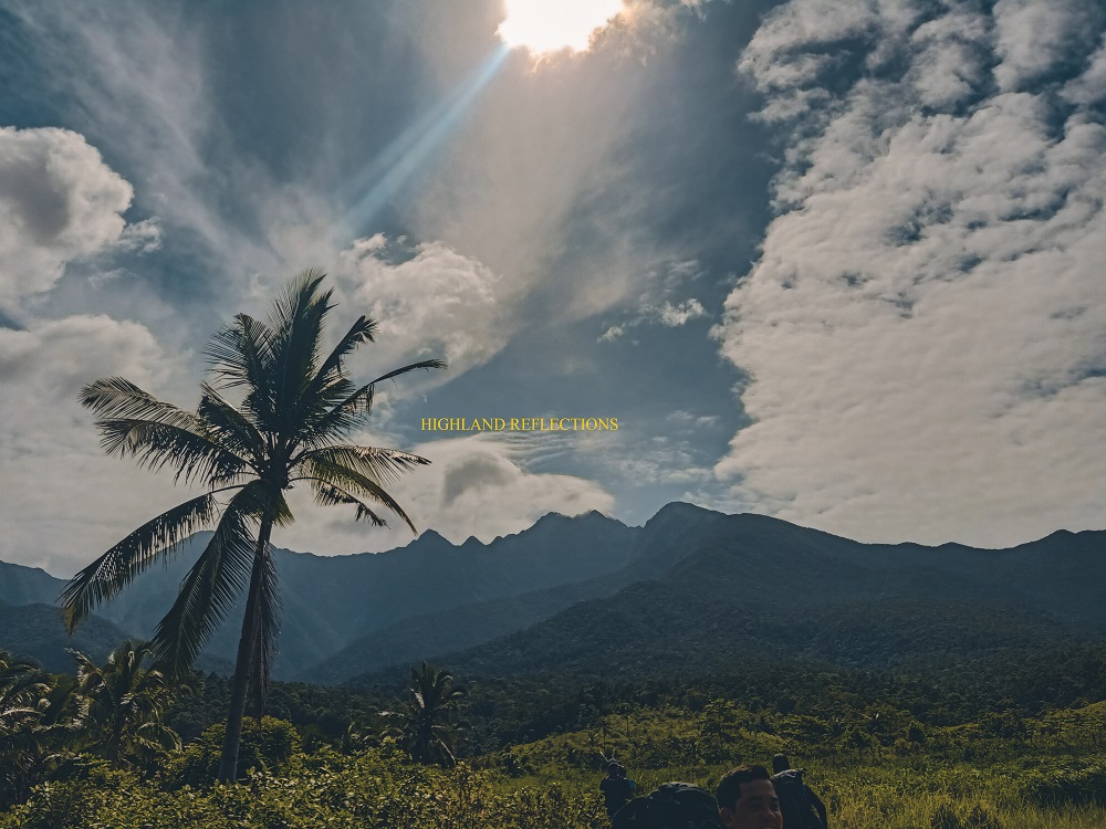
At 6 in the morning of the 27th of December, I placed my foot on the Island of Sibuyan for the first time. We were at the Ambulong Port located in the town of Magdiwang, one of the three main municipalities of the island. The sky was still an indigo hue, but we could faintly spot the slopes of Mt. Guiting-Guiting dressed in thick, humongous clouds. As we were famished from the 14 hours of sea ride, we decided to eat at a nearby carinderia.
Afterwards was a fulfillment of the necessary logistics for the climb. We registered at the Magdiwang Police Station, bought some packed lunch for the day, registered at Sir Bermar Tansiongco’s house, and registered once more at a house at the jump-off point. Our organizer for this hike was Win Calleja, who has already secured us an advanced orientation at the DENR Office in Sibuyan Island. Since it was still quite early, I decided to cleanse myself at the house in the jump-off point in Barangay Tampayan and caught some ample idle time.
At 10:30am, we started the procession towards the famed Mt. Guiting-Guiting. The sun was up in the sky, scorching every fiber in my body. The jagged peaks of the mountain loomed ahead of us, saying their hellos, and possibly goodbyes as this was the only time that we have seen them for the entire climb. As you will read in the next sections of this blog entry, our weather for the entire climb proved to be utterly unfavorable.

For the three-day excursion inside Guiting-Guiting, Day 1 was supposed to be the easiest. But climbing Mayo’s Peak, which was the first destination of the day standing at an elevation of 1500 meters above sea level, from a near sea level of 35 meters, was unquestionably a daunting task. I was about to find out that there are no easy days inside Guiting-Guiting.
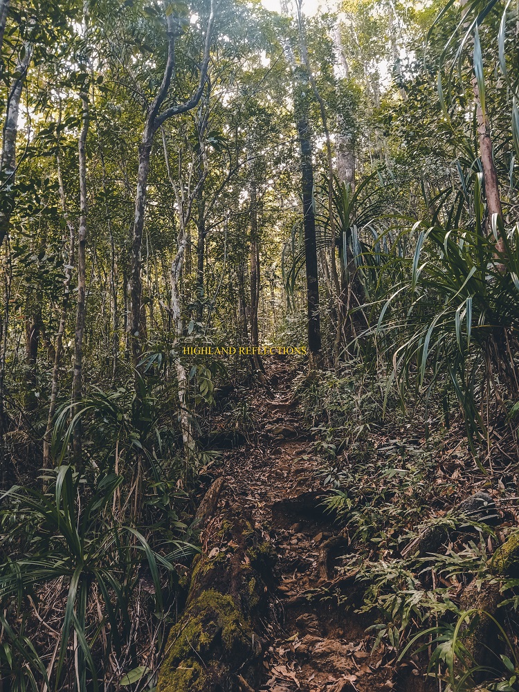
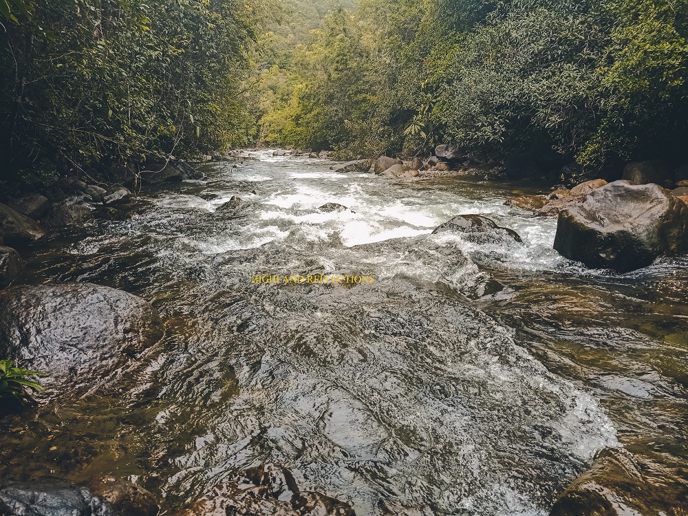
The initial parts pass through four sections of a river/creek (depending on the weather) inside a dipterocarp forest. In some parts, I waded my waterproof shoes through the waters of the river—a minimal mistake as this had probably added weight on my foothold. Then, the nonstop ascent started. We reached Camp 1 an hour after starting the hike, and Camp 2 after another hour. There, we took out our packed lunch and consumed the much needed carbs and protein.
Camp 2 to Camp 3 was where I started feeling my costochondritis. It’s an inflammatory condition of the breastbone, usually triggered by physical stress. The guide that followed me from Camp 2 was heaven sent, as he assisted me in carrying my tent, which was probably the heaviest item in my fully-packed 60L bag. I felt the weight lightened.
A good two hours after leaving Camp 2, we reached Camp 3. The weather was slowly becoming volatile at this point. It started as a fog, but slowly, the wind’s anger gradually piled up. In some waking moments past Camp 3, we were able to get a glimpse of the enormous slopes of Guiting-Guiting. Thankfully, we reentered the forest just in time to reach Bulod Spring.
But it was the trail to Mayo’s Peak after Bulod Spring where we started experiencing the rage of the wind surrounding the mountain. To reach Mayo’s Peak, we had to brave an open steep trail exposed to the roaring, howling winds. This was a foreshadowing of what lay ahead of us for Day 2. So what the heck, might as well take it and face the anger of the white sky.
Goodness gracious. What a day! We had two more days of these bothersome, even lethal predicaments. For now, we set aside our fears as we settled inside the swampy, mossy forest of Mayo’s Peak. At 5:30 in the afternoon, we slept early. The cold night was probably one of the most unbearable I’ve ever experienced.
I decided to eat dinner at midnight. Guiting-Guiting really brings the unusual in us.
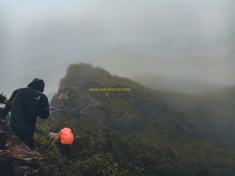
Day 2 was Judgment Day. It was the day of reckoning. We now had to brave our way through the most perilous spots of the mountain, named enticingly using bizarre expressions and appellations, such as the Knife Edge, the Camelback, the Kiss the Wall, Hilary Pass, and the Walk of Fame.
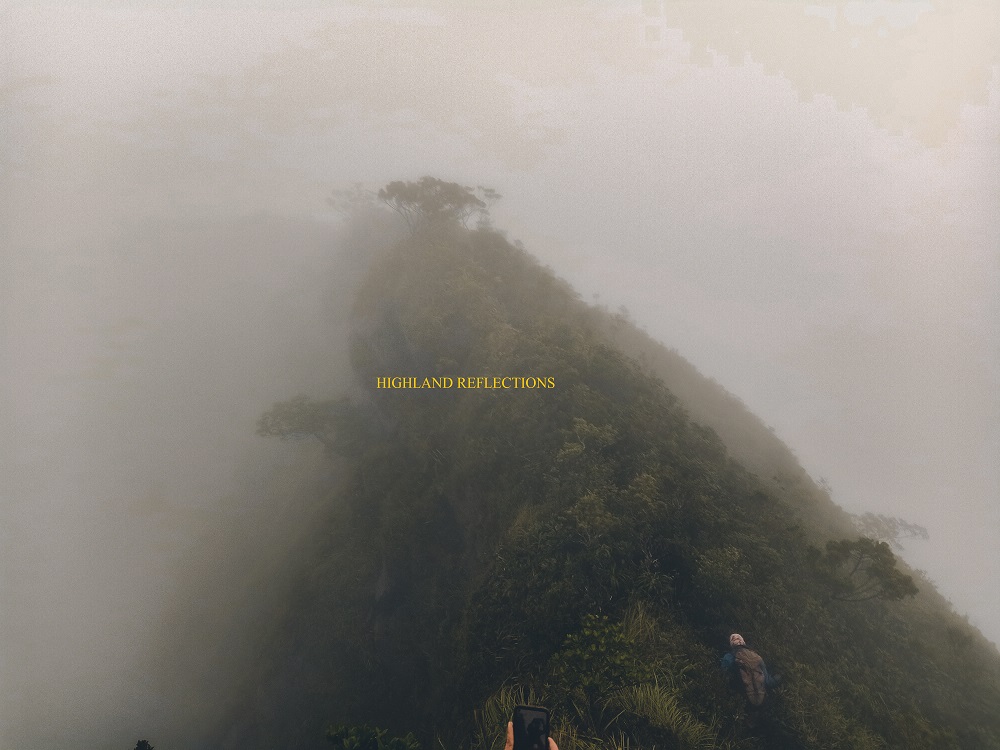
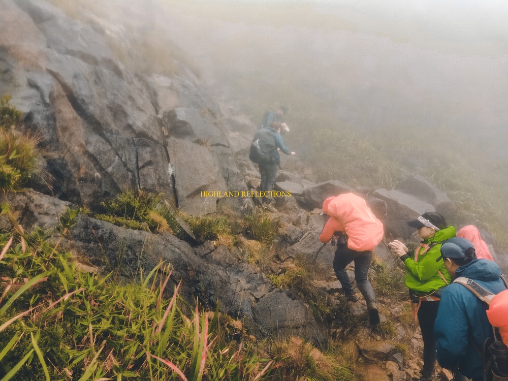
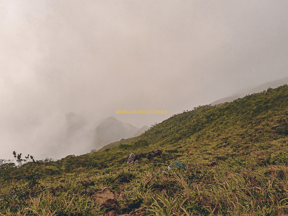
I decided to face Day 2’s reckoning past 6am. As with the weather yesterday afternoon, the clouds decided to envelope the entire mountain in its marvel, leaving no trace of sight around us. Everything was in heavenly white, save for the greenery of the nearby trails and the brown of the promontories we were taking.
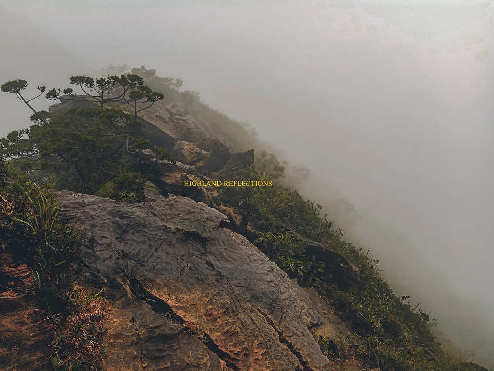
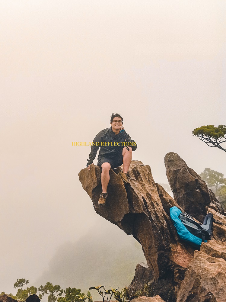
From Mayo’s Peak, we descended a good hundred meters onwards to Eagle Rock, which was a protrusion that supposedly gives an angle of the imposing mountain wall of Guiting-Guiting’s summit in the background. But as stated, there was only white for the entire hike. Still, I snapped some shots for memory’s sake.
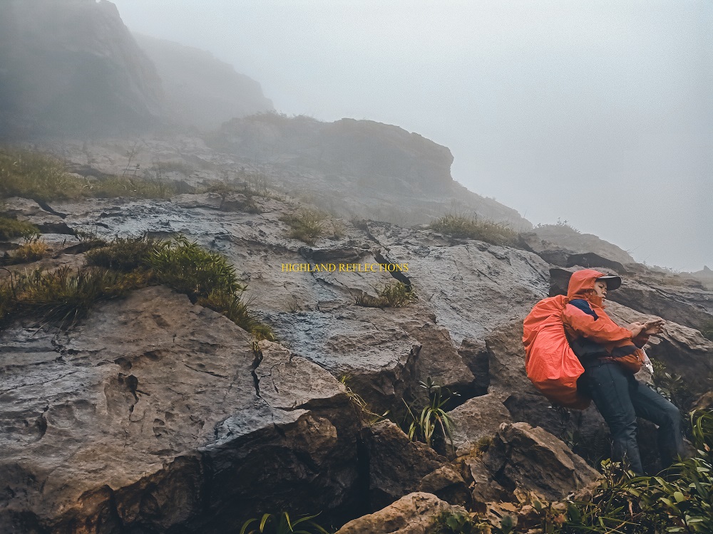
What came next was a playground for the madmen. We passed through a ridge dotted with boulders, aptly named as the Camel Back or the Knife Edge, owing to the shape of the ridge where both sides are deep drops on a ravine. At this part, it was as if we were negotiating a maze that needed solving by moving and contouring our bodies at different angles just to get through. We did our best not to make the hike more perilous than it was, as the wind kept its raging mood for the hour.
The second challenge of the day was encountered four hours after starting from Mayo’s Peak. This was evocatively named as the Kiss the Wall. It’s a narrow pass where we needed to hold on to the wall of boulder in front of us while making our way through footholds carved along the boulders underneath. To our back is a steep drop, that even if the surrounding was blocked in white, we knew how deep the plunge would be if we took a misstep.
But hey, since this is my blog, I can brag here. It wasn’t that difficult. In fact, it was the easiest part of Day 2. Let me just bask in this fact since what came next was the most unfavorable situation I faced for the entire hike.
Past Kiss the Wall was a continuation of the dealing-and-greeting-the-boulders typical of Day 2. At 10:20 in the morning, we reached Mabel’s Spring—a water source coming from a nozzle-like hole formed by two boulders. We took our lunch here. I was bathed by the condensed atmosphere.
Even after taking lunch, my body already gave me signals of exhaustion as we pushed through with the remaining parts of the hike. My knees were already screaming in agony. My mentality was at the verge of giving up. I wasn’t even thankful when we reached the Peak of Deception—the part of the mountain that fooled the first explorers of Guiting-Guiting, mistaking it as the summit, only to find out a higher ground as they reached the peak. Now imagine that with no sight to see and only the nonstop rain and raging winds howling at you. Truly a test of (my) character.
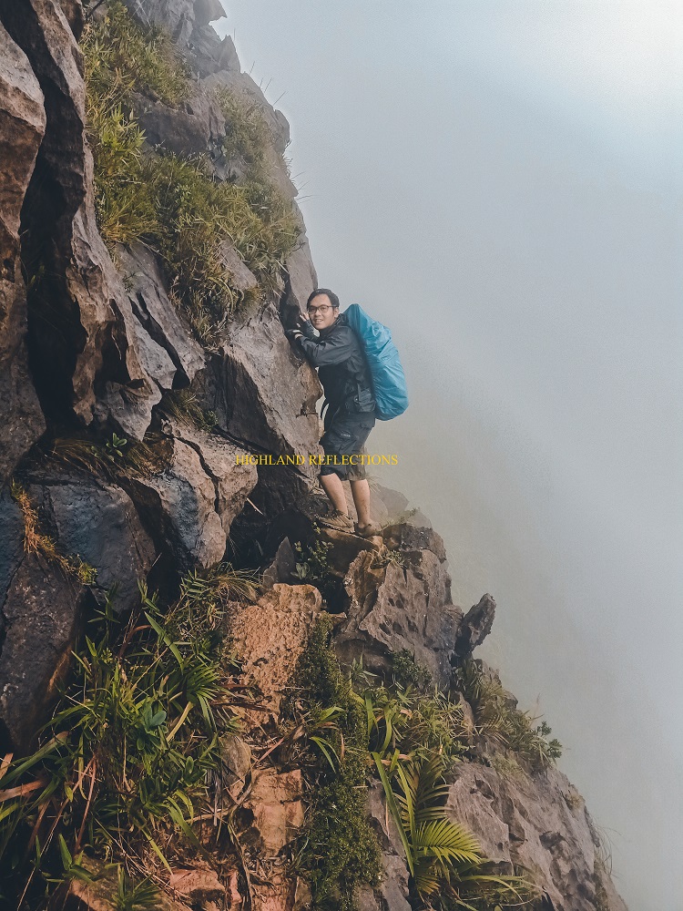
Past Peak of Deception was a short section of descent until continuing once more with having a field day with boulders and trying to figure out if they really wanted to let you pass and make the climb successful. And as we were nearing the summit, the final boss appeared in front of us. Her name was Hillary Pass. Feared by many, she also goes by the title of the 90 Degrees. Sure, it wasn’t entirely 90 degrees, but the climb up to Hilary Pass was no easy feat, as one misstep can lead you smashing onto the vertical boulders that you passed through, and maybe on the deep ravines below you.
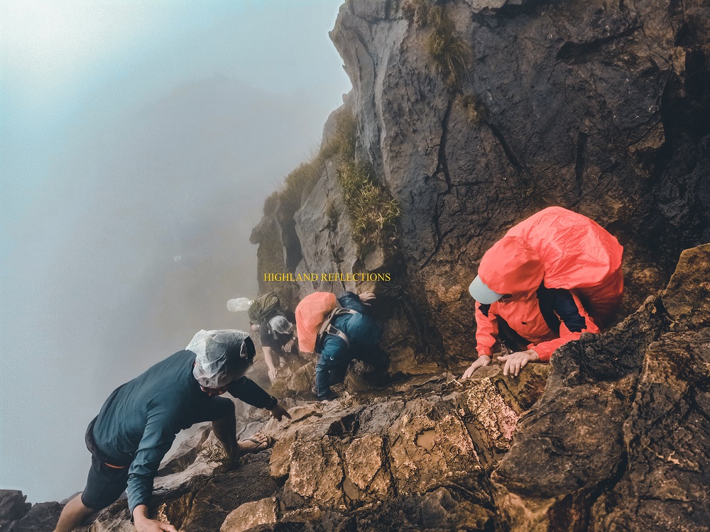
I gave my fully packed backpack to my guide to ease the climb up Hilary Pass. Slowly and surely, I followed the detailed instructions of my guide, sometimes resisting, but following nonetheless. I put all my weight into that climb since I very well knew my life depended on it. I let a sigh of relief upon succeeding.
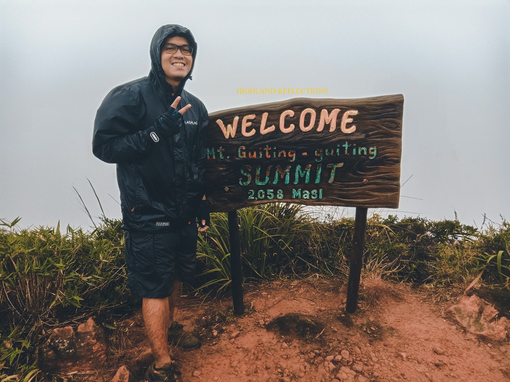
From the Hilary Pass, it was a good 30-minute climb up to the Walk of Fame, and then to the summit. The 30 minute-mark was supposed to be shorter. All the agony my knees were complaining about burst as I was treading the Walk of Fame. The pang of pain was overpowering. “Summit. Summit. Summit!” My mind was dragging my banged up body to get to the summit. Just a few painful minutes, I reached the summit. It was 1:15PM. Motherfreakin’ hot dang, finally! Took a shot. Smiled. And then proceeded with the descent. Didn’t have much to see there anyway, and the wind was still surely mad.
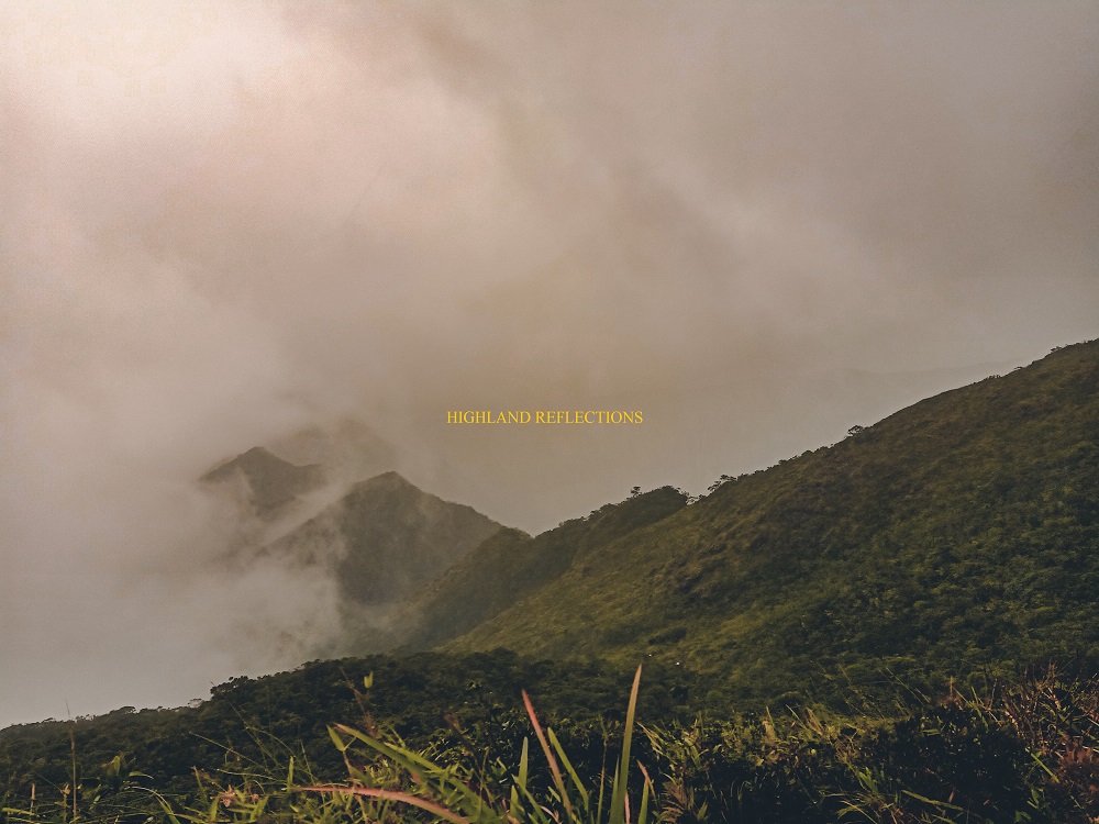
The descent to Olango Trail commenced uneventfully. With only a water break, I was following yellowed spots of the boulders in front of me. A silhouette of the mountain slopes we needed to negotiate loomed ahead of us. It was a continuous descent, one that wasn’t as clamorous as the one in Tampayan Trail. Sometimes, the sky would open and we would see glimpses of forested, giant pyramids in front of us, some of which had waterfalls carved along them.
At three in the afternoon, we passed by the Crash Site, where remnants of the Britten-Norman BN-2A-21 Islander plane scattered along the grassy, bouldery slopes. I threw a prayer for the departed souls.
Impatient but determined. This was what I was feeling as the clock ticked at 4. We were descending for three boring hours without a trace of Olango Trail’s Camp 3. Thankfully, we reached Camp 3 past five in the afternoon. With only a minimal water break, I pushed through with going to Camp 2, our assigned camp for the day.
Camp 3 to Camp 2 was where I spent most of the time alone in the trail. Dusk was falling and darkness foreboding, the lone time inside G2 proved to be cumbersome but nonetheless calming. I was passing through narrow knife edges obscured by grass. Then, it was all descent from there. Since my body was now accustomed to the pain coming from 12 hours of total nonstop action, I trail-ran the descent. Even in the midst of the dark, I considered the sacred mountain a playground where I can freely run and entice my spirit. At 6:45PM, I finally heard the laughters of Win and company. Camp 2!
The weather at Camp 2 seemed more forgiving compared to the biting cold in Mayo’s Peak. I slept soundly inside my orange makeshift abode.
Day 3! Freaking finally, it was Day 3. “This would be the easiest day,” I confidently claimed, not knowing what clownery I was proclaiming.
Thinking that it would be an easy descent, I staggered with what Olango Trail revealed to me—steep, almost 90-degree paths inside the forest. Man, I thought it was over. I thought that Day 3 would be the easing conclusion, the calm after the storm. Day 3 was a knockout punch after the constant mugging of Day 2. Without any strength left in me, I depended my every step, my every acrobatic movement on my collective experience and wisdom that I have gained in my past 6 years of hiking.
Everything was made more difficult by the mud. But thankfully, as we reached Camp 1, everything went back to normal. The steepness dissipated, and I was once again back in my element, save for the exhaustion. In no time, we reached the raging waters of Olango River. Crossing it was no easy feat. I could feel the pressure and force pushing my legs with every step. Thankfully, I reached the other side of the river safely. I decided to take some rest. I could now see the end.

Past the river, I took the last three kilometers of the entire hike. It was a flat section on top of thin ice… or mud. I was on the verge of slipping every now and then. Good thing, my Merrell shoes probably already had their own fair share of experiences and wisdom to not let me fall. I was also thankful to have met some of my companions. We shared stories while taking the long, long flat footpath to the end point. We exited the forest and emerged onto a wide farmland where I took the chance to run. At our backs, Mt. Guiting-Guiting was still smothered in clouds.
At 11:20AM, I reached the end-point, located in Sitio Olango in the town of San Fernando. Oh what a relief! I immediately posted on Facebook and informed my loved ones that I finished the entire traverse. Wow. My first difficulty 9/9 mountain. It did truly live up to the hype! I thanked the heavens for a safe climb.
And there I was, a 26-year old man with a fulfilled dream. It took me a while, but I was finally there. Finally, finally took the challenge to climb the country’s difficult, most technical mountain. Oh, what an honor! Thank you, Mt. Guiting-Guiting.
Our trip to Sibuyan Island concluded with an overnight stay at Cresta de Gallo, probably the most beautiful sandbar and beach that I have seen in my entire life. The magical cerulean waters surrounding the sandbar and the view of Mt. Guiting-Guiting in the nearby horizon made the stay truly a relaxing, wonderful experience. Even the boat ride to and from Cresta de Gallo was in itself a therapeutic, yet frightening experience. We live for such moments.
Only time will tell when I will return to Mt. Guiting-Guiting. Hopefully, I get to see her beauty in full bloom the next time we meet.

One thought on “Mt. Guiting-Guiting Traverse”