Towards the end of 2022, I was finally able to try hiking one of the major trails of Mt. Pinatubo, the Inararo Trail, also known then as the “Golden Trail”. The trail was popularized back in 2019 when the other major trails of Mt. Pinatubo, Delta-5 and Sapang Uwak, were temporarily closed. The Inararo Trail lets hikers immerse into the lahar landscape that formed the slopes of Mt. Pinatubo and the surrounding mountains. It is also notorious for its very long trail, spanning a total of 40+ kilometers to the summit and on the way back. Luckily, when we hiked during the months of 2022, the tour package now offers a 4×4 vehicle ride up until the base camp, which cuts down 20 kilometers, almost half the distance of the entire hike!
Still, it was a long and arduous hike that poses a fulfilling challenge to those searching for a thrilling adventure to Pinatubo.
The general characteristic of the trail are as follows:
MT. PINATUVO via INARARO TRAIL
Jump-off point: Sitio Target, Sapangbato, Angeles City, Pampanga
Elevation & total trail distance: 1,125+ MASL, 40+ KM / 20+KM (w/ 4×4 ride)
Days required / Hours to summit: 1-2 days / 8-10 hours
Specs: Major climb, difficulty 7/9 (subjective), Trail class 1-3 with river crossing
Features: Delta 5 river, Pinatubo view deck, lahar slopes
The adventure started at around 1:20 in the morning when we climbed aboard the 4×4 pick-up truck to take us to the base camp, some 10 kilometers away from the tourism office of the Golden Trail. This part was taken by foot back when Inararo Trail was still newly opened (imagine having to walk 10 kilometers before reaching the mountain’s base camp), so luckily, it can now be covered by wheels. The entire ride took us more than thirty minutes, with our vehicle traversing unpaved lahar roads flanked by lahar cliffs.
We reached the base camp some time around 2:00am. The camp was perched on an elevated hill where a makeshift nipa roof was installed for hikers to crash. On the side of the elevated hill are comfort rooms and what are possibly some station (and probably houses) of the trail’s caretakers. We stayed there for almost more than an hour. There, we registered and listened to the chieftain as he oriented not just us hikers, but also the guides, reminding them that if the river becomes too harsh to hike, we must abruptly abort the climb.
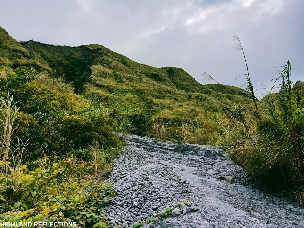
We started at 3:20 in the morning. We descended on the lahar road which quickly turned into two-feet wide knife edges surrounded by wide and deep pot holes. Every step is like gambling your safety on the lahar soil beneath you since it could collapse anytime on the depression on both sides. Afterwards, we exited on a wide lahar field, much like a desert, reminiscent of the Crow Valley in the Capas Trail. We walked a good portion of this valley for less than half of an hour.
What came next was the steep descent towards the Delta-5 river. This section was probably the most perilous as we needed to descend very steep roped segments of lahar slopes. Initially, the descending trail was characterized by a cramped path sandwiched by two lahar slopes. As we reached the first roped section, we braved the descent one-by-one. Upon my turn, I made the mistake of holding on the lahar formation to my right which quickly collapsed and fell onto the deep, dark slope beneath us. Luckily, I had the rope to hold on to for safety.
When everyone was accounted for, we took another roped segment that was less steep, plus another last round of technically steep descent. Afterwards, the last stretch of descent took us to another round of being flanked by lahar slopes on both sides. We reached the riverbank afterwards. This, according to some blogs, is the latter half of the Delta-5 trail. I was excited and nervous at the same time since this was (at least, the latter half of) the infamous river trail that everyone was raving about way back in 2018 and prior, a time when I first had my major climbs!

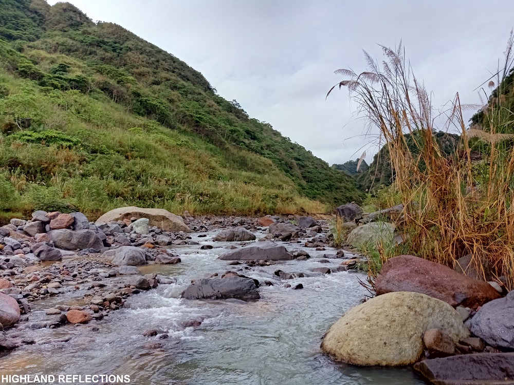
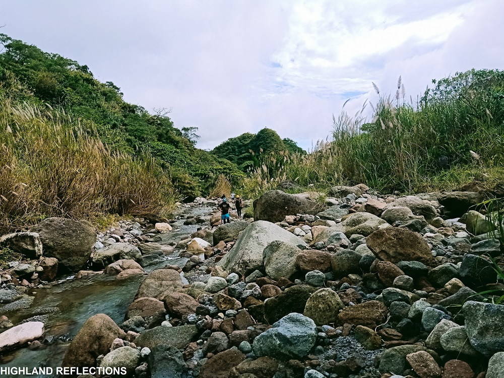
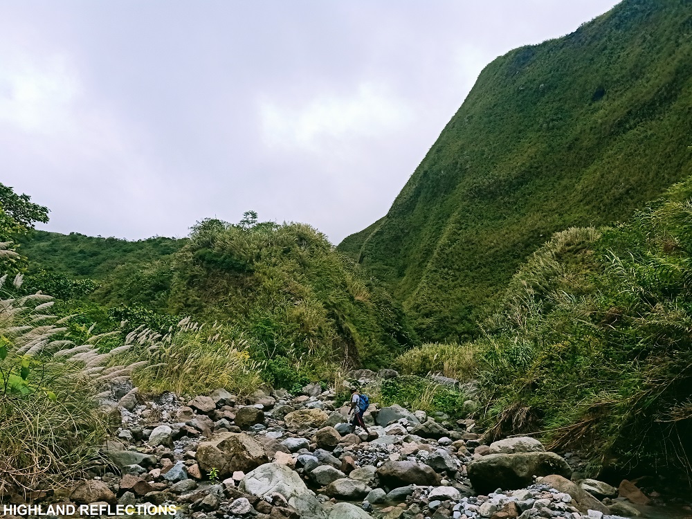
The Delta-5 trail was reminiscent of the Capas Trail where two mountain slopes surround the entire lahar river banks. Its difference from the Capas Trail was that the Delta-5 trail had a more intense river which we needed to follow until reaching the final assault to the summit. This long section of the hike either lets us walk on the lahar paths on the side of the river, hop on and crawl on larger boulders, or get forced to wade the currents of the Delta-5 river. Many portions reminded me of the Kagsa River trail in Real, Quezon, or the Sapang Biya in Mt. Corona in DRT, Bulacan. There were also portions reminiscent of the river trail in Mt. Damas.

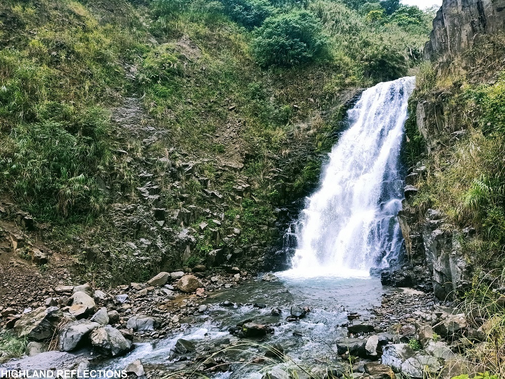
We reached Apu Malyari Falls past eight in the morning, 5 hours after starting the hike. Although we could have been here earlier, a lot of our companions were first timers and beginners that they mistook the Inararo Trail for the Capas Trail. As we savored the view of the falls and ate our early brunch, the team decided to return to the base camp as they were already exhausted from the hike. Luckily, four hikers tagged along with me as we persuaded one guide to come with us up to the crater, since at that time, I was still full of vigor.
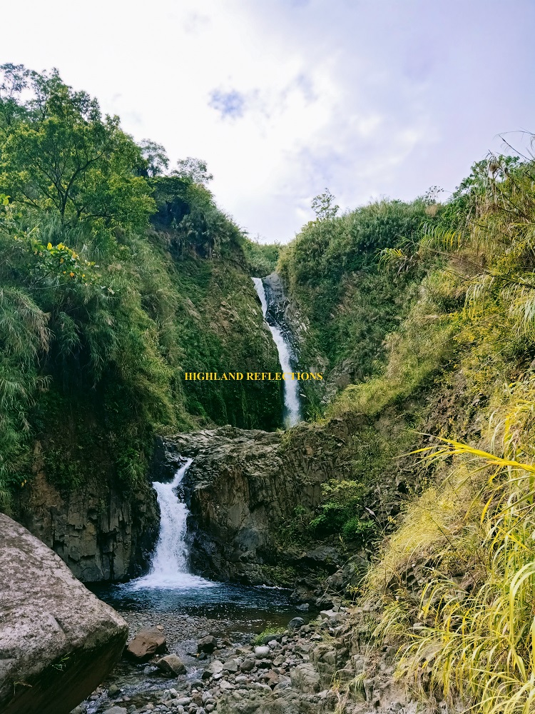
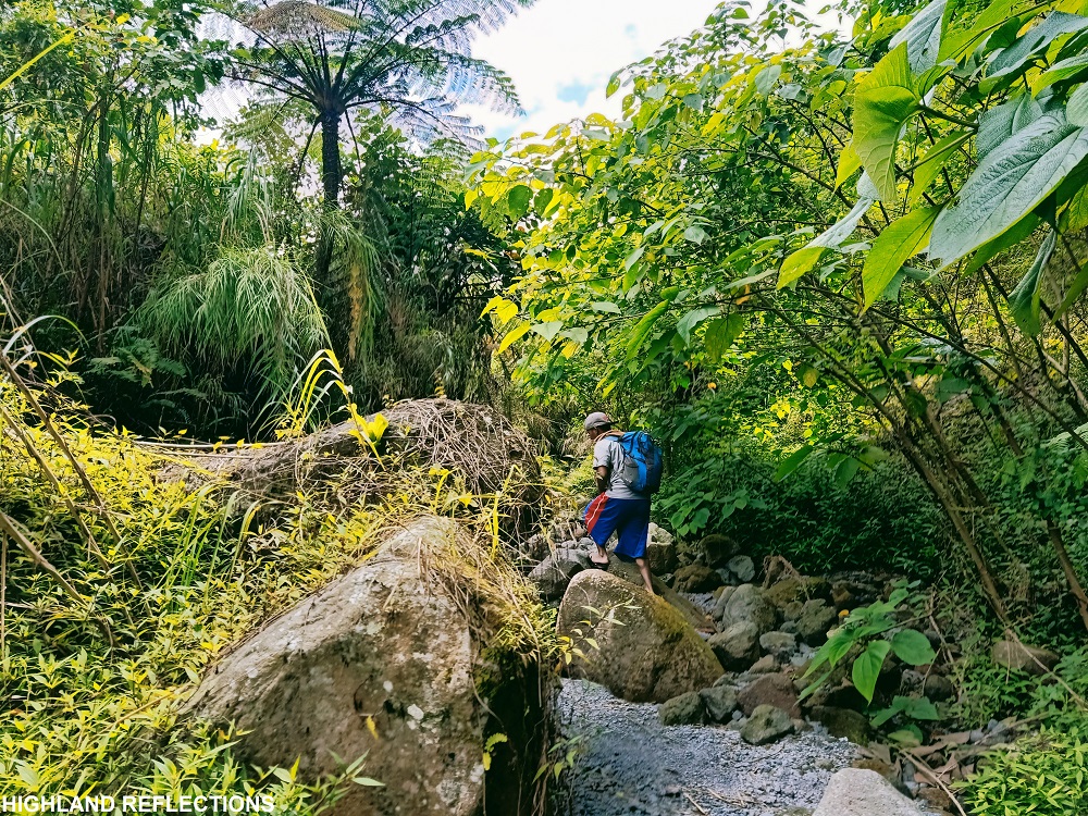
The six of us (me, the guide, and four other hikers) started the last push towards the crater past 9 in the morning. We took an ascending trail at the forested slope at the right side of Apu Malyari Falls. This exits through a gushing river with a deep drop to a waterfall (possibly Apu Malyari Falls) on the left side. Towards our front was a two-layered waterfall called the Twin Falls. We rested here for quite a while. Afterwards, we followed the path created by the river and boulders. There was a short section that exits through a grassland where a campsite was located. After that, the trail returns to the river.
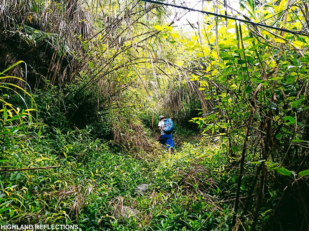
This was probably where I first felt exasperation, since I was expecting that, after the falls, it would be a grassy trail up until the summit. I was mistaken since the river continues for three more kilometers before reaching the base of the summit, where the actual grassy slopes were to be found. After two hours of following the river, our lone guide finally signaled to me that we will now be taking the final assault to the view deck.
Expecting that I would now be taking a grassy slope, I was again mistaken, as the trail was surprisingly still on a riverbed, but dry. However, I noticed that, unlike the river parts, this now has a lot of ascending portions, similar to the initial parts of Mt. Apo’s boulder face. Before entering the forested portion of the assault, the guide and I waited for our companions. Afterwards, we took the steep ascents inside the forest. The undergrowth was overwhelming all throughout. Nearby the start of the forested trail was a roped section that was both very steep and obscured by undergrowth, that I almost stumbled on one of the boulders perched on the trail.
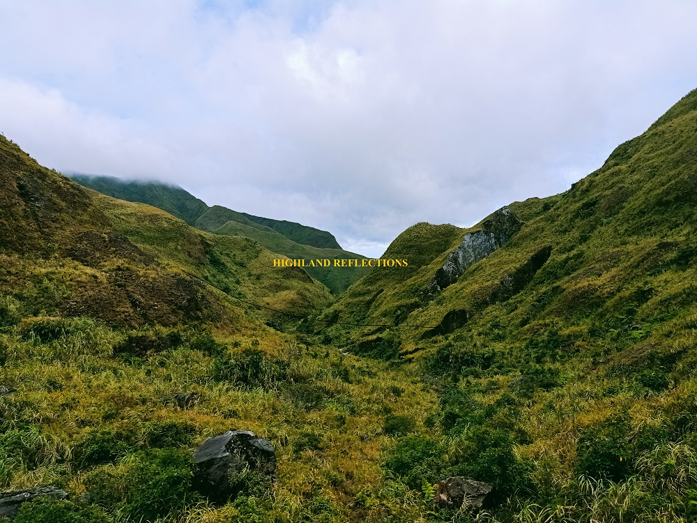
Past that area, we found ourselves again being sandwiched by scrubby boulders on both sides. Beneath our feet is a lahar path where a grey water was flowing, probably one of the unique things I saw for this hike. Finally, we exited towards a pebbly rough road surrounded by green, grassy volcanic slopes. I knew we were nearby. As there were many paths carved around that area, I waited for our dear guide to, well, guide us, since I passed through many dead ends in that area. As he guided us on the last stretch of trail onwards the crater view deck, I savored the gusts of wind smacking my face, all while ascending the grassy slopes. Before reaching the summit, I looked back, and there, contours of greenery comprised the awesome view. “So this is what the surroundings of Pinatubo look like,” I said to myself even if I had already gone to the Capas Trail a few years ago.
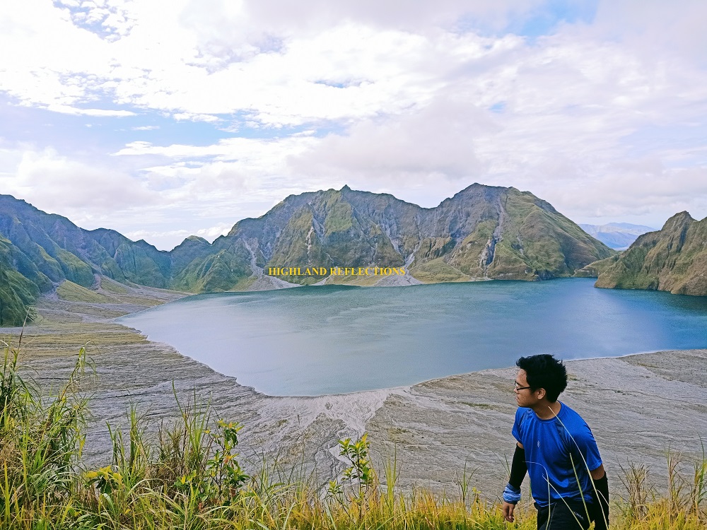
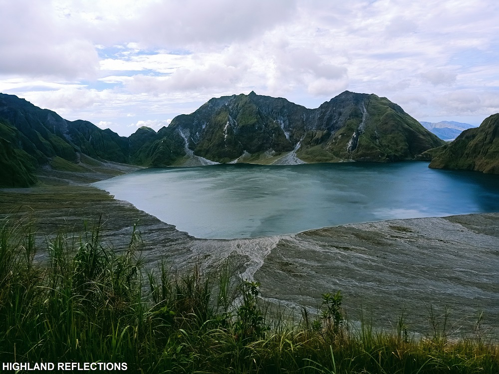
At around 12:30pm, together with my guide, I finally reached the crater view deck of Inararo Trail. My first glimpse of the entire crater coming from the trail left me awestruck, and I was honestly, honestly lost for words when I gazed upon the expansive crater lake, surrounded by titanic jagged peaks. The view was surreal! Even my photos uploaded in this blog cannot capture the expansiveness of what I was seeing.
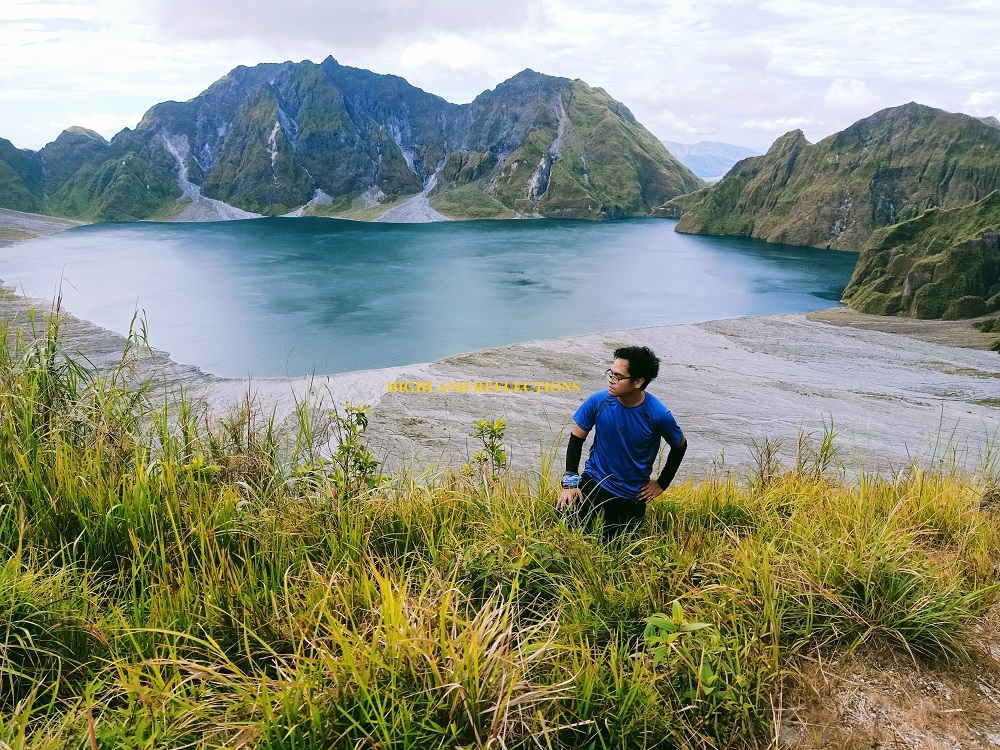
This view deck in the Inararo Trail, which was located east of the volcano, was said to be closer to the crater than the one in Sapang Uwak. Caution must be exercised in the view deck since one wrong misstep could lead to a deep plunge inside the crater. From this vantage point, the view deck in Capas in the northern side of the volcano is blocked by a large caldera wall. Despite the rain during the earlier parts of the hike, and the clouds covering the highest peaks of Mt. Pinatubo, the view deck still gave us the clearest view of the surrounding and even the mountains past the slopes of the western side of the crater, where faraway mountains of Cabangan, Zambales can be seen.
My four companions arrived. They, too, were struck in awe the first time they laid their eyes on the crater. We took pictures before starting the long descent.

Since I was with two others who have only completed two to three major climbs, and two beginners, I knew that we would be going slower than usual going back to the base camp. The hike on the way back proved to be nerve-wracking, since we needed to pass through, again, the steep roped segment inside the forest, more lahar paths that just became a passing nuisance for the entire hike, hundreds of boulders that we needed to either climb through or hop on, and a flowing river that gushes incessantly. Many times, due to my impatience, I tried advancing without a guide, only to find out I was lost. I was fortunate to have a functioning STRAVA record of the hike, so all I needed was to follow the path carved by my GPS recording, and voila, I would catch up with my guide and the four other hikers.
As one of our companions got cramps, we slowed down. We reached the Twin Falls almost past five in the afternoon. There, I gave her pain killer med, hoping it could alleviate her aches a little.
We backtracked the same trail. Twilight caught up when we reached Apu Malyari Falls. It was a only a matter of time when darkness caught up. I could feel the tiredness even from my guide. At this point, I placed myself in the middle of the team to account for everyone, as our guide needed to figure out the way in this puzzling river environment in the dark.
It took us more than an hour to reach the start of the steep lahar path with roped segments. Before negotiating that path, I shared some chocolates with my companions. There, the other guides who accompanied our companions who backed out were waiting to assist us in this perilous part of the hike. One-by-one, we climbed using the ropes, pushing our feet on the lahar surface of the steep slope with our hands either holding the ropes or some of the hardened parts of the surface.
After exiting towards the lahar valley, one of the guides was kind enough to accompany me as I can now hike on the way back with my regular pacing. I reached the base camp around 8 in the evening, almost 17 hours after starting the hike! My four companions followed after 15 minutes. It was a triumphant finish for the five of us. We cleansed ourselves before returning to Sitio Target, where our van driver was patiently waiting for us. We did not waste time as we all wanted to return home.
So that was my adventure inside the lahar kingdom of the Kapampangan god, Apo Namalyari. I know that this may seem impractical, but I do hope that I get the chance to try the drier, longer, and more punishing Sapang Uwak Trail in the future!
Itinerary
Day 0
08:00PM meet-up in Manila
Day 1
01:30AM Sitio Target, Sapang Bato, ride 4×4 truck
02:10AM Base camp, rest, register, and prepare
03:20AM Start hike
05:30AM Delta-5 river
08:00AM Apu Malyari Falls, rest, breakfast
09:00AM Continue hike
09:15AM Twin Falls
12:30PM Crater view deck
1:30PM Start descent
08:00PM base camp, wash-up
09:00PM Sitio Target, depart for Manila

One thought on “Mt. Pinatubo via Inararo Trail | The Lahar Kingdom of Apo Malyari”