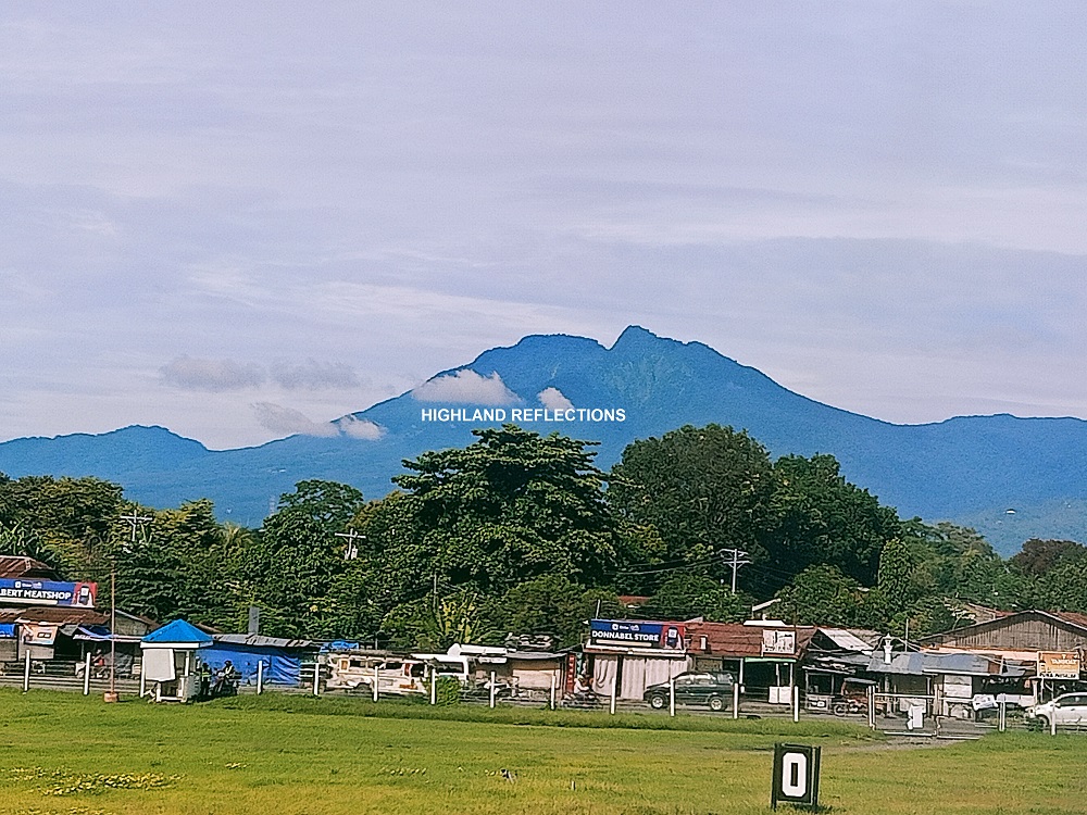
Last August of 2022, I was finally able to fulfill one of my dream climbs: Mt. Talinis. Situated in the Cuernos de Negros Mountain Range, Mt. Talinis is the highest summit within the range and possibly the second highest mountain in Negros Island next to Mt. Kanlaon. The hike up the highest peak of Cuernos de Negros (Horns of Negros) packs a roster of magnificent landmarks and stopovers within the trail, making this one of the most sought after mountains by Visayan mountaineers.
There are two traditional routes to Mt. Talinis. The Bediao Trail is the shorter but steeper route, located southeast of the mountain in the town of Dauin. One of the stopovers along this trail is the mystical Lake Yagumyum, which sits beside the pointy Yagumyum Peak. On the other hand, the Apolong Trail is the longer route, located east of Mt. Talinis in the town of Valencia. This trail boasts of two prominent landmarks: the Twin Falls and the Kaipohan sulfur vents. Another less popular trail is the Panghilakan Trail, still in the town of Valencia but located north of the mountain. All three trails converge at Lake Nailig at the base of the summit.
For this hike, we were supposedly scheduled for an Apolong-Panghilakan traverse, but we decided on the second day that we would descend in the shorter Bediao, since my companions for this hike were chasing their late afternoon flight to Manila.
The characteristics of the trail are as follows:
MT. TALINIS (APOLONG-BEDIAO TRAVERSE)
Entry point: Apolong, Valencia, Negros Oriental
Exit point: Bediao, Dauin, Negros Oriental
Elevation: 1,903+ MASL
Days required / Hours to summit: 2-3 days, 10-11 hours
Specs: Major climb, Difficulty 6/9, Trail class 2-4
Features: Lakes, waterfalls, mossy forest
Taken from pinoymountaineer.com
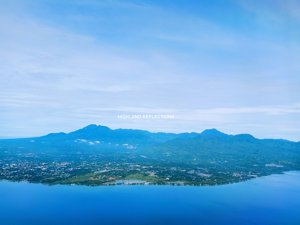
For this hike, I was with my friends Cristine (who organized this DIY hike), Fara, and Rex (his travel guide for this hike is published in Transit Pinas: https://transitpinas.com/talinis-negros-oriental/). Together with Rex and Fara, we arrived at Dumaguete-Sibulan Airport around 7:30 in the morning. Mt. Talinis was already visible from the airport when we arrived. Outside of the airport hall, our multicab service was already there waiting for us, and immediately took us to Dumaguete City proper to fetch Cristine and buy some necessary supplies.
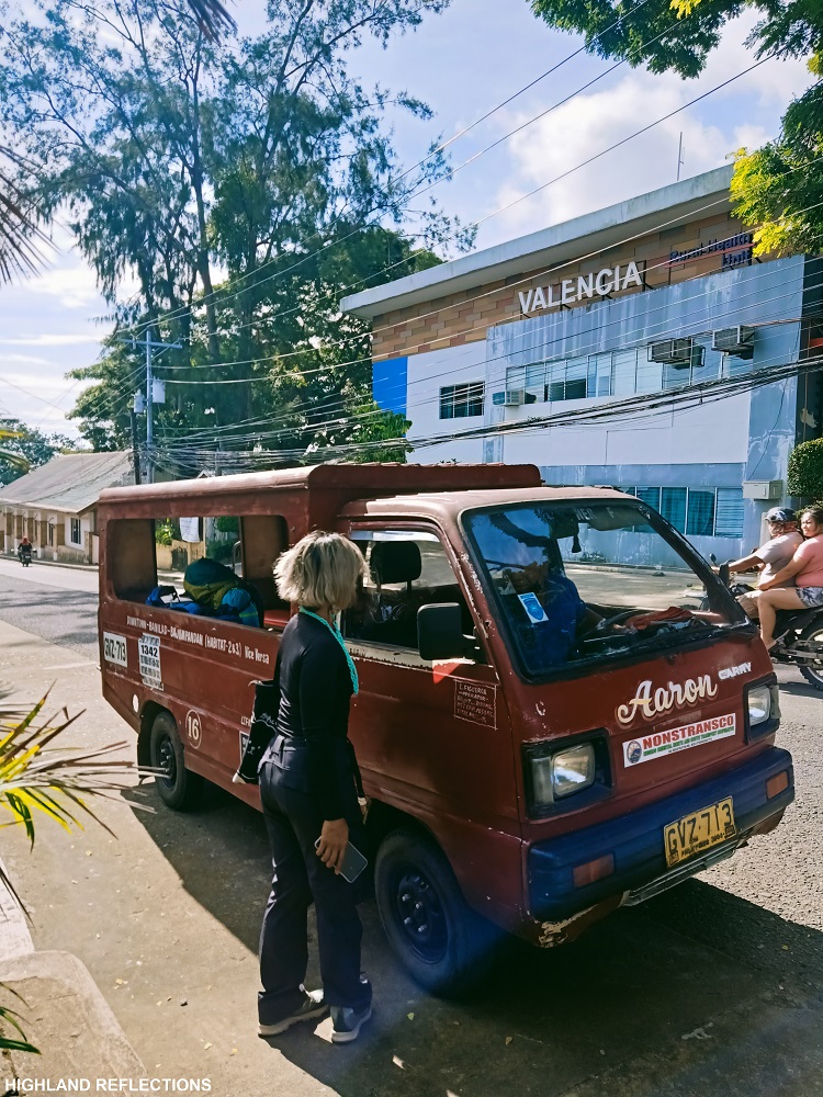
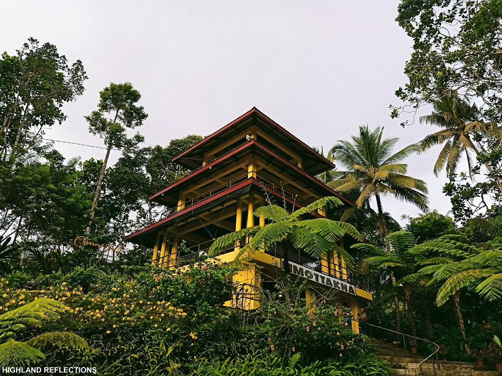
Then, our multicab service took us to the jump-off point of the Apolong Trail some 15 kilometers away from the airport. Interestingly, there is a restaurant in the jump-off area, named as Limottakna, where behind it is a trail going to a famous tourist spot in the area—Casaroro Falls—which I would be visiting two days after. We prepared our equipment, and of course, ourselves, while waiting for Kuya Chris (our guide) and our porter.

Day 1: Apolong Trail
We were a bit late and started the hike at 10 in the morning.
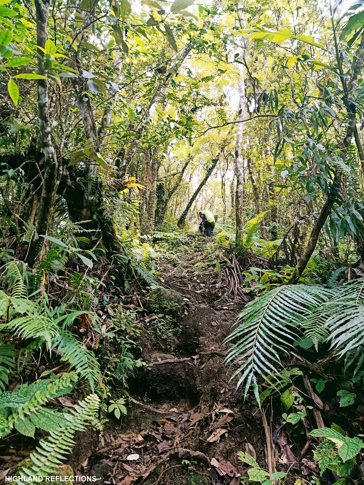
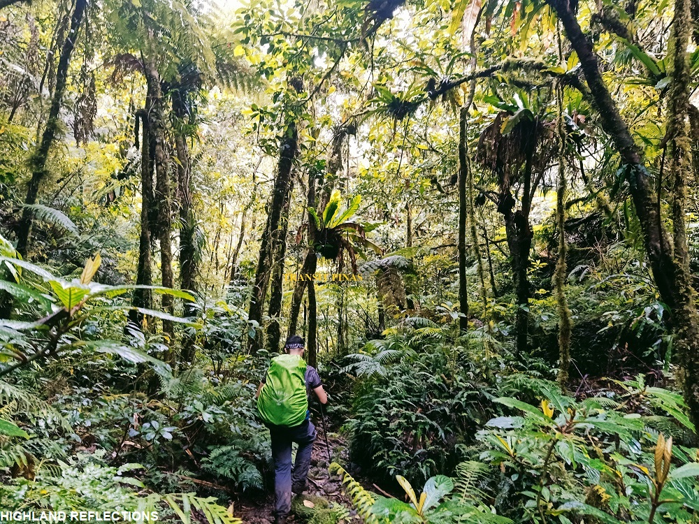
The start of the trail is located where the road ends in front of the restaurant. Although some residential houses dotted the initial parts of the trail, we were already deep into the forest of the Cuernos de Negros Range early on. The wilderness of the forest was evident in the house plants (I believe they were wild plants that grew in the area) and wild insects we saw outside of the houses. The entire initial part was somewhat rocky and muddy.
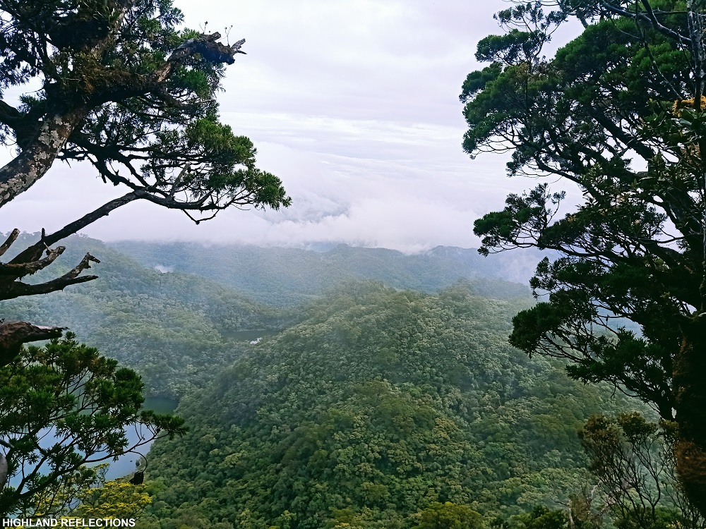
As we got deeper into the forest, the trail became more inclined and sometimes steep. The long Apolong trail seemed to be on a forested ridge, with occasional views of faraway waterfalls. Despite the tiring length, the trail was fairly established and relaxing to hike on despite our panting lungs. We had a couple of rest stops.
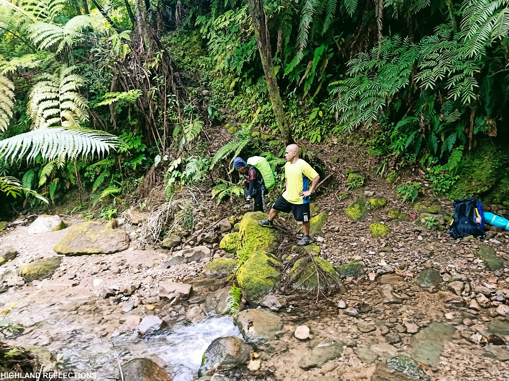
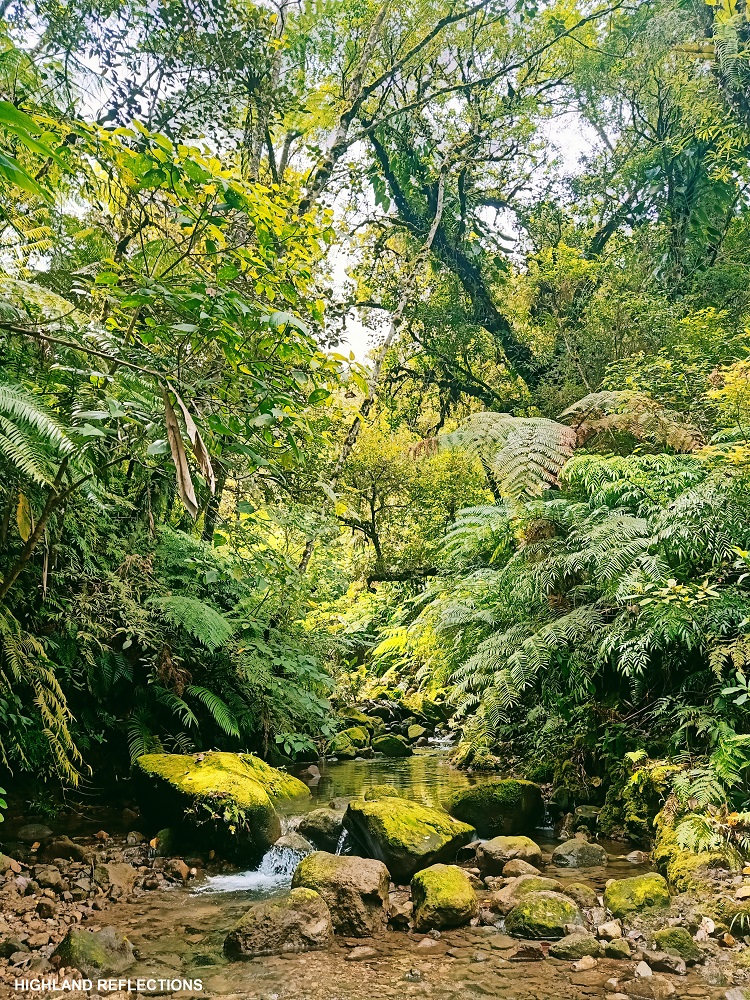
Three hours into the tiring hike, we reached a lagoon in the middle of the trail. Here, we took our lunch and refilled our bottles at the water source nearby. The actual lagoon was covered in large boulders, hence, we needed to crawl to get a view of the green waters.
Twin Falls
The trail afterwards descends to what locals call as a guard house, some twenty minutes away from the lagoon, which can serve as a major resting area. The guard house is manned by personnel and some pet cats who look after the pipes that pump water to the lower areas. Here, we met a very handsome feline with blue magical eyes that rested on our heavy packs. We rested there for a few minutes.

We, then, left our heavy backpacks to go off-trail towards a short riverside path dotted with mossy boulders going to the magnificent Twin Falls. In less than five minutes, we were already within the vicinity of the waterfalls. The basin of the waterfall is partially blocked by a huge boulder to the right where the opening contained knee-deep waters. The water flowing down the Twin Falls gushes a bit strongly. We only took pictures at the opening since we did not want to get our shoes wet.
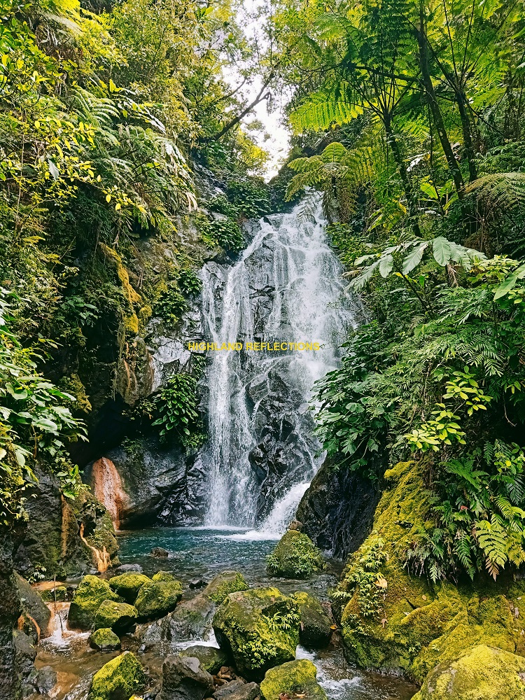
During that time, I had the impression that the Twin Falls’ name was due to the two separate water flow drops that characterizes the waterfall. However, I found out that the name refers to the two waterfalls found in the area, with the second located to our right. The flowing water of the waterfall to our right was so neglectfully small that we ignored it. According to Kuya Chris, the sorry state of the second waterfall was because of eroded soil brought by Typhoon Sendong in 2011.
Kaipohan Sulfur Vents
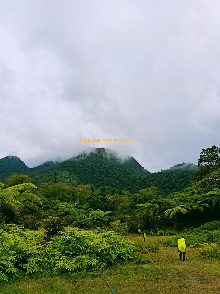
After returning to the guard house and fetching our full packs, we continued the hike. The continuation of the trail initially passes through a very steep section at the other side of the river near the guard house, but returning to the usual flat to moderately inclined path afterwards. After twenty minutes of walking, we exited towards a grassland plateau surrounded by forested mountain slopes. This wide plateau, at 1,260+ meters above sea level, is called the Rancho Camp, serving as our campsite and stopover for the day. We set our tents near the lone house at the camp. Interestingly, to the southeast, Yagumyum Peak, a subsidiary peak of Mt. Talinis, towers over the camp.

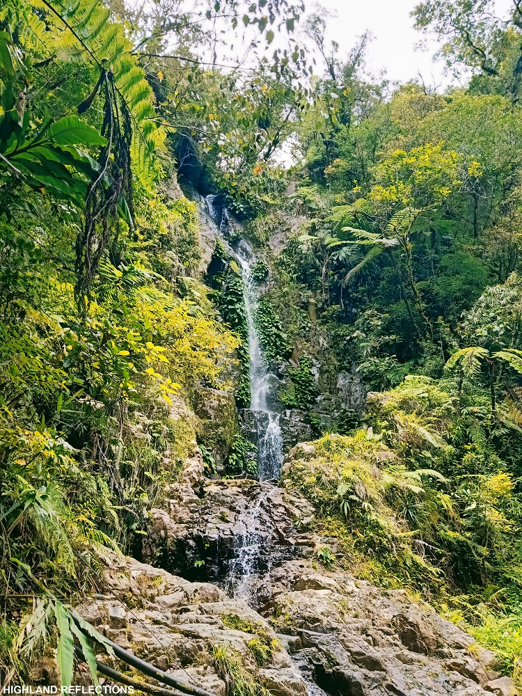
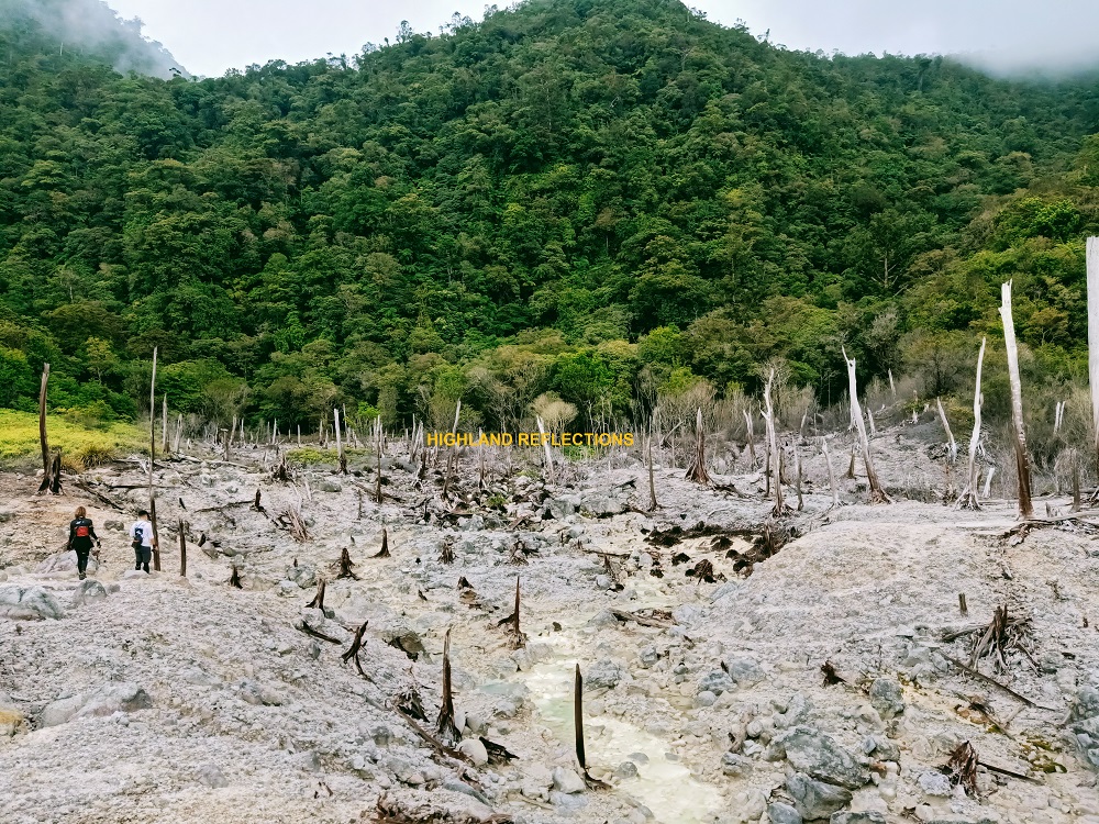
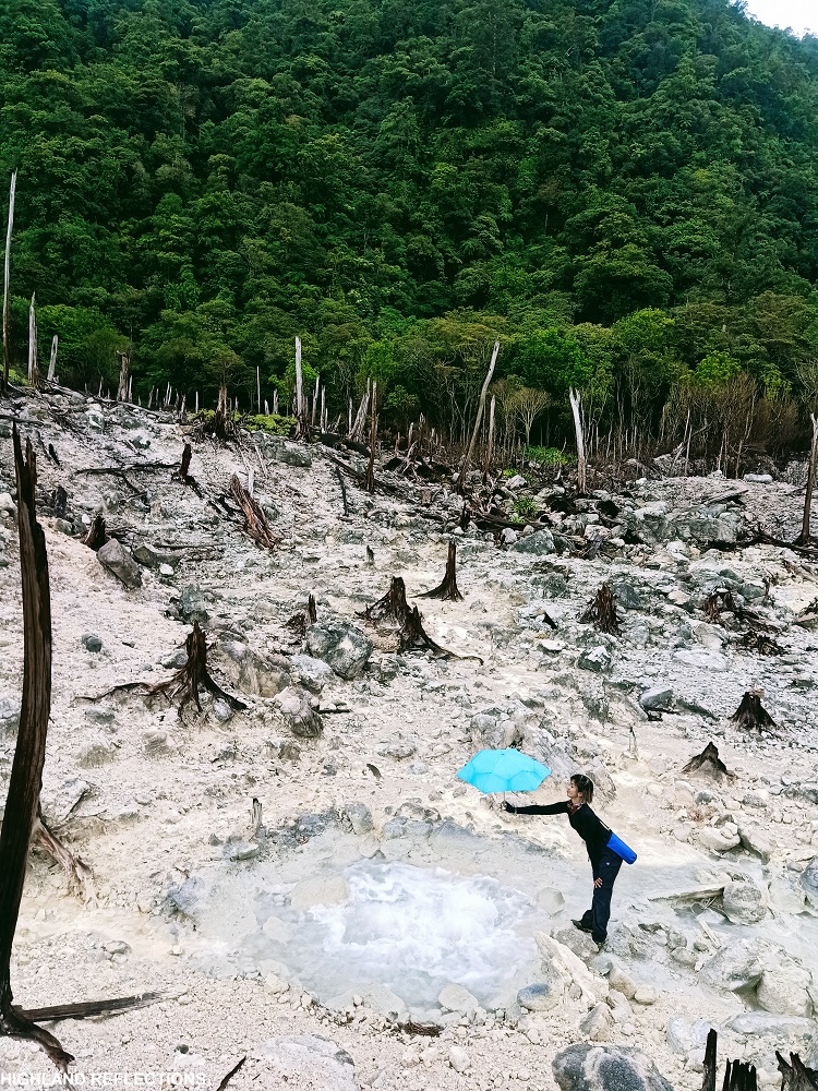
Since we will be passing through the Kaipohan Sulfur Vents, one of the landmarks in the Apolong Trail, very early in the morning going to Lake Nailig the next day, we decided to visit it the afternoon of our first day after dropping our bags at the Rancho Camp. The vents were located ten minutes away from the camp. As we were nearing the vents, the smell of rotten eggs swept the mountain air, indicating that we were near the area.
And alas, a deep white gully was revealed in front of us, stretching all the way to the base of Yagumyum Peak a few hundred meters away. This area reeks of desolation, with dead trees being consumed by the sulfuric land, as if it was plagued by an apocalypse. The water flowing in the gully had a dirty yellow shade. We went past the other side of the gully to have a closer view of this bleak vista, revealing a pond with bubbling and boiling water. And as we were contemplating the view, the afternoon rain poured.

After inhaling the rotten egg smell of sulfur, we returned to the Rancho to cook a dinner feast courtesy of Cristine and Rex. We retired to our tents afterwards. That night, there were occasional rains that made it difficult to sleep. We woke up at 4am to hike up to Lake Nailig and the summit.
Day 2: Lake Nailig, Summit, and Descent to Bediao Trail
With our heavy packs on, we marched the last remaining parts of the Apolong Trail starting at 4:30 in the morning. Coming from the Rancho Camp, we passed through the initial parts of the trail going to Kaipohan Sulfur Vents, then turned right towards the trail to Nailig. From there, the trail constantly continues upwards on a wild rainforest. We navigated this dark path during the wee hours of the second day. Along the trail in the middle of the forest, we encountered a fenced area at the side. According to Kuya Chris, it was a makeshift sanctuary to commemorate the lone hiker who possibly succumbed to hypothermia or hypertension, and died in that area a year ago.
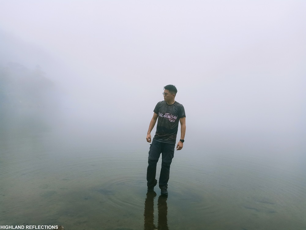
Two hours into the hike, we reached the highest point prior to Lake Nailig. Kuya Chris calls this mossy forest area as Totoy Dalaga Peak. There, we had a faint glimpse of Cebu and Siquijor in the horizon! After taking a long rest there, we descended the other side of the peak towards Lake Nailig. Somewhere along the trail is the junction going to Bediao Trail. And alas, after negotiating the large boulders at the banks of the lake, we reached the lakeside of Nailig at 6:45am.

Upon reaching the lakeside, we found out that camping at the Rancho was a good decision as there were so many campers on the lakeside. Even with just a quick survey of the area, we could already tell that we won’t have any space for our tents there. Another lucky take? The campers were already done with the summit assault once we arrived. So we will be having the summit all to ourselves!

We dropped our heavy packs at an area in the campsite and started the last 30-minute assault to the summit of Mt. Talinis. The trail starts at the back of the campsite, where we were welcomed by a thick, mossy assemblage of trees and shrubs. The path got steeper as we gained more elevation. My tiredness seeped in, causing me to be left behind. Patient as I was, I slowly continued hiking. The last portions prior to the summit had very steep sections that required the use of hands to pull myself up. I reached the summit 45 minutes after starting the final assault. Sadly, once I arrived, I found out that the entire summit was enveloped in fog.
Summit: The Nacolon Peak
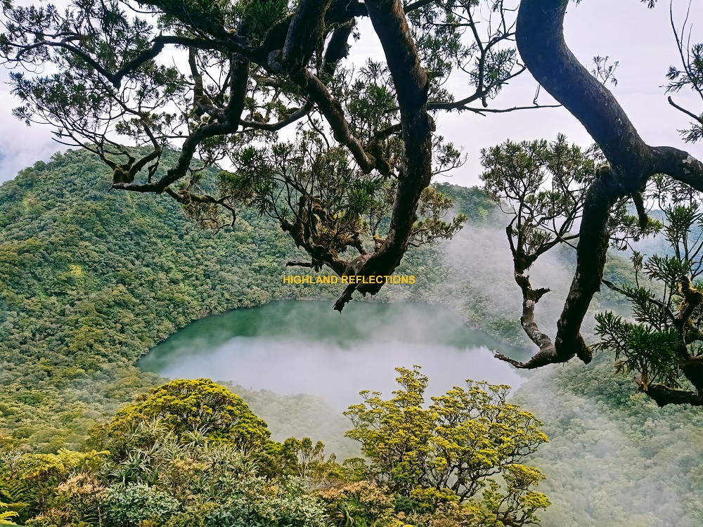
The 1,903m summit of Mt. Talinis, dubbed as Nacolon Peak, is on top of a narrow, forested ridge south of Lake Nailig. However, the 1,697m Yagumyum Peak was long thought to be the highest summit of Talinis, since it is the one directly visible from Dumaguete City, blocking Nacolon Peak from this angle. Further explorations by mountaineers made the discovery of the Nacolon Peak as the highest peak in the entire mountain range. Furthermore, according to Kuya Chris, when viewing Mt. Talinis from south, such as in the town of Zamboanguita or Dapitan, it is the Nacolon Peak that is visible. These two high peaks are evidence of the prominence and mystique of the Cuernos de Negros!
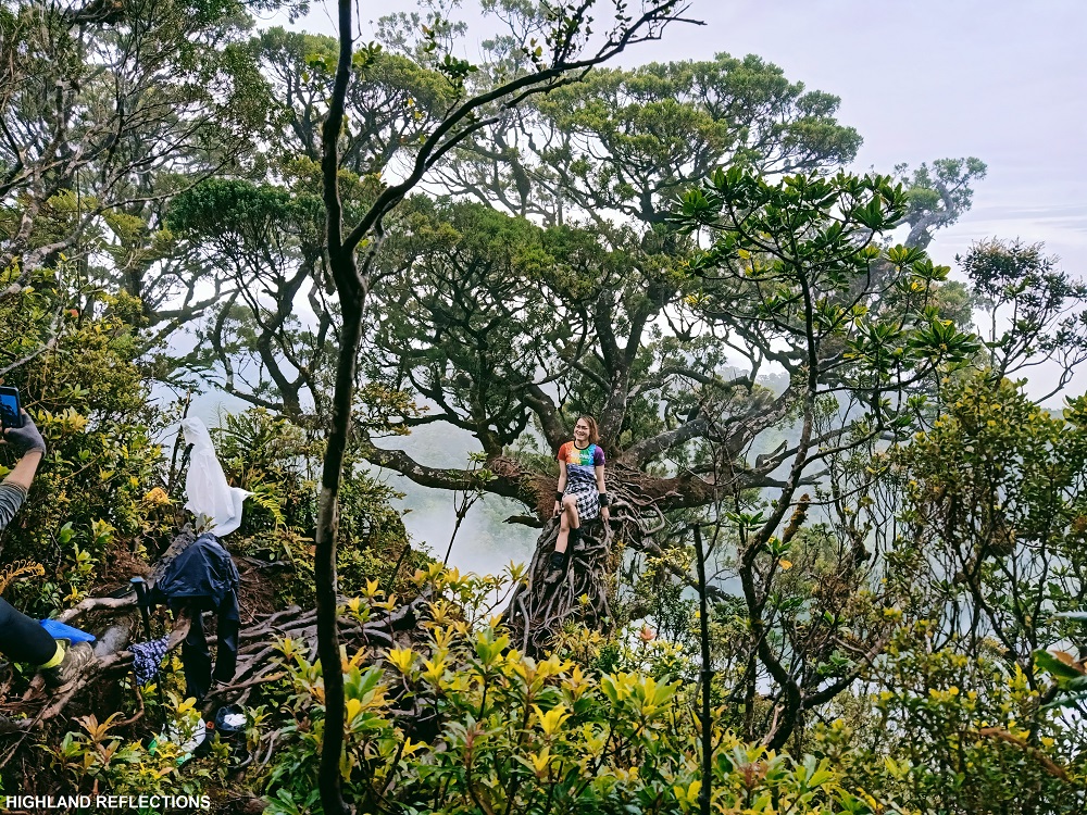
The most noticeable landmark at the Nacolon Peak is the slanted Maribuhok tree perched on the very confined summit ridge. This tree complements perfectly with the magnificent view of the seaweed colors of Lake Nailig below, which appeared to us after a few minutes of waiting! As the marvelous view of the lake was revealed to us, I held off tears—tears in awe of finally witnessing one of my long-time hiking goals. I thought that I traveled all the way here just to get turned down by the fog. But it seemed like the spirits in Talinis sensed my burning desire, and granted us with such an impressive view!
After savoring the magnificent scenery, we went down back to the lakeside camp and had our breakfast.
Descend to Bediao
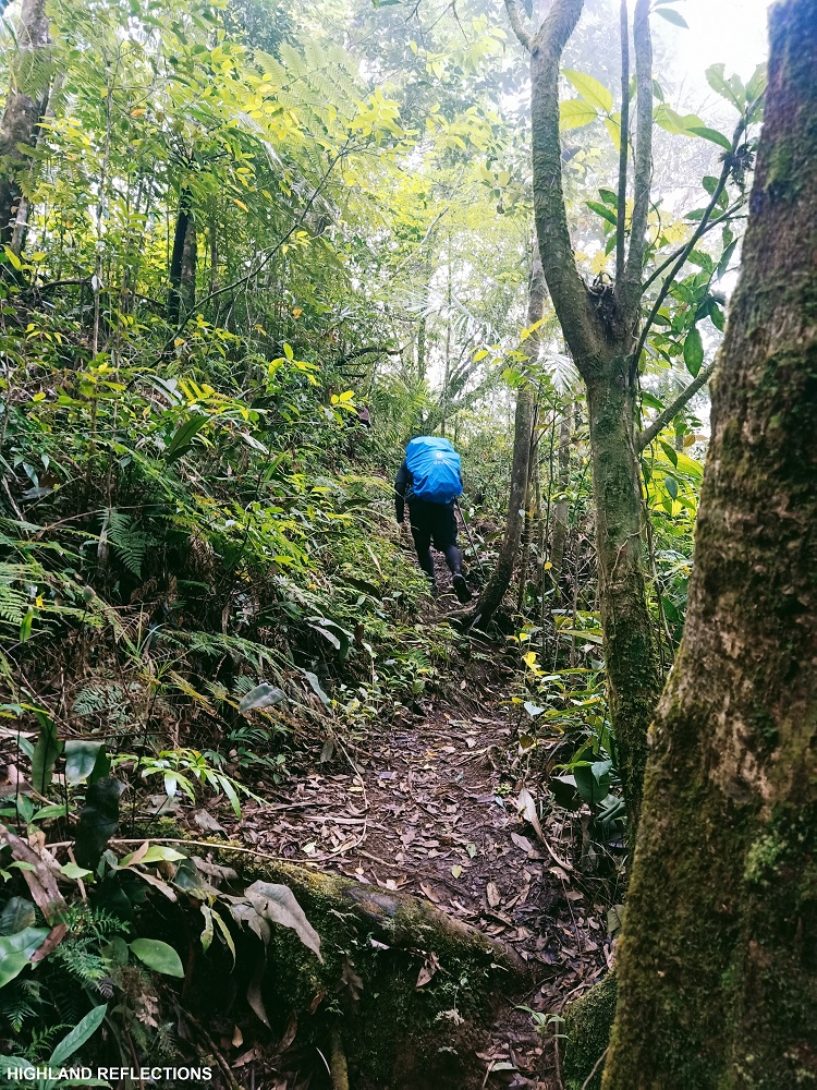
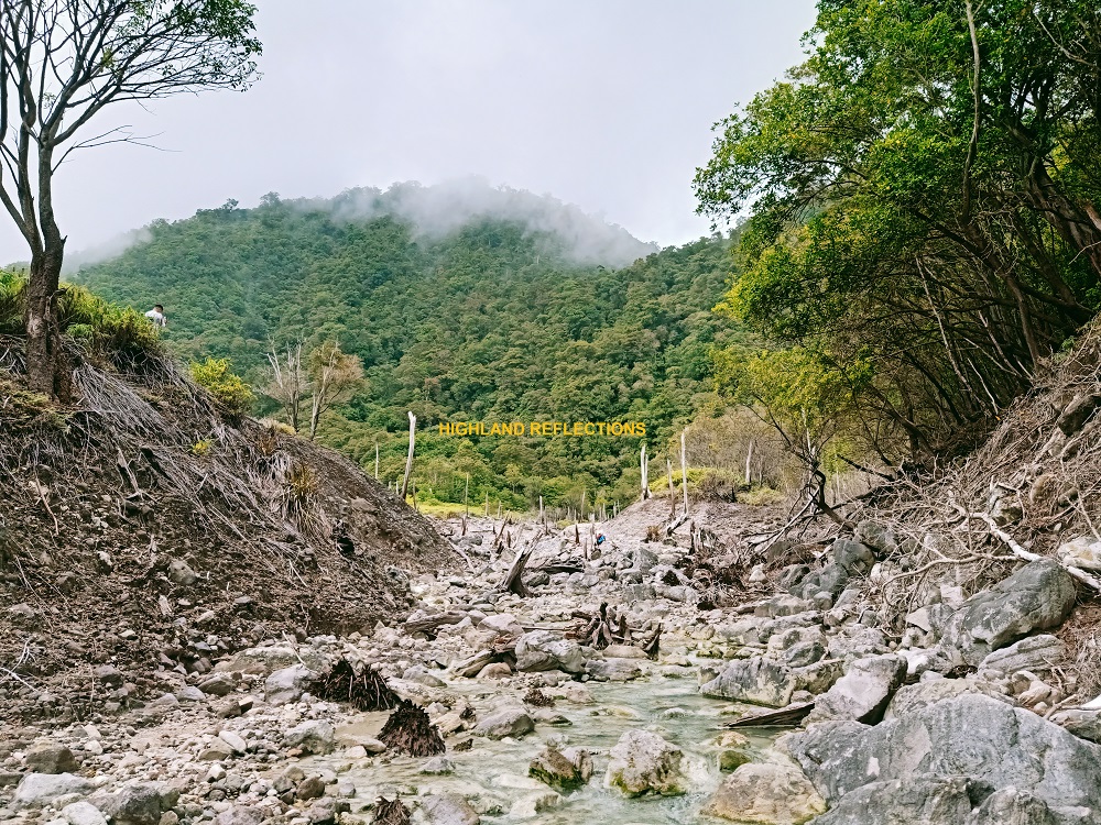
The descent to Dauin started with backtracking some portions of the Apolong Trail for a bit until reaching the junction to Bediao Trail. A kilometer away from Lake Nailig, we encountered Lake Halawig—a dried lake with mossy trees fully grown along its banks. Then, we turned left towards a very steep section in which we needed to use our hands. This short section is the entrance to the Nagbalagbag Ridge, which we traversed for less than an hour before reaching its other side. Once we reached the end of the ridge, a continuous descent on a rainforest followed.
One hour after the ridge, we reached the mystical Lake Yagumyum enveloped in fog. The lake sits right in front of Yagumyum Peak (at the opposite side of the peak is where the Kaipohan Sulfur Vents and the Rancho Camp are located; based on my STRAVA map, there is a trail connecting Lake Yagumyum and Kaipohan Sulfur Vents).
We didn’t stay here for long and only snapped some pictures of the lake. We continued the hike down afterwards. The descent was similar to that of Mt. Arayat—very steep but enjoyable.
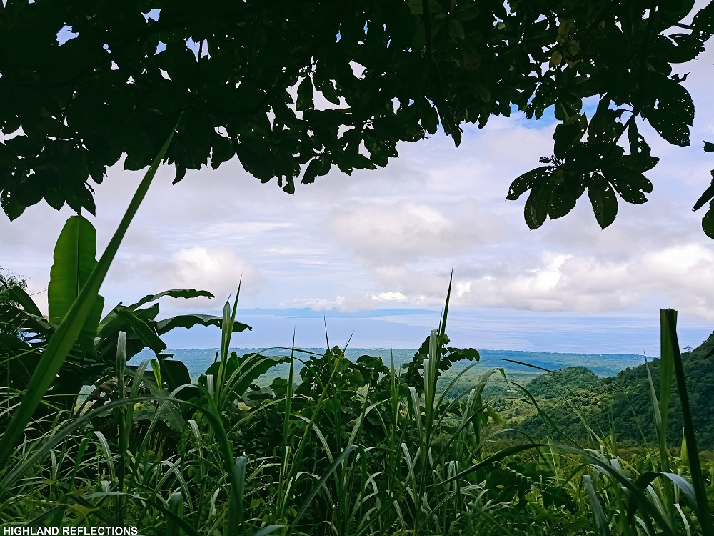
The last portion of the descent was an open area where the sea and Siquijor Island are visible. Even at those parts, the steepness did not disappear, and only did so once we exited towards the cemented road at the end of the trail. We walked some good portion of the wide road until reaching the area where our multicab was parked.
And that concludes my adventure to the Horns of Negros! We washed up and returned to Dumaguete City afterwards. My companions all returned to Manila on that day.
I, on the other hand, stayed in the city for two more days to visit some of the tourist spots nearby such as Casaroro Falls, Pulang Bato Falls, the sulfur vents in Valencia, and the Balinsasayao Twin Lakes! When I visited the twin lakes, I found out that two other prominent peaks in the Cuernos de Negros Range near the park are Mt. Guintabon (directly beside Lake Balinsasayao) and Mt. Guinsayawan (the second highest peak of the entire mountain range). I wonder if they will ever be opened to hikers!
I went home afterwards with a fulfilled soul. Daghang salamat, Mt. Talinis!
Itinerary (directly lifted from Transit Pinas)
Day 1
0600 Flight to Negros Oriental
0800 Arrival at Sibulan Airport, Dumaguete City
1015 Km. 0 start trek 678 MASL Apolong, Valencia
1040 Km 1.4 Watersource 890 MASL
1130 Km 2.6 Rest Area, 1017 MASL
1300 Km 4.5 Lagoon, Lunch, 1163 MASL
1347 Km 5.3 Guard House, 1199 MASL
1400 Twin Falls
1420 Guard House
1445 Km 6.8 Rancho, 1256 MASL
1500 Visit Kaipohan Sulfur Vents
1600 Back at the campsite, prepare dinner
1800 Dinner, socials
2100 Lights off
Day 2
0300 Wake-up call, break camp, breakfast
0430 Start trek
0600 Km 10.2 Totoy Dalaga 1615 MASL
0645 Km 11.2 Lake Nailig Campsite 1585 MASL
0745 Km 12.4 Mt. Talinis Summit 1900 MASL
0900 Km 13 Lake Nailig Campsite, breakfast
1000 Start descent via Bediao Trail
1030 Nagbalagbag Ridge, Lake Halawig
1130 Km 15.7 Lake Yagumyum 1425MASL
1315 Km 19.3 Bediao Trail exit point 800 MASL
1500 Travel back to Dumaguete
1600 Dumaguete City, late lunch

congratulations!
for reaching your dreams…
Gustong gusto ko rin kaya lang maybe i’m too old to get there…
And lack of hiking essentials…
hanggang sa pag babasa na lang ako…
God bless ang more hikes!
basta ingat lang palagi!
LikeLike