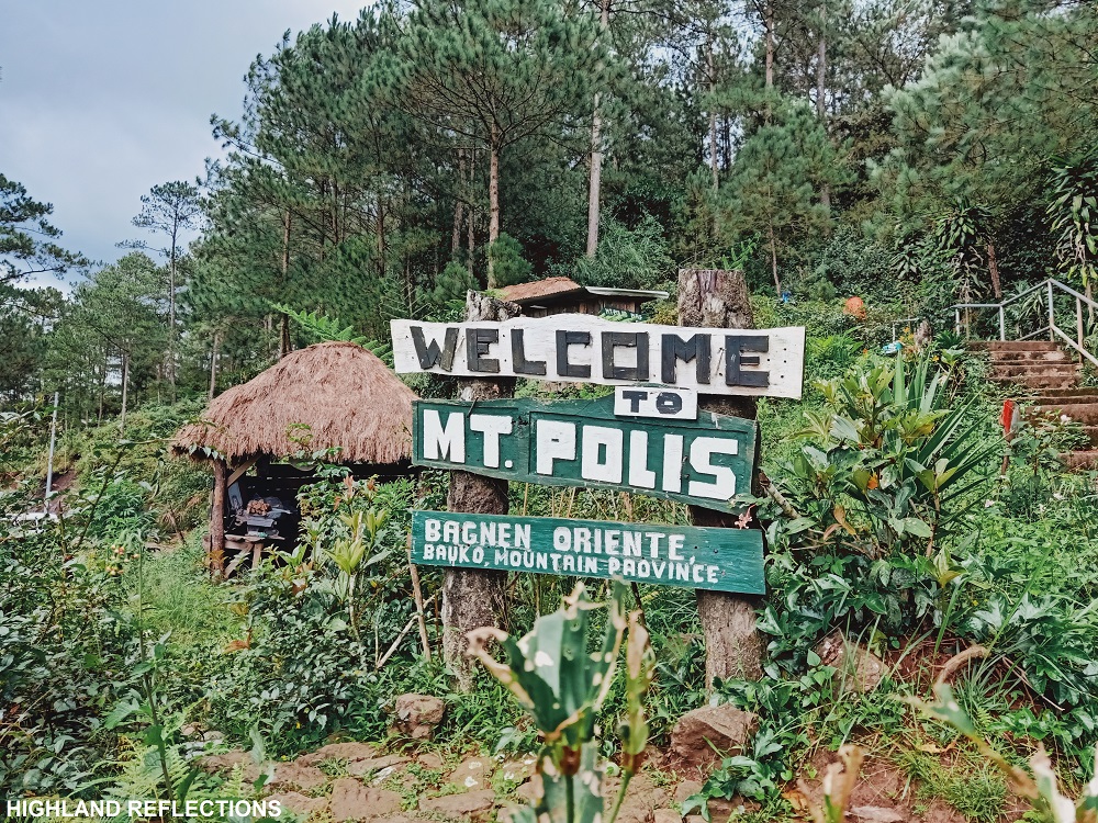
South of Sagada lies the quiet town of Bauko, one of the municipalities in Mountain Province. Although seldom heard among mainstream travel communities, Bauko boasts of hiking spots that every outdoor person should try. The most well-known hiking destination is Mt. Polis, standing at an elevation of 1,847+ MASL (not to be confused with another Mt. Polis in the Ifugao and Mountain Province border). It is an easy 15 to 30 minute climb coming from Barangay Bagnen Oriente, but can also be accessed through a more difficult route coming from Barangay Bila via the Tul-uwan Ridge.
Another hiking destination is the evocative Spanish Trail, which is a historical trail that was carved along the ridges of Mt. Am-o Mountain Range located in the western side of the town. This mountain range long ago served as a great vantage point for Spanish and American colonizers to access the far-flung town. The trail passes through five peaks, namely: Am-o peak 1 & 2, Bato, Mangasil, and Kapowao, with an off-trail to the last and highest peak which is Mt. Nentingle. The characteristic of the trail are as follows:
BAUKO 6 PEAKS via SPANISH TRAIL & MT. POLIS
Major jump-off point: Bila, Bauko, Mountain Province
Exit point: Bagnen Proper, Bauko
Mt. Polis jump-off point: Bagnen Oriente, Bauko
Days required / Hours to summit: 1-2 days, 6-8 hours (Spanish Trail to Polis)
Specs: Major climb, Difficulty 5/9, Trail Class 1-3, 16km distance (Bila-Spanish Trail-Polis)
Features: View of Bauko’s rice terraces, pine forests, mossy forests, community trails
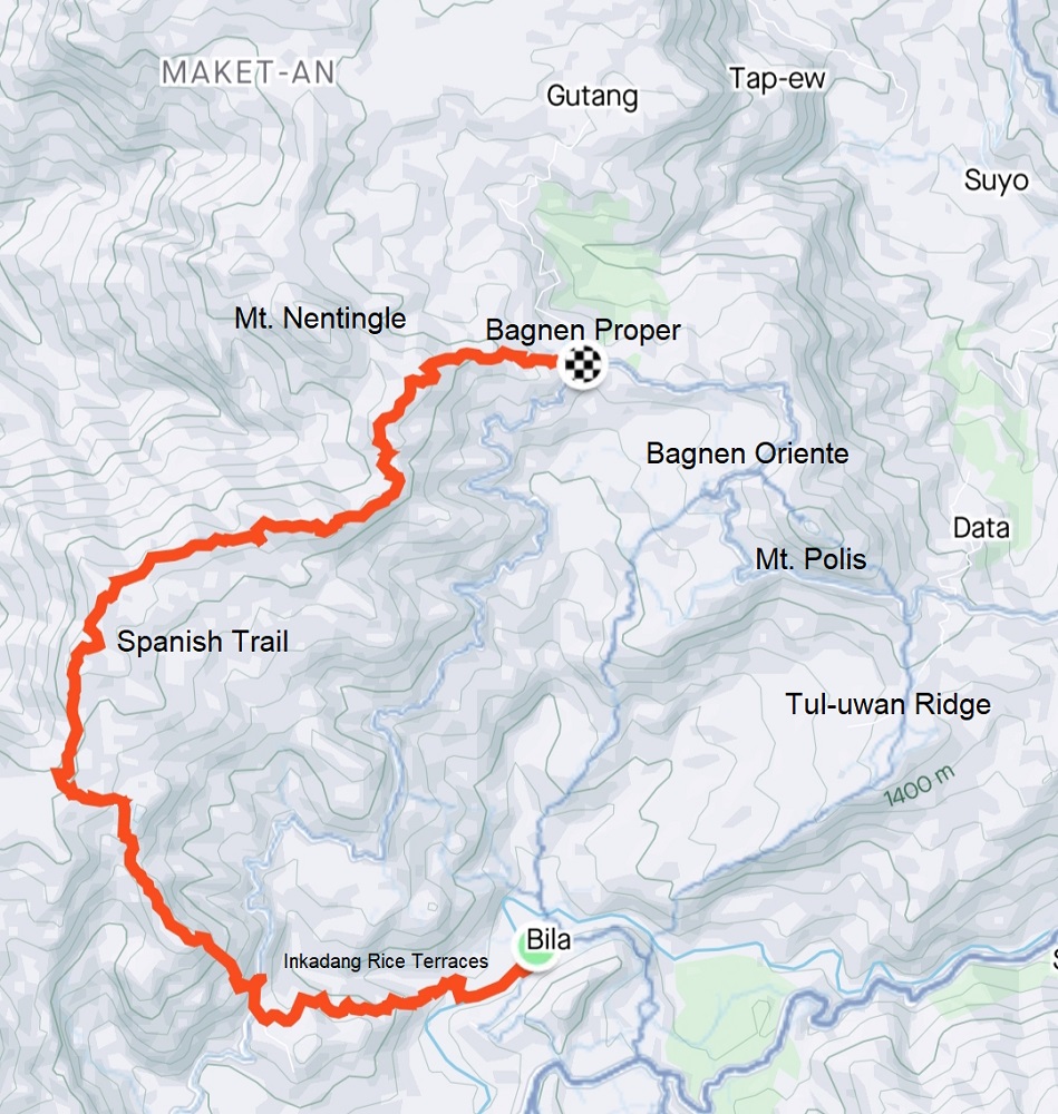
For this 2-day hike which happened in June of 2022, we commenced the hike in Barangay Bila, passing through the Inkadang Rice Terraces, traversing the entire Spanish Trail and exiting towards the other side in Bagnen Proper. We ended our first day by setting camp at Mt. Polis, ascending it via the short trail in Bagnen Oriente.
However, one can also do the reverse: starting form Bila, one can hike up the longer Tul-uwan Ridge trail going to Mt. Polis and setting camp there on the first day. Then the second day can be a hike up the Spanish Trail, entering via Bagnen Proper and exiting towards Bila, thus, forming a circuit trail.

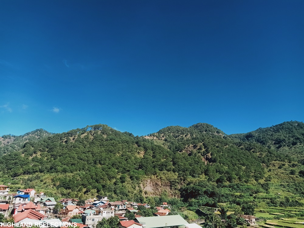
From the house of our guide, Jomar, Mt. Polis was already towering in the northern direction, while the Mt. Am-o Mountain Range stretches on the western side nearby.
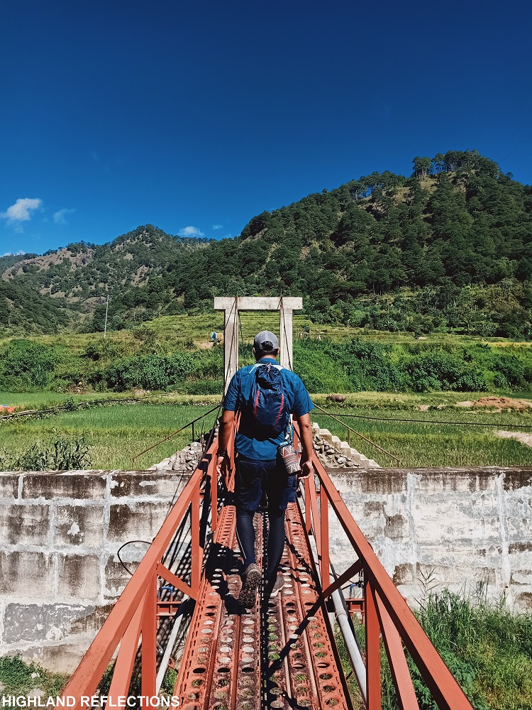
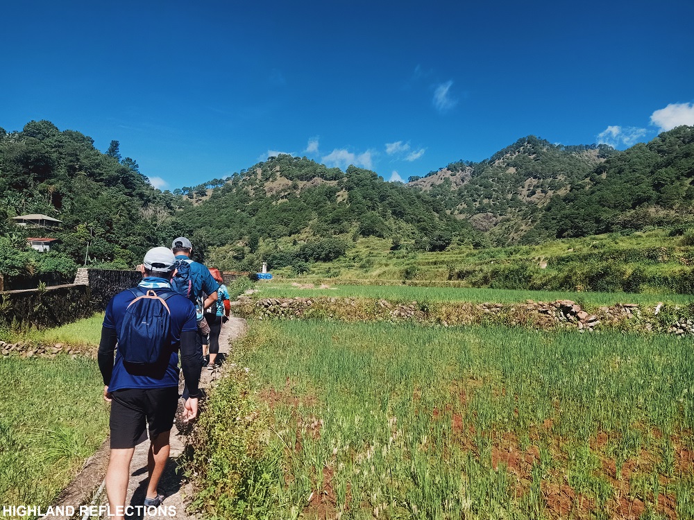
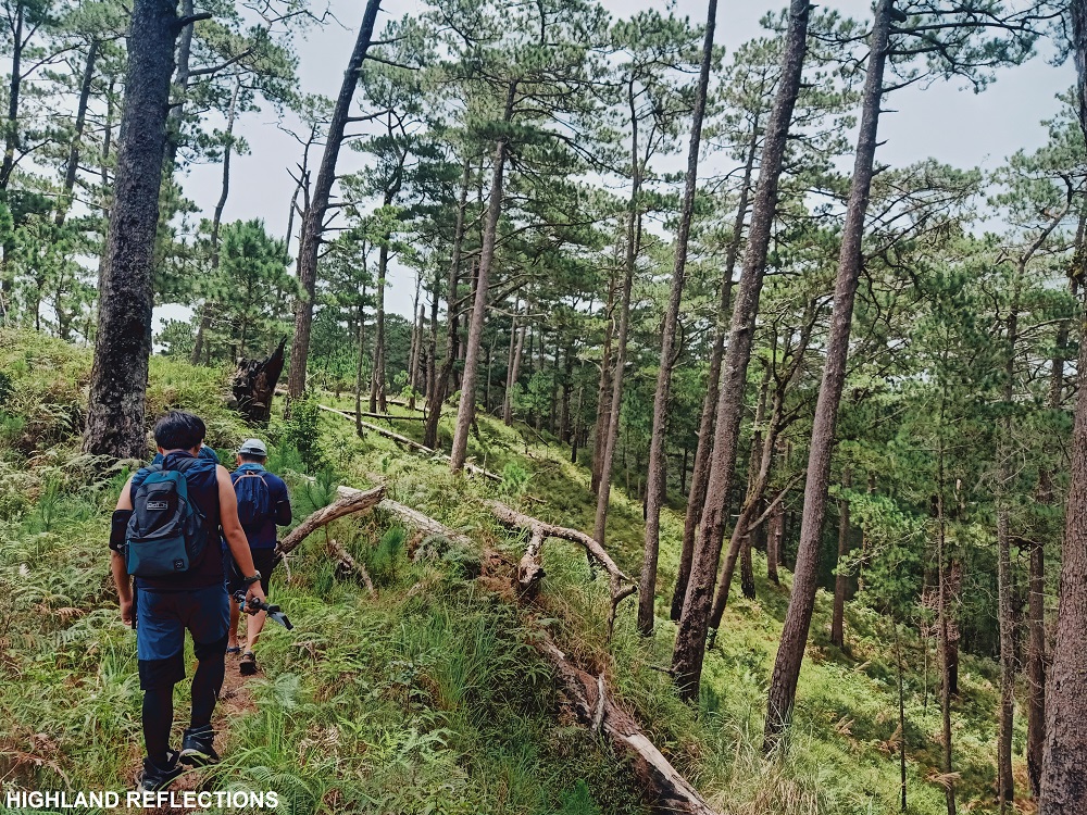
We started the hike from Bila at exactly 9 in the morning. From the community in Bila, we descended towards and traversed the Inkadang Rice Terraces, passing through cemented dikes and steel bridges until we ascended towards a muddy trail in the midst of a pine forest.
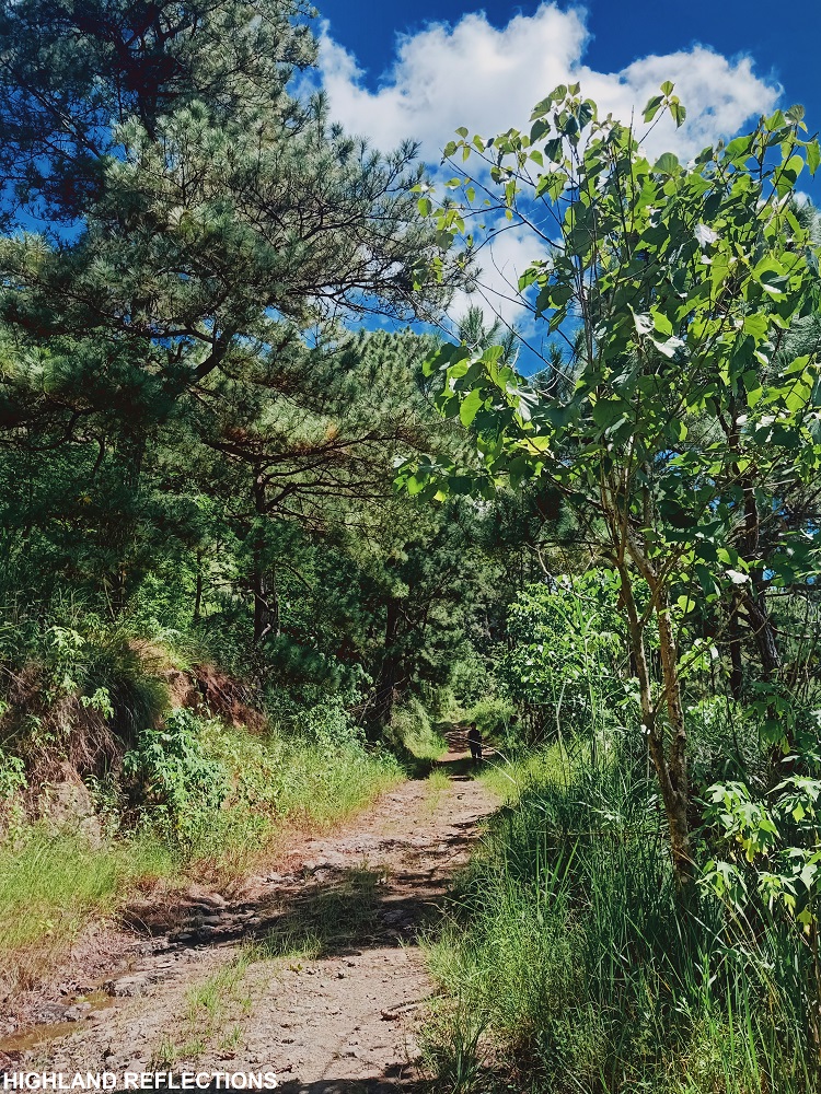
This trail exits through the Abatan-Bagnen Road, which goes directly to Bagnen Proper, the exit point of the Spanish Trail, located 8 kilometers from that point. Hence, those who are not up for the challenge of hiking the Spanish Trail can just take this long road. During our hike, some of our companions chose the road. But there are those craving for a more difficult adventure, like me, who chose to take the challenge climbing the Spanish Trail located 400 meters above the left side of the road.
The entrance to the Spanish Trail is located somewhere along the side of the road nearby.
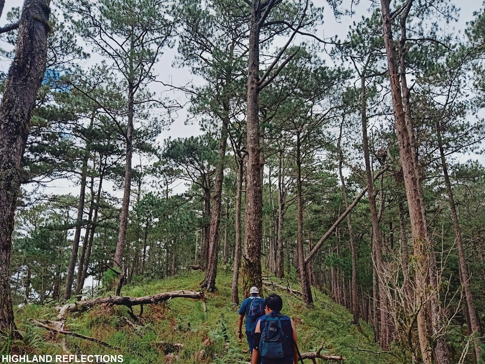
The trail coming from the road was a very steep path surrounded by pine trees. The trail can be very slippery as it is carved along a very steep slope. The last assault to the first peak was the steepest part, and is actually akin to the cardiac trail of Mt. Damas with its steepness. We reached the first peak an hour after starting the hike from the road. With three of us in the lead group, we snapped some photos and took some breathers until continuing the hike up to Peak 2.
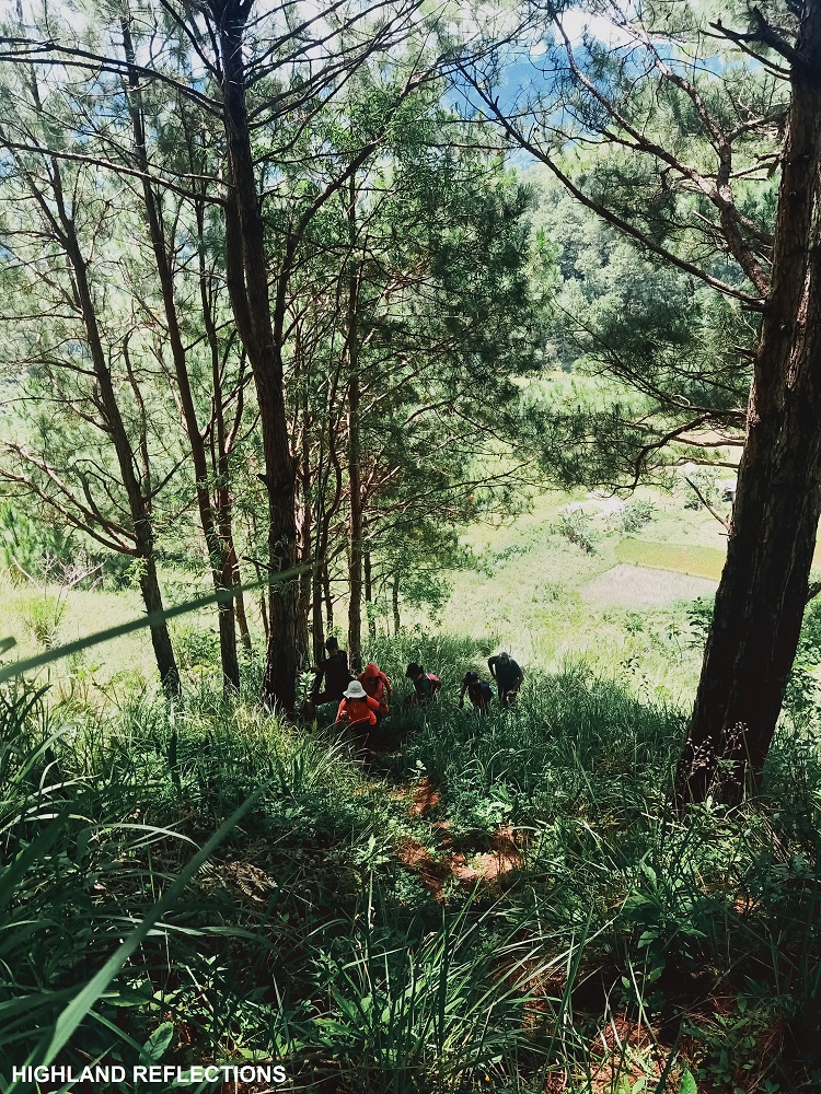
The trail from Peak 1 to 2 was reminiscent of the pine forests of Mt. Ugo and Mt Ulap, pine trees beautifully scattered along red rolling slopes. Once we reached the bottom of Peak 2’s slope, we decided to take an off-trail that goes directly to the other side of the summit, and waited for our companions there since we didn’t have a guide with us.
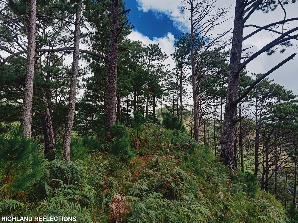
Once they arrived, we continued the hike and passed through more wide pine forest ridges. Along the trail is a water source hidden in some shrubs. From here, the trail becomes scattered with thick shrubs complementing the pine trees, where blood-sucking limatiks made their presence felt, biting some of our companions. Fog also caught up, enveloping the area.
The trail to Bato, Mangasil, and Kapowao were actually pretty long along thick shrubs and pine trees. And since we hiked after the immediate reopening during the ‘new normal’, summit markers were still not installed during our hike. Hence, we passed through those three mentioned peaks without stopping by. From Kapowao, the trail transformed into a mossy forest, where we encountered an off trail going to the highest peak, Mt. Nentingle.
Sadly, Nentingle was still closed during our hike because the trail had thick vegetation and still wasn’t cleared. Also, security concerns were cited by our guide. Hopefully, Nentingle would open soon, since, according to some blogs, it provides the best view of Bauko and the neighboring towns!
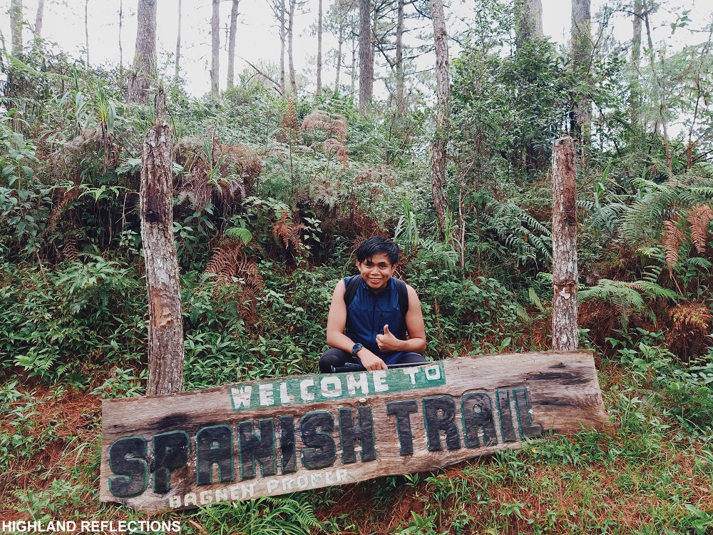
The last stretch of descent passes through what locals call as “Cotcot Aso” (literally meaning dug by a dog), which seems to pertain to a spring located along the trail. From Cotcot Aso, the last portion of the trail is where the “Spanish Trail” sign marker is located. From here, it only took us a few minutes to reach Barangay Bagnen Proper. A strong rain poured as we reached the barangay.
Once the rain stopped, we walked the ascending road from Bagnen Proper going to Bagnen Oriente. It would probably take at least 30 minutes of walking, so when an empty truck passed through, we hitchhiked up to the trailhead of Mt. Polis at the side of the road. There, our van was waiting for us to pick up our heavy backpacks.
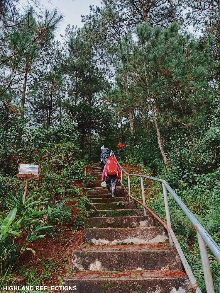
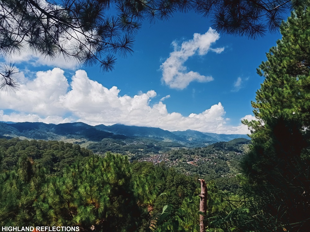
From the trailhead of Mt. Polis, a series of cemented stairs is carved all the way to the summit area. It took me less than 20 minutes of ascent before reaching the summit, where we pitched our tents to camp overnight. Rain poured again as we were setting our tents, making me retire to my temporary home for some long hours. But alas, as the dawn broke, the skies cleared and we had an awesome three hundred and sixty degree view of the surrounding.
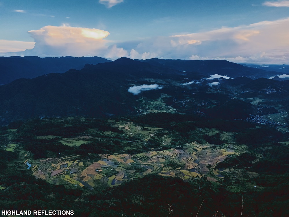
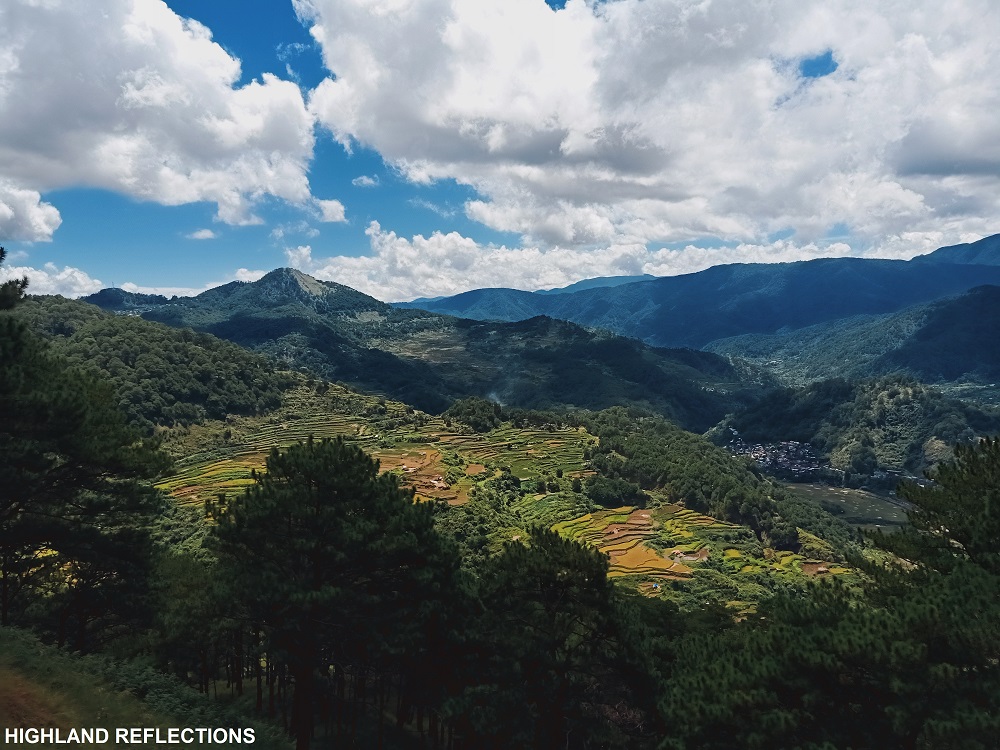
To the southwestern direction, one can view the entirety of the town of Bauko, with layers and layers of level rice terraces dominating the entire vista. The entire valley is flanked by mountain ranges. To the right, one can spot the entire Mt. Am-o mountain range, with its highest peak, Mt. Nentingle, saying hi to us pesky neighbors in Mt. Polis. In the northwestern direction are the mountain ranges of Besao, and past that, Ilocos Sur’s Tirad Peak.
In the northern direction, we spotted Sagada and some of the mountain ranges surrounding it, such as Mt. Ampacao. On the western direction is a gigantic, forested mountain, which was none other than the 10th highest summit of the country, Mt. Kalawitan.
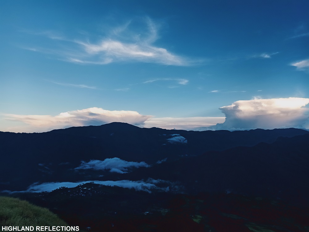
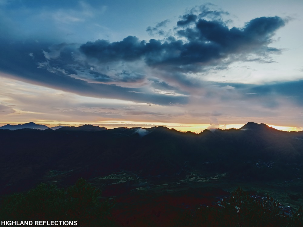
With the setting sun to the west and the rain clouds smothering some of the mountain slopes surrounding Mt. Polis, what better way to end an epic hike in this far flung town.
Itinerary
Day 0
09:00PM Depart from Manila
Day 1
08:00AM Breakfast in Bauko, prepare
09:00AM Start hike
10:00AM Start assault to Peak 1
11:00AM Peak 1
11:30AM Peak 2
12:00PM Water source, lunch
12:30PM Resume hike
02:30PM Cotcot Aso
03:00PM End of Spanish Trail
05:00PM Mt. Polis, set camp
Day 2
05:30AM Wake-up call, watch sunrise & breakfast
09:00AM Start descent
10:00AM Bila, wash-up
12:00PM ETD to Baguio
06:00PM Baguio City, dinner
Special thanks to Rabas Outdoors (Win Calleja) for this hike! For more awesome climbs up north, you may contact his Facebook page. Special thanks to Jomar Buclay and Bauko Tourism for this hike.

One thought on “Mt. Polis & The Spanish Trail of Bauko”