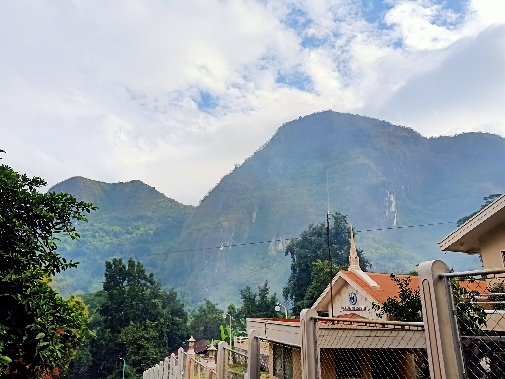
Last February 5, 2022, I was able to visit the mountains of Sitio Wawa. Situated in the town of Rodriguez (formerly Montalban), Sitio Wawa in Barangay San Rafael is a melting pot for outdoor enthusiasts. From casual travelers, bikers, hikers, trail runners, and rock climbers, Sitio Wawa bustles like no other mountain community in the Philippines.

The diversity of peoples in the area is matched with the diversity of its mountains. Sitio Wawa is filled with numerous mountains, with a various array of trail characteristics, elevation, and technicalities. Among these are three titanic limestone mountains: Mts. Binacayan, Pamitinan, and Hapunang Banoi, dubbed today as the “Montalban Trilogy v1”.
Prominent among hikers searching for a quick mountain fix near the Metro, Mts. Binacayan, Pamitinan, and Hapunang Banoi offer a challenging yet manageable hike for outdoor enthusiasts. Each individual mountain can be completed in a span of three to four hours, depending on the pace, and can be combined for those thrilling for an extra challenge.
Based on accounts of other hikers online and my own observation, here are the characteristics of the entire trilogy:
Jump-off point: Sitio Wawa, Brgy. San Rafael, Rodriguez, Rizal
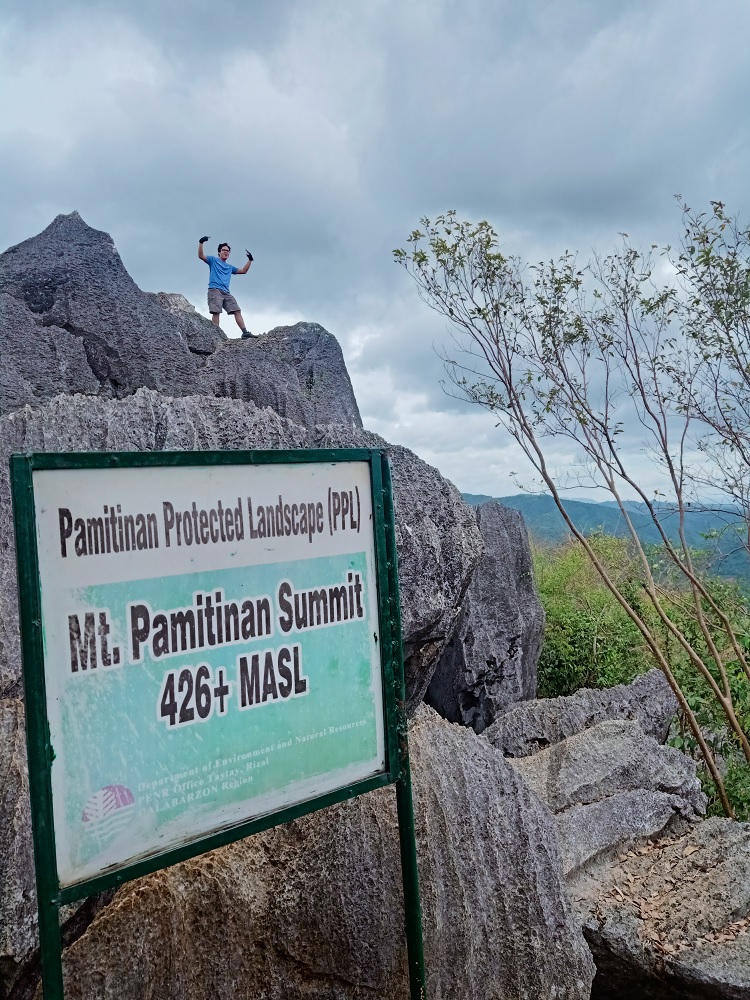
Elevation: 424+ MASL (Binacayan), 426+ MASL (Pamitinan), 517+ MASL (Hapunang Banoi)
Specs: Major climb, difficulty 5/9 (Minor climb for each mountain, 3/9 for Binacayan and Pamitinan, 4/9 for Hapunang Banoi)
Days required / Hours to summit of each mountain: 1 day / 1.5-2 hours
Features: limestone formations, scenic views of the Sierra Madre Mountain Range
Besides their notability among outdoor enthusiasts, these three mountains are filled with stories and historical significance. From folktales of natural elements and ghosts sighted in the area, historical narratives of the Katipunan’s refuge in the caves of the mountain, and legends surrounding the mythological figure Bernardo Carpio, who was said to be responsible for forming the gorge between Binacayan and Pamitinan by splitting the two gigantic rocks with his bare hands as an act of liberation—these three mountains are surrounded by thrills and mystique that add flavor to the adventure.
Here is an account of my hike up the three mountains:
Mt. Binacayan
I have hiked Mt. Binacayan before in 2018 (you can read my blog of that hike here). Pronounced as ‘Binikayan’ by the locals, Mt. Binacayan forms one half of the gorge that was said to be split by the legendary mythological figure Bernardo Carpio.
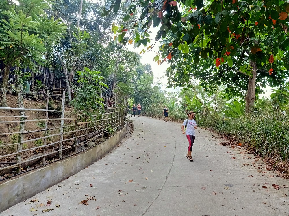
We started the hike at around five in the morning. The hike starts on an ascending cemented road which stretches for almost a kilometer, giving us a significant amount of elevation gain. Our guide then led us on a flat footpath on the left where a gradual ascent ensues. This ends on a junction with a house and still closed eatery. Last 2018, we took the trail to the right. This trail is longer but provides more scenic views and landmarks along the trail. For this hike, our guide led us the shorter but steeper trail which I took as a descent trail last 2018.
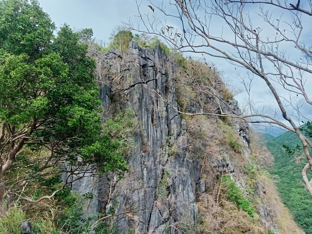
After having a take five rest at the closed store, we continued with the hike. The trail past the store was all ascent. We were immediately greeted with sharp limestones which we needed to climb using all four limbs. There were many instances where layers and layers of thin sharp limestones served as handholds and footholds. The trail was highly technical. After minutes of technical rock scrambling portions, I was able to reach the summit area of Mt. Binacayan.
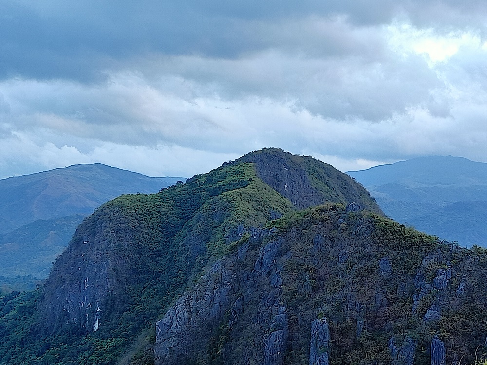
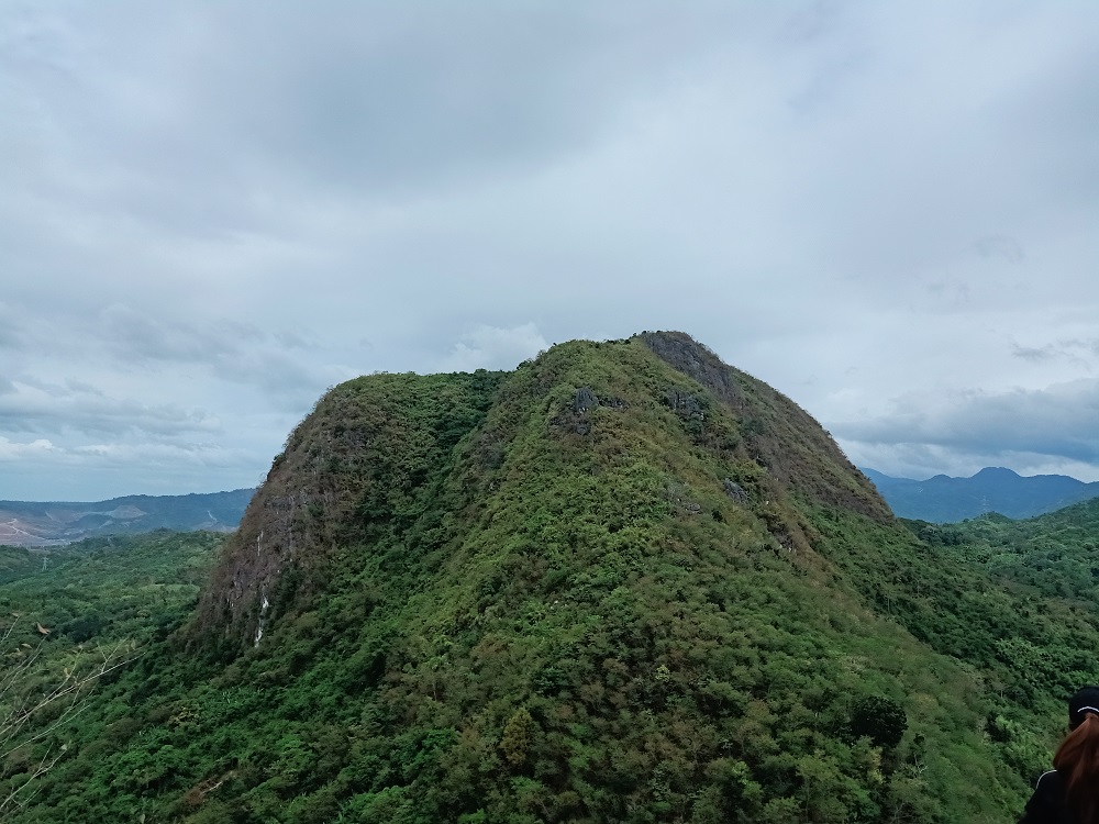
The summit of Binacayan provided a three hundred and sixty degree view of the surroundings. In the northern direction is the neighboring twin Mt. Pamitinan, with Mt. Hapunang Banoi’s higher summit peeking behind it. To the near right of Mt. Hapunang Banoi is Mt. Ayaas, which I last climbed way back in 2017. Behind Mt. Ayaas is the towering Mt. Oriod in Norzagaray, Bulacsn. To the left of Hapunang Banoi is Mt. Balagbag. Shifting my perspective to the northwest, one can have a limited view of the town of Montalban, and in the horizon, Mt. Arayat. A large portion of the southwestern and southern direction is dominated by the neighboring Mt. Parawagan.
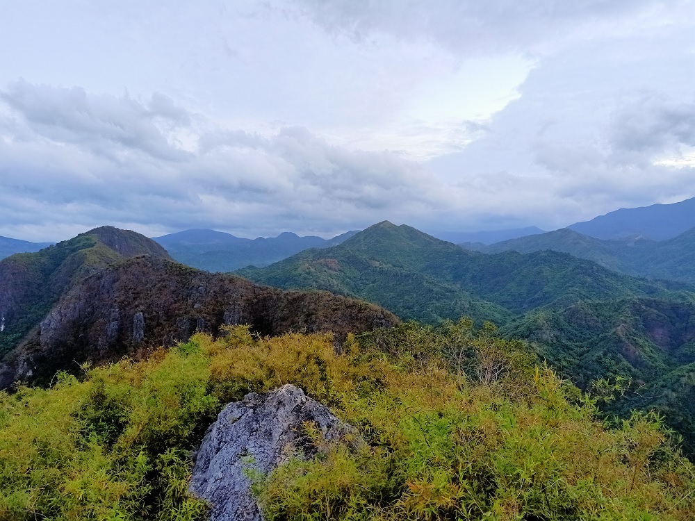

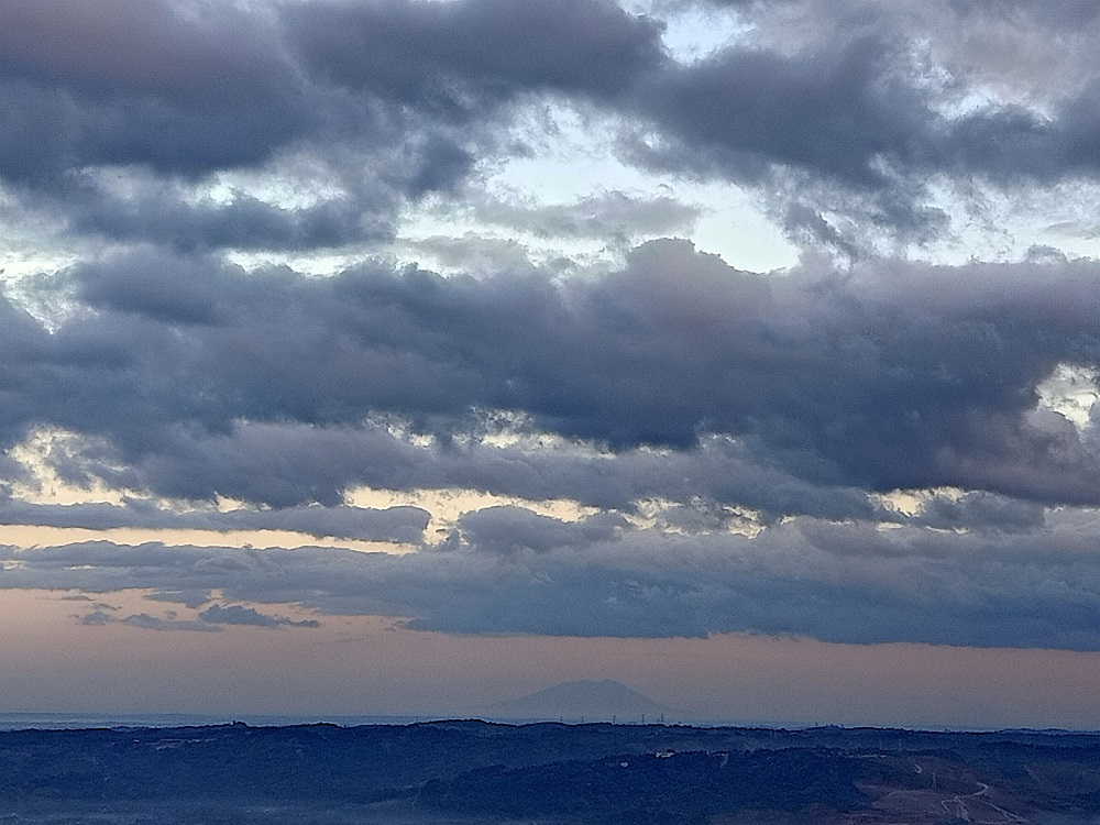
To the east and southeast, one can have a view of the nearby mountains in Tanay. The most prominent of these would be Mt. Domire (ESE), Mt. Tukduang Banoi (E), and Mt. Irid (ENE) which was covered in clouds.

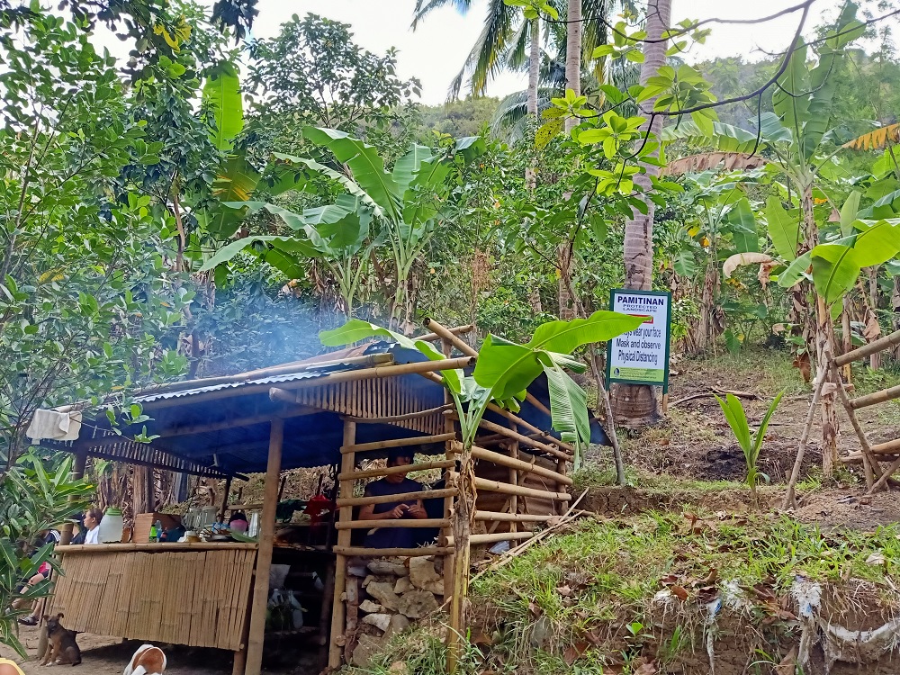
Since we had the summit all to ourselves, we took the chance to snap pictures around the summit area. Afterwards, I went off to descend on my own. In no time, I reached the store which, upon my arrival, was now open! I ordered a stick of banana cue, a cup of buko juice, and a cup of avocado shake to quench my thirst. After such a needed food break, I went ahead and followed the trail that exits through the cemented road. I ran a good portion of the descending pavement and reached the barangay hall in no time.
We had an early lunch at the house of our guide and took the chance to rest. Sun was now up and hot.
Mt. Pamitinan
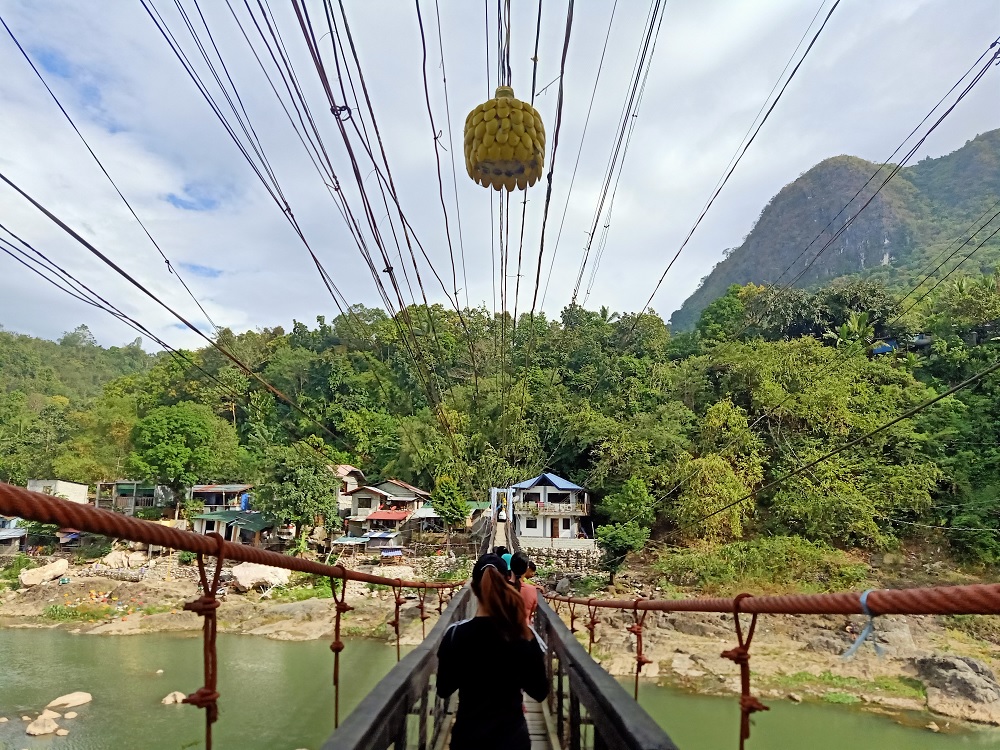
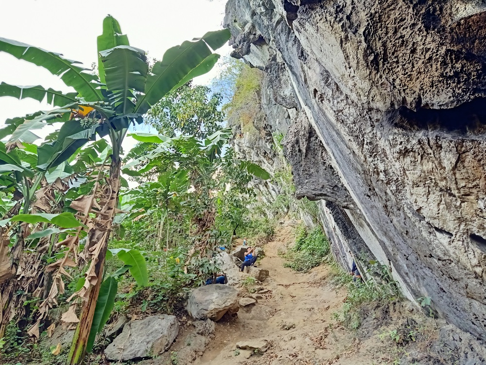
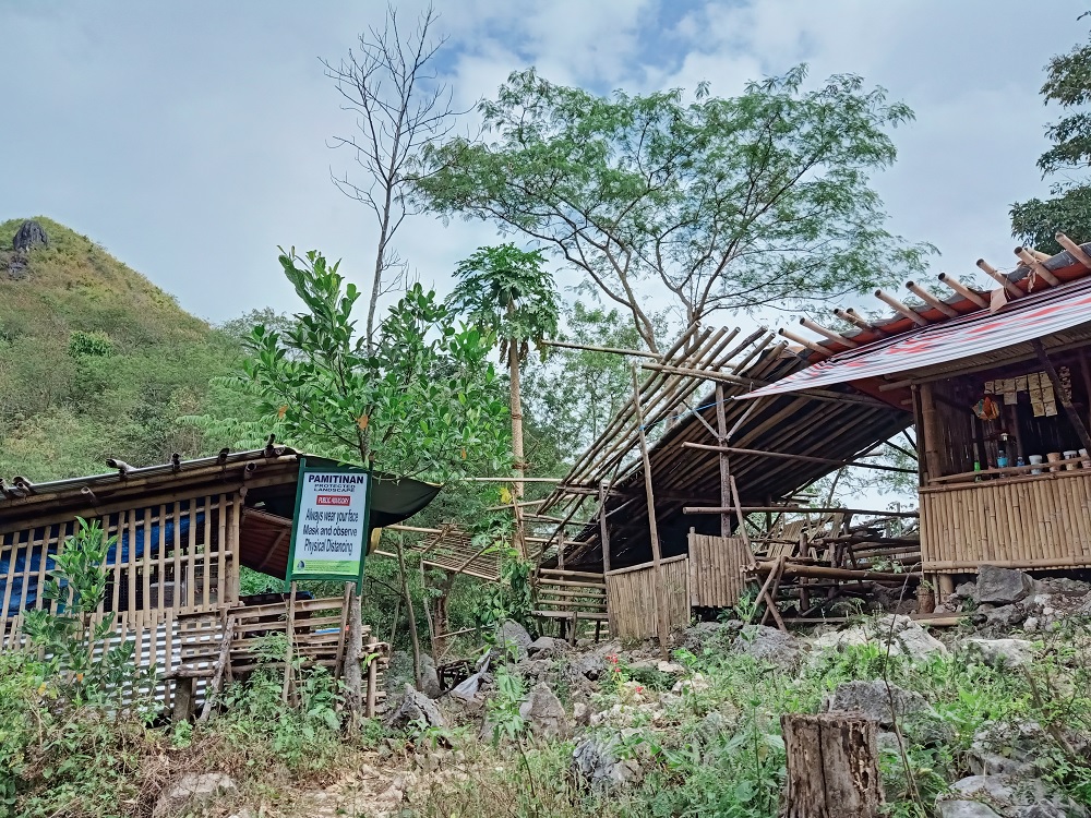
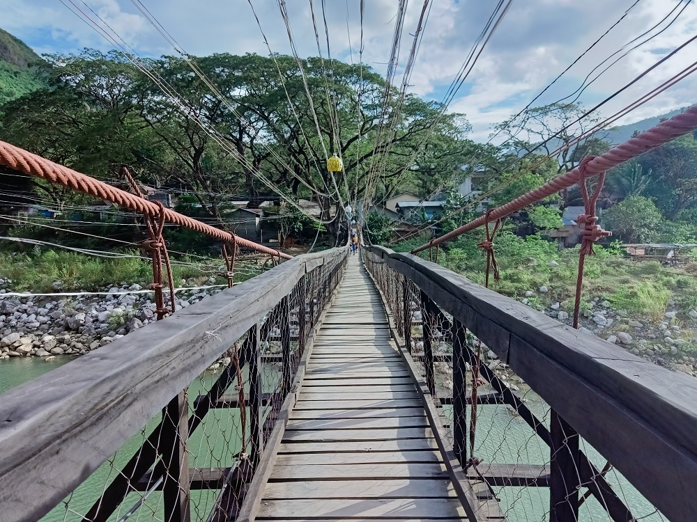
At 9:30 in the morning, we started the hike to the conjoined Mt. Pamitinan and Mt. Hapunang Banoi. The first part of the hike involves crossing a foot bridge on top of Wawa River. Past the foot bridge is a flight of stairs leading to a neighborhood community at the base of Mt. Pamitinan. At the back of this community is where the trail en route to the junction between Pamitinan and Hapunang Banoi starts. This trail is dominated by shrubs and fruit trees, mostly banana trees.
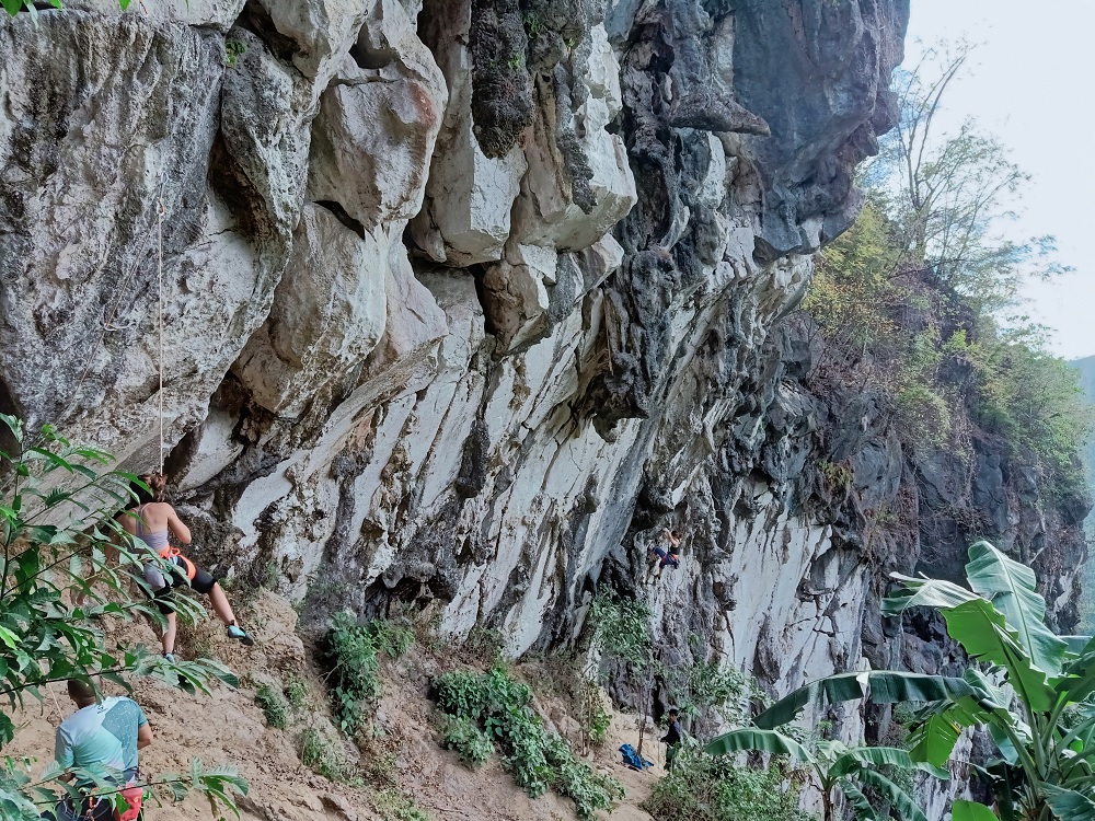
We passed through a balete tree which is said to be very near the Pamitinan Cave. After a gradual ascent, we reached a sandy trail where to its right is a gigantic wall of boulder where rock climbing enthusiasts were having a field day.
After that portion, I expedited my pace and went ahead. The trail continues on a gradually ascending path with fruit trees on the side. A few minutes later, I reached the junction of Mt. Pamitinan and Mt. Hapunang Banoi. I immediately rested at one of the sari-sari stores in the area.
After a long round of rest, we commenced the hike up to Mt. Pamitinan, which was on the right side of the junction. The trail was all limestone from the get-go. Similar to Binacayan, the limestones were complemented by bamboos and other shrubs. We needed to scramble upwards on sharp limestones and make our way through a canopy of boulders. We then entered a short section of a bamboo forest until reaching the viewpoint of Pamitinan after almost an hour of ascent. This viewpoint is where most hikers strike a perilous pose on the edge of a boulder with Sitio Wawa serving as a backdrop below.
One by one, we each took turns to strike different poses on the boulder. It was honestly scary to get there, but once you get the hang of it, and with the thought of not looking down, it becomes easier and much more comfortable making movements around the boulder. I was still a bit nervous though since my left, right, and front are all ravines where I could fall to the community below. Basta ang mindset lang, ‘wag tumingin sa baba!

After everyone had successfully taken their photos on the picturesque spot, we decided to proceed to the summit, which was just a minute away from the viewpoint. Similar to its twin mountain, Mt. Binacayan, the summit area of Pamitinan is a boulder perched on top of the mountain. The boulder, though, was a bit more difficult to climb with its short 90-degree roped segment. Our guide forbade us to climb it since we were chasing time. However, three of us braved through and climbed it anyway. It provided a spectacular view above, with Mt. Binacayan on the south, and Mt. Hapunang Banoi in the north.
We then decided to go down, reaching the junction more than thirty minutes after starting the descent. We cooled off at one of the stores and took a much needed long rest.
Mt. Hapunang Banoi
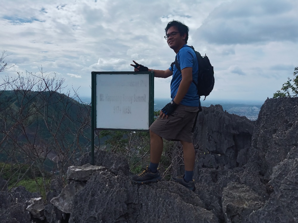
“Where the eagles feast” has a such badass ring to it. Mt. Hapunang Banoi, literally meaning where eagles eat, is the tallest and most difficult among the three Montalban limestone mountains. Standing at an elevation of more than 500 meters, Mt. Hapunang Banoi provides the longest trail in the Montalban Trilogy.
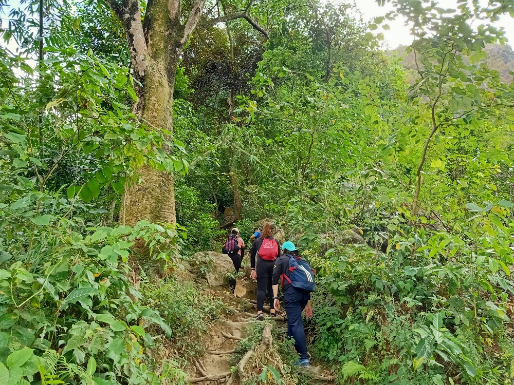
The trail going to Mt. Hapunang Banoi starts on a constantly ascending footpath in a forested area at the left side of the junction. This ascending footpath stretches longer than that of Pamitinan and Binacayan, and has some short boulder scrambling segments in the middle. At the top part of the mountain is a long flat footpath in the middle of a bamboo forest.
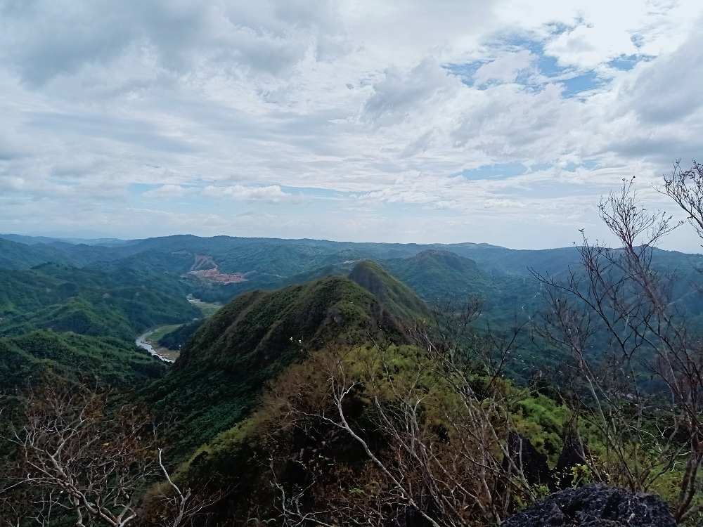
At the end of this footpath is a view deck where one can have a sight of the pillar-like structure of Mt. Hapunang Banoi’s summit. To the right of this giant boulder pillar is the nearby Mt. Ayaas! We had a short rest there before taking the final, technical, rock-scrambling assault to the summit of Hapunang Banoi.
Upon reaching the summit, we took short turns in taking photos at the signboard marker. The summit wasn’t as spacious as that of Pamitinan and Binacayan’s. We can’t even sit since we were stepping on jagged limestones. While everyone was taking their photos, I explored the back side of the summit and discovered that there is actually a higher area being covered by a thick foliage of bamboos. This was probably the true summit of Mt. Hapunang Banoi. I wanted to ask my guide about it, but I didn’t bother since, according to my STRAVA map, we were very, very close to the summit area.
We descended immediately after taking pictures at the summit marker. My companions, then, snapped some pictures at the view deck. I just bothered to rest since I was getting exasperated. We descended afterwards and reached the junction in less than an hour. I ordered ice-cold water from the sari-sari store to quench my thirst.
After less than thirty minutes of rest, we decided to go down to the community and finish the entire trilogy hike. Although I decided to tag along with the rest of the group in the initial parts of the descent, I decided to go ahead after passing through the big wall of boulder where rock climbers were having their field day. I reached the house of our guide at 4 in the afternoon.
Montalban Trilogy v1: Finished!
Since I already went to Wawa Dam in 2018, I decided to just take a bath and rest at the house of our guide. Our companions, though, spent an hour at the dam. When everyone was finished, all of us went back to the Metro and on with our lives.
The Montalban Trilogy, although doable in half a day, was still surprisingly challenging than expected. Despite having very short trails, the rock scrambling portions provided enough difficulty for a hiker like me who was searching for an aerobic workout. Here’s to hoping I get to explore some of the other Montalban mountains in the future!
Itinerary
04:00AM Breakfast at Sitio Wawa
05:00AM Start hike to Mt. Binacayan
06:00AM Summit
07:30AM Start descent
08:00AM Junction store
08:30AM Jump-off, rest, early lunch
09:30AM Start hike to Pamitinan & Hapunang Banoi junction
10:00AM Junction, rest
10:30AM Start assault to Pamitinan
11:30AM View deck, take pictures
12:15PM Summit of Pamitinan, take pictures
01:00PM Junction, rest
01:30PM Start assault to Hapunang Banoi
02:30PM Summit of Hapunang Banoi
03:00PM Junction, rest
03:30PM Start descent to Sitio Wawa
04:00PM End of hike
