Last 13th of February, 2022, I was able to finally climb one of Laguna’s mountains, Mount Kalisungan in the town of Calauan. Joining me in this endeavor are my friends Cristine and Fara, who have climbed Kalisungan once and twice respectively (making this Cristine’s second and Fara’s third climb up the mountain). Instead of joining organized events, we did the hike on our own.
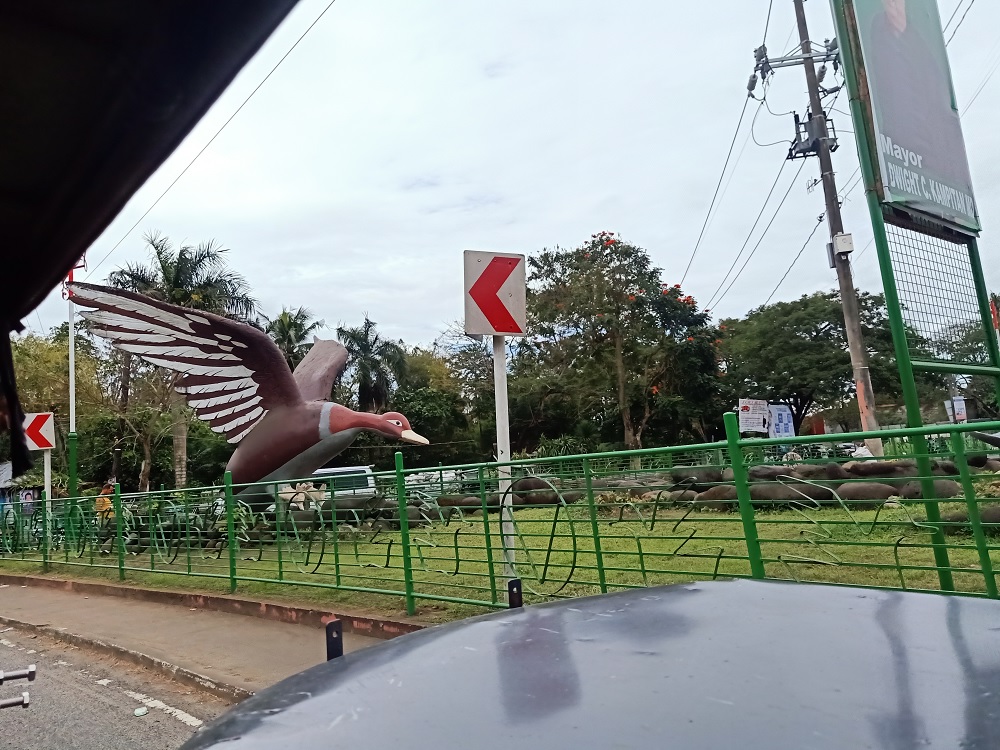
We rendezvoused at the Jac Liner bus station in Buendia around 7 in the morning. We took the Sta Cruz bound bus and alighted at the Masapang Junction, also known as the Duck Junction owing to the monument of ducks in the area, at the town of Victoria, Laguna two hours after the bus left Buendia. Then, we chartered a tricycle ride going to the barangay hall of Lamot Dos in the town of Calauan and arrived there after a thirty-minute ride. Our guide, Albert, was already there waiting for us.
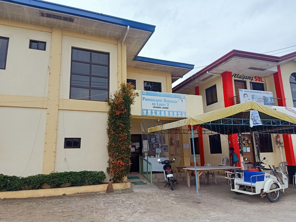
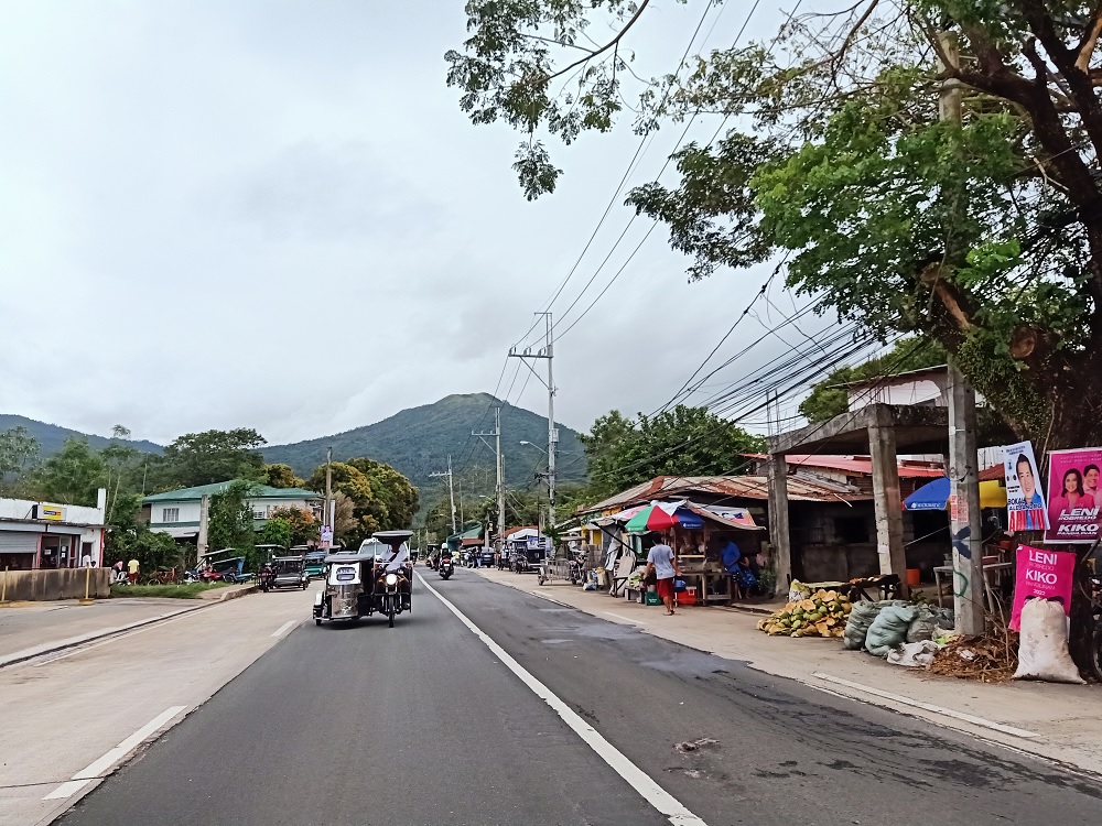
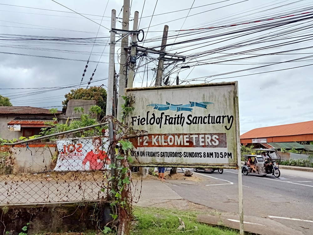
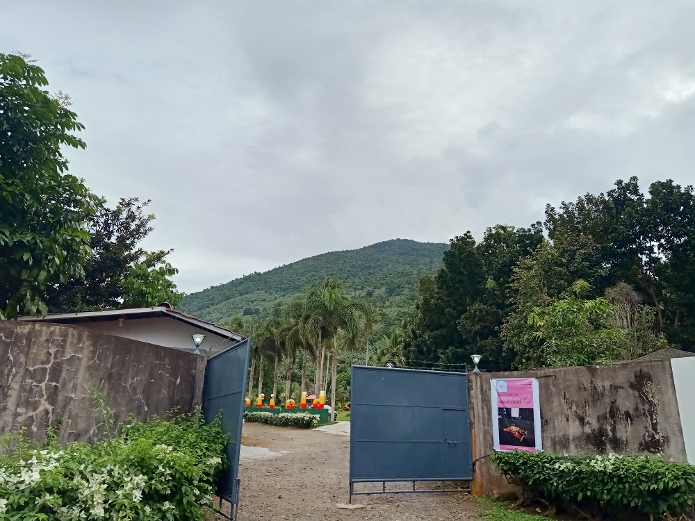
We settled at the back of the barangay hall and prepared our gears. Once we were ready, we registered and paid courtesy to the barangay officials present in the building. Albert then took us via his tricycle to the trailhead a kilometer away from the barangay hall, just beside the entrance of the Moonfield Recreational Hub (formerly known as Field of Faith Sanctuary). We started the hike at 10 in the morning.
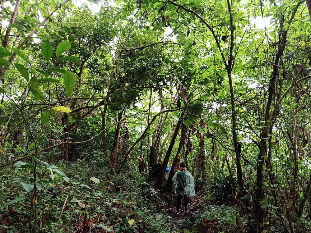
The first part of the hike involves passing through muddy community trails where a few houses dotted the place. Fruit trees like banana, mangoes, and coconuts were already present in the earlier parts of the hike. Just after a few minutes, the ascent ensues. This would go up until 490+ MASL, where the trail mostly gives off a view of the Laguna fields, Mt. Makiling, and Mt. Prinza nearby.

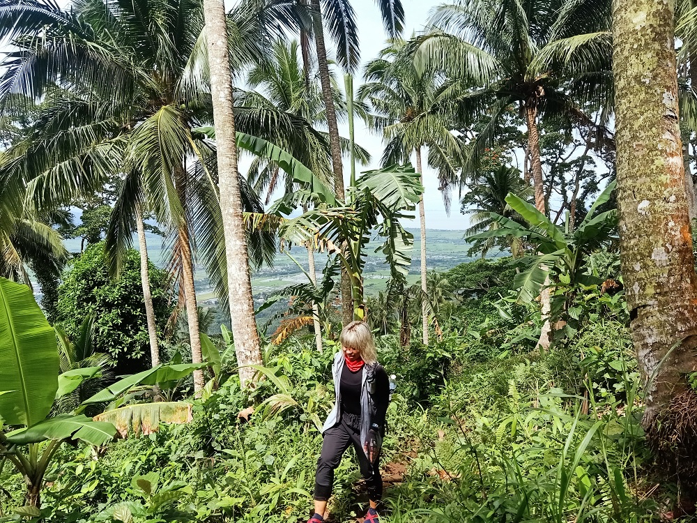
At around 490+ MASL, the trail became flat to gradually ascending on a thick rainforest. Different species of plants environ the place, most of which obscure the path that we were taking. Common burdocks were also scattered along the trail, its fruits sticking to our clothes every now and then.
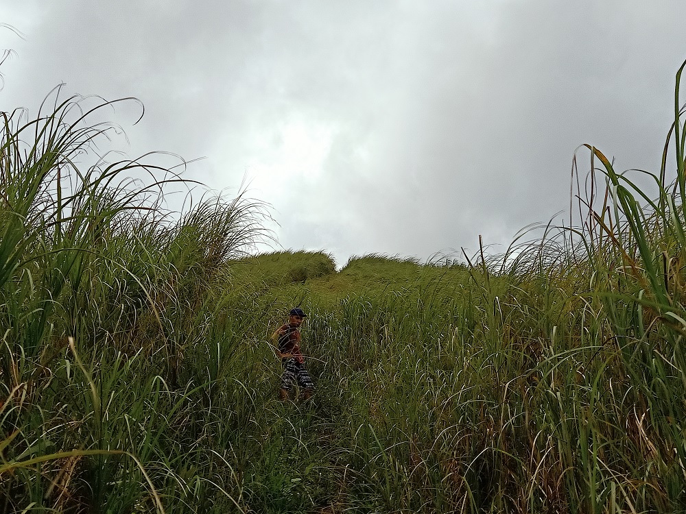
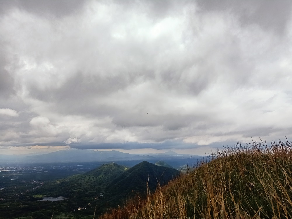
We exited towards the grassland at around 11:30 in the morning. This grassland is the final 70-meter assault going to the summit of Mt. Kalisungan. Although short, we panted heavily due to the heat of the cloud-covered midday sun. At around 12 noon, we reached the summit of Mt. Kalisungan. Contrary to many claims online, its elevation is not 760+MASL, but around 630+MASL according to STRAVA and Google Maps Terrain. This may need further verification.
The summit is divided into two different areas: the northern portion which is directly tied to the trail where a stone inscription is erected, serving as a boundary between the towns of Calauan and Nagcarlan. The other is located a few meters away from the northern portion which provides views of the southern direction.

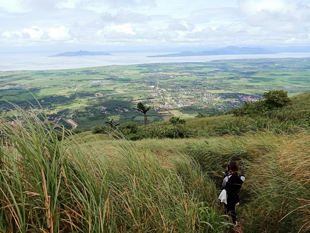
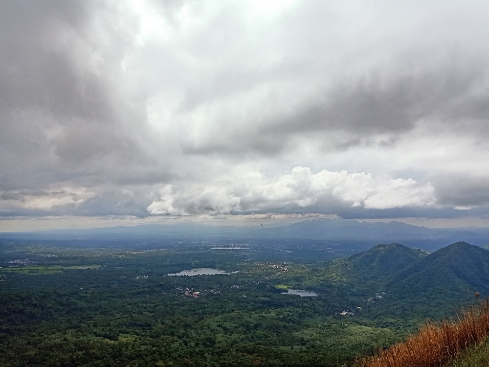
The view atop was magnificent! To our north is the expansive field of Laguna with Laguna de Bay dominating most of the view. At the center of the lake is Talim Island with Mt. Tagapo serving as its highest summit. I was able to hike this mountain in 2019 (click here for my blog of that hike). At the northeast direction just right beside Laguna de Bay is Jala-Jala Peninsula and Mt. Sembrano. I was also able to hike this mountain way back in 2017 and 2019! (Blog: here). The Makati skyline can also be seen in the horizon at the northwestern direction.
Shifting view to the west, one can see the nearby Laguna mountains such as Mt. Prinza and Mt. Obabis. Behind these hills is the legendary giant, Mt. Makiling slowly being dressed in clouds. To the left of Mt. Makiling is a stretching mountain range that makes up the Malipunyo-Manabu Mountains, more popularly known as the Malarayat Mountain Range (which I have hiked in 2019 as well! Blog: here). One can also spot Mt. Maculot (which I have hiked way back in 2016 when I was a college student) in the horizon in between the Malarayat Range and Mt. Makiling.
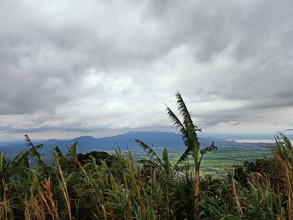
To the southwest, one can view the Batangas Coastal Mountains.
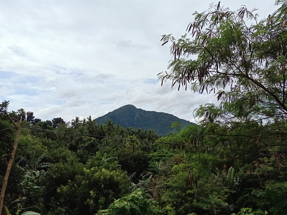
At the southern view nearby, we had a view of four of the seven lakes of San Pablo: Lakes Mohicap, Palakpakin, Sampaloc, and Bunot. There is also Mt. Mabilog (484+ MASL) nearby, attached to one of the slopes of Mt. Kalisungan.
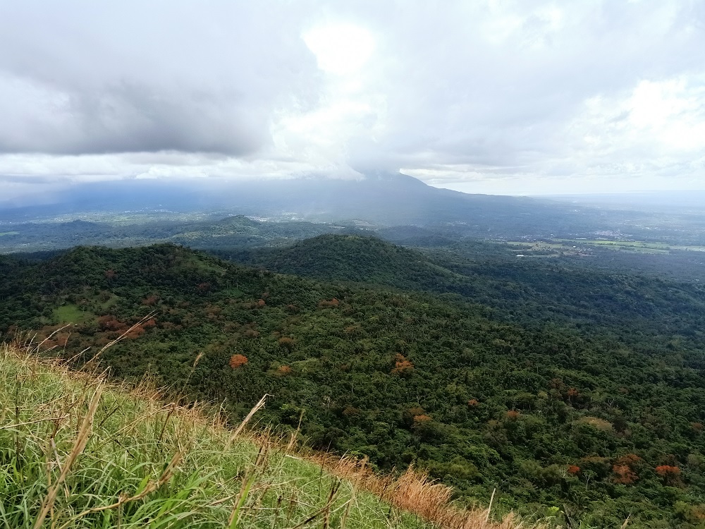

Of course, the most spectacular view to the south is the Banahaw Trilogy Complex consisting of Mt. Banahaw de Lucban(1,875+ MASL), Mt. Banahaw (2,158+MASL), and Mt. Cristobal (1,470+ MASL), which were all sadly covered in rainclouds during our hike. Completing the view is the conjoined Mt. Atimla to the east.

After snapping a few photos and munching on some snacks, we decided to descend before 1pm. Upon entering the rainforest, rain started to pour. This would go on until reaching the lower reaches of the mountain. When the rain stopped, our guide picked off three coconuts from one of the trees nearby, opened them, and gave them to us. We drank the sweet, sweet juice which refreshed our spirits!

Past two thirty in the afternoon (we were slowed down by the rain and by the long rest while waiting for our buko juice), we reached the end of the trail. Our guide Albert returned us to the barangay hall. We cleansed our mud and plant-filled extremities. Afterwards, we chartered a tricycle ride going back to Masapang Junction. We concluded the day with a victory meal in one of the eateries in Victoria, Laguna!
Itinerary
07:00AM Jac Liner Buendia, take bus to Sta Cruz
09:00AM Masapang Junction, ride trike to brgy hall
09:30AM Brgy. Lamot Dos, prepare, take trike to trailhead
10:00AM Start hike
12:00PM Summit
01:00PM Start descent
02:30PM Trailhead, wash-up
03:00PM Late lunch
04:00PM Take bus back to Manila
08:00PM Back in Manila
Some useful info for those planning to do a DIY hike here:
Buendia to Masapang Junction bus fee: 146php
Trike from Masapang Junction to brgy hall of Lamot Dos: 80-100php
Registration fee: 30php
Guide fee: 700php (not sure what is the limit as to how many persons can one guide accommodate)
