Last December, 2021, I was able to climb one of Cordillera’s prime hiking destinations, Mt. Kalawitan. Situated in Sabangan and Bontoc in Mountain Province, Mt. Kalawitan is the 10th highest summit in the Philippines, displacing its neighbor Mt. Amuyao (11th) in Barlig by only 10 meters. The mountain is known for its rich and thick mossy forest, and is infamous for being one of the most heavily limatik-infested mountains up north.
There are two entry points to Kalawitan. One is in Panorama Viewpoint along Halsema Highway at the town of Sabangan. The other, which we took for the hike, starts at Golden Farm Resort in Mountain Province’s capital, Bontoc. The latter is notorious for its length, spanning over 28 kilometers when doing a backtrail. The Bontoc trail also boasts of a circuit trail, which is longer and more difficult as claimed by some travel blogs.
One will surely find Kalawitan a challenging hike no matter what trail is taken. The name itself, Kalawitan, already signifies and foreshadows what lies ahead in the mountain – the word “kalawitan” is derived from the Kankaney word “Calauit” which means “to climb.” True enough, the climb up to the 10th highest summit seemed to never end and would take its toll even among experienced climbers.
Here are some basic information for the hike:
Jump-off point: Golden Farm Resort, Talubin, Bontoc, Mountain Province
Specs: Major climb, difficulty 7/9
Trail class: 2-3
Days required / Hours to summit: 1-2 days / 8-12 hours
Features: pine forests, mossy forests, 10th highest summit
**
Special thanks to Transit Pinas for some of the shots included in this blog. You can read his account of our Kalawitan hike through this blog entry in his website!
**
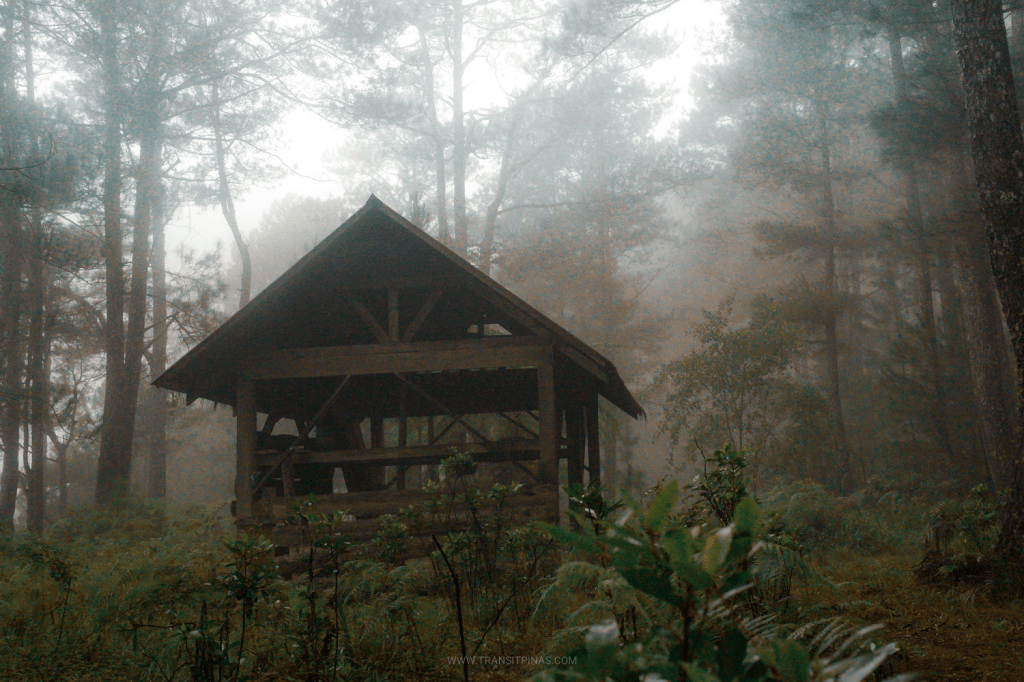
We started the hike late at exactly 8:50 in the morning. The initial part of the climb exits at the rear part of Golden Farm Resort where we took a cemented stairway that ends on a pine tree forest. Upon exiting, we found the entire surrounding to be foggy. You can feel the moisture and drizzle in the atmosphere as well as on the soil. We had this weather for the entire hike.
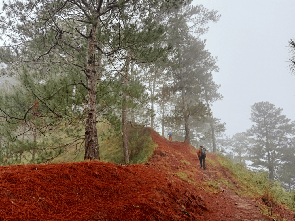
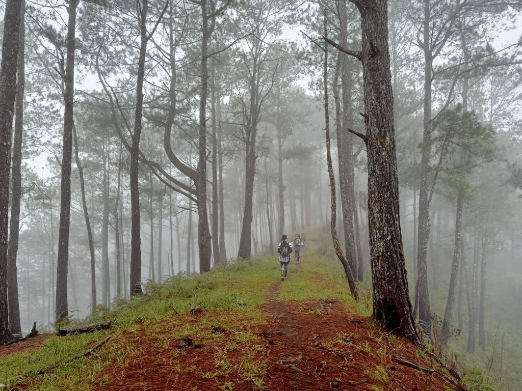
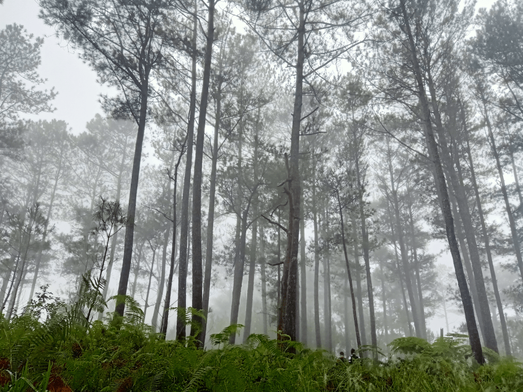
The initial parts consisted of flat to gradually ascending trail on pine forest slopes. Pine trees here were humongous! Despite being obscured by the thick fog, you can feel their enormity. It was like they were titans! On a clear sunny day, one can spot Bayo Rice Terraces to the left of the trail.

An hour into the hike, we passed by a ranch shelter. In between pine trees in this area are hundreds of wooden planks that were probably logged. We reached Munna Camp, or camp 1, at 11am, two hours into the hike. We had our rest here.

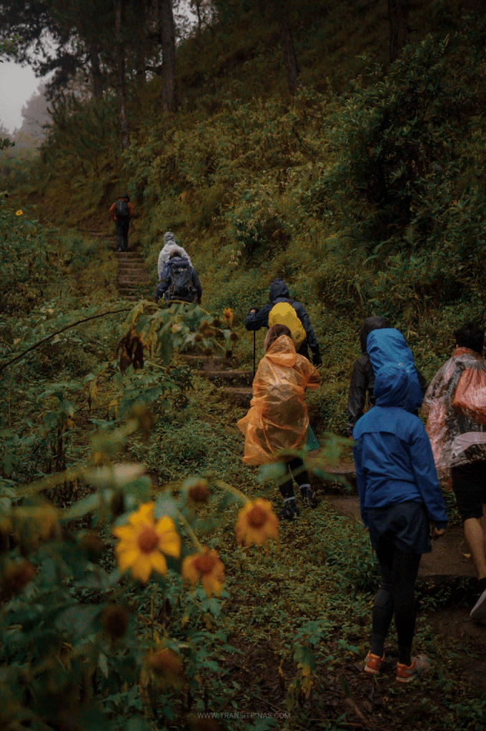
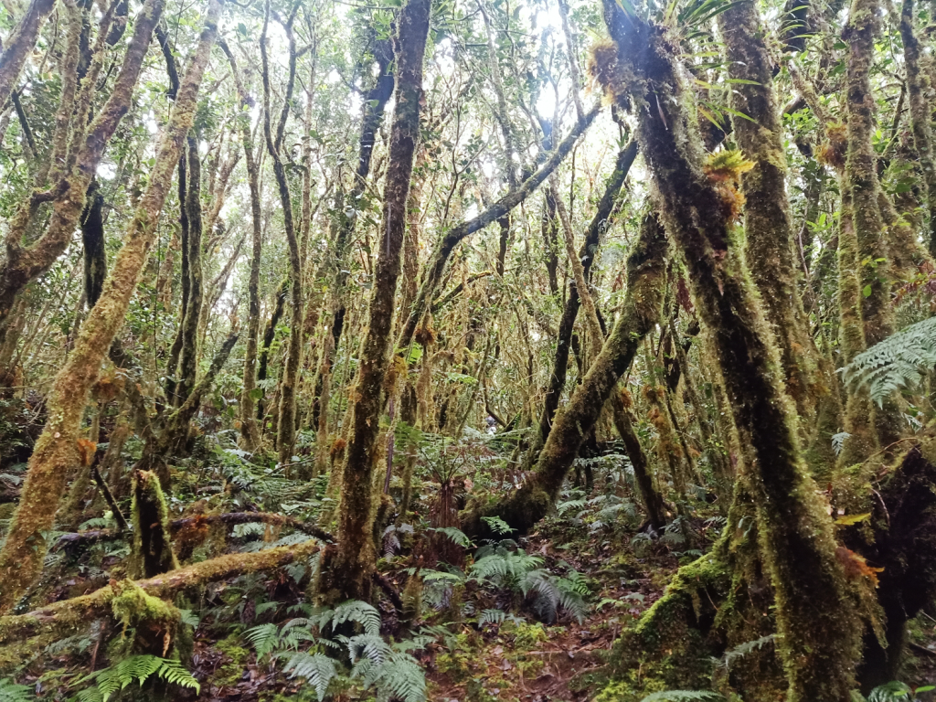
What followed after Munna Camp was a short section of a mossy forest, until exiting again on a steep pine forest slope. Afterwards, we entered the mossy forest once again, where every few meters, we had two or three limatiks sticking to our clothes! Some of our companions drew first blood. We reached the first water source at around 1pm. We had another rest here, but only for a short while as the cold was punishing and the rain only grew stronger.

The walk inside the mossy forest was one of the lengthiest ones I’ve ever experienced. Without taking lunch, we braved through the rain and the long cold walk. We were getting hungry as the minutes passed. At 2 in the afternoon, we reached Juuno’s Playground, a dried swamp in the middle of the forest where everything, even the ground, was covered in thick moss. We tried to have a short rest here while snapping photos with the very picturesque forest.

We continued with the hike and reached the last stop before the summit – Mateos’ Garden or Camp 2. We arrived here soaking wet. Our bodies were buffeted with strong gusts of rainy wind as the campsite was in an open area. Despite the bothersome predicament we were in, we had no choice but to take a rest here and have our very late lunch. It was 3 in the afternoon. All of us ate with shivering bodies, all while attending to limatiks attached on our clothes.
We pushed through with the final assault after gaining some much needed energy. Despite our carbos replenished, all of us, evidenced by the irritated marks on our faces, were exasperated and desperate to reach the summit.
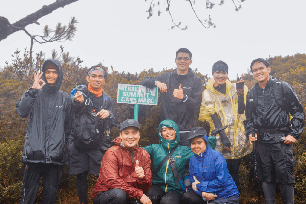
Alas, at 4:30 in the afternoon, 7 and a half hours after starting the hike, we finally reached the summit of Mt. Kalawitan! It was rather an uneventful success as we were met with a stormy cold weather on top of the summit. We hurriedly took pictures with the summit marker before deciding to descend.
Back-trailing our way, we reached Mateos’ Garden past five in the afternoon already. The four of us who were there decided to go ahead without a guide. En route to Juuno’s Playground, the entire surrounding fell into complete darkness. Several times, we lost the trail and wandered a few meters off. Good thing was that I was with a team of 4 and most of us were experienced hikers, so spotting and re-finding the trail became much more doable.
The four of us met four other hikers (again, without a guide) past Juuno’s Playground. The eight of us braved our way through the darkness, with two of them advancing, leaving us six individuals. Unfortunately, we had to walk on a snail’s pace as we were with a lone hiker with a much slower pacing than us. Even though survival mode was kicking in and some of us wanted to go ahead, we decided it was much better to stick together.
At around 10 in the evening, we reached the ranch shelter and decided to rest there and take our dinner. We made a makeshift bonfire inside the shelter to battle the biting cold. After everyone had an ample rest, we put off the fire and continued with the hike. I found two limatiks sucking the blood out of me, one on my right arm and one on my right calf.
The last push took us almost an hour of walking on a very slow pace. My STRAVA wasn’t working anymore due to the thick swathe of fog that was possibly covering the data signal, so we didn’t have a map to confirm if we were on the right trail. We depended on our collective instincts on tracing the trail.
At exactly 12 midnight, we arrived at the Golden Farm Resort. We found the three fastest hikers there already asleep. We took the chance to wash-up and clean our limatik bites as we waited for the remaining hikers in our group to arrive. We concluded our stay in the resort with a dinner consisting of a hot, steaming pinikpikan prepared by the resort caretakers. It was a quiet and peaceful dinner.
We left the resort past two in the morning. Sunlight caught up as we were traversing Dalton Pass going to Nueva Ecija. We had a celebratory morning breakfast in San Jose City. At 10am, it was home sweet home.
Concluding the year with a hike up to Mt. Kalawitan perfectly encaptures what I’ve been through the year of 2021 – tough challenges, getting pushed to the limits, and persevering through impossible predicaments. Although much of what happened in this hike was rather unexceptional, there were still moments shared and bonds that were strengthened, not just with people, but with nature as well. Hopefully, the mountains up north would be more merciful the next time I meet them.
Itinerary
Day 0
09:00PM Meet-up at Quezon City
Day 1
07:30AM Breakfast at Bontoc
08:50AM Start hike
09:00AM Ranch shelter
11:00AM Munna Camp 1
1:00PM Water source
02:00PM Juuno’s Playground
03:15PM Mateos’ Garden Camp 2
04:30PM Summit
11:59PM Back in Golden Farm Resort, wash-up

One thought on “Mt. Kalawitan Dayhike (2,714+ MASL) via Bontoc Trail | Golden Farm Resort Jump-off”