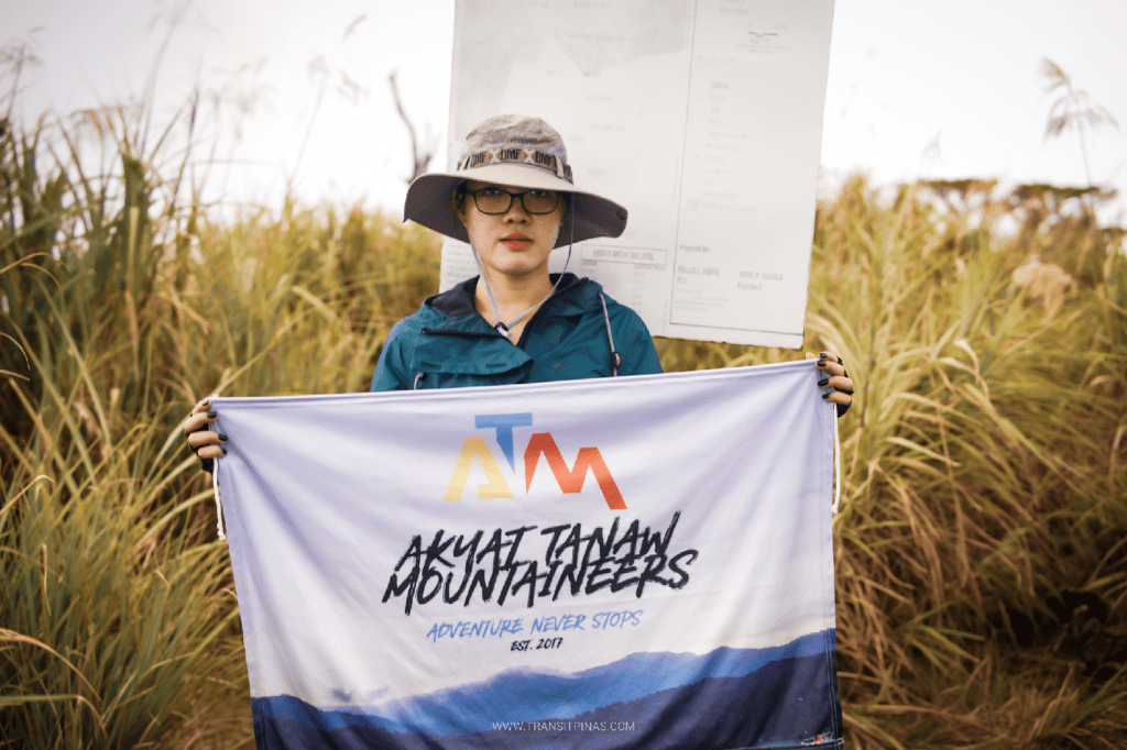
Last 30th and 31st of October, I was able to successfully climb the country’s fifth highest summit, Mt. Kalatungan in Pangantucan, Bukidnon. For this hike, I joined an organized event by Akyat Tanaw Mountaineers in coordination with Bukidnon’s Dauntless Outdoor. It was my first time to be in the southern portion of the country, making the little kid in me joyful for this trip. The two-day hike was an unforgettable immersion to one of the grandest forests I’ve ever seen here in the country.
Mt. Kalatungan is a mountain range that stretches north of Mindanao in the province of Bukidnon, covering four towns in the province: Talakag, Pangantucan, Maramag, and Valencia City. It is one of the two gigantic and towering mountain ranges in the province, with the other being the Kitanglad Mountain Range, which houses the second (Mt. Dulang-Dulang), fourth (Mt. Kitanglad), and eighth (Mt. Maagnaw) highest peaks in the country, located just a few kilometers northeast of Mt Kalatungan. The mountain, just like its neighbor Kitanglad, is looked after by the Manobo and Talaandig tribes that reside at the base of the mountain.
Manobo and Talaandig legend says that when Bukidnon was submerged by a great flood, it was not just Kitanglad’s summit that prevailed above the waters, but also Kalatungan’s. This complements Kitanglad’s story that above the summit, they found a tanglad. For Kalatungan, the Talaandigs found eggs of a praying mantis, which was “kalatungan” in the native language. These signify the cultural importance of the two legendary mountains in the province, adding to the mystique of the trip that these mountains offer.
Added to the biological, cultural, and historical aspects of Mt. Kalatungan is the fact that it is one of the toughest hikes to do in the country. Although an extreme day hike is possible, the traverse from Mt. Kalatungan to Mt. Lumpanag (an adjacent peak inside the mountain range) involves two to three days of strenuous hike. When we were being oriented by Dauntless Outdoor prior to the hike, we were informed that even seasoned climbers would find the hike up to Mt. Kalatungan extremely difficult.
Just to give an idea about how the difficult the hike is, here are its basic specs:
Jump-off point: Brgy. Mendis, Pangantucan, Bukidnon
Elevation: 2,880+ MASL (Pinoy Mountaineer, Kalatungan), 2,907+ MASL (DENR reading for Kalatungan); 2,819+ MASL for Mt. Lumpanag/Wiji
Specs: Major climb, difficulty 8/9
Trail class: 3-4
Days required / Hours to summit: 2-3 days, 10-15 hours
Features: tribal domain, mossy forest, top 5 highest summit
Specs are from the travel guides of Pinoy Mountaineer and Transit Pinas; updated its jump-off point; special thanks to Transit Pinas for some of the shots for this hike! You can check his travel guide for the Mt. Kalatungan Traverse by clicking the linked text!
Here is a daily account of our grand adventure to the country’s 5th highest peak!
Day 1: From to Davao to Bukidnon: Maramag’s Clean Market, La Montaña Cafe, and a Lazy Day at Brgy. Mendis
The adventure started in Davao City as we were fetched by a truck at around 7 in the morning of October 29. We went northwards passing by what they call Buda or Bukidnon-Davao Highway. The road was scenic, filled with mountain slopes on each side, complemented by a sunny weather and portions of sea of clouds. We arrived in the town of Maramag, Bukidnon at around ten in the morning to buy some supplies. We also had our lunch at the public market, which was probably the cleanest and driest one I’ve seen in the entire country (I haven’t been to many, so take this comparison with a grain of salt).

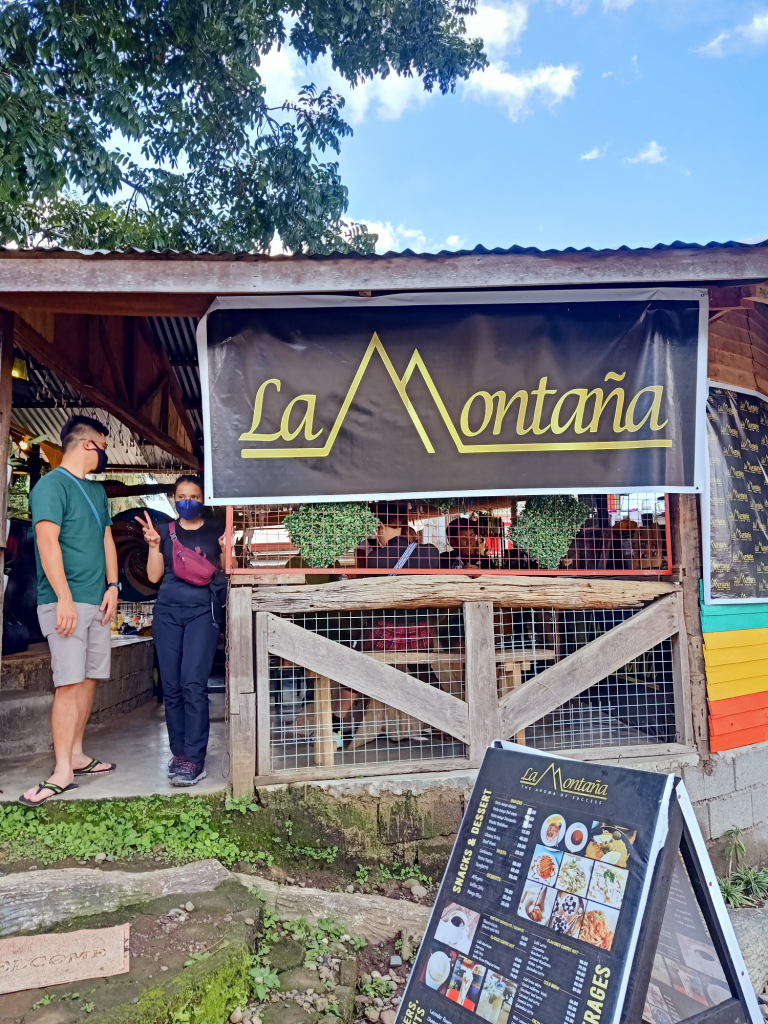
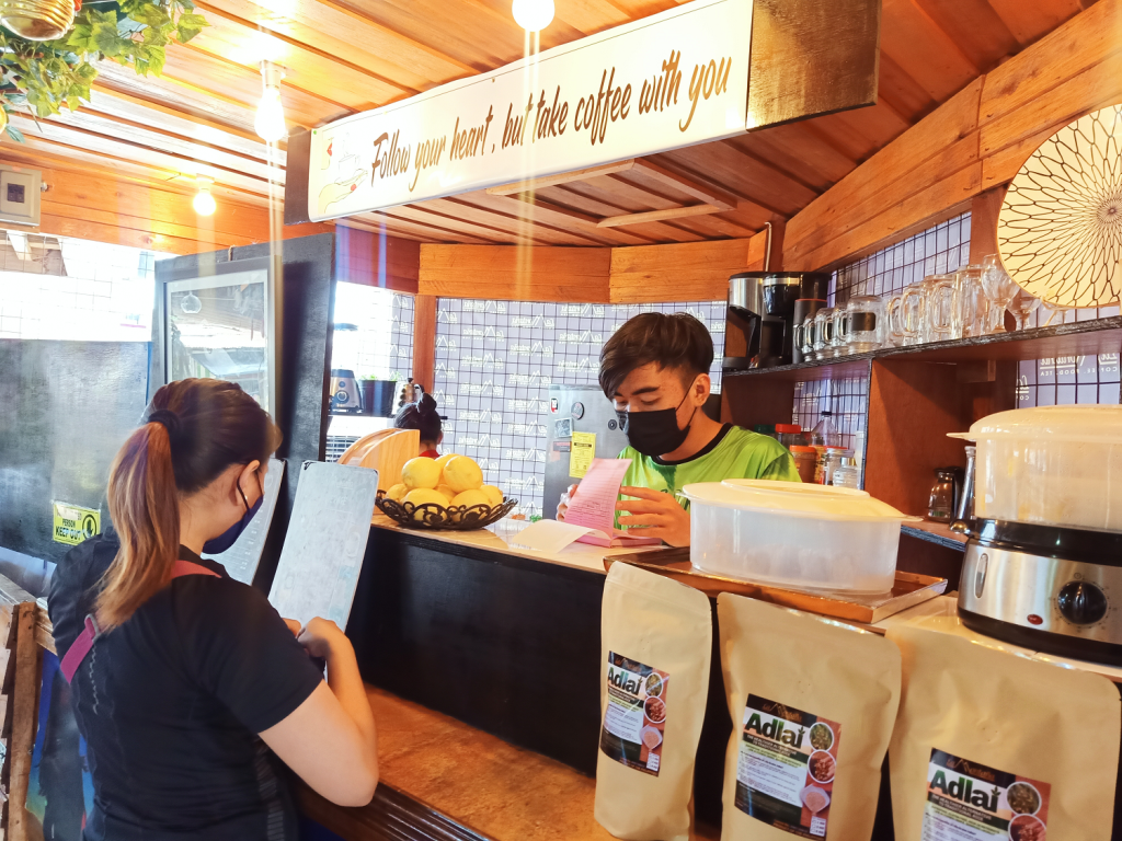
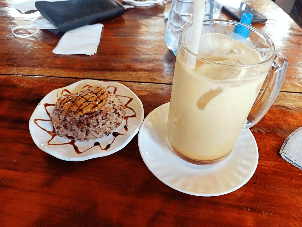
Afterwards, we went to the town of Pangantucan to have our orientation facilitated by Dauntless Outdoors’ Ms. Liz Tiongson at the La Montaña Cafe, a humble nook at the town center that serves one of the most luscious coffees I’ve ever tasted. They use coffee beans that are harvested from the farmlands at the base of Mt. Kalatungan! During the orientation, some of our companions ordered puto maya dabawenyo and other delicacies available in the cafe. Food trip muna bago ahon!
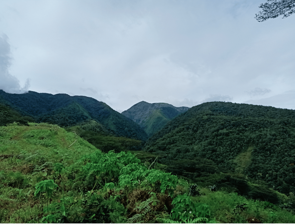
We went straight to Brgy. Mendis after the orientation, which took an hour of negotiating an unpaved road. En route to the barangay, we already had an awesome view of Mt. Kalatungan being shrouded by clouds. Upon arriving at Brgy. Mendis, we paid courtesy to the military detachment and logged our names. We settled in for the day at a hut within the community a few meters away from the military detachment.
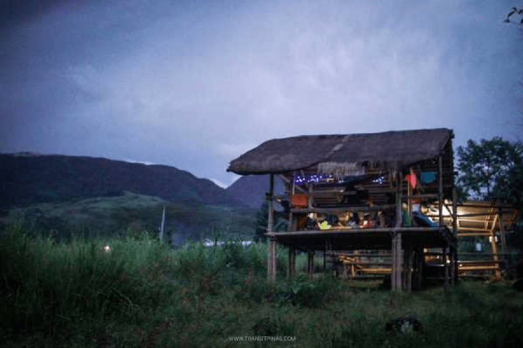

The hike was supposed to be a three-day itinerary. Typically, the first day involves a two-hour hike to the base camp. However, we opted to just stay at the hut for the rest of the day as a heavy afternoon rain poured.
Our afternoon stay at the hut proved to be serendipitously relaxing. There was something about staying in such a bucolic place that made me feel peace and oneness with the earth. I enjoyed the quiet, lazy afternoon; the calm before the ravage.
Pangapug: A Ritual to Appease the Mountain’s Deities
As nighttime came, we were instructed to gather at a nearby hut to watch the mandatory ritual done by the elder datu of the community, Datu Erio Inahan. Luckily, we were permitted to take pictures and videos. Coins, strips of cloth, liquor, and soda were placed on a table, serving as offerings for the ritual. The main offering, however, was a live chicken, which we bought from Maramag.
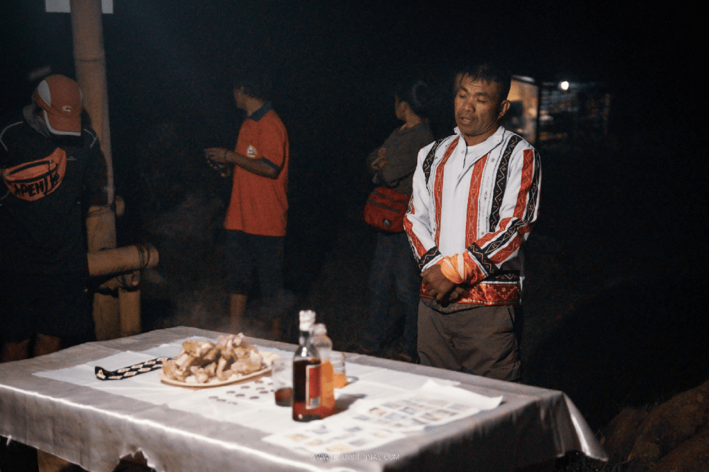
The ritual started with a prayer by Datu Erio. Next, Datu slit the throat of the chicken and collected the blood that flowed from its neck. This blood served as an offering to the deities of the mountain so that none may be taken from those entering their abode. This chicken was then cooked and offered to us. The meat of the chicken, together with the liquor, were blessed with incantations to make us stronger and protected for the entire hike.
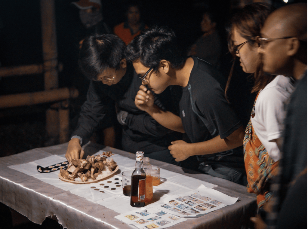
Right after the ritual, Datu and the rest of the local guides invited us to an intimate dinner. Together with the boiled chicken, they cooked vegetables ala pinakbet style and nilagang isda perfect for the cold weather.
We retired for the night afterwards, stuffing ourselves inside our sleeping bags to protect ourselves from the cold. We had a good night’s sleep in the hut.
Day 2: The Long Uphill Battle Climbing the Fifth Highest Peak in the Country
Brgy. Mendis to Base Camp
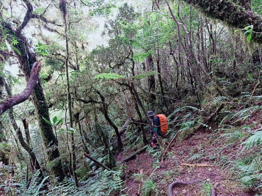
The hike started at 2 in the morning on the cemented road of Brgy. Mendis. We then turned right on a chunky boulder-filled path soaked in muddy waters, which was probably brought by the afternoon shower the day before. In no time, we were inside a forest. Some portions of it were swampy, requiring us to find submerged boulders to step on and make dangerous leaps. We also passed by a river via a bridge made of bamboo.
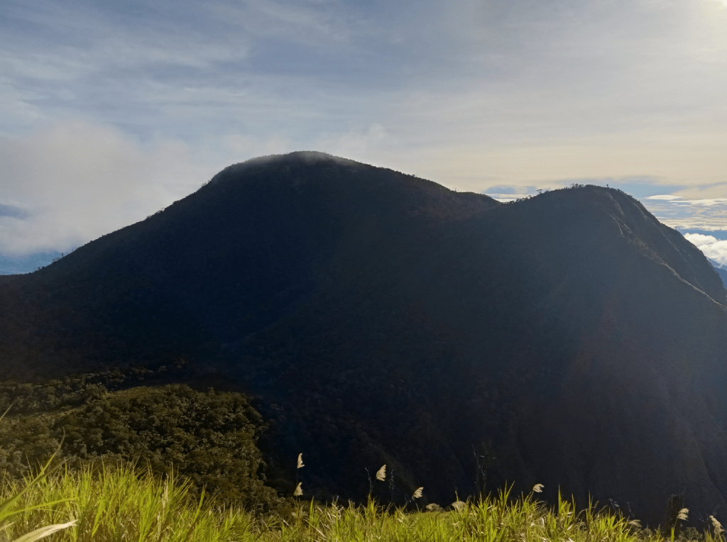
The trail after the bamboo bridge is the start of the never ending upward trail. From there, we exited on a grassland with an open wide trail, with the cold morning wind blasting off on our faces. The area after the grassland was in a forest. Two hours into the hike, we reached Kalatungan’s base camp, where an elevated tree house is erected. We rested there for a couple of minutes, as the first ray of light appeared in the dark sky.
Kikikoka Peak, Buko-Buko sa Anay, and Muleta Falls View Deck
We continued the hike with all of us were sweating buckets and panting heavily. At six in the morning, we reached what they call as Kikikoka Peak, a heavily forested area on top of one the “hills” in the lower reaches of Mt. Kalatungan. We had our breakfast here.
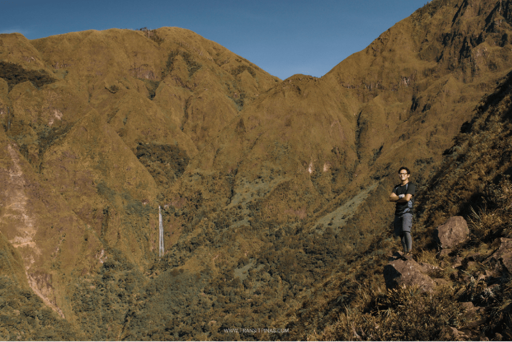
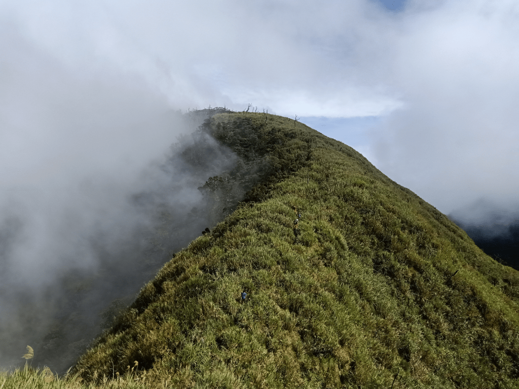
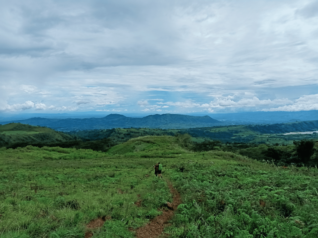
Past Kikikoka Peak is a short forest walk that exits to an exposed grassy slope. This area, known as Buko Buko sa Anay, is one of the toughest parts of the climb due to the exposure of the slope to the sun. Even with the early morning sun rising in the east, we felt its heat as we were making our way up. It wasn’t as hot as compared to Cawag, but it was enough to tire someone who’s carrying a heavy load on their back.
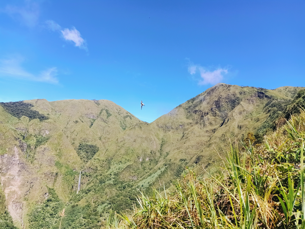
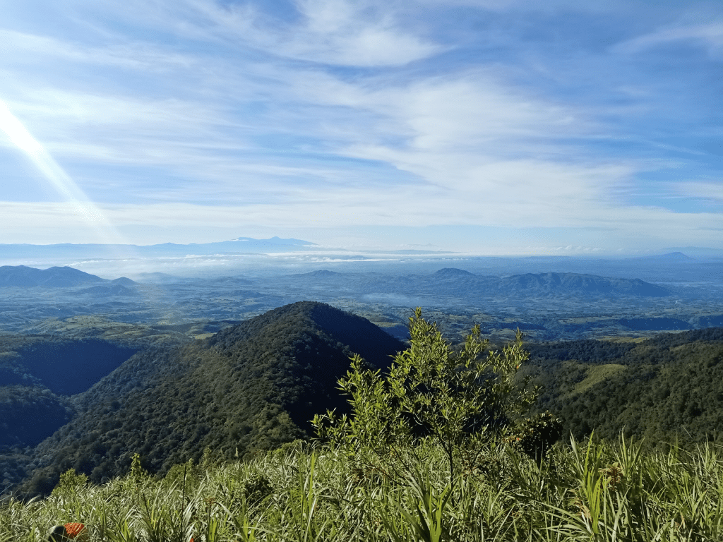
What compensates for the heat was the magnificent view of the hilly plains of Bukidnon to our back. In the horizon, we spotted Mt. Talomo and Mt. Apo, and to its right, Mt. Matutum. To our left when facing the upward trail is the nearby slope of Mt. Wiji, which we will be taking as our descent trail and exit point for the next day.
Besides these astonishing views, we also spotted two Philippine eagles circling the sky, as if two lovebirds dancing to welcome us. They immediately retreated to the forest as soon as we made our presence felt.
After minutes of continuous ascent on the exposed, grassy slope, the first sight of the distant Muleta Falls showed itself in its magnificence. This waterfall is nestled at the bottom of the slopes in between the bosom of Lumpanag and Kalatungan. Our guides informed us that only their ancestors or “Baylans” have access to the waterfall. No one is permitted to go there, and nobody dared, or else, they would be tried (in their words, “sinasala”) by the elders of the mountain community.
At around 7:30, we reached the view deck of the waterfalls and rested there. Sunlight was now up and scorching.
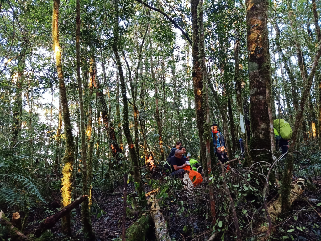
Enter the Mossy Forest!
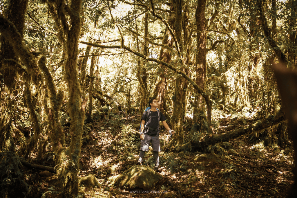
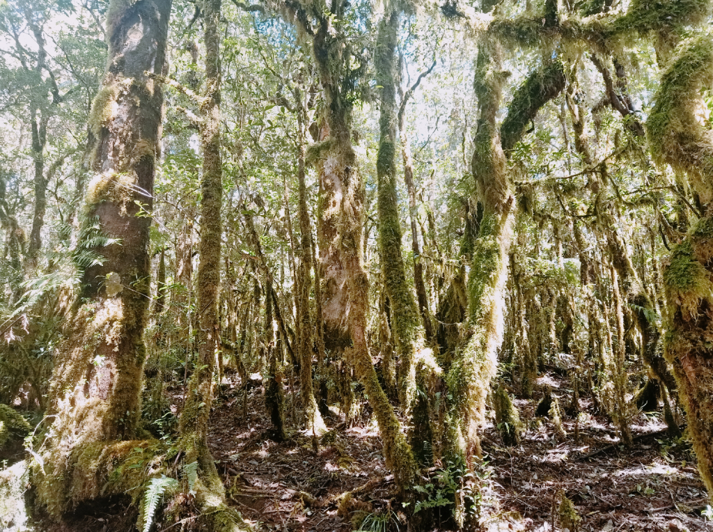
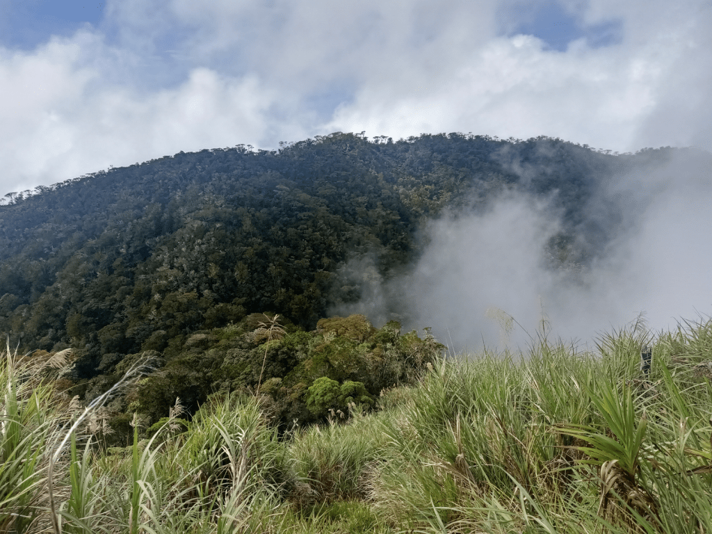
At 9, after an hour and a half of staying and resting at the view deck, we proceeded with the remaining half of the ascent. The trail after the view deck continues on a grassy and exposed ridge which stretches and ends on a tree line. This tree line serves as an entrance to the mossy forest of Mt. Kalatungan.
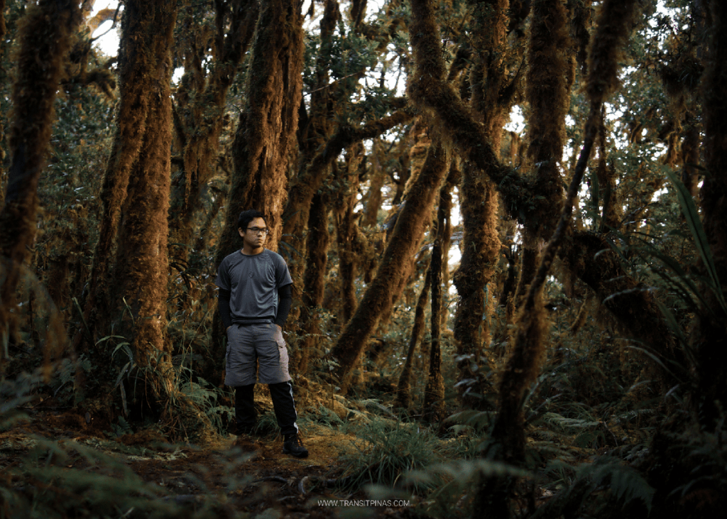
The trail inside the mossy forest was breathtaking, literally. It was also the easiest part of the hike since the trail was mostly flat. The ambience felt like I was in the Cordilleras, but Kalatungan’s mossy forest has a flavor of its own! In the Cordilleras, the trees seem mysterious and introverted. Here in Mindanao, it seemed to welcome us and had a friendlier vibe. Maybe because they seemed closer and brighter. Both mossy forests in the region, although unique in their own right, are stunningly beautiful.
At ten in the morning, with the eighth hour registering after we started the climb, we reached Sako Camp. We were supposed to rest there but we decided to go straight ahead with the climb since the camp was the last stopover before reaching the junction that divides the trail into two – one that leads to the summit of Kalatungan and the other goes to Sanggaya Camp and Mt. Lumpanag.
We were shocked with what followed after leaving Sako Camp. With our tired bodies and exhausted lungs, we were met with yet again another ascent on an exposed grassy trail that seemed to never end. I was using dead tall trees as markers for that portion, thinking that it was the “end” of the grassy area.
We let a sigh of relief once we entered the mossy forest again, and in no time, we were at the campsite serving as a junction to Mt. Kalatungan and Mt. Lumpanag. It was past eleven in the morning. We had our lunch and our water bottles refilled.
Final Assault
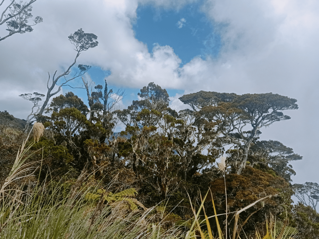
Past one in the afternoon, after having a long siesta session at the junction, we started the final assault to the summit of Mt. Kalatungan. The trail, of course, was mossy, but as we gained more elevation, the trees dwarfed into bonsai-sizes, indicating that we were at the topmost area of the mountain. Besides lushes of green, plants here had a variety of color like yellow and red. The entire area felt like a little garden in heaven where spirits walk and converse.

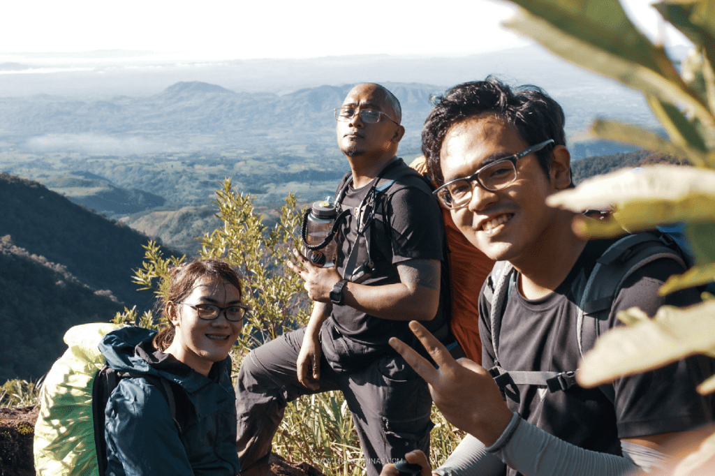
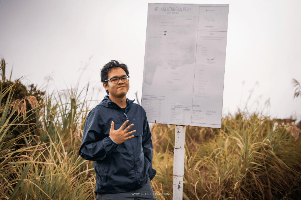
It was all smiles and cheers at around 1:45 in the afternoon as we reached the fifth highest point in the country at the summit of Mt. Kalatungan. It took us eleven freaking hours to reach this point from Brgy. Mendis! We exchanged cheers and greetings of congratulations for the success. One by one, we had our pictures snapped at the faded DENR signboard marker.
My heart was full—happiness, joy, awe, and gratitude all mixing into one indescribable emotional experience.
The Descent to Sanggaya Camp
Rain started to pour as we returned to the junction coming from the summit of Mt. Kalatungan. Despite the heavy downpour, we had to brave getting soaked and cold as we made our way to our last stopover for the day, Sanggaya Camp. This campsite, also called Bamboo Camp (owing to the presence of bamboo grass in the area) is flanked in between the slopes of Mt. Kalatungan and Mt. Lumpanag/Wiji. Hikers would often describe the campsite as having its own weather system—even if it’s all sunny and dry for the rest of the mountain, it could be raining and storming at the campsite. Moreover, locals here describe the wind as “being trapped” between the mountains, which explains the cold atmosphere.
The forested trail en route to Sanggaya Camp was slippery due the nonstop afternoon rain. Despite being a downward trail, I felt more exhausted here, most probably brought by the 10-hour ascent that we did and exacerbated by the rain and slipperiness of the trail. At around 4 in the afternoon, I arrived at Sanggaya Camp all wet and tired. Prior to reaching the camp site, we passed through a swamp where I had to submerge my legs into the deep mud.
I immediately went to the guide’s kitchen area (a makeshift cooking area protected by a wide fly sheet) to get my body warmed with the fire they were making. Then, I retired to my tent and changed into my dry clothes to prevent hypothermia. Since it was extremely cold outside, I decided to stay inside my tent to warm myself up some more.
At around six in the evening, I went out of my tent, shivering, to have our early dinner. I honestly thought that I would get hypothermia at that time since my shivers weren’t abating. Good thing that my body kind of just adapted to the cold, despite the cold being too unbearable.
By seven, we were already fast asleep. Despite the biting cold, I had plenty of rest inside my tent and stuffed in my sleeping bag. The giant burrito finally had his well-deserved sleep.
Day 3: Final Assault to Mt. Wiji, Dead Nail’s Trail, and the Bucolic Sitio Mahayahay
Wakey wakey!
At four in the morning, we joined our guides inside the makeshift kitchen once again to have our early morning coffee while they cook our breakfast. We were supposed to leave the camp site at four, but just like in my experience in Mt. Tabayoc two years ago, we preferred to start the hike when the sun was up.
It was a good decision to wait for the sun since we didn’t get to appreciate the majesty of the mossy forest surrounding us yesterday because it was already dark when we got there (at 4pm in the afternoon, the sky was already dark due to the grey heavy clouds above us). When the sun’s rays illuminated the surroundings, a glorious amount of chaotic, mossy trees were revealed in their full glory. To think that we were sleeping with this much beauty surrounding us!
Assault to Mt. Wiji/Lumpanag
The last part of the hike involved hiking the subsidiary adjacent peak of Mt. Kalatungan. This peak goes by many names. To many mountaineers, it is called as Mt. Wiji, owing it to the first person to summit the area, who was, as the name suggests, a Japanese man. It’s also called locally as Mt. Lumpanag. On a less popular note, it is also known as Mt. Makaupao.
At 2,819+ MASL, it may as well be the eighth highest summit in the country next to Mt. Tabayoc (6th) and Mt. Ragang (7th). However, many would not consider this as an official summit due to its proximity to Mt. Kalatungan, which made me think why it wasn’t the case for Kitanglad and Dulang-Dulang considering that both are also geographically close to each other.
Anyway, on to the hike.
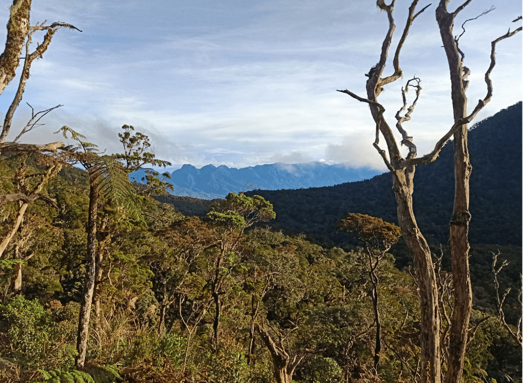
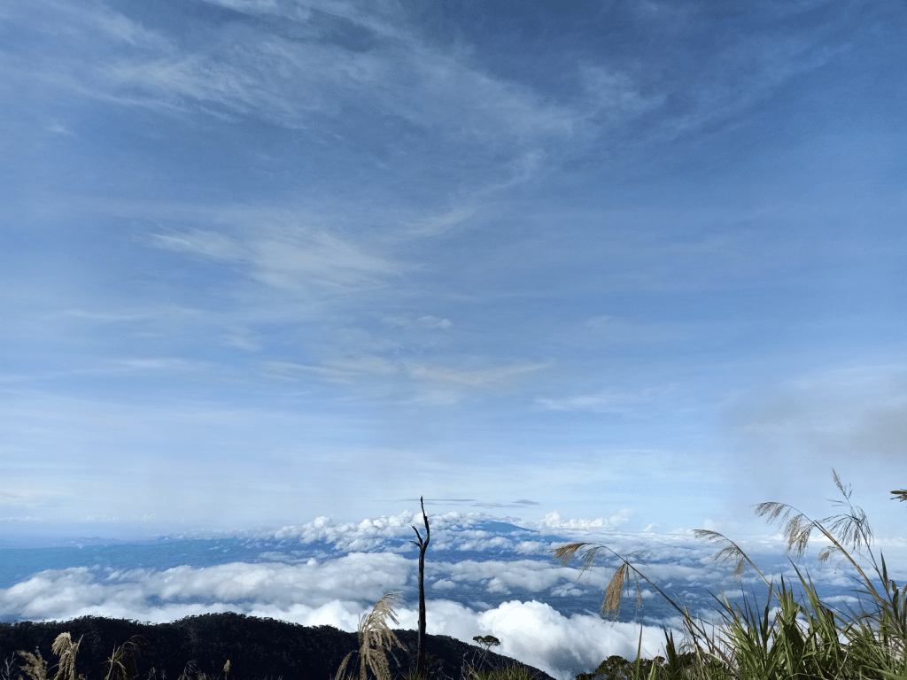
At six in the morning, we started the final assault to Mt. Wiji. In no time, we exited from the mossy forest to a grassland slope once again. The initial parts were very steep; we needed to push our way up through fallen trees and thick roots along the trail. Early on in the assault, we had a clear view of Mt. Kalatungan’s forested slopes. To its left, a slightly faint view of the Kitanglad Mountain Range was visible. Like when I was seeing Mt. Pulag and Mt. Tabayoc from Mt. Timbak for the first time, I said hello to them and promised that I would summit them someday!
The trail then became less steep but was still constantly ascending. With a manageable pace, we reached the summit of Lumpanag an hour after we started. Like yesterday’s summit customs, we had our pictures snapped with the signboard marker. At the summit, clouds teased us, surrounding the whole grassland peak and obscuring the view. But despite its playful nature, it still gave way to let us enjoy the view.
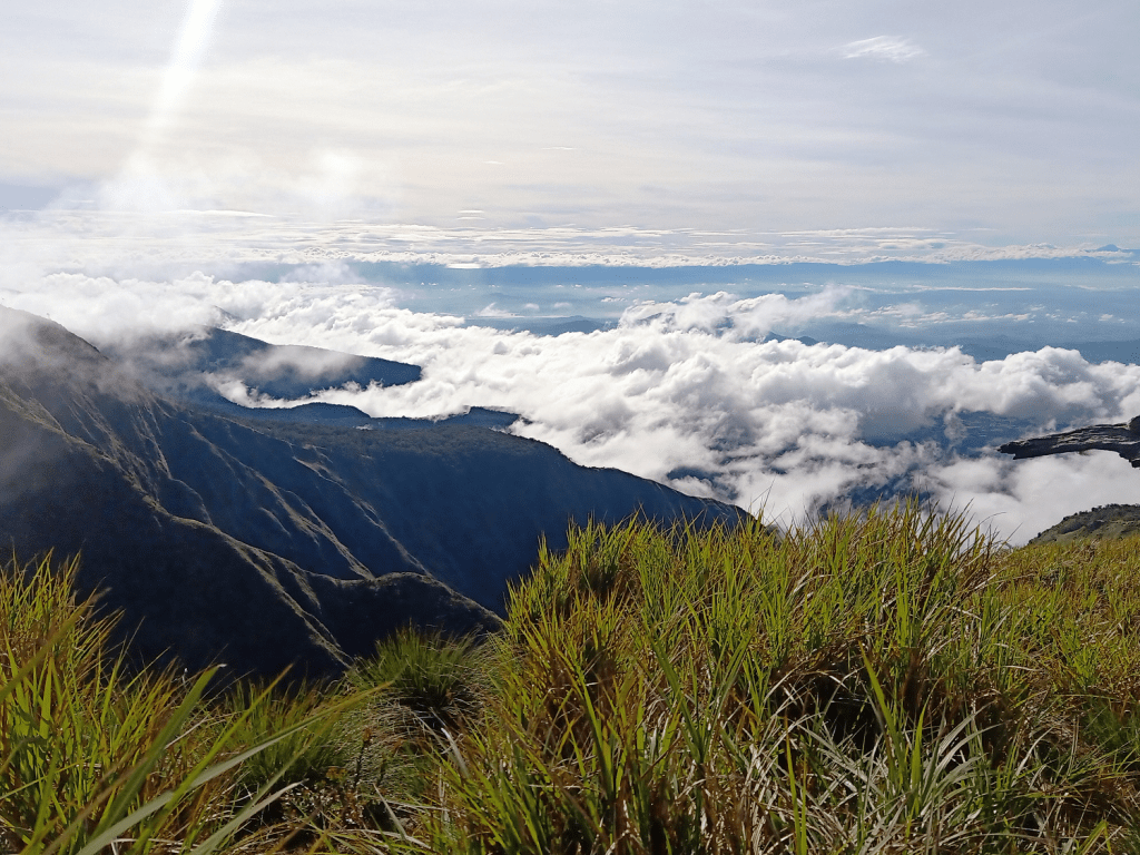
A few meters away from the summit is a splendid view deck where we posed for pictures. To our left, we had a view of the ridge that we took yesterday coming from the base camp up to the summit. We can pretty much trace the landmarks we went to yesterday: the forested Kikikoka Peak, the open grassy ridge of Buko-Buko sa Anay, and then the last portion of mossy forest prior to the junction and summit area.
To our right, we were able to spot Lake Lanao and Mt. Ragang. I was astounded with the thought that I’ve seen all of the Mindanao mountain giants included in the top 10 highest summits in just one hike! Hopefully, I get to see them again in the future.
The Five Hour Descent to Brgy. Mendis via the Dead Nail’s Trail and Sitio Mahayahay
All things that go up must come down. Despite enjoying the awesome view atop of Mt. Lumpanag, we needed to to start the descent. From the summit of Mt. Lumpanag, it takes around five to eight hours of continuous descent to Brgy. Mendis. For our group, it took us five hours, making this one of the longest (time-wise and elevation loss-wise) descents I’ve ever done.
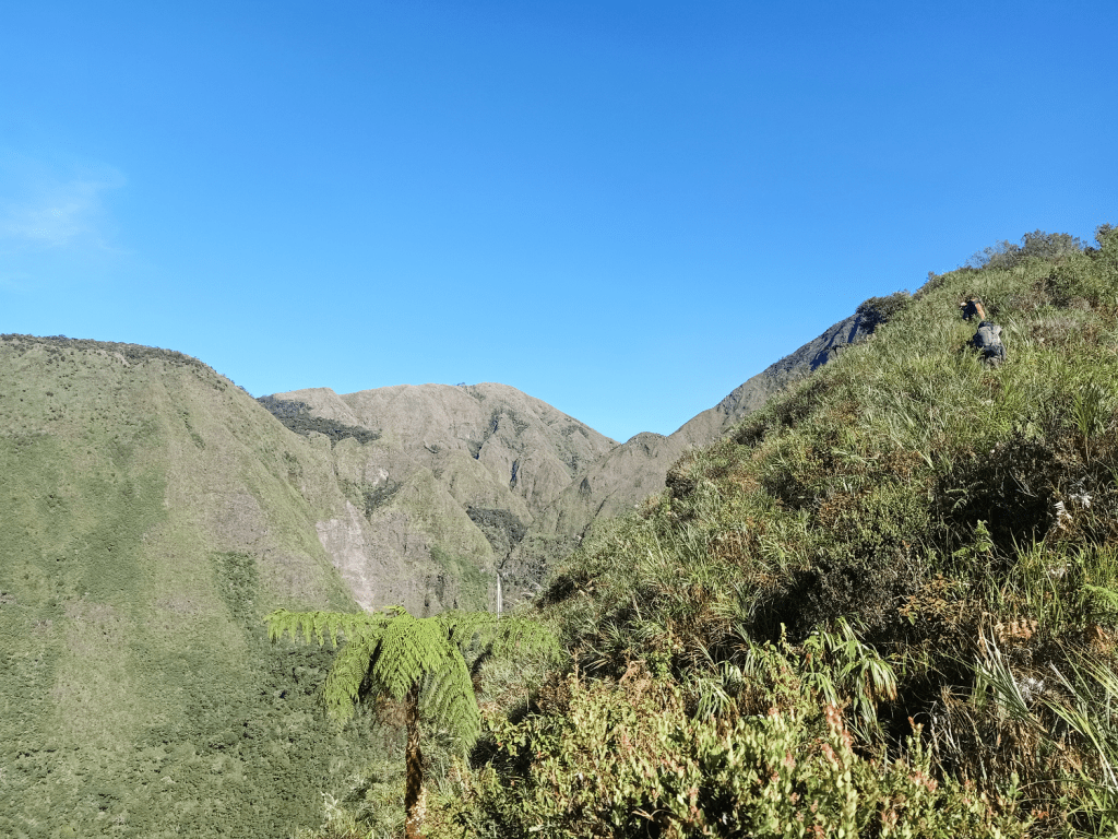
We started the descent at around 8 in the morning. The first part of the descent passes through tall grasses. A short ascent ensues, followed by a descent leading to what they call as “Danger Zone”. This area is a cliff with dangerous drops on both sides. To our left, we can see the adjacent slopes way, way down below. This slope, we believe, is where Muleta Falls gushes.

We then entered the mossy forest once again. After a short but pant-inducing round of ascent is where the continuous descent starts. From here, it would be all descent inside the mossy forest of Mt. Lumpanag before exiting to the farmlands of Sitio Mahayahay. In the early parts of the descent, we passed through Lishun Creek, a small water system inside the mountain where we refilled our water bottles. Afterwards, it was all descent once again. It was enjoyable, honestly. Despite its notorious toenail-killing length, I had a great time going down the forested trail.
It was 11am when we reached the first resting area (there were two in the trail map). There, we took the chance to rest and have our lunch. I was craving for carbohydrates after the nonstop descent we just did.
We continued the hike and arrived at the second resting area, which was now outside of the forest, at around 12 noon. In no time, we were walking at the expansive fields of Sitio Mahayahay, where a view of Brgy. Mendis can be seen from afar. When I looked to my left, I saw the makeshift tree house of the base camp nestled on the slopes of a forested hill, which meant that we were now near the end of the hike! I was also able to spot Buko Buko sa Anay’s exposed ridge!
The hike down Sitio Mahayahay was the real dead nail’s trail. With only a downward soil without any roots nor rocks to step on, our toenails were battered with every step going down. Still, I got to appreciate how expansive Mindanao is—in front of me was a vast rolling farmland that stretches all the way to horizon. I also spotted Lake Napalit to the right. Complementing this view was the windy atmosphere that took the tiredness from our bodies. We also passed through several coffee plantations and local houses along the way.
I was still awestruck despite being in the last portions of the hike.
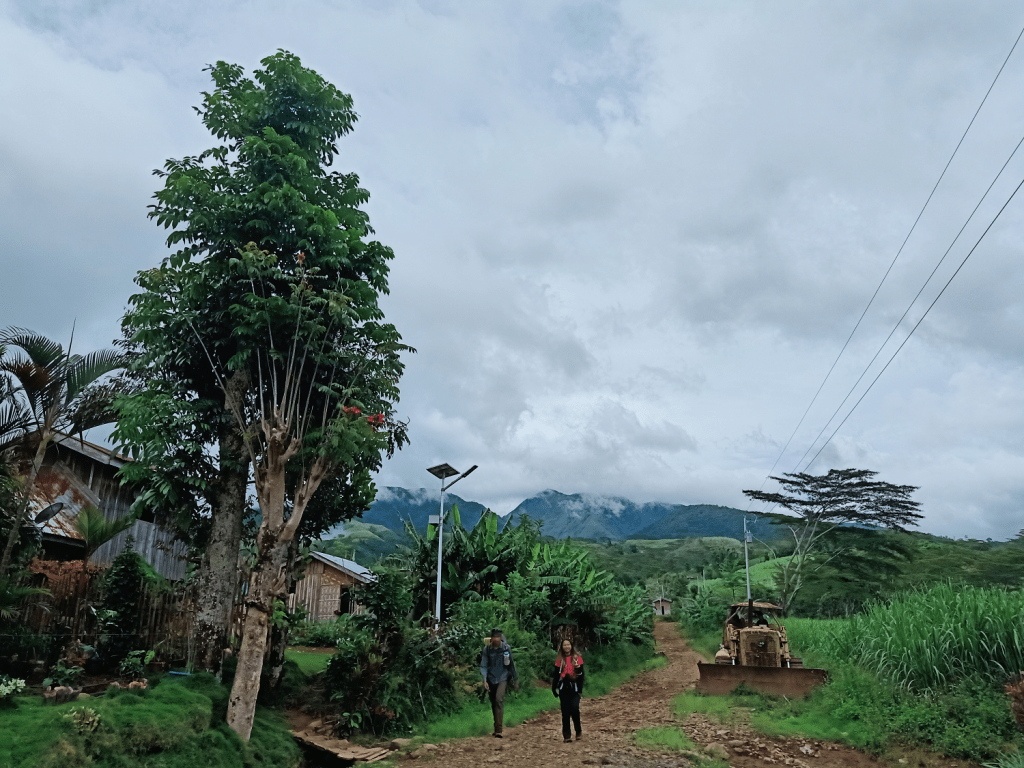
In no time, we were already walking on a paved road. Communities were now present at the side.
At one in the afternoon of October 31, 2021, five hours after starting the descent, we reached the hut where we stayed during the first day of our stay in Brgy. Mendis, marking the successful finish of our hike to Mt. Kalatungan! Fifth highest summit: finished and conquered!
While waiting for our companions to arrive, we took the chance to bathe, eat, and rest. The remaining persons within our group arrived at four in the afternoon. When everyone was finished tidying up, we bade good bye to Mt. Kalatungan and Brgy. Mendis. Before returning to Davao City, we were rewarded with certificates by Dauntless Outdoors at the La Montaña Cafe for successfully conquering the fifth highest summit in the country. It was a praise-worthy feat indeed!
**
Looking back, my first adventure in Mindanao proved to be an unforgettable experience. I think I speak on behalf of some outdoorsmen in the country that Mt. Kalatungan is typically not on the topmost priority list when it comes to conquering the Mindanao giants. When it comes to priority, it would often be in this particular order: Mt. Apo, Mt. Dulang-Dulang, and Mt. Kitanglad, and then Mt. Kalatungan. But even as a first Mindanao mountain, Mt. Kalatungan provides a serendipitous charm that makes it unrivaled with the rest of the mountains in the country.
See you in the near future, Mindanao!
Itinerary
Day 0
Arrival at Davao Airport
Day 1
07:00AM ETD Davao City
10:00AM Maramag, Bukidnon, buy supplies
12:00PM Pangantucan town proper, orientation at La Montaña Cafe
01:30PM Brgy. Mendis, log at the military detachment, settle at the community hut
06:00PM Ritual, dinner
07:00PM Lights off
Day 2
02:00AM Start hike
03:00AM River crossing
04:00AM Base camp
06:00AM Kikikoka Peak
07:00AM Buko Buko sa Anay
07:30AM Muleta Falls Viewdeck
09:00AM Resume hike
10:30AM Sako Camp
11:30AM Junction
01:00PM Start assault to summit
01:30PM Summit
02:00PM Return to junction, start descent to Sanggaya Camp
04:00PM Sanggaya Camp
06:00PM Dinner
07:00PM Lights out
Day 3
04:00AM Wake up, prepare breakfast
06:00AM Start assault to Mt. Wiji
07:00AM Mt. Wiji summit, picture taking
08:00AM Start descent
08:30AM Danger zone
09:30AM Lishun Creek
11:00AM Rest Area 1
12:00PM Sitio Mahayahay
01:00PM Brgy. Mendis, wash-up
06:00PM Awarding of certificates at La Montaña Cafe
11:59PM Back in Davao City
