Note: This is my second time climbing Mt. Arayat. My first attempt was in April, 2018 when we did the classic North Peak to South Peak Traverse. Click here to read my account for that hike!
Another note: This blog narrates my second attempt in climbing Mt. Arayat in September, 2021. The pictures, however, are from my hikes from that attempt and during my third visit in Mt. Arayat in December, 2023.
As a hiker from Central Luzon, I have always made a promise to myself to go back to the mountains of my region. Particularly, I have made a pact with Mt. Arayat that I will be climbing her multiple times in my lifetime. Mt. Arayat has had a special place in my heart. It played a big part of my childhood when our whole family would go to Clark or SM San Fernando for some Sunday getaways. My mother and my grandfather would often hype up Mt. Arayat, and as a child, I was fortunate to bask in its geographic glory as it towers over Pampanga.
In September of 2021 when strict community quarantines were in place, I was fortunate to get the chance to climb Mt. Arayat again. For this hike, we did the Pinnacle Peak to South Peak loop hike. This trail starts and ends at the Mt. Arayat National Park in Brgy. San Juan Bano in the town of Arayat, Pampanga. It crosses the southern side of Mt. Arayat, ascending towards Pinnacle Peak – a subsidiary horn-like peak adjacent to South Peak – and then taking the perilous monkey trail ridge connecting it to South Peak, and finally descending via the traditional trail connecting the jump-off point and South Peak.
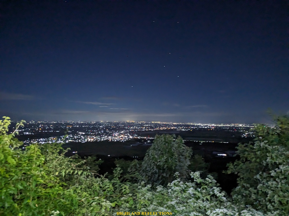
We started the hike past two in the morning. Since I was with casual travelers for this hike, we made sure to pace everyone so that we could successfully navigate the dark surroundings. Many times, we would have long stopovers to appreciate the orange-lit towns below the mountain.
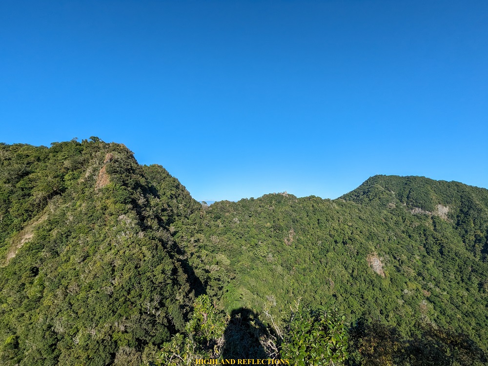
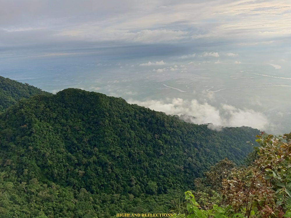
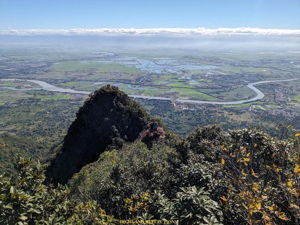
We were on the upper reaches of the mountain when sunlight caught up. To our left, a giant forested wall could be seen behind the canopy of trees – a portion of Arayat’s southern part.
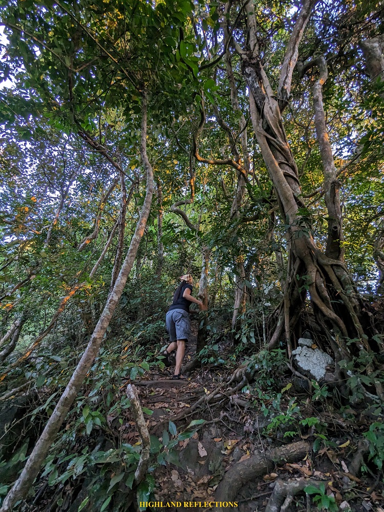

As we were nearing the pinnacle peak, the trail got steeper and more technical. We were using all four limbs to negotiate the trail. I reached the viewpoint of Pinnacle Peak past 6:30 in the morning, four hours after starting the hike. Here, we had an awesome view of Pampanga and Nueva Ecija’s plains, with Pampanga River slithering in the middle. We stayed there for less than an hour.
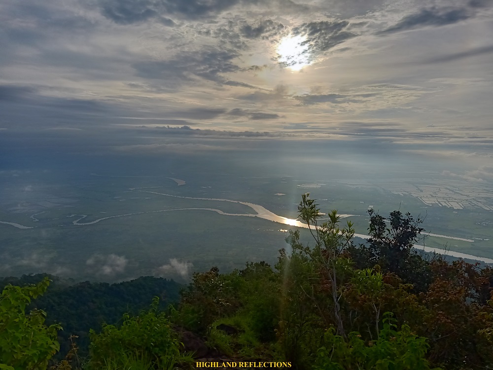
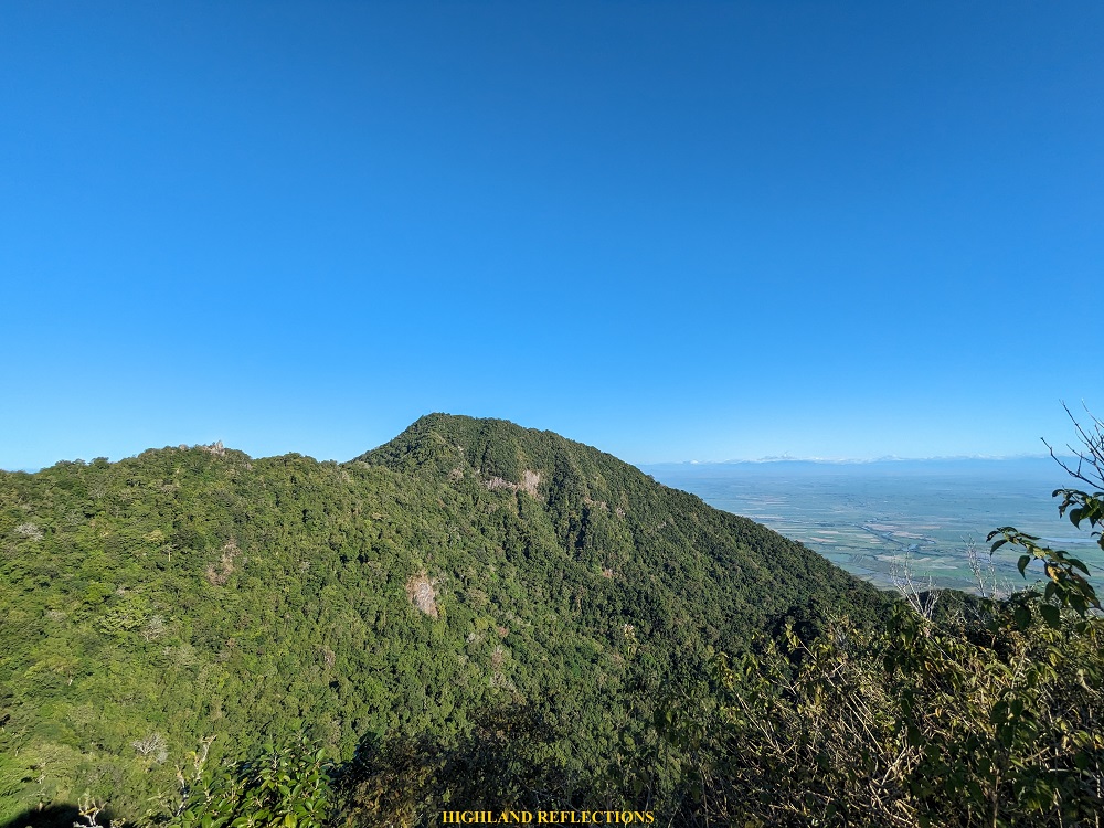
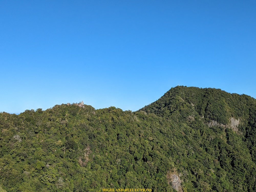
We then climbed the summit of Pinnacle Peak, where we had a view of the nearby South Peak, looming over the pinnacle. I was also able to spot the faraway North Peak to our right. North Peak is the official highest point of Mt. Arayat (1,034+ MASL).
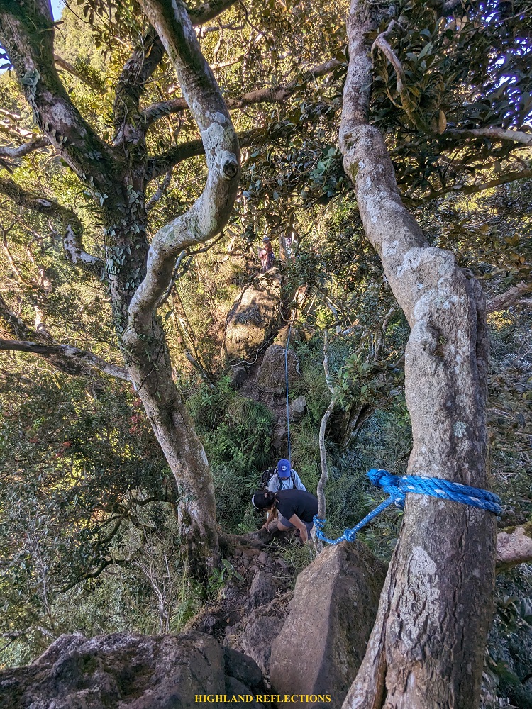
The descent from Pinnacle Peak was the most dangerous part of the climb. We descended a boulder assisted by a rope and our guide. Afterwards, we crossed what they call a “monkey trail,” a one meter wide ridge with dangerous drops on both sides. Both cliffs on either side are obscured by branches and trees. After successfully crossing the monkey ridge, a series of very steep ascent follows. One must use both arms and legs in negotiating the trail, and a whole lot of upper body strength is required to push oneself up.
The uppermost part of the steep ascent ends at a view deck near South Peak. This was now a familiar territory for me since I was able to go to this spot in our North to South Peak Traverse in 2018! With only a few minutes of breather, I left my companions and went ahead towards the summit of South Peak, which was in the middle of the forest. There, I ate my snacks and rested for a bit. It was 9 in the morning.
Past 10, I requested permission from our guide that I would be starting the descent alone since I wanted to walk comfortably with my own pacing. With our guide’s approval, I went ahead and immediately trail ran the start of the descent but slowed down my pacing after covering a few yards since I did not want to batter my knees. Following the trail and looking at my STRAVA map once in a while to check if I was still in the right path, I descended alone, appreciating the magnificent flora and fauna inside the mountain. I reached the jump-off point past twelve noon, two hours after starting the descent. Back in 2018, we also covered the South Peak to jump-off descent for two hours, which means I did not get it faster for this hike as I expected. Dang. I’ll try again next time.
I, then, waited for my companions to reach the jump-off point. Afterwards, we ate lunch and took our baths inside the resort of the national park. We went home and I arrived in Malolos City past five in the afternoon.
Really felt grateful to go back to one of my favorite mountains. Hoping for more hikes inside the Kapampangan mountain!

One thought on “Mt. Arayat Pinnacle Peak to South Peak Loop (983+ MASL)”