The grand mountains of Central Luzon are places that I have always wanted to go to since they are closer to home, and in effect, closer to my identity. As a Bulakenyo, I am fond of the mountains I see in the horizon when traversing through expressways going to the different parts of the region. In July of 2021, in the middle of the pandemic, I was able to hike the Novo Ecijano mountain that is Mt. Labi.
Mt. Labi was explored in the middle of the last decade (around 2015 or 2016) by the Nueva Ecija Backpackers & Mountaineers Community (NEBMC). It is situated in the barangay of its namesake (Brgy. Labi) in the town of Bongabon in Nueva Ecija. The mountain is nestled in the Aurora Memorial Park, a protected area of the Sierra Madre Mountain Range bordering Nueva Ecija and Aurora which contains other high peaks such as Mt. Mingan, Mt. Kemalugong, and Mt. Danayag. Its trails consist of a tropical rainforest, sometimes mossy, teeming with a diverse set of flora and fauna.
The traditional trail of Mt. Labi starts off near the Aurora Province Welcome Marker a few kilometers away from the touristy Labi River. This trail is used by a digital service provider company to access a cell site tower that is located on the slopes of Mt. Labi. This trail was already rated as 7/9 using the Pinoy Mountaineer standards, and is really steep, technical, and difficult. The traverse trail, on the other hand, crosses the entire ridge of the mountain, and ends on the banks of Labi River itself. The trail here, albeit more gentle in steepness, is longer. Some hikers would rate it a higher 8/9, but after this hike, the combined traditional and traverse trail, subjectively, warrants the same 7/9.
Based on initial records by the NEBMC and my own observations, here are some basic information about the hike:
Jump-off point: Cell site tower trail, Brgy Labi, Bongabon, Nueva Ecija
Exit point for the traverse: Labi River, Brgy Labi, Bongabon, Nueva Ecija
Specs: Major climb, difficulty 7/9 both for the backtrail and traverse (subjective)
Trail class: 2-3
Days required / Hours to summit: 1 day / 3-4 hours
Features: mossy forest, monkey trails, view of the Sierra Madre and Caraballo Mountain Range
For this hike, I joined an event by Bundokerong Pandak. Coming from the Metro, the team arrived at Barangay Labi in the quiet town of Bongabon in Nueva Ecija around two in the morning. We parked near the barangay hall and slept for two hours until our guide arrived and woke us up. We then went further the Nueva Ecija-Aurora Road going towards the jump-off point near the Aurora Province Welcome Marker. It took us almost 15 minutes to negotiate the zigzaggy, Cordillera-like highway. Once we arrived, we settled at an open sari-sari store and had our coffee breaks. Sipping a cup of hot coffee was such a perfect complement to the weather, as that part of the highway was already at a high elevation, around 600+ MASL, which explains the Tagaytay/Baguio-like breeze.
We started the hike at exactly 4:50 in the morning. The trail is located at the opposite side of the store a few meters away. Thick shrubs and plants welcomed us, almost obscuring the trail we were treading. A few minutes, the path slowly transforms into an ascending trail, albeit still being covered with thick undergrowth. I was already panting at this point, but I knew I was in good condition.
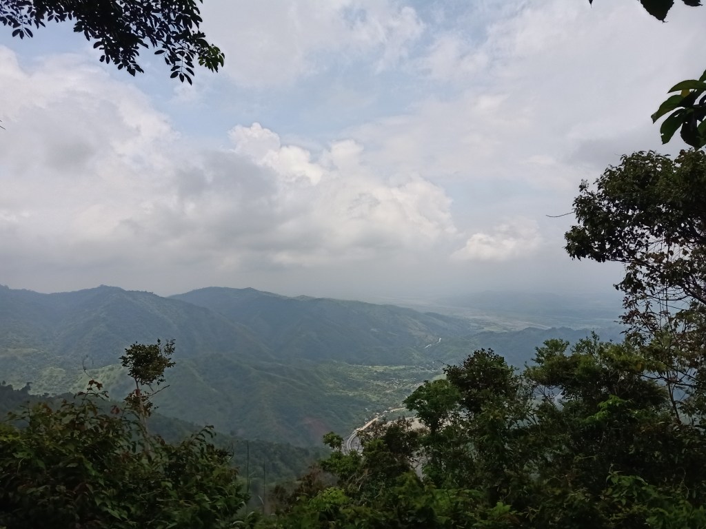
We then entered a trail in the middle of the forest. This trail stretches for a few meters, which then zigzags to the left, stretches for a few good meters, then zigzags to the right. This would go on and on until reaching the cell site tower. After gaining some amount of elevation, we were welcomed by a magnificent sea of clouds by the side of the trail. No wonder it was foggy on the highway! We stopped for a few minutes to appreciate the magical view.

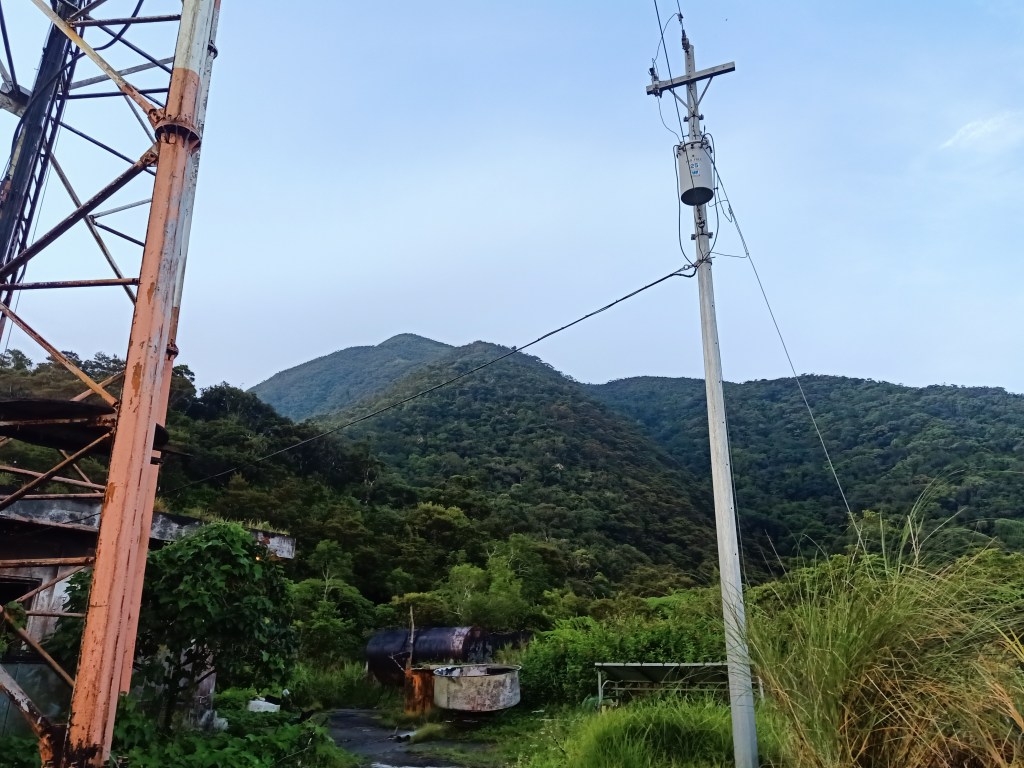
While zigzagging the stomach-like trail, we continued to be struck in awe of the sea of clouds as we gained more elevation. There was a brief part of the trail where the path was wide and mossy trees form arcs along the pathway, giving off an eerie vibe. Our guide, then, informed us, much to our shock, that this was actually a “road” that leads to the cell site tower. I was wondering how this wild trail could be considered a road.
I reached the cell site tower at exactly 5:45 in the morning, 55 minutes after starting the hike. There, a bunker that houses the caretaker of the tower is erected. He greeted us a good morning with three of his curious dogs. We took a long rest and savored the cold morning breeze. Mt. Labi’s slopes were already looming near at that area, giving us an idea of the trail that we needed to negotiate. To our surprise, there were already limatiks in the cell site area! One of our companions drew first blood.


After snapping some pictures, we continued the ascent past six in the morning. As we entered Mt. Labi’s mossy forest, we were immediately greeted with a claustrophobic trail, a steep ascent, and an attack of pesky, little, aggressive limatiks! Every few meters of distance covered, I would find limatiks lying on my arm, ready to suck my blood! For this hike, I brought an alcohol spray as I did not want to get bloodied again like in my last hike in Magsaysay in Quezon.
After twenty minutes, we emerged towards a view deck, which gives a higher view of the sea of clouds, with the cell site tower already a few hundred meters below us. Complementing the sea of clouds are the lower mountains at the opposite side of the highway. In the horizon are the high mountains of the Caraballo Mountain Range in Nueva Vizcaya. I speculate that within those mountain ranges are Mt. Bintuod and Mt. Guiwan, two candidates of being the highest mountains in the entire Sierra Madre Mountain Range at 1900+ MASL!

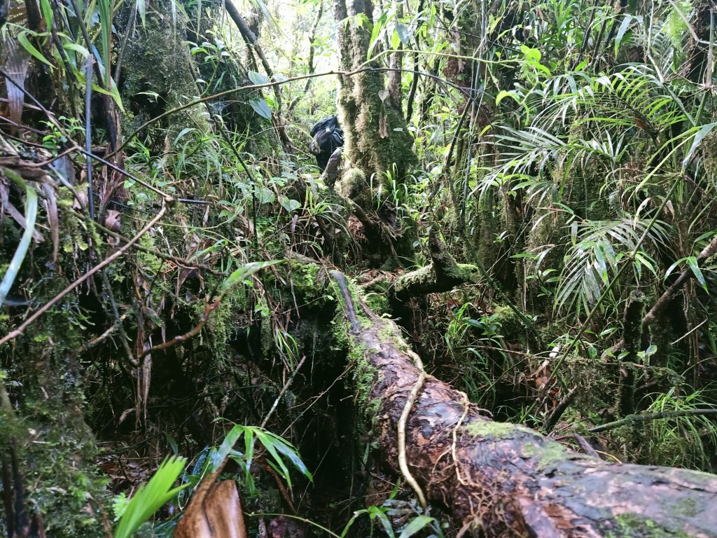
We continued the hike after staying for long minutes in that view deck. Inside the mossy forest, we negotiated the technical trail, its steepness was similar to Mt. Napulauan and Mt. Amuyao of the Cordilleras. Past seven, we exited the forest towards a grassy area, where the trail suddenly became a lot steeper! Stopping by before entering the mossy forest once again, I was able to spot the cell site tower already far from us, and the sharply inclined slopes that we’ve passed so far. Looking back, I realized how difficult the climb that we did thus far in this hike.

As we entered the mossy forest once again, we took another series of steep and technical ascent coupled with an occasional hello from the limatiks. For this hike, I chose to be mindful of the trail and avoided asking if we were near the summit, because at that point, I knew that it was still a long way to go. At around 07:40 in the morning, the three of us in the lead group arrived at an emergency campsite. There, we waited for our companions and rested. We also went to a view deck a few meters away, which sadly, only gave off a limited surrounding due to the thick swathe of fog enveloping the surrounding.
Froilan, our organizer, boiled some water for us to drink coffee. It was the right time to drink coffee as I was already feeling the coldness of the surrounding, despite being in the midst of mossy trees. We took a long break there and chitchatted. Some of our companions were already bleeding from the limatik bites. I, on the other hand, only had some bite marks as I was actively removing them every now and then.
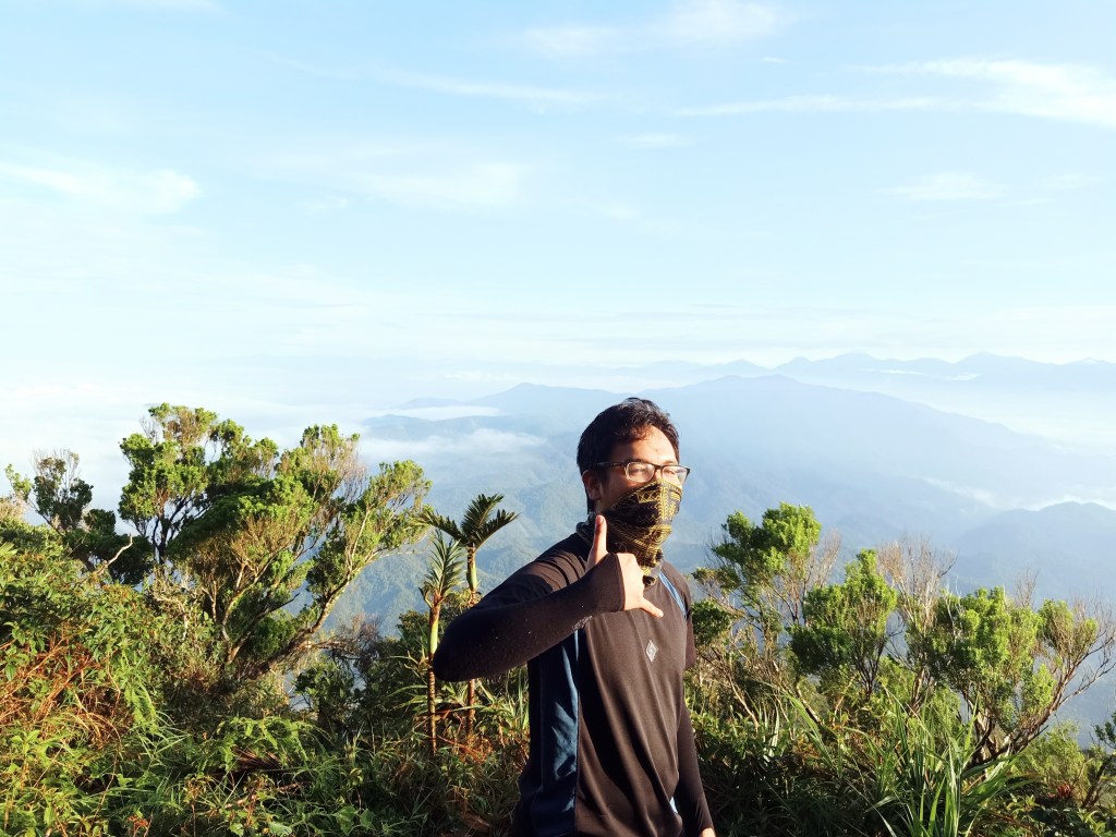
At around 8 in the morning, we continued the ascent. The trail continues on a steep ascending fashion, much like the earlier parts. However, there was now an added element of having to step on trunks and branches of rattan trees as well as on top of rocks. This was highly reminiscent of the monkey trail in Mt. Tabayoc in Benguet! No soil to step on, just trees and boulders as pathway. After an hour, before the clock ticks at 9, we reached the junction where the path leading to the traverse trail is located. A few meters away is the summit, Mt. Labi’s Peak 1, standing at 1,620+ MASL, which we reached after four bloody (literally) hours!
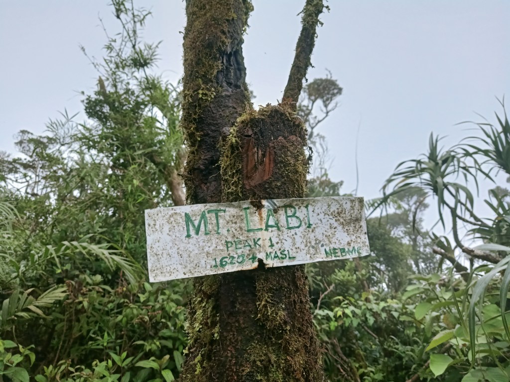
We took turns on taking pictures by the summit marker, which was a small white painted wood installed by the NEBMC on a tree trunk. Even at the summit area, we were being attacked by limatiks, and I had several on my tshirt after staying on a secluded side of the summit!
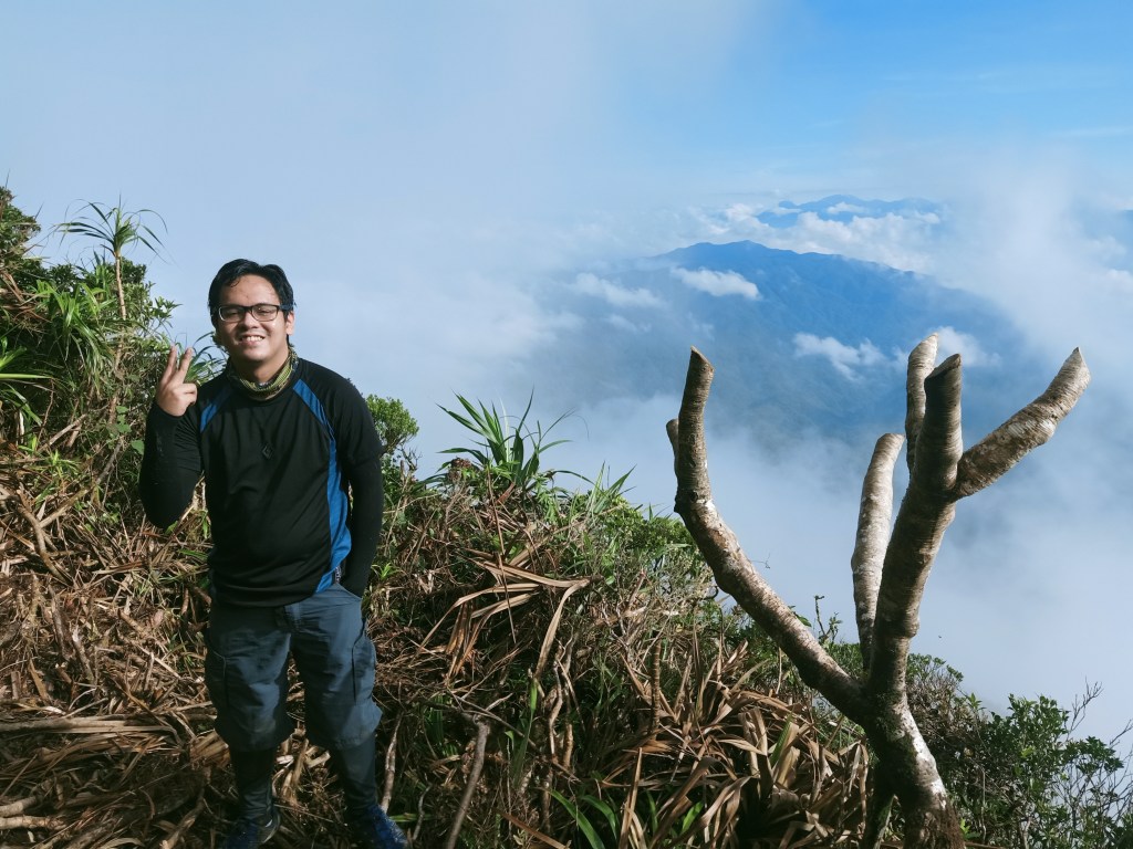
Unlike our spectacular view at the lower slopes of the mountain, the entire summit of Mt. Labi was covered in fog. On a clear, sunny day, one can view Mt. Labi’s Peak 2. This peak, as of this writing, is still unexplored by hikers, and is actually the higher summit of the two, standing at 1700+ MASL! Hopefully, this gets explored in the near future.
**
We then took our brunch at an area near the junction. Before ten in the morning, we resumed the hike. It was now time to take on the longer descent trail!
Unlike the trail we took on the ascent, the trail for the descent was ironically more established and not at all steep! The descent was gradual and not pronounced. There are two reasons for this. One, we were walking on the ridge of the mountain that stretches all the way to Labi River. Two, the guide told us that this was actually a hunter’s trail, and have long been established maybe even before mountaineers have explored Mt. Labi. In less than an hour, we immediately covered almost half of the distance for the descent! I was wondering why previous hikers took four to five hours to take this trail. I was about to find out.

After resting by another campsite, we continued the hike. We initially took a two minute ascending trail then continued with the descent again afterwards. The descent then, surprisingly, became a lot steeper. We were now taking an actual descending trail. My knees were already signaling me bouts of distress, but I kept marching downwards, until very gradually, my speed dissipated and I was now with the sweeper group.
With the slow descent, I was able to catch up with the others while everyone was resting at an open area, where Labi River can already be seen at a distance. Judging from the elevation, there was still around 500 meters of elevation to lose before reaching Labi River. It looked so near, but actually was still far. We had our lunch at that area. It was twelve noon.
After having our lunch, we continued with the descent. I would now know the answer to my question of why previous hikers took four hours (or more) taking this trail. The descent continues, which to my surprise, became a lot more inclined than it already was. The trail was extremely steep, and there were no ropes nor any form of structure to assist you. You can hold on to some of the vines and grasses on the side of the trail, but it can only do so much.
Despite the gloomy weather, we were thanking the heavens for not raining on us, as the steepness was really dangerous, and a muddy trail would make the descent extra difficult. Since my legs were becoming tired, I negotiated the trail by sitting down and sliding my feet. Luckily, with my persistence of marching forward (and downward), I wasn’t far from the group.

My body was already quitting on me especially when we were at the lower portions of the mountain, where I could already see the canopy of trees on the lowest portions of the mountain. With perseverance and persistence, I reached the lowest portion where we exited towards a creek. There, I washed my mud-filled shoes, legs, and shorts. Afterwards, we negotiated the stream until exiting through the highway! We then turned left of the highway and went towards the barangay hall.
Mt. Labi, completed! It was almost 1:40 in the afternoon, almost 9 hours after starting the hike!

Since there were many resorts near the barangay hall, we had many options to take our baths on. Some of our companions chose to take a dip in the nearby Labi River, where quite a number of tourists were having fun on that day. Once we were all done, we ate at a nearby carinderia. I ordered a cup of steaming rice and dinuguan. Afterwards, we went home. It was four in the afternoon. I reached home past eight in the afternoon, with a banged up body but a fulfilled soul.
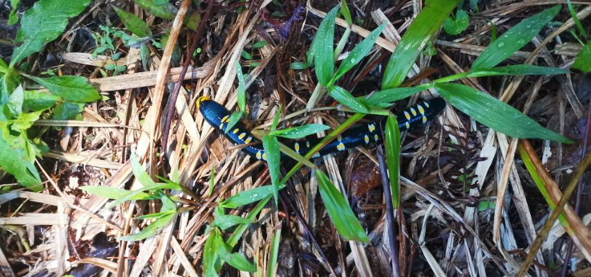
Mt. Labi is one of my most difficult hikes for this year. Its steep and perilous trail was similar to that of Mt. Napulauan, only a bit more difficult than the Ifugao mountain. Its mossy forest, although not grand, was still teeming with wildlife. During our hike, we were able to spot two fried egg worms (Archipheretima middletoni) and very colorful plants and flowers such as the climbing pandanus. Hopefully, we get to preserve its pristine and lush environment.
On to the next wild hike!

Itinerary
Day 0
09:00PM Meet-up at McDo Greenfield
10:00PM ETD Labi
Day 1
02:00AM ETA Brgy Labi, wait for guides
05:00AM Start hike
06:00AM Cell site tower, rest
06:30AM First view deck
07:30AM Emergency campsite, rest
09:00AM Summit
10:00AM Start descent
10:30AM Campsite and water source
02:00PM Labi River, exit
04:00PM ETD Labi
08:00PM Home
