In the mountainous, touristy landscape of Doña Remedios Trinidad (DRT), Bulacan lies the grassy twin mountain known as Mt. Palanas. The two mountains are situated at the rear of Tila Pilon Hills, and is known to many motorcycle enthusiasts as “Daang Mahangin.” Interestingly, it is also directly at the front of DRT’s highest hikeable summit, the Bulacan Peak of Mt. Silad (also known to the locals as Mt. Tanawan). The mountain features a Tagapo-like slope, where, to the left lies its North Peak standing at 597+ MASL, while to the right is its South Peak at 519+ MASL (STRAVA recorded). The specs of the hike are as follows:
Jump-off point: Eco Farm Park, Sitio Palanas, Brgy. Kalawakan, DRT, Bulacan (15.1128, 121.1154)
Difficulty: minor climb, 3/9
Trail class: 1-2
Days required / hours to summit: 1 day / 2-3 hours
Features: grassland slopes, view of the Biak-na-Bato National Park and Mt. Arayat, two waterfalls
For this hike, I was with my girlfriend, Pat, as joiners for an event organized by Dabpackers Philippines. Since most of the joiners were beginners, our guide, Kuya Rexel, opted that we just go to Mt. Palanas’ South Peak because the trail going to the North Peak has a thick, dense grassy trail that might not be friendly for newbies. We also went to two waterfalls at the foot of Mt. Silad – Trinity Falls and Avalon Falls – which, interestingly, were two waterfalls we passed through during our Mt. Silad (Bulacan Peak) hike back in January when I joined DIEhikers Unlimited (DHU).
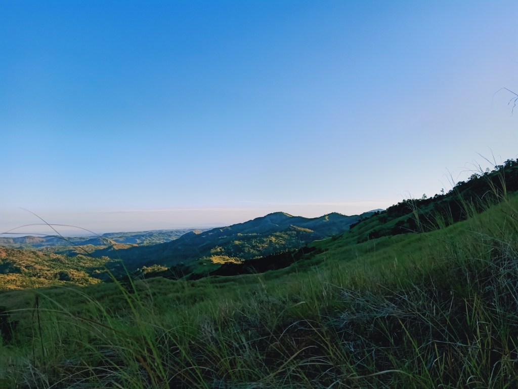
We started the hike at exactly 04:58 in the morning, thinking that since the trail was on an exposed slope, we should start as early as possible. However, since it was the height of summer, the sun was already up even before the clock struck six. Even in the darkness of the dawn, we could see Bulacan Peak towering in the night sky, as if inviting us to climb its immaculate slopes.
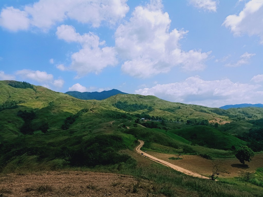
Coming from the Eco Farm Park, we followed a rough road that goes directly to the slopes of Mt. Palanas. This rough road was the same path that we took as an exit point during our Mt. Mulawin Traverse (Kalawakan Penta) in March when I joined an event by DHU. The path is mainly an ascending dirt road that elevates slowly as you gain more distance. We passed by a guard post that was, during our Mt. Mulawin Traverse, manned by officials, but was empty during our Mt. Palanas hike.
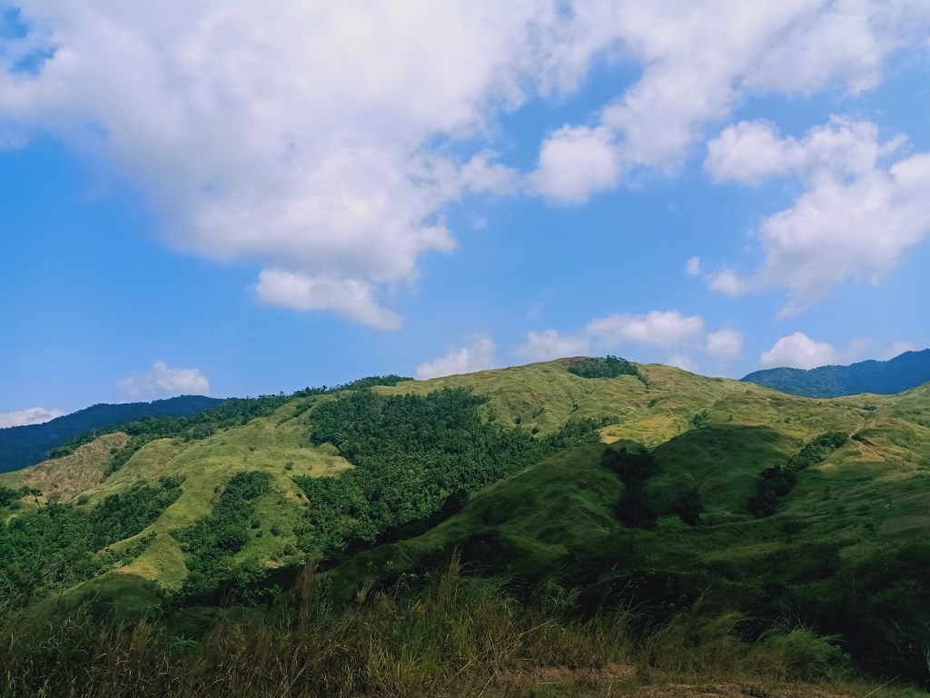
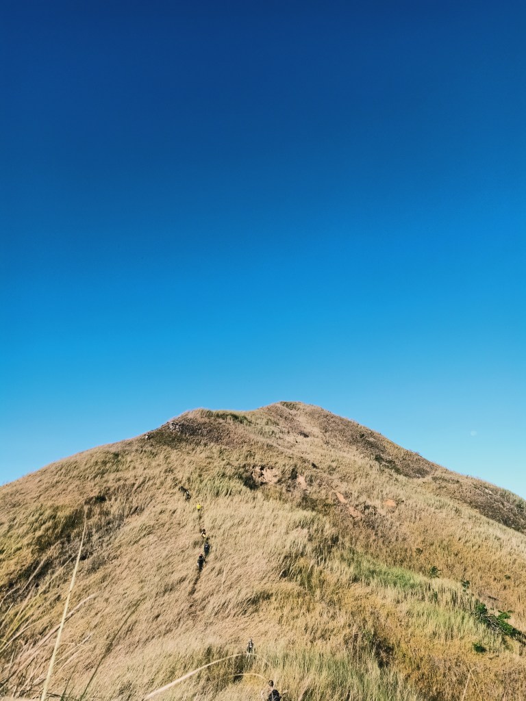
As we gained more elevation, we spotted the community of houses near the foot of Mt. Palanas’ South Peak. This was said to be a community of members of a dominant church group in the Philippines, said to be the ones who own this particular mountain. Minutes into the ascent and after a thousand heavy breathes from Pat (kidding), we entered a narrow path on the grassy slopes of Mt. Palanas’ North Peak. Here, we had several stopovers to catch our breaths and appreciate the view behind us, where the mountains of Biak-na-Bato National Park can be appreciated. These mountains are Mt. Mabio also called as Mt. Silid to some locals, Mt. Susong Dalaga, and Mt. Nabio, which contains the famous Mt. Pinagbanderahan.

We reached a part of the trail where we were directly at the foot of Mt. Palanas’ North Peak. Here, since there was an ample shade, and the slopes of the South Peak was already being bathed in sunlight, we took the chance to have breakfast. Acky, the headman of Dabpackers Philippines, brought boxes of ube bars and pan de coco, as well as coffee and hot water. The delicacies he brought were made at the oldest bakery in Sampaloc, Manila. Each of us picked one ube bar and one pan de coco, which served as our breakfast that morning.
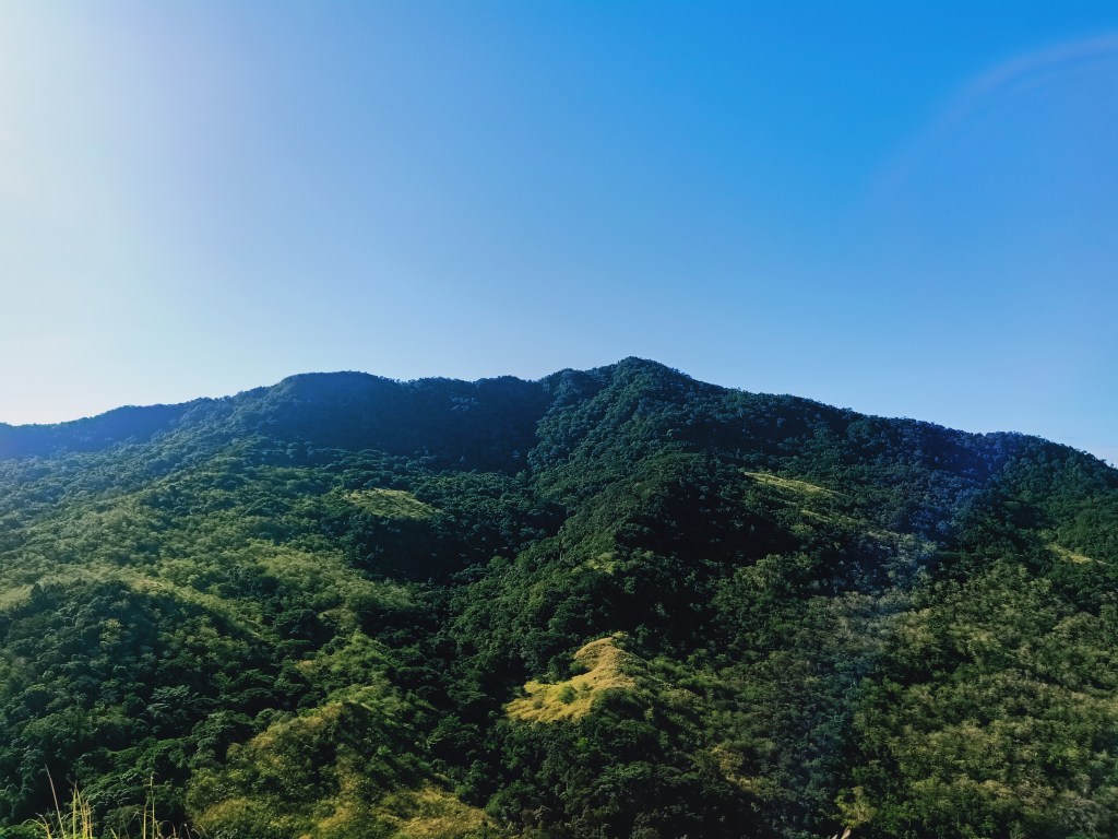
After getting our stomachs filled to our hearts’ content, we pushed through with the final assault going to Mt. Palanas’ South Peak. Coming from that part of the trail where we took breakfast, the summit of the South Peak was just a five-minute steep assault on a grassy slope. Here, we had a very close encounter with Mt. Silad! I could see its slopes all the way from the bottom up to the ridges at the side of its summit.
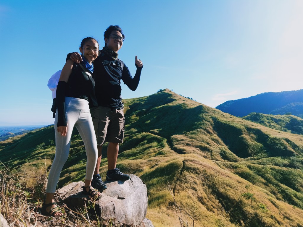
Along the trail, there was a picturesque spot where we stopped over and did some not-so-buwis-buhay shots, where the backdrop is the nearby North Peak. Mt. Silad can also serve as a backdrop at another angle. The summit was just a stone’s throw away from that point. We reached the summit at around 7:30 in the morning, two and a half hours after starting the hike.
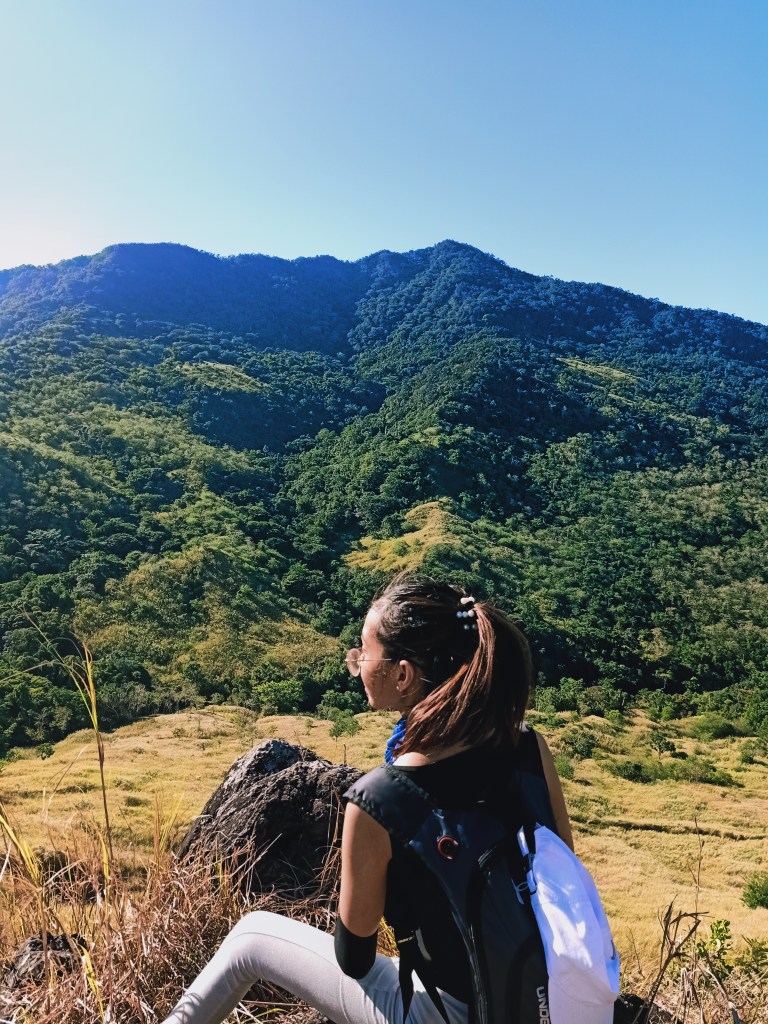
The summit was only a small area that can accommodate just our group. Site orienting was very easy, as the view at the north is obviously, Mt. Palanas’ North Peak. Dominating the eastern view is the gigantic Mt. Silad and its immaculate forest. Towards the south are other forested mountain ranges, in which the nearby peak is what I can only assume as Mt. Lumot in Barangay Camachin. To the west are the mountains of Biak-Na-Bato National Park, where, in the horizon, Mt. Arayat is beautifully unveiled in between Mt. Mabio and Mt. Susong Dalaga. Haze seems to be covering the sky, so we were not able to see the Cabusilan Mountain Range (Mt. Pinatubo) and the rest of the Zambales Mountain Range.

After snapping pictures, we descended on a trail-less slope where we needed to make our way through tall cogon grass while descending. After a few minutes, we reached the end of that talahib trail and emerged on a rough path that forks to the left, right, and to our front. We took the left side of the path which leads to the rear of Mt. Palanas and ends at the forest foot of Mt. Silad. The trail here was constantly descending, and as the sun was becoming a punisher, Pat and I slowed our descent. In no time, we reached the foot of the slope, where Trinity Falls is located.
As I laid my eyes on the rock formations where the waters of the Trinity Falls cascade, memories of that place slowly formed in my mind like a puzzle. When the puzzles were put together, I had a lightbulb moment in my head and realized that it was the same waterfall that we climbed during our Mt. Silad hike in January! In my narration of that climb in this blog, this was the waterfall that we climbed all the way to the top, only to find out that the trail is on the slopes at the side of the falls!


We stayed there for a little while and rested. Pat and I ate our onigiri that she made. Afterwards, we went to Avalon Falls, which has a very deep, clear lagoon at the bottom. Here, we took the chance to swim and bathe under the falls. For Pat, this was her most enjoyable part of the hike! Sino ba naman ang hindi mag-eenjoy sa swimming sa ganitong kainit na summer?

Past 11, it was time to say good bye to Avalon Falls. At this point, Pat was already experiencing cramps. Good thing was that some of our companions brought salt. Once we took the ascending rough path that we passed by earlier, we slowed down and trekked the slope very slowly so as to not shock Pat’s muscles. We passed the time by chitchatting with Acky, and sharing our past stories on different mountain slopes.
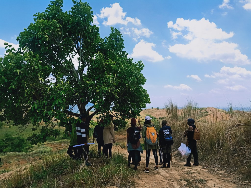
Once we reached the fork, we stayed on some small trees and shrubs to get some ample shade, as the sun was punishingly hot at that time. Then, we continued the hike by taking the right side of the fork. From here on, the trail becomes wide and dusty, and passes through the grassy slopes of the mountain. According to our guide, this is now the famous Daang Mahangin taken by motorcycle enthusiasts when going to Trinity and Avalon Falls. It got its name from the strong gusts of wind present in the slopes during -ber months and Amihan season. Sadly, as we hiked during the summer, the gusts were scant.
We passed by the community we spotted earlier during our ascent. Here, we took some time to rest, take bathroom breaks, and buy some cold beverages to quench our thirst. I also took the time here to play basketball on a makeshift court.
Once we continued the descent, we reached the rough road we took earlier. It was all descent from here going to Eco Farm Park. We savored our time here since there was no rush to finish the hike earlier. At the parts where we were very near the Eco Farm, I attended to Pat’s cramps as her knees were getting battered by the gravelly road coupled with heat exhaustion.
We reached the Eco Farm Park around one thirty in the afternoon, seven and a half hours after starting the hike. All in all, Mt. Palanas was an easy hike perfect for introducing beginners to hiking. Although of course, the summer heat made our hike a little bit more difficult than it should be. This should be an exciting climb to take during Amihan season!
After taking our baths at the community a kilometer away from the Eco Farm Park, we had a celebratory late lunch / early dinner at Mang Pongz Bulaluhan near the DRT arch. Another satisfying hike completed!
