On the third week of May, I was able to hike one of Tinucan Circuit’s summits – Mt. Tinucan. The mountain features a very scenic, three hundred and sixty degree view of the Tanay highlands as well as a chance to encounter a sea of clouds. For this hike, I joined Akyat Tanaw Mountaineers in what was supposed to be a Magsaysay Traverse hike in Infanta, Quezon. Sadly, we were not able to get to the jump-off point of the Magsaysay Traverse due to lapses in travel protocols between the locals and the uniformed men manning a checkpoint in Marilaque Highway. Hence, we settled with a lesser known mountain in Tanay. Coincidentally, I was also with the author and vlogger of Transit Pinas (you can check his legit blog of our Mt. Tinucan hike here! His photo shots are superb!).

Coming from Marilaque Highway, our adventure started at midnight in Tanay town proper where we ate at a tapsilogan eatery. Unfortunately, during our stay in the eatery, we were disturbed by drunk, tambay-dressed soldiers with guns tucked in their basketball shorts. It was an hour of discomfort in the presence of those armed irrational halfwits. Fortunately, the situation was pacified by local police and barangay officials, ironically woken by these drunk, foolish men.
Getting freed from that disturbing predicament, we made our way to Barangay Tinucan past four in the morning, passing by the barangays of San Andres and Cayabu. The last time I was in this area was in 2017 when my college friends and I hiked Mt. Batolusong in Barangay San Andres for a celebratory hike after passing the board exam, and in late 2018, when I was in the secluded Sta. Ines to hike Mt. Irid, Rizal’s highest summit (my personal account for that hike can be found in this blog).
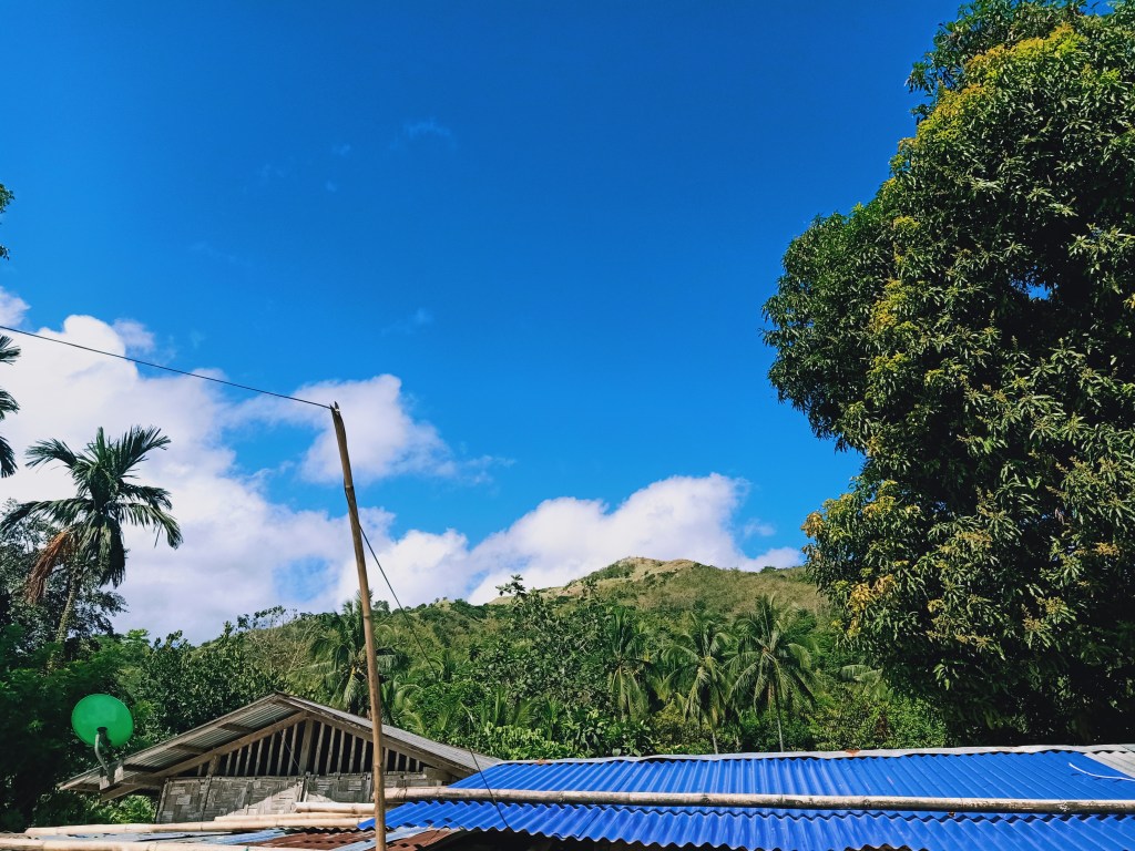
To get to the barangay hall of Tinucan, we needed to cross a river twice. It’s difficult for vehicles to cross it since the river was strewn with large boulders. Just after a short walk, we were able to reach the barangay hall of Tinucan. We registered and bided our time as it was still early. We sipped some coffee, took some light breakfast, observed the night sky filled stars, and joked about the unfortunate event that transpired earlier.

Even in the barangay hall, one can already spot the summit of Mt. Tinucan, towering over the whole community. By five in the morning, as the sky is slowly being lit, we commenced the hike. The actual trailhead was a few meters away from the barangay hall. Once we entered the trail, we were immediately greeted with an ascending path. The trail is mostly on sub-montane forest filled with dipterocarp trees scattered widely on the slopes, providing only little shade.
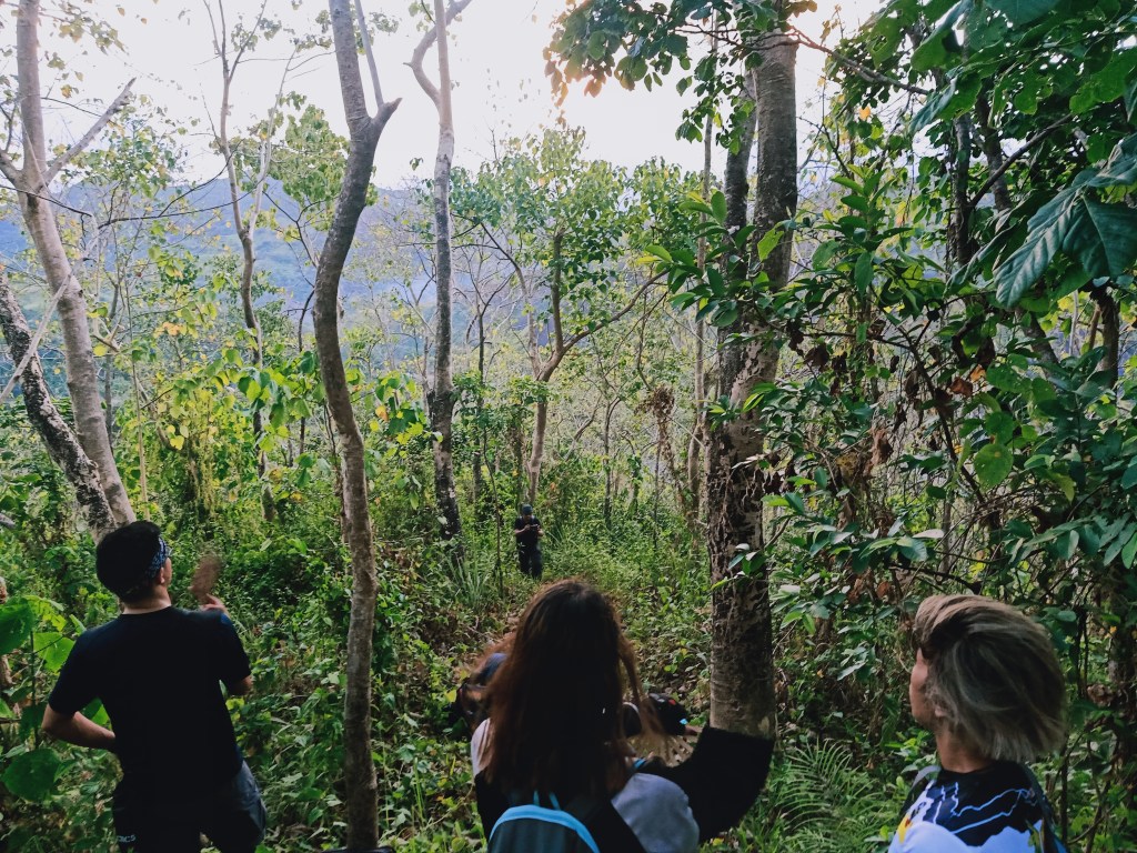
Since it was a straightforward ascent with almost no flat ground, we gained elevation very quickly, revealing the neighboring mountains. To our left, we were able to spot Mt. Maynoba and Mt. Cayabu. To our back is a mountain at the opposite side of the valley, which, according to our guide, is Mt. Natad, one of the prospect summits of Tinucan Circuit.

As the sun was slowly penetrating the cloud-filled sky, we rested before taking the second half of the assault. The next part of the assault was on a steep, grassy slope that ends at the peak of the mountain.
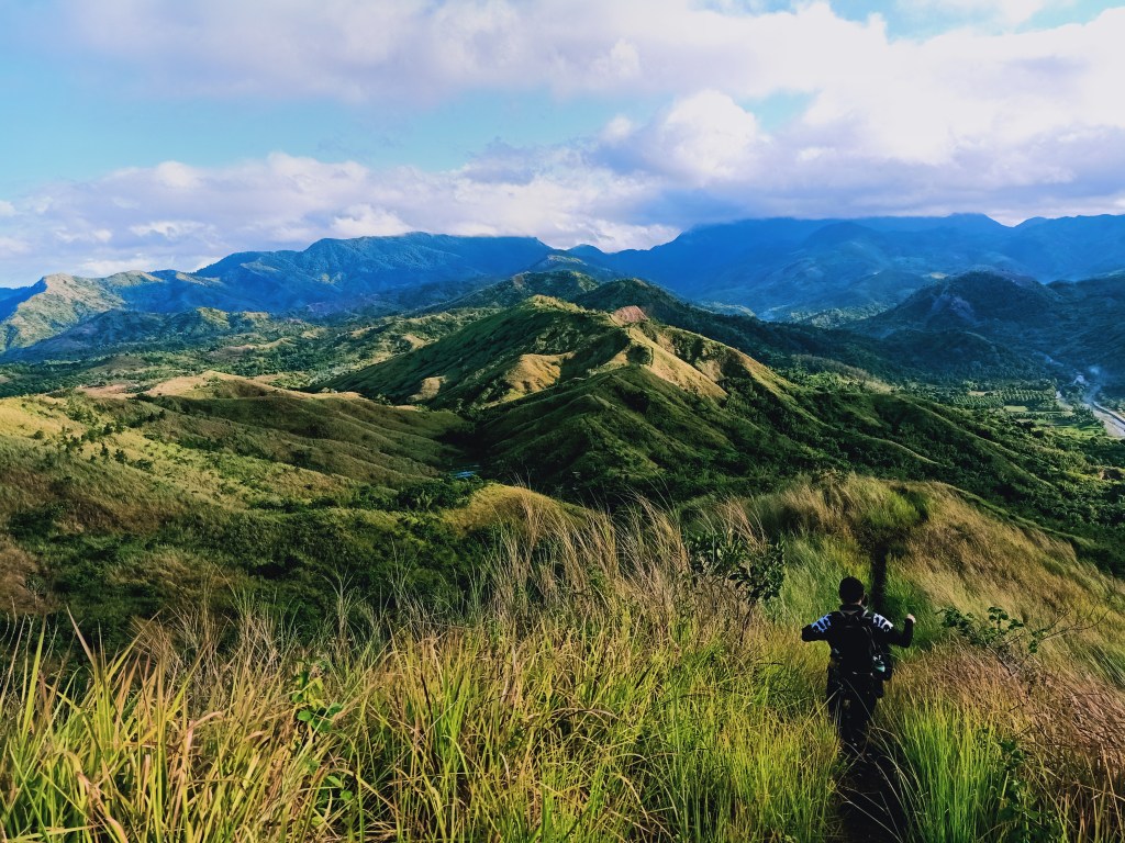
At 6 in the morning, an hour after we commenced the hike, we reached the summit of Mt. Tinucan at 591 MASL+! The view atop was spectacular as mountains were scattered in all directions. As someone who is not familiar with the Tanay scenery since I was often in the Cordilleras pre-pandemic, I had the chance to reacquaint myself with the mountains of this town.
The summit area was small and can only accommodate maybe two or three groups. A small transmission tower was erected on the eastern side of the summit, where a view of the valley where Barangay Tinucan is located can be seen. Behind that valley is Mt. Natad (846+ MASL). Turning right, the view consists of Mt. Maynoba (728+ MASL) and behind it is Mt. Canumay (980+ MASL) in Antipolo, Rizal, towering over Mt. Tinucan.To our west, we spotted the tall buildings of Quezon City in the horizon. Near Mt. Tinucan at the same direction, was a valley, which was Barangay San Ysiro in Antipolo, Rizal. Past that valley, at northwest direction, is the 800m Mt. Domire, located in the Upper Marikina River Basin Protected Landscape.


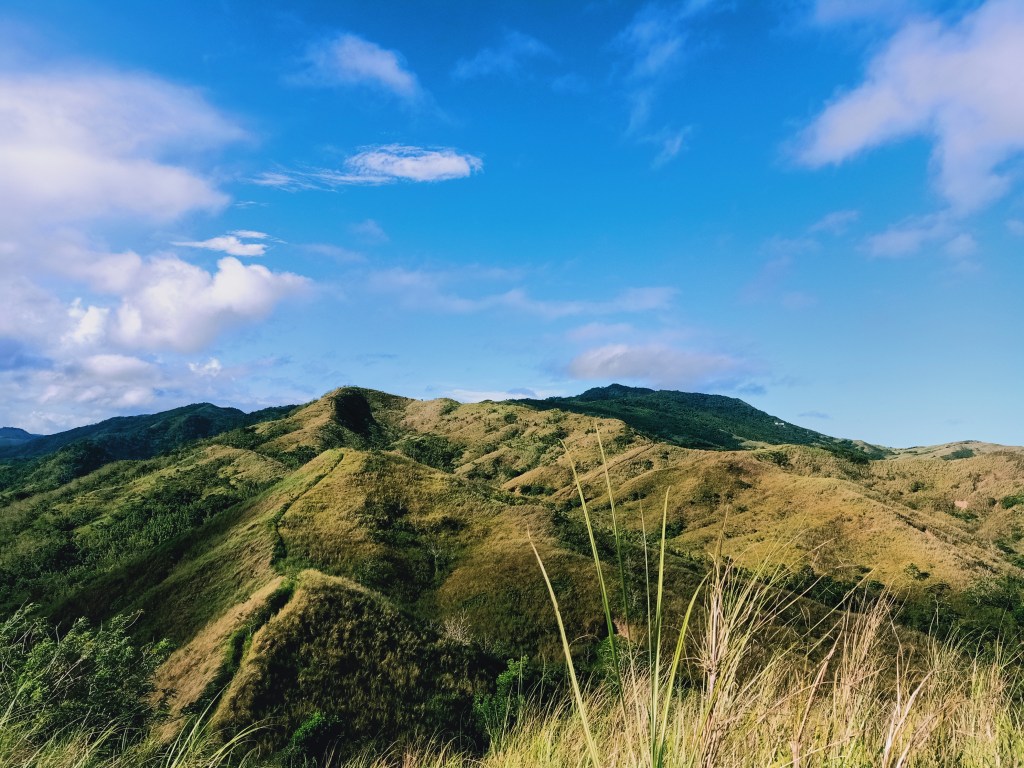
To our north, Mt. Tinucan’s grassy, rolling slopes extends on another mountain, which was Mt. Lilid (556+ MASL), the second part of Tinucan Circuit. Sadly, our guide informed us that they have not yet “cleaned” the trail as of this writing due to the hiking hiatus in the second wave of the COVID surge. Behind Mt. Lilid are the towering mountains of Sta. Ines, starting with Mt. Masarat (798+ MASL), and behind it, Mt. Tukduang Banoi (1258+ MASL) and Mt. Irid (1467+ MASL) loom with their cloud-covered peaks.

We started the descent around seven in the morning. We took the trail that goes to Mt. Lilid, crossing by the grassy ridges connecting the two mountains. Many portions of that descent were steep, reminiscent of the descent trail in Mt. 387, only shorter. Since the guide did not want to risk going to Mt. Lilid with an unchecked trail, we turned right, descending towards the valley where Barangay Tinucan is located. In no time, we reached the road below Mt. Tinucan. Before going to the barangay hall, we had a short dip at a nearby river. It’s exciting to think that I was very near Sta. Ines – Mt. Irid was just a stone’s throw away!

Around eight in the morning, we returned to our van at the trailhead a hundred meters away from the barangay hall. Since we still had a lot of energy, we walked all the way to Barangay Cayabu where we took our baths. We went home afterwards. This was the earliest return to the Metro I had in an organized hike!
I wasn’t really a fan of the Tanay Mountains for being often crowded during the pre-pandemic days. But unexpectedly, I was able to enjoy this hike despite how short it was. I guess, despite my lack of fascination for mountains in this area, mountains are still mountains. They still have charms that present in their own unique ways no matter how well-known they are, just like people! True enough, the people I was with during this hike were all strangers to me, but just like mountains, their idiosyncrasies make them interesting to observe and to be with. Despite the unfortunate events of that day, I was still blessed by this southern highland.
‘Till the next hike, Tanay!
Itinerary
04:00AM Barangay Tinucan, register
05:00AM Start hike
06:00AM Summit
07:00AM Start descent
08:00AM Barangay hall
10:00AM ETD to Metro Manila!

One thought on “A Short Hike at Mt. Tinucan (591+ MASL) – Tanay, Rizal”