Mt. Corona is a subsidiary peak at the northern-most tip of the what is labeled in maps as Mt. Sumacbao – a long stretching mountain range at the northern part of DRT, Bulacan. Opened just this pandemic period (kind of obvious where it got its name from), Mt. Corona is located near the border dividing Bulacan and Nueva Ecija at Barangay Talamsi Dos, Doña Remedios Trinidad (DRT) in Bulacan. The trail towards the upper portions of the mountain is relatively easy. Beginners can easily negotiate this trail and opt for a backtrail. However, those who want a more challenging hike can take the traverse trail, crossing some of the available paths behind Mt. Corona en route to Sumacbao River. Some hikers would even as go as far as following the river towards a sitio in Nueva Ecija. For this hike, we opted to just stop at Sumacbao River and retrace our steps, backtrailing to Talamsi Dos.
Based from what I have recorded and observed, the characteristics of the hike are as follows:
Elevation: 612+ MASL (highest point); 510+ MASL (view deck)
Jump-off point: Barangay Talamsi Dos, DRT, Bulacan
Difficulty: Minor climb, 3/9 (backtrail); Major climb, 6/9 (traverse)
Trail class: Trail class 1-2 (backtrail); Trail class 1-4 (traverse)
Hours Required to Mt. Corona: 2 hours (summit); 5-7 hours (Sumacbao River)
Features: view of the Central Luzon mountains, river trekking and bouldering
Coordinates: 15.227306, 121.171731 (summit)
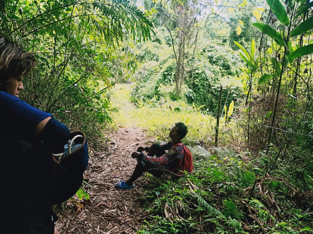
For this hike, I joined an organized event led by the group Bundok Adik Adventures. Arriving at Talamsi Dos past twelve midnight, we found ourselves in the care of Tatay Molo, the guide who established the trails of Mt. Corona and other mountains in Brgy. Talamsi Dos such as Mt. Sagpotan and Bahay Agila Peak. There, he welcomed us and offered a bowl’s worth of delicious ube sticky rice. After some chitchat, we commenced the hike at around two in the morning. The trailhead is located at the side of the road a few meters away from Tatay Molo’s house.

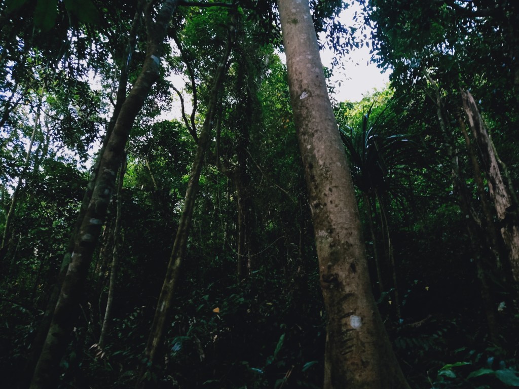
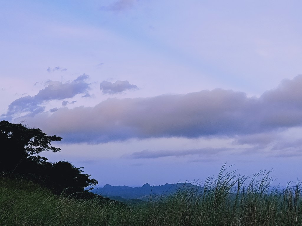
The start of the trail was through an easy, almost straightforward path that extends until the foot of Mt. Corona. The trail would sometimes descend, although not that steep and noticeable. When we reached the foot of the mountain, the ascent ensued. Leading the way, the upward path was on an enjoyable, easy trail that made me sweat buckets and pant heavily. After a few minutes, city lights appeared at the back of our view, indicating that we were gaining elevation. Afterwards, Tatay Molo and I expedited upwards, left the others behind, and entered a submontane forest with thick foliage of trees blocking the night sky. Just a few minutes from the grassland of Mt. Corona, Tatay Molo and I rested and waited for others to catch up.
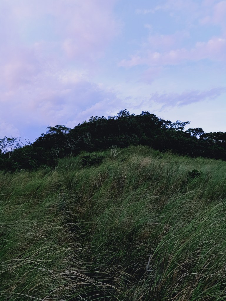
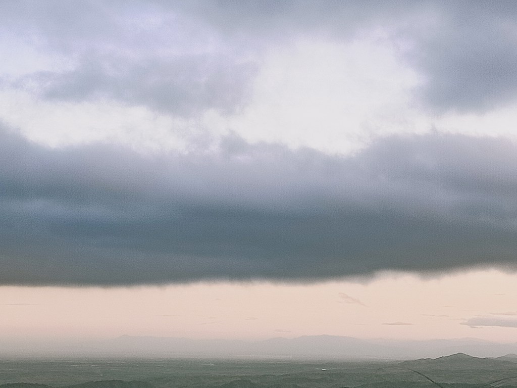
Once everyone had arrived, we entered Mt. Corona’s upper grassy slopes. Just after a few minutes of pushing tall grasses to our side, we reached the view deck of Mt. Corona past three in the morning, one hour after commencing the hike. There, we camped and waited for the sunrise. Our organizer, Arman, brought some cook set and butane gas for us to take coffee breaks and breakfast atop the view deck. Savoring the cold atmosphere, we relaxed for almost two hours, observing the stars and the waxing crescent moon. Sometimes, clouds would block the view and teased us with a little bit of light drizzle, which thankfully did not turn into rain. Lying down at the view deck, we exchanged stories and jammed through some OPM songs.
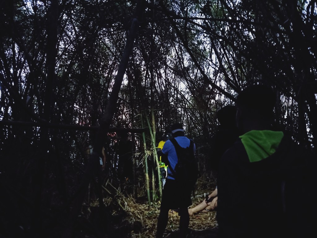
Around 5 in the morning, we decided to push through with the assault towards the summit. Leading the way again, we entered the upper portions of the mountain containing a lower montane forest, filled with bamboos and giant dipterocarp trees. Just after ten or fifteen minutes or so, we reached the uppermost portion, which is in the middle of a bamboo forest without any view except for the lit sky above. We immediately descended.
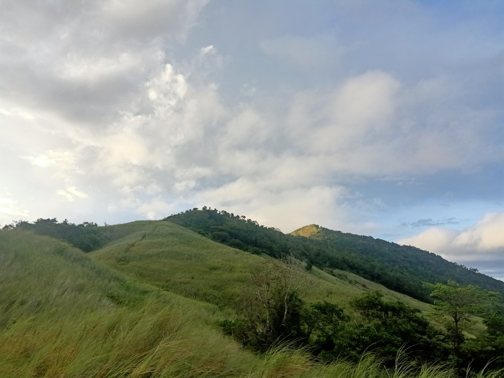
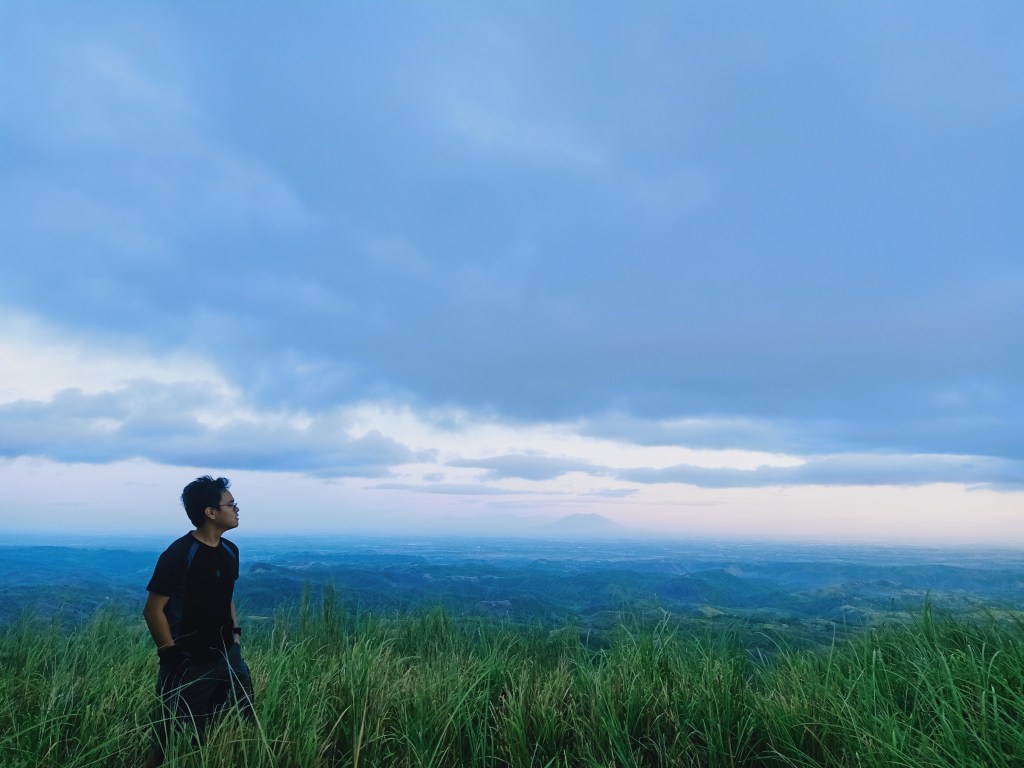
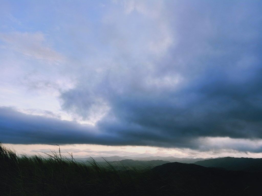
As the sunlight was slowly penetrating the skies to our right, we were able to witness a spectacular view on the way back to the view deck. With the cold morning breeze complementing the magnificent, almost a hundred and eighty degree view, we slowed down our pace and took pictures at the upper grassy portions of the trail.
Although its elevation is lower compared to most of the mountains that I have hiked in the past, the views atop of Mt. Corona beholds just the same quality of beautiful scenery. It even offers a newer angle of scenery compared to most mountains in DRT. To my hard left (SW), I was able to spot the mountains of southwestern DRT: Mt. Mabio, Mt. Susong Dalaga, and Mt. Pinagbanderahan.
To my left ![]() are the vast fields of Bulacan and Pampanga, with, of course, Mt. Arayat dominating the view. Behind Mt. Arayat, I spotted a faint view of the Cabusilan Mountain Range comprising of Mt. Pinatubo, Mt. Negron, and Mt. Cuadrado. This mountain range extends leftwards, in which the lower slopes, I assume, is where Mt. Zamatam and Mt. Quadrante are located. Left of that long stretching mountain range, I was able to faintly spot Mt. Natib in Bataan, and next to it, Mt. Mariveles was being obscured by clouds.
are the vast fields of Bulacan and Pampanga, with, of course, Mt. Arayat dominating the view. Behind Mt. Arayat, I spotted a faint view of the Cabusilan Mountain Range comprising of Mt. Pinatubo, Mt. Negron, and Mt. Cuadrado. This mountain range extends leftwards, in which the lower slopes, I assume, is where Mt. Zamatam and Mt. Quadrante are located. Left of that long stretching mountain range, I was able to faintly spot Mt. Natib in Bataan, and next to it, Mt. Mariveles was being obscured by clouds.
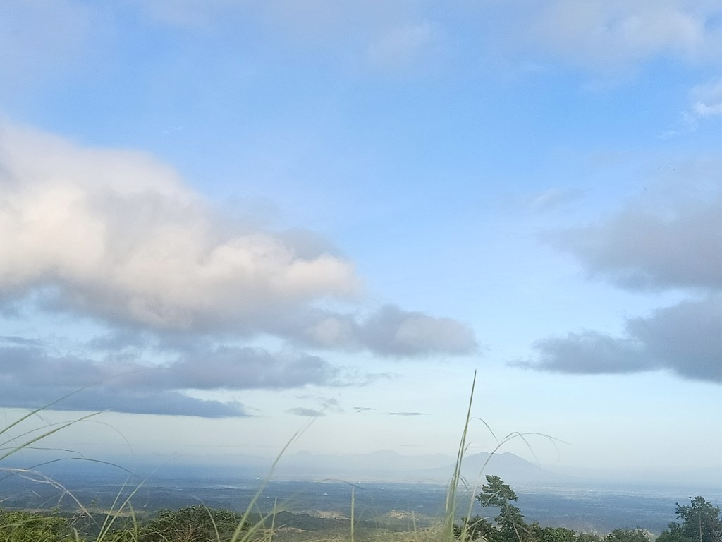
To the northwest, I was able to faintly spot yet again another stretching mountain range, which I highly assume is the northern Zambales Mountain Range that contains the Tarlac mountains such as Mt. Damas and the San Jose Mountains, and, of course, the highest mountain in Central Luzon, Mt. Tapulao!
At my front (N) is the vast fields of Nueva Ecija. In the horizon, I spotted two mountain ranges, which, upon checking on Google Maps, appear to be the mountain ranges of Carranglan in Nueva Ecija (L) which contains Mt. 387 and Mt. Lakay, and the mountain ranges in Pantabangan in the same province (R). I excitedly assumed that it was the Cordilleras, but it seems that the northern mountain range is still invisible to the naked eye when in Mt. Corona.
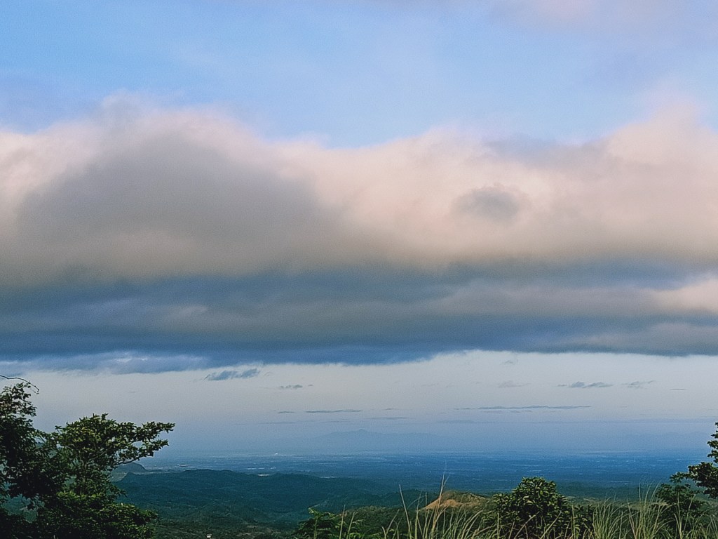
To my northeast, I spotted a faint view of Mt. Guiwan in Alfonso Castañeda in Nueva Vizcaya, one of the candidates of being the highest summit of the entire Sierra Madre at 1915+ MASL! I also spotted Mt. Labi (1620+ MASL) and Mt. Kemalugong (1754+ MASL) in Bongabon and Laur, Nueva Ecija, towering in the horizon. To my east northeast (ENE), another towering summit is peeking, in what I can only assume as Mt. Mingan (1901+ MASL) in Aurora! Of course, nearby mountains are present at this direction, including the lower Mt. Sagpotan near Sumacbao River.

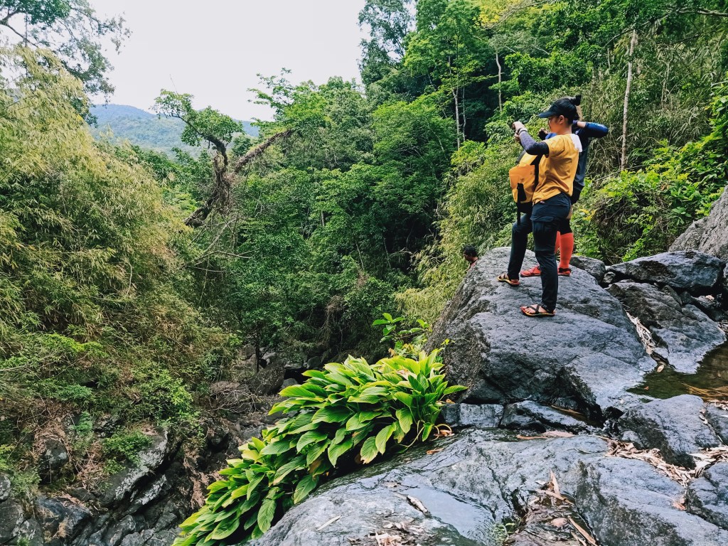
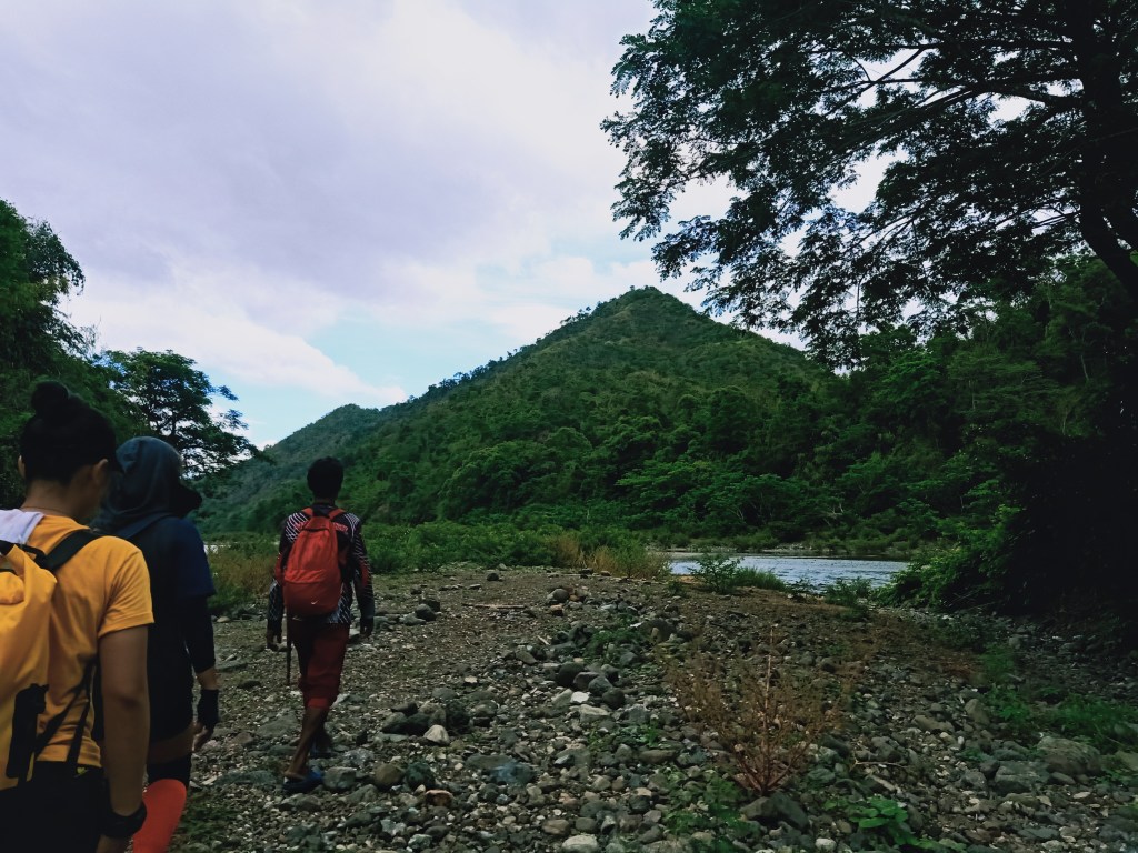
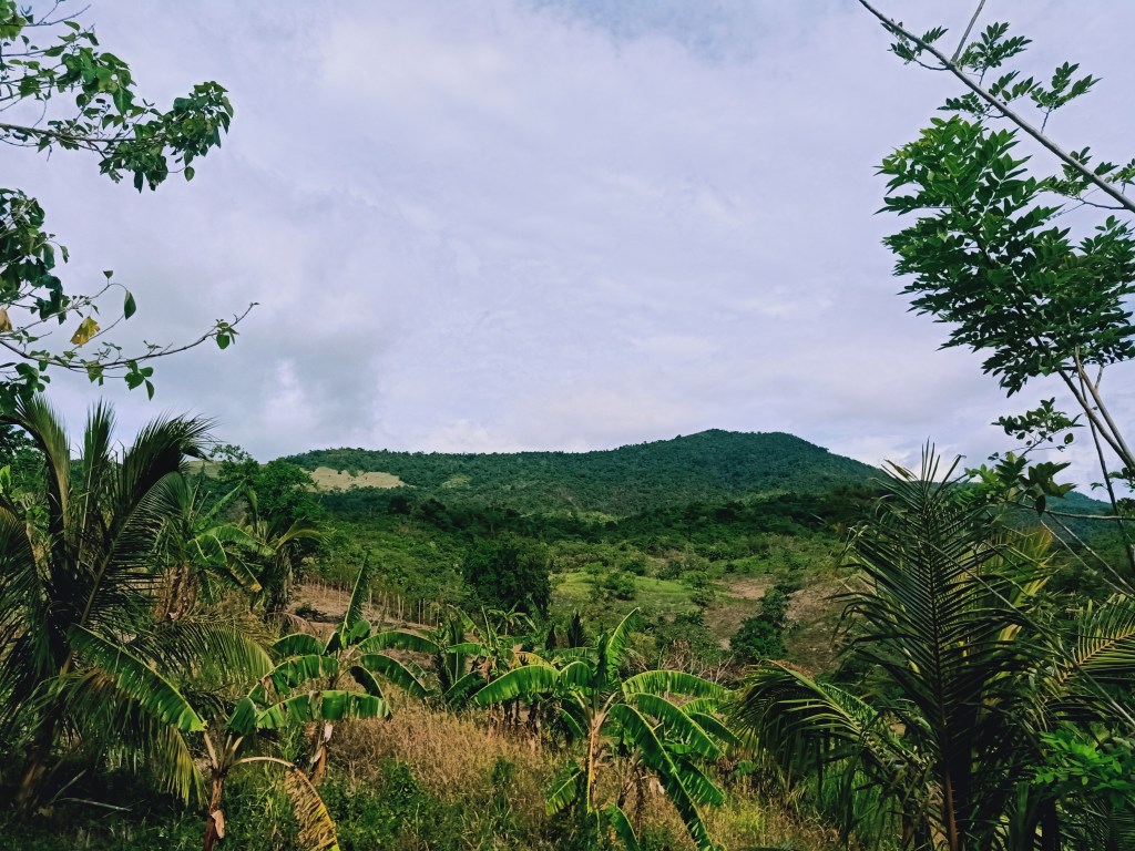
Towards east, we can see the lower mountain nearby which we will have to pass through in order to get to Sumacbao River. Behind that low mountain is a wall of mountain range, which is labeled as Mt. Balintigon in my STRAVA Map.

We took more pictures when we reached the view deck. There, Arman was guarding our bags and prepared some boiled water for those who would want to take some sip of coffee before taking the most challenging part of the trail – the hike onwards to Sumacbao River.
Starting the traverse at around 6:30 in the morning, we backtrailed for a little while and then turned right towards a path that leads to the northern side of Mt. Corona. The trail here is filled with a mixture of cogon grass and small trees, reminiscent of our Kalawakan Penta Traverse. The trail circles the entire side of Mt. Corona, leading to its back (eastern side). The trail here is similar to the Cordilleras, where to our left side is a downward slope filled with dipterocarp trees (instead of the Cordilleran pine trees), which extends to a nearby ascending slope filled with countless trees. We noticed that the the downward slope is bordered by a barbed wire, indicating that this was a private land.
After an hour of nonstop walk, we descended on an almost nonexistent trail that ends at the banks of Sapang Biya, the trail that we will be taking going to Sumacbao River. It was 7:30 in the morning. We rested for a while.
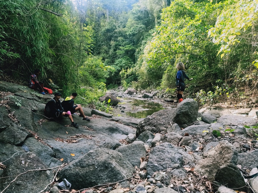
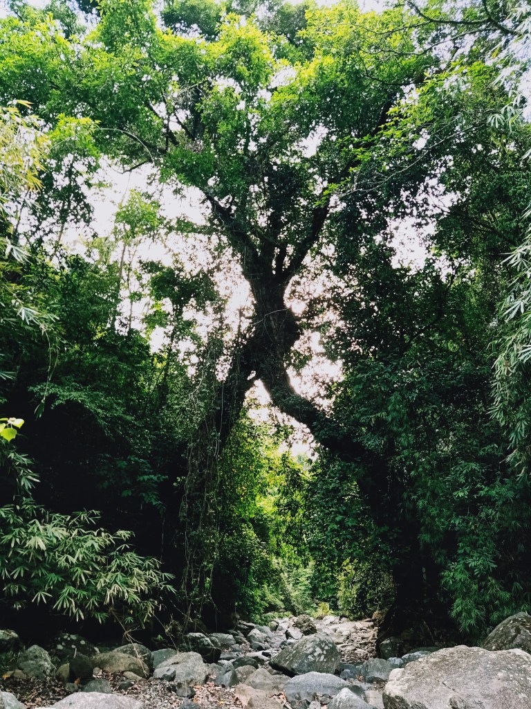
The trail at Sapang Biya was similar to the river trail in Mt. Damas and in Mt. Silad/Tanawan. We had to leap through medium sized rocks and sometimes, scramble through large boulders. Early on at the start of the river trek, we passed by two balete trees that seemed to “hug” each other, kind of like a passage through a different dimension. An hour into the hike, we encountered portions similar to those in Mt. Damas wherein we needed to scramble by the side of boulders, where to our side is a fatal drop towards a deep basin of water. Compared to those in Mt. Damas, the ones here in Sapang Biya were easier and did not need any ropes to install. It also had a lot of room to step on.
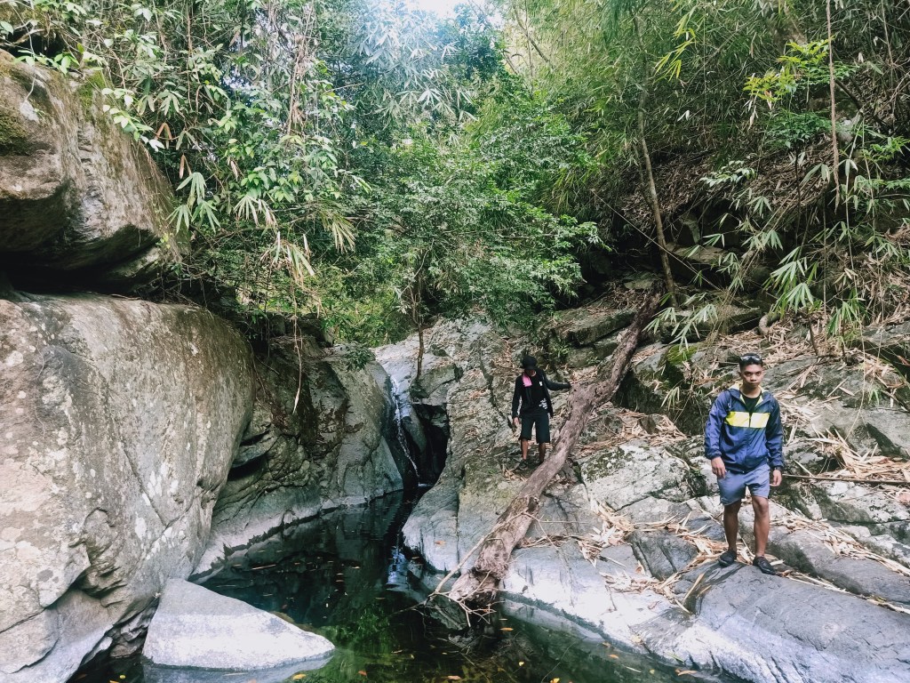
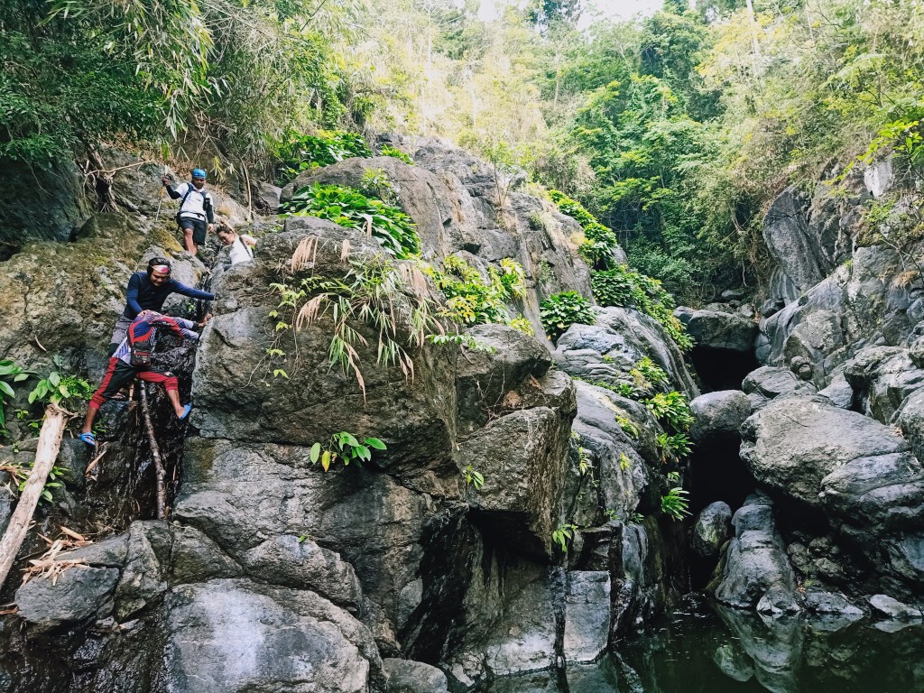
Afterwards, we noticed that the boulders disappeared and that we were walking on a smooth floor of rock. To everyone’s surprise, this trail ends at a cliff with a very high drop. This is now what Tatay Molo calls as Mt. Corona’s “killer trail.”
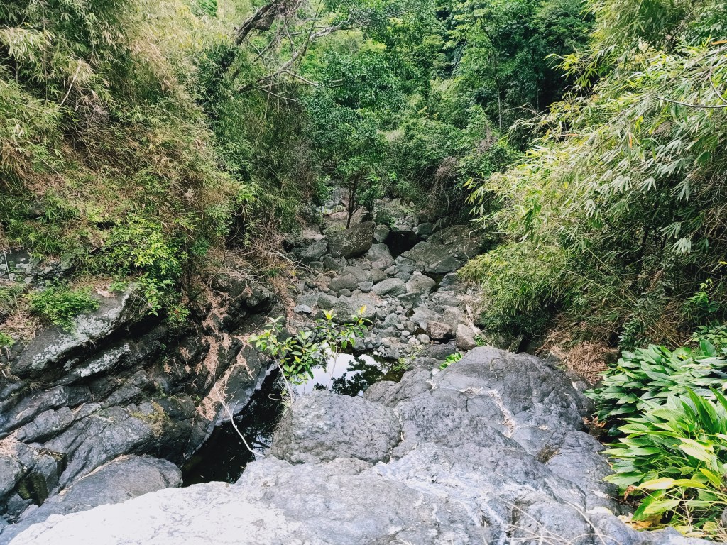
This cliff, according to Arman and Tatay Molo, is actually where a waterfall cascades during the rainy season. Luckily, because we hiked during the summer, the cliff was entirely dry. After a few minutes of resting, we negotiated the dangerous trail downwards. The initial parts of the scrambling portion were relatively easy (but caution must still be exercised as an accidental drop could prove fatal). We breezed our way until reaching the second half of the tier of the falls, where we needed to step on some logs installed for assistance. The last leg of the descent was the hardest, in which we needed to cramp ourselves on a gap between two boulders where a water was running, meaning that it was slippery. Here, we had no choice but to figure out the best foothold and plant our feet very firmly to it so as to not fall. Since we were in the lead group, we had the chance to rest and wait for everyone to negotiate the very technical trail.
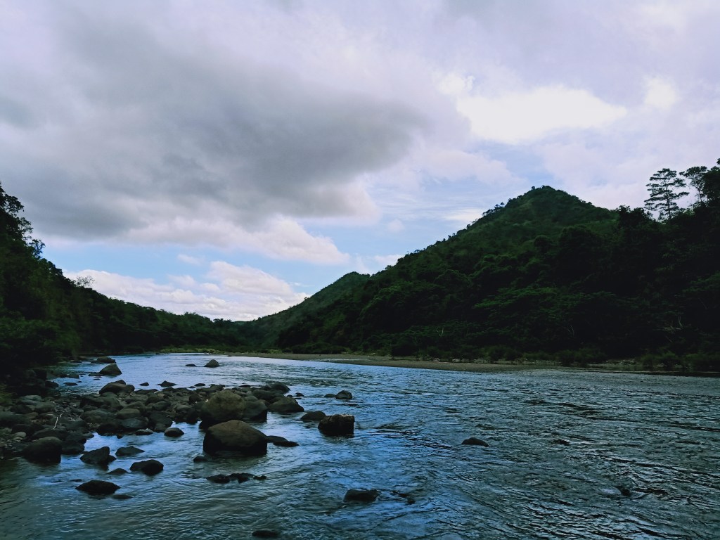
We continued the hike towards Sumacbao River via Sapang Biya. The hike after that “killer trail” runs on the same sapa, but with smaller boulders and a straightforward, nontechnical path. At 09:30 in the morning, two hours after starting the hike in Sapang Biya, we finally reached Sumacbao River! At the other side of the river is where Mt. Sagpotan is located.

We settled at a spacious, rocky, dry riverbed a few meters away from the trail. There, we cooked some instant noodles and took the time to swim at the clear waters of the river. We stayed there for three long hours. For the traverse, previous hikers would follow the river until reaching a sitio in Nueva Ecija, and then ride at a kolong-kolong on the way back to Talamsi Dos. However, we opted to just retrace our way by backtrailing.
Starting the hike around twelve noon, Tatay Molo led us a to a trail that ascends the small mountain we spotted earlier at the view deck. This means that we would not need to spend excruciating hours at Sapang Biya and take the very technical trail- highly reminiscent of the second cardiac trail in Mt. Damas that lets hikers avoid the river on the way back!
Of course, this trail presented its own challenges. Because locals and hikers seldom take this trail, Tatay Molo was required to whack and create a pathway for us. The most difficult part of the hike was when thick foliage of plants were blocking the way, so Tatay Molo had to clear some pathway first. Here, the ascent was so steep that we needed to scramble using all four limbs. We were so cautious not to disrupt some of the boulders that might roll down towards our companions in the sweep group. Thankfully, this kind of trail isn’t new to me anymore after spending fifteen long hours on a similar trail in Mt. Silad/Tanawan in the same town!
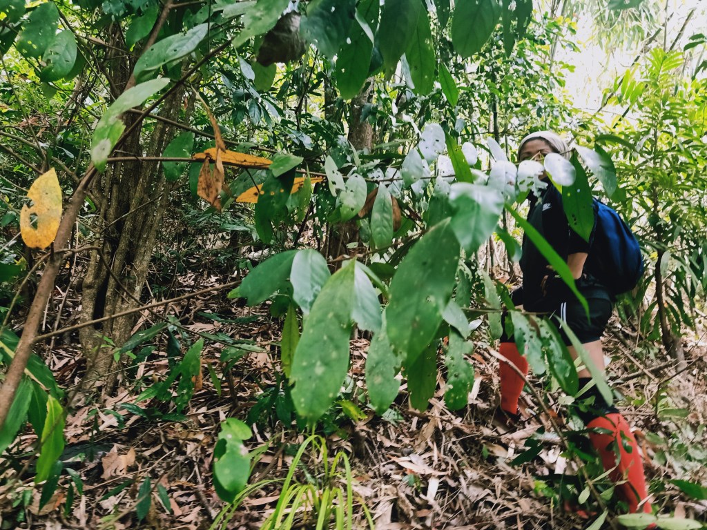
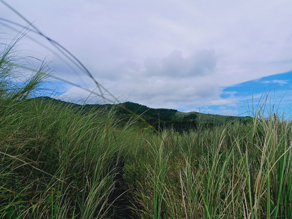
After long minutes of ascent, we exited towards the upper parts of the mountain filled with tall, sharp, and claustrophobic cogon grass. Since there was no trail, we had no choice but to brave this subsection of the traverse. Everyone, including me, was so exasperated with this trail because it was so painful to parts of our skin that were not covered in clothing. The consolation for this part was that we were able to spot the rear of Mt. Corona, as well as the higher Bahay Agila Peak to its left! After a few minutes, we descended and exited towards the trail we took earlier prior to Sapang Biya. We were now back at the original trail near Mt. Corona!
Since, earlier, this was a descending trail, on our way back, it became an ascending trail. Most of our companions were complaining, as, in their own words, this was a “budol hike.” Luckily, I still had the strength to push forward, only to be disrupted by bouts of thirst and hunger, especially at the last legs of the hike.
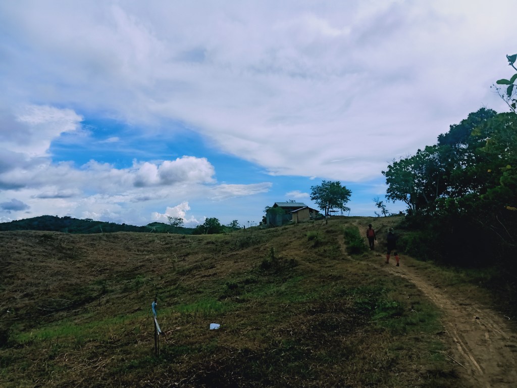
Instead of going back to the view deck, Tatay Molo led us to a junction that leads directly to the trailhead. At this trail, we were able to spot Barangay Talamsi Dos from afar and the sitio in Nueva Ecija that was supposed to be our exit point. The three of us in the lead group expedited our paces, taking the once dim trail, now lit with the complete light of the sun.
The last leg of the hike, which was at the lower portions of Mt. Corona, rolled on village footpaths where to the side are plantations. The three of us in the lead group reached the trailhead past three in the afternoon, three long hours after starting from Sumacbao River and thirteen hours after commencing the hike!
One by one, our companions arrived. Once we were complete, we took our late lunch at Tatay Molo’s house. Tatay Molo’s wife prepared a hot, steaming brown rice and fresh fried tortang talong. While eating lunch, we took turns in taking baths, and by five in the afternoon, we were ready to depart.
Mt. Corona, especially the trail traversing through Sumacbao River, proved to be a challenging and endurance-testing hike. It was, by far, the first mountain in DRT that provided me a complete view of the Central Luzon Mountains – from the mountains in Bataan, Zambales, all the way to the northernmost part of Nueva Ecija! With new mountains being opened in the area such as Bahay Agila Peak, I have high hopes that this place gets loved and taken care of by hikers and locals alike. Hopefully, in the future, I may get to summit the elusive highest point of the area – Mt. Sumacbao.
Itinerary
12:00AM ETA at Barangay Talamsi Dos, DRT, Bulacan
02:00AM Start hike
03:00AM View deck, wait for sunrise
05:00AM Start assault to summit
05:30AM Summit
06:00AM Back at view deck, breakfast, take pictures
06:30AM Start traverse to Sumacbao River
07:30AM Sapang Biya Trail
09:30AM Sumacbao River
12:00PM Start the traverse going back to Talamsi Dos
03:00PM Talamsi Dos, eat late lunch, ligo!
05:00PM ETD to Manila
