The province of Nueva Ecija is home to many unexplored mountains. North of the province is where the Caraballo and Sierra Madre Mountain Ranges meet, together with the southeastern-most tip of the Cordilleras. To the province’s east is the Sierra Mountain Range of Aurora Memorial National Park in the towns of Bongabon, Laur, and Gabaldon. Lastly, to the province’s southeast is the Sierra Madre Mountain Range once again in the towns of Palayan, Laur, and General Tinio, which are directly connected to the towns of Dingalan, Aurora, and Doña Remedios Trinidad, Bulacan. These mountain ranges contain closed forests, most of which are unexplored by hikers and mountaineers. Thanks to the efforts of local mountaineers in the province, some mountains have been opened to the public in the past decade. One such mountain is Mt. Sawi, also known to some as Mt. Sawing Balete.

Mt. Sawi is an open mountain at the southern end of the mountain ranges of Aurora Memorial National Park, located in the town of Gabaldon. Its summit, which stands at 594+ MASL, pales in comparison to its neighboring summits. However, due to its accessibility from the lowland and with tales from the mountain resonating with hugot zeitgeist of our time, Mt. Sawi became a popular hiking destination among hikers. With its easy trail and beautiful views, Mt. Sawi is a welcome addition to the list of precious mountains loved by adventurers.
I was able to climb this mountain last March 13, 2021. In this hike, I was with my girlfriend Pat, her father, my immediate family, some of my closest friends—JM, Fae, Rasch, and Joshie—whom I joined with in my Baguio City trip last 2019, and other known people in my bubble. We departed Bulacan past two in the morning, crossing the towns of our province and some towns in Nueva Ecija before making our way towards Gabaldon-Dingalan Road. We reached the jump-off point, located at Barangay Malinao in Gabaldon, at around five in the morning. We prepped and readied ourselves for the hike.
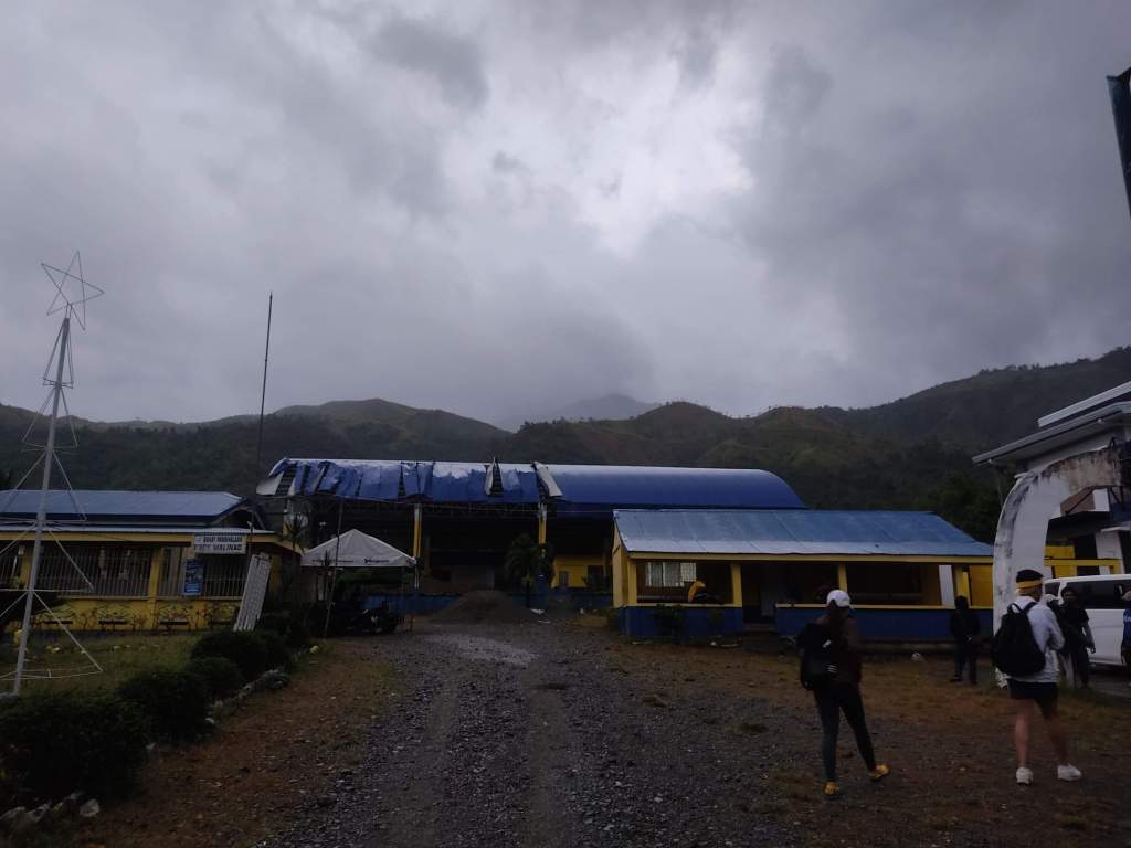
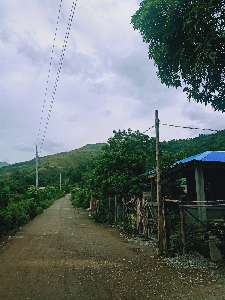
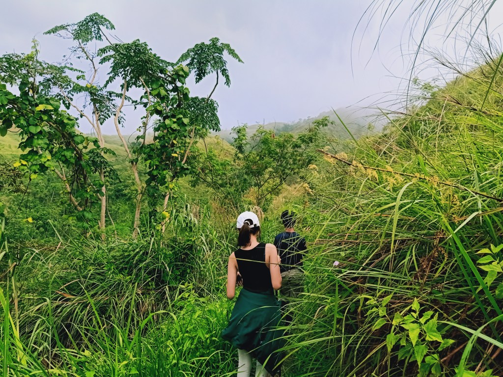
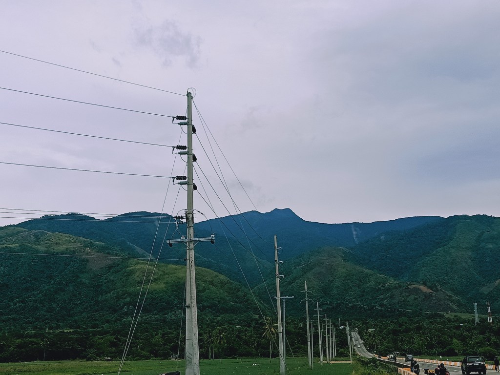
We started the hike past six in the morning. Coming from the barangay hall, we took a rough road that directly goes to the foot of the mountain. We then entered what seems to be a farmland which took us immediately to a straightforward ascending trail. This trail, which interestingly seems to be on a narrow ridge, would stretch for a few kilometers. This was the steepest portion of the hike and it got almost everyone in the group panting and stopping for five-minute breaks. The view on the trail-ridge was already magnificent. To our right side is a forested slope, forming the lower parts of Mt. Sawi. We can also see the jump-off point below as well as the stretching fields of Gabaldon, with the mountains of General Tinio in the near horizon.

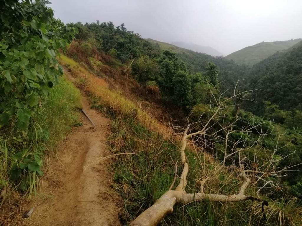
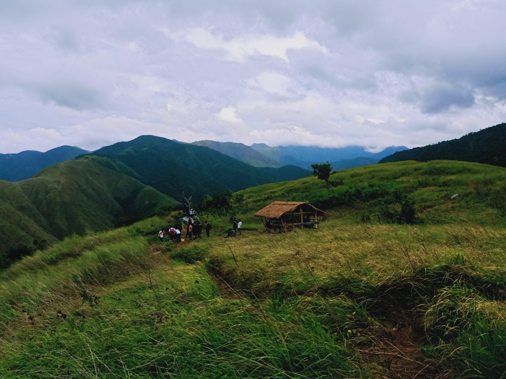
We negotiated this steep trail for more than an hour. We then entered into an almost flat footpath by the side of a dipterocarp forested slope. The trail afterwards transforms into a grassy trail. Going left of the mountain, we already spotted the uppermost portion of the summit, which was by the other side of the grassy slope to our left. It was all talahib from here, with almost no trees to cover. Good thing was that we had a cloudy and a windy weather at that time, so hiking the upper slopes of Mt. Sawi was more relaxing than exhausting.
In that grassy trail, Pat and I took the chance to trail run upwards. We would stop for a few meters after covering some distance by running. The trail here, although ascending, was not as sharply inclined as that of the trail at the earlier parts of the hike. After a few minutes, we were able to reach the topmost portion of the grassy mountain we spotted earlier, which forms the plateau-summit of Mt. Sawi. The summit area is located at the end of the plateau where a commanding view of the town of Gabaldon is located. It was marked by a dead tree perched on top of limestone rocks. This dead tree, tales would say, was where a local woman hanged herself because of heartbreak, the folk legend that gave this mountain the name Mt. Sawing Balete.
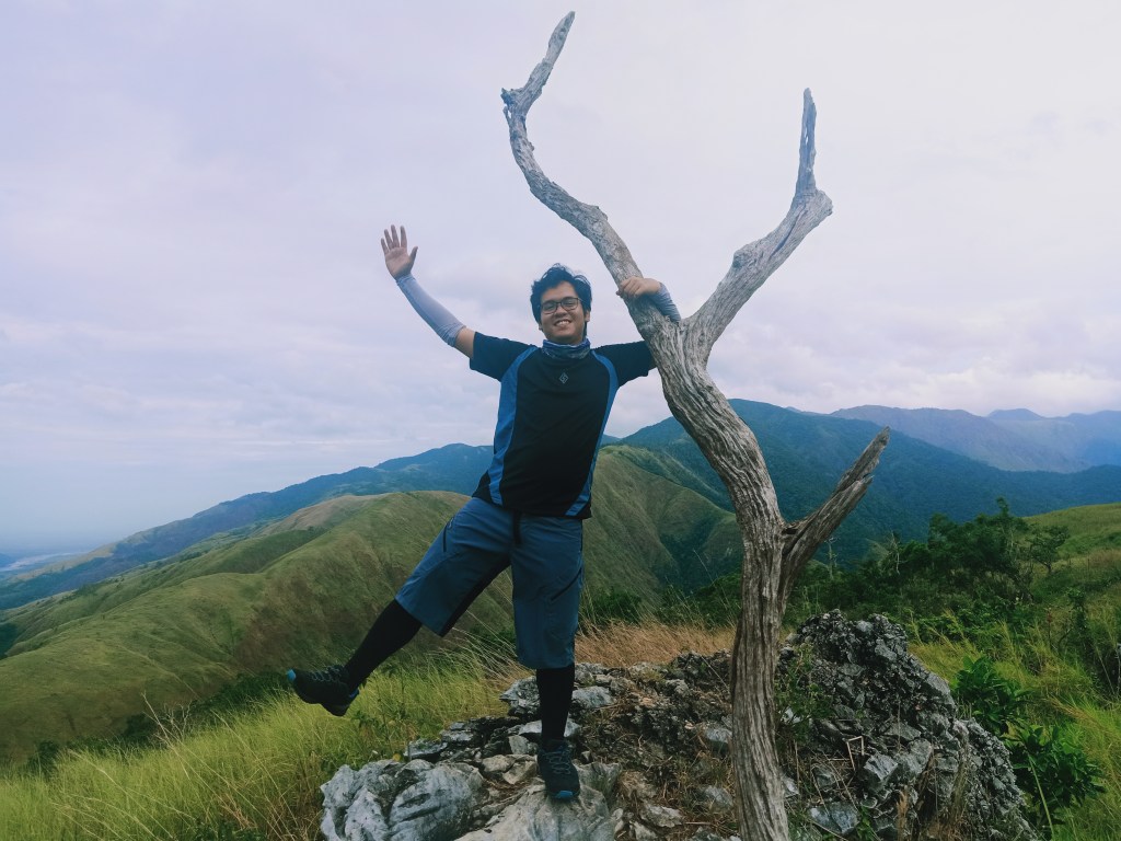
Pat and I, together with my long-time hiking friend from college, JM, were the first to reach the summit area. It was eight in the morning, two hours after starting the hike. We spotted the rest of the group on the lower end of the other side of the grassy slopes. As there was still another group who were taking pictures by the dead tree summit marker, we stayed by a cliff area away from the other group. There, we took pictures and savored the view. Afterwards, we sat by the edge of the grassy cliff in which a long bridge can be seen below. The wide river under the bridge was filled with kubos, kind of like a resort, where a few people were swimming.
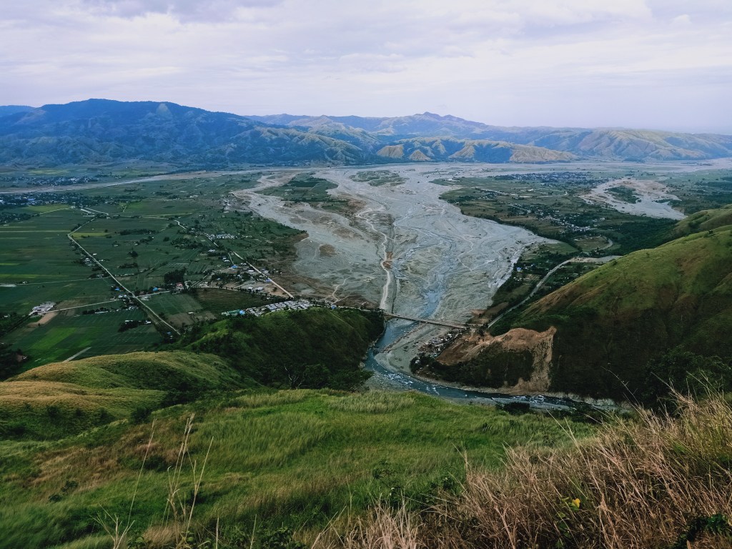
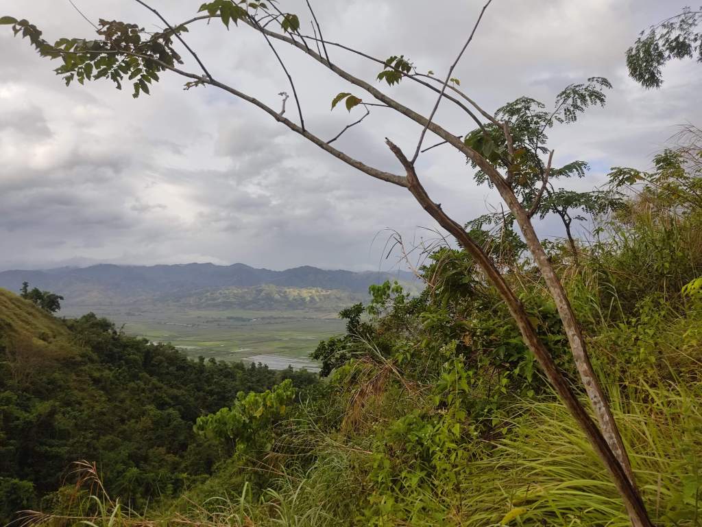
The view of the surroundings from the summit of Mt. Sawi was astonishing. To our front (SW, W, NW) are the stretching wide fields of Gabaldon, with many plantation farms. A long, gravelly river can also be seen stretching as far as northwest. At the end of the field is the Sierra Madre Mountain Range at the towns of Palayan and General Tinio, which I have mentioned earlier to be connected to the towns of Dingalan and DRT. Many of the peaks in that mountain range are still untouched by hikers.
To our north and northeast, which was on our right and on the direction of the dead balete tree, are nearby mountains that are way, way higher than Mt. Sawi. This forms the lower slopes of Mt. Kemalugong (1754+ MASL), otherwise known as Paasa Peak, which is considered as the highest peak and the king of Nueva Ecija mountains. Opposite of the fields of Gabaldon, which was at the east and southeastern direction, are yet again higher mountain slopes which were heavily forested. The higher parts of these mountains were already covered in clouds due to its immense elevation. These mountain slopes are part of the mysterious Mt. Mingan (1901+ MASL), a semi-explored mountain at the boundary of Gabaldon, Nueva Ecija and Dingalan, Aurora. Mt. Mingan is one of the contenders to be the highest summit in the entire Sierra Madre Mountain Range (Cagayan-Quezon), only displaced by Mt. Bintuod in the town of Alfonso Castañeda, Nueva Vizcaya.

After taking pictures by the dead balete tree, we retired at the edge of the cliff of the plateau, with its windy atmosphere complementing the moments that I shared with my significant other as well as with my closest friends. By nine in the morning, we decided to go back to the jump-off point. Pat, her father, JM, and I decided to trail run the entire upper grassy slopes of Mt. Sawi on the way down. We reached the forested slopes and the sharply inclined ridge in a short span of time. Since the ridge was somewhat steep, Pat and I decided to just climb it down on a normal pacing, reaching the lower slopes almost an hour after descending. We were back at the jump-off point by 10 in the morning, completing the entire hike for only four hours! The total trail distance was roughly at seven kilometers, a manifestation of how Mt. Sawi is a relaxed and easy hike.
We immediately cleansed ourselves when we reached the barangay hall. Afterwards, Pat and I, together with her father, ordered some lugaw with egg, satisfying our hungry stomachs and challenged bodies after taking on Mt. Sawi. When everyone else had arrived, we left Barangay Malinao and had our lunch at an eatery by the side of the road near the Gabaldon welcome marker. There, I spotted the towering Paasa Peak of Mt. Kemalugong, which provided me an intriguing view as I munched on my lunch consisting of rice, cordon bleu, and a tasty local dinuguan.
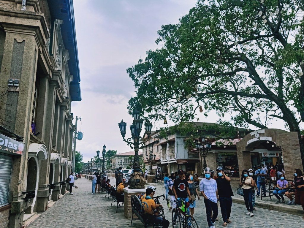
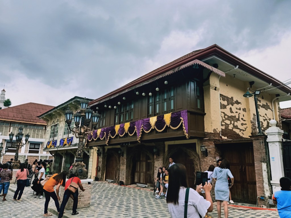
After eating our lunch, we went to the town of Gapan to visit the famous Lumang Gapan, also known as Little Vigan. We arrived there around three in the afternoon. The place was filled with tourists taking pictures of the old houses and Spanish-era streets around the area.
Afterwards, we went home, reaching Malolos City around six in the afternoon. Another mountain conquered! Having finiished my second hike in the province of Nueva Ecija, I am now more than ever excited to take on trails of our very own here in Central Luzon!

Itinerary
02:00AM Departure from Malolos City
05:00AM Barangay Malinao, Gabaldon
06:00AM Start of hike
08:00AM Summit, rest
09:00AM Start descent
10:00AM Back at jump-off, rest
12:00PM Lunch at Gabaldon Marker
03:00PM Visit Little Vigan in Gapan
06:00PM Home
