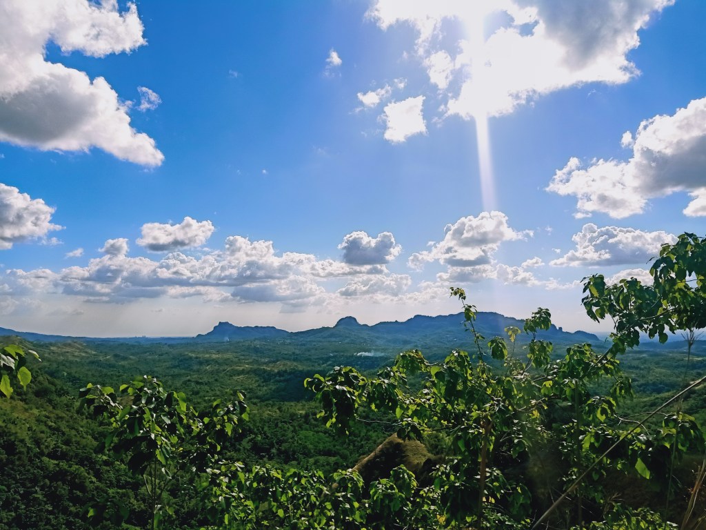
Last 25th of February, after coming from a Mt. Susong Dalaga hike in the same town, we visited one of the rising destinations of DRT Bulacan—Mt. Mulawin. Situated in the almost remote Sitio Calumpit of Barangay Kalawakan, Mt. Mulawin is a relatively easy hike comparable with that of Tila Pilon Hills, only a bit more difficult because of its continuously ascending trail. It offers a different angle of the vast mountains of DRT, and actually makes you closer to the stretching mountain ranges usually seen in the mainstream spots of the town!

The specs for Mt. Mulawin are as follows:
Elevation: 290+ MASL
Specs: Minor hike, difficulty 2/9
Trail class: 1-2
Days required / hours to summit: 1 day, 30 minutes to 1 hour
Features: view of DRT mountains and grassy ridges
Summit coordinates: 15.162460, 121.131001.
For this hike, I was with the same Malolos-based organizer that my mother and I joined with in our previous hikes, together with the same regular people joining them.
The adventure started not at the base of the mountain, but a few kilometers away from it! We were past Sitio Madlum, the famous spot where Mt. Manalmon and Gola can be found. However, instead of turning right to the road leading to that sitio, we turned left towards an unpaved road leading to a shallow river. That river was the stopover of our van, since our driver didn’t want to risk crossing it. From there, it was still a 30-minute ride away going to Sitio Calumpit. We were fetched by an old pickup truck which took us to the jump-off point en route roads carved on rolling hills. It was actually a very nice experience, reminiscent of our top load jeep rides in Cordillera! Oh how I’ve missed the pine tree covered highlands!
It was a pleasant ride despite discomfort caused by the bumps on the road and the leaves that smacked our faces. The view during the ride was such an elegant sight to behold, with Mt. Nabio and Mt. Susong Dalaga having a stellar appearance to our right. We also passed by the jump-off point of Zamora Falls, another notable destination in the town. A few meters from the trailhead, we stopped over and registered at the mountain caretaker’s house. That place already felt like we were in a remote area, but we actually weren’t! Afterwards, we went ahead towards the trailhead, which was by the side of Calumpit River.
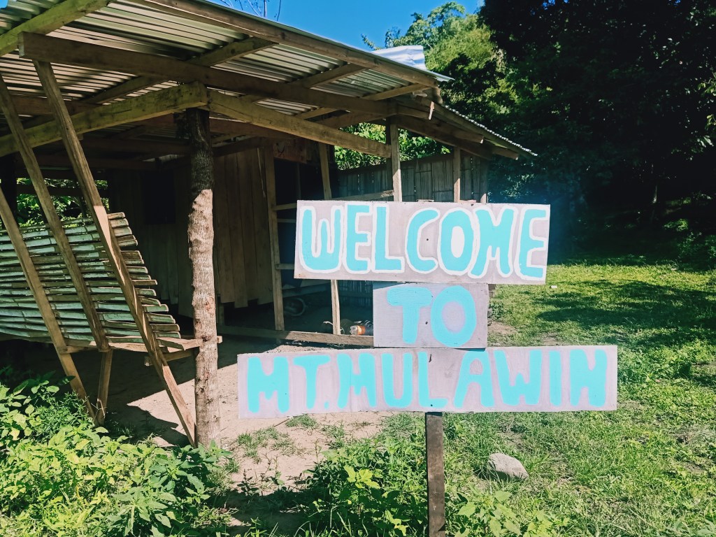
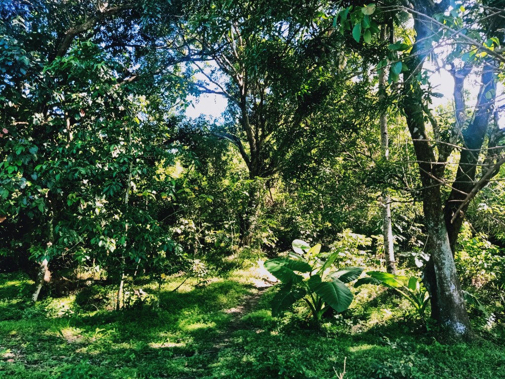
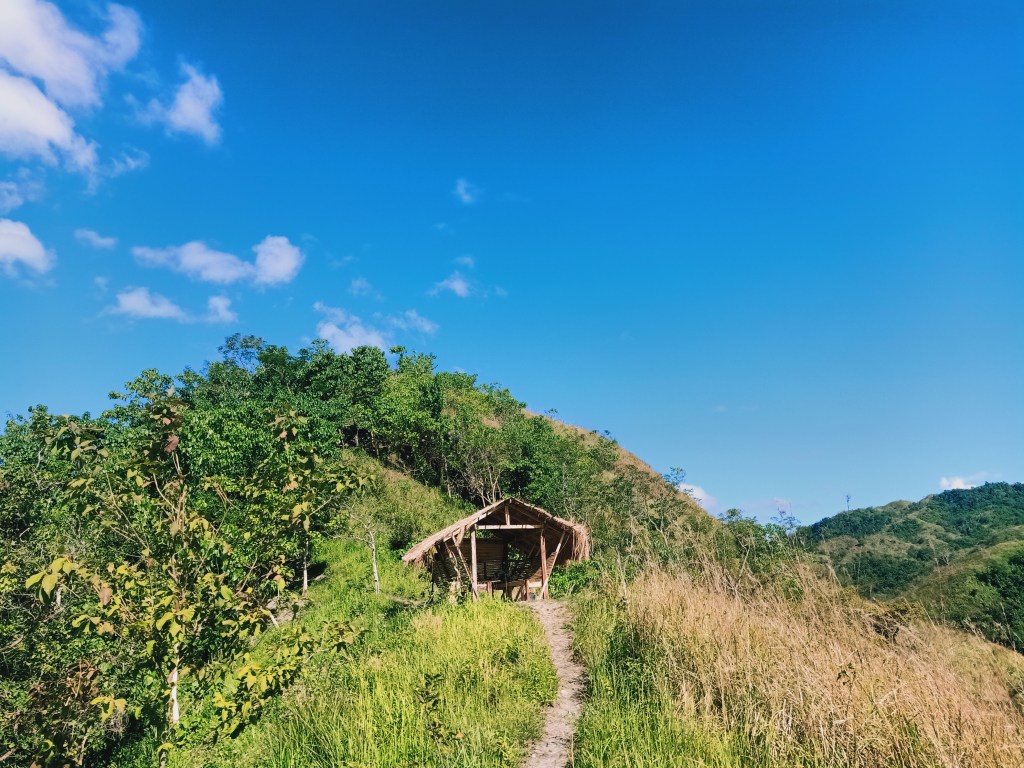
The hike starts by crossing the shallow waters of Calumpit River. Mt. Mulawin, which was just directly by the other side of the river can already be seen at this point, with it merely looking like a hill than a mountain. After crossing the river, we entered a lot with a sign that says “Welcome to Mt. Mulawin” and a kubo. There, we had our orientation. After the short mandatory reminder, we started the hike. The trail was directly in front of a sloped area whereby a giant plant would welcome hikers.
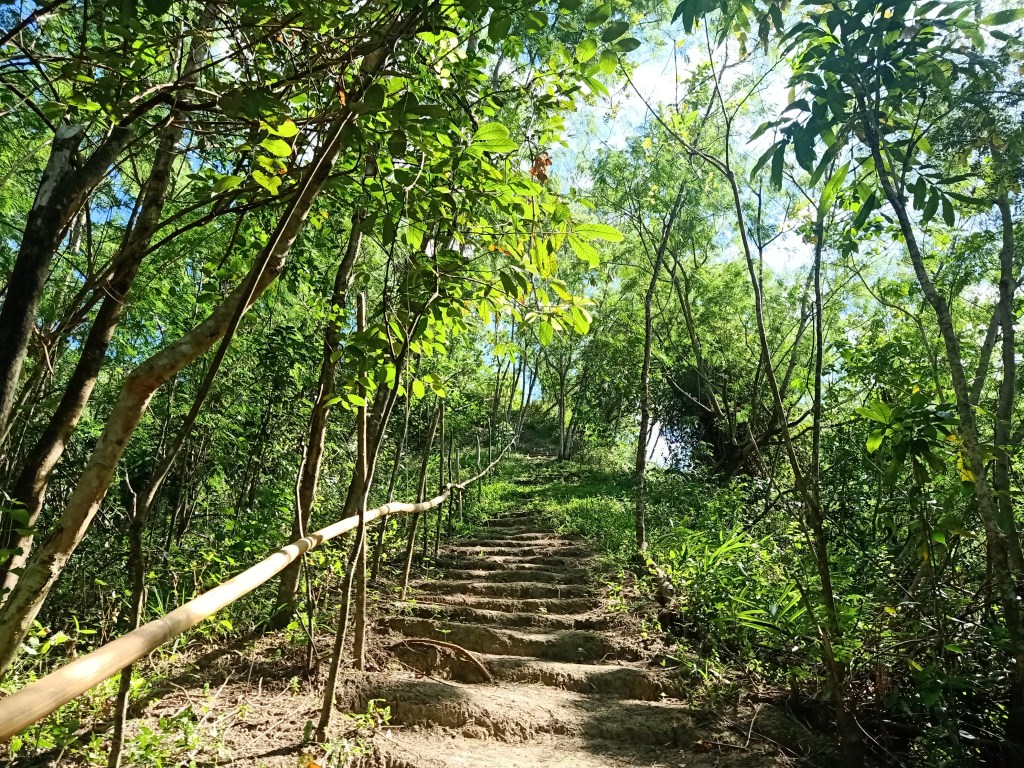
The trail on the way up was actually quite monotonous. It was a pretty straightforward ascending trail carved to resemble a staircase. There were makeshift bamboo handrails to assist hikers. There were two resting stations in the middle of the trail. Just after twenty minutes I reached the topmost part of the trail, which ends on a ridge that forks both towards left and right. The right path leads to a very narrow ridge with a picturesque spot at the end, while the left path leads to a kubo and past it, the trail going to the summit.

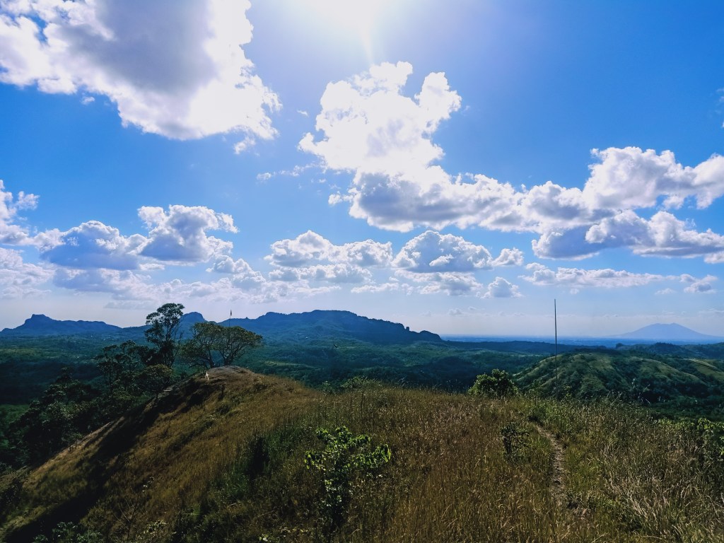
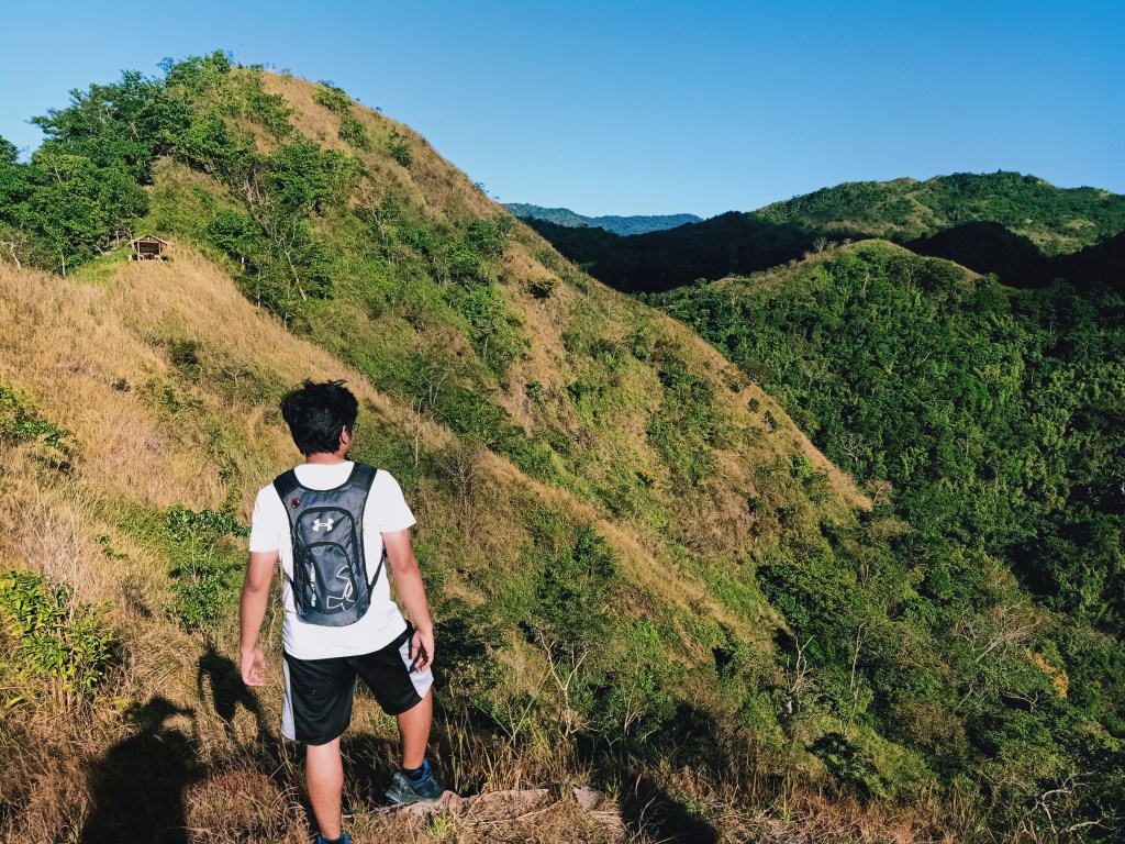
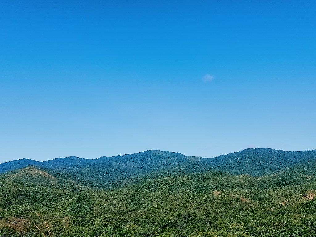
Since I was the first one there and I was basically alone, I surveyed the right path. To my right, I spotted Mt. Arayat as well as the southwestern portion of DRT which includes Mt. Mabio, Mt. Susong Dalaga, Mt. Nabio, and Mt. Pinagbanderahan. To my left, the grassy slopes of Mt. Mulawin directly connects to the slopes of another higher mountain. After surveying the area, JM, my hiking buddy from college who last joined me in my Malipunyo-Manabu Traverse way back in 2019, reached the area.

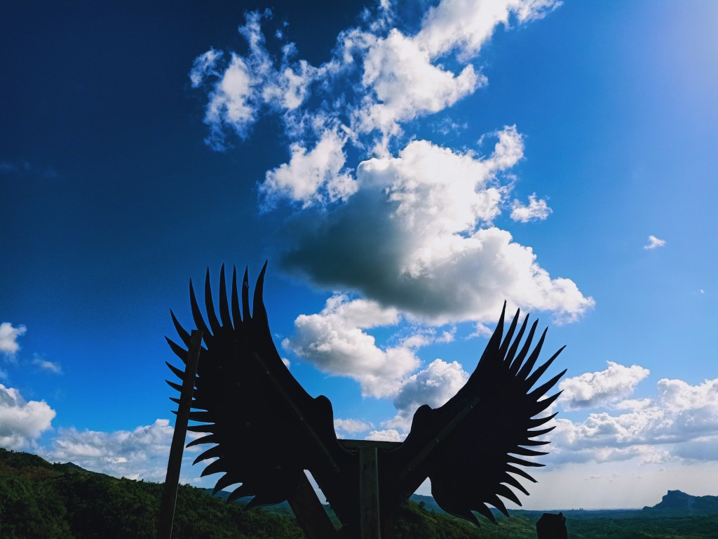
We took the last assault going to the summit of Mt. Mulawin, which was on a steep slope behind the kubo. Although sharply inclined, the summit can be reached in less than two minutes. Arriving there, the sun was punishingly scorching us. The summit was a circular living room-wide area that offers a three hundred and sixty degree view. At its center is a wooden platform where a makeshift eagle wing—alluding to the name Mulawin—is installed. Note though that the caretakers of the place named the mountain Mulawin because of the abundance of molave trees along its slopes.
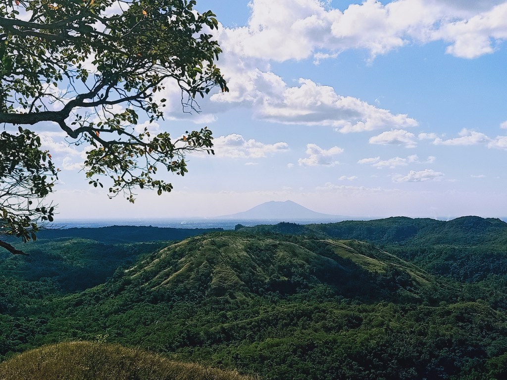
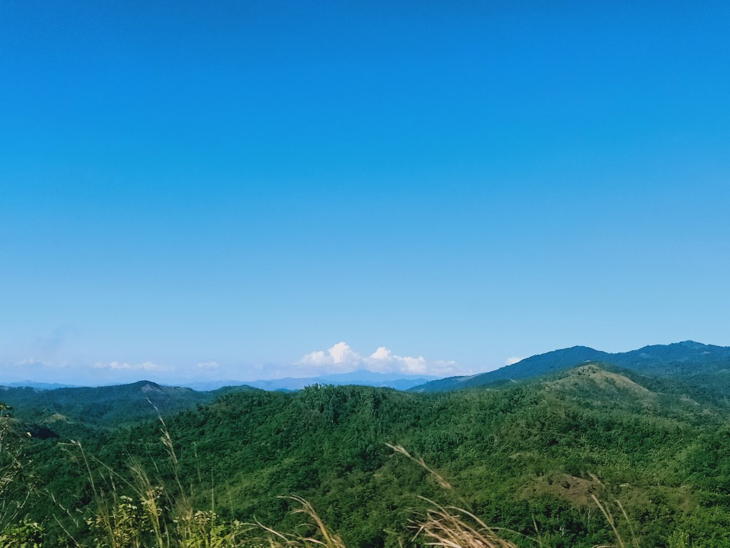
The summit offers a complete view of the surroundings. To our west is the river that we crossed and the hills that we passed en route to Sitio Calumpit. Of course, Mt. Arayat’s ever-present looming presence is there. To our southwest, a stunning angle of the Mt. Mabio, Mt. Susong Dalaga, and Mt. Nabio can be seen. To our south, southeast, and east are higher mountain slopes directly connected to Mt. Mulawin. Towards north are mountain slopes as high as Mt. Mulawin. Behind these slopes are the hills that we passed en route to Talon ni Eba last month! Further behind those mountain slopes is a forested towering mountain range. This is Mt. Sumacbao, a semi-explored area of DRT, which contains the slopes of Mt. Corona on the northernmost edge of the mountain range. Just this month, a waterfall was explored behind Mt. Sumacbao, which was named as Titipyaan Falls.

After snapping some photos and resting by the shade that the wooden platform offered, JM and I tried to trail run going to the other side of the ridge where our companions were taking their pictures on the makeshift nests and chairs by the side of the slope.

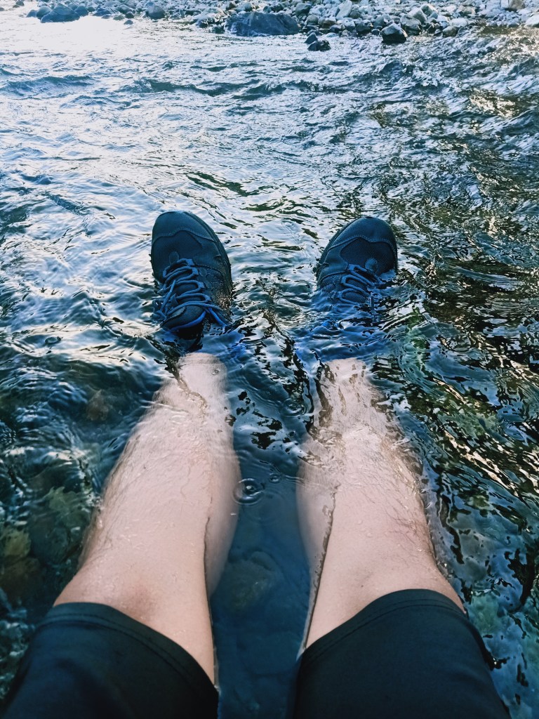
Afterwards, we started the descent. After some good minutes of running, JM and I were already at the base of the mountain near the river. Upon reaching the river, we saw that our companions who didn’t choose to climb Mulawin were already relaxing in the shallow waters of the river. We were happy to join them after the scorching hike, so we just let our bodies get engulfed by the running water. What a relief! When our other companions arrived, they, too, took the time to sit by the shallow river and let their bodies get enveloped by the running water. Afterwards, we climbed aboard our pickup ride and returned to Sibul in San Miguel, Bulacan. There, we cleansed ourselves and went home.
As the day concluded, the once blue sky turned completely dark. The events that unfolded on that day, from our morning hike in Mt. Susong Dalaga to our afternoon adventure in Mt. Mulawin, were memories to cherish. During our ride home, I kept wondering how many times I will go back to this town—a town filled with endless possibilities of adventure.